14 PEREGRINE AVENUE
DERBY, ETWALL, DERBYSHIRE DE65 6SR
Property details
Tenure
FREEHOLD
Floor area
166 m²
EPC rating
B
Last sold
£667,000 Feb 2026
Price per m²
£4,127/m²
Local average
£455,376 (+50.4%)
Street crime
12 incidents within 1 mile (Apr 2026)
Key features
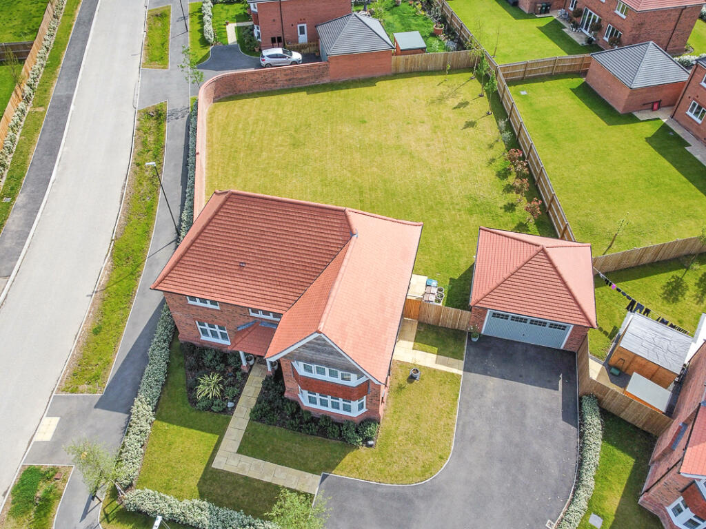
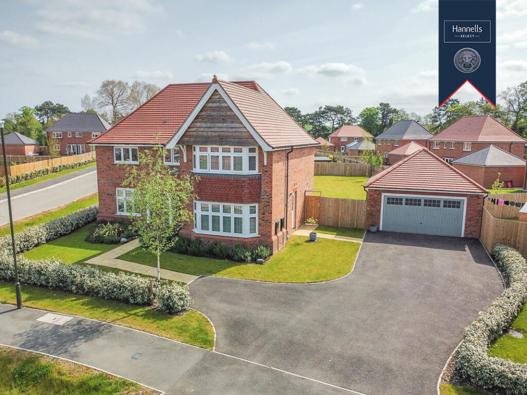
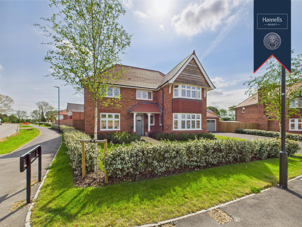
- Four-Bedroom, Standard Construction Detached Property
- Benefits From Circa £35,000 Of Upgrades
- EPC Rating B
- Council Tax Band F
- Freehold
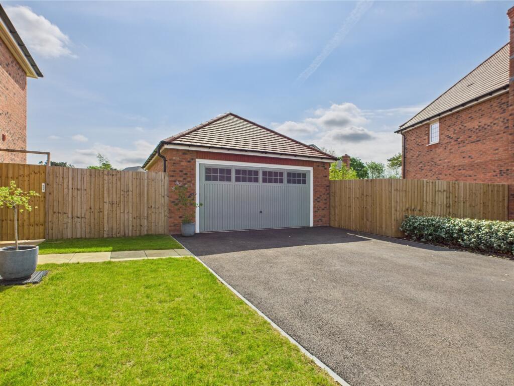
- Ample Off Road Parking For Several Vehicles & A Double Detached Garage
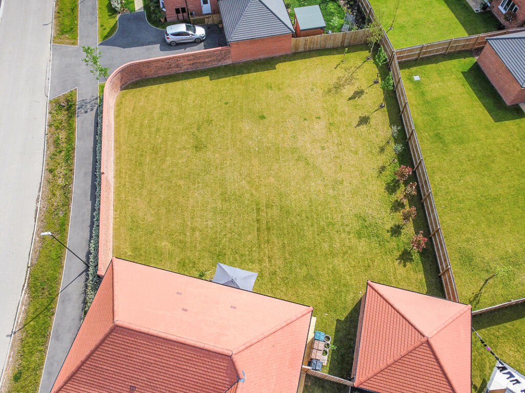
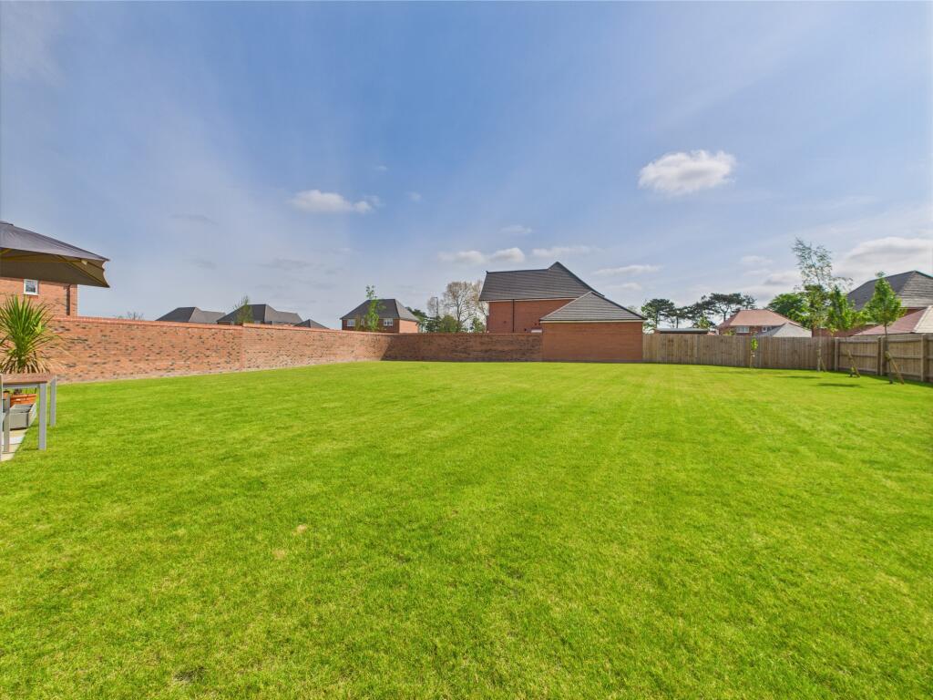
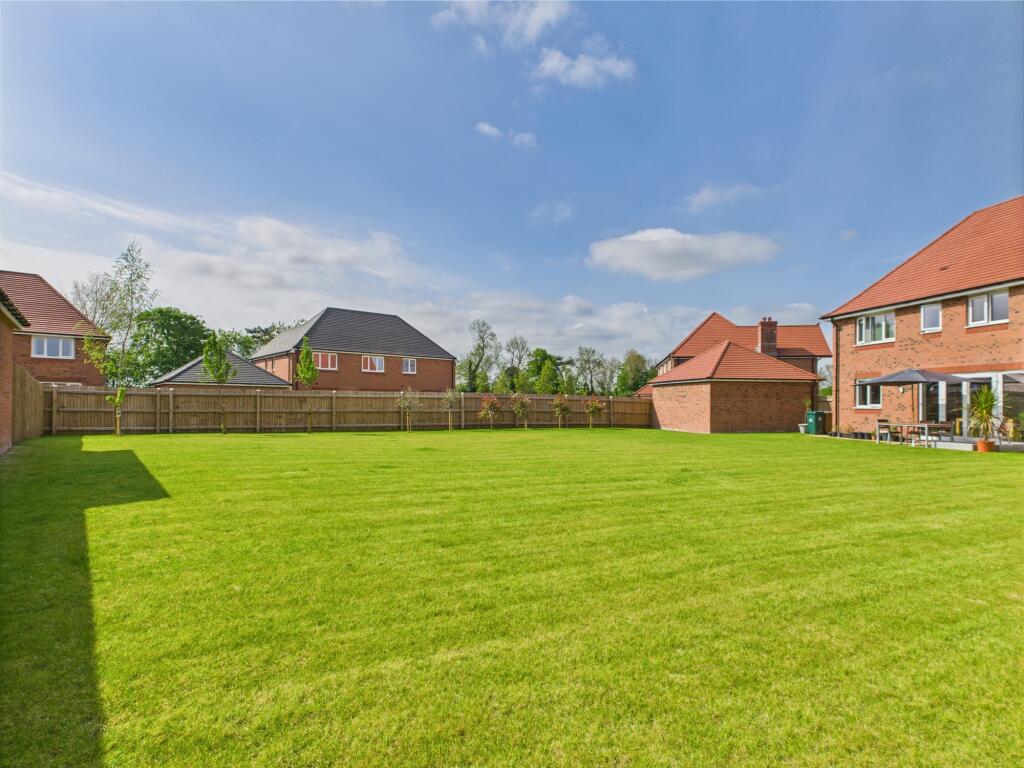
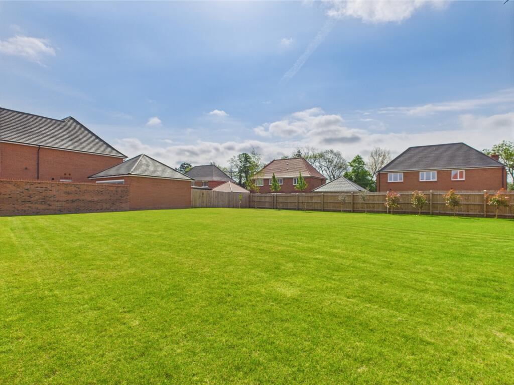
- Sitting On A Larger Than Average Plot
- Large Enclosed Garden
- Situated On A Sought-After Modern Development
- Ideal For A Growing Family
Additional details
- Parking
- Yes
- Garden
- Yes
Description
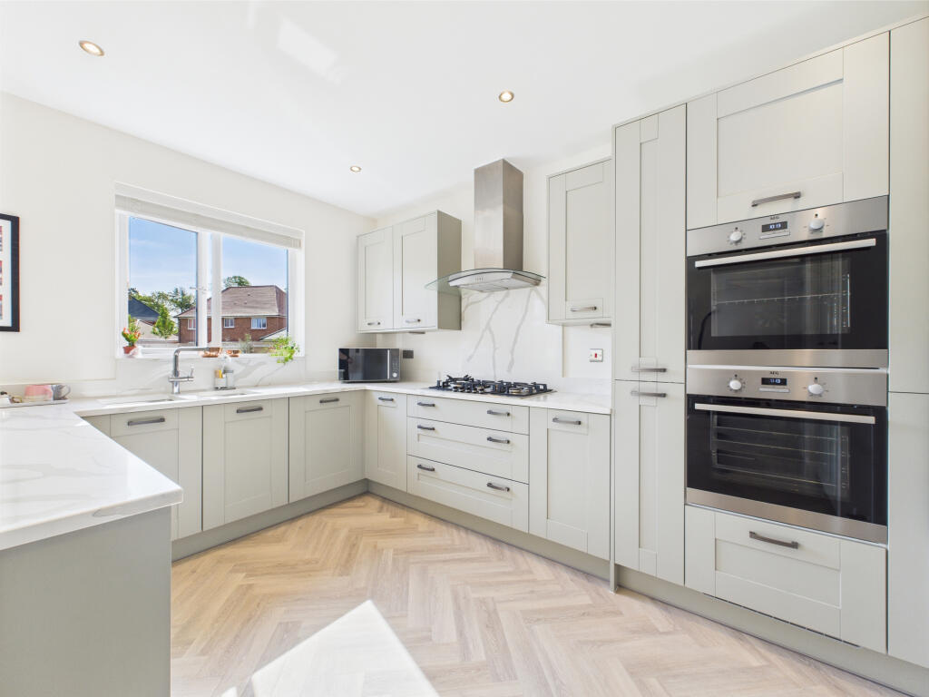
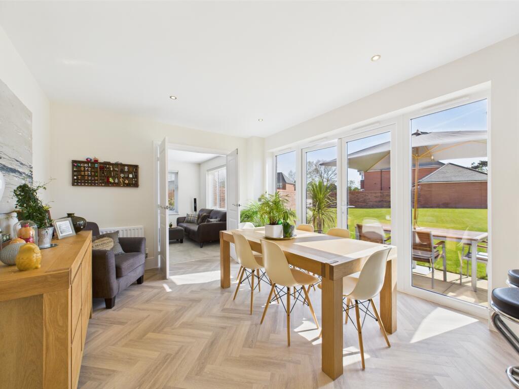
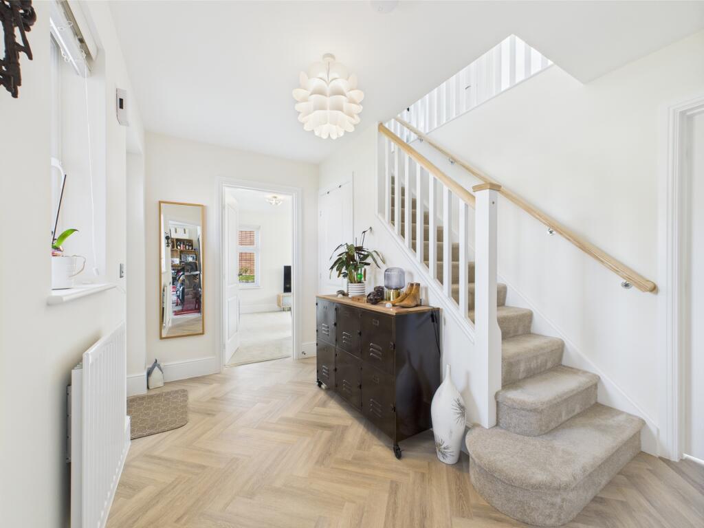
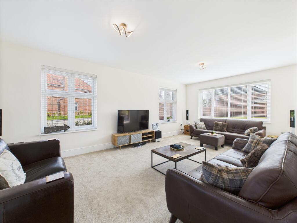
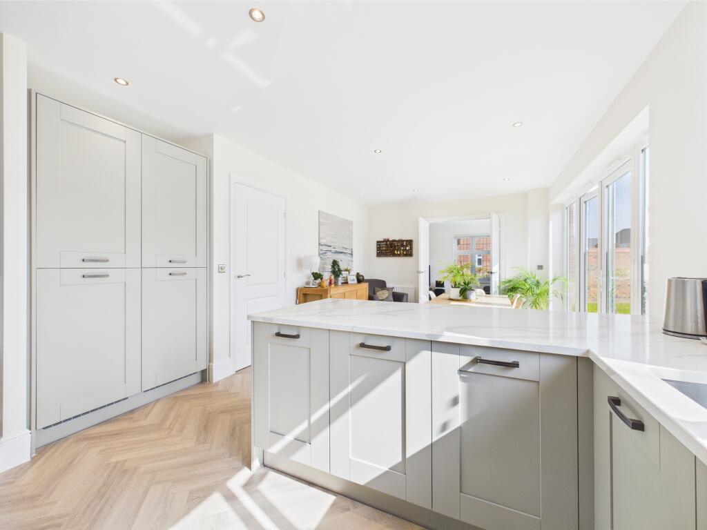
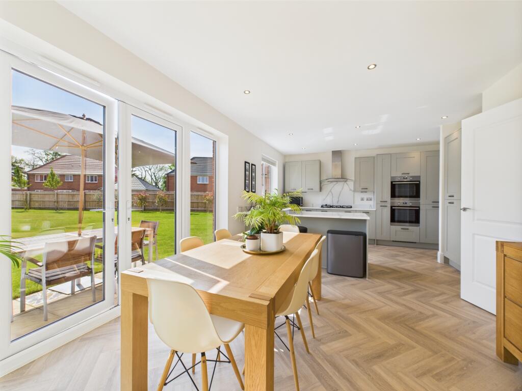
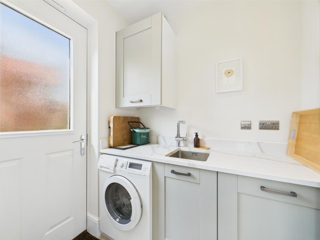
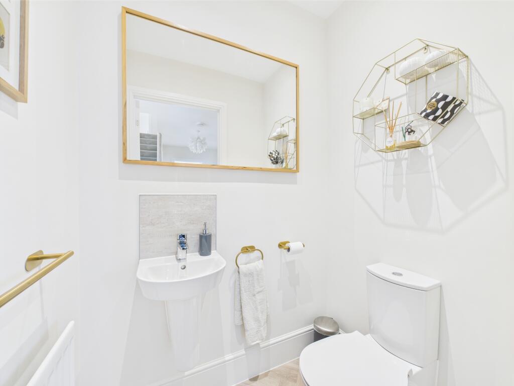
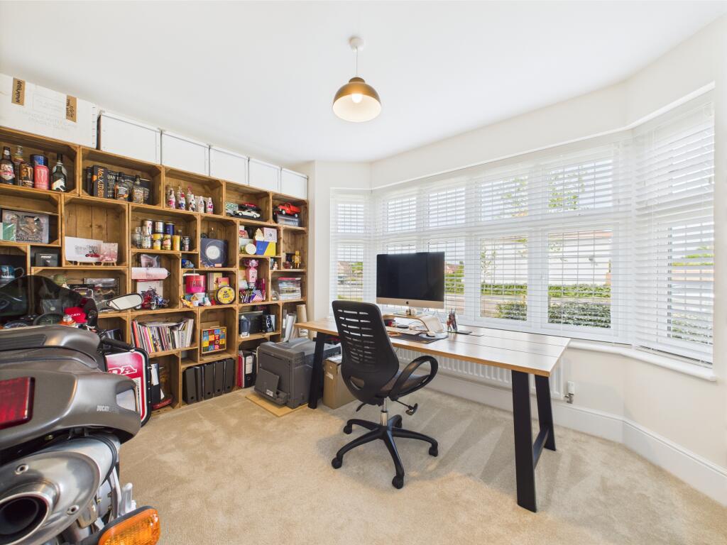
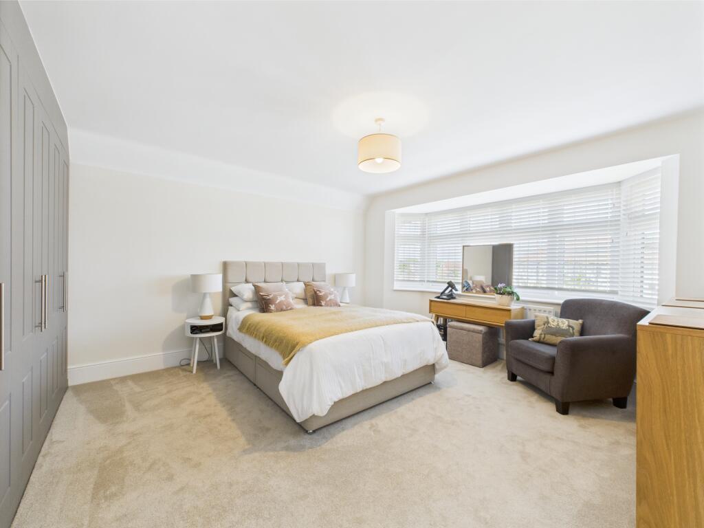
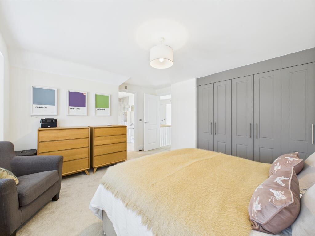
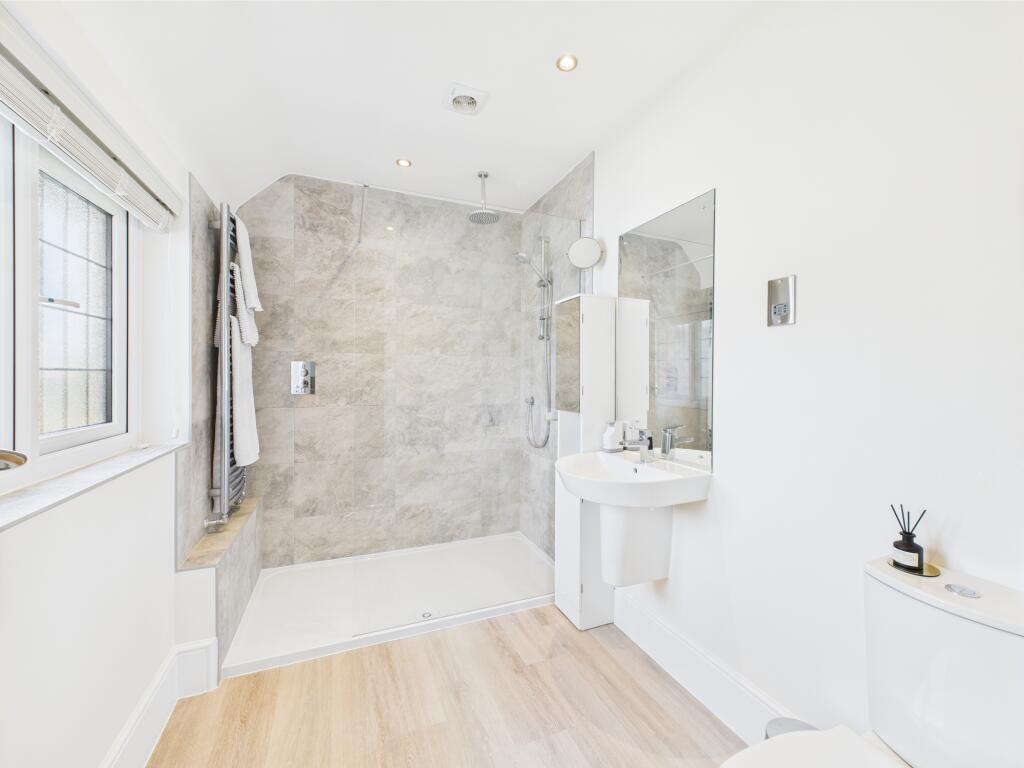
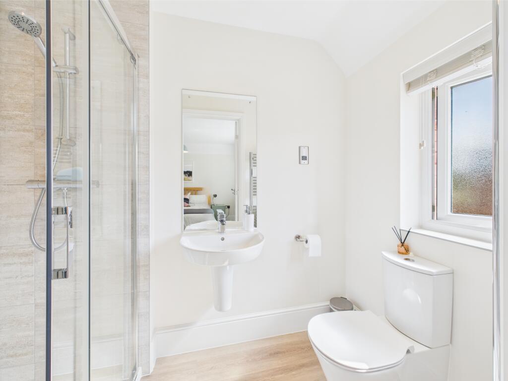
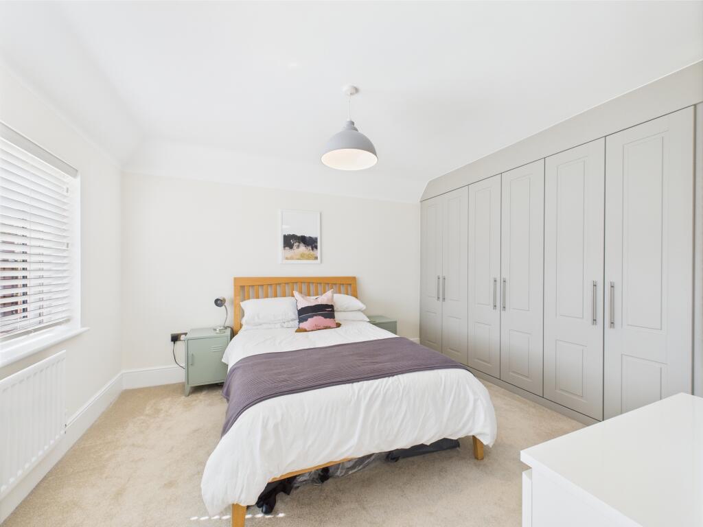
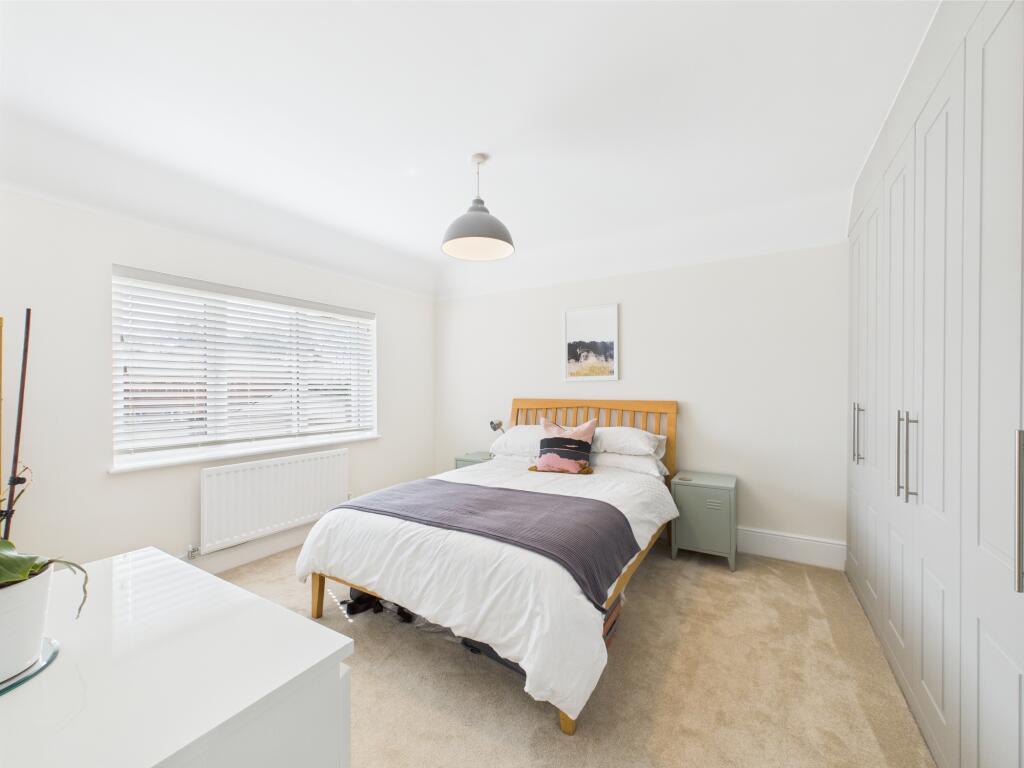
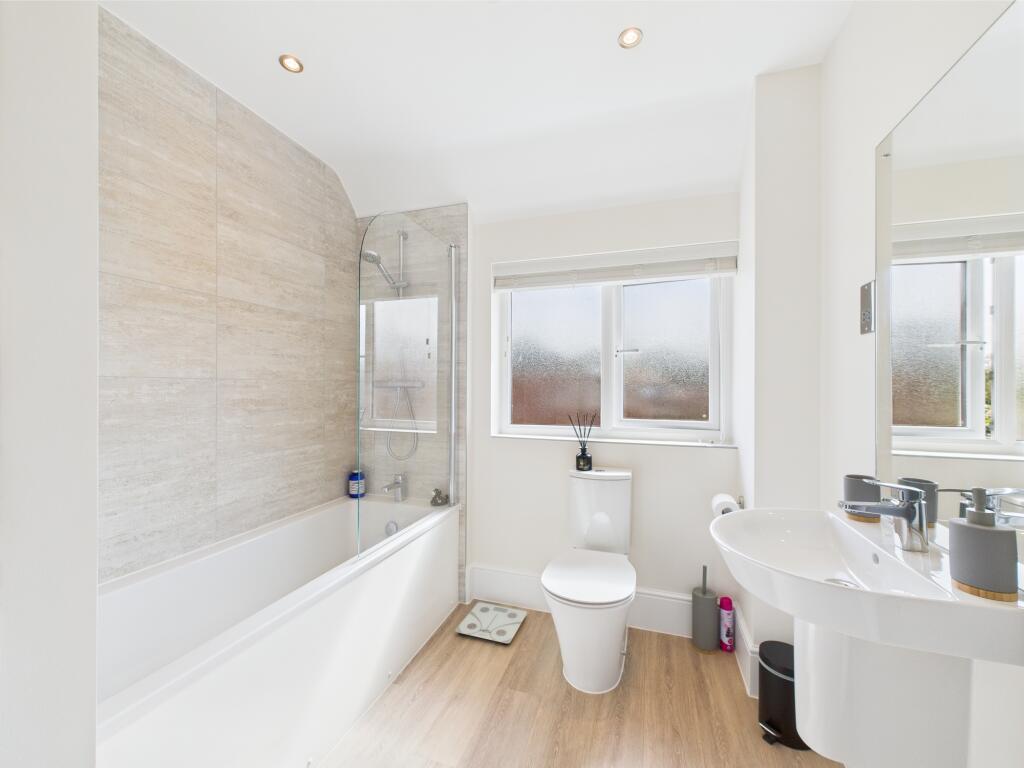
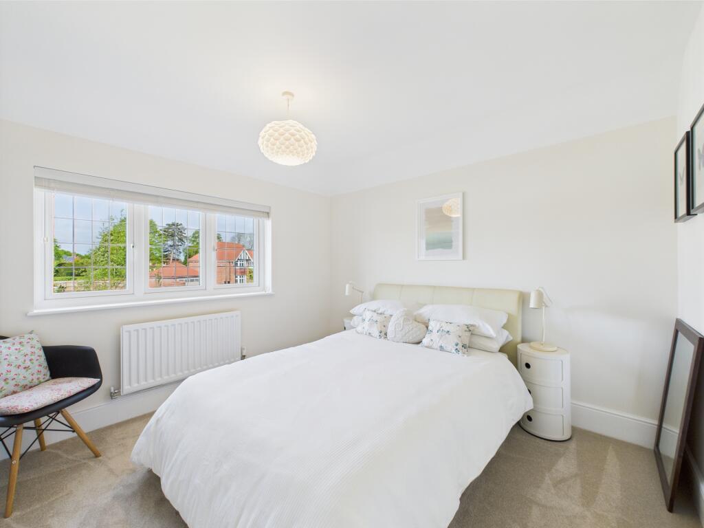
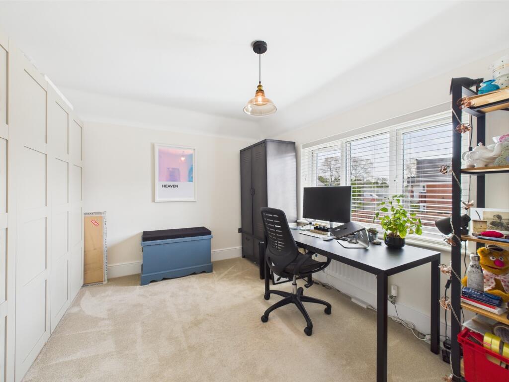
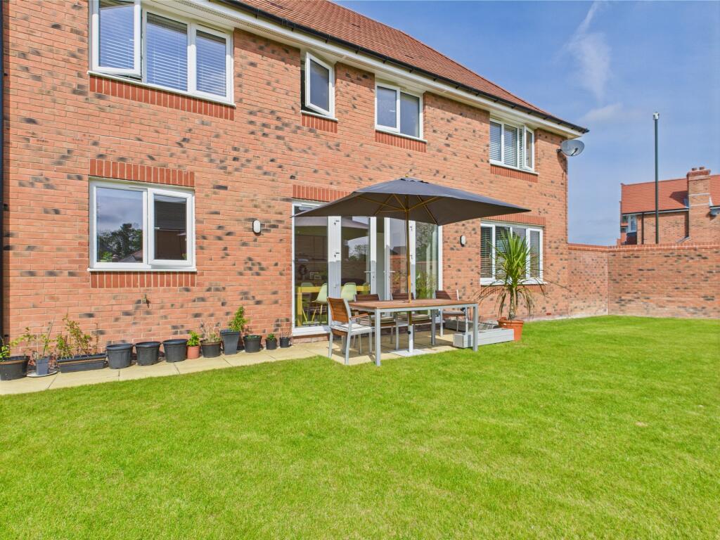
In brief the accommodation comprises; Entrance hallway with an under stairs storage cupboard, a spacious lounge with dual aspect windows, an office with a bay window and a modern fitted and open plan kitchen diner, having Quartz worksurface, high specification integrated appliances and a separate utility room. Found to the first floor are four double bedrooms with two of the bedrooms having fitted wardrobes, two en-suite shower rooms, a family bathroom and a galleried landing.
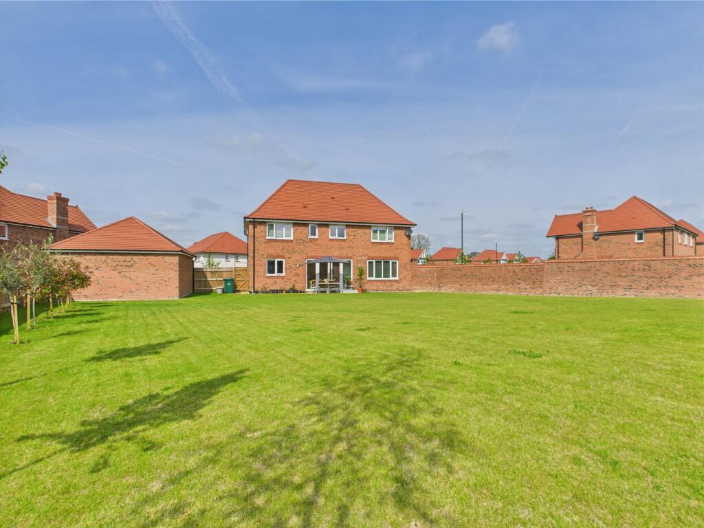
At the front of the property is a sizable driveway providing ample off road parking for several vehicles together with a detached double garage, lawned garden, flower beds and shrubbery beds, hedge boundaries and a secure gate giving access to the rear garden. To the rear of the property is a sensational, enclosed rear garden. Being larger than average in size the garden comprises; patio area, lawn fenced boundaries and tress.
Peregrine Avenue is conveniently located close to local shops, well regarded schools such as the John Port Academy and other local amenities in neighbouring Hilton and Willington. The property also benefits from excellent road access to the A38, A52 and A50 road networks, leading to the M1 motorway and East Midlands airport.
Maintenance Fee - TBC
Listed by
Mickleover
Hannells Estate Agents
Reference: 161737913
EPC Rating & Upgrade Cost
Current rating: B
Potential rating: A
Inspection date: 06/12/2023
Expiry date: 05/12/2033
Current heating cost: £796/year
Potential heating cost: £799/year
Est. upgrade cost to C: £9,500
Recommendations
- Solar water heating (£4,000 - £6,000)
- Solar photovoltaic panels, 2.5 kWp (£3,500 - £5,500)
Flood risk
Zone: 1
Risk: Low
Job (default Low)
Floorplans
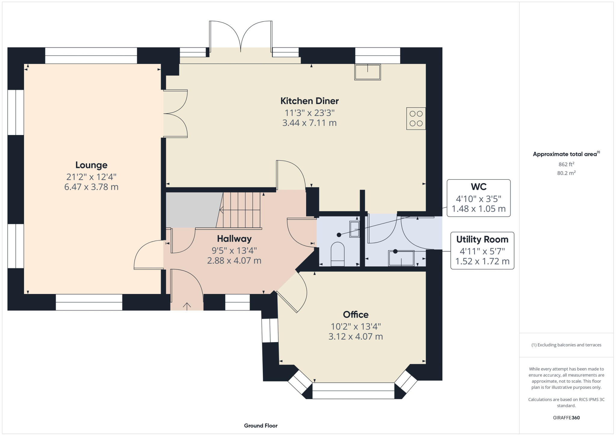
Ground Floorplan
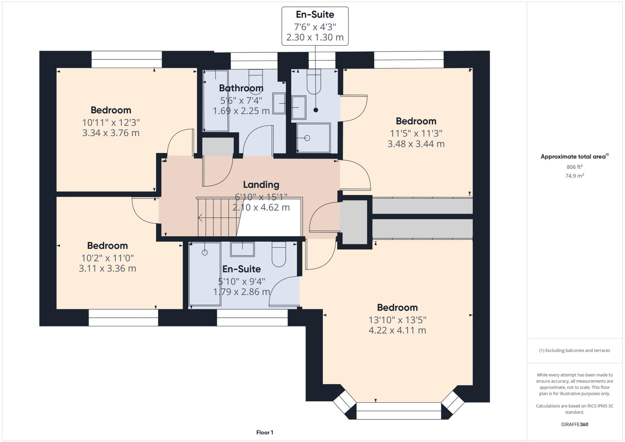
First Floorplan
EPC Graphs
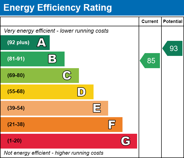
EE
Price history
| Event | Date | Price | % change |
|---|---|---|---|
| Sold | 19/02/2026 (3 months ago) | £667,000 | — |
Source: HM Land Registry Price Paid Data. Crown copyright.
Sold Comparables
Same street and nearby sales within 0.25 miles (last 5 years). Data from Land Registry Price Paid.
| Address | Price | Date | Type |
|---|---|---|---|
| 7 COMMON END, ETWALL, DERBY, SOUTH DERBYSHIRE, DERBYSHIRE, DE65 6NW | £390,000 | 25/11/2025 | Detached |
| Same street 20 PEREGRINE AVENUE, ETWALL, DERBY, SOUTH DERBYSHIRE, DERBYSHIRE, DE65 6SR | £853,000 | 28/03/2025 | Detached |
| Same street 3 PEREGRINE AVENUE, ETWALL, DERBY, SOUTH DERBYSHIRE, DERBYSHIRE, DE65 6SR | £630,000 | 15/12/2023 | Detached |
| Same street 12 PEREGRINE AVENUE, ETWALL, DERBY, SOUTH DERBYSHIRE, DERBYSHIRE, DE65 6SR | £826,950 | 01/12/2023 | Detached |
| 44 EGGINTON ROAD, ETWALL, DERBY, SOUTH DERBYSHIRE, DERBYSHIRE, DE65 6NP | £225,000 | 31/05/2023 | Detached |
| 118 EGGINTON ROAD, ETWALL, DERBY, SOUTH DERBYSHIRE, DERBYSHIRE, DE65 6NP | £242,500 | 14/02/2022 | Detached |
Street average: £769,983 (3 sales)
Area average: £285,833 (3 sales)
Capital growth trend
Land Registry outcode average: last 12 months vs 5y and 10y ago (from sold prices).
House Price Index (HM Land Registry — official index, not sold-price averages): East Midlands. Series: Detached. As of March 2026.
Rental Range
Estimated market rent for East Midlands. Low = conservative, Realistic = average, Optimistic = best case.
Based on Postcode area DE → East Midlands.
LHA (30th percentile) floor for Derby: £932/mo (Apr 2025 – Mar 2026)
Location
Nearby
Nearest stations, universities and amenities (distance from property).
| Type | Name | Distance |
|---|---|---|
| Shop | Blakes Barbers | 0.4 miles |
| Shop | Blakes Boutique | 0.4 miles |
| Bus stop | Hilton Road | 0.5 miles |
| Train station | Willington | 2.1 miles |
| Train station | Tutbury and Hatton | 3.5 miles |
| Hospital | Outwood Site | 4.5 miles |
| Hospital | Queen's Hospital | 4.6 miles |
| University | University of Derby | 6.1 miles |
Street-level crime
| Category | Count |
|---|---|
| Violence and sexual offences | 6 |
| Anti-social behaviour | 2 |
| Other theft | 2 |
| Criminal damage and arson | 1 |
| Drugs | 1 |
| Total incidents | 12 |
Within 1 mile during Apr 2026. Source: data.police.uk (England & Wales).
Schools nearby
Nearest open schools with Ofsted ratings (England). Closed schools are not shown. Data from Get Information about Schools and Ofsted.
| Name | Type | Distance | Ofsted |
|---|---|---|---|
| Etwall Primary School | Primary | 0.5 miles | Good — 12 Nov 2012 |
| John Port Spencer Academy | Secondary | 0.7 miles | Good — 13 Jul 2022 |
| Longdon Park School | Other | 1.0 miles | Good — 11 Sep 2024 |
| Hilton Spencer Academy | Primary | 1.4 miles | Good — 22 Jul 2014 |
| The Mease Spencer Academy | Primary | 1.4 miles | Good — 27 Mar 2024 |
Rental Comparables
Rental listings exist nearby, but none matched the 4-bedroom count for this property.
Rent-driven metrics
Based on Area rent estimate.
- Rent ratio — Monthly rent ÷ purchase price (1% rule). 1%+ = strong, 0.8–1% = okay, <0.8% = weak for cashflow.
- Max investor price — Rent ÷ 0.8%; the price at which rent would be 0.8% of price (Stoke-style target).
- Target investor price — Rent ÷ 1%; the price at which rent would be 1% of price (strong cashflow band).
- Gross yield — Annual rent as % of purchase price (no costs).