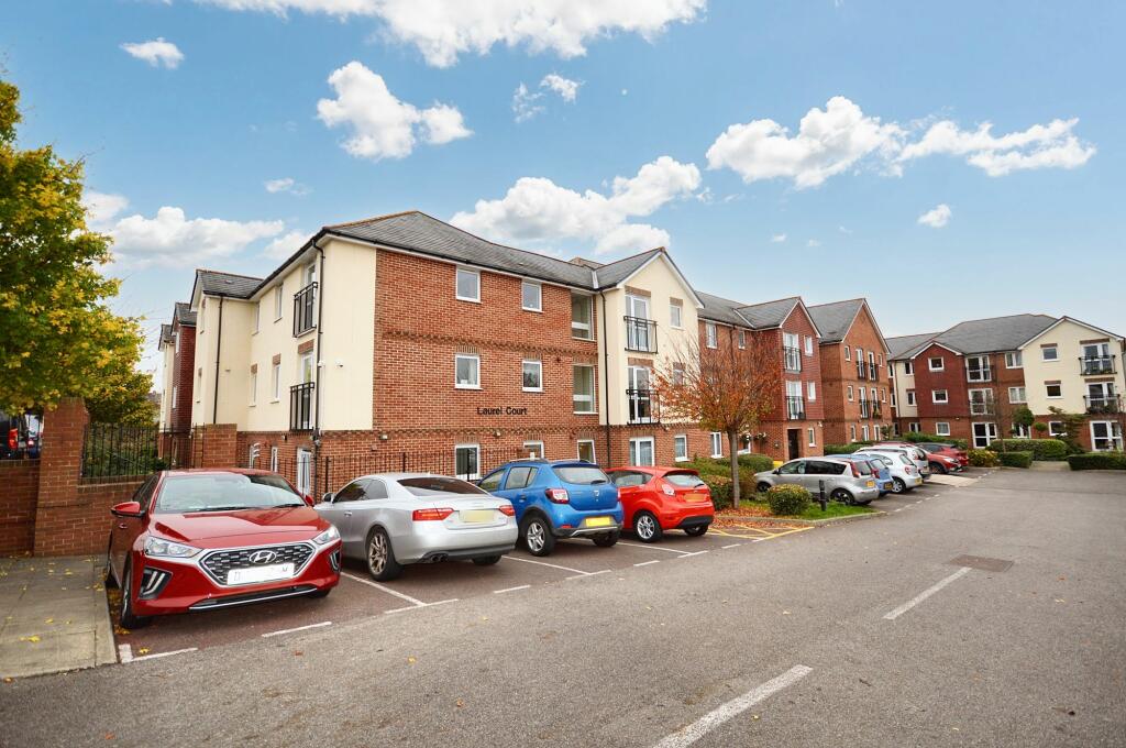
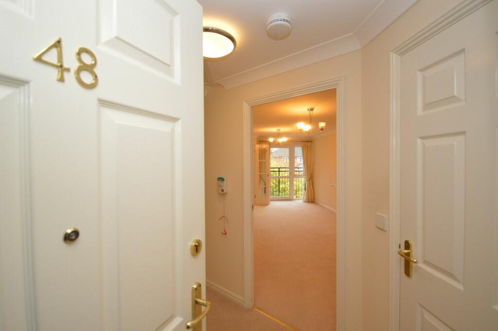
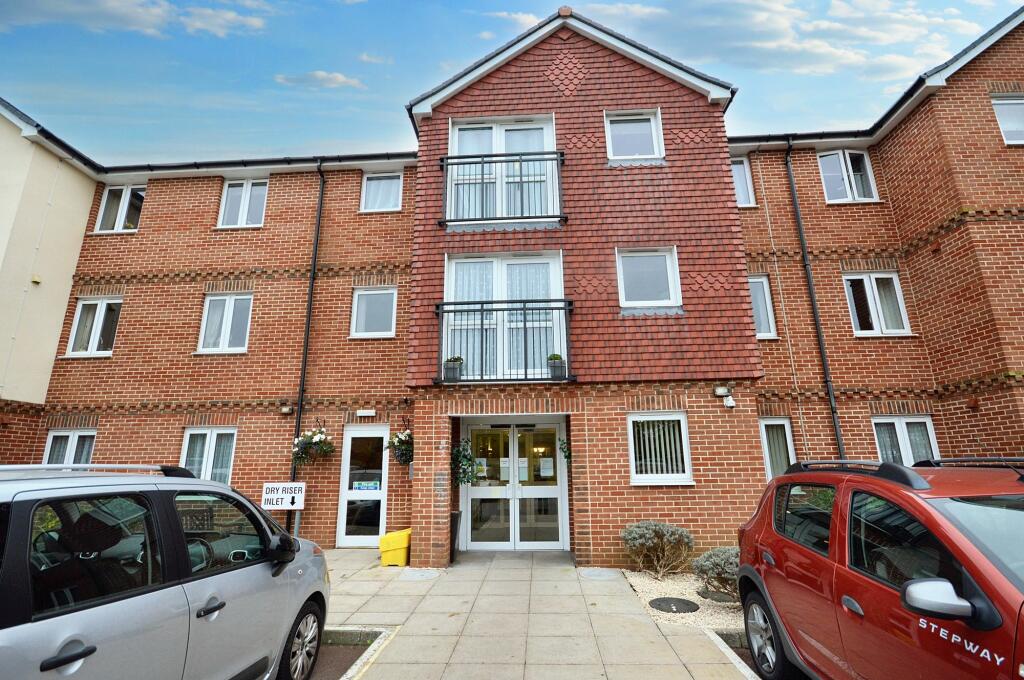
FLAT 48
LAUREL COURT, 24, STANLEY ROAD, FOLKESTONE, KENT CT19 4RL


Property details
Tenure
LEASEHOLD (112 years remaining on lease)
Floor area
51 m²
Council tax band
B
Year built
England and Wales: 2003-2006
Last sold
£55,000 Aug 2025
Price per m²
£980/m²
Local average
£397,866 (-87.4%)
Deprivation
Decile 3 (8,393 of 33,755)
Street crime
121 incidents within 1 mile (Apr 2026)
Key features
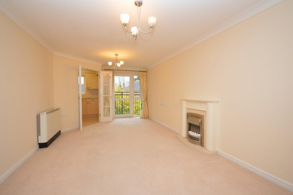
- Offers in Region of £50,000
- Second Floor Apartment
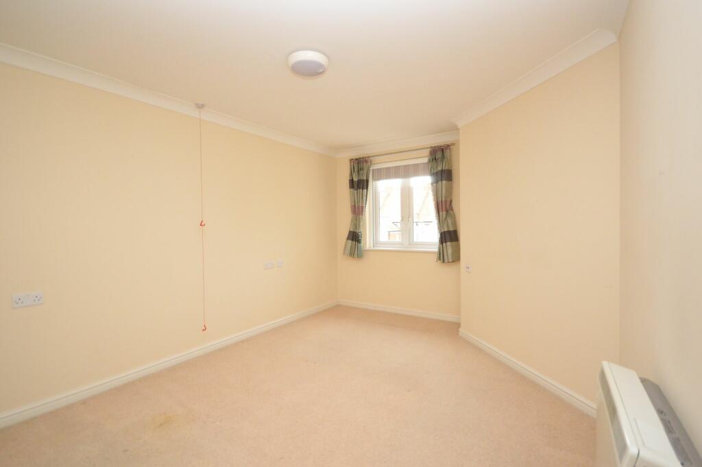
- One Bedroom
- Retirement Development
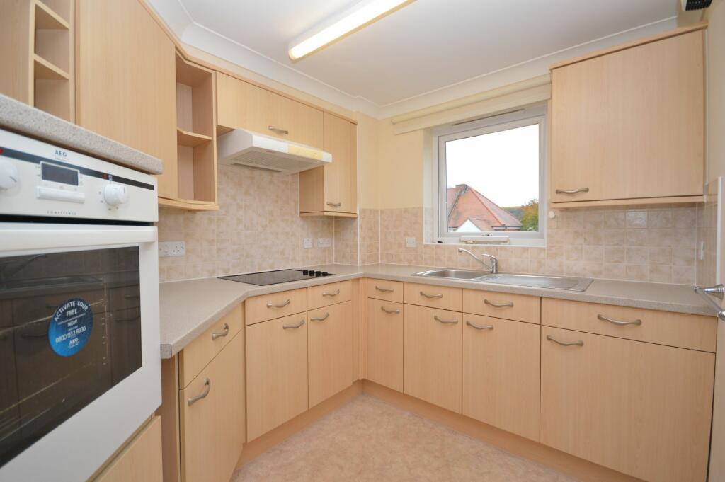
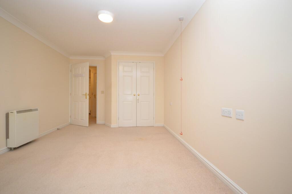
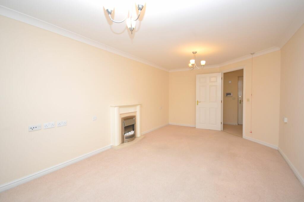
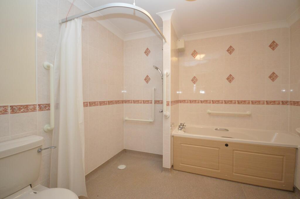
- Good Condition Throughout
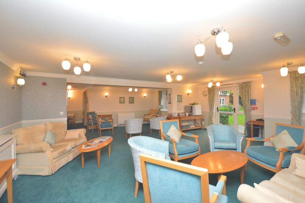
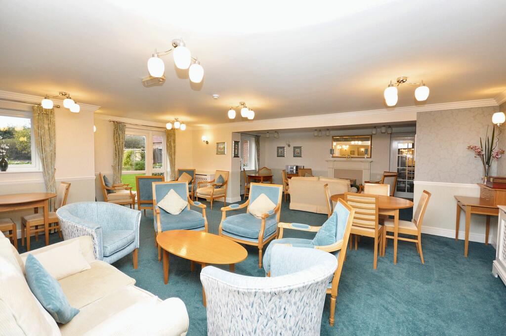
- Lovely Communal Areas Including Lounge Area and Function Room / Reading Area
- On Site Restaurant Facility
- EPC Rating ''C''
Additional details
- Electricity
- Mains supply
- Water
- Mains supply
- Sewerage
- Mains supply
- Heating
- Electric
- Parking
- Off street
- Garden
- Communal garden
- Listed property
- No
- Restrictions
- No
- Required access
- No
- Rights of way
- No
- Flooded in last 5 years
- No
- Flood defences
- No
Description
Outside, the development features beautifully landscaped gardens and seating areas where residents can unwind amidst nature's beauty. The presence of a parking forecourt at the entrance provides convenient parking for residents, with additional space allocated for visitor parking, ensuring hassle-free arrivals and departures. This property offers a serene and welcoming environment for retirees looking to embrace a peaceful lifestyle in a tight-knit community setting.
EPC Rating: C
Listed by
Cheriton
Skippers Estate Agents LTD
Reference: 156266942
EPC Rating & Upgrade Cost
Fetching EPC data… Refresh this page in a moment.
Flood risk
Zone: 1
Risk: Low
Job (default Low)
Price history
| Event | Date | Price | % change |
|---|---|---|---|
| Sold | 12/08/2025 (10 months ago) | £55,000 | — |
Source: HM Land Registry Price Paid Data. Crown copyright.
Sold Comparables
Same street and nearby sales within 0.25 miles (last 5 years). Data from Land Registry Price Paid.
| Address | Price | Date | Type |
|---|---|---|---|
| Same street LAUREL COURT, 24 FLAT 12 STANLEY ROAD, FOLKESTONE, FOLKESTONE AND HYTHE, KENT, CT19 4RL | £75,000 | 01/11/2023 | Flat |
| Same street LAUREL COURT, 24 FLAT 33 STANLEY ROAD, FOLKESTONE, FOLKESTONE AND HYTHE, KENT, CT19 4RL | £65,000 | 26/05/2023 | Flat |
| Same street LAUREL COURT, 24 FLAT 55 STANLEY ROAD, FOLKESTONE, FOLKESTONE AND HYTHE, KENT, CT19 4RL | £75,000 | 09/05/2022 | Flat |
| 61 SOMERSET ROAD, FOLKESTONE, FOLKESTONE AND HYTHE, KENT, CT19 4NW | £290,000 | 14/02/2022 | Other |
| Same street LAUREL COURT, 24 FLAT 27 STANLEY ROAD, FOLKESTONE, FOLKESTONE AND HYTHE, KENT, CT19 4RL | £67,500 | 03/11/2021 | Flat |
Street average: £70,625 (4 sales)
Area average: £290,000 (1 sale)
Capital growth trend
Land Registry outcode average: last 12 months vs 5y and 10y ago (from sold prices).
House Price Index (HM Land Registry — official index, not sold-price averages): Folkestone and Hythe. Series: All dwelling types. As of March 2026.
Rental Range
Estimated market rent for Folkestone and Hythe. Low = conservative, Realistic = average, Optimistic = best case.
Based on Local Authority from postcode lookup → Folkestone and Hythe.
LHA (30th percentile) floor for Dover-Shepway: £509/mo (Apr 2025 – Mar 2026)
Location
Address
24 Stanley Road
Nearby
Nearest stations, universities and amenities (distance from property).
| Type | Name | Distance |
|---|---|---|
| Bus stop | Laurel Court | 0.0 miles |
| Bus stop | Stanley Road | 0.1 miles |
| Shop | Co-op Food | 0.2 miles |
| Shop | Tyre Fix | 0.2 miles |
| Train station | Folkestone West | 0.7 miles |
| Train station | Folkestone Central | 1.3 miles |
| Hospital | Kent Community Health | 1.9 miles |
| Hospital | William Harvey Hospital (Ashford) | 10.3 miles |
Street-level crime
| Category | Count |
|---|---|
| Violence and sexual offences | 41 |
| Shoplifting | 26 |
| Anti-social behaviour | 13 |
| Other theft | 10 |
| Criminal damage and arson | 9 |
| Vehicle crime | 6 |
| Possession of weapons | 5 |
| Burglary | 3 |
| Drugs | 3 |
| Public order | 3 |
| Other crime | 2 |
| Total incidents | 121 |
Within 1 mile during Apr 2026. Source: data.police.uk (England & Wales).
Schools nearby
Nearest open schools with Ofsted ratings (England). Closed schools are not shown. Data from Get Information about Schools and Ofsted.
| Name | Type | Distance | Ofsted |
|---|---|---|---|
| Harcourt Primary School | Primary | 0.2 miles | Good — 19 Apr 2013 |
| All Soul's Church of England Primary School | Primary | 0.2 miles | Good — 8 Nov 2023 |
| Birchwood | Other | 0.3 miles | Good — 11 Mar 2019 |
| Turner Free School | Secondary | 0.3 miles | Good — 30 Jan 2023 |
| Morehall Primary School and Nursery | Primary | 0.5 miles | Good — 20 Oct 2019 |
Rental Comparables
Rental listings exist nearby, but none matched the 1-bedroom count for this property.
Rent-driven metrics
Based on Area rent estimate.
- Rent ratio — Monthly rent ÷ purchase price (1% rule). 1%+ = strong, 0.8–1% = okay, <0.8% = weak for cashflow.
- Max investor price — Rent ÷ 0.8%; the price at which rent would be 0.8% of price (Stoke-style target).
- Target investor price — Rent ÷ 1%; the price at which rent would be 1% of price (strong cashflow band).
- Gross yield — Annual rent as % of purchase price (no costs).