FLAT 32
TARO APARTMENTS, HENRY STRONG ROAD, HARROW, GREATER LONDON HA1 4BF
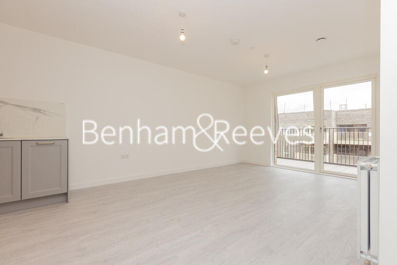
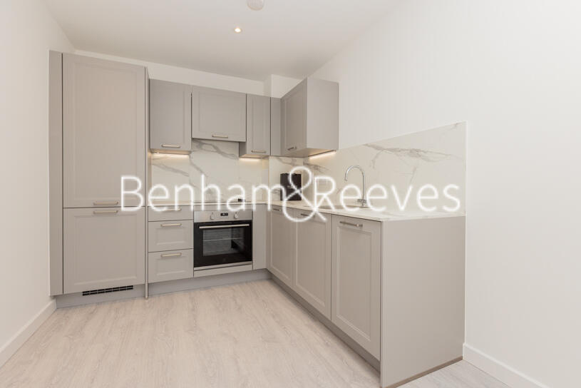
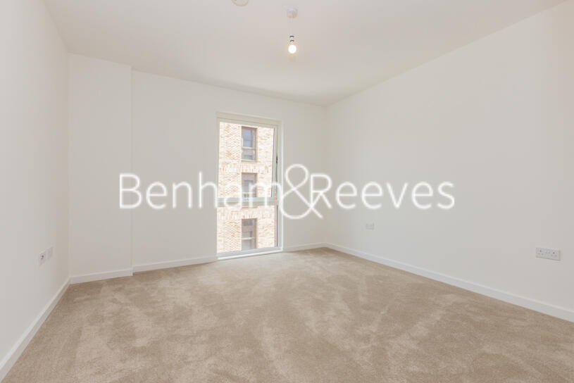

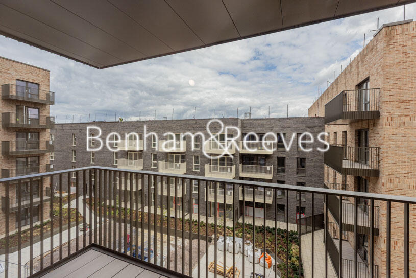
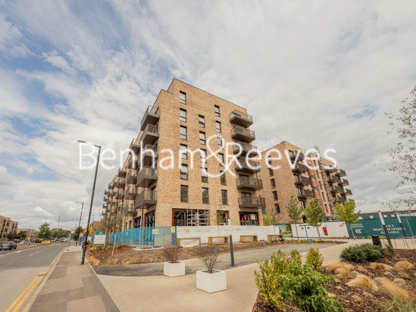
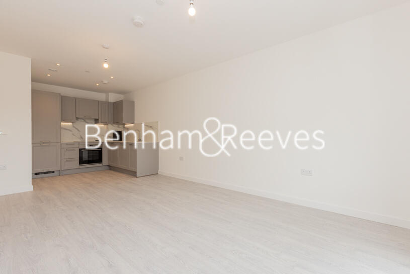
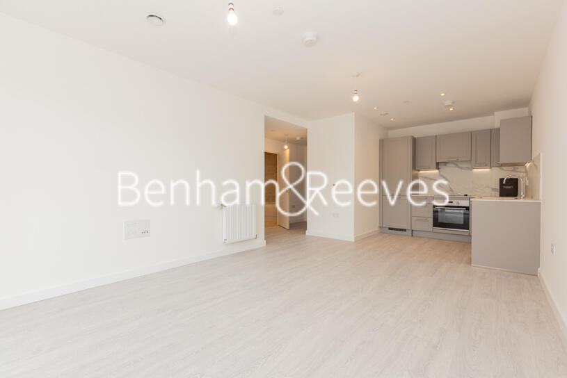
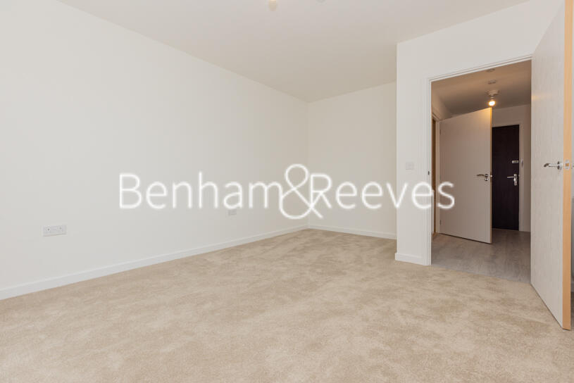
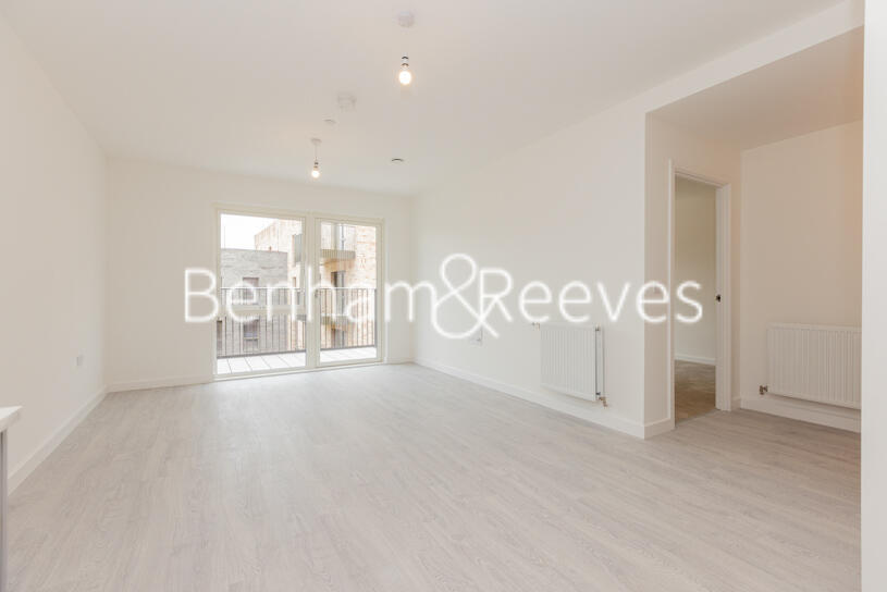
Photo 1 Photo 2 Photo 3 Photo 4 Photo 5 Photo 6 Photo 7 Photo 8 Photo 9 Photo 10
/ 10
Property details
Floor area
66 m²
EPC rating
B
Deprivation
Decile 6 (17,886 of 33,755)
Street crime
548 incidents within 1 mile (Apr 2026)
Key features
- Brand new
- 1 Bedroom
- Residents gym
- Balcony
- EPC-B
- Unfurnished
- local amenities of Harrow and transport links
- Harrow & Wealdstone underground and Overground station.
Description
Comprising a large open plan reception room, wood floor and large floor-to-ceiling windows which provide a lot of natural light into the room. There is a fully fitted modern kitchen with integrated appliances, double bedrooms with storage space, en-suite to the main and a sleekly designed family bathroom. Other benefits include a large private balcony accessed via the reception room and a residents' gym.
Eastman Village is situated on the site of a former Kodak factory in Wealdstone, Harrow, set amongst lovely, landscaped green open spaces. The local area of Harrow offers shopping amenities in the form of high-street shops and a shopping centre, while there are a selection of restaurants, cafes, and open spaces to explore.
Listed by
Wembley
Benham & Reeves
Reference: 163653329
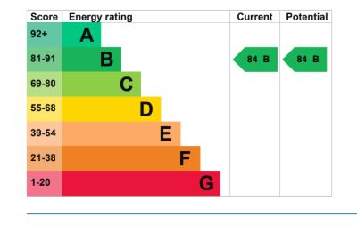
EPC Rating & Upgrade Cost
Current rating: B
Potential rating: B
Inspection date: 24/05/2023
Expiry date: 23/05/2033
Current heating cost: £221/year
Potential heating cost: £221/year
Flood risk
Zone: 1
Risk: Low
Job (default Low)
Floorplans
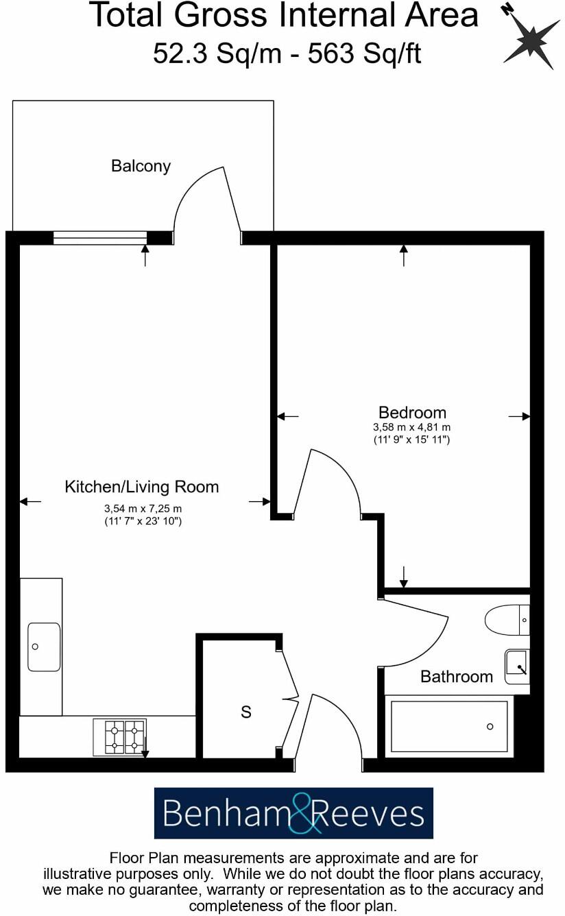
Floorplan 1
EPC Graphs
EPC
Rental Range
Estimated market rent for Harrow. Low = conservative, Realistic = average, Optimistic = best case.
Based on Local Authority from postcode lookup → Harrow.
LHA (30th percentile) floor for North West London: £1,097/mo (Apr 2025 – Mar 2026)
Location
Address
Hargrave Drive
Nearby
Nearest stations, universities and amenities (distance from property).
| Type | Name | Distance |
|---|---|---|
| Shop | CEF | 0.1 miles |
| Bus stop | Headstone Drive | 0.1 miles |
| Shop | Unknown | 0.1 miles |
| Bus stop | Harrow View | 0.1 miles |
| Train station | Harrow & Wealdstone | 0.5 miles |
| Train station | Headstone Lane | 0.7 miles |
| University | Westminster University, Harrow Campus | 1.6 miles |
| Hospital | Northwick Park Hospital | 1.7 miles |
| Hospital | St Mark's | 1.7 miles |
| University | John Scales Centre for Biomedical Engineering | 2.9 miles |
Street-level crime
| Category | Count |
|---|---|
| Violence and sexual offences | 155 |
| Anti-social behaviour | 137 |
| Shoplifting | 44 |
| Vehicle crime | 41 |
| Other theft | 33 |
| Theft from the person | 31 |
| Criminal damage and arson | 28 |
| Public order | 22 |
| Drugs | 20 |
| Burglary | 14 |
| Robbery | 13 |
| Other crime | 5 |
| Bicycle theft | 4 |
| Possession of weapons | 1 |
| Total incidents | 548 |
Within 1 mile during Apr 2026. Source: data.police.uk (England & Wales).
Schools nearby
Nearest open schools with Ofsted ratings (England). Closed schools are not shown. Data from Get Information about Schools and Ofsted.
| Name | Type | Distance | Ofsted |
|---|---|---|---|
| Harrow Collegiate | Other | 0.3 miles | — (No rating) |
| Whitefriars School | Other | 0.3 miles | Good — 16 May 2024 |
| Marlborough Primary School | Primary | 0.4 miles | Good — 13 Nov 2023 |
| Salvatorian Roman Catholic College | Secondary | 0.5 miles | Good — 27 Feb 2017 |
| The Sacred Heart Language College | Secondary | 0.5 miles | — (Inspected (no overall grade)) |
Rental Comparables
Residential lets from OpenRent and Rightmove for the area (same bedroom count). Use to validate rent estimates. Student lets are excluded.
| Title | Rent | Beds | Distance | As seen on |
|---|---|---|---|---|
| 1 Bed Flat, Queens House, HA1 | £1,650/mo | 1 | 1.01 miles | OpenRent |
| 1 Bed Flat, Alpha Court, HA1 | £1,600/mo | 1 | 1.05 miles | OpenRent |
Average rent: £1,625/mo (2 listings)