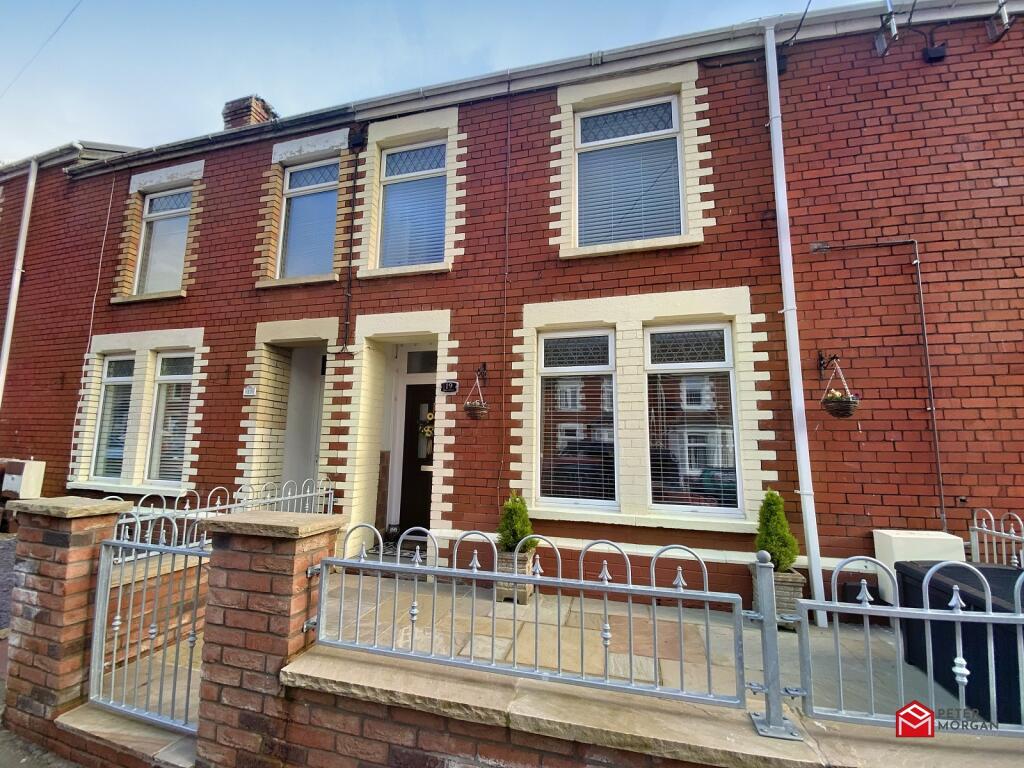
19 PARK STREET
BRIDGEND, KENFIG HILL, BRIDGEND CF33 6DF
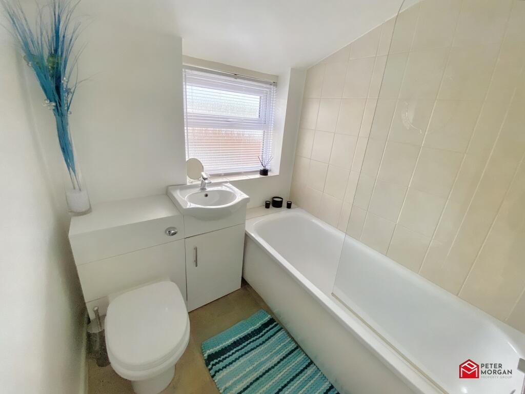
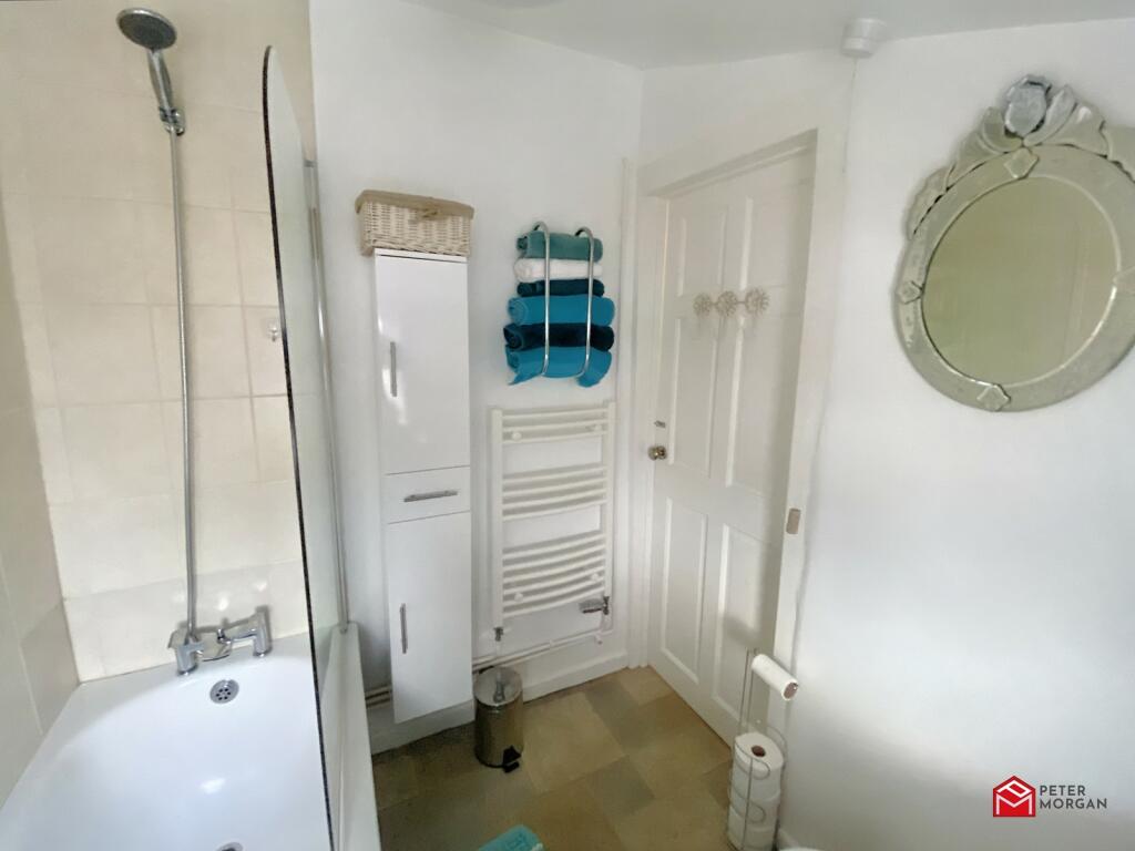
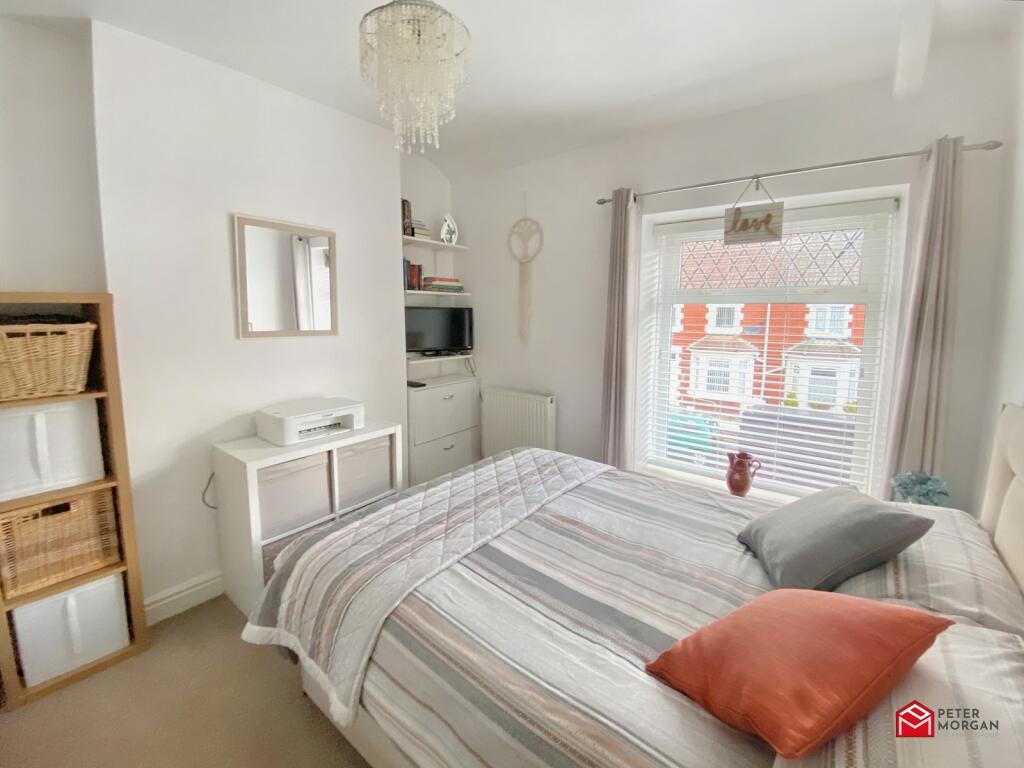
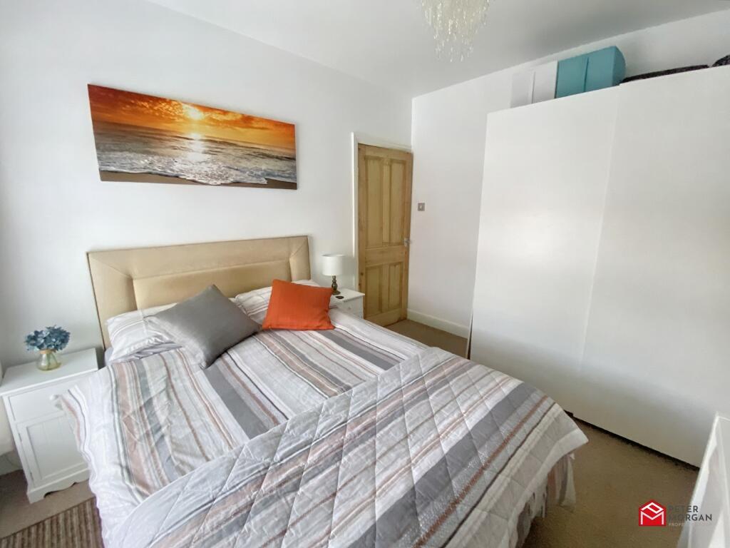
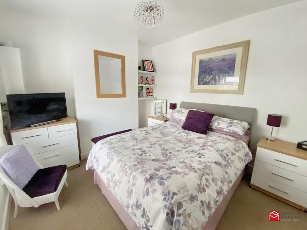
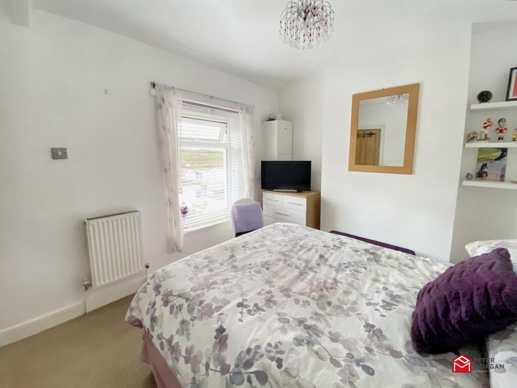
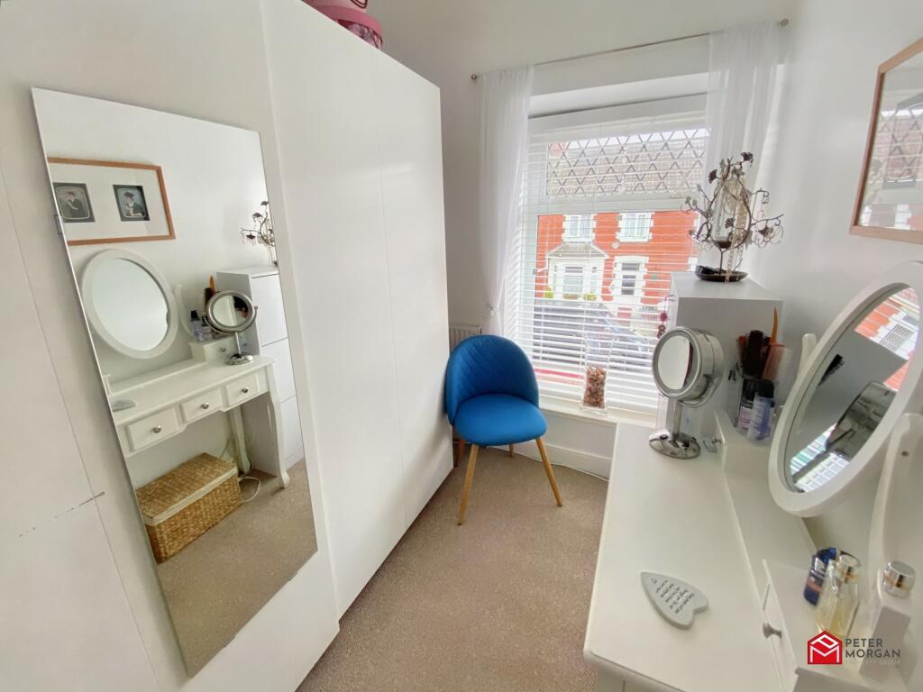
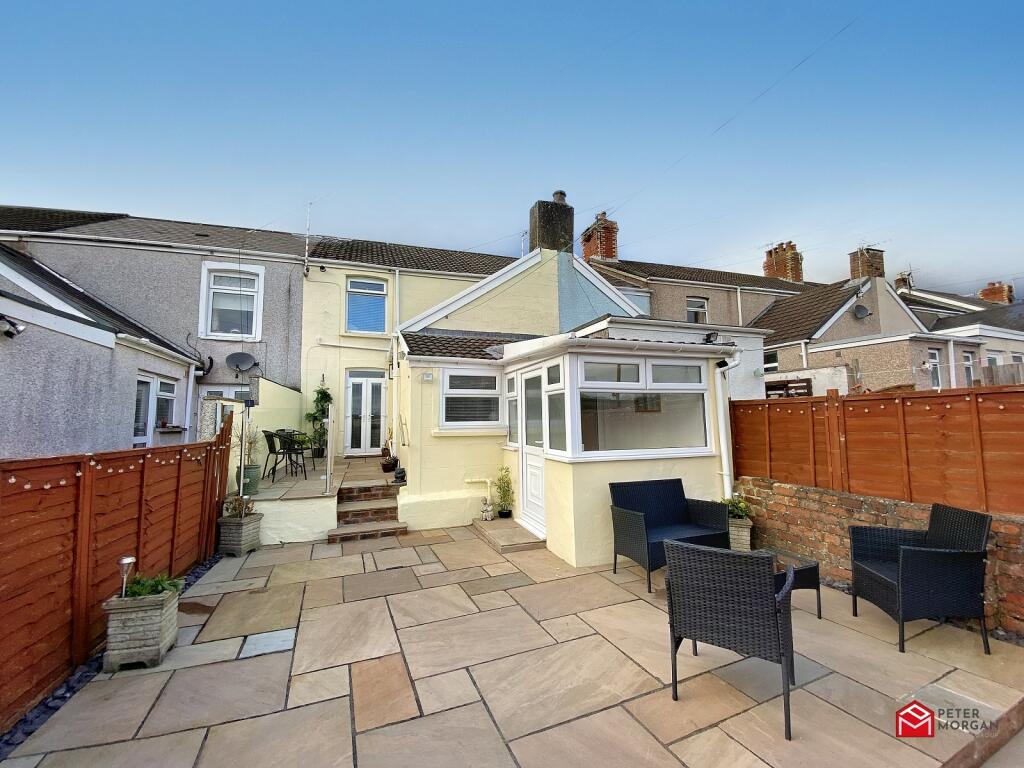
Main Image Rear Garden Sitting Room Lounge/Dining Room Hallway Sitting Room Lounge Lounge Kitchen/Breakfast Room Kitchen/Breakfast Room Kitchen/Breakfast Room Rear Porch Family Bathroom Family Bathroom Bedroom 1 Bedroom 1 Bedroom 2 Bedroom 2 Bedroom 3 Rear Garden Rear Garden Rear Garden Rear Garden Front Garden Rear Garden Rear Garden Rear Garden Not Specified
/ 28
Property details
Tenure
FREEHOLD
Floor area
81 m²
Council tax band
C
EPC rating
D
Year built
England and Wales: 1900-1929
Last sold
£184,000 Sep 2023
Price per m²
£2,315/m²
Local average
£173,865 (+7.8%)
Street crime
57 incidents within 1 mile (Apr 2026)
Key features
- Immaculately presented and fully modernised
- 3 bedroom mid terraced home
- 2 reception rooms
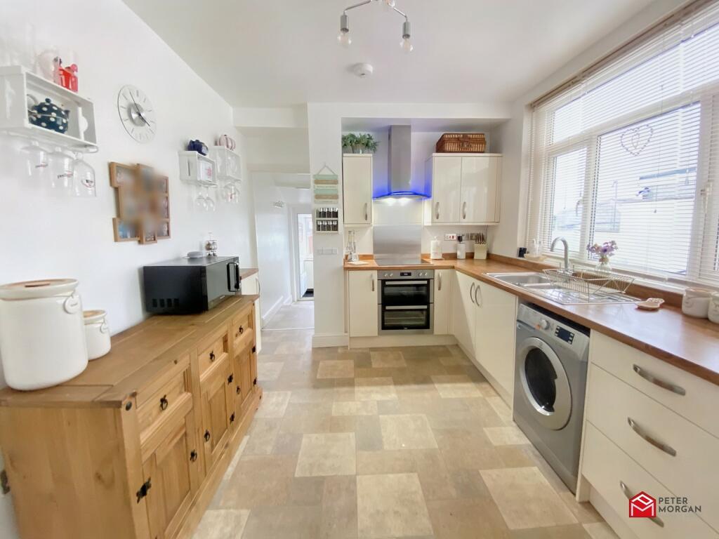
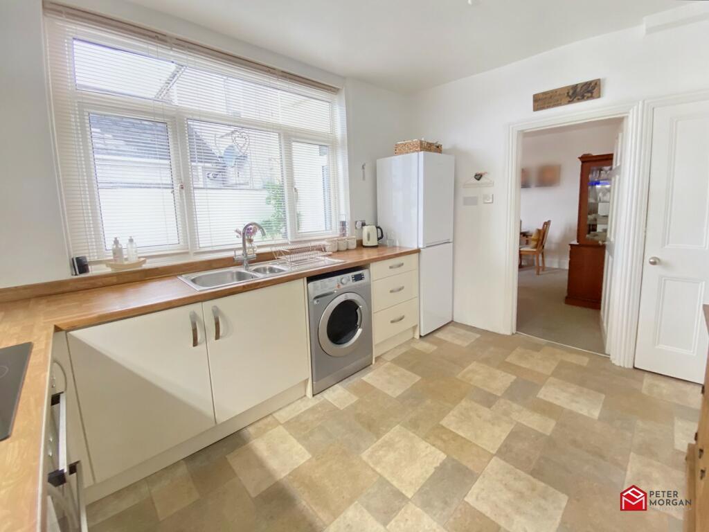
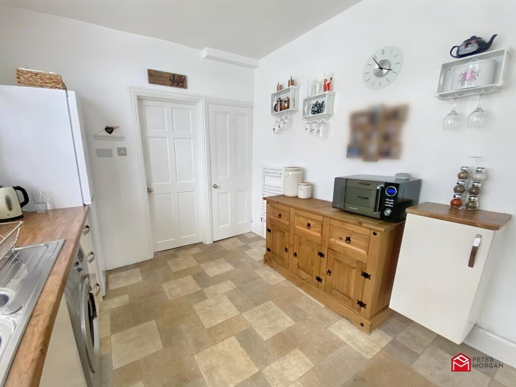
- Fully fitted kitchen/ breakfast room
- Approximately 500m from the Village centre
- Approximately 2 miles from the M4 at Junction 37 and 3 miles from Kenfig Nature Reserve
- Approximately 6 miles from the Coastline at Rest Bay Porthcawl
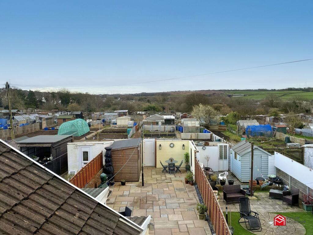
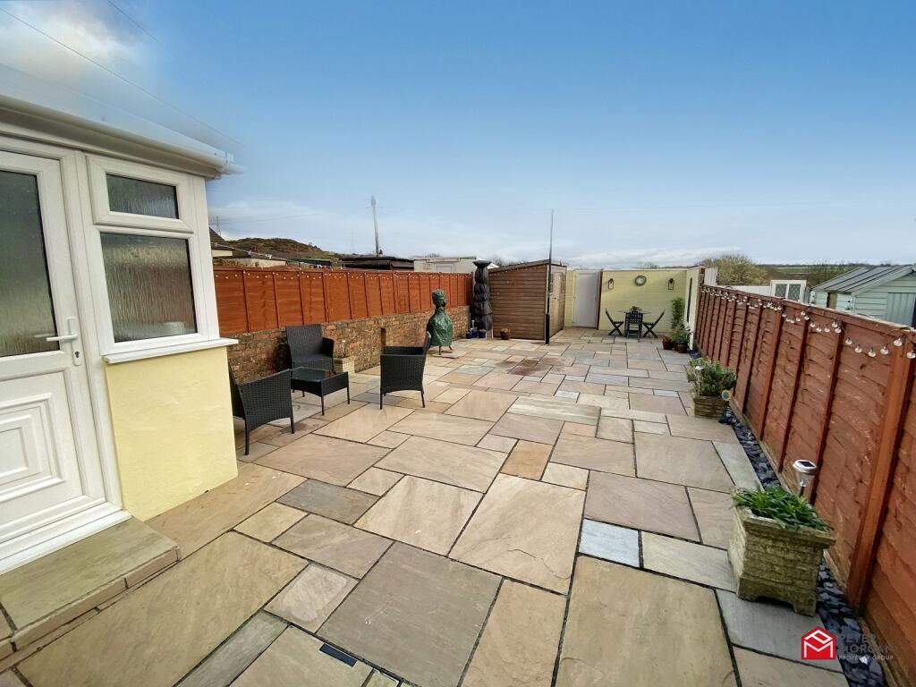
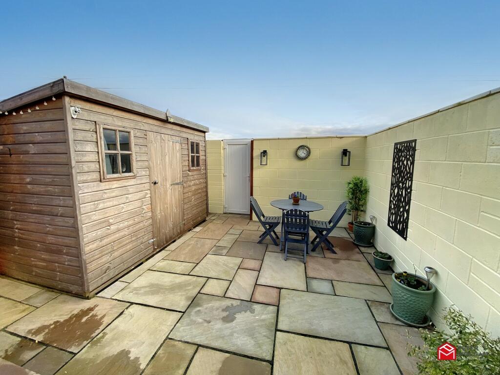
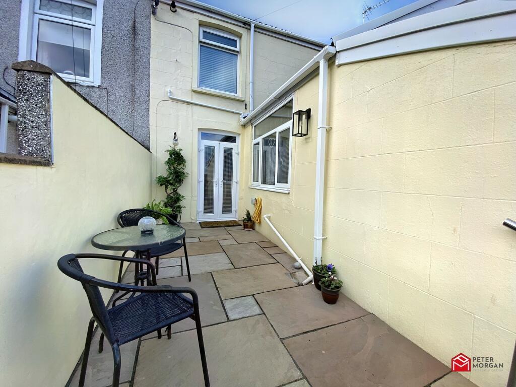
- Fully landscaped, low maintenance gardens
- uPVC double glazing and combi GCH
- Council Tax Band: C. EPC:D
Additional details
- Parking
- Yes
- Garden
- Yes
Description
Approximately 500m from the Village centre, 2 miles from the M4 at Junction 37, 3 miles from Kenfig Nature Reserve and 6 miles from the Coastline at Rest Bay Porthcawl.
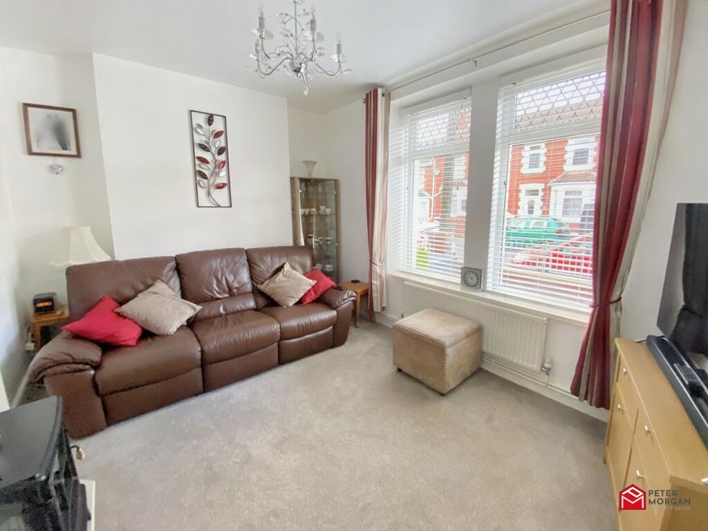
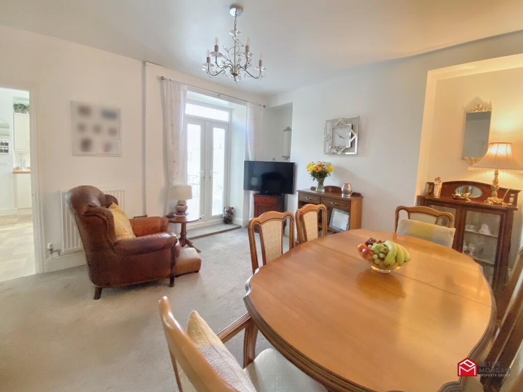
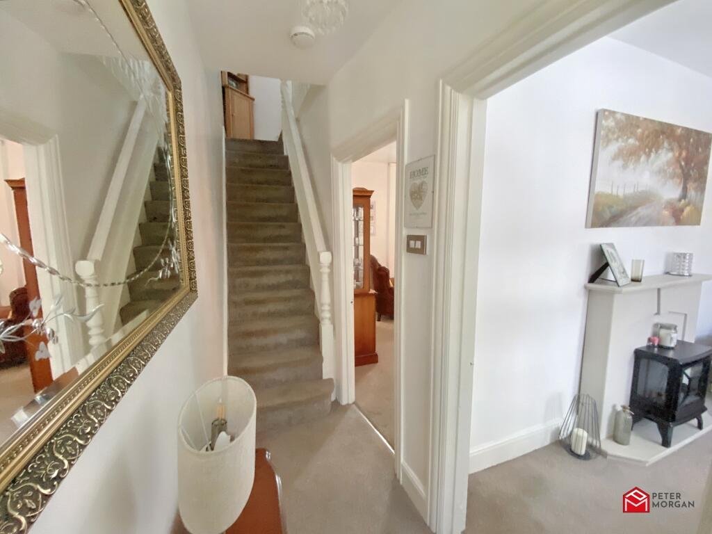
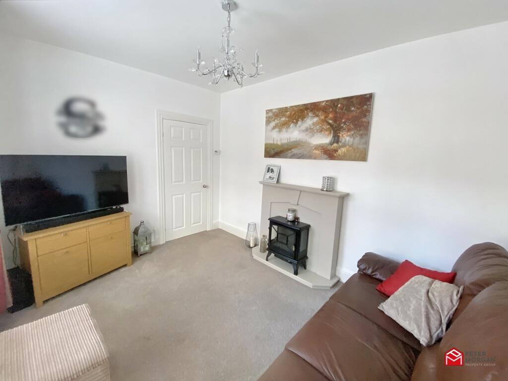
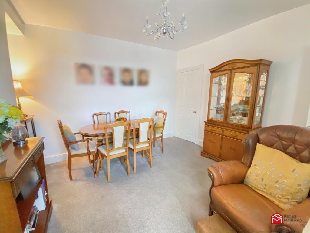
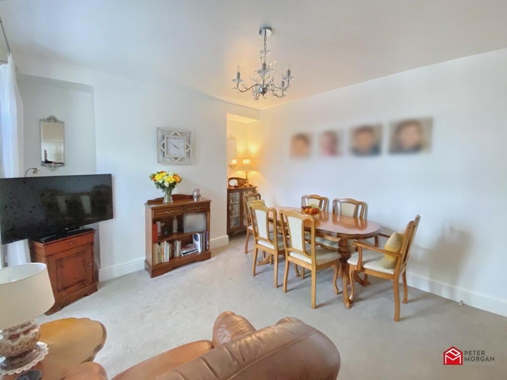
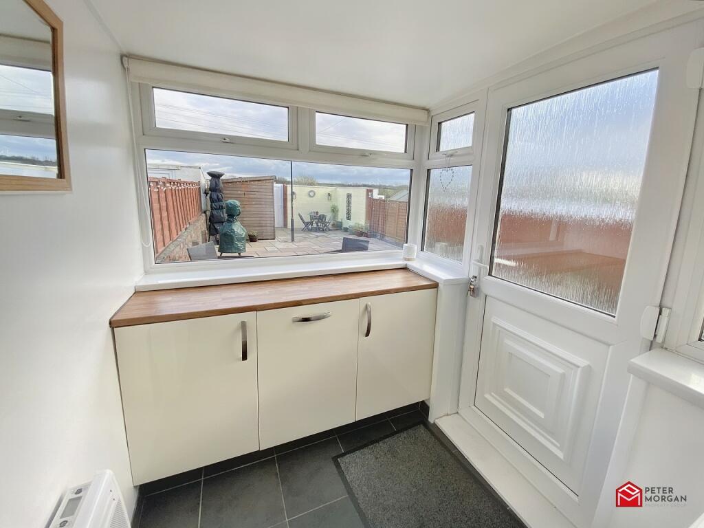
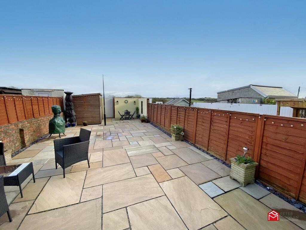
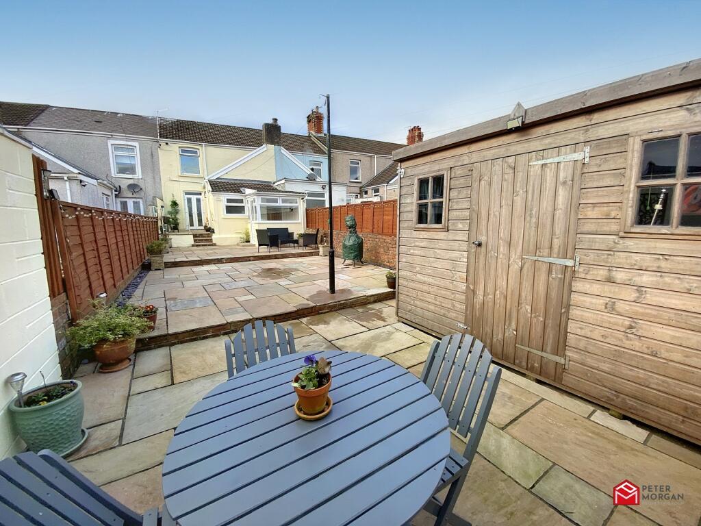
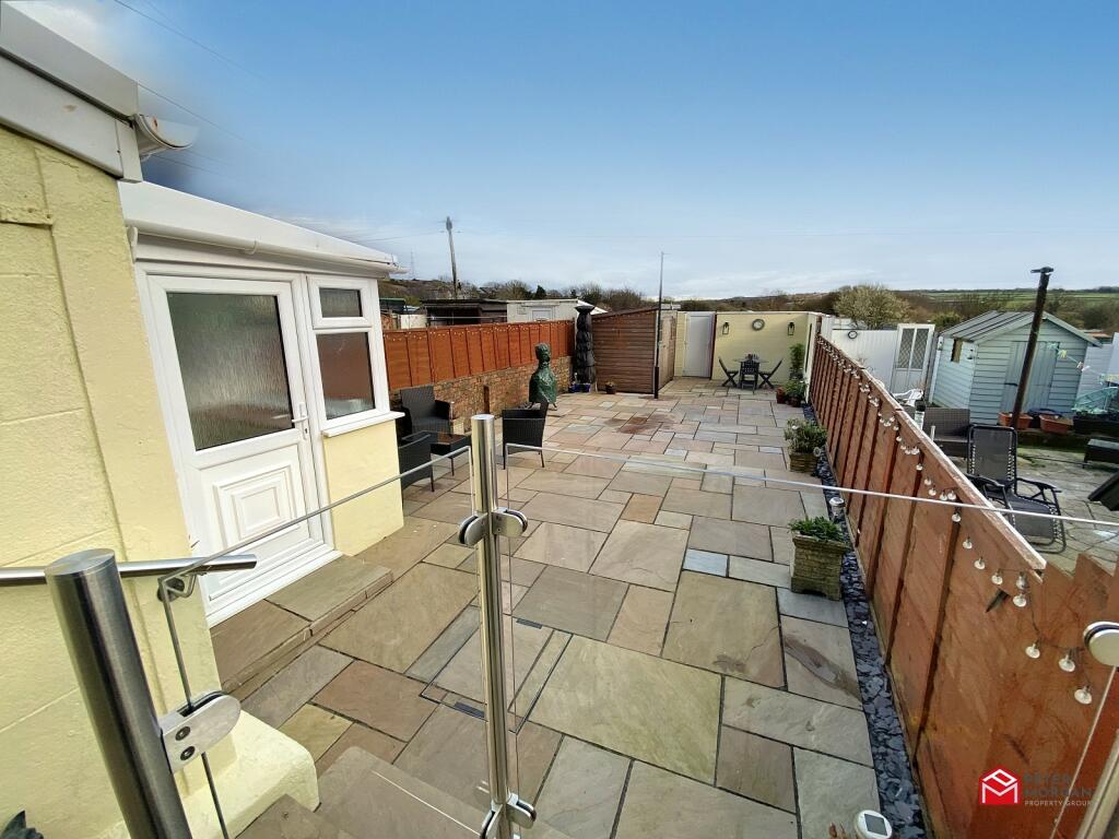
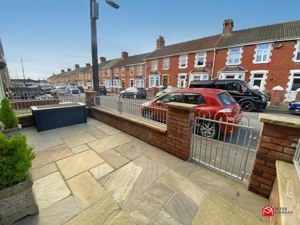
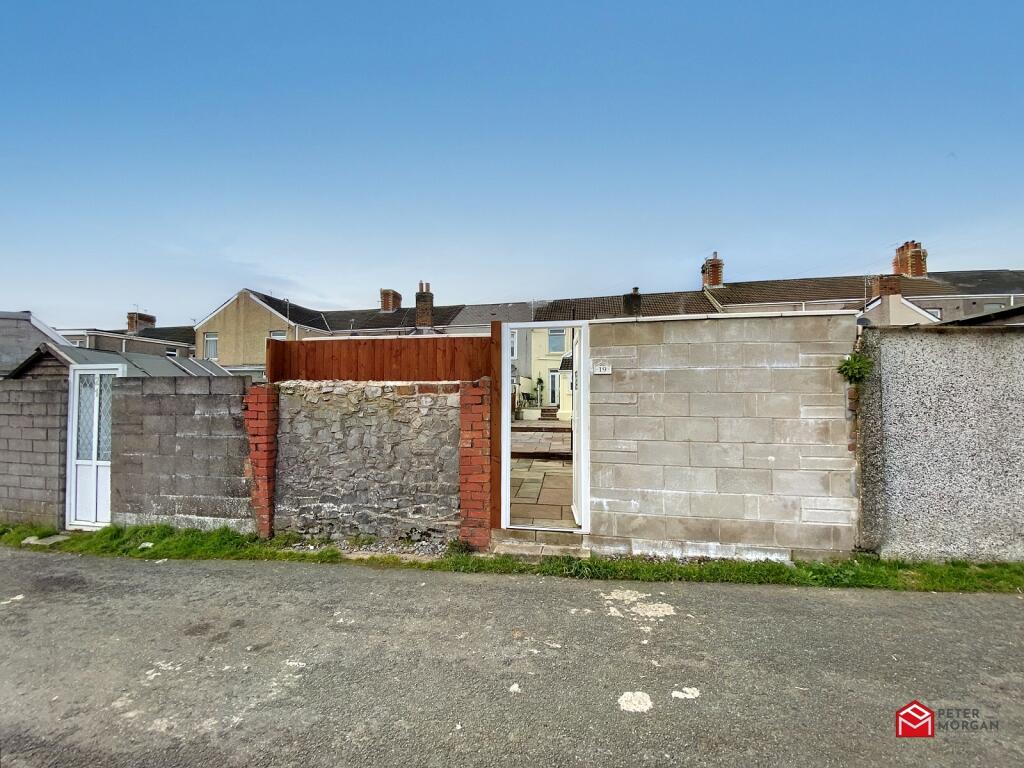
This home has immaculately presented accommodation comprising hallway, 2 reception rooms, fitted kitchen/ breakfast room, bathroom, rear hallway, rear porch and 3 first floor bedrooms. Fully landscaped low maintenance gardens to front and rear, laid with Indian flagstone. Illuminated South/ West facing rear garden with rear lane access and open aspect.
The property benefits from major renovation works over recent years and has uPVC double glazing and combi gas central heating. Flooring and blinds to remain. MUST BE VIEWED!!
Listed by
Bridgend
Peter Morgan
Reference: 132207278
EPC Rating & Upgrade Cost
Current rating: D
Potential rating: C
Inspection date: 05/10/2013
Current heating cost: £679/year
Potential heating cost: £555/year
Est. upgrade cost to C: £26,540
Recommendations
- 50 mm internal or external wall insulation (£4,000 - £14,000)
- Floor insulation (£800 - £1,200)
- Low energy lighting for all fixed outlets (£40)
- Solar water heating (£4,000 - £6,000)
- Solar photovoltaic panels, 2.5 kWp (£9,000 - £14,000)
Flood risk
Zone: 1
Risk: Low
Job (default Low)
Floorplans
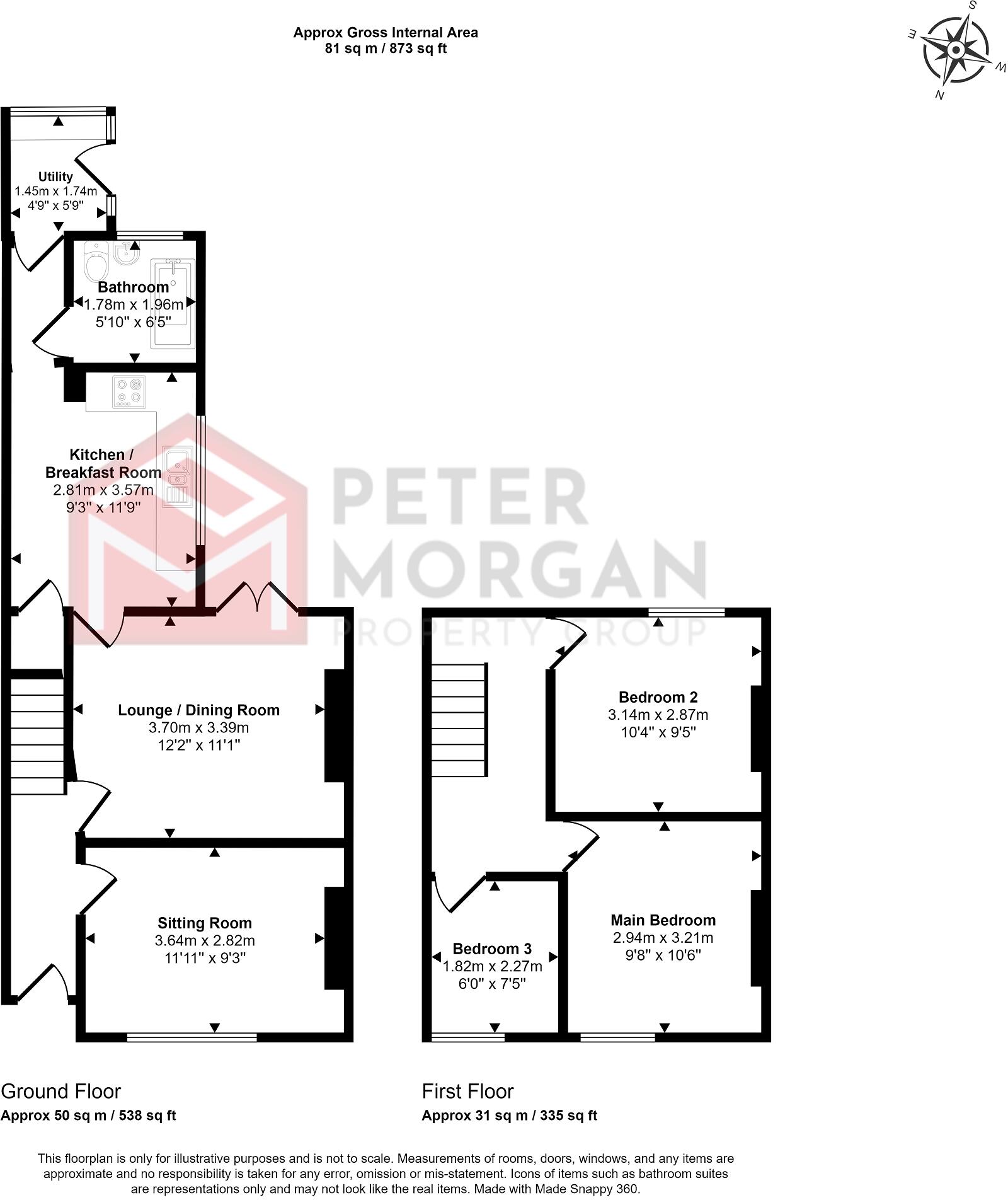
Not Specified
EPC Graphs
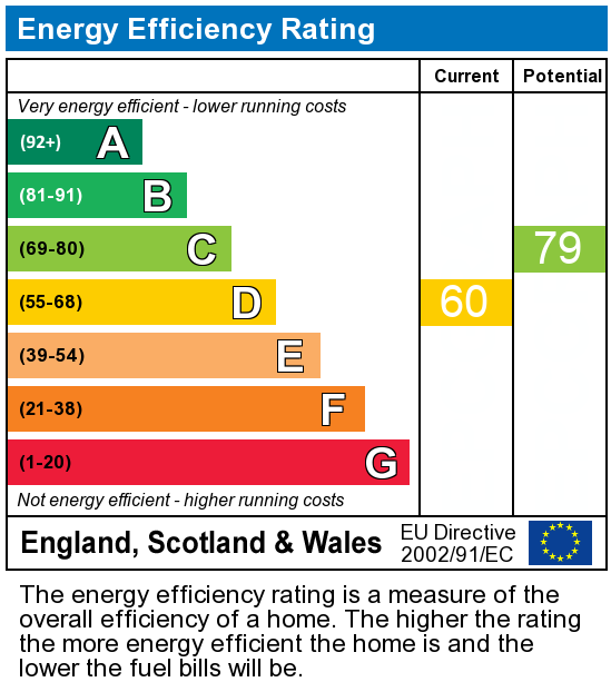
EPC Graph
Price history
136% since 2014
| Event | Date | Price | % change |
|---|---|---|---|
| Sold | 11/09/2023 (2 years ago) | £184,000 | +97.8% |
| Sold | 27/02/2017 (9 years ago) | £93,000 | +19.2% |
| Sold | 28/02/2014 (12 years ago) | £78,000 | — |
Source: HM Land Registry Price Paid Data. Crown copyright.
Sold Comparables
Same street and nearby sales within 0.25 miles (last 5 years). Data from Land Registry Price Paid.
| Address | Price | Date | Type |
|---|---|---|---|
| 19 LAING STREET, KENFIG HILL, BRIDGEND, CF33 6NG | £195,000 | 02/12/2025 | Terraced |
| 8 EAST AVENUE, KENFIG HILL, BRIDGEND, CF33 6NN | £180,000 | 30/06/2025 | Terraced |
| 45 PISGAH STREET, KENFIG HILL, BRIDGEND, CF33 6BU | £155,000 | 19/12/2024 | Terraced |
| 45 PISGAH STREET, KENFIG HILL, BRIDGEND, CF33 6BU | £155,000 | 19/12/2024 | Terraced |
| 11 MAES LLAN, KENFIG HILL, BRIDGEND, CF33 6DX | £130,000 | 04/12/2023 | Terraced |
| 2 BRYN ONNEN, KENFIG HILL, BRIDGEND, CF33 6EA | £143,000 | 15/09/2023 | Terraced |
| 20 BRYN ONNEN, KENFIG HILL, BRIDGEND, CF33 6EA | £197,000 | 30/06/2023 | Terraced |
| 26 BRYN ONNEN, KENFIG HILL, BRIDGEND, CF33 6EA | £148,000 | 16/06/2023 | Terraced |
| Same street 46 PARK STREET, KENFIG HILL, BRIDGEND, CF33 6DF | £119,000 | 24/03/2023 | Terraced |
| 10 BRYN ONNEN, KENFIG HILL, BRIDGEND, CF33 6EA | £150,000 | 16/03/2023 | Terraced |
| Same street 17 PARK STREET, KENFIG HILL, BRIDGEND, CF33 6DF | £155,000 | 12/12/2022 | Semi-detached |
| 20 LAING STREET, KENFIG HILL, BRIDGEND, CF33 6NG | £125,000 | 18/11/2022 | Terraced |
| 28 PWLLYGATH STREET, KENFIG HILL, BRIDGEND, CF33 6ES | £164,000 | 04/11/2022 | Terraced |
| 14 LAING STREET, KENFIG HILL, BRIDGEND, CF33 6NG | £140,000 | 28/10/2022 | Terraced |
| 24 EAST AVENUE, KENFIG HILL, BRIDGEND, CF33 6NN | £175,000 | 31/08/2022 | Terraced |
| Same street 36 PARK STREET, KENFIG HILL, BRIDGEND, CF33 6DF | £135,000 | 25/08/2022 | Terraced |
| 11 TON VIEW, KENFIG HILL, BRIDGEND, CF33 6EX | £152,000 | 02/08/2022 | Terraced |
| 7 EAST AVENUE, KENFIG HILL, BRIDGEND, CF33 6NN | £190,000 | 15/07/2022 | Terraced |
| 24 MAES LLAN, KENFIG HILL, BRIDGEND, CF33 6DX | £128,000 | 11/07/2022 | Terraced |
| 65 PWLLYGATH STREET, KENFIG HILL, BRIDGEND, CF33 6ET | £125,000 | 05/07/2022 | Terraced |
| 47 COMMERCIAL STREET, KENFIG HILL, BRIDGEND, CF33 6DH | £150,000 | 28/06/2022 | Terraced |
| 8 MAES LLAN, KENFIG HILL, BRIDGEND, CF33 6DX | £145,000 | 17/06/2022 | Terraced |
| 23 EAST AVENUE, KENFIG HILL, BRIDGEND, CF33 6NN | £180,000 | 01/06/2022 | Terraced |
| Same street 22 PARK STREET, KENFIG HILL, BRIDGEND, CF33 6DF | £180,000 | 17/01/2022 | Terraced |
| Same street 28 PARK STREET, KENFIG HILL, BRIDGEND, CF33 6DF | £165,000 | 25/10/2021 | Terraced |
Street average: £150,800 (5 sales)
Area average: £156,350 (20 sales)
Capital growth trend
Land Registry outcode average: last 12 months vs 5y and 10y ago (from sold prices).
House Price Index (HM Land Registry — official index, not sold-price averages): Bridgend. Series: Terraced. As of March 2026.
Rental Range
Estimated market rent for Bridgend. Low = conservative, Realistic = average, Optimistic = best case.
Based on Local Authority from postcode lookup → Bridgend.
Location
Nearby
Nearest stations, universities and amenities (distance from property).
| Type | Name | Distance |
|---|---|---|
| Shop | Spar | 0.1 miles |
| Bus stop | Commercial Street (NE) | 0.1 miles |
| Shop | theFringe | 0.2 miles |
| Bus stop | Ael-y-Bryn | 0.8 miles |
| Train station | Pyle | 0.8 miles |
| Hospital | Porthcawl Medical Centre | 3.1 miles |
| University | Union School of Theology | 3.6 miles |
| Train station | Tondu | 3.9 miles |
| University | Swansea University Bay Campus | 10.6 miles |
Street-level crime
| Category | Count |
|---|---|
| Violence and sexual offences | 26 |
| Anti-social behaviour | 9 |
| Criminal damage and arson | 9 |
| Public order | 7 |
| Other theft | 3 |
| Burglary | 2 |
| Drugs | 1 |
| Total incidents | 57 |
Within 1 mile during Apr 2026. Source: data.police.uk (England & Wales).
Schools nearby
Nearest open schools with Ofsted ratings (England). Closed schools are not shown. Data from Get Information about Schools and Ofsted.
| Name | Type | Distance | Ofsted |
|---|---|---|---|
| Cynffig Comprehensive School | Other | 0.2 miles | — (No rating) |
| Pil Primary School | Other | 0.5 miles | — (No rating) |
| Afon-Y-Felin Primary School | Other | 1.0 miles | — (No rating) |
| Ysgol Y Ferch O'r Sger | Other | 1.1 miles | — (No rating) |
| Corneli Primary School | Other | 1.2 miles | — (No rating) |
Rental Comparables
Loading rental comparables for this postcode. Refresh in a few minutes.
Rent-driven metrics
Based on Area rent estimate.
- Rent ratio — Monthly rent ÷ purchase price (1% rule). 1%+ = strong, 0.8–1% = okay, <0.8% = weak for cashflow.
- Max investor price — Rent ÷ 0.8%; the price at which rent would be 0.8% of price (Stoke-style target).
- Target investor price — Rent ÷ 1%; the price at which rent would be 1% of price (strong cashflow band).
- Gross yield — Annual rent as % of purchase price (no costs).