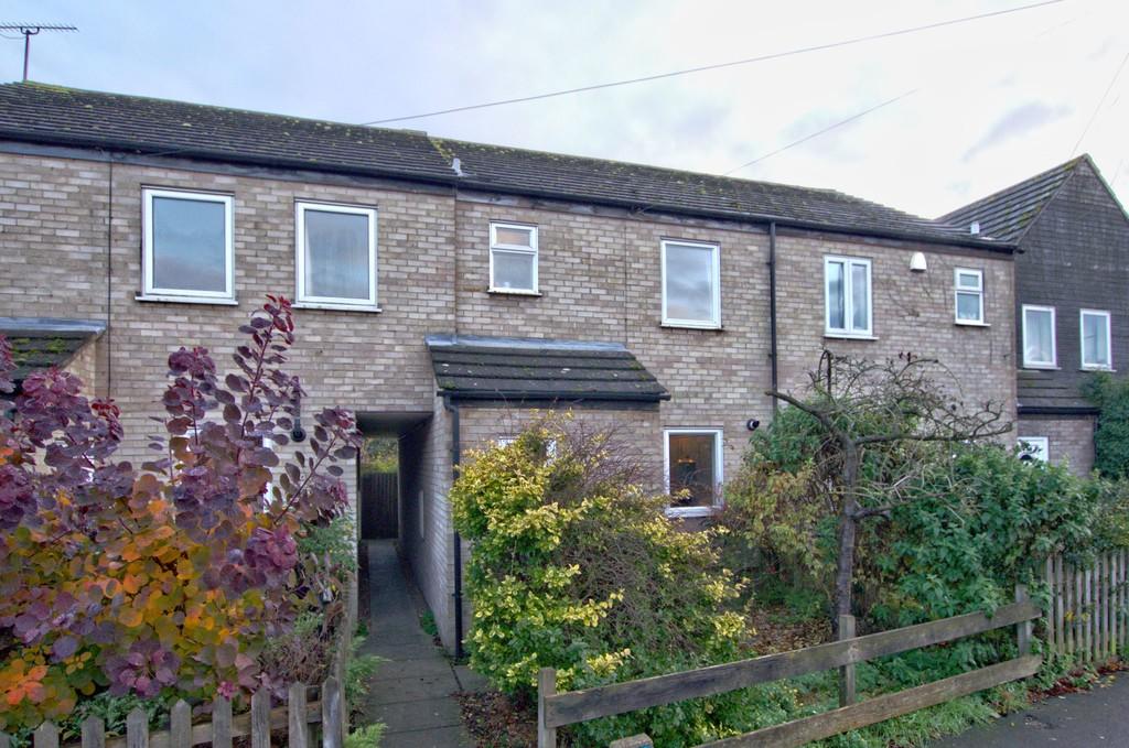
High Street
Chesterton, CB4 1NX
Property details
Tenure
FREEHOLD
Floor area
75 m²
Local average
£488,111 (-28.3%)
Deprivation
Decile 5 (14,244 of 33,755)
Street crime
373 incidents within 1 mile (Apr 2026)
Key features
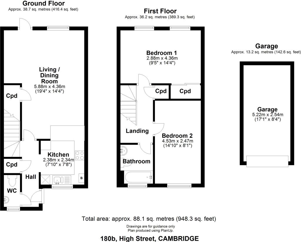
- 87 sqm / 942 sqft
- 82 sqm / 0.02 acre
- Terraced house
- 2 bed, 1 recep, 1.5 bath
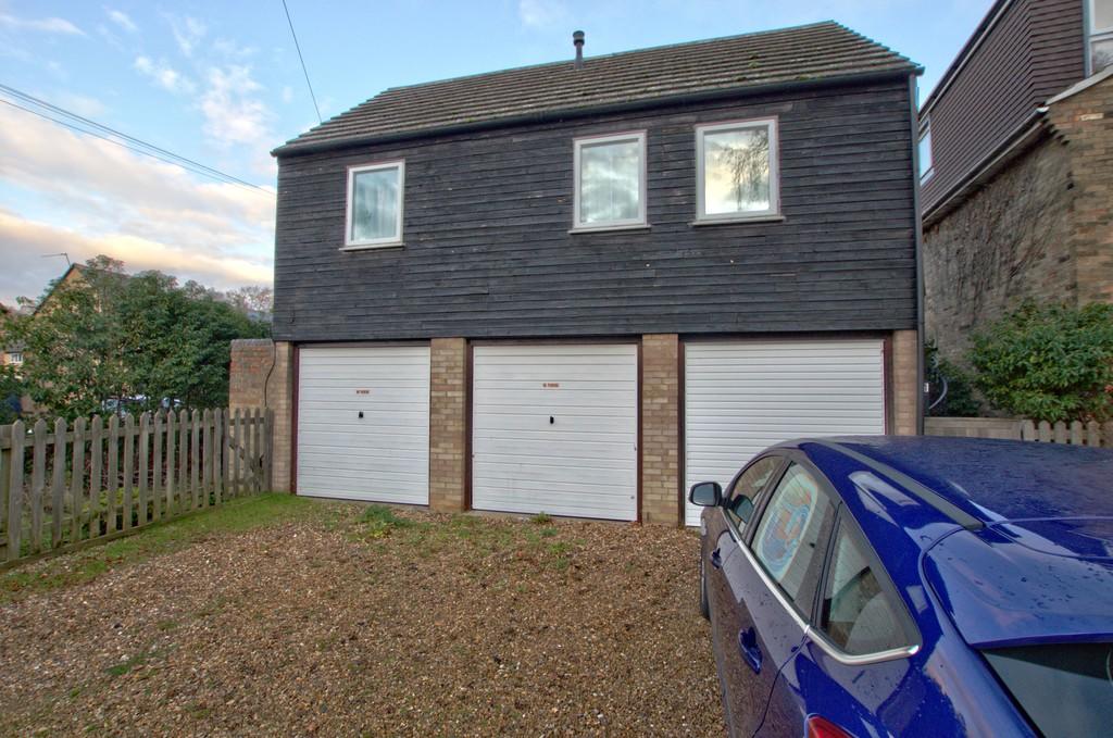
- Garage and parking
- 1980
- EPC - TBC
- Council tax band - C
Additional details
- Parking
- Garage, Off street
- Garden
- Yes
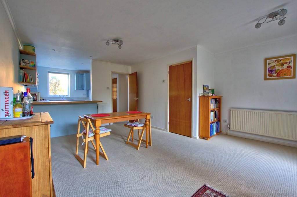
Description
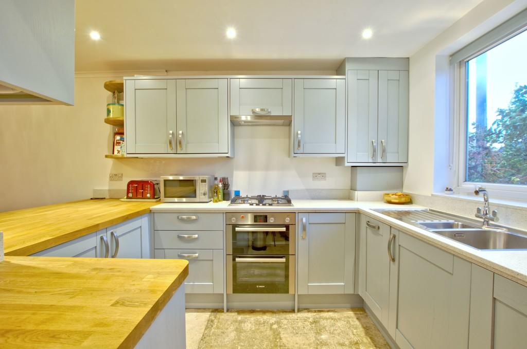
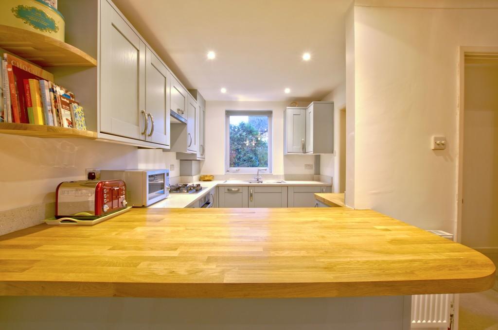
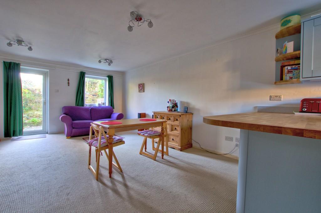
The property benefits from an entrance porch and hallway with access to a cloakroom w.c, storage cupboard and stairs to the first floor. The living room is very spacious and benefits from southerly aspects. The kitchen has been fitted with a lovely range of units and is finished with Quartz and solid oak worktops. Integrated Bosch appliances include a fridge/freezer, washing machine, dishwasher, double oven and 4-ring gas hob with extractor over.
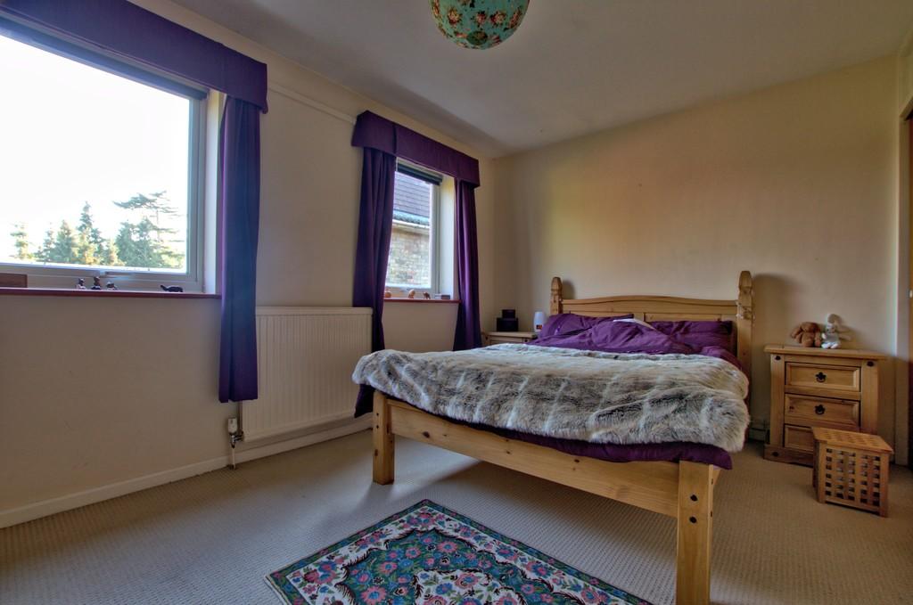
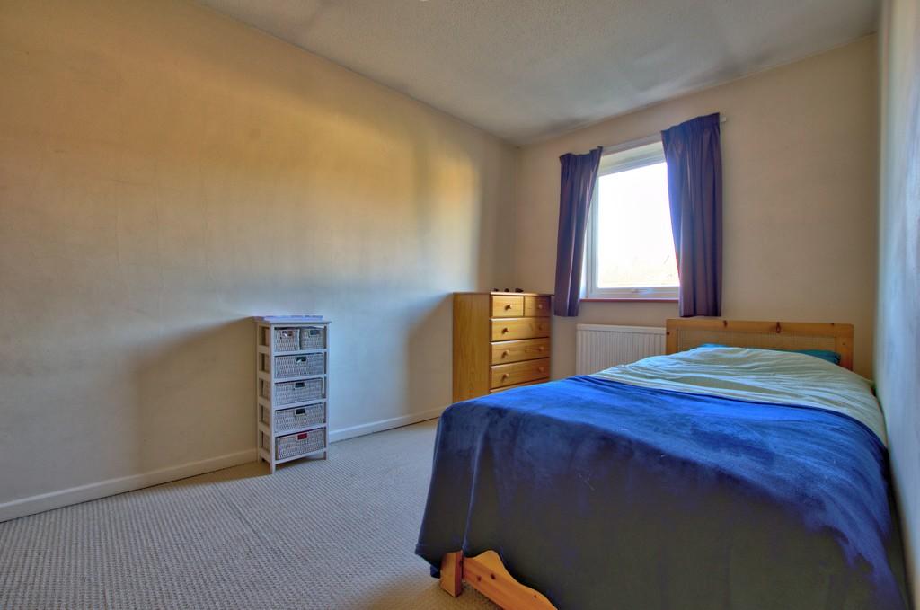
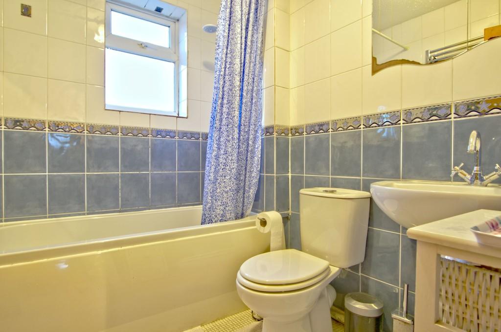
Upstairs are 2 double bedrooms, the master bedroom including built-in wardrobes. The bathroom has been fitted with a white suite and is complemented by tiled walls.
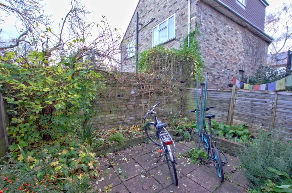
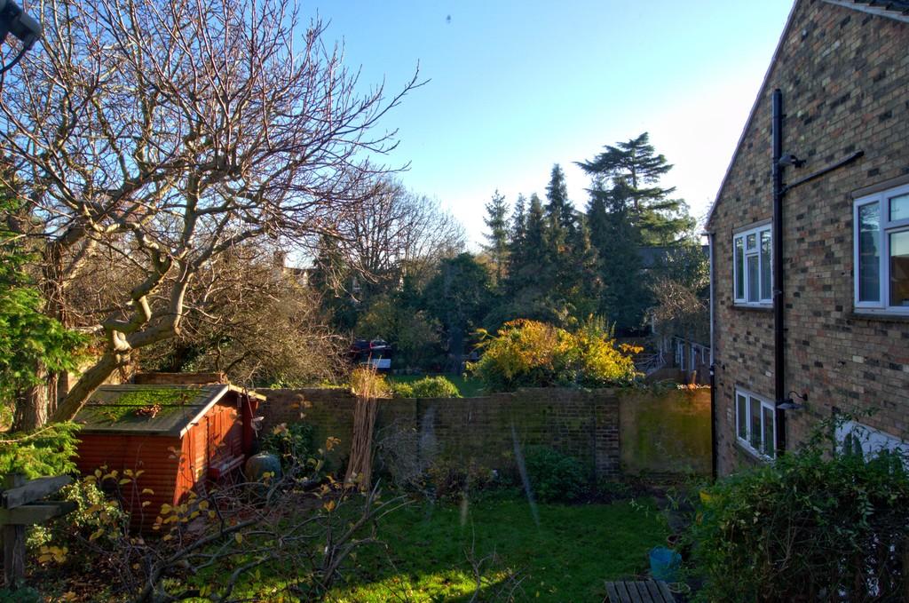
Outside, the property is set back behind a low maintenance garden and has a shared passageway that leads to the south-facing rear garden. This is fully enclosed and mainly paved for ease of maintenance with shrub borders. There is also a single garage and parking space located in nearby Ferry Lane.
Agents Note: We understand that the garage is held on a lease. The term of the lease is 99 years, commencing from 01/07/1980. There is a ground rent of £10 per annum plus additional insurance charges of around £10 per annum.
The area is located less than 2 miles from the City Centre and just half a mile from Cambridge North Railway Station. Chesterton has an excellent range of local facilities and amenities including a Post Office, medical centre, 2 churches and a number of public houses, takeaways and restaurants.
You can walk or cycle along Riverside to the City or to various nearby green spaces including Midsummer Common and Stourbridge Common. The Guided Busway is within easy reach as well as the Park & Ride. The Cambridge Science Park is about 1.5 miles away, a Tesco superstore and the Newmarket Road retail parks are also within easy reach.
There are a number of reputable schools including Shirley Community Primary and Chesterton Primary, both of which are OFSTED rated as good. Secondary Schooling is also available at Chesterton Community College.
Listed by
Cambridge
Cooke Curtis & Co LLP
Reference: 87155984
EPC ratings on this postcode
We don't have a matched EPC for this property yet. Below are efficiency scores and details for other addresses on this postcode.
| Address | Current | Potential | Floor area | Age band | Type |
|---|---|---|---|---|---|
| 180b, High Street, Chesterton, CAMBRIDGE | 72 | 89 | 75 m² | England and Wales: 1976-1982 | Terraced |
| 180c High Street, Chesterton, CAMBRIDGE | 70 | 83 | 89 m² | England and Wales: 1983-1990 | Terraced |
| 182a, High Street, Chesterton, CAMBRIDGE | 67 | 71 | 75 m² | England and Wales: 1967-1975 | Flat |
| 192a, High Street, Chesterton, CAMBRIDGE | 64 | 70 | 75 m² | England and Wales: 1967-1975 | Flat |
| 194 High Street, Chesterton, CAMBRIDGE | 55 | 81 | 63 m² | England and Wales: before 1900 | Terraced |
| 194, High Street, Chesterton, CAMBRIDGE | 63 | 89 | 66 m² | England and Wales: before 1900 | Terraced |
| 200, High Street, Chesterton, CAMBRIDGE | 62 | 86 | 65 m² | England and Wales: 1900-1929 | Terraced |
| 202 High Street, Chesterton, CAMBRIDGE | 21 | 63 | 63 m² | England and Wales: before 1900 | Terraced |
| 204 High Street, Chesterton, CAMBRIDGE | 55 | 83 | 66 m² | England and Wales: before 1900 | Terraced |
| 204, High Street, Chesterton, CAMBRIDGE | 49 | 86 | 65 m² | England and Wales: 1900-1929 | Terraced |
| 206, High Street, Chesterton, CAMBRIDGE | 58 | 87 | 65 m² | England and Wales: before 1900 | Terraced |
| 210 High Street, Chesterton, CAMBRIDGE | 72 | 88 | 56 m² | England and Wales: 1900-1929 | Terraced |
| 212 High Street, Chesterton, CAMBRIDGE | 71 | 90 | 43 m² | England and Wales: 1900-1929 | Terraced |
| 212 HIGH STREET, CHESTERTON, CAMBRIDGE, CAMBRIDGE | 58 | 88 | 52 m² | England and Wales: before 1900 | Terraced |
| 212, High Street, Chesterton, CAMBRIDGE | 6 | 84 | 52 m² | England and Wales: before 1900 | Terraced |
Flood risk
Zone: 1
Risk: Low
Job (default Low)
Floorplans
Floorplan
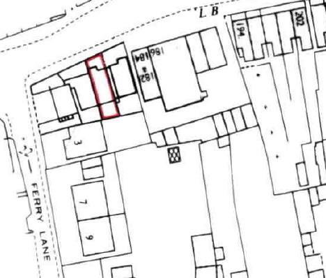
Location Plan
EPC Graphs

EPC Front Page
Price history
No sales history found for this property in Land Registry Price Paid data.
Sold Comparables
Same street and nearby sales within 0.25 miles (last 5 years). Data from Land Registry Price Paid.
| Address | Price | Date | Type |
|---|---|---|---|
| 22 PRIMARY COURT, CAMBRIDGE, CAMBRIDGESHIRE, CB4 1NB | £340,000 | 07/01/2026 | Terraced |
| 8 PYE TERRACE, CAMBRIDGE, CAMBRIDGESHIRE, CB4 1DX | £525,000 | 01/07/2025 | Terraced |
| 72 SCOTLAND ROAD, CAMBRIDGE, CAMBRIDGESHIRE, CB4 1QG | £455,000 | 24/04/2025 | Terraced |
| 13 GRAYLING CLOSE, CAMBRIDGE, CAMBRIDGESHIRE, CB4 1NP | £475,000 | 28/02/2025 | Terraced |
| 25 PRIMARY COURT, CAMBRIDGE, CAMBRIDGESHIRE, CB4 1NB | £347,000 | 21/04/2023 | Terraced |
| Same street 180C HIGH STREET, CHESTERTON, CAMBRIDGE, CAMBRIDGESHIRE, CB4 1NX | £425,000 | 04/04/2023 | Terraced |
| 101 SCOTLAND ROAD, CAMBRIDGE, CAMBRIDGESHIRE, CB4 1QN | £510,000 | 12/12/2022 | Terraced |
| 184 GREEN END ROAD, CAMBRIDGE, CAMBRIDGESHIRE, CB4 1RN | £372,500 | 04/11/2022 | Terraced |
| Same street 212 HIGH STREET, CHESTERTON, CAMBRIDGE, CAMBRIDGESHIRE, CB4 1NX | £392,000 | 14/10/2022 | Terraced |
| 185 GREEN END ROAD, CAMBRIDGE, CAMBRIDGESHIRE, CB4 1RJ | £550,000 | 28/09/2022 | Terraced |
| Same street 218 HIGH STREET, CHESTERTON, CAMBRIDGE, CAMBRIDGESHIRE, CB4 1NX | £645,000 | 07/09/2022 | Terraced |
| 7 ENNISKILLEN ROAD, CAMBRIDGE, CAMBRIDGESHIRE, CB4 1SQ | £460,000 | 08/08/2022 | Terraced |
| 205 HIGH STREET, CHESTERTON, CAMBRIDGE, CAMBRIDGESHIRE, CB4 1NL | £490,000 | 08/07/2022 | Terraced |
| 31 PRIMARY COURT, CAMBRIDGE, CAMBRIDGESHIRE, CB4 1NB | £271,000 | 08/04/2022 | Terraced |
| 6 ENNISKILLEN ROAD, CAMBRIDGE, CAMBRIDGESHIRE, CB4 1SQ | £490,000 | 16/12/2021 | Terraced |
| 153 HIGH STREET, CHESTERTON, CAMBRIDGE, CAMBRIDGESHIRE, CB4 1NL | £380,000 | 23/11/2021 | Terraced |
| 36 PRIMARY COURT, CAMBRIDGE, CAMBRIDGESHIRE, CB4 1NB | £360,000 | 12/10/2021 | Terraced |
| 1A SCOTLAND CLOSE, CAMBRIDGE, CAMBRIDGESHIRE, CB4 1QH | £347,000 | 09/09/2021 | Terraced |
| 205 GREEN END ROAD, CAMBRIDGE, CAMBRIDGESHIRE, CB4 1RJ | £403,000 | 06/08/2021 | Terraced |
| 136 SCOTLAND ROAD, CAMBRIDGE, CAMBRIDGESHIRE, CB4 1QQ | £415,000 | 04/08/2021 | Terraced |
| Same street 212 HIGH STREET, CHESTERTON, CAMBRIDGE, CAMBRIDGESHIRE, CB4 1NX | £370,000 | 30/06/2021 | Terraced |
| 214 GREEN END ROAD, CAMBRIDGE, CAMBRIDGESHIRE, CB4 1RL | £450,000 | 28/06/2021 | Terraced |
| 16 THRIFTS WALK, CAMBRIDGE, CAMBRIDGESHIRE, CB4 1NR | £351,752 | 25/06/2021 | Terraced |
Street average: £458,000 (4 sales)
Area average: £420,645 (19 sales)
Capital growth trend
Land Registry outcode average: last 12 months vs 5y and 10y ago (from sold prices).
House Price Index (HM Land Registry — official index, not sold-price averages): Cambridge. Series: Terraced. As of March 2026.
Rental Range
Estimated market rent for Cambridge. Low = conservative, Realistic = average, Optimistic = best case.
Based on Local Authority from postcode lookup → Cambridge.
LHA (30th percentile) floor for Cambridge: £947/mo (Apr 2025 – Mar 2026)
Location
Nearby
Nearest stations, universities and amenities (distance from property).
| Type | Name | Distance |
|---|---|---|
| Shop | Unknown | 0.0 miles |
| Shop | Cheryl's News | 0.0 miles |
| Bus stop | Water Lane | 0.0 miles |
| Hospital | Urgent Care Cambridge | 0.4 miles |
| Train station | Cambridge North | 0.7 miles |
| University | BPP | 1.4 miles |
| Train station | Cambridge | 1.7 miles |
| Hospital | Cambridge Lea Hospital (Spire) | 2.3 miles |
| University | Sub-department of Animal Behaviour (University of Cambridge) | 4.3 miles |
Street-level crime
| Category | Count |
|---|---|
| Violence and sexual offences | 116 |
| Shoplifting | 74 |
| Anti-social behaviour | 56 |
| Vehicle crime | 23 |
| Criminal damage and arson | 22 |
| Bicycle theft | 19 |
| Other theft | 14 |
| Burglary | 12 |
| Public order | 11 |
| Drugs | 9 |
| Other crime | 7 |
| Possession of weapons | 6 |
| Robbery | 2 |
| Theft from the person | 2 |
| Total incidents | 373 |
Within 1 mile during Apr 2026. Source: data.police.uk (England & Wales).
Schools nearby
Nearest open schools with Ofsted ratings (England). Closed schools are not shown. Data from Get Information about Schools and Ofsted.
| Name | Type | Distance | Ofsted |
|---|---|---|---|
| Chesterton Primary School | Primary | 0.2 miles | Good — 11 Sep 2015 |
| Cambridge Arts and Sciences (CATS and CSVPA) | Other | 0.4 miles | — (No rating) |
| Shirley Community Primary School | Primary | 0.5 miles | Good — 24 Apr 2024 |
| Olive AP Academy - Cambridge | Other | 0.7 miles | Good — 30 Sep 2022 |
| Milton Road Primary School | Primary | 0.7 miles | Good — 17 Jun 2019 |
Rental Comparables
Loading rental comparables for this postcode. Refresh in a few minutes.
Rent-driven metrics
Based on Area rent estimate.
- Rent ratio — Monthly rent ÷ purchase price (1% rule). 1%+ = strong, 0.8–1% = okay, <0.8% = weak for cashflow.
- Max investor price — Rent ÷ 0.8%; the price at which rent would be 0.8% of price (Stoke-style target).
- Target investor price — Rent ÷ 1%; the price at which rent would be 1% of price (strong cashflow band).
- Gross yield — Annual rent as % of purchase price (no costs).
Enter House Number
Enter the house number to help us retrieve more accurate pricing history and property data.
Please log in to submit or correct the house number for this listing.
Log in to continue