30 COTTON END ROAD
BEDFORD, WILSTEAD, BEDFORD MK45 3DB
Property details
Floor area
108 m²
Council tax band
E
EPC rating
C
Last sold
£390,000 Apr 2024
Price per m²
£3,704/m²
Local average
£628,318 (-36.3%)
Street crime
25 incidents within 1 mile (Apr 2026)
Key features
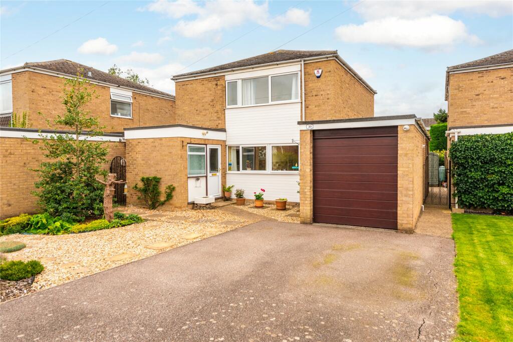
- Extended detached property
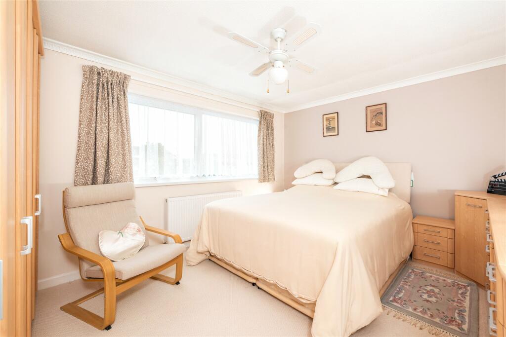
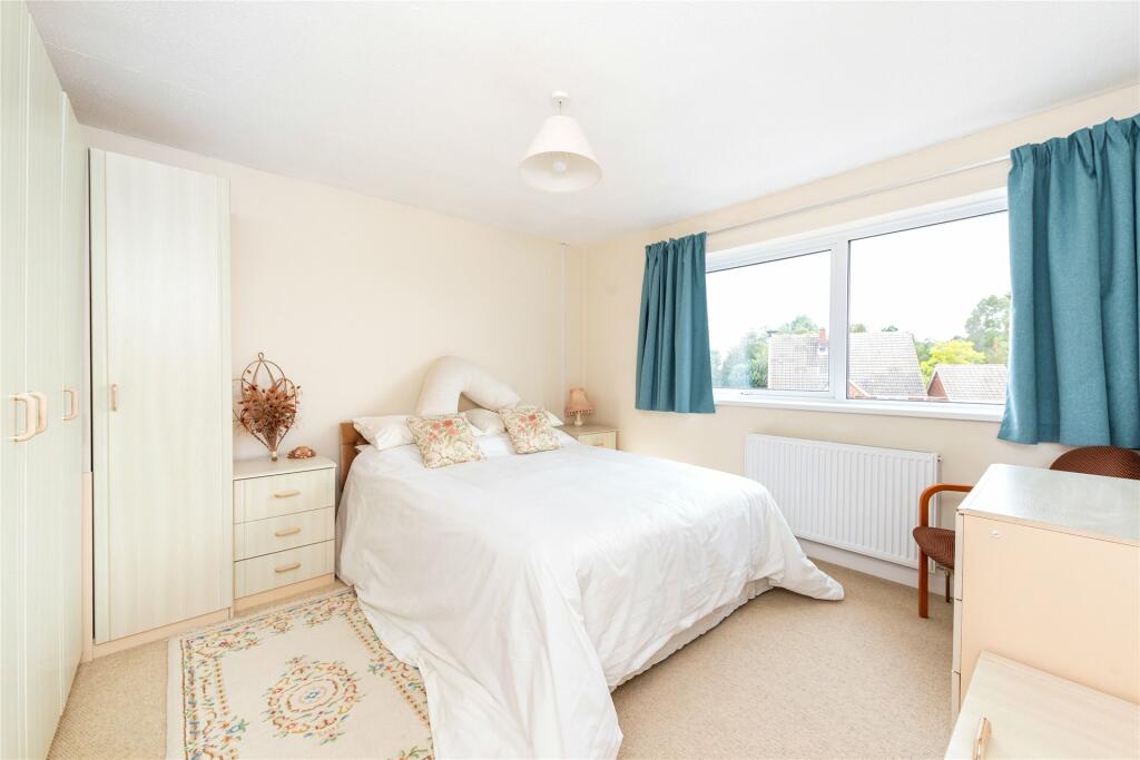
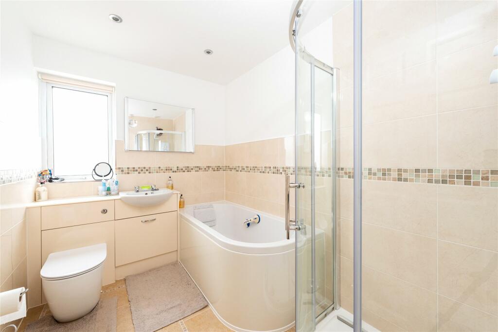
- Three bedrooms, bathroom, and cloakroom
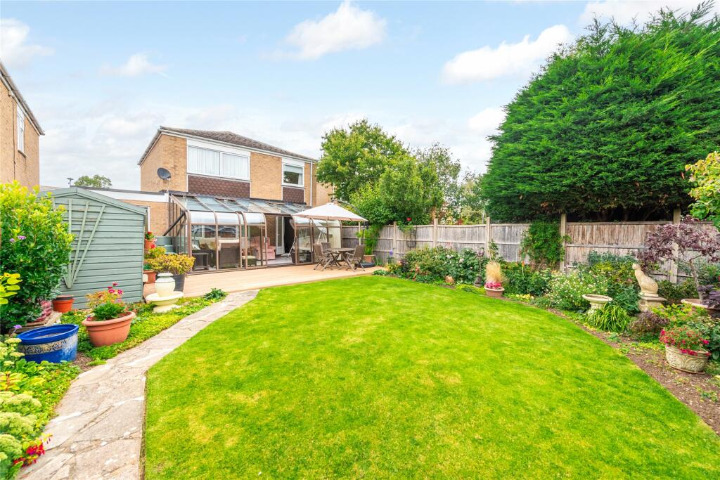
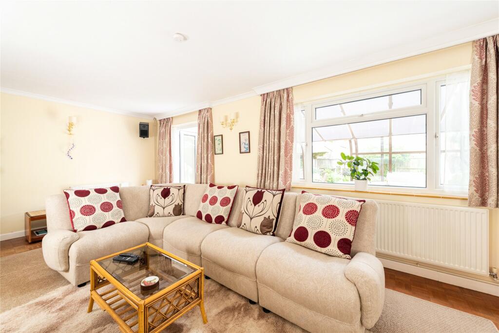
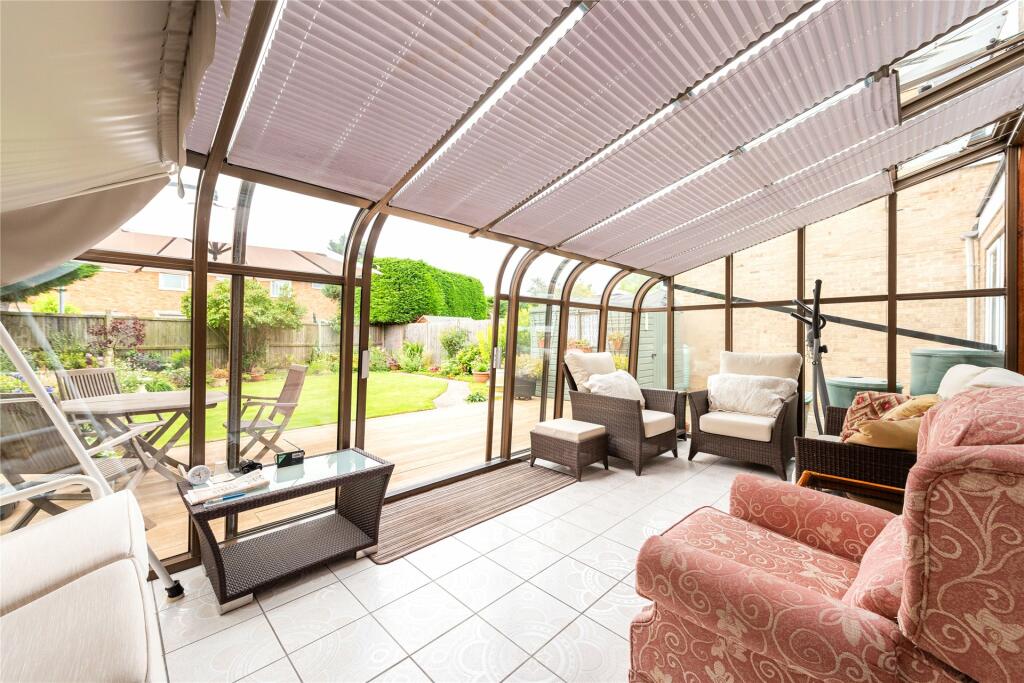
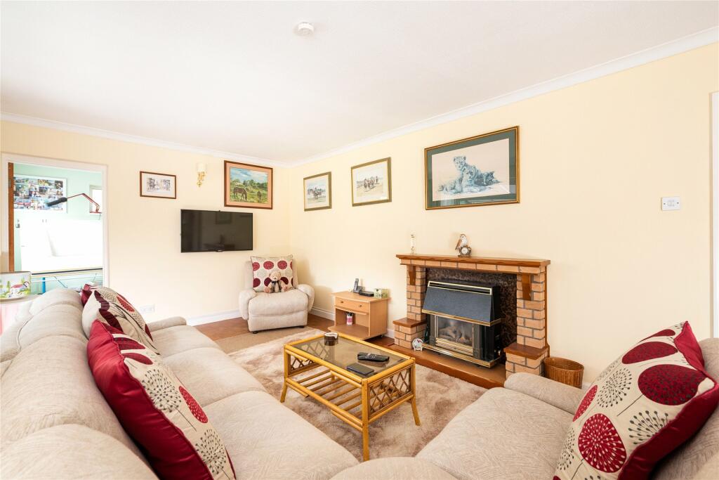
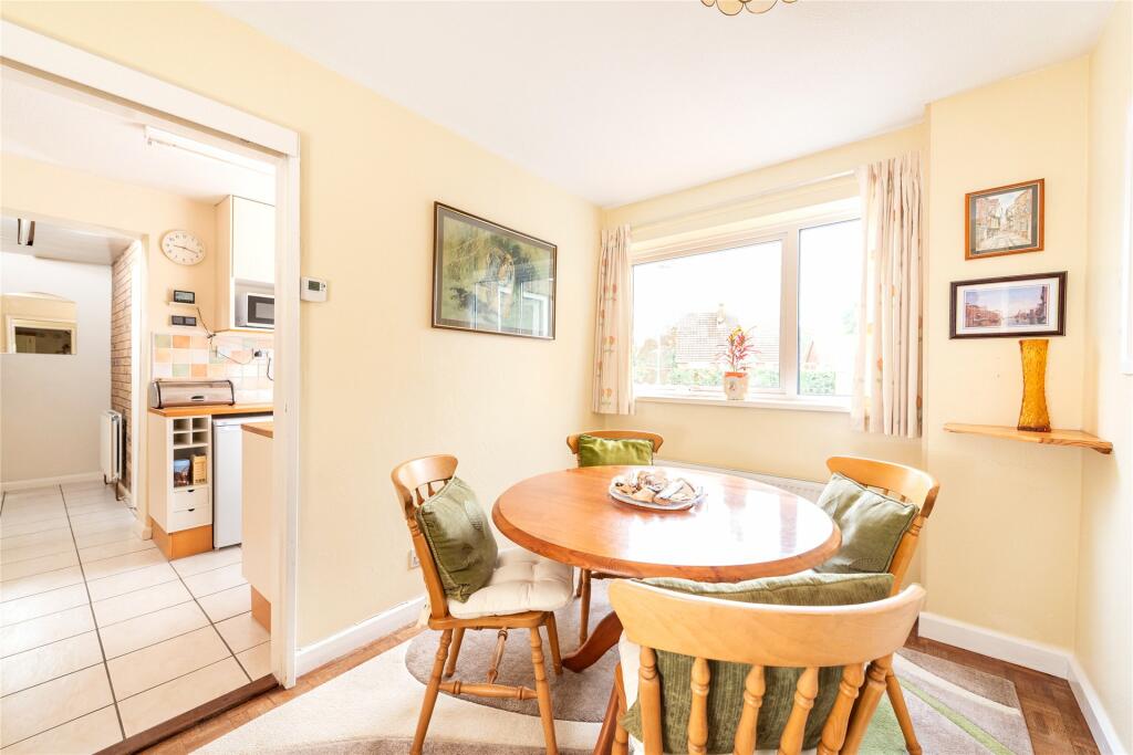
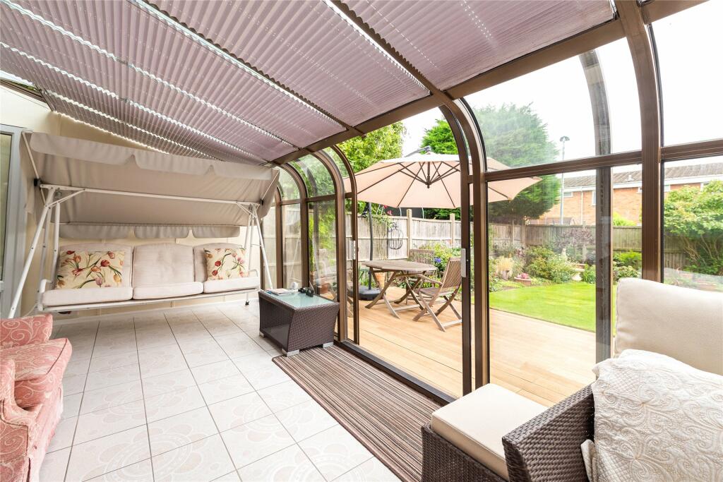
- Sitting room, dining room, conservatory
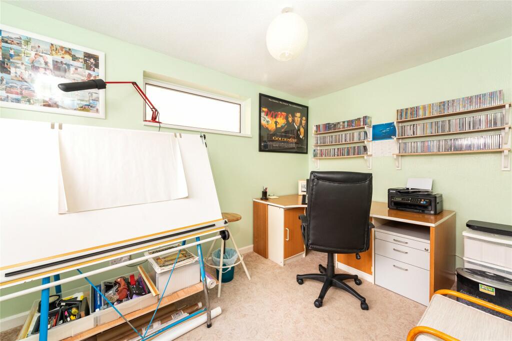
- Study/bedroom four
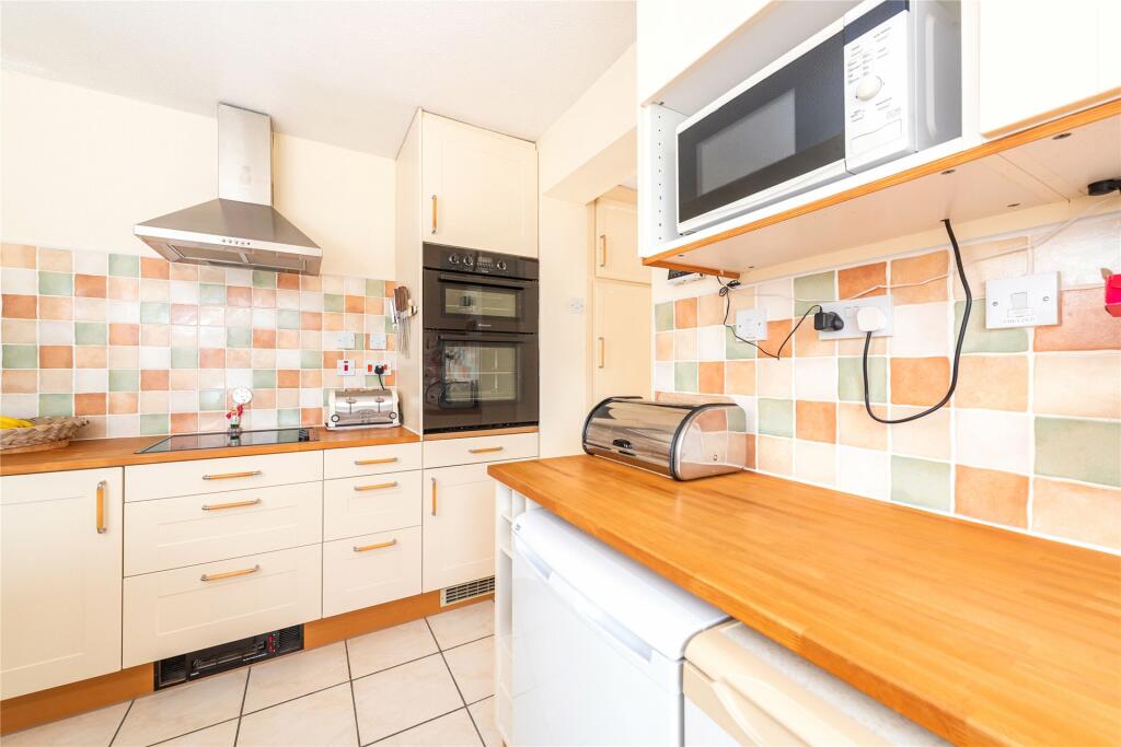
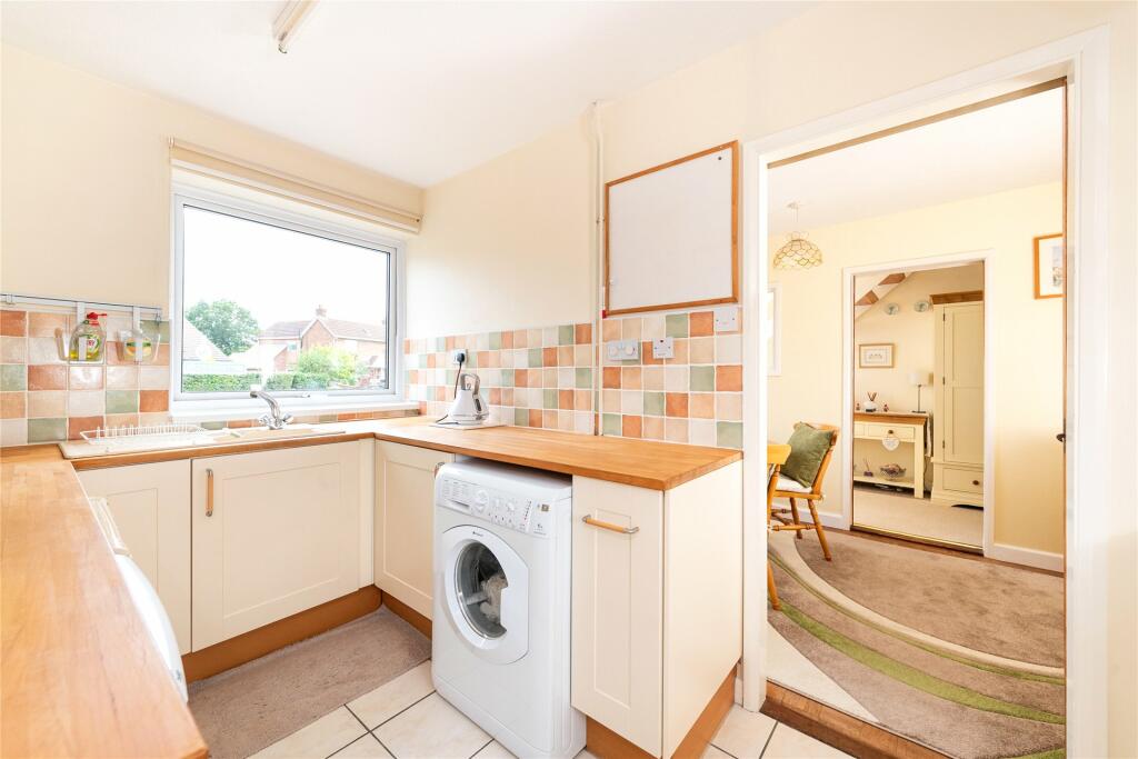
- Fitted kitchen
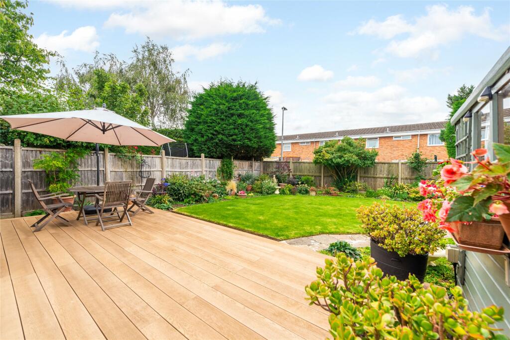
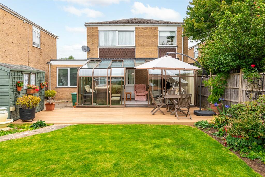
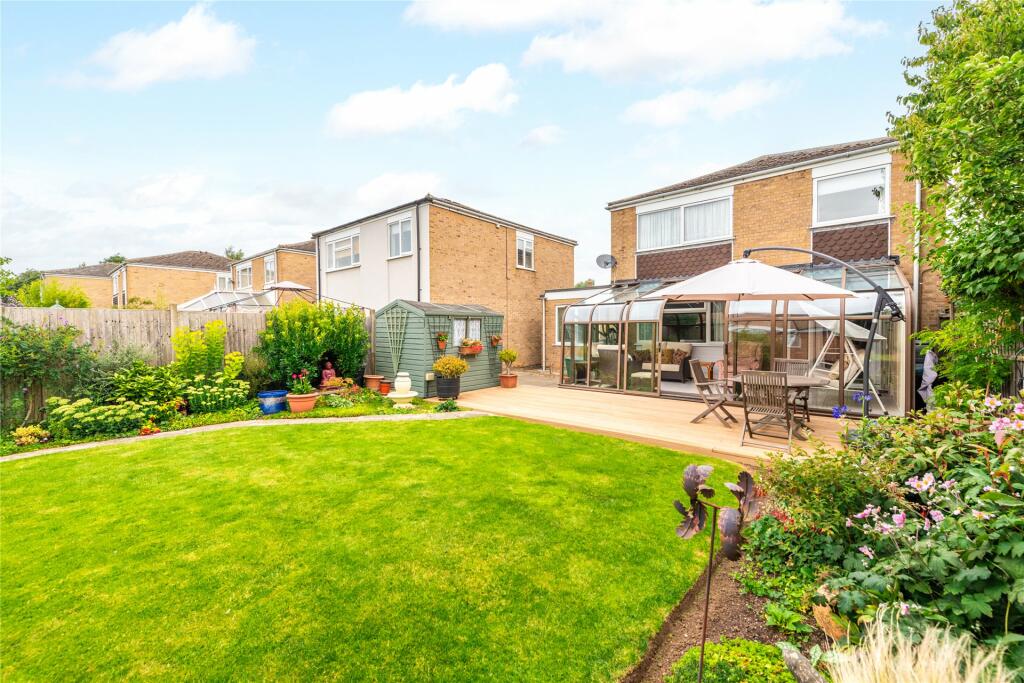
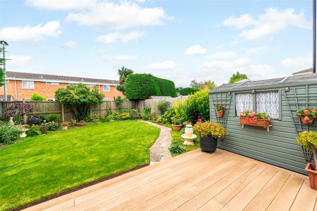
- South facing rear garden
- Garage and driveway parking
- Walking distance from village amenities
Additional details
- Parking
- Yes
- Garden
- Yes
Description
At the front there is driveway parking for two cars leading to the garage, and a gravelled shingle area and path to the front door.
Listed by
Bedford
Michael Graham
Reference: 138514493
EPC Rating & Upgrade Cost
Current rating: C
Potential rating: B
Inspection date: 04/08/2023
Expiry date: 03/08/2033
Current heating cost: £1,594/year
Potential heating cost: £1,435/year
Est. upgrade cost to C: £14,500
Recommendations
- Floor insulation (solid floor) (£4,000 - £6,000)
- Solar water heating (£4,000 - £6,000)
- Solar photovoltaic panels, 2.5 kWp (£3,500 - £5,500)
Flood risk
Zone: 1
Risk: Low
Job (default Low)
Floorplans
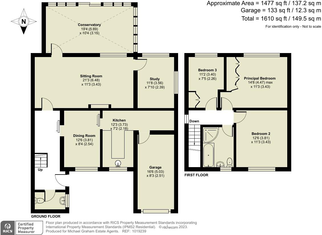
Floorplan
EPC Graphs
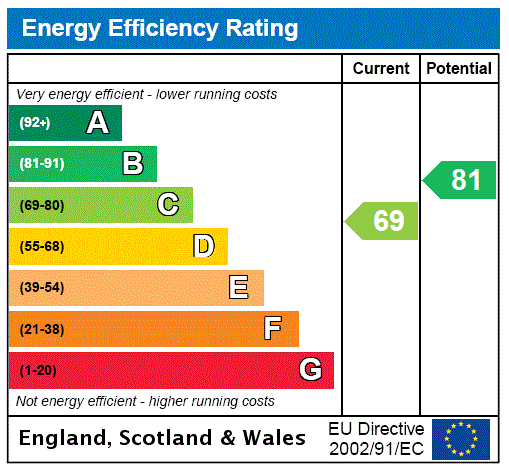
EPC Rating Graph
Price history
| Event | Date | Price | % change |
|---|---|---|---|
| Sold | 05/04/2024 (2 years ago) | £390,000 | — |
Source: HM Land Registry Price Paid Data. Crown copyright.
Sold Comparables
Same street and nearby sales within 0.25 miles (last 5 years). Data from Land Registry Price Paid.
| Address | Price | Date | Type |
|---|---|---|---|
| 41 DINES CLOSE, WILSTEAD, BEDFORD, MK45 3BU | £340,000 | 05/12/2025 | Detached |
| 2 WOODING WAY, WILSTEAD, BEDFORD, MK45 3PG | £410,000 | 28/11/2025 | Detached |
| 12A LUTON ROAD, WILSTEAD, BEDFORD, MK45 3HD | £517,000 | 15/09/2023 | Detached |
| Same street 32 COTTON END ROAD, WILSTEAD, BEDFORD, MK45 3DB | £435,000 | 28/04/2023 | Detached |
| 49 WHITWORTH WAY, WILSTEAD, BEDFORD, MK45 3EE | £510,000 | 06/04/2023 | Detached |
| 4 WOODING WAY, WILSTEAD, BEDFORD, MK45 3PG | £407,000 | 11/05/2022 | Detached |
| 1 WHITWORTH WAY, WILSTEAD, BEDFORD, MK45 3DX | £392,500 | 08/03/2022 | Detached |
| 34 WOODING WAY, WILSTEAD, BEDFORD, MK45 3PG | £485,000 | 11/08/2021 | Detached |
| Same street 42 COTTON END ROAD, WILSTEAD, BEDFORD, MK45 3DB | £580,000 | 30/06/2021 | Detached |
| 65 DINES CLOSE, WILSTEAD, BEDFORD, MK45 3BU | £420,000 | 30/06/2021 | Detached |
| 12 LUTON ROAD, WILSTEAD, BEDFORD, MK45 3HD | £620,000 | 28/06/2021 | Detached |
Street average: £507,500 (2 sales)
Area average: £455,722 (9 sales)
Capital growth trend
Land Registry outcode average: last 12 months vs 5y and 10y ago (from sold prices).
House Price Index (HM Land Registry — official index, not sold-price averages): Bedford. Series: Detached. As of March 2026.
Rental Range
Estimated market rent for Bedford. Low = conservative, Realistic = average, Optimistic = best case.
Based on Local Authority from postcode lookup → Bedford.
LHA (30th percentile) floor for Bedford: £997/mo (Apr 2025 – Mar 2026)
Location
Nearby
Nearest stations, universities and amenities (distance from property).
| Type | Name | Distance |
|---|---|---|
| Bus stop | The Woolpack | 0.3 miles |
| Shop | Co-op | 1.1 miles |
| Shop | Seasons Garden Center | 1.2 miles |
| Train station | Kempston Hardwick | 2.7 miles |
| Train station | Stewartby | 3.4 miles |
| Hospital | Bedford Hospital SDEC - Same Day Emergency Care | 3.5 miles |
| Hospital | Bedford Hospital South Wing | 3.6 miles |
| University | University of Bedfordshire Polhill Campus | 4.3 miles |
| University | University of Bedfordshire | 5.0 miles |
Street-level crime
| Category | Count |
|---|---|
| Violence and sexual offences | 11 |
| Anti-social behaviour | 9 |
| Public order | 3 |
| Other theft | 1 |
| Vehicle crime | 1 |
| Total incidents | 25 |
Within 1 mile during Apr 2026. Source: data.police.uk (England & Wales).
Schools nearby
Nearest open schools with Ofsted ratings (England). Closed schools are not shown. Data from Get Information about Schools and Ofsted.
| Name | Type | Distance | Ofsted |
|---|---|---|---|
| Wilstead Primary School | Primary | 0.2 miles | Good — 26 Nov 2023 |
| Lakeview School | Primary | 1.0 miles | Good — 27 Nov 2022 |
| Wixams Tree Primary School | Primary | 1.2 miles | Good — 20 May 2024 |
| Wixams Academy | Secondary | 1.2 miles | Requires improvement — 9 Jun 2024 |
| Cotton End Forest School | Primary | 1.5 miles | Requires improvement — 19 Mar 2023 |
Rental Comparables
Loading rental comparables for this postcode. Refresh in a few minutes.
Rent-driven metrics
Based on Area rent estimate.
- Rent ratio — Monthly rent ÷ purchase price (1% rule). 1%+ = strong, 0.8–1% = okay, <0.8% = weak for cashflow.
- Max investor price — Rent ÷ 0.8%; the price at which rent would be 0.8% of price (Stoke-style target).
- Target investor price — Rent ÷ 1%; the price at which rent would be 1% of price (strong cashflow band).
- Gross yield — Annual rent as % of purchase price (no costs).