7 GLEMSFORD ROAD
LOWESTOFT, SUFFOLK NR32 4RH
£220,000
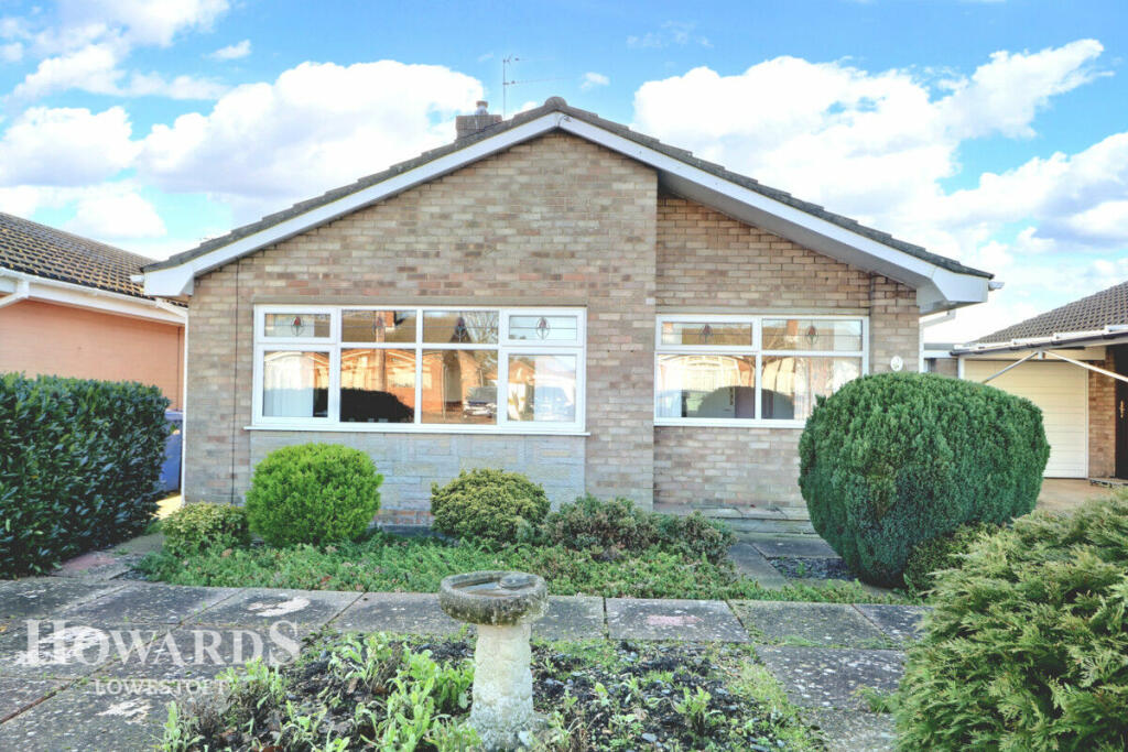
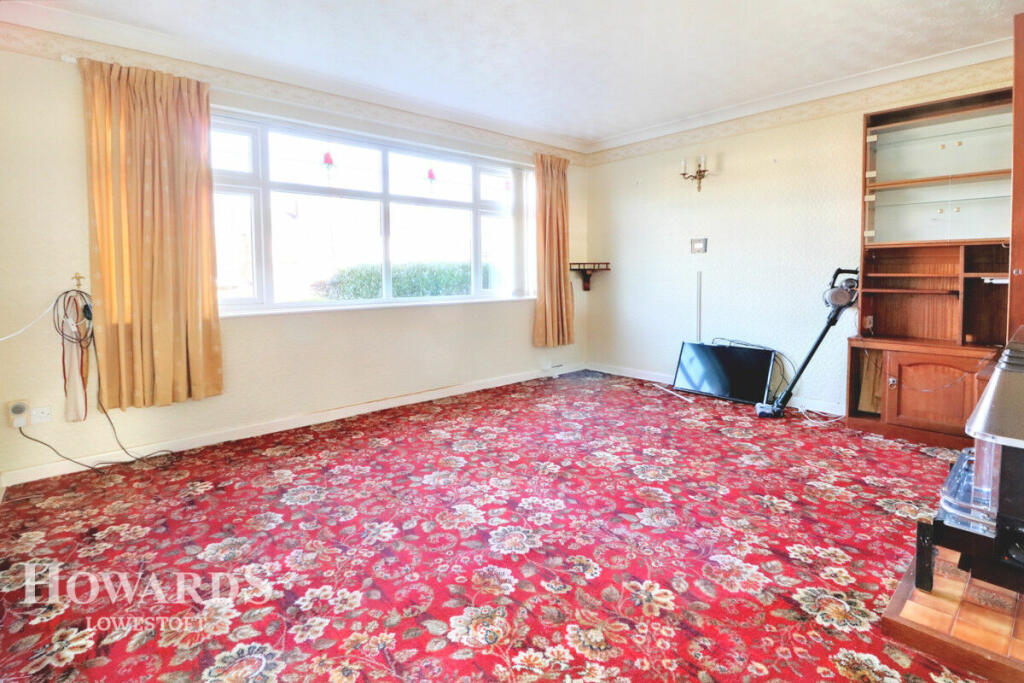
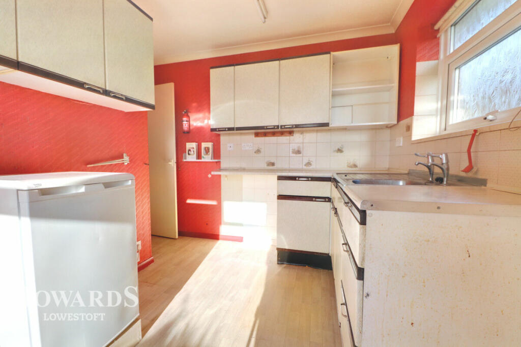
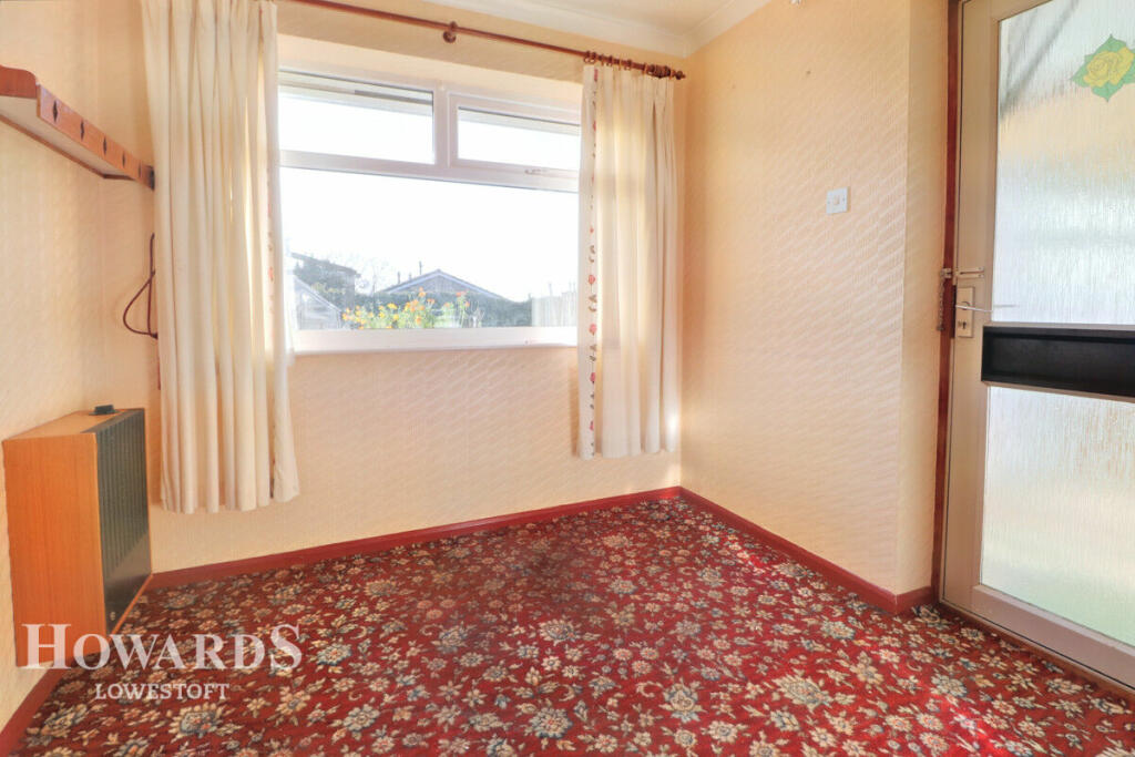
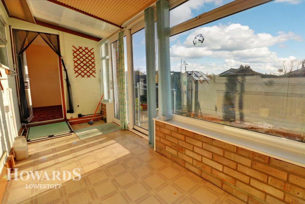
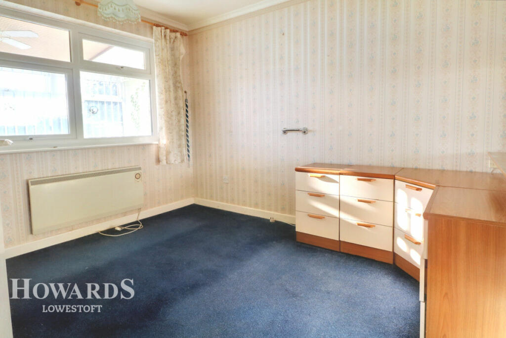
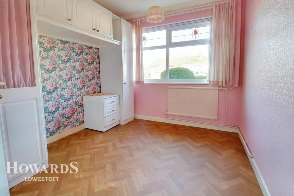
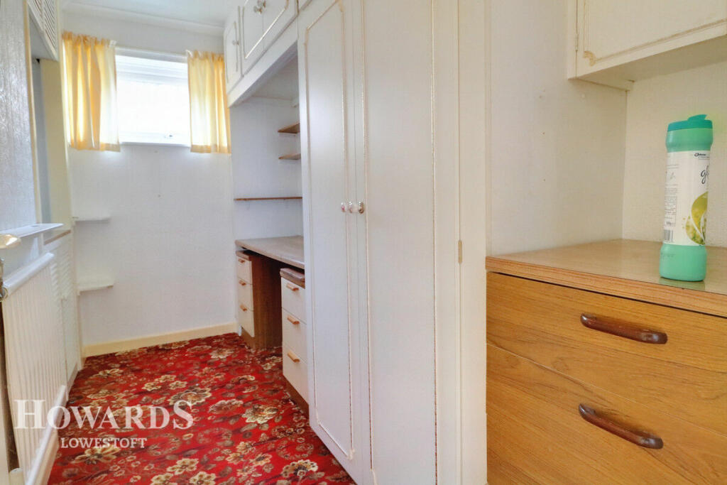
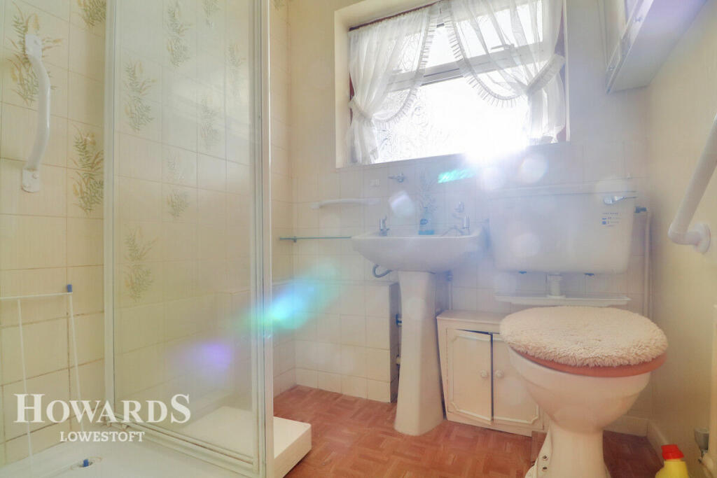
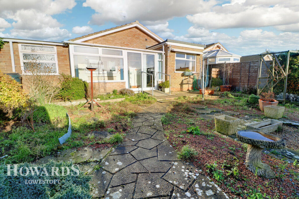
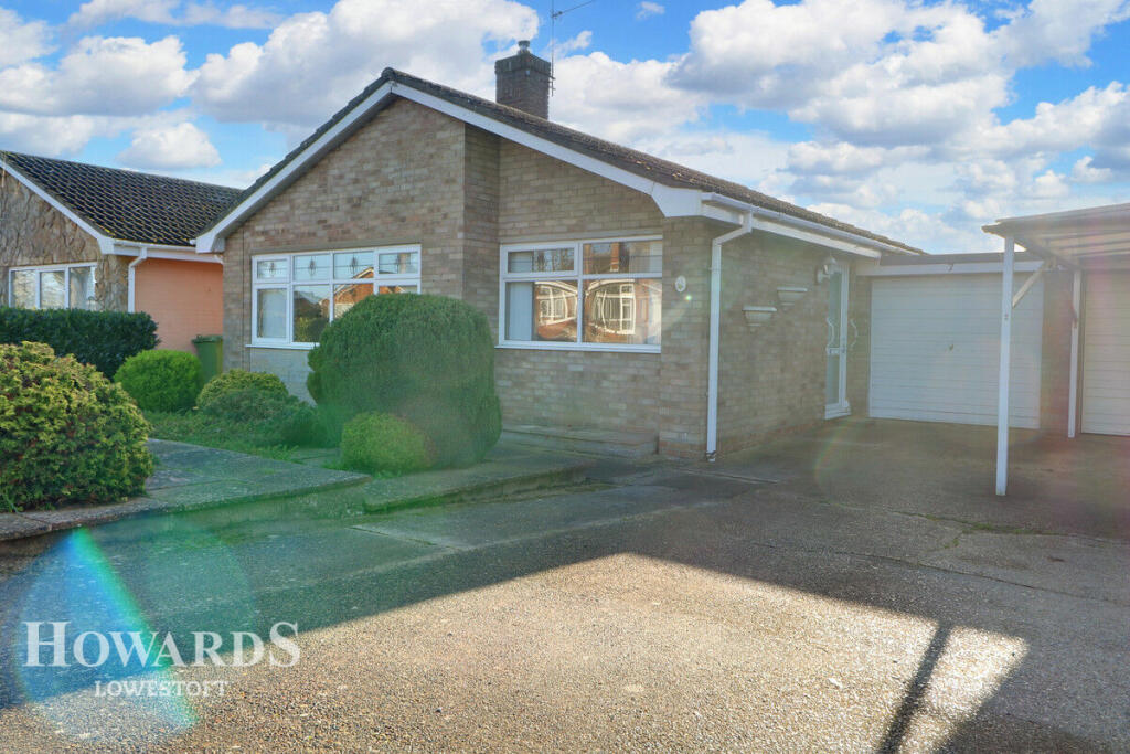
Photo 1 Photo 2 Photo 3 Photo 4 Photo 5 Photo 6 Photo 7 Photo 8 Photo 9 Photo 10 Photo 11
/ 11
Property details
Tenure
FREEHOLD
Floor area
62 m²
Council tax band
B
Last sold
£210,000 Sep 2023
Local average
£329,915 (-33.3%)
Deprivation
Decile 7 (23,327 of 33,755)
Street crime
106 incidents within 1 mile (Apr 2026)
Key features
- 3 Bedrooms
- Separate Lounge & Dining Areas
- Popular Location
- Updating Required
- Very Competitive Price
- South Facing Garden
- No Chain
Additional details
- Parking
- Yes
- Garden
- Yes
Description
Listed by
Lowestoft
Spicerhaart
Reference: 137162693
EPC Rating & Upgrade Cost
Fetching EPC data… Refresh this page in a moment.
Flood risk
Zone: 1
Risk: Low
Job (default Low)
Floorplans
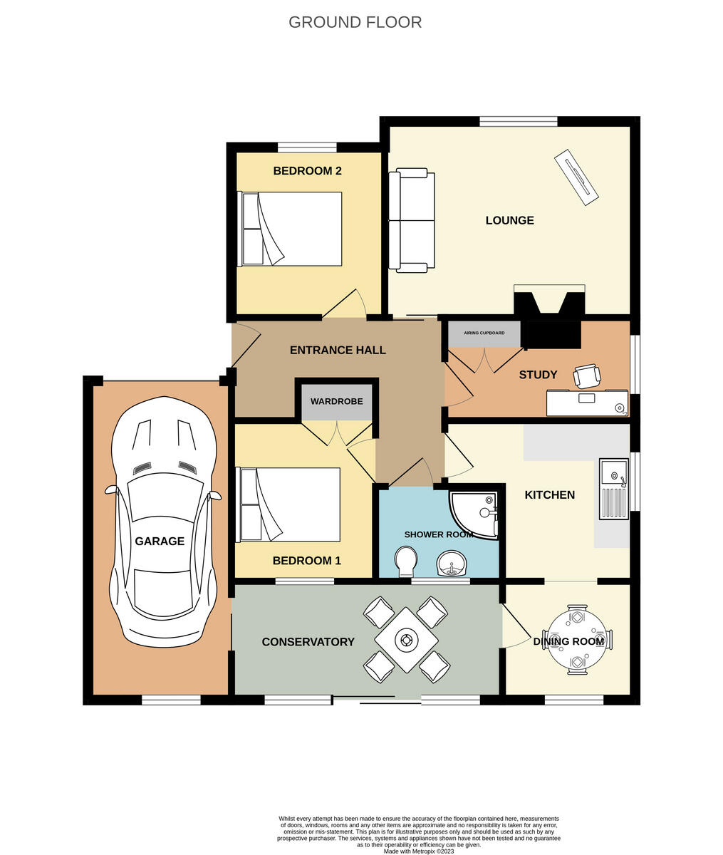
Floorplan 1
EPC Graphs
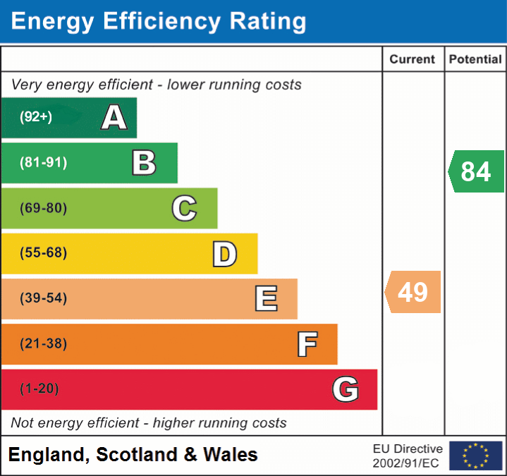
EPC 1
FENSA Certificates
This property has 3 FENSA certificate(s) on record, indicating window/door installations by FENSA-approved installers.
FENSA Certificate #4154777
Property Details
Street: 7 Glemsford Road
Town: LOWESTOFT
Postcode: NR32 4RH
Installation Details
Items: 2 windows and 1 door
Certificate Issued: 24/10/2006
Work Completed: 11/09/2006
This certificate data was retrieved from FENSA's database
FENSA Certificate #2428971
Property Details
Street: 7 Glemsford Road
Town: LOWESTOFT
Postcode: NR32 4RH
Installation Details
Items: 1 window
Certificate Issued: 31/01/2005
Work Completed: 01/12/2004
This certificate data was retrieved from FENSA's database
FENSA Certificate #16198471 Recent
Property Details
Street: 7 Glemsford Road
Town: LOWESTOFT
Postcode: NR32 4RH
Installation Details
Items: 6 windows and 1 door
Certificate Issued: 10/03/2024
Work Completed: 28/02/2024
This certificate data was retrieved from FENSA's database
What is FENSA? FENSA (Fenestration Self-Assessment Scheme) is a government-authorised scheme that monitors building regulation compliance for replacement windows and doors. Certificates indicate that work was completed by FENSA-approved installers.
Price history
| Event | Date | Price | % change |
|---|---|---|---|
| Sold | 01/09/2023 (2 years ago) | £210,000 | — |
Source: HM Land Registry Price Paid Data. Crown copyright.
Sold Comparables
Same street and nearby sales within 0.25 miles (last 5 years). Data from Land Registry Price Paid.
| Address | Price | Date | Type |
|---|---|---|---|
| 55 SOMERLEYTON ROAD, LOWESTOFT, EAST SUFFOLK, SUFFOLK, NR32 4RB | £230,000 | 21/07/2025 | Detached |
| 9 GREEN FLEET DRIVE, OULTON, LOWESTOFT, EAST SUFFOLK, SUFFOLK, NR32 3QN | £270,000 | 04/09/2023 | Detached |
| 2 WENHASTON WAY, LOWESTOFT, EAST SUFFOLK, SUFFOLK, NR32 3EA | £325,000 | 25/08/2023 | Detached |
| 3 HOLTON AVENUE, LOWESTOFT, EAST SUFFOLK, SUFFOLK, NR32 4RR | £230,000 | 11/08/2023 | Detached |
| 224 OULTON ROAD, LOWESTOFT, EAST SUFFOLK, SUFFOLK, NR32 4GZ | £360,000 | 04/08/2023 | Detached |
| 138 HIGHER DRIVE, LOWESTOFT, EAST SUFFOLK, SUFFOLK, NR32 3DE | £236,500 | 23/05/2023 | Detached |
| 51 DEDHAM DRIVE, LOWESTOFT, EAST SUFFOLK, SUFFOLK, NR32 3ED | £260,000 | 15/05/2023 | Detached |
| 49 DEDHAM DRIVE, LOWESTOFT, EAST SUFFOLK, SUFFOLK, NR32 3ED | £230,000 | 04/04/2023 | Detached |
| 10 HOLTON AVENUE, LOWESTOFT, EAST SUFFOLK, SUFFOLK, NR32 4RR | £305,000 | 04/04/2023 | Detached |
| 12 ORFORD DRIVE, LOWESTOFT, EAST SUFFOLK, SUFFOLK, NR32 3DJ | £285,000 | 19/12/2022 | Detached |
| 22 ORWELL DRIVE, LOWESTOFT, EAST SUFFOLK, SUFFOLK, NR32 4SL | £305,000 | 16/12/2022 | Detached |
| 59 ORFORD DRIVE, LOWESTOFT, EAST SUFFOLK, SUFFOLK, NR32 3DJ | £320,000 | 09/12/2022 | Detached |
| 3 CRANWORTH GARDENS, LOWESTOFT, EAST SUFFOLK, SUFFOLK, NR32 4RE | £290,000 | 02/12/2022 | Detached |
| 14 MEADOW ROAD, LOWESTOFT, EAST SUFFOLK, SUFFOLK, NR32 3AZ | £225,000 | 22/11/2022 | Detached |
| 145 HIGHER DRIVE, LOWESTOFT, EAST SUFFOLK, SUFFOLK, NR32 3DE | £295,000 | 21/09/2022 | Detached |
| 9 AMBERLEY COURT, LOWESTOFT, EAST SUFFOLK, SUFFOLK, NR32 4RL | £250,000 | 16/09/2022 | Detached |
| 67 CLAYDON DRIVE, LOWESTOFT, EAST SUFFOLK, SUFFOLK, NR32 3DZ | £350,000 | 19/08/2022 | Detached |
| 13 MEADOW ROAD, LOWESTOFT, EAST SUFFOLK, SUFFOLK, NR32 3AZ | £320,000 | 19/08/2022 | Detached |
| 4 DEDHAM DRIVE, LOWESTOFT, EAST SUFFOLK, SUFFOLK, NR32 3ED | £225,000 | 11/08/2022 | Detached |
| 24 ORFORD DRIVE, LOWESTOFT, EAST SUFFOLK, SUFFOLK, NR32 3DJ | £276,000 | 08/08/2022 | Detached |
| Same street 11 GLEMSFORD ROAD, LOWESTOFT, EAST SUFFOLK, SUFFOLK, NR32 4RH | £190,000 | 16/08/2021 | Semi-detached |
Street average: £190,000 (1 sale)
Area average: £279,375 (20 sales)
Capital growth trend
Land Registry outcode average: last 12 months vs 5y and 10y ago (from sold prices).
House Price Index (HM Land Registry — official index, not sold-price averages): East Suffolk. Series: Detached. As of March 2026.
Rental Range
Estimated market rent for East Suffolk. Low = conservative, Realistic = average, Optimistic = best case.
Based on Local Authority from postcode lookup → East Suffolk.
LHA (30th percentile) floor for Lowestoft & Great Yarmouth: £628/mo (Apr 2025 – Mar 2026)
Location
Nearby
Nearest stations, universities and amenities (distance from property).
| Type | Name | Distance |
|---|---|---|
| Bus stop | Pound Farm Drive | 0.1 miles |
| Shop | Bikespeeds | 0.1 miles |
| Shop | Solar Tan & Beauty | 0.1 miles |
| Bus stop | High House Corner | 0.1 miles |
| Hospital | Airey Close | 0.5 miles |
| Train station | Oulton Broad North | 0.9 miles |
| Train station | Pleasurewood Hills | 1.5 miles |
| Hospital | Carlton Court Hospital | 2.8 miles |
Street-level crime
| Category | Count |
|---|---|
| Violence and sexual offences | 48 |
| Anti-social behaviour | 19 |
| Vehicle crime | 9 |
| Other theft | 8 |
| Public order | 7 |
| Criminal damage and arson | 6 |
| Other crime | 3 |
| Possession of weapons | 3 |
| Burglary | 1 |
| Drugs | 1 |
| Theft from the person | 1 |
| Total incidents | 106 |
Within 1 mile during Apr 2026. Source: data.police.uk (England & Wales).
Schools nearby
Nearest open schools with Ofsted ratings (England). Closed schools are not shown. Data from Get Information about Schools and Ofsted.
| Name | Type | Distance | Ofsted |
|---|---|---|---|
| Woods Loke Primary School | Primary | 0.3 miles | Outstanding — 13 May 2024 |
| The Limes Primary Academy | Primary | 0.5 miles | Good — 26 Apr 2023 |
| Benjamin Britten Academy of Music and Mathematics | Secondary | 0.6 miles | Good — 5 Jun 2019 |
| The Ashley School | Other | 0.9 miles | Outstanding — 16 May 2014 |
| Include Suffolk | Other | 0.9 miles | Good — 8 Sep 2024 |
Rental Comparables
Rental comparables are temporarily unavailable while listing-site fetches are paused. Try again later.
Rent-driven metrics
Based on Area rent estimate.
- Rent ratio — Monthly rent ÷ purchase price (1% rule). 1%+ = strong, 0.8–1% = okay, <0.8% = weak for cashflow.
- Max investor price — Rent ÷ 0.8%; the price at which rent would be 0.8% of price (Stoke-style target).
- Target investor price — Rent ÷ 1%; the price at which rent would be 1% of price (strong cashflow band).
- Gross yield — Annual rent as % of purchase price (no costs).