6 RHODES CLOSE
MARKET HARBOROUGH, LEICESTERSHIRE LE16 9FB
£149,950
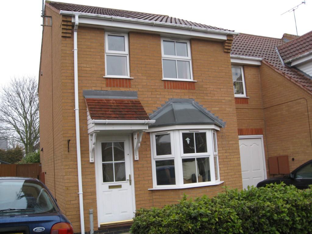
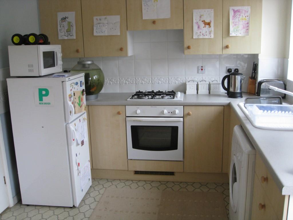
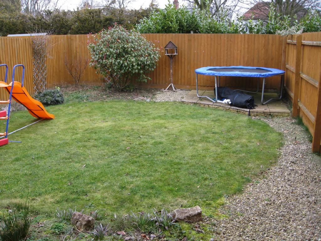
Photo 1 Photo 2 Photo 3
/ 3
Property details
Tenure
FREEHOLD
Floor area
57 m²
Last sold
£137,000 May 2009
Local average
£259,560 (-42.2%)
Deprivation
Decile 10 (33,704 of 33,755)
Street crime
89 incidents within 1 mile (May 2026)
Key features
- Lounge
- Kitchen/ breakfast room
- 2 double bedrooms
- Upstairs bathroom
- Parking
- Gardens front and rear
- Gas Central Heating
- UPVC Double Glazing
Additional details
- Parking
- Yes
- Garden
- Yes
Description
stairs to first floor landing. Radiator. Door to:
Lounge 15' 0 x 9' 6
Feature fireplace surround. UPVC double glazed window to the front, radiator, TV and phone point.
Understairs cupboard. Door to:
Kitchen / Diner 13' 0 x 8' 10
Range of built in wall and base units with rolled edge worktops. Built in electric oven and hob with pull out extractor over. Tiling to walls. Single bowl sink unit. Wall mounted boiler. Radiator. UPVC double glazed window and door to rear.
Staircase leading to first floor landing:-
Access to loft, doors leading to bedrooms. Airing cupboard with tank and shelving..
Bedroom one 13' 0 max (9' 9 min) x 9' 11 max
2 UPVC double glazed windows to the front. Radiator and TV point.
Bedroom Two 12' 6 0 x 6' 6
UPVC double glazed window to the rear. Radiator .
Family Bathroom.
Three piece suite, comprising low level WC, pedestal wash basin, bath with Triton shower and screen over. Extractor, spotlights to ceiling. UPVC double glazed obscure window to the rear. Radiator.
Driveway
To the side of the property.
Rear garden laid to lawn with borders
To the front there is a small garden area.
Agent's notes: Viewing is strictly by appointment.
Call Albery Tyson: 01858 434400
email harborough@alberytyson.co.uk
Directions:-
From the High Street turn right into Coventry Road and continue to the first main roundabout turning right into Lubenham Hill and first right into Rhodes Close where the property can be found on the right hand side.
Listed by
Market Harborough
Albery Tyson
Reference: 24851606
EPC Rating & Upgrade Cost
Fetching EPC data… Refresh this page in a moment.
Flood risk
Zone: 1
Risk: Low
Job (default Low)
EPC Graphs
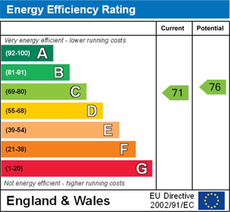
EPC 1
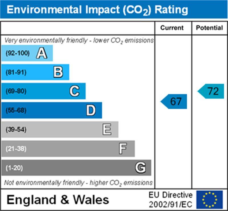
EPC 2
Price history
129% since 1999
| Event | Date | Price | % change |
|---|---|---|---|
| Sold | 22/05/2009 (17 years ago) | £137,000 | +128.5% |
| Sold | 26/03/1999 (27 years ago) | £59,955 | — |
Source: HM Land Registry Price Paid Data. Crown copyright.
Sold Comparables
Same street and nearby sales within 0.25 miles (last 5 years). Data from Land Registry Price Paid.
| Address | Price | Date | Type |
|---|---|---|---|
| 3 WHEAT CLOSE, MARKET HARBOROUGH, HARBOROUGH, LEICESTERSHIRE, LE16 9FP | £165,000 | 24/02/2023 | Terraced |
| 14 BARLEY WAY, MARKET HARBOROUGH, HARBOROUGH, LEICESTERSHIRE, LE16 9FQ | £137,500 | 31/01/2022 | Terraced |
| 18 BARLEY WAY, MARKET HARBOROUGH, HARBOROUGH, LEICESTERSHIRE, LE16 9FQ | £137,500 | 23/11/2021 | Terraced |
Area average: £146,667 (3 sales)
Capital growth trend
Land Registry outcode average: last 12 months vs 5y and 10y ago (from sold prices).
House Price Index (HM Land Registry — official index, not sold-price averages): Harborough. Series: Terraced. As of April 2026.
Rental Range
Estimated market rent for Harborough. Low = conservative, Realistic = average, Optimistic = best case.
Based on Local Authority from postcode lookup → Harborough.
LHA (30th percentile) floor for Leicester: £648/mo (Apr 2025 – Mar 2026)
Location
Nearby
Nearest stations, universities and amenities (distance from property).
| Type | Name | Distance |
|---|---|---|
| Bus stop | Lubenham Hill | 0.1 miles |
| Shop | Unknown | 0.3 miles |
| Shop | Spar | 0.4 miles |
| Train station | Market Harborough | 1.3 miles |
| Hospital | Procurement & Supplies Department (Stores) | 9.8 miles |
| Train station | Kettering | 10.4 miles |
| Hospital | Broomhill | 10.7 miles |
| University | University of Leicester - The Village | 11.1 miles |
Street-level crime
| Category | Count |
|---|---|
| Violence and sexual offences | 36 |
| Shoplifting | 17 |
| Anti-social behaviour | 10 |
| Public order | 8 |
| Criminal damage and arson | 4 |
| Drugs | 4 |
| Burglary | 3 |
| Other theft | 2 |
| Robbery | 2 |
| Possession of weapons | 1 |
| Theft from the person | 1 |
| Vehicle crime | 1 |
| Total incidents | 89 |
Within 1 mile during May 2026. Source: data.police.uk (England & Wales).
Schools nearby
Nearest open schools with Ofsted ratings (England). Closed schools are not shown. Data from Get Information about Schools and Ofsted.
| Name | Type | Distance | Ofsted |
|---|---|---|---|
| St Joseph's Catholic Voluntary Academy | Primary | 0.6 miles | Good — 31 Mar 2011 |
| Market Harborough Church of England Academy | Primary | 0.6 miles | Good — 17 Jul 2019 |
| Welland Park Academy | Secondary | 0.7 miles | Good — 2 Sep 2019 |
| Brooke House College | Other | 0.8 miles | — (No rating) |
| Farndon Fields Primary School | Primary | 0.9 miles | Good — 26 Oct 2012 |
Rental Comparables
Rental listings exist nearby, but none matched the 2-bedroom count for this property.
Rent-driven metrics
Based on Area rent estimate.
- Rent ratio — Monthly rent ÷ purchase price (1% rule). 1%+ = strong, 0.8–1% = okay, <0.8% = weak for cashflow.
- Max investor price — Rent ÷ 0.8%; the price at which rent would be 0.8% of price (Stoke-style target).
- Target investor price — Rent ÷ 1%; the price at which rent would be 1% of price (strong cashflow band).
- Gross yield — Annual rent as % of purchase price (no costs).