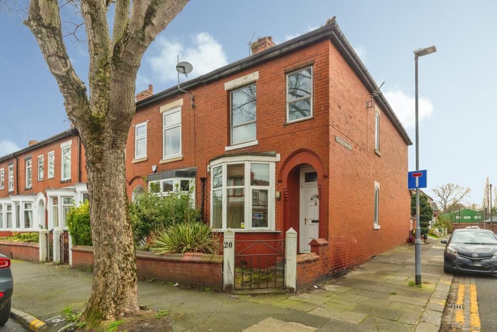
20 ST ANNES ROAD
MANCHESTER, GREATER MANCHESTER M21 8TR
Property details
Tenure
FREEHOLD
Floor area
93 m²
Council tax band
B
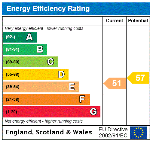
EPC rating
C
Year built
England and Wales: 1930-1949
Last sold
£215,000 Nov 2010
Price per m²
£4,032/m²
Local average
£418,878 (-10.5%)
Deprivation
Decile 7 (22,469 of 33,755)
Street crime
0 incidents within 1 mile (Apr 2026)
Additional details
- Garden
- Yes
Description
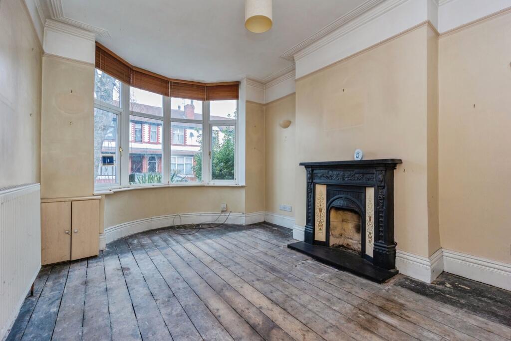
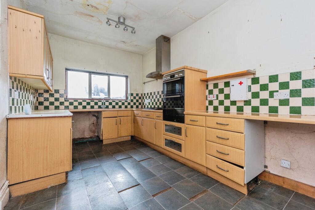
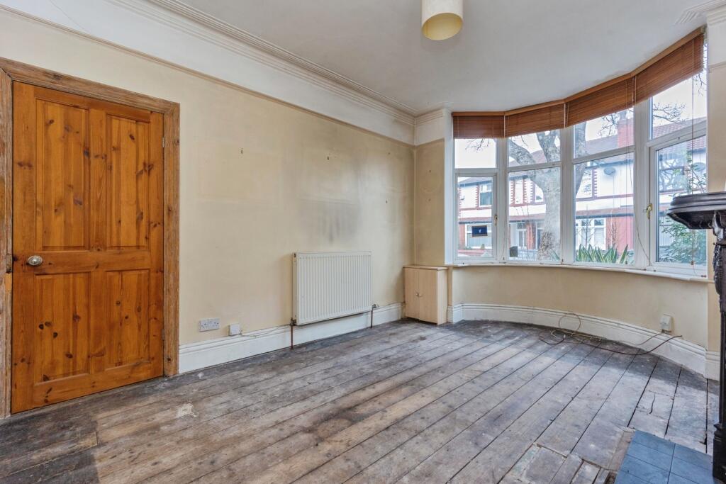
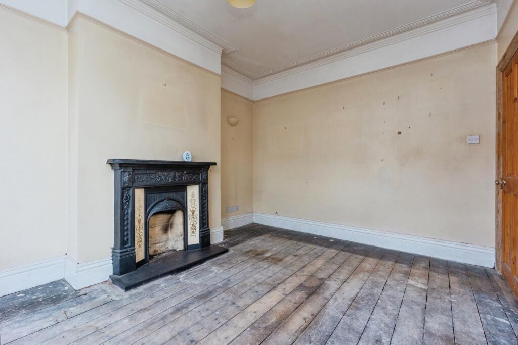
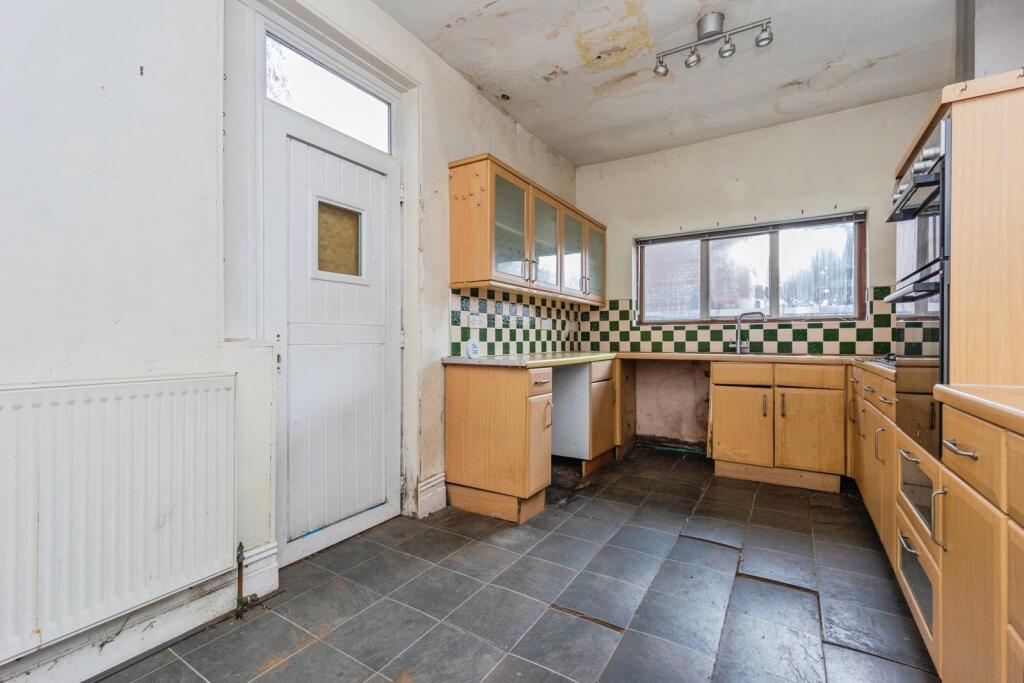
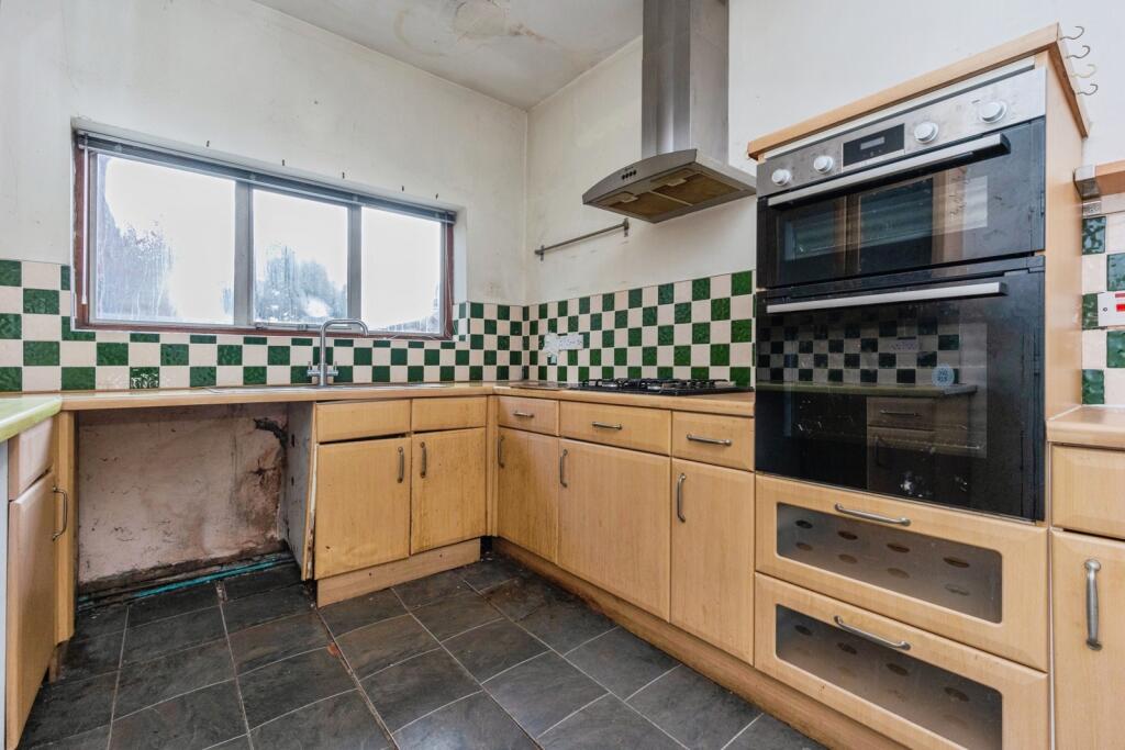
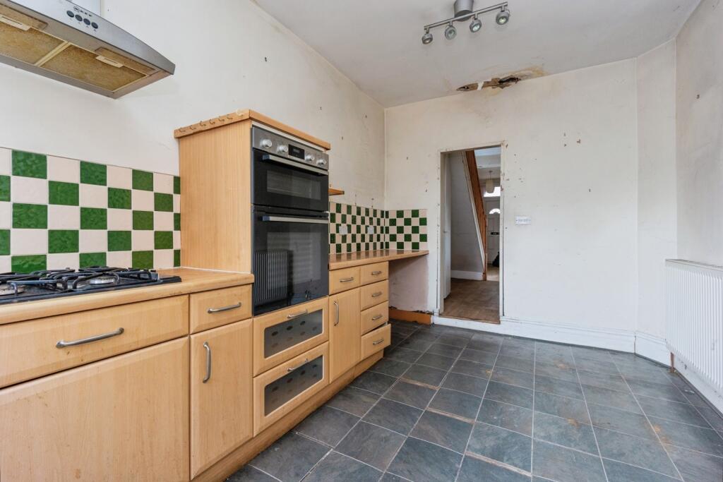
Briefly comprising of a welcoming hallway, lounge with feature fireplace and bay window, a second good sized reception room and spacious dining kitchen with a range of wall and base units giving access to the privately enclosed rear yard.
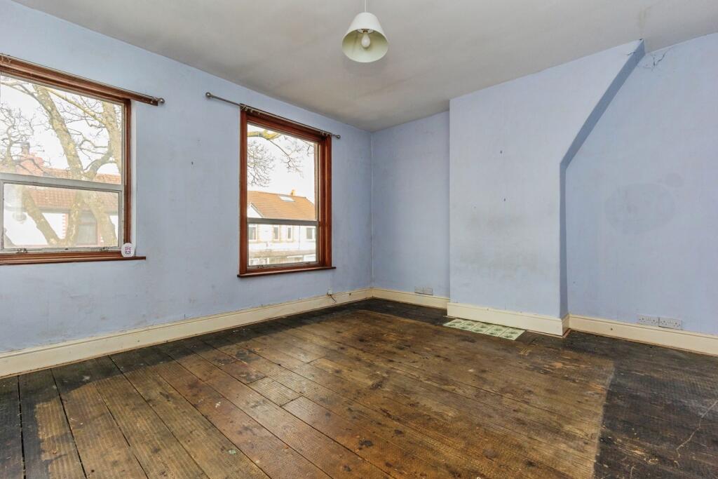
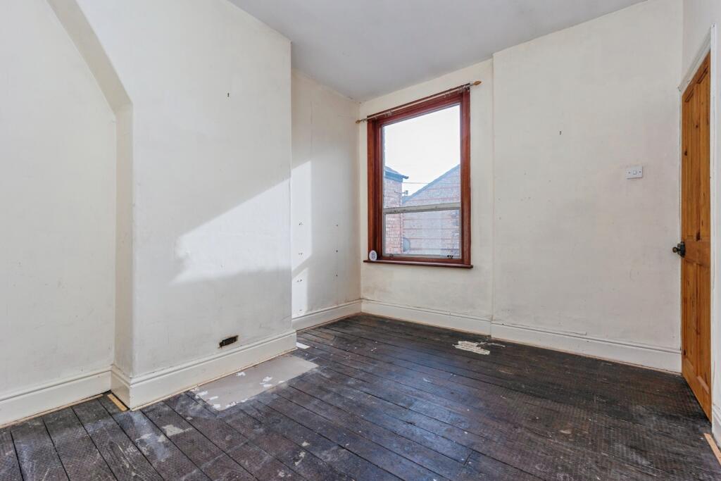
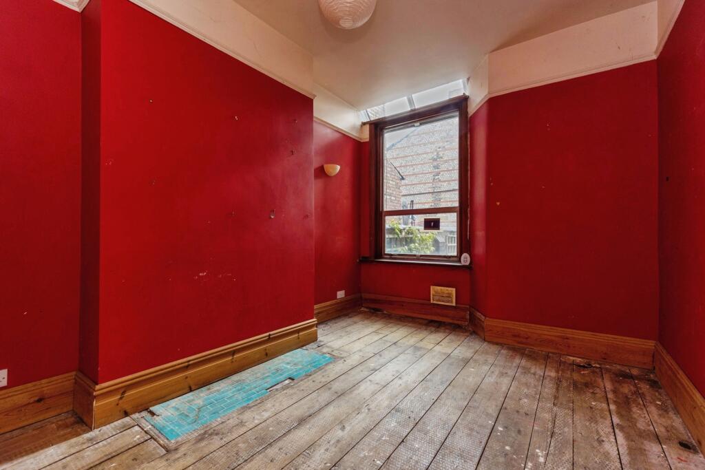
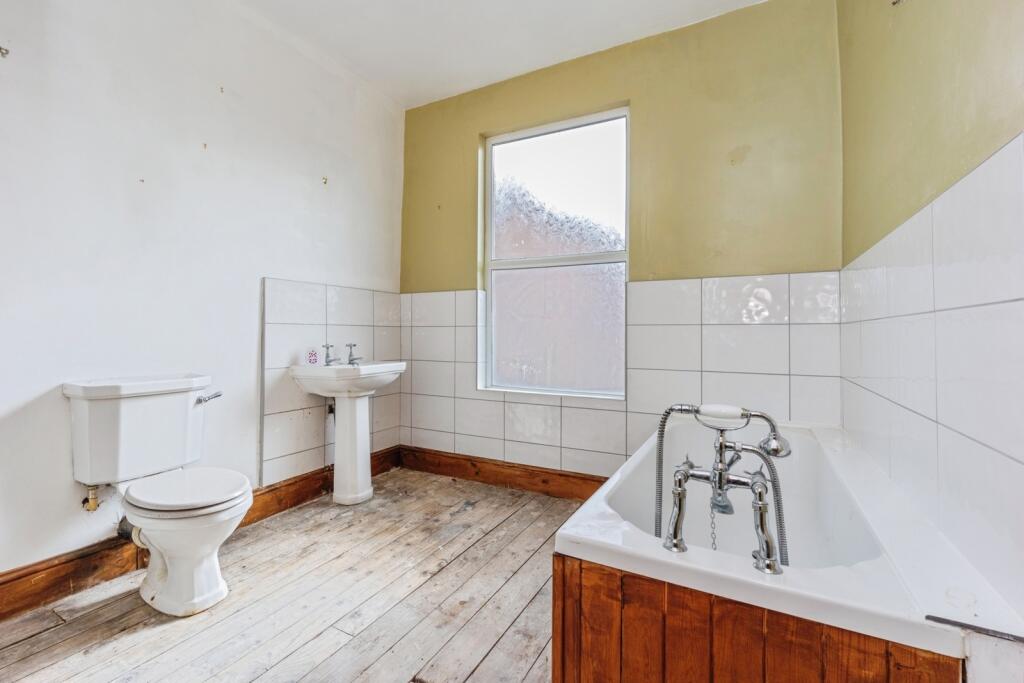
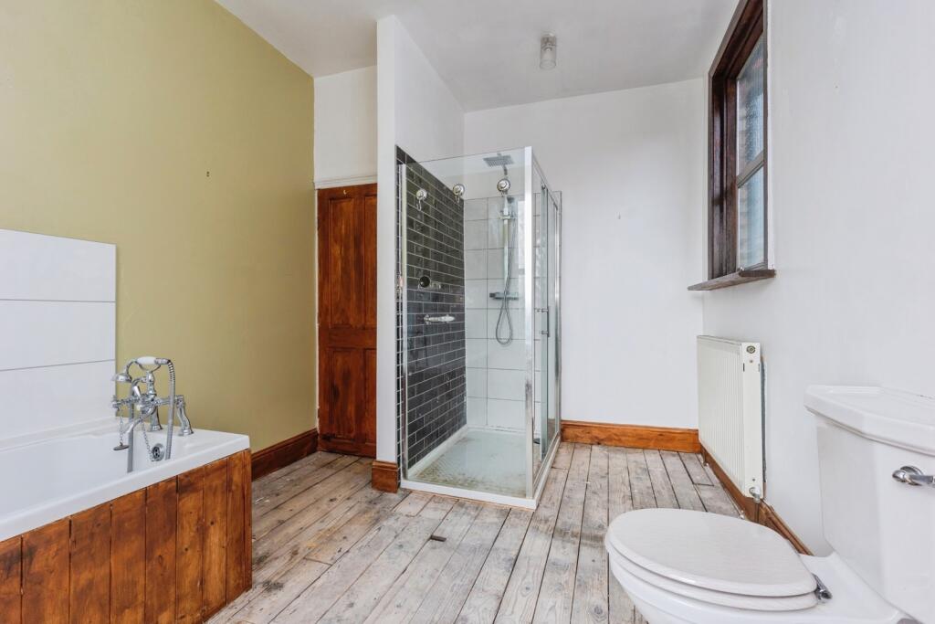
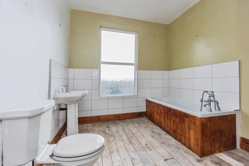
To the first floor are two well proportioned bedrooms and a larger than average four piece bathroom, providing scope to reconfigure to three bedrooms subject to appropriate planning.
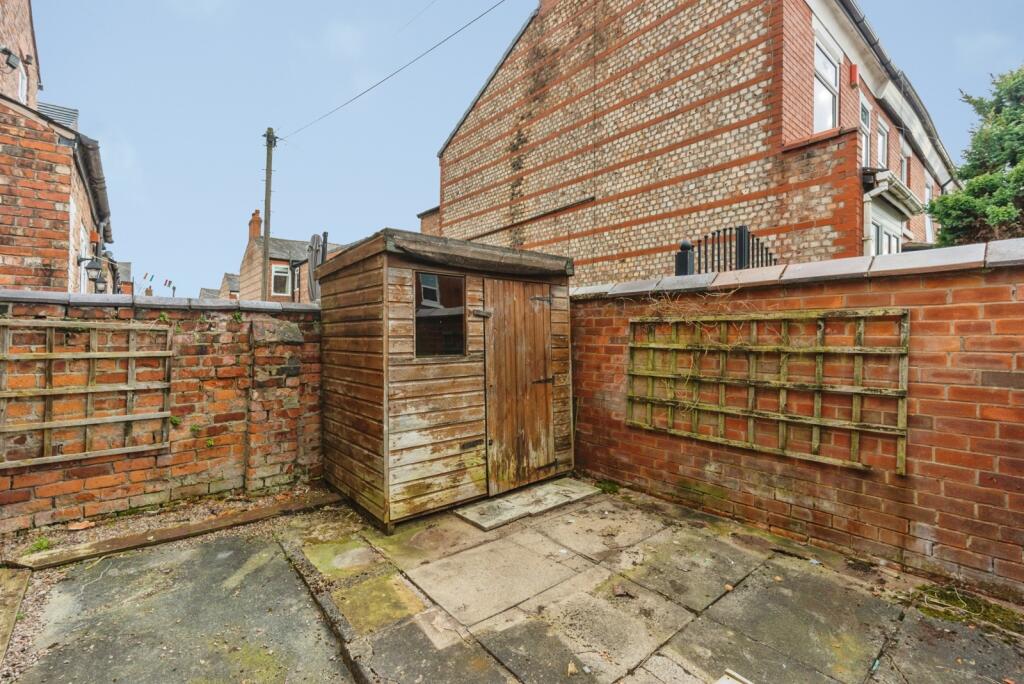
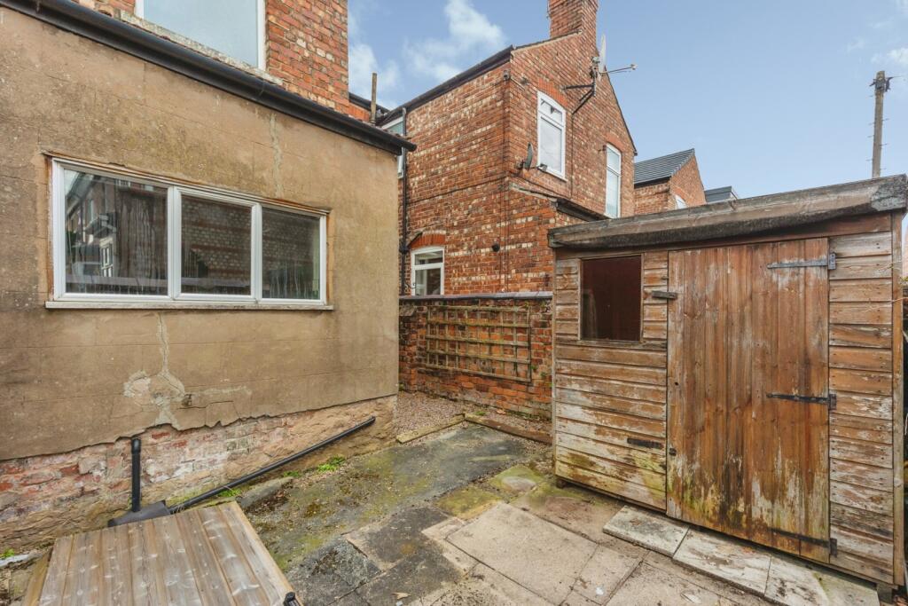
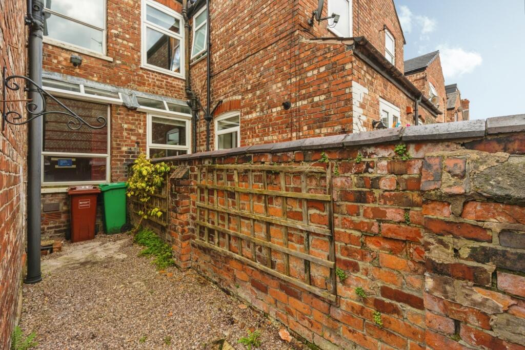
Externally, the property is garden fronted with low brick wall and to the rear is a privately enclosed rear yard with timber built shed.
Located in the heart of Chorlton, close to all local amenities including independent shops, restaurants and excellent schools and within walking distance of the metro link, the property is ideally located!
Offered for sale with no onward chain please call our sales team today to arrange your viewing!
Listed by
Chorlton
Countrywide UK Sales - Connells
Reference: 173119025
EPC Rating & Upgrade Cost
Current rating: C
Potential rating: C
Inspection date: 18/03/2026
Expiry date: 17/03/2036
Current heating cost: £816/year
Potential heating cost: £760/year
Est. upgrade cost to C: £16,500
Recommendations
- Floor insulation (suspended floor) (£5,000 - £10,000)
- Solar photovoltaic panels, 2.5 kWp (£8,000 - £10,000)
Flood risk
Zone: 1
Risk: Low
Job (default Low)
Floorplans
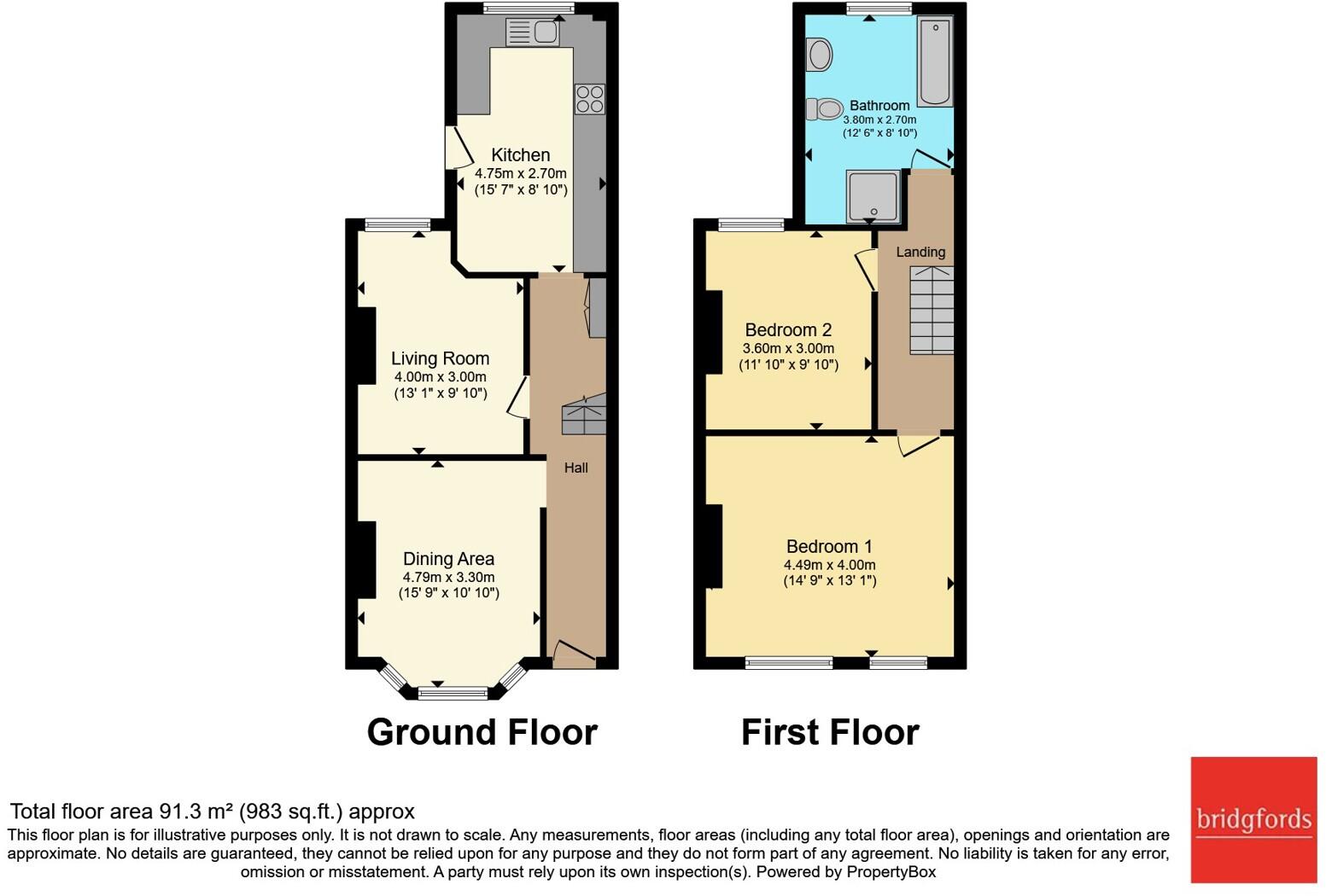
pbox-FP.jpg
EPC Graphs
EPC Rating Graph
FENSA Certificates
This property has 1 FENSA certificate(s) on record, indicating window/door installations by FENSA-approved installers.
FENSA Certificate #1831436
Property Details
Street: 20 St. Annes Road
Town: Manchester
Postcode: M21 8TR
Installation Details
Items: 1 window and 1 door
Certificate Issued: 05/07/2004
Work Completed: 03/06/2004
This certificate data was retrieved from FENSA's database
What is FENSA? FENSA (Fenestration Self-Assessment Scheme) is a government-authorised scheme that monitors building regulation compliance for replacement windows and doors. Certificates indicate that work was completed by FENSA-approved installers.
Price history
236% since 1999
| Event | Date | Price | % change |
|---|---|---|---|
| Listed for sale | — | £375,000 | +74.4% |
| Sold | 26/11/2010 (15 years ago) | £215,000 | +235.9% |
| Sold | 15/10/1999 (26 years ago) | £64,000 | — |
Source: HM Land Registry Price Paid Data. Crown copyright.
Sold Comparables
Same street and nearby sales within 0.25 miles (last 5 years). Data from Land Registry Price Paid.
| Address | Price | Date | Type |
|---|---|---|---|
| 22 ST ANNES ROAD, MANCHESTER, GREATER MANCHESTER, M21 8TR | £461,500 | 13/10/2023 | Terraced |
| 15 NORBRECK AVENUE, MANCHESTER, GREATER MANCHESTER, M21 8TG | £432,000 | 12/10/2023 | Terraced |
| 76 SANDY LANE, MANCHESTER, GREATER MANCHESTER, M21 8TT | £477,500 | 27/09/2023 | Terraced |
| 8 FAIRHAVEN AVENUE, MANCHESTER, GREATER MANCHESTER, M21 8TW | £438,000 | 08/09/2023 | Terraced |
| 25 CLEVELEYS AVENUE, MANCHESTER, GREATER MANCHESTER, M21 8TS | £470,000 | 14/08/2023 | Terraced |
| 8 LYTHAM AVENUE, MANCHESTER, GREATER MANCHESTER, M21 8TF | £402,500 | 03/01/2023 | Terraced |
| 1 FAIRHAVEN AVENUE, MANCHESTER, GREATER MANCHESTER, M21 8TW | £415,000 | 13/12/2022 | Terraced |
| 9 WHALLEY AVENUE, CHORLTON CUM HARDY, MANCHESTER, GREATER MANCHESTER, M21 8TU | £532,999 | 23/11/2022 | Terraced |
| 7 LYTHAM AVENUE, MANCHESTER, GREATER MANCHESTER, M21 8TF | £410,000 | 04/11/2022 | Terraced |
| 2 NORBRECK AVENUE, MANCHESTER, GREATER MANCHESTER, M21 8TG | £452,000 | 28/10/2022 | Terraced |
| 5 NORBRECK AVENUE, MANCHESTER, GREATER MANCHESTER, M21 8TG | £405,000 | 13/10/2022 | Terraced |
| 15 WHALLEY AVENUE, CHORLTON CUM HARDY, MANCHESTER, GREATER MANCHESTER, M21 8TU | £570,000 | 19/08/2022 | Terraced |
| 7 WHALLEY AVENUE, CHORLTON CUM HARDY, MANCHESTER, GREATER MANCHESTER, M21 8TU | £495,000 | 27/06/2022 | Terraced |
| 7 CLEVELEYS AVENUE, MANCHESTER, GREATER MANCHESTER, M21 8TS | £410,000 | 24/06/2022 | Terraced |
| 1 ANSDELL AVENUE, MANCHESTER, GREATER MANCHESTER, M21 8TP | £502,000 | 18/03/2022 | Terraced |
| 3 ANSDELL AVENUE, MANCHESTER, GREATER MANCHESTER, M21 8TP | £382,500 | 18/02/2022 | Terraced |
| 2 CLEVELEYS AVENUE, MANCHESTER, GREATER MANCHESTER, M21 8TS | £400,000 | 02/12/2021 | Terraced |
| 21 ST ANNES ROAD, MANCHESTER, GREATER MANCHESTER, M21 8TQ | £392,315 | 12/11/2021 | Terraced |
| 14 LYTHAM AVENUE, MANCHESTER, GREATER MANCHESTER, M21 8TF | £383,000 | 29/09/2021 | Terraced |
| 7 LYTHAM AVENUE, MANCHESTER, GREATER MANCHESTER, M21 8TF | £379,000 | 30/06/2021 | Terraced |
Area average: £440,516 (20 sales)
Capital growth trend
Land Registry outcode average: last 12 months vs 5y and 10y ago (from sold prices).
House Price Index (HM Land Registry — official index, not sold-price averages): Manchester. Series: Terraced. As of March 2026.
Rental Range
Estimated market rent for Manchester. Low = conservative, Realistic = average, Optimistic = best case.
Based on Local Authority from postcode lookup → Manchester.
LHA (30th percentile) floor for West Pennine: £449/mo (Apr 2025 – Mar 2026)
Location
Nearby
Nearest stations, universities and amenities (distance from property).
| Type | Name | Distance |
|---|---|---|
| Shop | Costcutter | 0.1 miles |
| Shop | Chorlton Fireworks | 0.1 miles |
| Bus stop | Chorlton Bus Station (Stand E) | 0.1 miles |
| Bus stop | Chorlton Bus Station (Stop B) | 0.1 miles |
| Hospital | Spire Manchester Hospital | 1.2 miles |
| Hospital | Withington Community Hospital | 1.4 miles |
| University | University Academy 92 | 1.5 miles |
| University | University of Manchester | 2.0 miles |
| Train station | Trafford Park | 2.0 miles |
| Train station | Humphrey Park | 2.5 miles |
Street-level crime
| Category | Count |
|---|---|
| Total incidents | 0 |
Within 1 mile during Apr 2026. Source: data.police.uk (England & Wales).
Schools nearby
Nearest open schools with Ofsted ratings (England). Closed schools are not shown. Data from Get Information about Schools and Ofsted.
| Name | Type | Distance | Ofsted |
|---|---|---|---|
| Chorlton Park Primary | Primary | 0.3 miles | Good — 11 Jul 2024 |
| Chorlton High School | Secondary | 0.3 miles | Good — 10 Oct 2011 |
| Manchester Islamic Grammar School for Girls | Other | 0.4 miles | Outstanding — 3 Apr 2019 |
| Brookburn Community School | Primary | 0.4 miles | Good — 25 Apr 2024 |
| Chorlton CofE Primary School | Primary | 0.5 miles | — (Inspected (no overall grade)) |
Rental Comparables
Loading rental comparables for this postcode. Refresh in a few minutes.
Rent-driven metrics
Based on Area rent estimate.
- Rent ratio — Monthly rent ÷ purchase price (1% rule). 1%+ = strong, 0.8–1% = okay, <0.8% = weak for cashflow.
- Max investor price — Rent ÷ 0.8%; the price at which rent would be 0.8% of price (Stoke-style target).
- Target investor price — Rent ÷ 1%; the price at which rent would be 1% of price (strong cashflow band).
- Gross yield — Annual rent as % of purchase price (no costs).