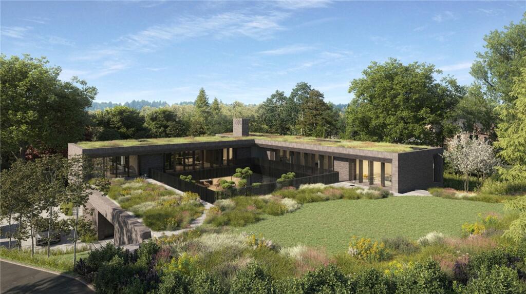
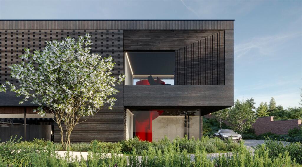
Cherrydene
MACCLESFIELD ROAD, ALDERLEY EDGE, CHESHIRE EAST SK9 7BL
Property details
Tenure
FREEHOLD
Floor area
304 m²
Council tax band
TBC
Year built
England and Wales: 1950-1966
Last sold
£1,350,000 Nov 2020
Price per m²
£9,819/m²
Local average
£837,551 (+256.4%)
Deprivation
Decile 10 (32,862 of 33,755)
Street crime
19 incidents within 1 mile (May 2026)
Additional details
- Electricity
- Mains supply
- Water
- Mains supply
- Sewerage
- Mains supply
- Parking
- Yes
- Garden
- Yes
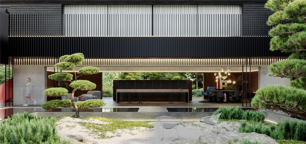
Description
Potential to increase further square footage, subject to necessary planning approvals.
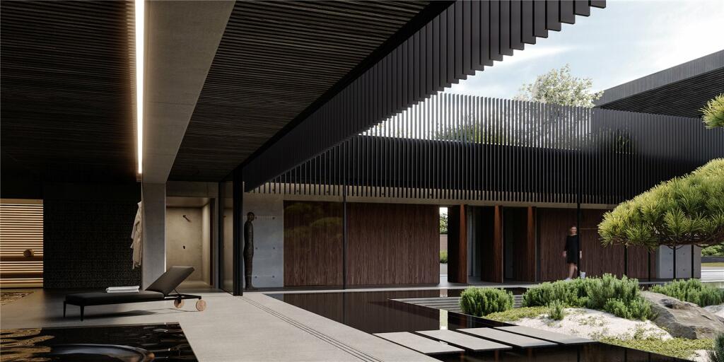
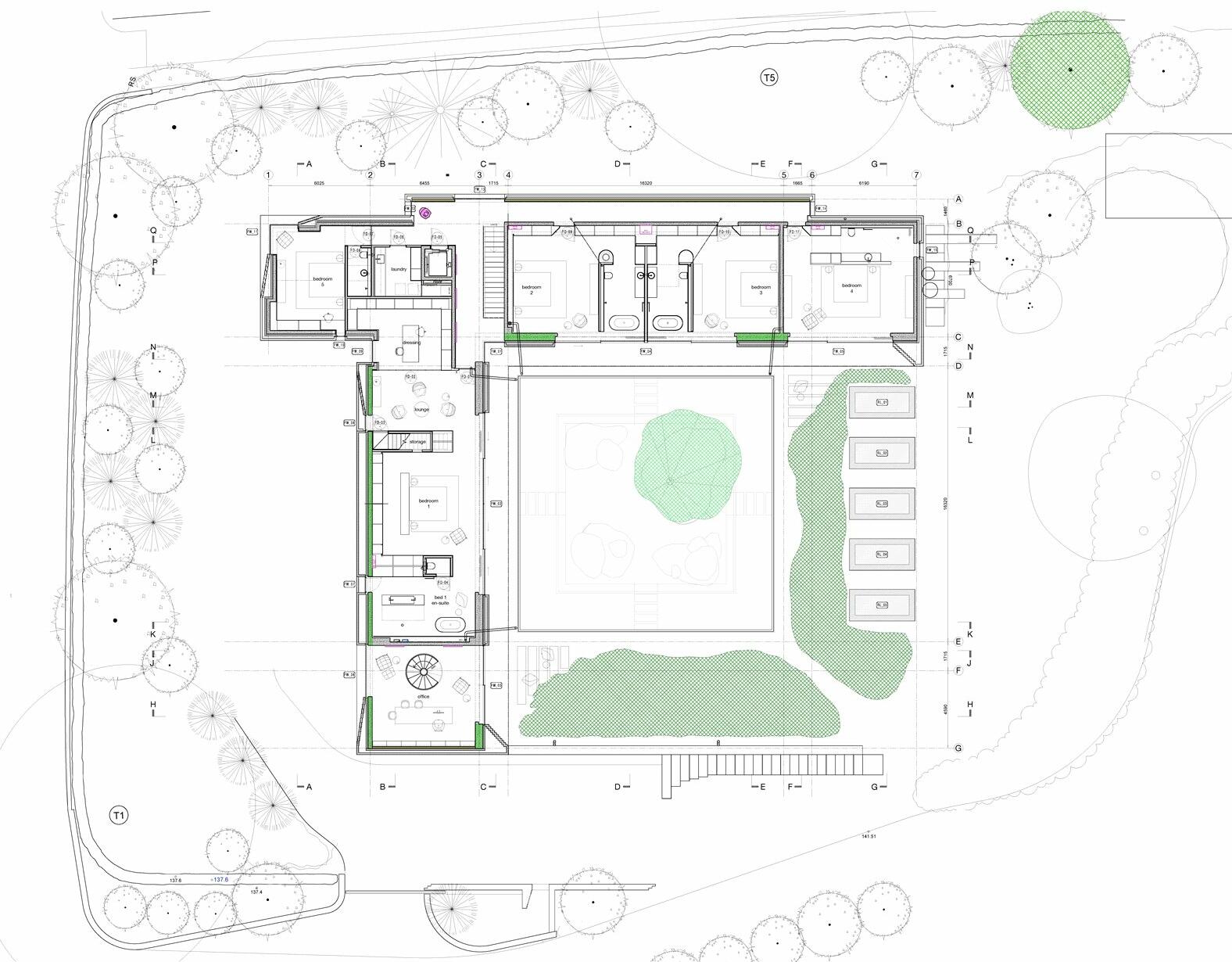
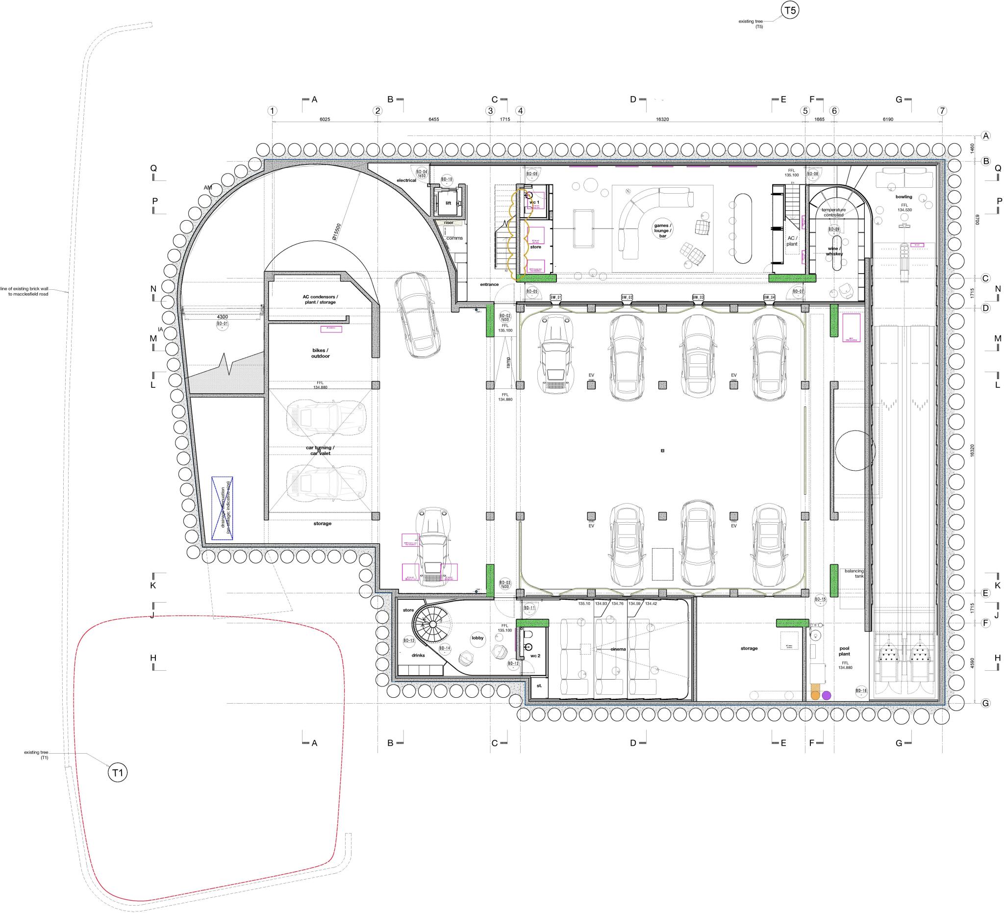
LOWER GROUND FLOOR
Cinema room, WC, cloakroom, two plant/store rooms, bike store, six car garage, lift.
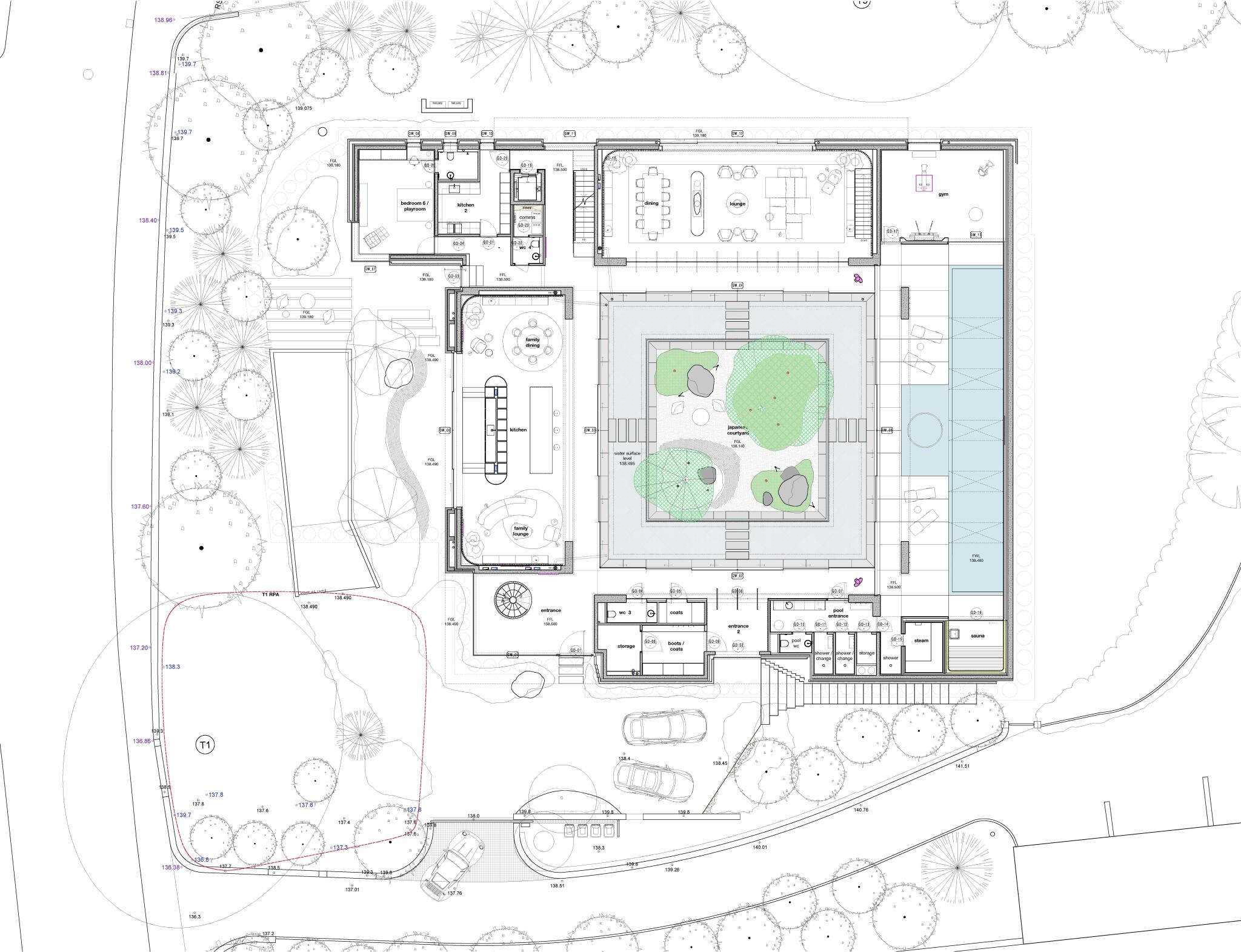
GROUND FLOOR
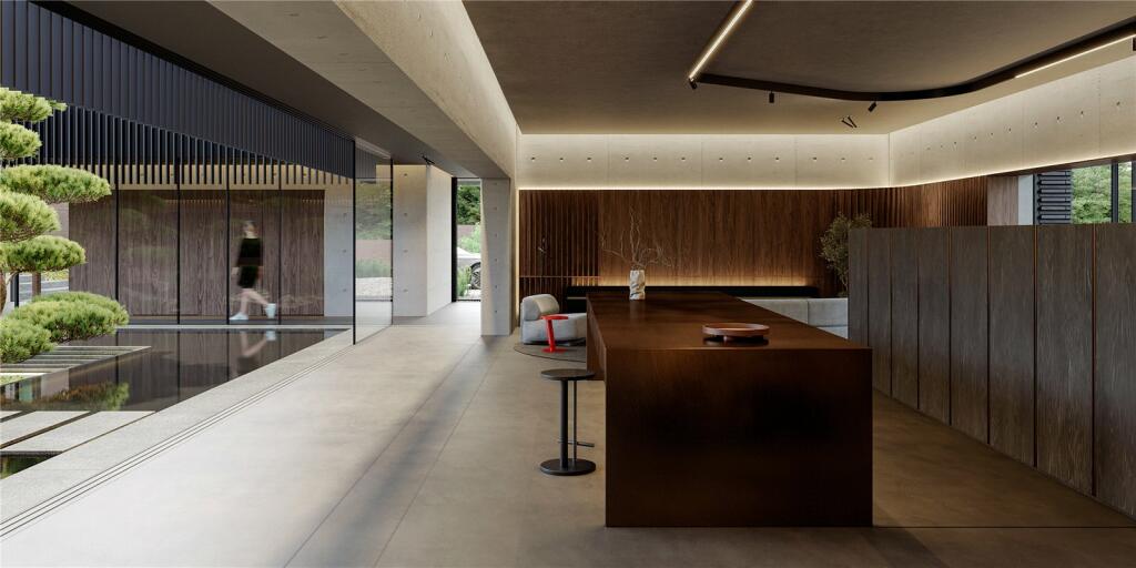
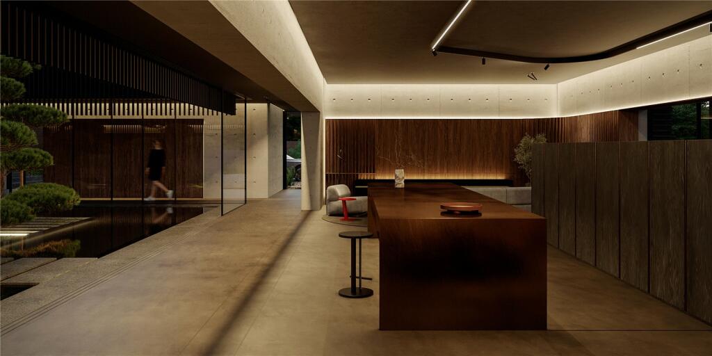
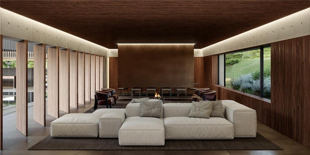
Entrance hall with spiral staircase, two WCs, cloakroom, store room and boot rooms, kitchen/breakfast room open-plan to the family and dining areas, dining room, sitting room, bedroom six/playroom with en suite, reading room, chefs kitchen, lift.
GROUND FLOOR LEISURE SUITE
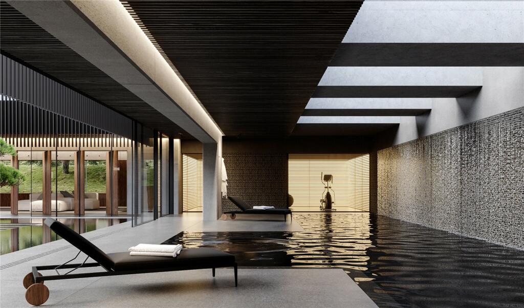
20m indoor pool, sauna/steam room, WC, changing room, gym, Jacuzzi and plunge pool.
FIRST FLOOR
Principal bedroom with relaxation/seating area, dressing room, en suite bathroom and separate WC. Four further double bedroom suites, laundry room, office.
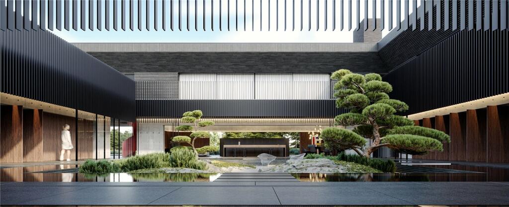
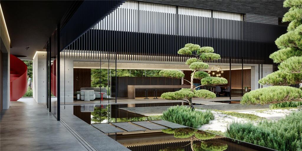
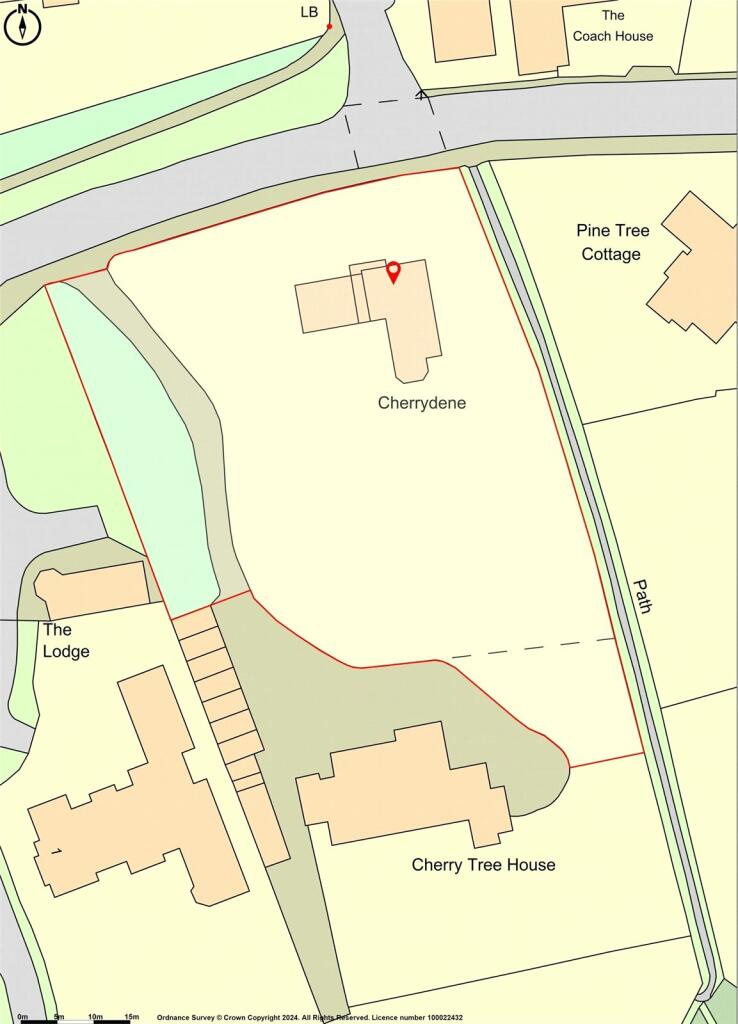
GROUNDS
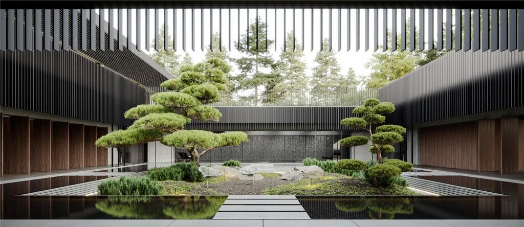
Landscaped gardens, Japanese courtyard with moated island of approximately 2,766 sq ft alone, in all about 0.96 acres.
Council Tax Band: to be assessed
Freehold.
Listed by
Alderley Edge
Jackson-Stops & Staff
Reference: 147214712
EPC ratings on this postcode
We don't have a matched EPC for this property yet. Below are efficiency scores and details for other addresses on this postcode.
| Address | Current | Potential | Floor area | Age band | Type |
|---|---|---|---|---|---|
| 1 Rockside, Macclesfield Road, ALDERLEY EDGE | 44 | 74 | 230 m² | England and Wales: before 1900 | Detached |
| 2 Rockside, Macclesfield Road, ALDERLEY EDGE | 24 | 74 | 198 m² | England and Wales: before 1900 | Detached |
| Amber-Gates, MacClesfield Road, ALDERLEY EDGE | 83 | 85 | 530 m² | England and Wales: 2012 onwards | Detached |
| Amber-Gates, Macclesfield Road, ALDERLEY EDGE | 87 | 87 | 638 m² | — | Detached |
| Cherrydene, Macclesfield Road | 48 | 75 | 304 m² | England and Wales: 1950-1966 | House |
| Cherrydene, Macclesfield Road, ALDERLEY EDGE | 48 | 75 | 304 m² | England and Wales: 1950-1966 | Detached |
| Cippyn House, Macclesfield Road, ALDERLEY EDGE | 73 | 74 | 748 m² | England and Wales: 1996-2002 | Detached |
| Copper Beech, Macclesfield Road, ALDERLEY EDGE | 68 | 79 | 274 m² | England and Wales: 1976-1982 | Detached |
| Flat 1 Cherry Tree House, Macclesfield Road, ALDERLEY EDGE | 69 | 78 | 130 m² | England and Wales: 1900-1929 | Flat |
| Flat 2 Cherry Tree House, Macclesfield Road, ALDERLEY EDGE | 68 | 80 | 129 m² | England and Wales: 1930-1949 | Flat |
| Flat 3 Cherry Tree House, Macclesfield Road, ALDERLEY EDGE | 68 | 73 | 116 m² | England and Wales: before 1900 | Flat |
| Flat 3, Cherry Tree House, MacClesfield Road, ALDERLEY EDGE | 71 | 79 | 116 m² | England and Wales: 1900-1929 | Flat |
| Honeywood, Macclesfield Road, ALDERLEY EDGE | 75 | 77 | 901 m² | England and Wales: 2007-2011 | Detached |
| Maple Bank, Macclesfield Road, ALDERLEY EDGE | 46 | 79 | 513 m² | England and Wales: before 1900 | Detached |
| Norwood, Macclesfield Road, ALDERLEY EDGE | 60 | 69 | 339 m² | England and Wales: 1950-1966 | Detached |
Flood risk
Zone: 1
Risk: Low
Job (default Low)
Floorplans
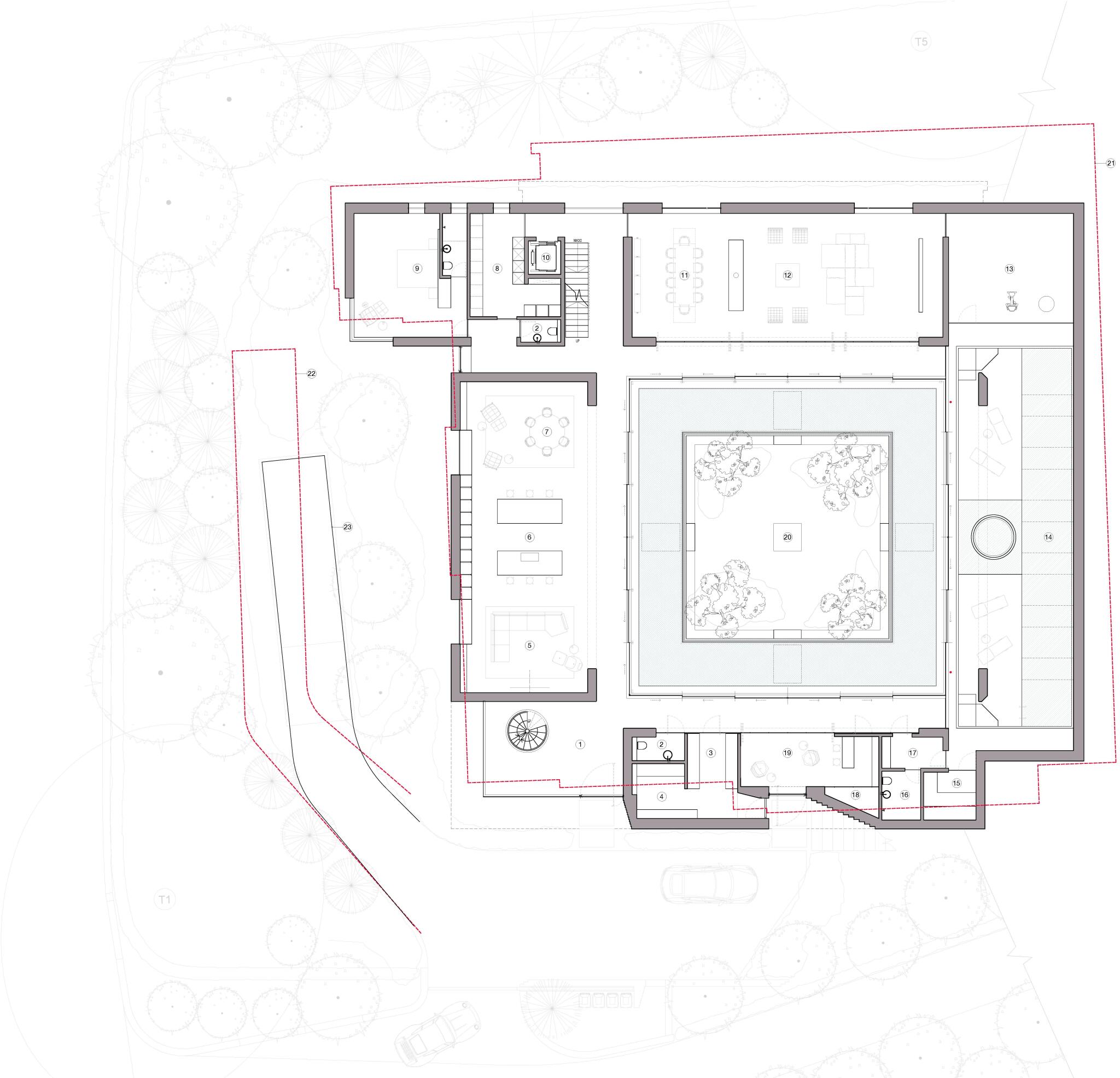
Ground Floor
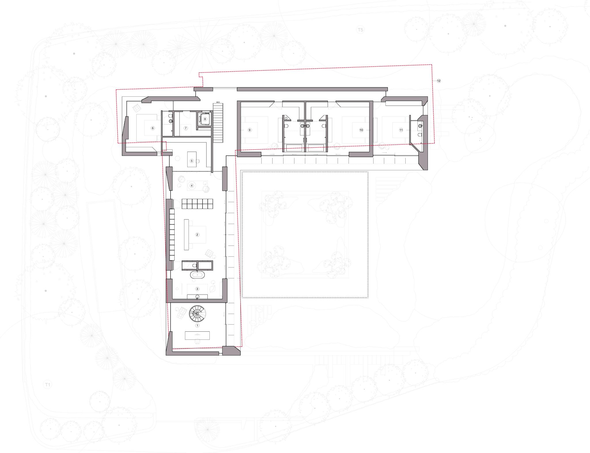
First Floor
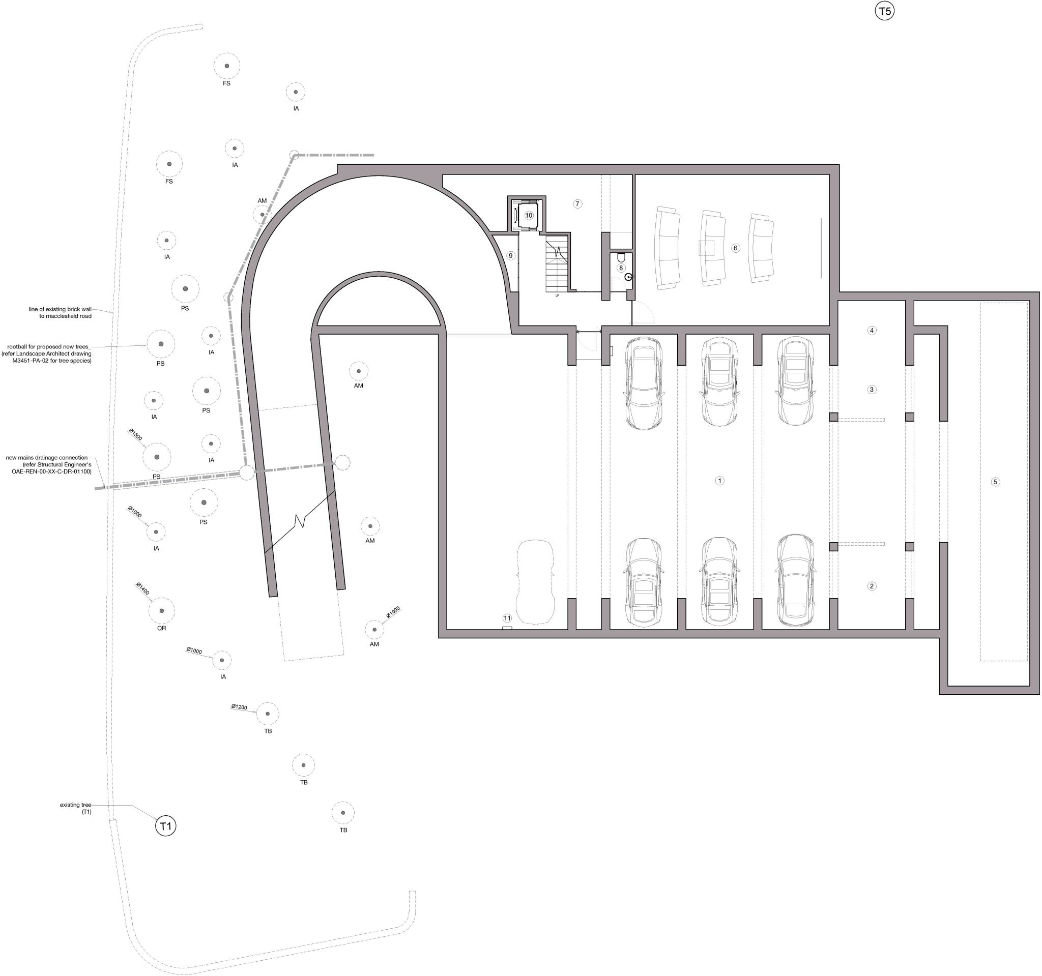
Lower Ground Floor
Potential Ground
Potential First
Potential LG Floor
Price history
85% since 2020
| Event | Date | Price | % change |
|---|---|---|---|
| Listed for sale | — | £2,985,000 | +19.4% |
| Sold | 01/09/2021 (4 years ago) | £2,500,000 | +85.2% |
| Sold | 17/11/2020 (5 years ago) | £1,350,000 | — |
Source: HM Land Registry Price Paid Data. Crown copyright.
Sold Comparables
Same street and nearby sales within 0.25 miles (last 5 years). Data from Land Registry Price Paid.
| Address | Price | Date | Type |
|---|---|---|---|
| Same street BROOMFIELD HOUSE MACCLESFIELD ROAD, ALDERLEY EDGE, CHESHIRE EAST, SK9 7BL | £4,300,000 | 30/01/2026 | Detached |
| Same street CHERRY TREE HOUSE FLAT 3 MACCLESFIELD ROAD, ALDERLEY EDGE, CHESHIRE EAST, SK9 7BL | £460,000 | 10/12/2024 | Flat |
| Same street CHERRY TREE HOUSE FLAT 2 MACCLESFIELD ROAD, ALDERLEY EDGE, CHESHIRE EAST, SK9 7BL | £435,000 | 04/10/2024 | Other |
Street average: £1,731,667 (3 sales)
Capital growth trend
Land Registry outcode average: last 12 months vs 5y and 10y ago (from sold prices).
House Price Index (HM Land Registry — official index, not sold-price averages): Cheshire East. Series: All dwelling types. As of April 2026.
Rental Range
Estimated market rent for Cheshire East. Low = conservative, Realistic = average, Optimistic = best case.
Based on Local Authority from postcode lookup → Cheshire East.
LHA (30th percentile) floor for West Pennine: £760/mo (Apr 2025 – Mar 2026)
Location
Address
Macclesfield Road
Nearby
Nearest stations, universities and amenities (distance from property).
| Type | Name | Distance |
|---|---|---|
| Bus stop | Alderley Edge, Congleton Road / Beechfield Road | 0.4 miles |
| Shop | Marie Curie | 0.4 miles |
| Shop | Fora Social Cuts | 0.4 miles |
| Train station | Alderley Edge | 0.6 miles |
| Hospital | The Wilmslow Hospital | 1.8 miles |
| Hospital | Soss Moss Hospital | 1.9 miles |
| Train station | Wilmslow | 2.0 miles |
| University | Fallowfield Reception and Richmond Amenities Building | 10.1 miles |
| University | Manchester School of Art | 11.8 miles |
Street-level crime
| Category | Count |
|---|---|
| Violence and sexual offences | 10 |
| Criminal damage and arson | 2 |
| Drugs | 2 |
| Other theft | 2 |
| Burglary | 1 |
| Public order | 1 |
| Vehicle crime | 1 |
| Total incidents | 19 |
Within 1 mile during May 2026. Source: data.police.uk (England & Wales).
Schools nearby
Nearest open schools with Ofsted ratings (England). Closed schools are not shown. Data from Get Information about Schools and Ofsted.
| Name | Type | Distance | Ofsted |
|---|---|---|---|
| Alderley Edge School for Girls | Other | 0.7 miles | — (No rating) |
| Alderley Edge Community Primary School | Primary | 0.7 miles | — (Inspected (no overall grade)) |
| The Ryleys School | Other | 0.8 miles | — (No rating) |
| Nether Alderley Primary School | Primary | 0.9 miles | Good — 1 May 2012 |
| Ashdene Primary School | Primary | 1.6 miles | Outstanding — 23 Apr 2019 |
Rental Comparables
Loading rental comparables for this postcode. Refresh in a few minutes.
Rent-driven metrics
Based on Area rent estimate.
- Rent ratio — Monthly rent ÷ purchase price (1% rule). 1%+ = strong, 0.8–1% = okay, <0.8% = weak for cashflow.
- Max investor price — Rent ÷ 0.8%; the price at which rent would be 0.8% of price (Stoke-style target).
- Target investor price — Rent ÷ 1%; the price at which rent would be 1% of price (strong cashflow band).
- Gross yield — Annual rent as % of purchase price (no costs).
Enter House Number
Enter the house number to help us retrieve more accurate pricing history and property data.
Please log in to submit or correct the house number for this listing.
Log in to continue