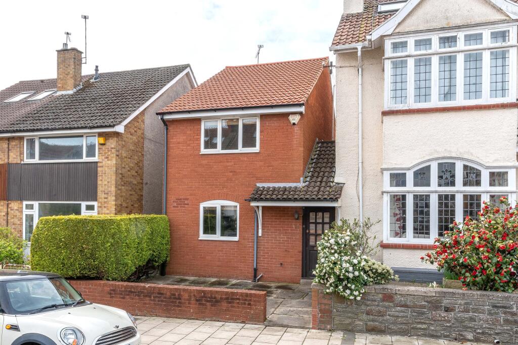
22 HALSBURY ROAD
BRISTOL, WESTBURY PARK, CITY OF BRISTOL BS6 7SR
Property details
Tenure
FREEHOLD
Floor area
115 m²
Council tax band
D
Last sold
£550,000 Aug 2025
Local average
£809,200 (-27.7%)
Deprivation
Decile 10 (32,757 of 33,755)
Street crime
334 incidents within 1 mile (Apr 2026)
Key features
- Redland Green school catchment
- Three good size double bedrooms
- Link-detached house
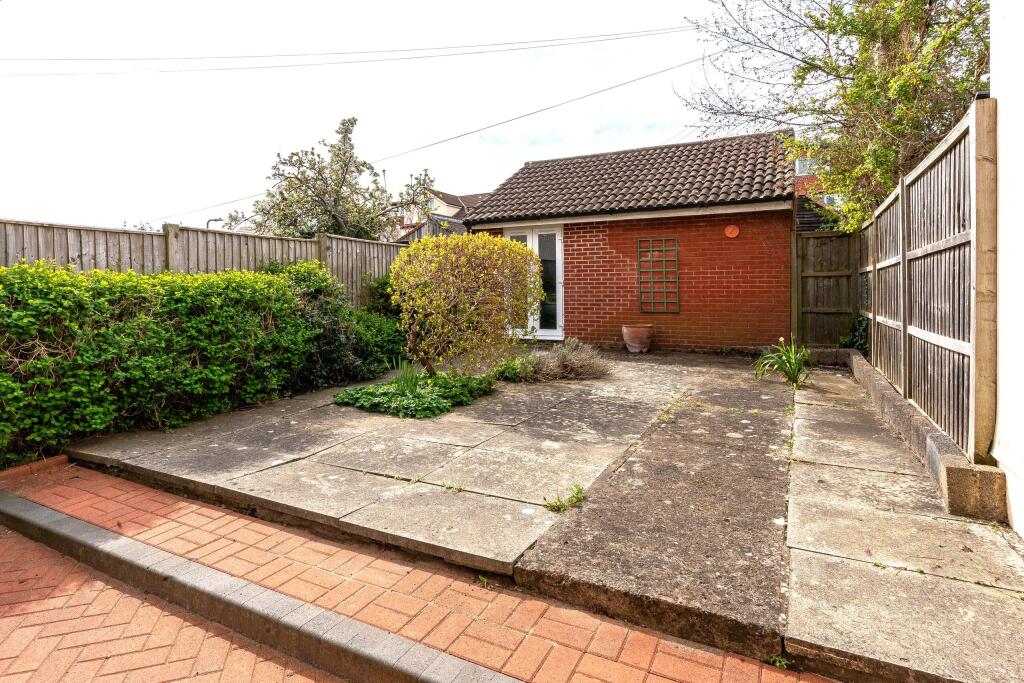
- South-west facing garden
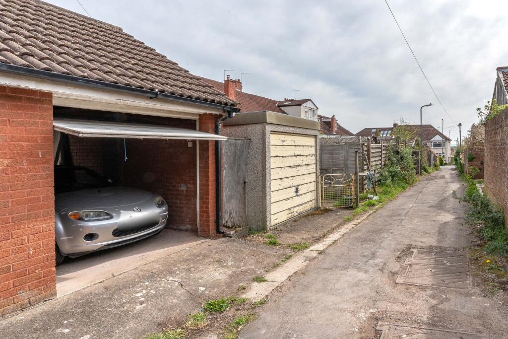
- Garage which has potential to be converted in to a home office
- Being sold with no onward chain
Additional details
- Accessibility
- No wheelchair access
- Parking
- Yes
- Garden
- Yes
Description
Overview
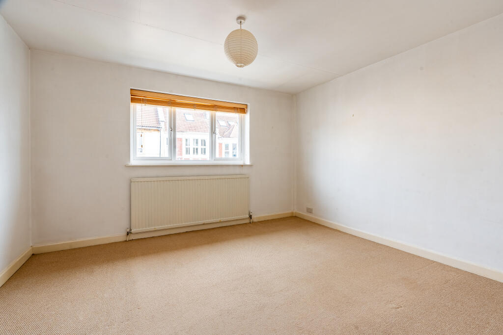
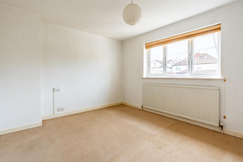
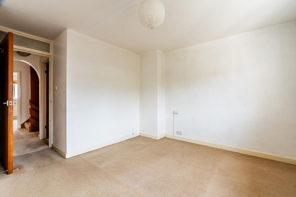
An interesting and larger than expected three bedroom house, located on a quiet, tree lined residential road within the first priority catchment for Redland Green school. Good size south-west facing garden and a garage.
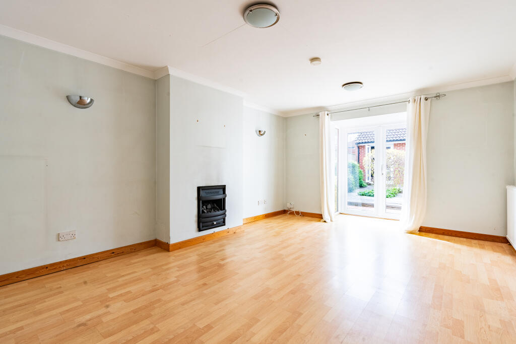
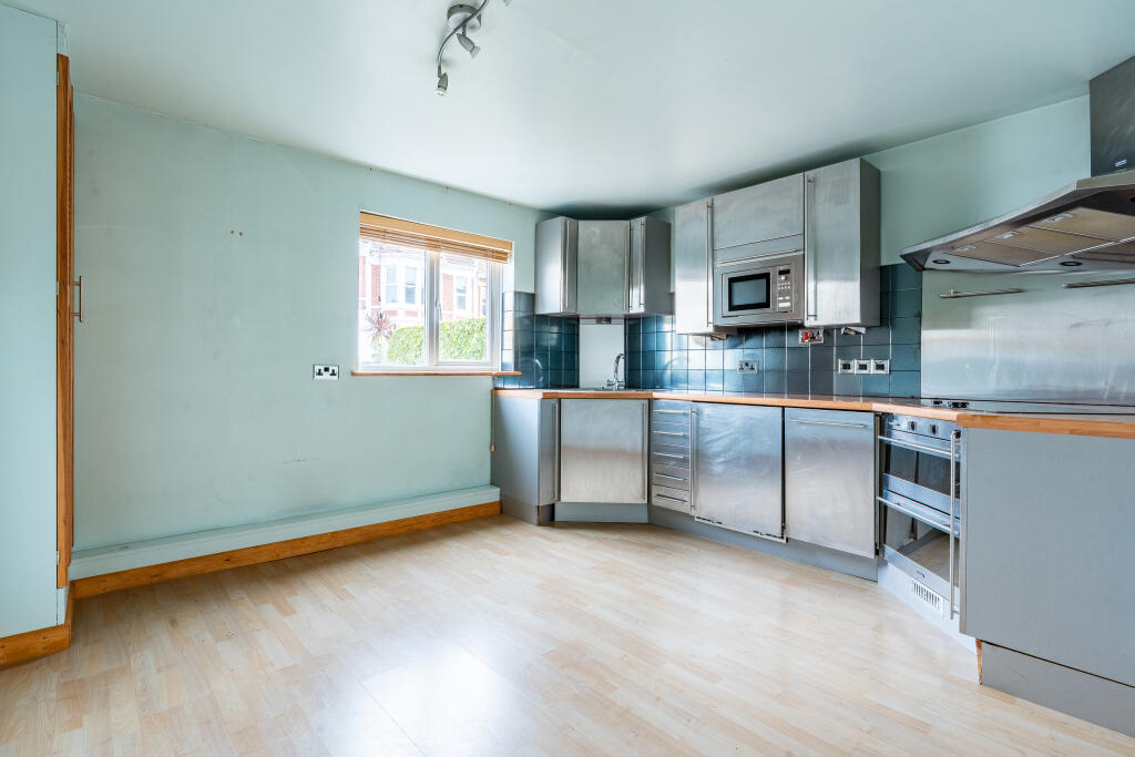
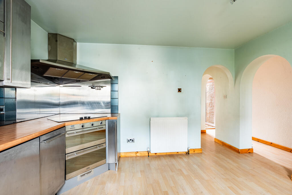
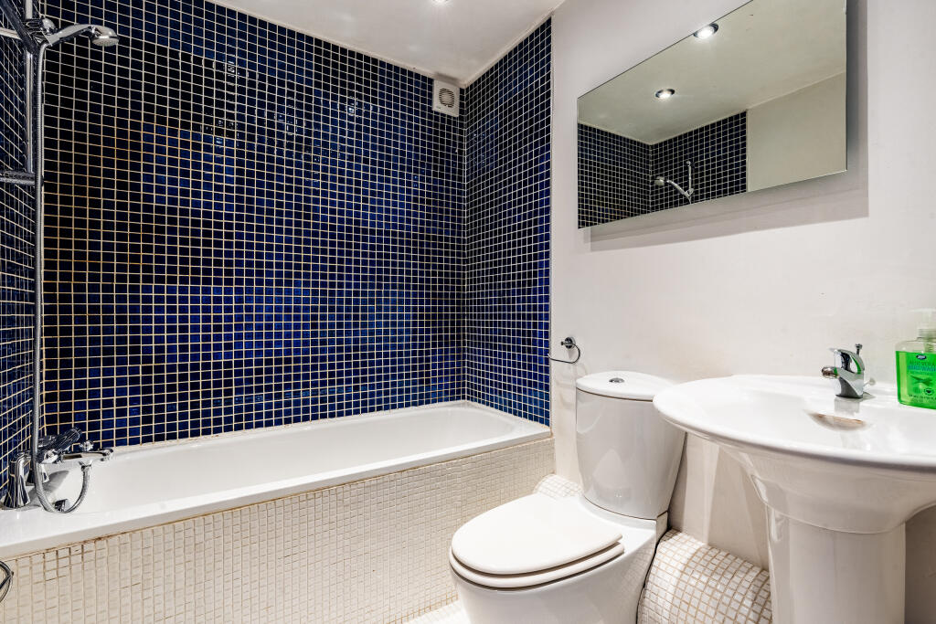
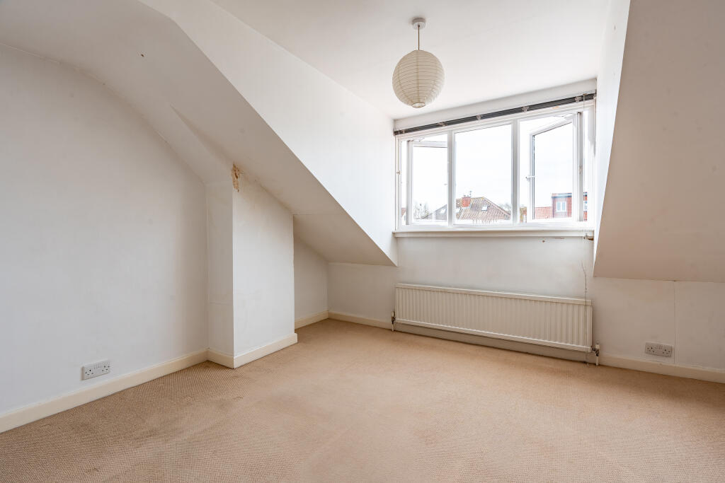
The property is in good condition, yet offers an exciting opportunity for someone to modernise and make their own. A large living room to the rear of the house provides versatile space for relaxing, dining and entertaining. French doors allow light to pour in and give direct access out to the secluded rear garden. The kitchen is a really good size, fitted with plenty of cupboards and is large enough for a breakfast table. Upstairs are three decent double bedrooms that will cater for all family needs.
Outside, at the rear of the garden is a one car garage. Alternatively, it could be used for storage or has the potential to convert to a home office.
Being sold with no onward chain.
Location
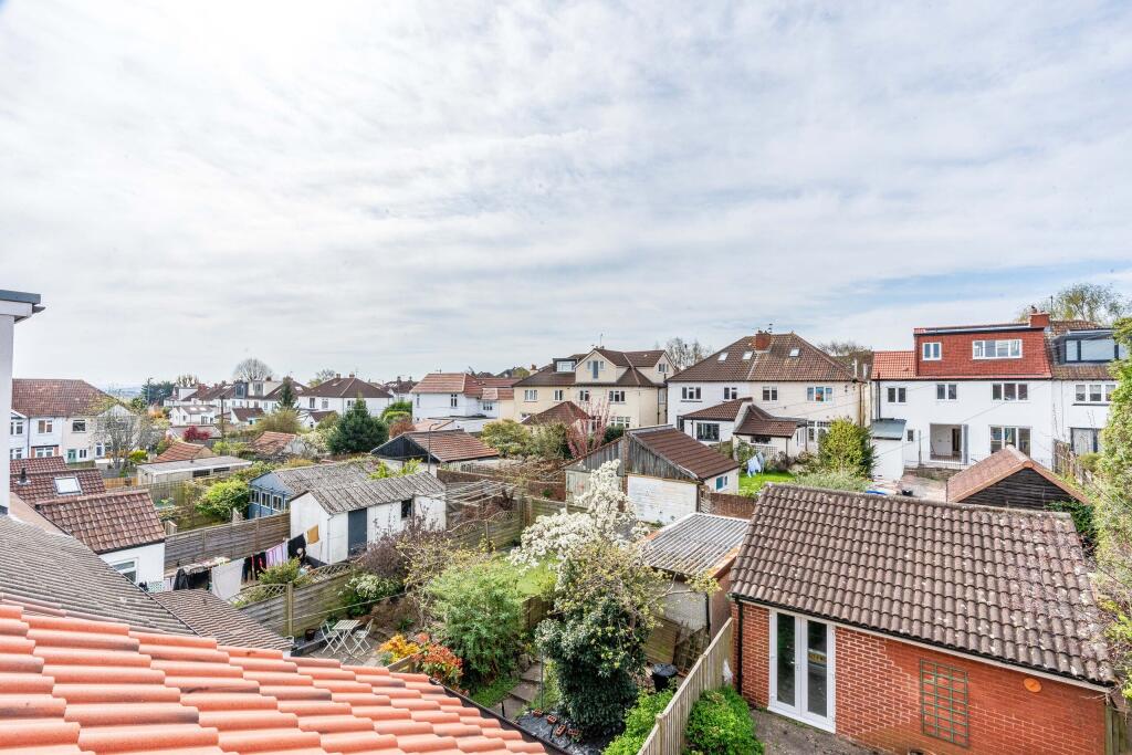
Westbury Park is a small, leafy and affluent area found to the east of The Durdham Downs, between Redland and Henleaze.
There's a frequent bus service to the city centre, about two miles away. Clifton Down station is on the the way on Whiteladies Road. Falcondale Road takes you to the M5, passing Cribbs Causeway shopping centre.
Westbury Park is a popular area, attracting professionals and families wanting easy access to the city while enjoying excellent local conveniences in a quieter neighbourhood.
North View has a selection of independent shops, including a butchers and fishmongers. There’s a Waitrose and a fantastic independent cinema, The Orpheus, showing a selection of blockbusters and independent films.
Material information (provided by owner)
Tenure - Freehold
Council tax band - D
Listed by
Clifton
Ocean
Reference: 161404172
EPC Rating & Upgrade Cost
Fetching EPC data… Refresh this page in a moment.
Flood risk
Zone: 1
Risk: Low
Job (default Low)
Floorplans
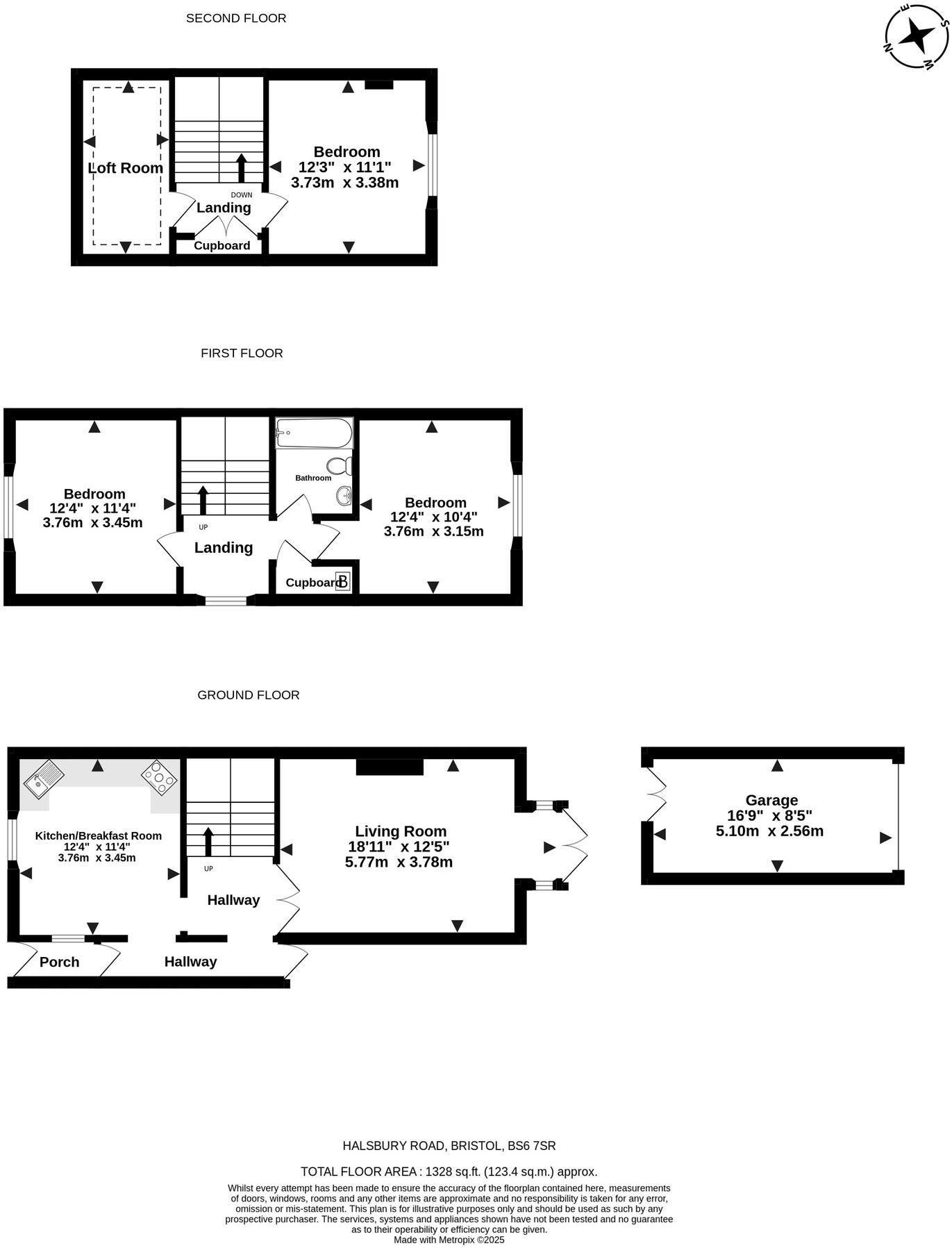
22HalsburyRoad-High
EPC Graphs
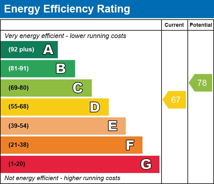
EE

Energy Performance Certificate
Price history
358% since 1999
| Event | Date | Price | % change |
|---|---|---|---|
| Sold | 15/08/2025 (9 months ago) | £550,000 | +358.3% |
| Sold | 09/06/1999 (27 years ago) | £120,000 | — |
Source: HM Land Registry Price Paid Data. Crown copyright.
Sold Comparables
Same street and nearby sales within 0.25 miles (last 5 years). Data from Land Registry Price Paid.
| Address | Price | Date | Type |
|---|---|---|---|
| 11 WILDCROFT ROAD, BRISTOL, CITY OF BRISTOL, BS9 4HZ | £712,500 | 14/11/2025 | Detached |
| 27A FALLODON WAY, BRISTOL, CITY OF BRISTOL, BS9 4HX | £615,000 | 30/11/2023 | Detached |
| 32 FALLODON WAY, BRISTOL, CITY OF BRISTOL, BS9 4HX | £772,500 | 31/10/2023 | Detached |
| 13 REMENHAM PARK, BRISTOL, CITY OF BRISTOL, BS9 4HE | £790,000 | 20/10/2023 | Detached |
| 9C KELLAWAY AVENUE, BRISTOL, CITY OF BRISTOL, BS6 7XP | £425,000 | 05/10/2023 | Detached |
| 47 FALLODON WAY, BRISTOL, CITY OF BRISTOL, BS9 4HF | £810,000 | 11/05/2023 | Detached |
| 30 FALLODON WAY, BRISTOL, CITY OF BRISTOL, BS9 4HX | £785,000 | 19/12/2022 | Detached |
| Same street 26 HALSBURY ROAD, WESTBURY PARK, BRISTOL, CITY OF BRISTOL, BS6 7SR | £635,000 | 13/12/2022 | Semi-detached |
| 12 REMENHAM PARK, BRISTOL, CITY OF BRISTOL, BS9 4HE | £815,000 | 24/08/2022 | Detached |
| 44 FALLODON WAY, BRISTOL, CITY OF BRISTOL, BS9 4HF | £732,000 | 01/07/2022 | Detached |
| 41 FALLODON WAY, BRISTOL, CITY OF BRISTOL, BS9 4HF | £760,000 | 23/05/2022 | Detached |
| 62 ST ALBANS ROAD, BRISTOL, CITY OF BRISTOL, BS6 7SH | £750,000 | 25/03/2022 | Detached |
| 32 FALLODON WAY, BRISTOL, CITY OF BRISTOL, BS9 4HX | £740,000 | 28/01/2022 | Detached |
| 5 REMENHAM PARK, BRISTOL, CITY OF BRISTOL, BS9 4HE | £540,000 | 15/09/2021 | Detached |
| 32 FALLODON WAY, BRISTOL, CITY OF BRISTOL, BS9 4HX | £600,000 | 30/06/2021 | Detached |
Street average: £635,000 (1 sale)
Area average: £703,357 (14 sales)
Capital growth trend
Land Registry outcode average: last 12 months vs 5y and 10y ago (from sold prices).
House Price Index (HM Land Registry — official index, not sold-price averages): City of Bristol. Series: Detached. As of March 2026.
Rental Range
Estimated market rent for Bristol, City of. Low = conservative, Realistic = average, Optimistic = best case.
Based on Local Authority from postcode lookup → Bristol, City of.
LHA (30th percentile) floor for Gloucester: £848/mo (Apr 2025 – Mar 2026)
Location
Nearby
Nearest stations, universities and amenities (distance from property).
| Type | Name | Distance |
|---|---|---|
| Bus stop | Halsbury Road | 0.0 miles |
| Bus stop | Linden Road | 0.1 miles |
| Hospital | Spire Bristol | 0.6 miles |
| Shop | Unknown | 0.6 miles |
| Shop | Spar | 0.7 miles |
| Train station | Redland | 0.9 miles |
| Train station | Clifton Down | 1.1 miles |
| Hospital | South West Regional Laboratories | 1.4 miles |
| University | 5 Priory Road, Life Sciences | 1.4 miles |
| University | dBs Institute Bristol Campus | 2.1 miles |
Street-level crime
| Category | Count |
|---|---|
| Shoplifting | 91 |
| Violence and sexual offences | 77 |
| Vehicle crime | 37 |
| Anti-social behaviour | 30 |
| Burglary | 21 |
| Other theft | 21 |
| Public order | 16 |
| Criminal damage and arson | 15 |
| Other crime | 9 |
| Robbery | 9 |
| Bicycle theft | 6 |
| Drugs | 1 |
| Theft from the person | 1 |
| Total incidents | 334 |
Within 1 mile during Apr 2026. Source: data.police.uk (England & Wales).
Schools nearby
Nearest open schools with Ofsted ratings (England). Closed schools are not shown. Data from Get Information about Schools and Ofsted.
| Name | Type | Distance | Ofsted |
|---|---|---|---|
| Westbury Park School | Primary | 0.3 miles | — (Inspected (no overall grade)) |
| Henleaze Junior School | Primary | 0.3 miles | Requires improvement — 25 Jul 2024 |
| Henleaze Infant School | Primary | 0.3 miles | Good — 13 Nov 2022 |
| Claremont School | Other | 0.3 miles | Good — 20 Mar 2013 |
| St Bonaventure's Catholic Primary School | Primary | 0.4 miles | Good — 4 Jul 2013 |
Rental Comparables
Residential lets from OpenRent and Rightmove for the area (same bedroom count). Use to validate rent estimates. Student lets are excluded.
| Title | Rent | Beds | Distance | As seen on |
|---|---|---|---|---|
| 3 Bed Flat, Redland Road, BS6 | £2,400/mo | 3 | 0.71 miles | OpenRent |
Average rent: £2,400/mo (1 listing)
Rent-driven metrics
Based on OpenRent comparables.
- Rent ratio — Monthly rent ÷ purchase price (1% rule). 1%+ = strong, 0.8–1% = okay, <0.8% = weak for cashflow.
- Max investor price — Rent ÷ 0.8%; the price at which rent would be 0.8% of price (Stoke-style target).
- Target investor price — Rent ÷ 1%; the price at which rent would be 1% of price (strong cashflow band).
- Gross yield — Annual rent as % of purchase price (no costs).
- Cost-to-rent — Price ÷ annual rent (from OpenRent comparables). Under 14× = strong, 14–16× = acceptable, 17×+ = compressed.
- Cashflow — Rent minus mortgage, 10% maintenance, £25/mo compliance. Assumes 75% LTV, 3.95% APR (5yr fixed), 25yr term.
- ROI — Annual profit ÷ cash in (deposit + 4% purchase costs).