Saltersford Lane
Alton, ST10, ST10 4AU
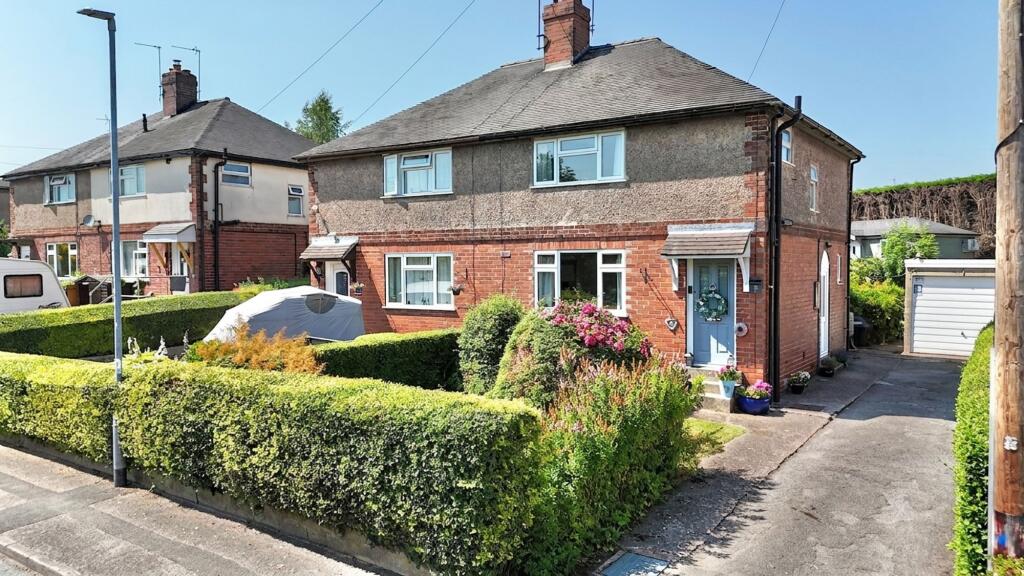
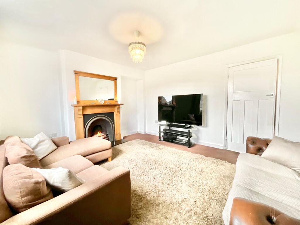
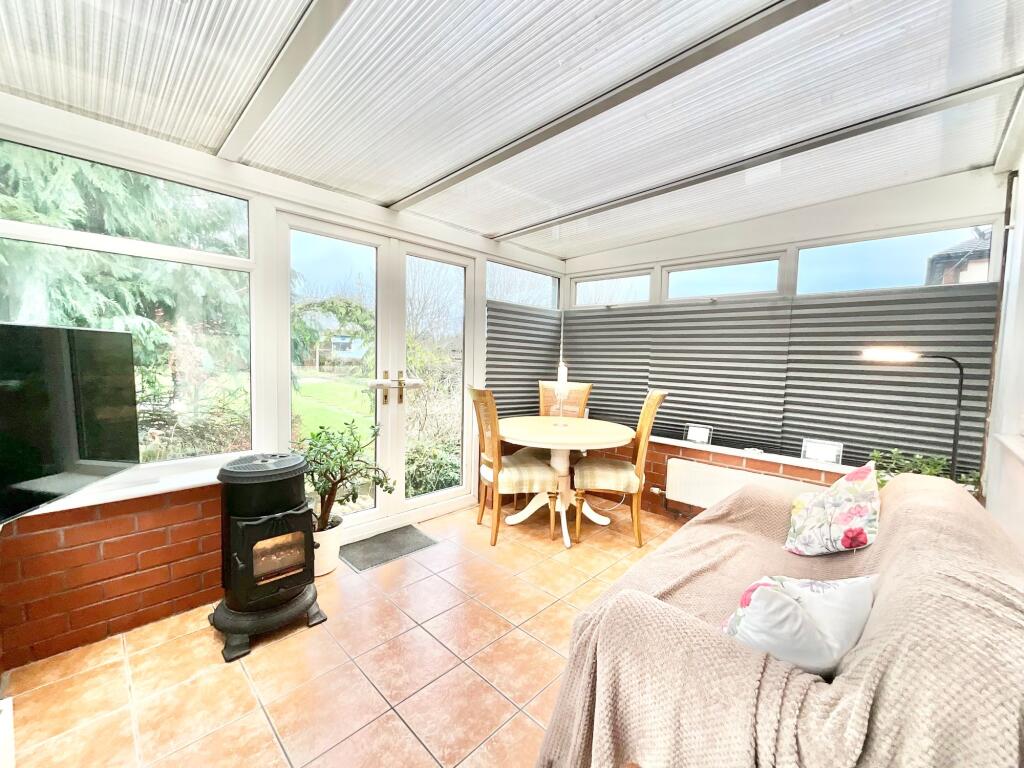
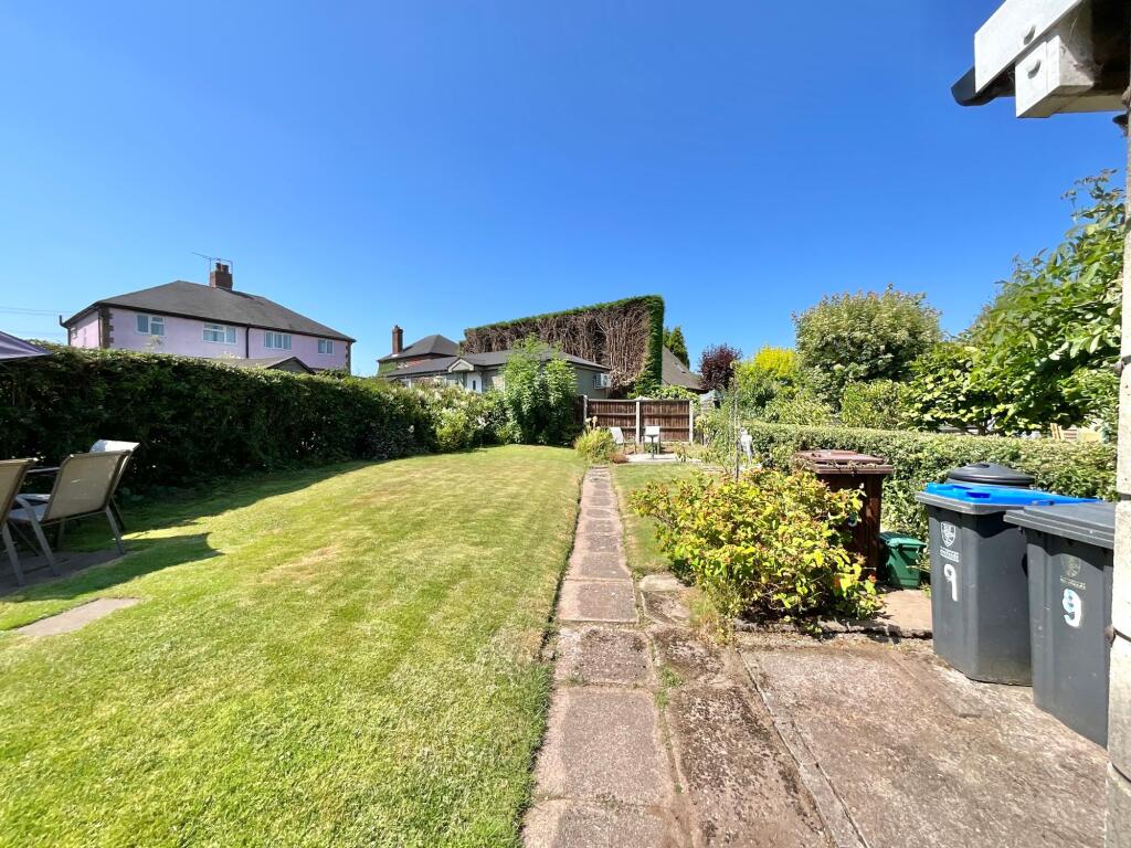
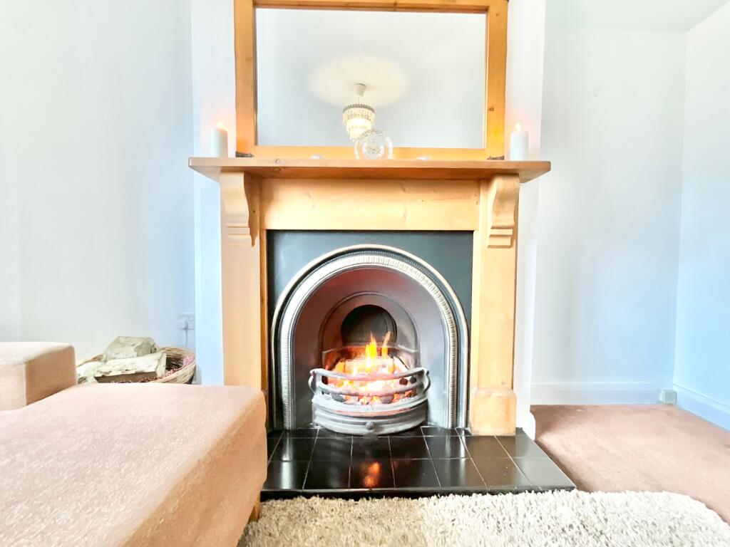
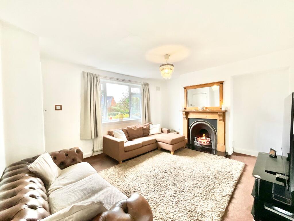
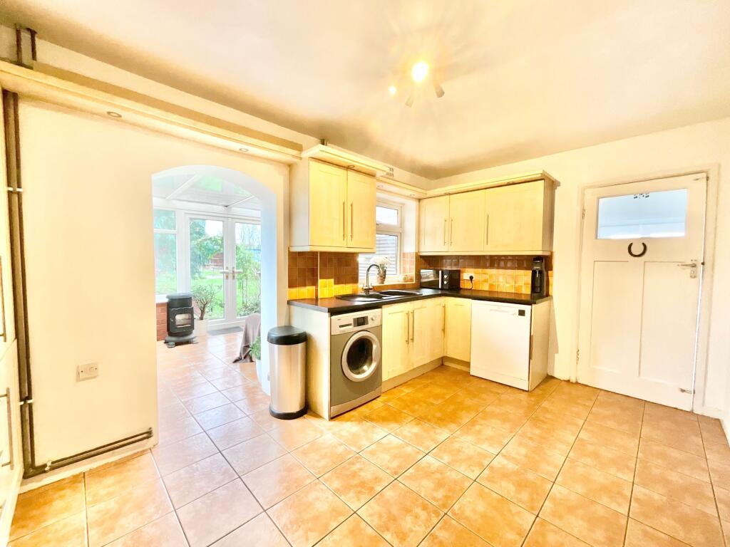
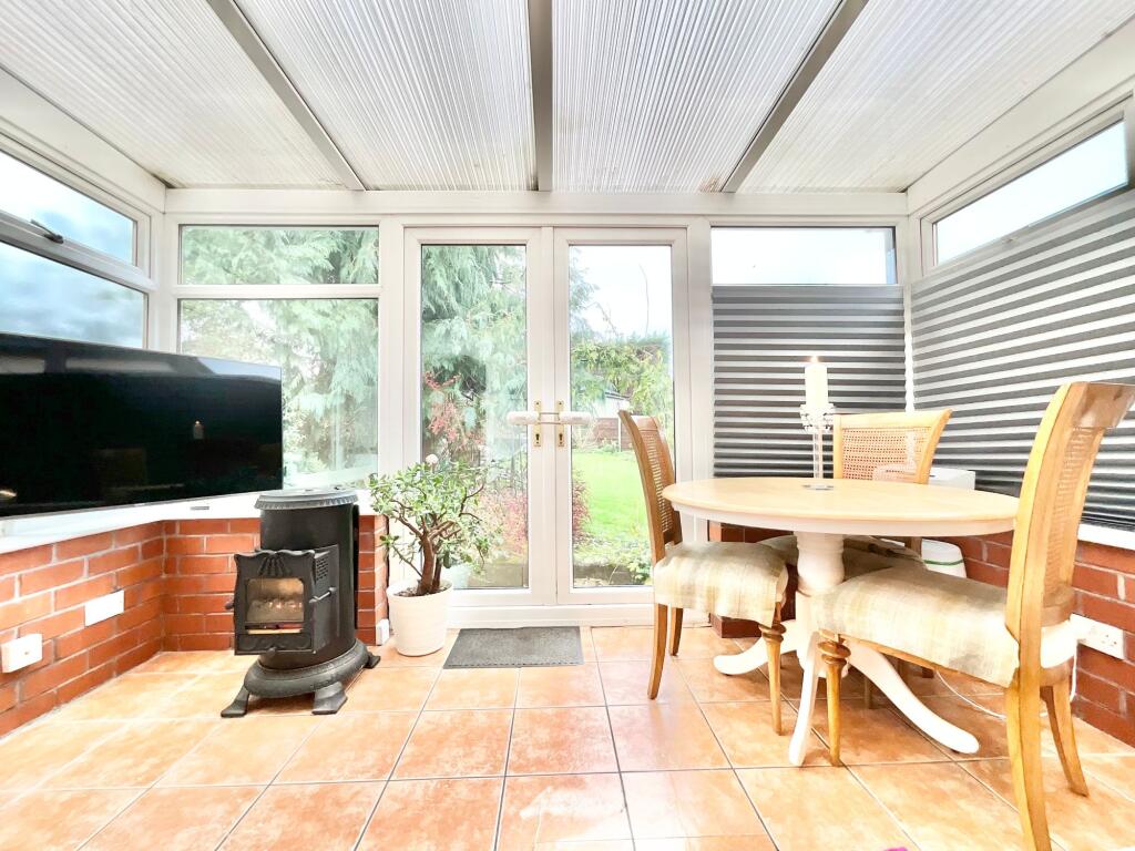
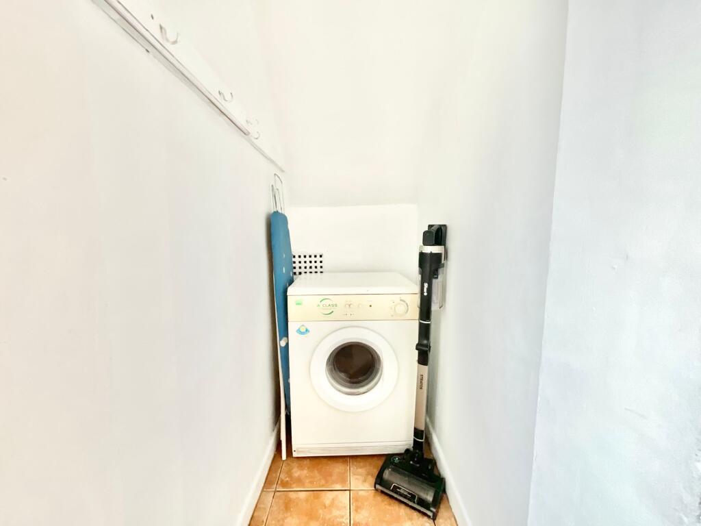
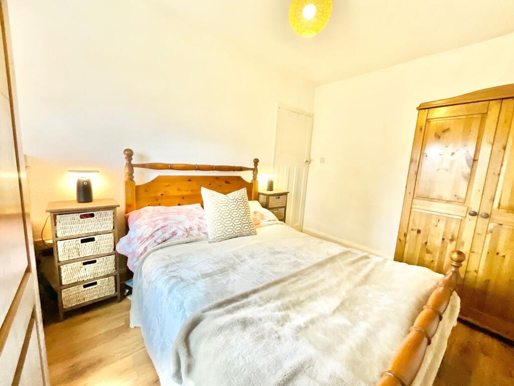
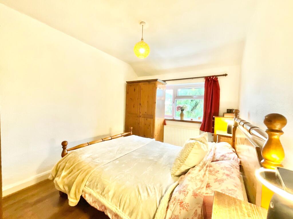
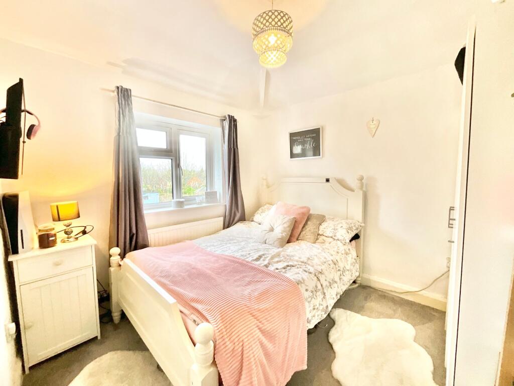
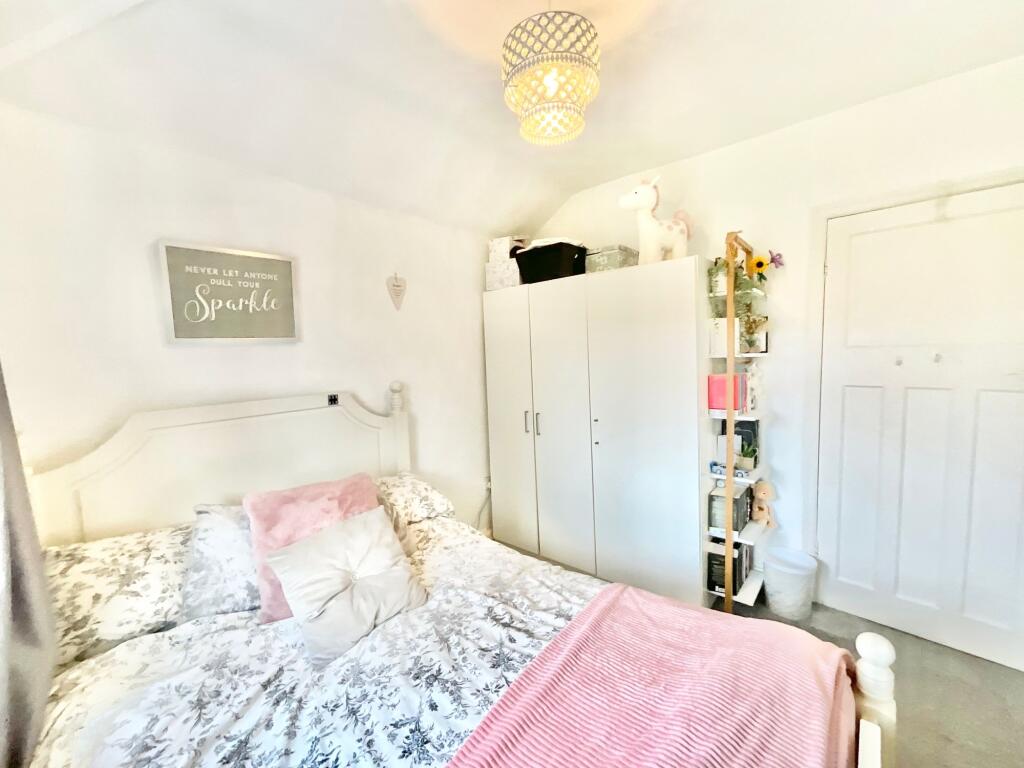
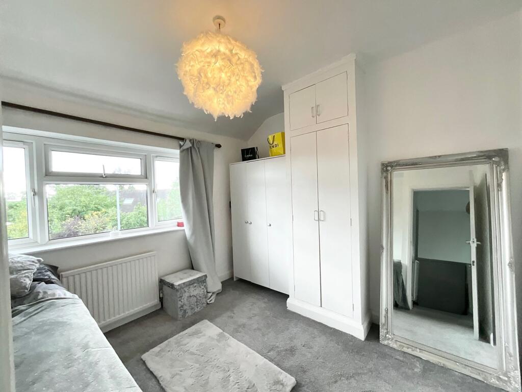
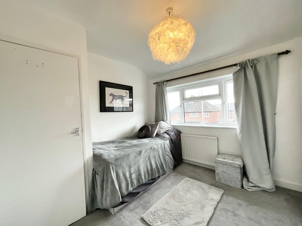
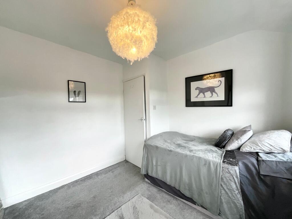
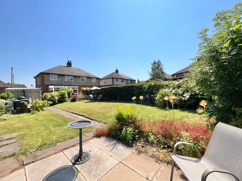
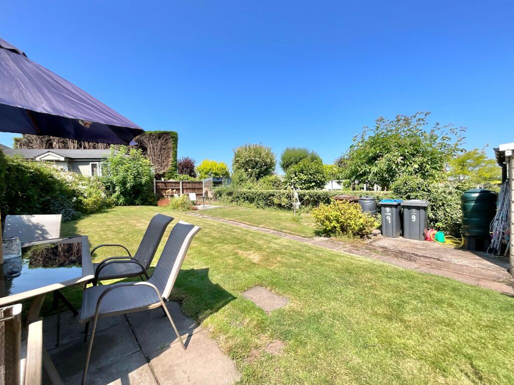
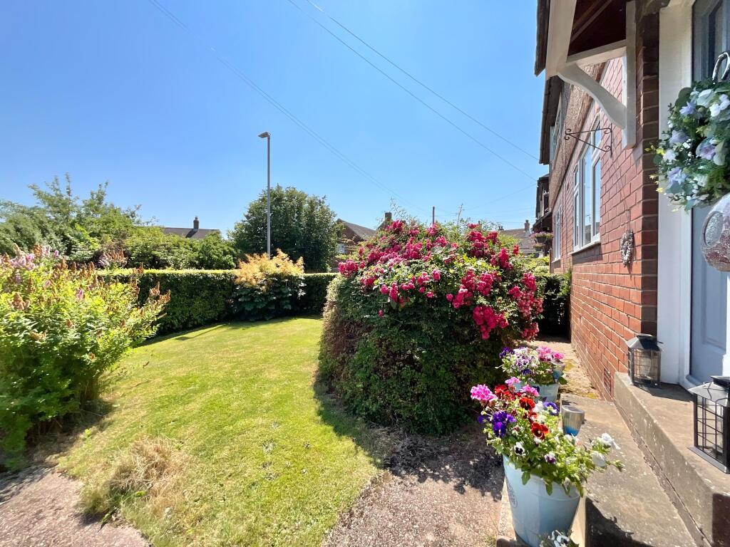
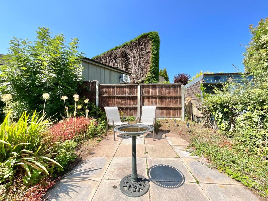
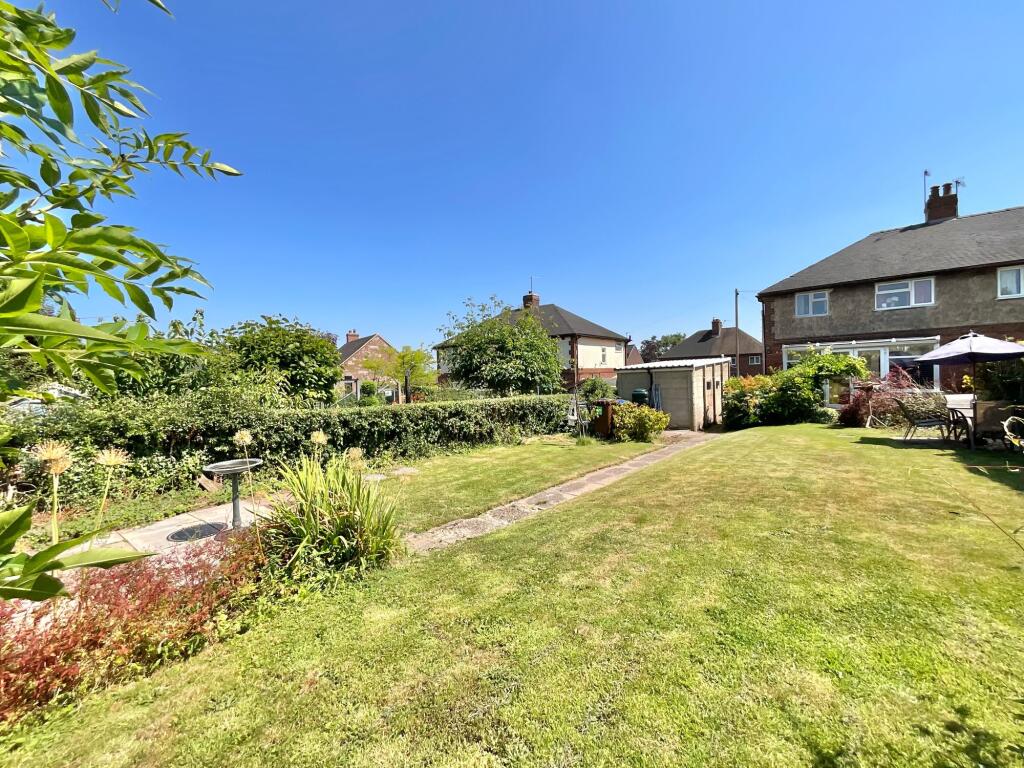
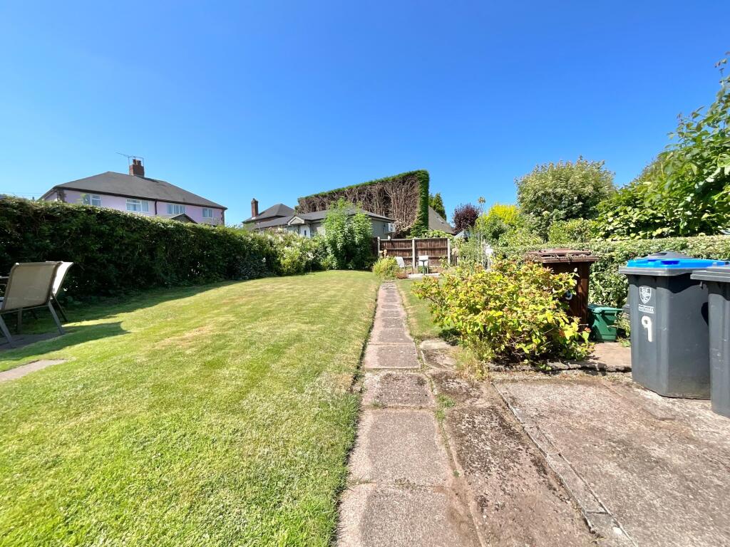
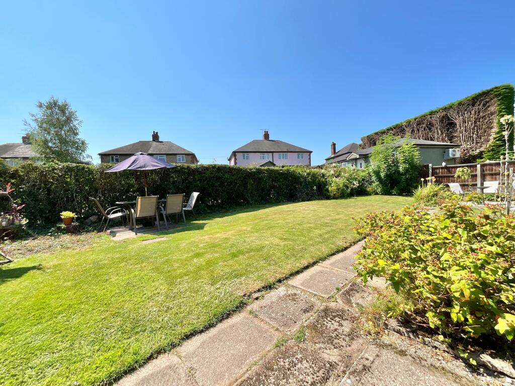
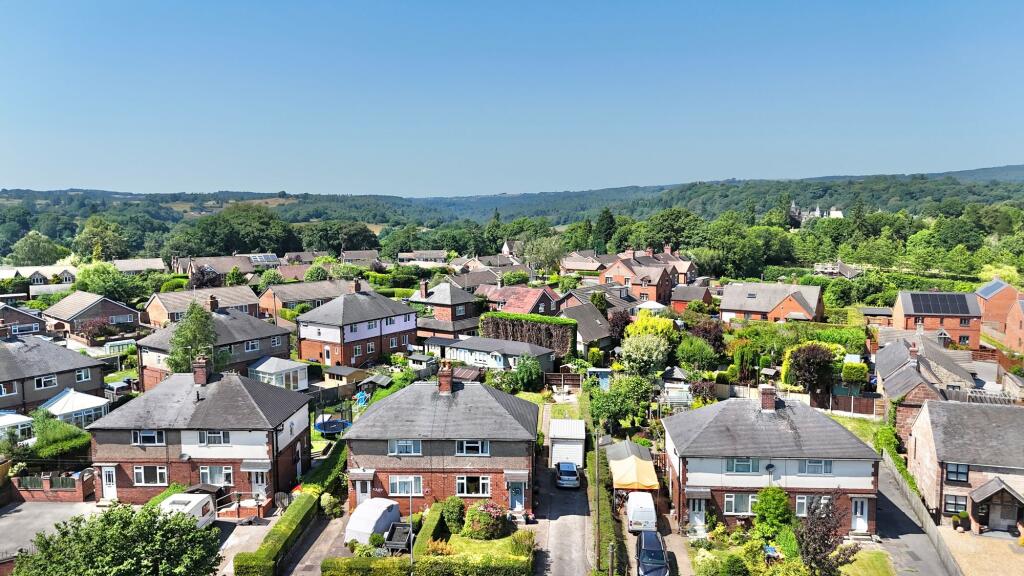
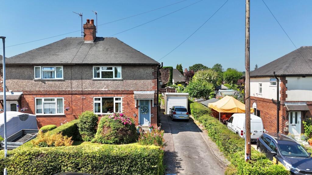
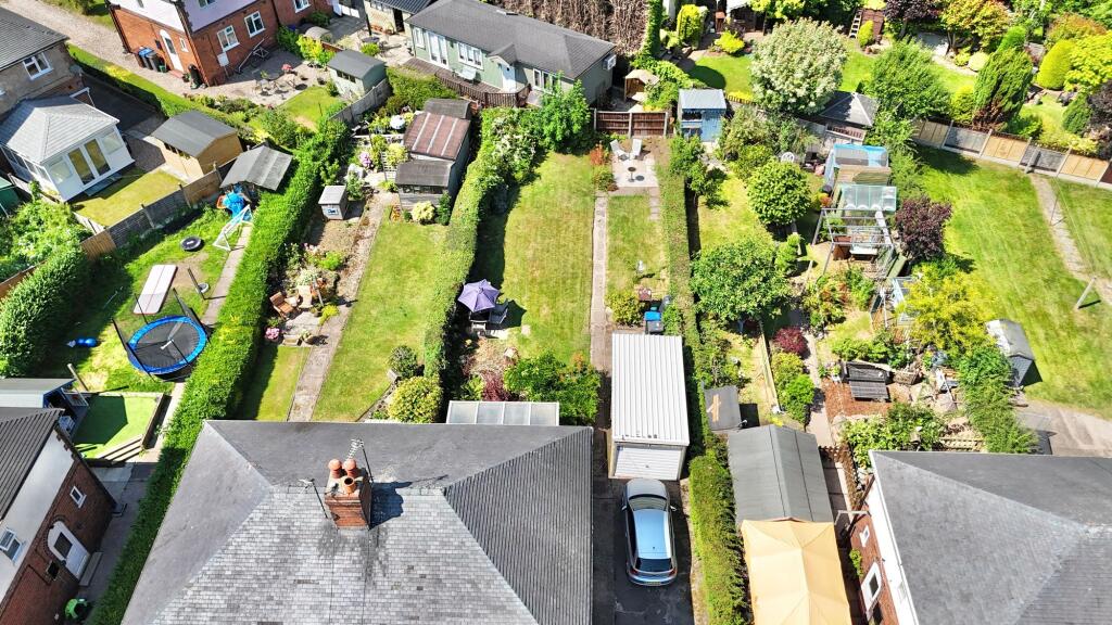
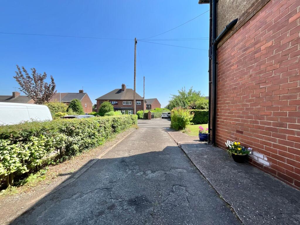
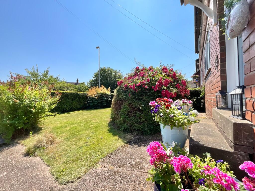
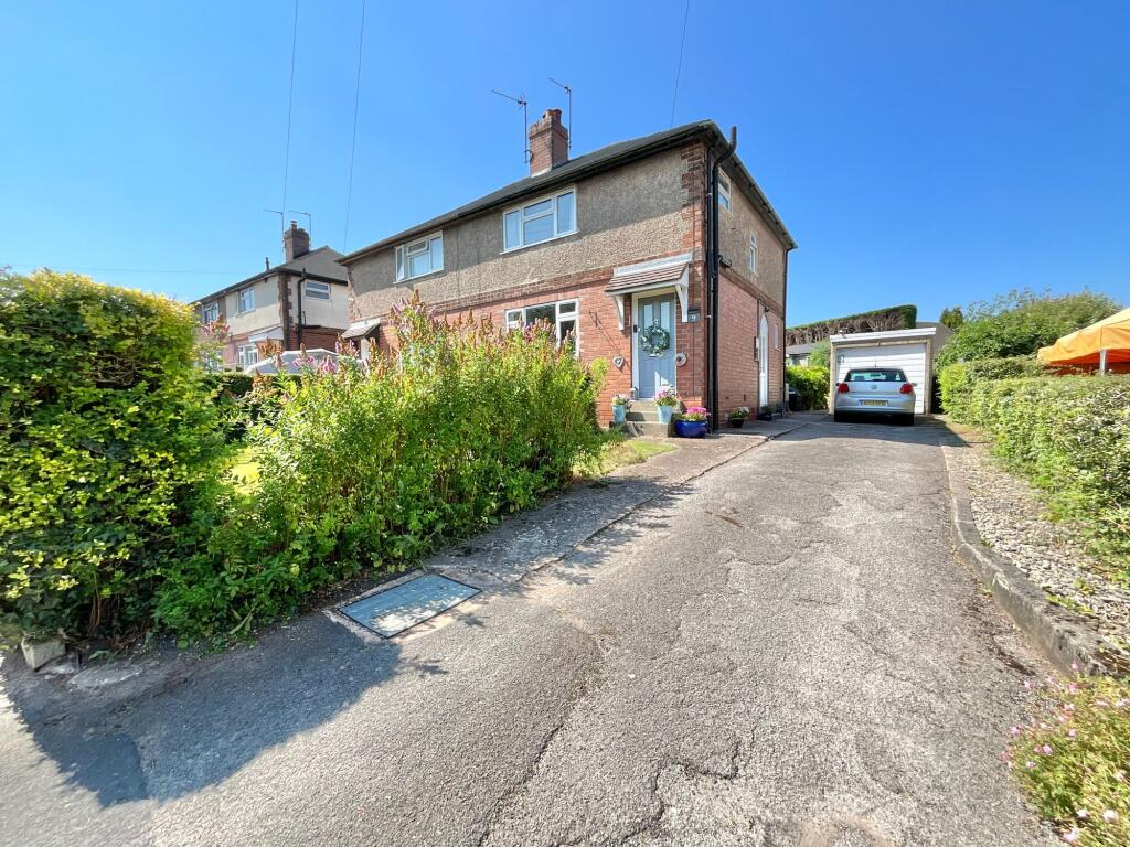
Photo 1 Photo 2 Photo 3 Photo 4 Photo 5 Photo 6 Photo 7 Photo 8 Photo 9 Photo 10 Photo 11 Photo 12 Photo 13 Photo 14 Photo 15 Photo 16 Photo 17 Photo 18 Photo 19 Photo 20 Photo 21 Photo 22 Photo 23 Photo 24 Photo 25 Photo 26 Photo 27 Photo 28 Photo 29 Photo 30 Photo 31 Photo 32 Photo 33 Photo 34 Photo 35 Photo 36
/ 36
Property details
Tenure
FREEHOLD
Council tax band
B
Local average
£212,828 (+21.7%)
Deprivation
Decile 8 (24,390 of 33,755)
Street crime
5 incidents within 1 mile (Aug 2026)
Key features
- A cosy living room with an open fireplace for that comfortable touch. As well as a conservatory for you to bask in natural light with a book or brew in hand.
- The beautiful village of Alton, you’ll be surrounded by local treasures such as Alton Castle and Dimmingsdale and Alton Towers. Boasting a country pub and a convenience store it has it all.
- Three double sized bedrooms.
- Parking for multiple vehicles and a garage for those frosty mornings.
- A large garden boasting lush green lawn and patio bordered with mature hedgerows and fence panels.
Additional details
- Electricity
- Mains supply
- Broadband
- ADSL copper wire
- Water
- Mains supply
- Sewerage
- Mains supply
- Heating
- Gas central, Wood burner
- Parking
- Yes
- Garden
- Yes
- Listed property
- No
- Restrictions
- No
- Required access
- No
- Rights of way
- No
- Flooded in last 5 years
- No
- Flood defences
- No
Description
Listed by
Cheadle
James Du Pavey Ltd
Reference: 170151587
EPC ratings on this postcode
We don't have a matched EPC for this property yet. Below are efficiency scores and details for other addresses on this postcode.
| Address | Current | Potential | Floor area | Age band | Type |
|---|---|---|---|---|---|
| 11, Saltersford Lane, Alton, STOKE-ON-TRENT | 62 | 85 | 74 m² | England and Wales: 1930-1949 | Detached |
| 12 Saltersford Lane, Alton, STOKE-ON-TRENT | 69 | 83 | 89 m² | England and Wales: 1930-1949 | Detached |
| 13, Saltersford Lane, Alton, STOKE-ON-TRENT | 65 | 80 | 74 m² | England and Wales: 1930-1949 | Detached |
| 14 SALTERSFORD LANE, ALTON, ALTON | 57 | 79 | 89 m² | England and Wales: 1930-1949 | Detached |
| 16, Saltersford Lane, Alton, STOKE-ON-TRENT | 69 | 84 | 72 m² | England and Wales: 1930-1949 | Detached |
| 17 SALTERSFORD LANE, ALTON, STOKE-ON-TRENT | 43 | 77 | 218 m² | England and Wales: before 1900 | Detached |
| 17 SALTERSFORD LANE, ALTON, STOKE-ON-TRENT | 37 | 77 | 218 m² | England and Wales: before 1900 | Detached |
| 19, Saltersford Lane, Alton, STOKE-ON-TRENT | 92 | 96 | 81 m² | England and Wales: 1967-1975 | Detached |
| 21, Saltersford Lane, Alton, STOKE-ON-TRENT | 60 | 86 | 88 m² | England and Wales: 1967-1975 | Detached |
| 25, Saltersford Lane, Alton, STOKE-ON-TRENT | 70 | 86 | 84 m² | England and Wales: 1983-1990 | Detached |
| 25, Saltersford Lane, Alton, STOKE-ON-TRENT | 59 | 88 | 84 m² | England and Wales: 1983-1990 | Detached |
| 26, Saltersford Lane, Alton, STOKE-ON-TRENT | 65 | 80 | 76 m² | England and Wales: 1930-1949 | Detached |
| 27, Saltersford Lane, Alton, STOKE-ON-TRENT | 69 | 84 | 82 m² | England and Wales: 1983-1990 | Detached |
| 31 Saltersford Lane, Alton, STOKE-ON-TRENT | 70 | 84 | 93 m² | England and Wales: 1996-2002 | Detached |
| 4, Saltersford Lane, Alton, STOKE-ON-TRENT | 66 | 81 | 83 m² | England and Wales: 1967-1975 | Detached |
Flood risk
Zone: 1
Risk: Low
Job (default Low)
Registered land (INSPIRE)
This location falls inside an HM Land Registry INSPIRE registered freehold polygon.
Plot: ~363 m² (0.09 acres)
Source: HM Land Registry INSPIRE Index Polygons.
Floorplans
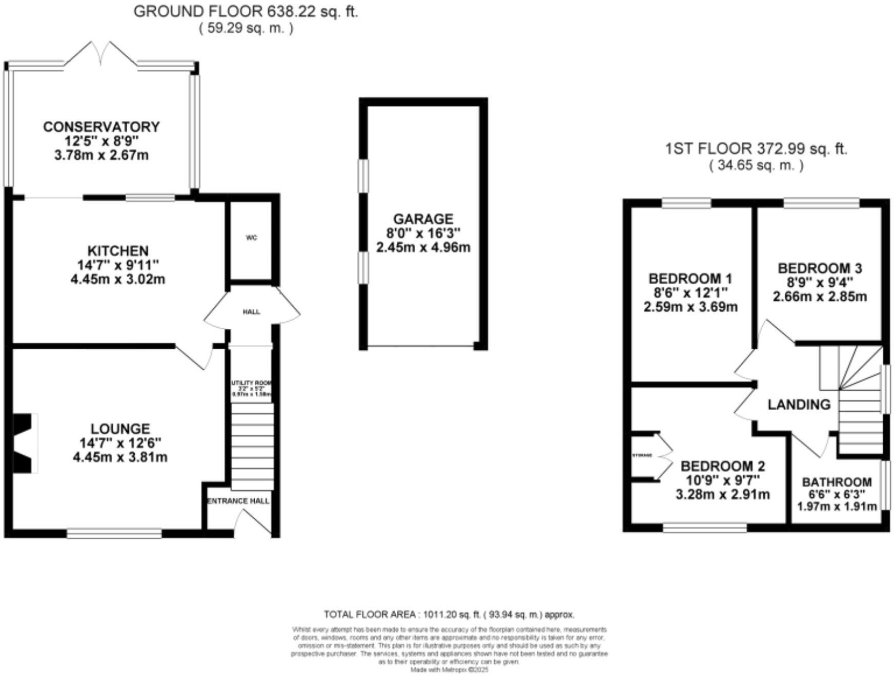
All
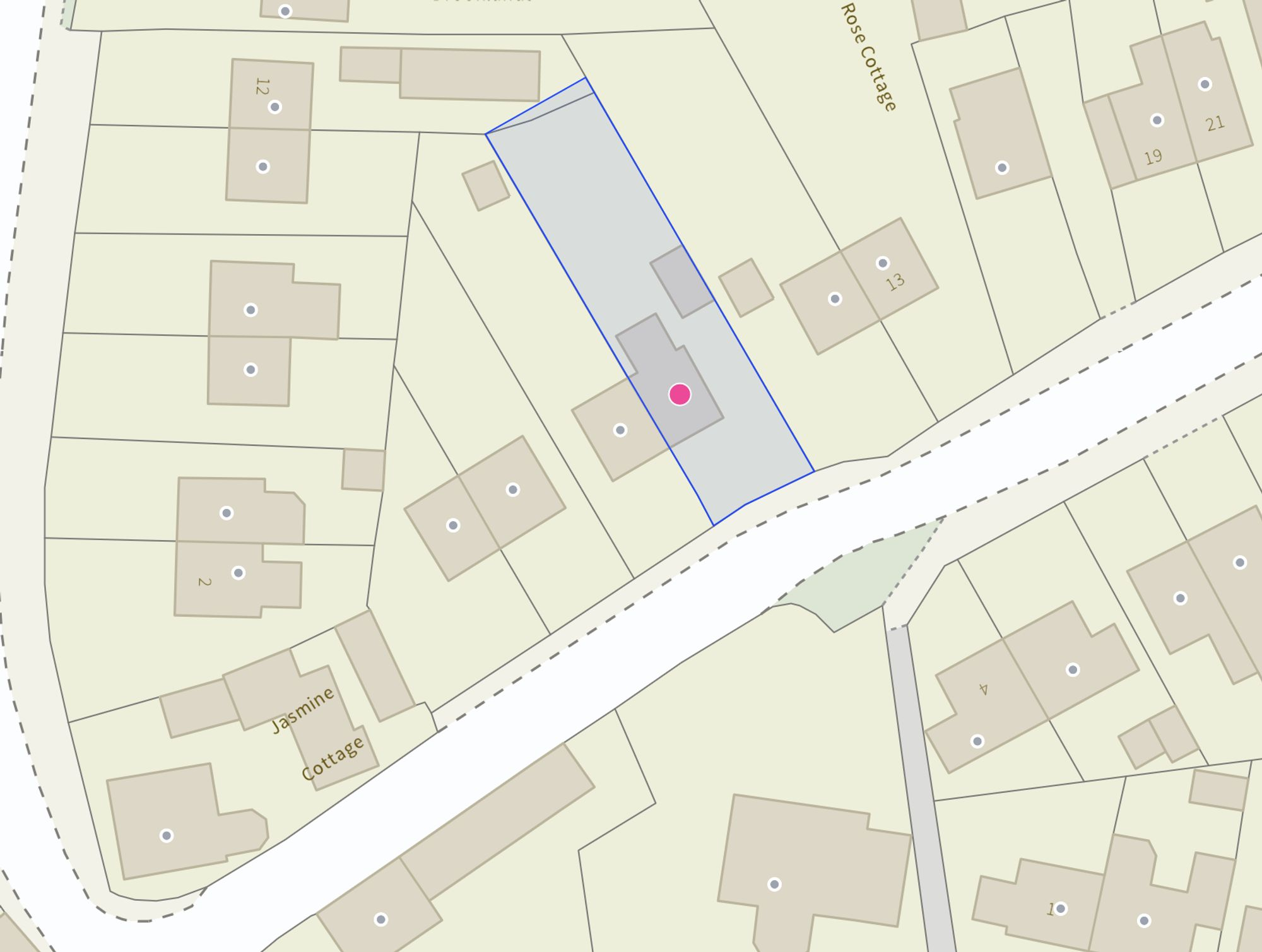
Site Plan
Price history
| Event | Date | Price | % change |
|---|---|---|---|
| Listed for sale | — | £259,000 | — |
Source: HM Land Registry Price Paid Data. Crown copyright.
Sold Comparables
Same street and nearby sales within 0.25 miles (last 5 years). Data from Land Registry Price Paid.
| Address | Price | Date | Type |
|---|---|---|---|
| Same street 12 SALTERSFORD LANE, ALTON, STOKE-ON-TRENT, STAFFORDSHIRE MOORLANDS, STAFFORDSHIRE, ST10 4AU | £155,700 | 24/10/2025 | Semi-detached |
| BELLA VISTA LIME KILN LANE, ALTON, STOKE-ON-TRENT, STAFFORDSHIRE MOORLANDS, STAFFORDSHIRE, ST10 4AR | £210,000 | 11/03/2025 | Semi-detached |
| 12 UTTOXETER ROAD, ALTON, STOKE-ON-TRENT, STAFFORDSHIRE MOORLANDS, STAFFORDSHIRE, ST10 4AT | £315,000 | 14/02/2025 | Semi-detached |
| Same street 31 SALTERSFORD LANE, ALTON, STOKE-ON-TRENT, STAFFORDSHIRE MOORLANDS, STAFFORDSHIRE, ST10 4AU | £315,000 | 14/10/2022 | Detached |
| Same street BEE COTTAGE, 17 SALTERSFORD LANE, ALTON, STOKE-ON-TRENT, STAFFORDSHIRE MOORLANDS, STAFFORDSHIRE, ST10 4AU | £330,000 | 09/08/2022 | Semi-detached |
| HIGH VIEW LIME KILN LANE, ALTON, STOKE-ON-TRENT, STAFFORDSHIRE MOORLANDS, STAFFORDSHIRE, ST10 4AR | £300,000 | 29/07/2022 | Semi-detached |
| FERNLEA COTTAGES 32 CHEADLE ROAD, ALTON, STOKE-ON-TRENT, STAFFORDSHIRE MOORLANDS, STAFFORDSHIRE, ST10 4BH | £415,000 | 01/06/2022 | Semi-detached |
| 22 GLEN DRIVE, ALTON, STOKE-ON-TRENT, STAFFORDSHIRE MOORLANDS, STAFFORDSHIRE, ST10 4DJ | £345,000 | 10/02/2022 | Semi-detached |
Street average: £266,900 (3 sales)
Area average: £317,000 (5 sales)
Capital growth trend
Land Registry outcode average: last 12 months vs 5y and 10y ago (from sold prices).
House Price Index (HM Land Registry — official index, not sold-price averages): Staffordshire Moorlands. Series: Semi-detached. As of August 2026.
Rental Range
Estimated market rent for Staffordshire Moorlands. Low = conservative, Realistic = average, Optimistic = best case.
Based on Local Authority from postcode lookup → Staffordshire Moorlands.
LHA (30th percentile) floor for Staffordshire North: £593/mo (Apr 2025 – Mar 2026)
Location
Address
Saltersford Lane
Nearby
Nearest stations, universities and amenities (distance from property).
| Type | Name | Distance |
|---|---|---|
| Bus stop | Saltersford Lane | 0.0 miles |
| Bus stop | Denstone Road | 0.0 miles |
| Shop | Raj's Shop | 0.8 miles |
| Shop | TH13TEEN Shop | 0.8 miles |
| Train station | Alton Towers Car Park | 1.0 miles |
| Train station | Runaway Mine Train | 1.1 miles |
| Hospital | Cheadle Hosptal | 4.2 miles |
| Hospital | Saint Oswald's Hospital | 6.9 miles |
| University | Buxton & Leek College | 10.8 miles |
| University | Tovell Building, Buxton & Leek College | 10.8 miles |
Street-level crime
| Category | Count |
|---|---|
| Violence and sexual offences | 2 |
| Burglary | 1 |
| Criminal damage and arson | 1 |
| Possession of weapons | 1 |
| Total incidents | 5 |
Within 1 mile during Aug 2026. Source: data.police.uk (England & Wales).
Schools nearby
Nearest open schools with Ofsted ratings (England). Closed schools are not shown. Data from Get Information about Schools and Ofsted.
| Name | Type | Distance | Ofsted |
|---|---|---|---|
| St Peter's CofE Academy Alton | Primary | 0.4 miles | Good — 10 Nov 2011 |
| Denstone College | Other | 1.3 miles | — (No rating) |
| All Saints CofE Academy Denstone | Primary | 1.8 miles | Good — 10 Jan 2012 |
| The Valley Primary School | Primary | 2.4 miles | Good — 2 May 2024 |
| Ryecroft CofE Middle School | Primary | 2.4 miles | Good — 24 Nov 2017 |
Rental Comparables
Rental listings exist nearby, but none matched the 3-bedroom count for this property.
Rent-driven metrics
Based on Area rent estimate.
- Rent ratio — Monthly rent ÷ purchase price (1% rule). 1%+ = strong, 0.8–1% = okay, <0.8% = weak for cashflow.
- Max investor price — Rent ÷ 0.8%; the price at which rent would be 0.8% of price (Stoke-style target).
- Target investor price — Rent ÷ 1%; the price at which rent would be 1% of price (strong cashflow band).
- Gross yield — Annual rent as % of purchase price (no costs).
Enter House Number
Enter the house number to help us retrieve more accurate pricing history and property data.
Please log in to submit or correct the house number for this listing.
Log in to continue