69 FRIARSWOOD ROAD
NEWCASTLE, STAFFORDSHIRE ST5 2EF
£477 pcm
Property details
Floor area
86 m²
Council tax band
A
Last sold
£75,000 Nov 2010
Local average
£144,587 (-99.7%)
Deprivation
Decile 10 (32,714 of 33,755)
Street crime
320 incidents within 1 mile (Apr 2026)
Key features
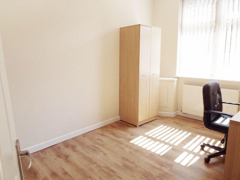
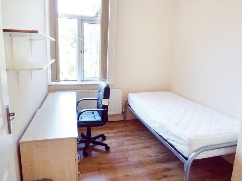
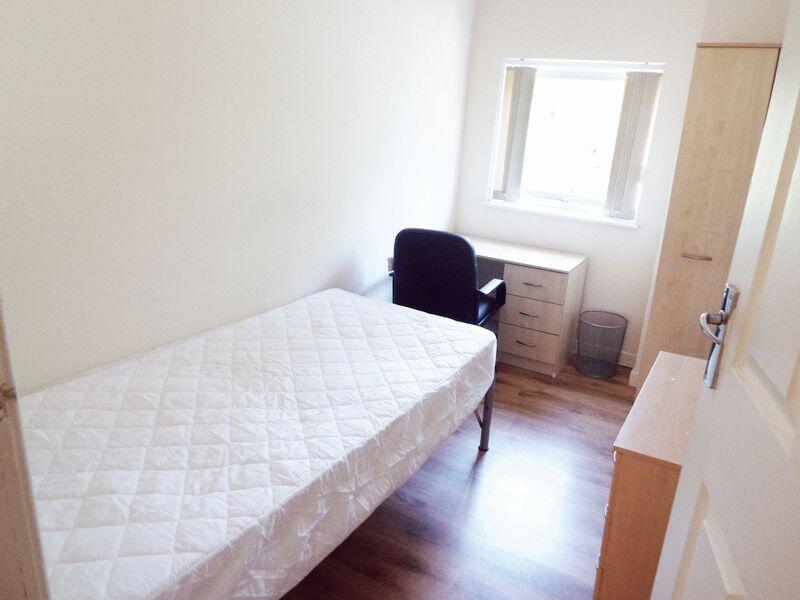
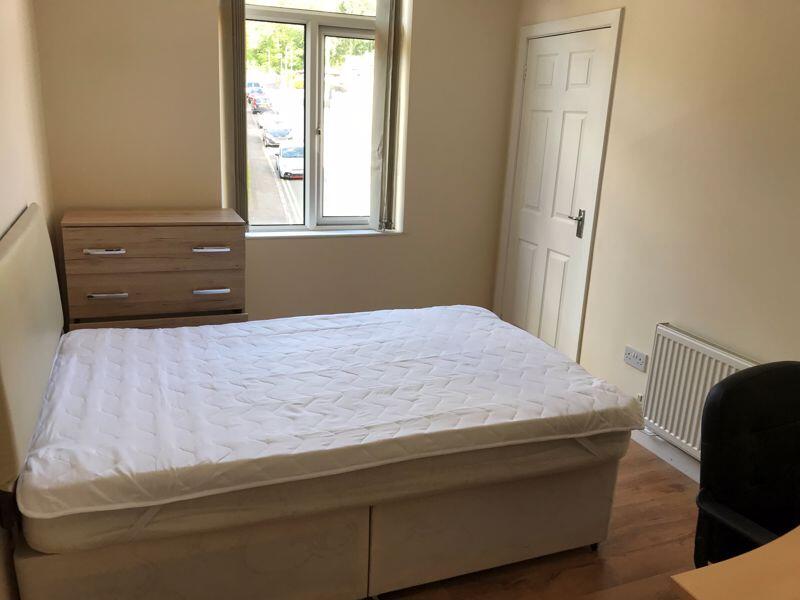
- AVAILABLE SEPTEMBER 2025: Furnished Four Bed Student Rental
- Close to Shops, Bars & Keele Bus Route
- Gas Central Heated, Part Double Glazed
- Bills Included in the rental.
- EPC Band D Rating 57 Council Tax A
- Please Ask One of Our Advisors For Further Details
Additional details
- Garden
- Yes
Description
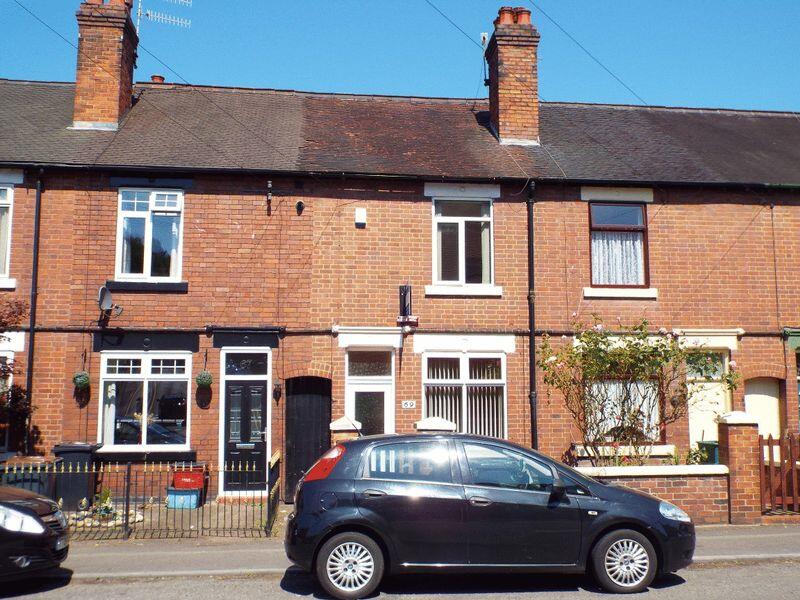
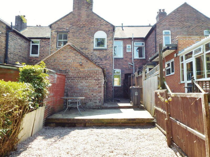
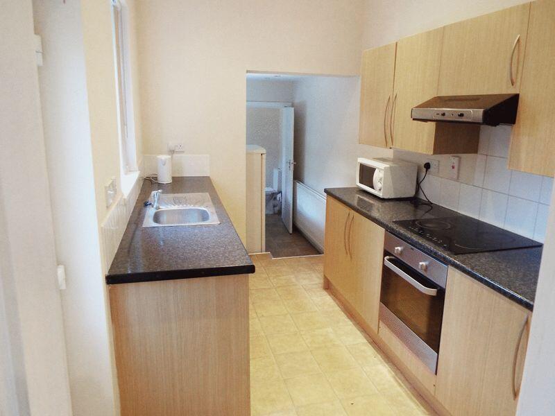
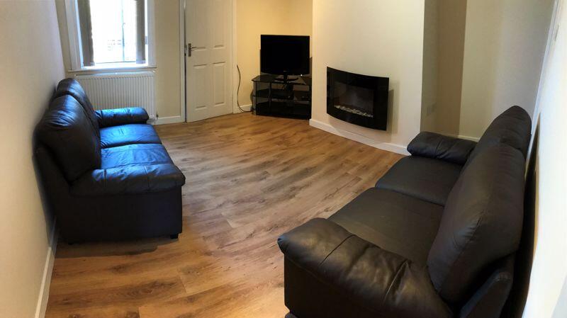
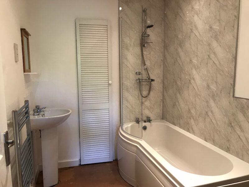
The property is gas central heated and part double glazed, with living accommodation comprising hallway, ground floor bedroom, living room, kitchen, utility room, and W.C. / washroom at ground floor level, with three bedrooms and a bathroom to the first floor. To the rear of the property is a small garden area, with wooden decking, paved patio area and planted shrubs.
Listed by
Stoke On Trent
Keates Hulme
Reference: 130291433
EPC Rating & Upgrade Cost
Fetching EPC data… Refresh this page in a moment.
Flood risk
Zone: 1
Risk: Low
Job (default Low)
EPC Graphs

Energy Performance Certificate
FENSA Certificates
This property has 1 FENSA certificate(s) on record, indicating window/door installations by FENSA-approved installers.
FENSA Certificate #7895621
Property Details
Street: 69 Friarswood Road
Town: NEWCASTLE
Postcode: ST5 2EF
Installation Details
Items: 2 windows and 1 door
Certificate Issued: 14/01/2011
Work Completed: 15/12/2010
This certificate data was retrieved from FENSA's database
What is FENSA? FENSA (Fenestration Self-Assessment Scheme) is a government-authorised scheme that monitors building regulation compliance for replacement windows and doors. Certificates indicate that work was completed by FENSA-approved installers.
Price history
| Event | Date | Price | % change |
|---|---|---|---|
| Listed for sale | — | £477 | -99.4% |
| Sold | 12/11/2010 (15 years ago) | £75,000 | — |
Source: HM Land Registry Price Paid Data. Crown copyright.
Sold Comparables
Same street and nearby sales within 0.25 miles (last 5 years). Data from Land Registry Price Paid.
| Address | Price | Date | Type |
|---|---|---|---|
| 4 HATRELL STREET, NEWCASTLE, NEWCASTLE-UNDER-LYME, STAFFORDSHIRE, ST5 1LX | £136,000 | 19/12/2025 | Terraced |
| 60 HATRELL STREET, NEWCASTLE, NEWCASTLE-UNDER-LYME, STAFFORDSHIRE, ST5 1LX | £130,000 | 31/03/2025 | Terraced |
| 62 HATRELL STREET, NEWCASTLE, NEWCASTLE-UNDER-LYME, STAFFORDSHIRE, ST5 1LX | £101,000 | 14/11/2023 | Terraced |
| 29 HATRELL STREET, NEWCASTLE, NEWCASTLE-UNDER-LYME, STAFFORDSHIRE, ST5 1LX | £125,000 | 30/10/2023 | Terraced |
| 12 HATRELL STREET, NEWCASTLE, NEWCASTLE-UNDER-LYME, STAFFORDSHIRE, ST5 1LX | £110,000 | 13/10/2023 | Terraced |
| Same street 113 FRIARSWOOD ROAD, NEWCASTLE, NEWCASTLE-UNDER-LYME, STAFFORDSHIRE, ST5 2EF | £137,000 | 26/09/2023 | Terraced |
| 19 HATRELL STREET, NEWCASTLE, NEWCASTLE-UNDER-LYME, STAFFORDSHIRE, ST5 1LX | £132,000 | 30/06/2023 | Terraced |
| 49 FRIARSWOOD ROAD, NEWCASTLE, NEWCASTLE-UNDER-LYME, STAFFORDSHIRE, ST5 2EE | £120,000 | 15/05/2023 | Terraced |
| 5 HATRELL STREET, NEWCASTLE, NEWCASTLE-UNDER-LYME, STAFFORDSHIRE, ST5 1LX | £127,500 | 24/11/2022 | Terraced |
| 36 HATRELL STREET, NEWCASTLE, NEWCASTLE-UNDER-LYME, STAFFORDSHIRE, ST5 1LX | £141,000 | 28/10/2022 | Terraced |
| 1 REFINERY STREET, NEWCASTLE, NEWCASTLE-UNDER-LYME, STAFFORDSHIRE, ST5 1LJ | £150,000 | 20/09/2022 | Terraced |
| 6 HATRELL STREET, NEWCASTLE, NEWCASTLE-UNDER-LYME, STAFFORDSHIRE, ST5 1LX | £120,000 | 21/06/2022 | Terraced |
| 3 BROOK LANE, NEWCASTLE, NEWCASTLE-UNDER-LYME, STAFFORDSHIRE, ST5 3AA | £98,000 | 10/06/2022 | Terraced |
| Same street 85 FRIARSWOOD ROAD, NEWCASTLE, NEWCASTLE-UNDER-LYME, STAFFORDSHIRE, ST5 2EF | £117,500 | 22/04/2022 | Terraced |
| 15 HATRELL STREET, NEWCASTLE, NEWCASTLE-UNDER-LYME, STAFFORDSHIRE, ST5 1LX | £145,000 | 18/03/2022 | Terraced |
| 54 LONDON ROAD, NEWCASTLE, NEWCASTLE-UNDER-LYME, STAFFORDSHIRE, ST5 1LL | £136,750 | 18/02/2022 | Terraced |
| 63 HATRELL STREET, NEWCASTLE, NEWCASTLE-UNDER-LYME, STAFFORDSHIRE, ST5 1LX | £101,500 | 18/02/2022 | Terraced |
| Same street 81 FRIARSWOOD ROAD, NEWCASTLE, NEWCASTLE-UNDER-LYME, STAFFORDSHIRE, ST5 2EF | £148,500 | 04/02/2022 | Terraced |
| 48 STUBBS GATE, NEWCASTLE, NEWCASTLE-UNDER-LYME, STAFFORDSHIRE, ST5 1LU | £110,000 | 12/01/2022 | Terraced |
| 51 HATRELL STREET, NEWCASTLE, NEWCASTLE-UNDER-LYME, STAFFORDSHIRE, ST5 1LX | £125,000 | 17/12/2021 | Terraced |
| 13 BROOK LANE, NEWCASTLE, NEWCASTLE-UNDER-LYME, STAFFORDSHIRE, ST5 3AA | £97,000 | 29/11/2021 | Terraced |
| 29 FRIARSWOOD ROAD, NEWCASTLE, NEWCASTLE-UNDER-LYME, STAFFORDSHIRE, ST5 2EE | £137,000 | 24/11/2021 | Terraced |
| 50 LONDON ROAD, NEWCASTLE, NEWCASTLE-UNDER-LYME, STAFFORDSHIRE, ST5 1LL | £112,000 | 12/11/2021 | Terraced |
Street average: £134,333 (3 sales)
Area average: £122,738 (20 sales)
Capital growth trend
Land Registry outcode average: last 12 months vs 5y and 10y ago (from sold prices).
House Price Index (HM Land Registry — official index, not sold-price averages): Newcastle-under-Lyme. Series: Terraced. As of March 2026.
Rental Range
Estimated market rent for Newcastle-under-Lyme. Low = conservative, Realistic = average, Optimistic = best case.
Based on Local Authority from postcode lookup → Newcastle-under-Lyme.
LHA (30th percentile) floor for Staffordshire North: £798/mo (Apr 2025 – Mar 2026)
Location
Nearby
Nearest stations, universities and amenities (distance from property).
| Type | Name | Distance |
|---|---|---|
| Bus stop | Lyme Valley Road | 0.1 miles |
| Shop | Timpson | 0.1 miles |
| Bus stop | Morrison's | 0.1 miles |
| Shop | News and Booze Express | 0.3 miles |
| Hospital | Royal Stoke University Hospital | 0.6 miles |
| Hospital | Hartshill Medical Centre | 0.7 miles |
| University | Keele University | 1.9 miles |
| Train station | Stoke-on-Trent | 1.9 miles |
| University | University of Staffordshire Stoke Campus | 1.9 miles |
| Train station | Silverdale | 2.4 miles |
Street-level crime
| Category | Count |
|---|---|
| Violence and sexual offences | 95 |
| Anti-social behaviour | 60 |
| Public order | 35 |
| Criminal damage and arson | 24 |
| Shoplifting | 23 |
| Other theft | 21 |
| Burglary | 16 |
| Drugs | 13 |
| Vehicle crime | 10 |
| Other crime | 8 |
| Robbery | 6 |
| Possession of weapons | 5 |
| Theft from the person | 3 |
| Bicycle theft | 1 |
| Total incidents | 320 |
Within 1 mile during Apr 2026. Source: data.police.uk (England & Wales).
Schools nearby
Nearest open schools with Ofsted ratings (England). Closed schools are not shown. Data from Get Information about Schools and Ofsted.
| Name | Type | Distance | Ofsted |
|---|---|---|---|
| Blackfriars Academy | Other | 0.2 miles | Outstanding — 6 Feb 2013 |
| Co-op Academy Friarswood | Primary | 0.3 miles | Good — 8 Mar 2013 |
| Hassell Primary School | Primary | 0.3 miles | Good — 25 Oct 2023 |
| Coppice Academy | Other | 0.3 miles | Good — 6 Mar 2014 |
| St Giles' and St George's Church of England Academy | Primary | 0.3 miles | Good — 21 May 2023 |
Rental Comparables
Residential lets from OpenRent and Rightmove for the area (same bedroom count). Use to validate rent estimates. Student lets are excluded.
Average rent: £1,489/mo (14 listings)
Rent-driven metrics
Based on OpenRent comparables.
- This street — Gross yield for this street only (Land Registry sales + rental comparables, same postcode + street).
- Rent ratio — Monthly rent ÷ purchase price (1% rule). 1%+ = strong, 0.8–1% = okay, <0.8% = weak for cashflow.
- Max investor price — Rent ÷ 0.8%; the price at which rent would be 0.8% of price (Stoke-style target).
- Target investor price — Rent ÷ 1%; the price at which rent would be 1% of price (strong cashflow band).
- Gross yield — Annual rent as % of purchase price (no costs).
- Cashflow — Rent minus mortgage, 10% maintenance, £25/mo compliance. Assumes 75% LTV, 3.95% APR (5yr fixed), 25yr term.
- ROI — Annual profit ÷ cash in (deposit + 4% purchase costs).