69 BOSTON ROAD
SPILSBY, LINCOLNSHIRE PE23 5HH
Property details
Tenure
FREEHOLD
Floor area
142 m²
EPC rating
D
Year built
England and Wales: 1930-1949
Last sold
£260,500 Oct 2025
Price per m²
£493/m²
Local average
£191,250 (-63.4%)
Deprivation
Decile 2 (4,015 of 33,755)
Street crime
0 incidents within 1 mile (May 2026)
Key features
- Building Plot with Direct Road Access
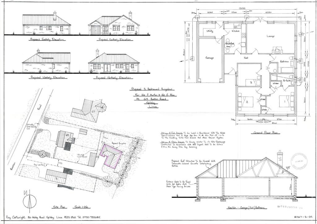
- Full Planning Permission for a 3 Bedroom Detached Dwelling
- Intergrated Garage
- Set back from the road
- Services understood to be on public highway
- Sought-after Market Town location
- Within walking distance of amenities
Additional details
- Parking
- Yes
Description
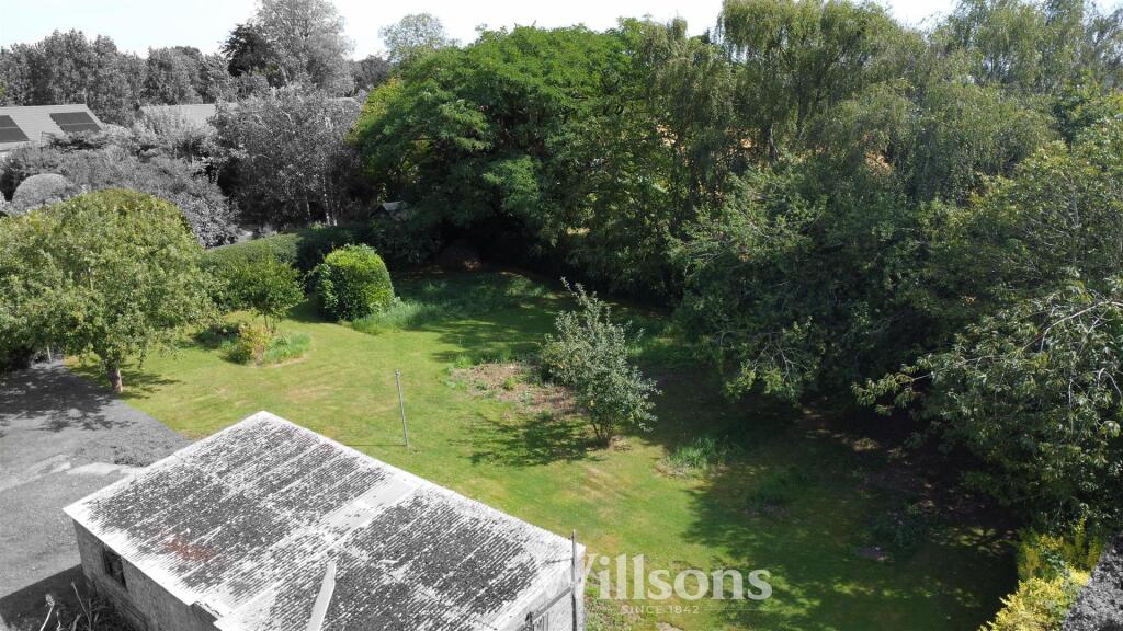
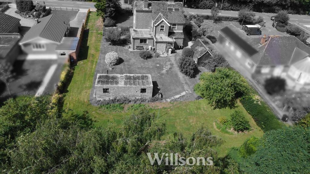
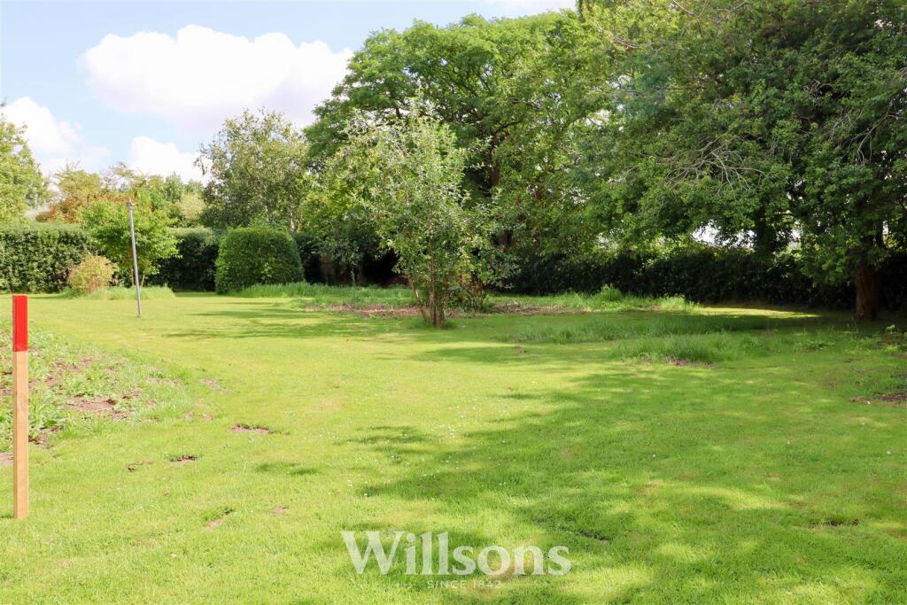
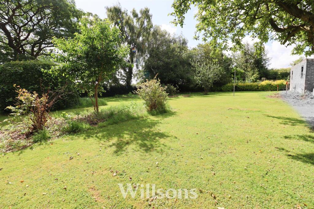
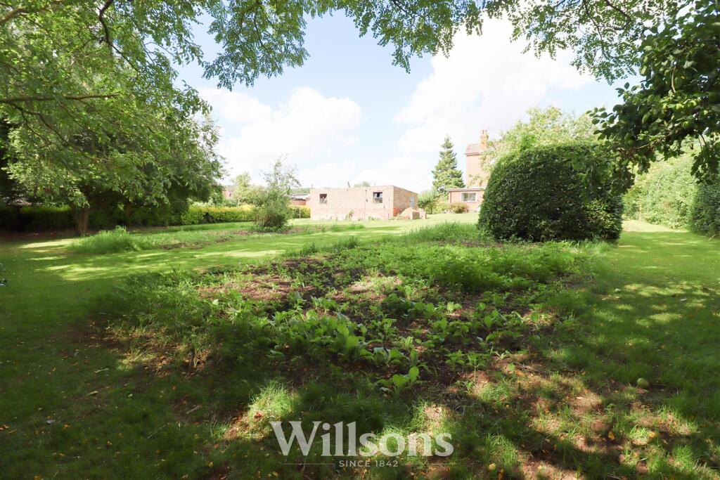
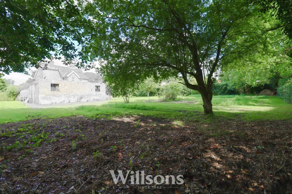
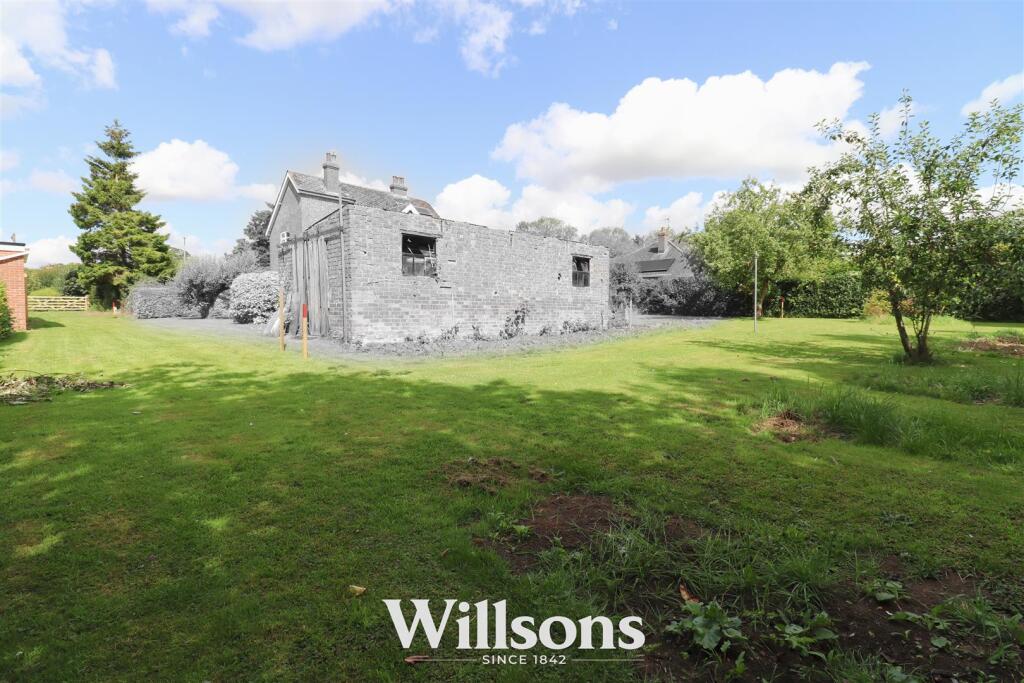
Full planning permission has been granted for this area of land which is set back from the highway however offers direct road access and a building plot to accommodate a three bedroom dwelling with an integral garage.
Full Planning Permission - Full planning permission has been granted by East Lindsey District Council for the “erection of a bungalow with attached garage and the construction of internal access road.”
The Planning Application Number is S/165/01669/24 and the permission was granted on 7th January 2025.
All relevant documents relating to the Planning Application can be viewed on East Lindsey District Council website (
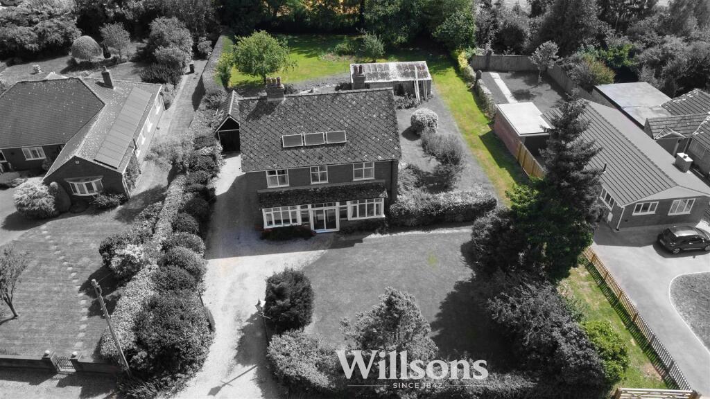
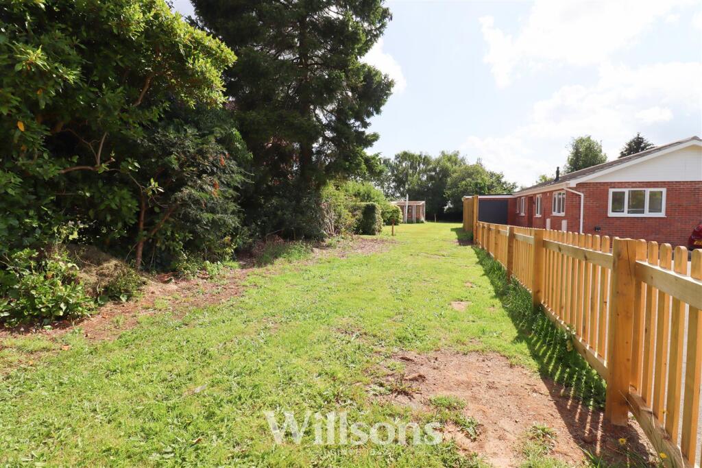
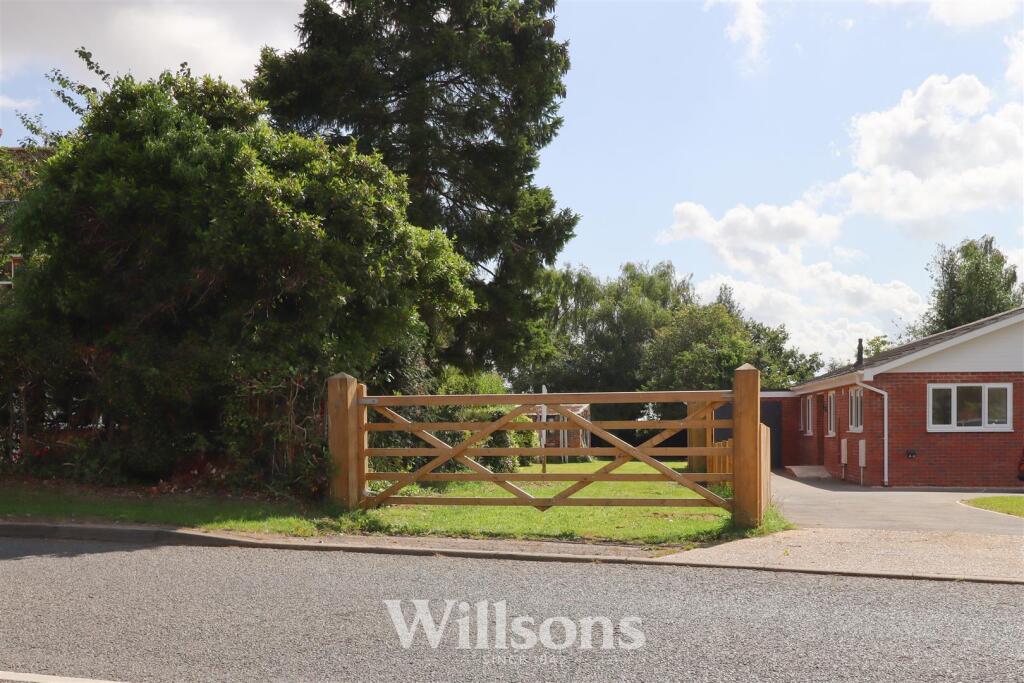
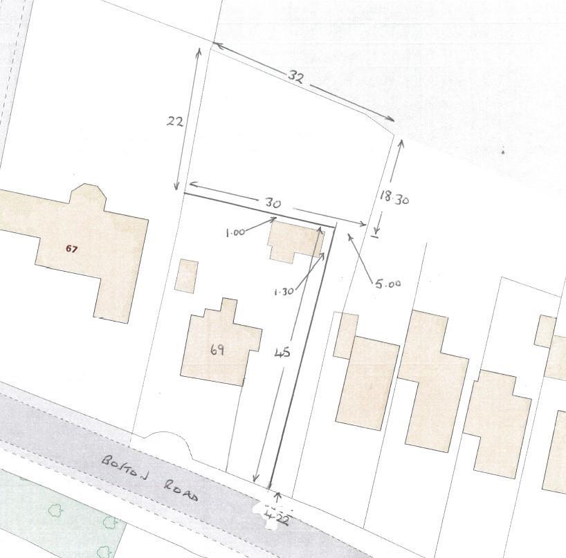
Location & Access - Situated on Boston Road, Spilsby, the land can be found to the rear of 69 Boston Road, with direct road access to the right hand side of the property via a 5-bar gate. The location can be identified by a "For Sale" board close to the gate.
What3words///quarrel.prepped.angry
Services - All mains services are believed to be available within the public highway. Prospective purchaser should make their own enquiries as to the availability of services.
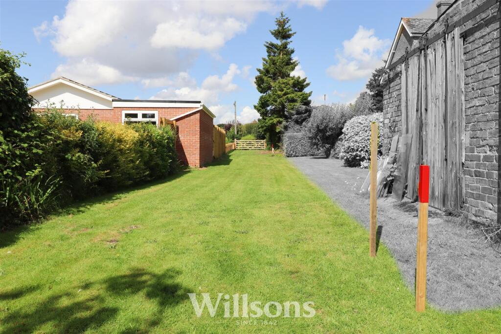
Boundaries - The boundaries of the plots are shown on the plans submitted with the planning application. The exact position has been pegged out on site. The purchasers will be responsible for the erection of a suitable boundary fence within 6 months.
The purchaser should be deemed to have full knowledge of all boundaries and neither the vendor nor the selling agent will be responsible for defining the boundaries nor their ownership.
Plot Dimensions (Approximate) - Plot: Average Width 31m. Average Length 20m.
Land & Access: Average Length 45m. Min Width 4.3m Max Width 5m.
Sporting, Timber & Mineral Rights - Sporting, timber and mineral rights are included in the sale insofar as they are owned, subject to statutory exclusions.
Hm Land Registry - Currently, the development site is not registered with HM Land Registry.
Restrictions, Easements, Wayleaves & Rights Of Way - All the land is sold subject to and with the help and benefit of all existing rights, including rights of way whether public or private, light, support, drainage, water and electricity supplies and other rights, easements, and all wayleaves whether referred to or not in these particulars. The adjoining property 69 Boston Road retains the right to discharge foul waste across the area of plot.
Viewing - The site may be viewed at any reasonable time during daylight hours providing a set of particulars are to hand and you have made contact with our Alford Office to leave your contact details. When viewing, interested parties are responsible for their own safety and view at their own risk.
Local Authorities - Lincolnshire County Council
Newlands, Lincoln LN1 1YW. Tel: .
East Lindsey District Council
The Hub, Mareham Road, Horncastle, Lincolnshire, LN9 6PH.
Tel:
Anglian Water - Tel:
Western Power - Tel:
British Gas - Tel:
Anti-Money Laundering - In accordance with the most recent Anti Money Laundering legislation the purchaser will be required to provide proof of identity and proof of funds to the selling agent once an offer has been submitted and accepted (subject to contract) prior to solicitors being instructed.
Vat - It is understood that the sale does not attract VAT.
Directions - From the A16 Louth to Boston road, on reaching Spilsby, turn onto the B1195 towards the town, after 350 metres, turn right into Boston Road. Continue on Boston Road for 500m. The building plot can be found on the left after 700m.
What3words///quarrel.prepped.angry
Listed by
Alford
Willsons Chartered Surveyors
Reference: 170897276
EPC Rating & Upgrade Cost
Current rating: D
Potential rating: C
Inspection date: 24/07/2024
Expiry date: 23/07/2034
Current heating cost: £2,080/year
Potential heating cost: £1,727/year
Est. upgrade cost to C: £7,675
Recommendations
- Flat roof or sloping ceiling insulation (£850 - £1,500)
- Cavity wall insulation (£500 - £1,500)
- Floor insulation (suspended floor) (£800 - £1,200)
- Solar photovoltaic panels, 2.5 kWp (£3,500 - £5,500)
Flood risk
Zone: 1
Risk: Low
Job (default Low)
FENSA Certificates
This property has 3 FENSA certificate(s) on record, indicating window/door installations by FENSA-approved installers.
FENSA Certificate #10754666
Property Details
Street: 69 Boston Road
Town: SPILSBY
Postcode: PE23 5HH
Installation Details
Items: 7 windows
Certificate Issued: 09/02/2015
Work Completed: 19/12/2014
This certificate data was retrieved from FENSA's database
FENSA Certificate #7628245
Property Details
Street: 69 Boston Road
Town: SPILSBY
Postcode: PE23 5HH
Installation Details
Items: 1 window and 1 door
Certificate Issued: 07/09/2010
Work Completed: 20/08/2010
This certificate data was retrieved from FENSA's database
FENSA Certificate #13393486
Property Details
Street: 69 Boston Road
Town: SPILSBY
Postcode: PE23 5HH
Installation Details
Items: 2 windows
Certificate Issued: 19/02/2019
Work Completed: 25/01/2019
This certificate data was retrieved from FENSA's database
What is FENSA? FENSA (Fenestration Self-Assessment Scheme) is a government-authorised scheme that monitors building regulation compliance for replacement windows and doors. Certificates indicate that work was completed by FENSA-approved installers.
Price history
| Event | Date | Price | % change |
|---|---|---|---|
| Listed for sale | — | £70,000 | -73.1% |
| Sold | 31/10/2025 (8 months ago) | £260,500 | — |
Source: HM Land Registry Price Paid Data. Crown copyright.
Sold Comparables
Same street and nearby sales within 0.25 miles (last 5 years). Data from Land Registry Price Paid.
| Address | Price | Date | Type |
|---|---|---|---|
| Same street 79 BOSTON ROAD, SPILSBY, EAST LINDSEY, LINCOLNSHIRE, PE23 5HH | £285,000 | 25/11/2022 | Detached |
| 28 ANCASTER AVENUE, SPILSBY, EAST LINDSEY, LINCOLNSHIRE, PE23 5HP | £155,000 | 22/08/2022 | Other |
| Same street 83 BOSTON ROAD, SPILSBY, EAST LINDSEY, LINCOLNSHIRE, PE23 5HH | £245,000 | 05/08/2022 | Semi-detached |
| KINGS YARD, 51 BOSTON ROAD, SPILSBY, EAST LINDSEY, LINCOLNSHIRE, PE23 5HQ | £35,000 | 10/11/2021 | Other |
Street average: £265,000 (2 sales)
Area average: £95,000 (2 sales)
Capital growth trend
Land Registry outcode average: last 12 months vs 5y and 10y ago (from sold prices).
House Price Index (HM Land Registry — official index, not sold-price averages): East Lindsey. Series: All dwelling types. As of April 2026.
Rental Range
Estimated market rent for East Lindsey. Low = conservative, Realistic = average, Optimistic = best case.
Based on Local Authority from postcode lookup → East Lindsey.
LHA (30th percentile) floor for Wolds and Coast: Apr 2025 – Mar 2026
Location
Nearby
Nearest stations, universities and amenities (distance from property).
| Type | Name | Distance |
|---|---|---|
| Bus stop | Ancaster Avenue | 0.2 miles |
| Shop | Bernard Ellerby | 0.5 miles |
| Shop | Spilsby Opticians | 0.5 miles |
| Train station | Thorpe Culvert | 5.5 miles |
| Train station | Wainfleet | 7.4 miles |
| Hospital | Horncastle War Memorial Hospital | 9.0 miles |
| Hospital | Skegness Hospital | 10.1 miles |
Street-level crime
| Category | Count |
|---|---|
| Total incidents | 0 |
Within 1 mile during May 2026. Source: data.police.uk (England & Wales).
Schools nearby
Nearest open schools with Ofsted ratings (England). Closed schools are not shown. Data from Get Information about Schools and Ofsted.
| Name | Type | Distance | Ofsted |
|---|---|---|---|
| The Eresby School, Spilsby | Other | 0.4 miles | Outstanding — 27 Feb 2013 |
| Spilsby Primary School | Primary | 0.6 miles | — (Inspected (no overall grade)) |
| King Edward VI Academy | Secondary | 0.7 miles | Good — 5 Mar 2023 |
| Woodlands Academy | Other | 0.7 miles | Good — 21 May 2024 |
| Halton Holegate CofE Primary School | Primary | 1.1 miles | Good — 21 Mar 2024 |
Rental Comparables
Residential lets from OpenRent and Rightmove for the area. Bedroom counts vary — use the Beds column to compare like-for-like lets. Student lets are excluded.
| Title | Rent | Beds | Distance | As seen on |
|---|---|---|---|---|
| 2 Bed Semi-Detached House, Boston Road, PE23 | £790/mo | 2 | 0.25 miles | OpenRent |
| 2 Bed Flat, The Terrace, PE23 | £525/mo | 2 | 0.49 miles | OpenRent |
| 2 Bed Terraced House, Halton Road, PE23 | £680/mo | 2 | 0.5 miles | OpenRent |
| 1 Bed Flat, Market Street, PE23 | £500/mo | 1 | 0.51 miles | OpenRent |
| 2 Bed Flat, Market Street, PE23 | £625/mo | 2 | 0.52 miles | OpenRent |
| 4 Bed Terraced House, Marie Walk, PE23 | £1,050/mo | 4 | 0.54 miles | OpenRent |
Average rent: £695/mo (6 listings)
Rent-driven metrics
Based on OpenRent comparables.
- This street — Gross yield for this street only (Land Registry sales + rental comparables, same postcode + street).
- Rent ratio — Monthly rent ÷ purchase price (1% rule). 1%+ = strong, 0.8–1% = okay, <0.8% = weak for cashflow.
- Max investor price — Rent ÷ 0.8%; the price at which rent would be 0.8% of price (Stoke-style target).
- Target investor price — Rent ÷ 1%; the price at which rent would be 1% of price (strong cashflow band).
- Gross yield — Annual rent as % of purchase price (no costs).
- Cost-to-rent — Price ÷ annual rent (from OpenRent comparables). Under 14× = strong, 14–16× = acceptable, 17×+ = compressed.
- Cashflow — Rent minus mortgage, 10% maintenance, £25/mo compliance. Assumes 75% LTV, 3.95% APR (5yr fixed), 25yr term.
- ROI — Annual profit ÷ cash in (deposit + 4% purchase costs).