22 CUMMING STREET
STOKE-ON-TRENT, STOKE-ON-TRENT ST4 7NT
£725 pcm
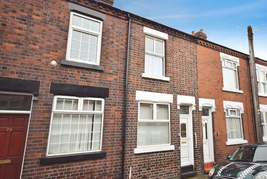
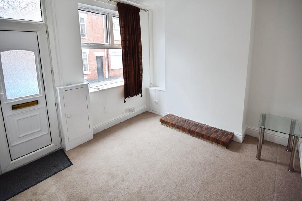
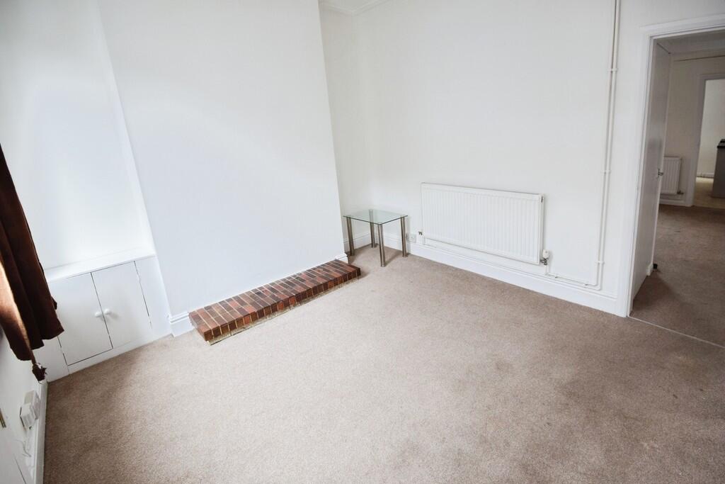
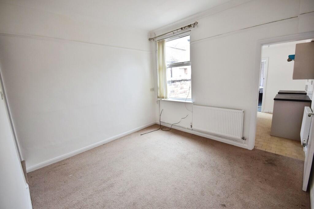
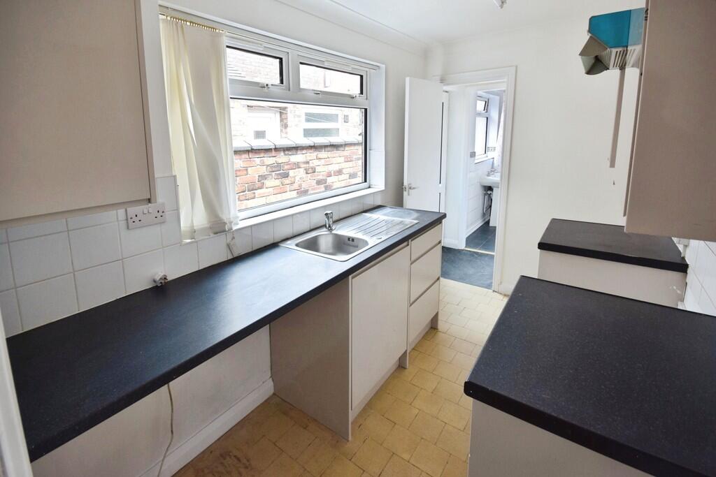
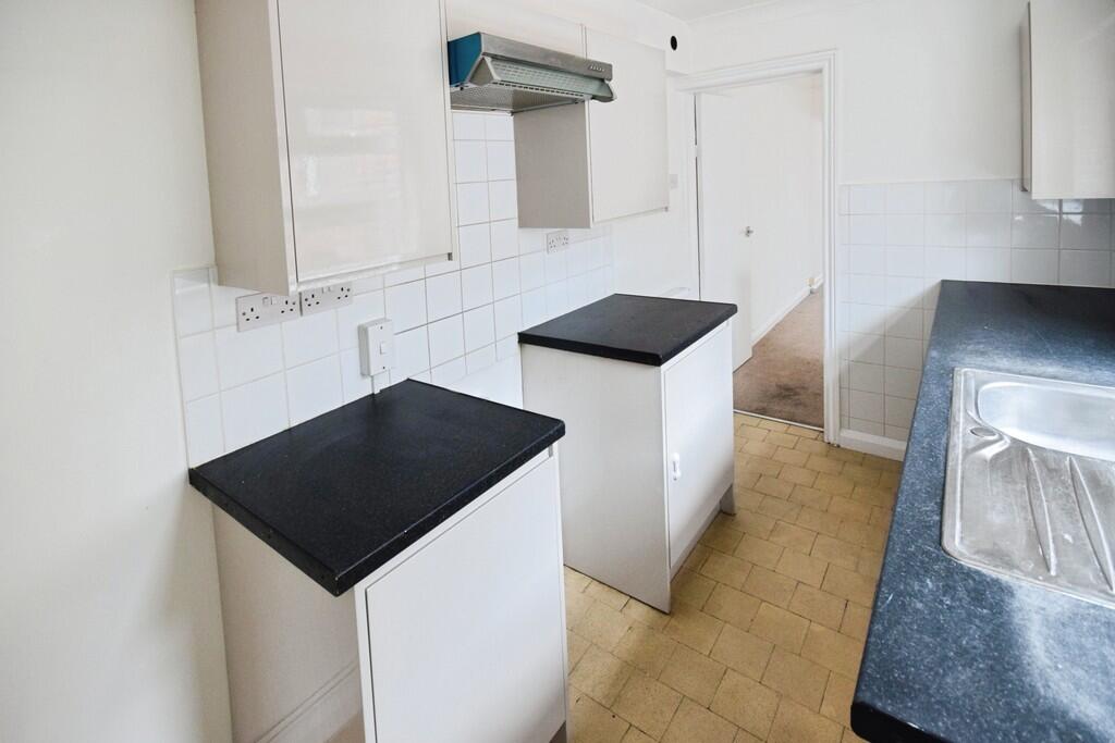
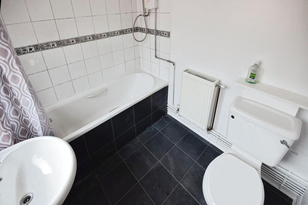
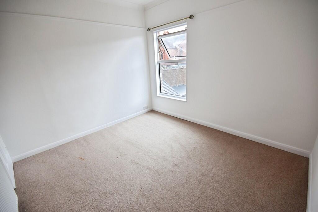
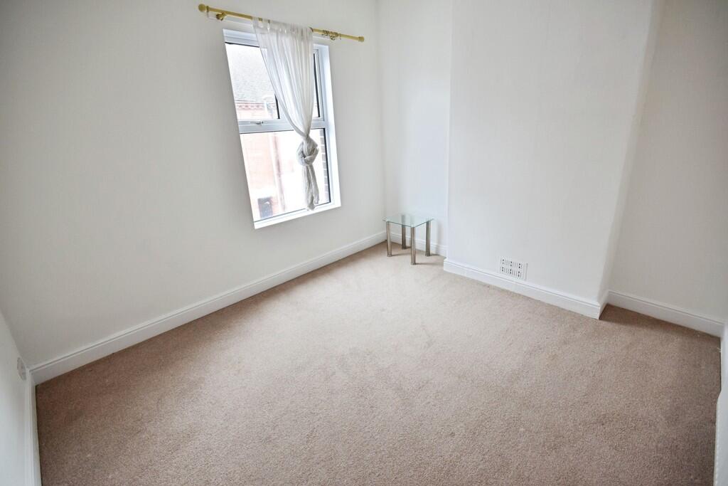
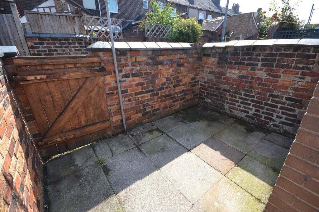
Photo 1 Photo 2 Photo 3 Photo 4 Photo 5 Photo 6 Photo 7 Photo 8 Photo 9 Photo 10
/ 10
Property details
Council tax band
A
Deprivation
Decile 6 (18,288 of 33,755)
Street crime
409 incidents within 1 mile (Apr 2026)
Key features
- Two bed Mid Terraced House
- Two Reception Room
- Kitchen
- Downstairs Bathroom
- Close to all amenities
- Ideal For Hospital
- Close to Newcastle Town Centre
- Council tax band A
Additional details
- Parking
- On street
- Garden
- Yes
Description
FRONT RECEPTION ROOM Window to front elevation, carpeted flooring, wall mounted radiator.
REAR RECEPTION ROOM Window to rear elevation, carpeted flooring, wall mounted radiator.
KITCHEN Window to side elevation, range of wall and base units with work tops over, stainless steel sink and drainer with mixer tap over, tiled flooring.
BATHROOM Window side elevation, three piece suite comprising of WC, wash hand basin and bath with shower over plus electric shower, shower rail, heated towel rail, radiator, tiled flooring, part tiled walls
BEDROOM ONE Window to front elevation, double bedroom with carpeted flooring, wall mounted radiator
BEDROOM TWO Window to rear elevation, double bedroom with carpeted flooring, storage cupboard, wall mounted radiator
EXTERNALLY ** Paved rear yard
Listed by
Stoke On Trent
The Property Franchise Group
Reference: 88102725
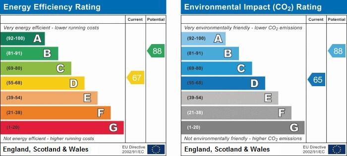
EPC Rating & Upgrade Cost
Fetching EPC data… Refresh this page in a moment.
Flood risk
Zone: 1
Risk: Low
Job (default Low)
EPC Graphs
EPC 1
Rental Range
Estimated market rent for Stoke-on-Trent. Low = conservative, Realistic = average, Optimistic = best case.
Based on Local Authority from postcode lookup → Stoke-on-Trent.
LHA (30th percentile) floor for Staffordshire North: £479/mo (Apr 2025 – Mar 2026)
Location
Nearby
Nearest stations, universities and amenities (distance from property).
| Type | Name | Distance |
|---|---|---|
| Shop | Terry's Textiles | 0.0 miles |
| Shop | Quality Super Store | 0.0 miles |
| Bus stop | Hartshill Road, opposite Holy Trinity Church | 0.1 miles |
| Bus stop | Hartshill Road, opposite Nelson Road | 0.1 miles |
| Hospital | Royal Stoke University Hospital | 0.6 miles |
| Train station | Stoke-on-Trent | 1.0 miles |
| Hospital | North Staffordshire Nuffield Hospital | 1.7 miles |
| Train station | Longport | 2.3 miles |
| University | Keele University | 2.9 miles |
| University | Buxton & Leek College | 10.1 miles |
Street-level crime
| Category | Count |
|---|---|
| Violence and sexual offences | 125 |
| Anti-social behaviour | 67 |
| Public order | 45 |
| Criminal damage and arson | 35 |
| Shoplifting | 35 |
| Drugs | 27 |
| Other theft | 18 |
| Burglary | 17 |
| Vehicle crime | 13 |
| Other crime | 12 |
| Possession of weapons | 7 |
| Robbery | 4 |
| Bicycle theft | 2 |
| Theft from the person | 2 |
| Total incidents | 409 |
Within 1 mile during Apr 2026. Source: data.police.uk (England & Wales).
Schools nearby
Nearest open schools with Ofsted ratings (England). Closed schools are not shown. Data from Get Information about Schools and Ofsted.
| Name | Type | Distance | Ofsted |
|---|---|---|---|
| St Thomas Aquinas Catholic Primary School | Primary | 0.3 miles | Good — 15 Jan 2023 |
| Harpfield Primary Academy | Primary | 0.4 miles | Good — 10 Feb 2015 |
| The Willows Primary School | Primary | 0.5 miles | Good — 14 Dec 2010 |
| Newcastle-under-Lyme School | Other | 0.6 miles | — (No rating) |
| Lyme Brook Independent School | Other | 0.6 miles | Good — 22 Oct 2023 |
Rental Comparables
Residential lets from OpenRent and Rightmove for the area (same bedroom count). Use to validate rent estimates. Student lets are excluded.
Average rent: £785/mo (62 listings)