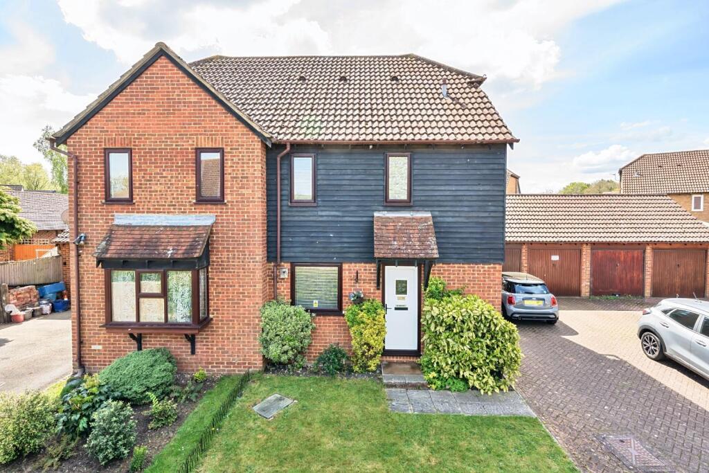
29 COOMBE CLOSE
SNODLAND, KENT ME6 5HZ
Property details
Tenure
FREEHOLD
Floor area
38 m²
Council tax band
B
EPC rating
D
Year built
England and Wales: 1983-1990
Last sold
£230,000 Oct 2025
Price per m²
£6,184/m²
Local average
£330,733 (-28.9%)
Deprivation
Decile 3 (7,180 of 33,755)
Street crime
142 incidents within 1 mile (Apr 2026)
Key features
- A ONE BEDROOM FREEHOLD HOUSE
- A GARAGE AND DRIVEWAY
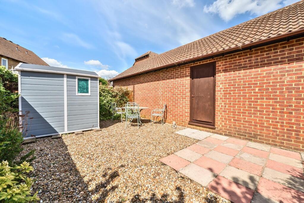
- Its OWN Enclosed Garden to Rear
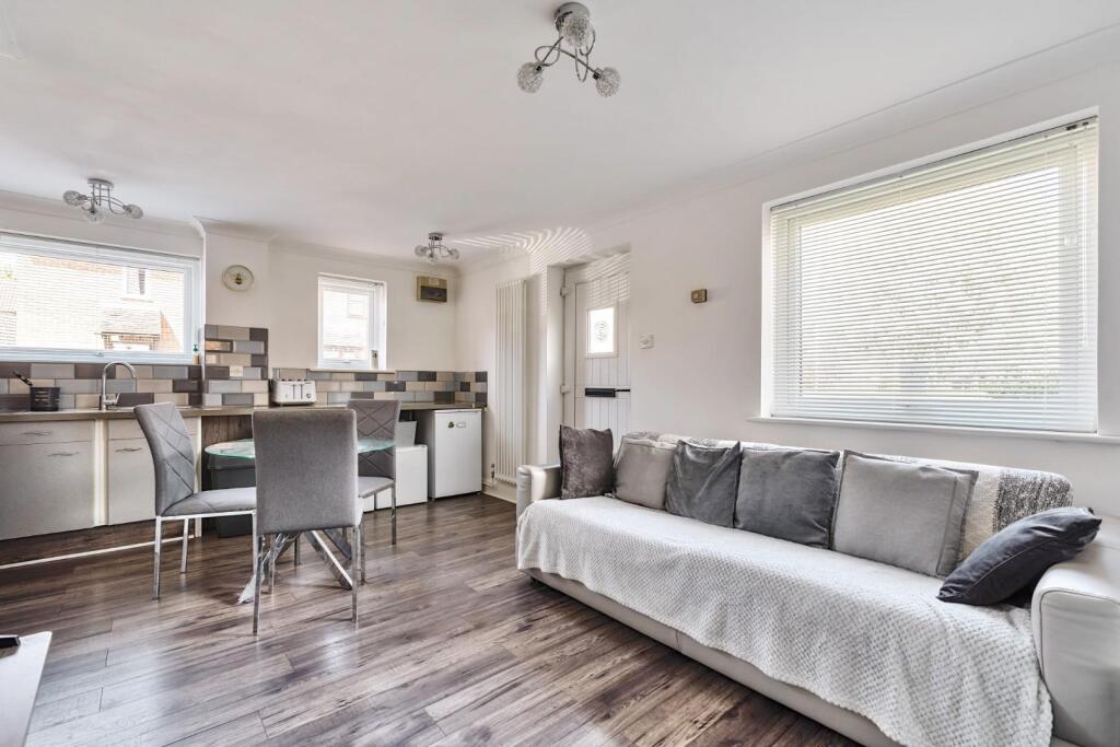
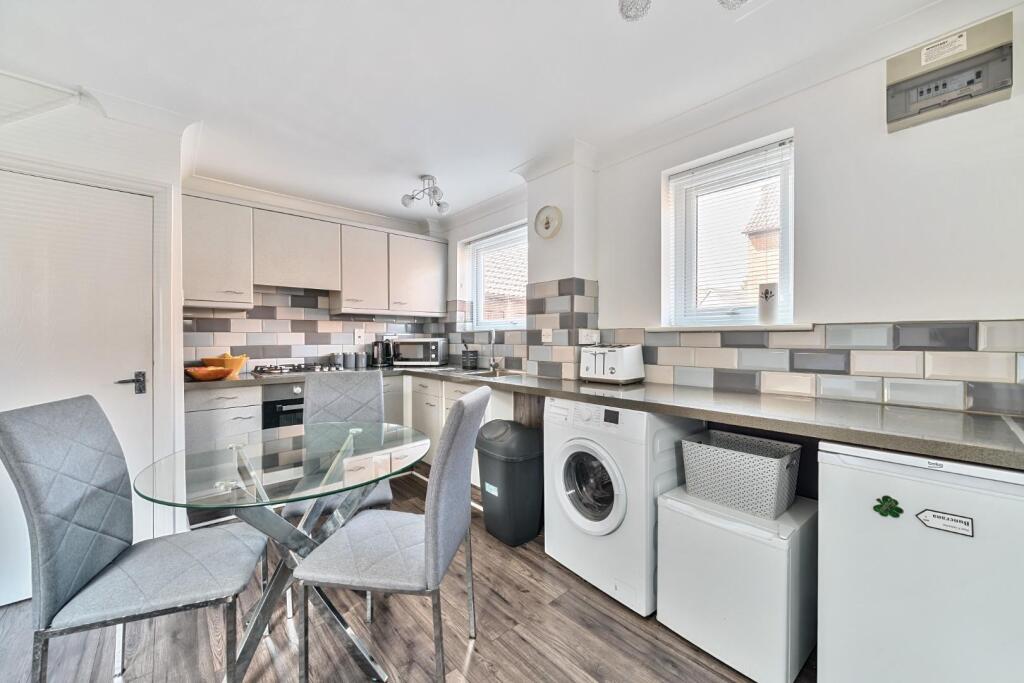
- Updated and Improved Interior
- Cul-de-sac Location
- No ONWARD CHAIN
Additional details
- Parking
- Yes
- Garden
- Yes
Description
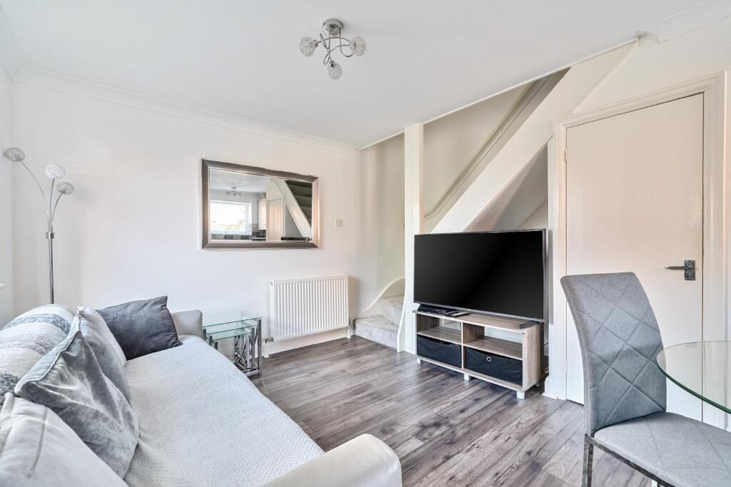
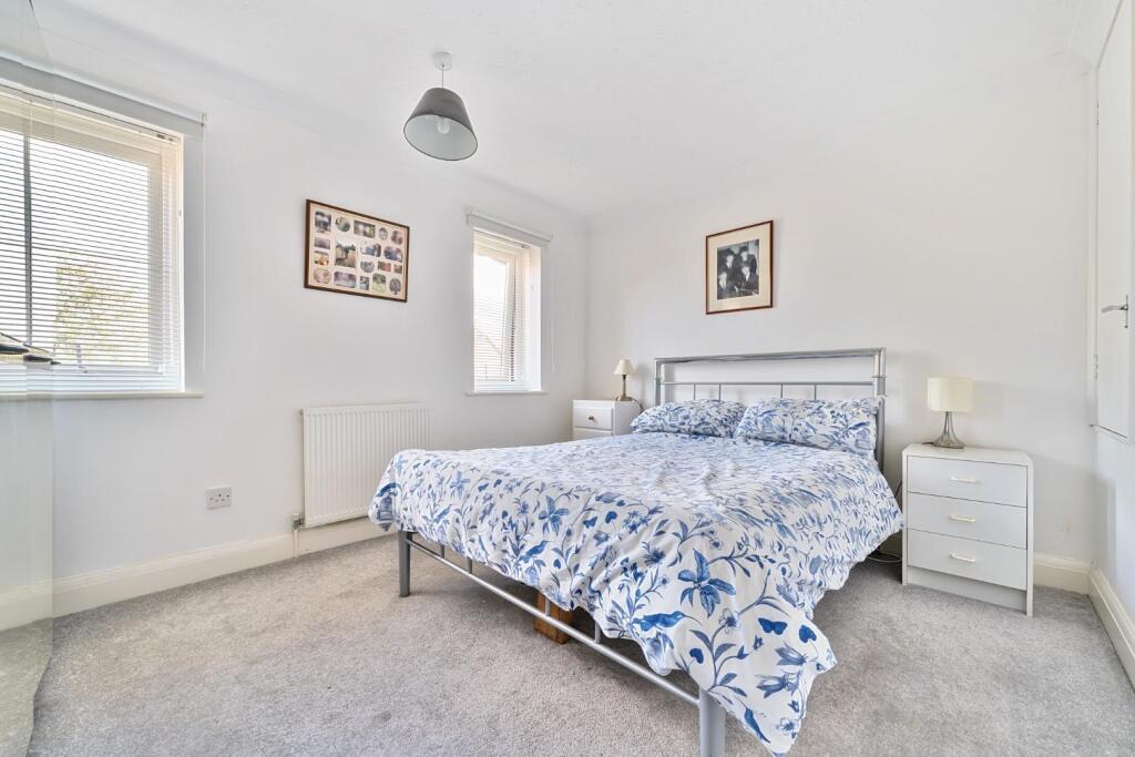
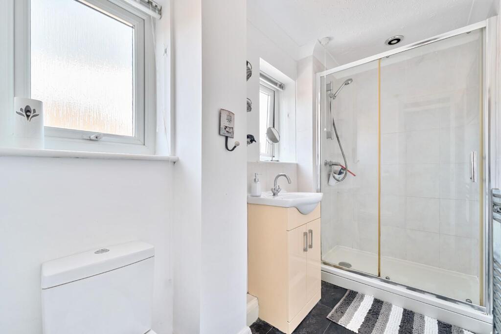
A one bedroom FREEHOLD house with a GARAGE, DRIVEWAY and ITS OWN GARDEN. The present owners have improve their property and its cul-de-sac location only goes to enhance the accommodation that is on offer. There is a replaced kitchen, bathroom, and double glazed windows. plus parking for 2 cars on the driveway and an additional small garden area to front too.
Please contact the office to arrange a viewing
Freehold
EPC: D
Council Tax: B
Full Fibre Broadband Available Now
Listed by
Malling
Simon Miller & Company
Reference: 161082137
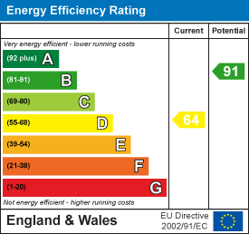
EPC Rating & Upgrade Cost
Current rating: D
Potential rating: B
Inspection date: 22/04/2025
Current heating cost: £441/year
Potential heating cost: £361/year
Est. upgrade cost to C: £17,123
Recommendations
- Floor insulation (solid floor) (£4,000 - £6,000)
- Add additional 80 mm jacket to hot water cylinder (£15 - £30)
- Replace boiler with new condensing boiler (£2,200 - £3,000)
- Solar water heating (£4,000 - £6,000)
- Solar photovoltaic panels, 2.5 kWp (£3,500 - £5,500)
Flood risk
Zone: 1
Risk: Low
Job (default Low)
Floorplans
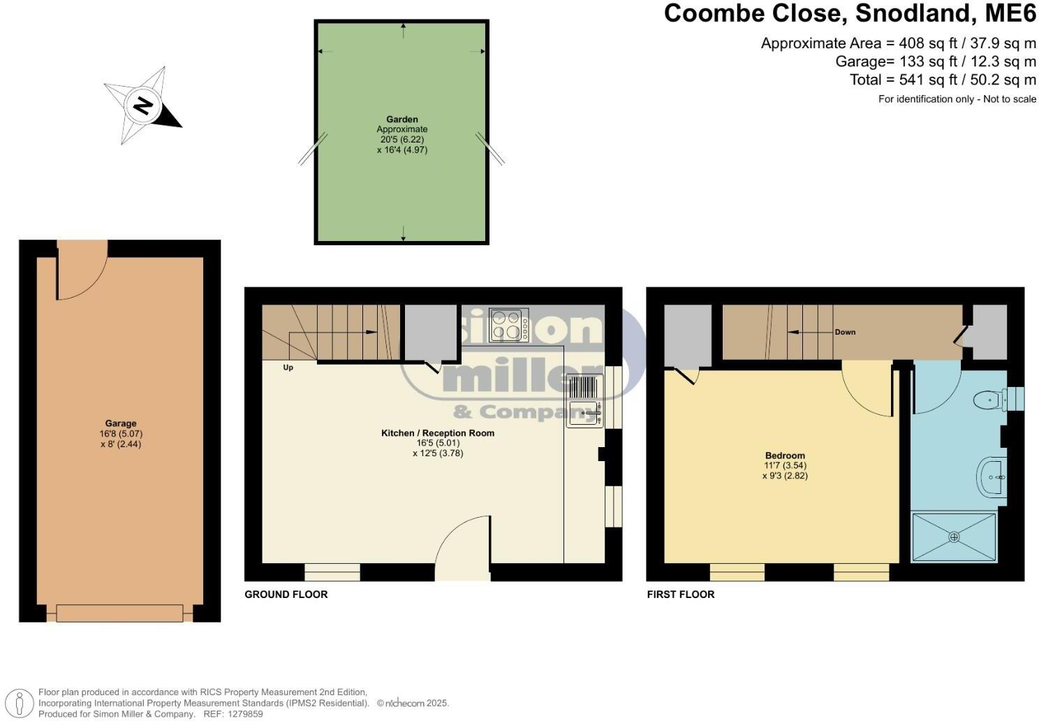
1279859 C.jpg
EPC Graphs
EE Rating
Price history
347% since 2000
| Event | Date | Price | % change |
|---|---|---|---|
| Sold | 29/10/2025 (7 months ago) | £230,000 | +346.6% |
| Sold | 31/03/2000 (26 years ago) | £51,500 | — |
Source: HM Land Registry Price Paid Data. Crown copyright.
Sold Comparables
Same street and nearby sales within 0.25 miles (last 5 years). Data from Land Registry Price Paid.
| Address | Price | Date | Type |
|---|---|---|---|
| 3 POTYNS WALK, SNODLAND, TONBRIDGE AND MALLING, KENT, ME6 5BG | £405,000 | 26/02/2025 | Terraced |
| Same street 11 COOMBE CLOSE, SNODLAND, TONBRIDGE AND MALLING, KENT, ME6 5HZ | £250,000 | 20/10/2023 | Terraced |
| Same street 67 COOMBE CLOSE, SNODLAND, TONBRIDGE AND MALLING, KENT, ME6 5HZ | £300,000 | 24/08/2023 | Semi-detached |
| Same street 23 COOMBE CLOSE, SNODLAND, TONBRIDGE AND MALLING, KENT, ME6 5HZ | £305,000 | 11/04/2023 | Semi-detached |
| Same street 59 COOMBE CLOSE, SNODLAND, TONBRIDGE AND MALLING, KENT, ME6 5HZ | £297,000 | 11/03/2022 | Semi-detached |
| Same street 67 COOMBE CLOSE, SNODLAND, TONBRIDGE AND MALLING, KENT, ME6 5HZ | £285,000 | 15/02/2022 | Semi-detached |
| Same street 93 COOMBE CLOSE, SNODLAND, TONBRIDGE AND MALLING, KENT, ME6 5HZ | £337,000 | 26/11/2021 | Semi-detached |
| Same street 43 COOMBE CLOSE, SNODLAND, TONBRIDGE AND MALLING, KENT, ME6 5HZ | £280,000 | 01/11/2021 | Detached |
| Same street 77 COOMBE CLOSE, SNODLAND, TONBRIDGE AND MALLING, KENT, ME6 5HZ | £335,000 | 30/06/2021 | Detached |
| 32 ASHBEE CLOSE, SNODLAND, TONBRIDGE AND MALLING, KENT, ME6 5HQ | £210,000 | 30/06/2021 | Terraced |
Street average: £298,625 (8 sales)
Area average: £307,500 (2 sales)
Capital growth trend
Land Registry outcode average: last 12 months vs 5y and 10y ago (from sold prices).
House Price Index (HM Land Registry — official index, not sold-price averages): Tonbridge and Malling. Series: Terraced. As of March 2026.
Rental Range
Estimated market rent for Tonbridge and Malling. Low = conservative, Realistic = average, Optimistic = best case.
Based on Local Authority from postcode lookup → Tonbridge and Malling.
LHA (30th percentile) floor for Maidstone: £748/mo (Apr 2025 – Mar 2026)
Location
Nearby
Nearest stations, universities and amenities (distance from property).
| Type | Name | Distance |
|---|---|---|
| Shop | Catts pharmacy | 0.1 miles |
| Bus stop | Recreation Ground | 0.2 miles |
| Shop | Unknown | 0.3 miles |
| Train station | Snodland | 0.4 miles |
| Train station | New Hythe | 1.0 miles |
| Hospital | Unknown | 2.8 miles |
| Hospital | Spire Alexandra Hospital | 3.6 miles |
| University | University for the Creative Arts, Maidstone TV Studios | 4.4 miles |
| University | Unknown | 5.0 miles |
Street-level crime
| Category | Count |
|---|---|
| Anti-social behaviour | 49 |
| Violence and sexual offences | 38 |
| Criminal damage and arson | 17 |
| Shoplifting | 17 |
| Public order | 7 |
| Vehicle crime | 7 |
| Drugs | 3 |
| Bicycle theft | 1 |
| Burglary | 1 |
| Other crime | 1 |
| Robbery | 1 |
| Total incidents | 142 |
Within 1 mile during Apr 2026. Source: data.police.uk (England & Wales).
Schools nearby
Nearest open schools with Ofsted ratings (England). Closed schools are not shown. Data from Get Information about Schools and Ofsted.
| Name | Type | Distance | Ofsted |
|---|---|---|---|
| Grow 19 LTD | Other | 0.3 miles | — (No rating) |
| The Holmesdale School | Secondary | 0.3 miles | Requires improvement — 13 Sep 2021 |
| St Katherine's School & Nursery | Primary | 0.3 miles | Good — 10 Mar 2024 |
| Snodland CofE Primary School | Primary | 0.6 miles | Good — 5 Dec 2012 |
| Valley Invicta Primary School at Holborough Lakes | Primary | 0.7 miles | Good — 29 Oct 2018 |
Rental Comparables
Rental listings exist nearby, but none matched the 1-bedroom count for this property.
Rent-driven metrics
Based on Area rent estimate.
- Rent ratio — Monthly rent ÷ purchase price (1% rule). 1%+ = strong, 0.8–1% = okay, <0.8% = weak for cashflow.
- Max investor price — Rent ÷ 0.8%; the price at which rent would be 0.8% of price (Stoke-style target).
- Target investor price — Rent ÷ 1%; the price at which rent would be 1% of price (strong cashflow band).
- Gross yield — Annual rent as % of purchase price (no costs).