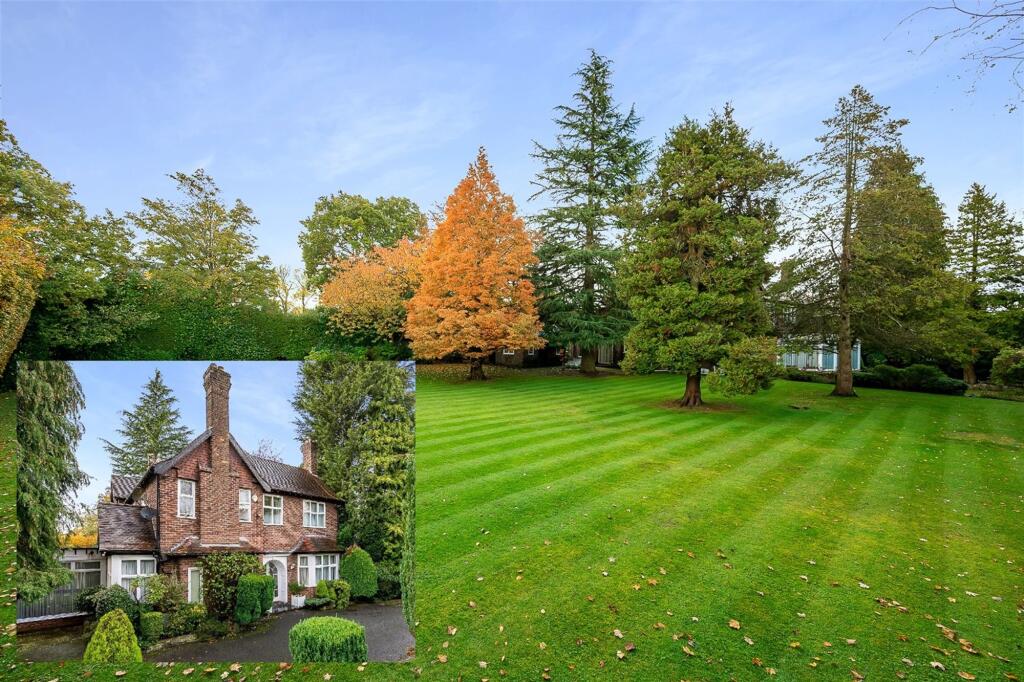
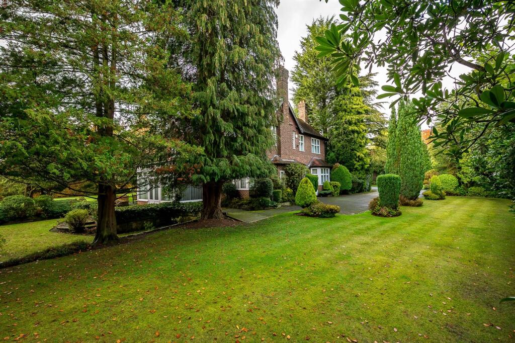
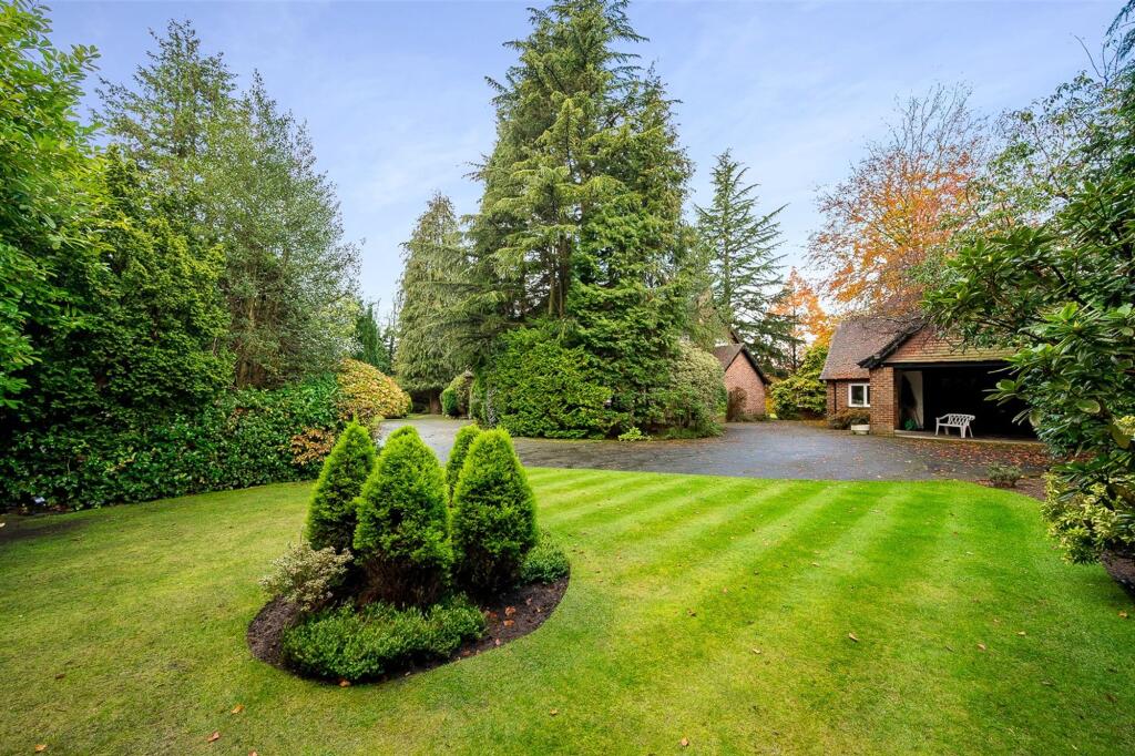
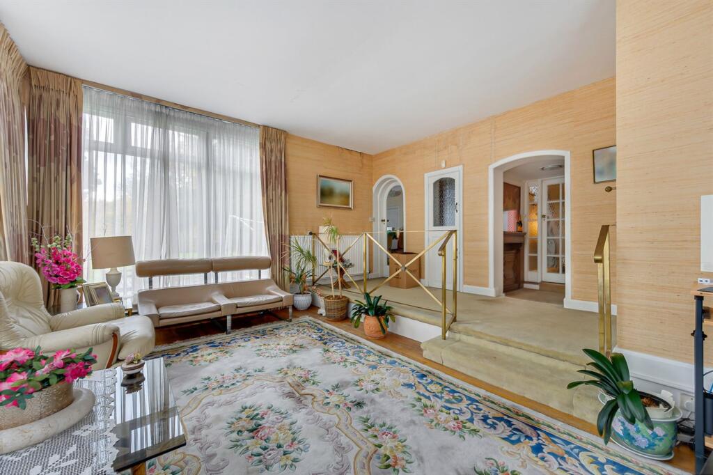
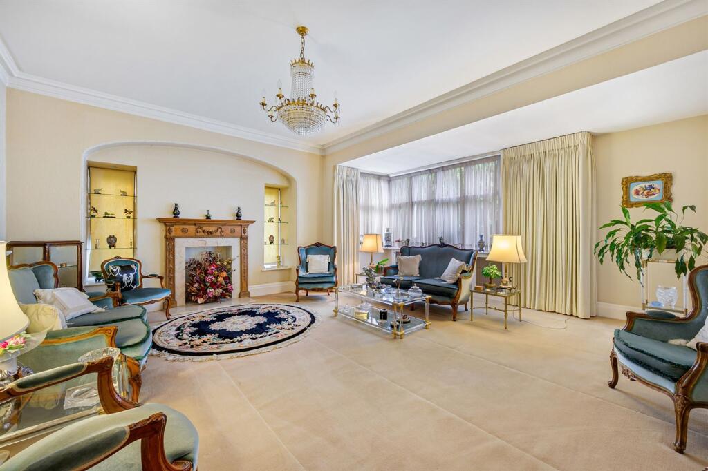
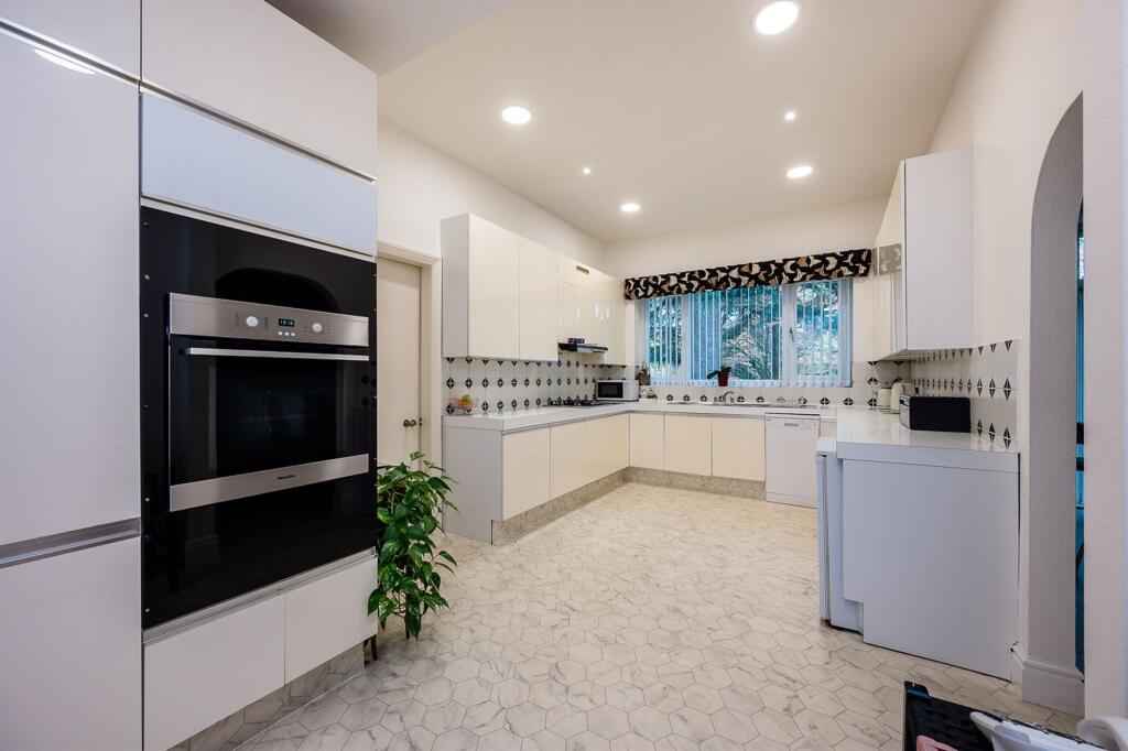
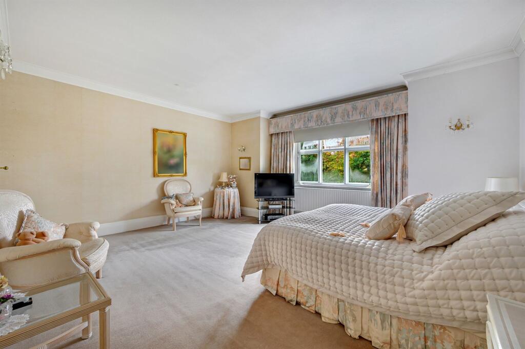
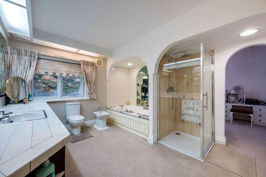
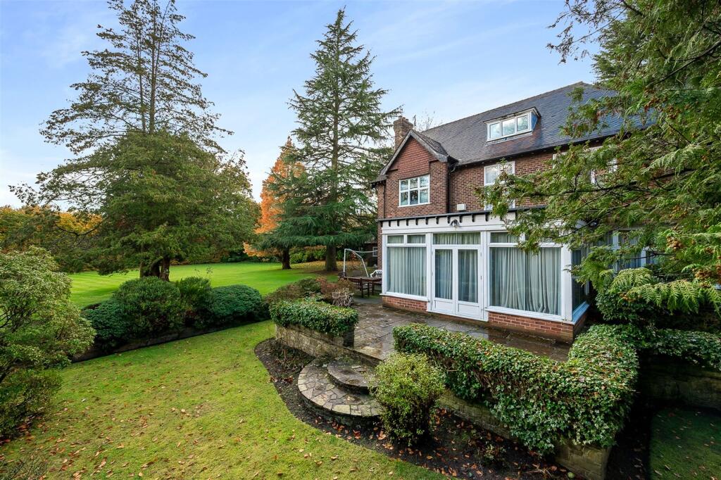
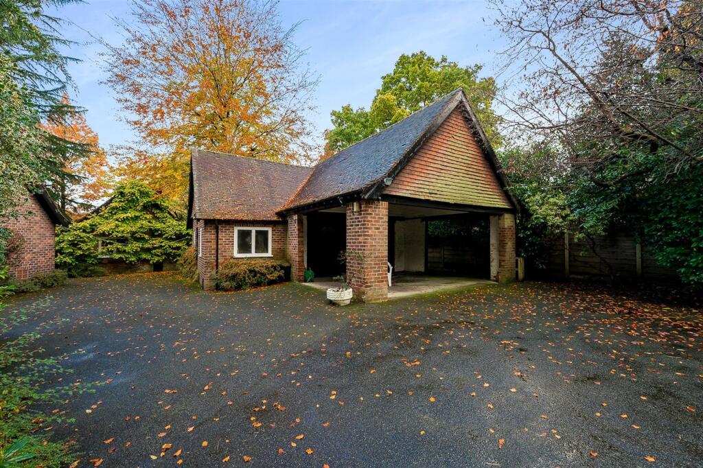
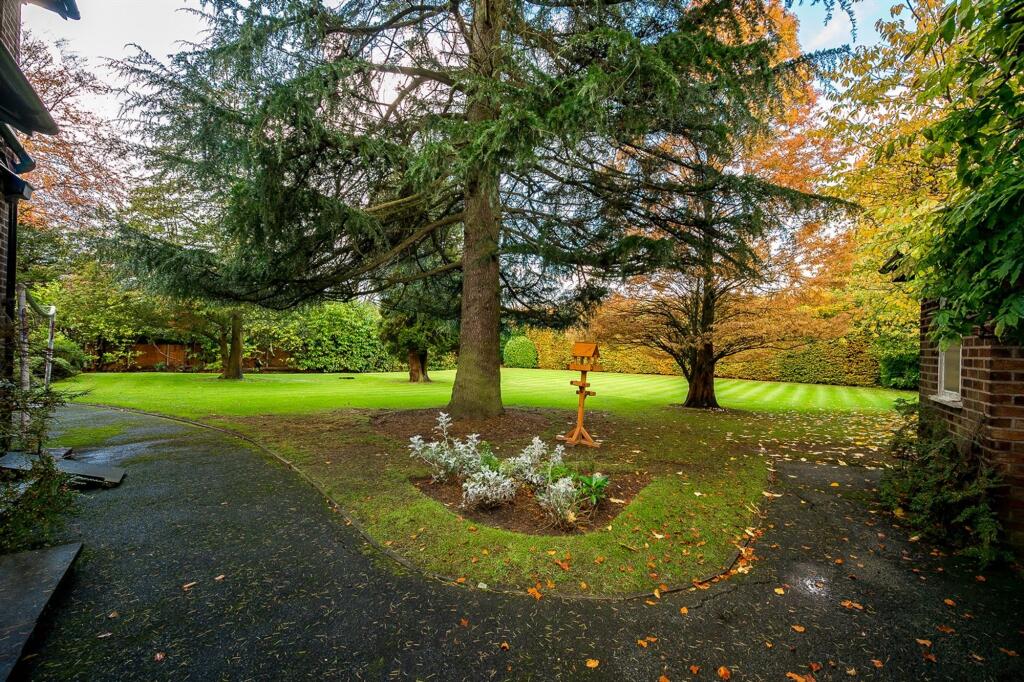
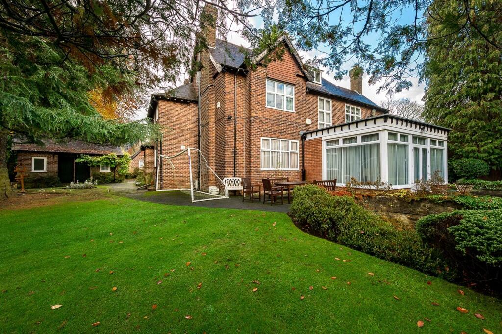
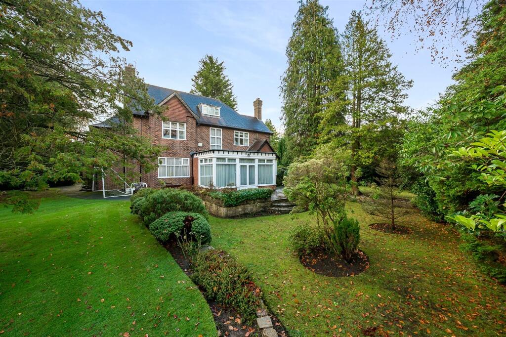
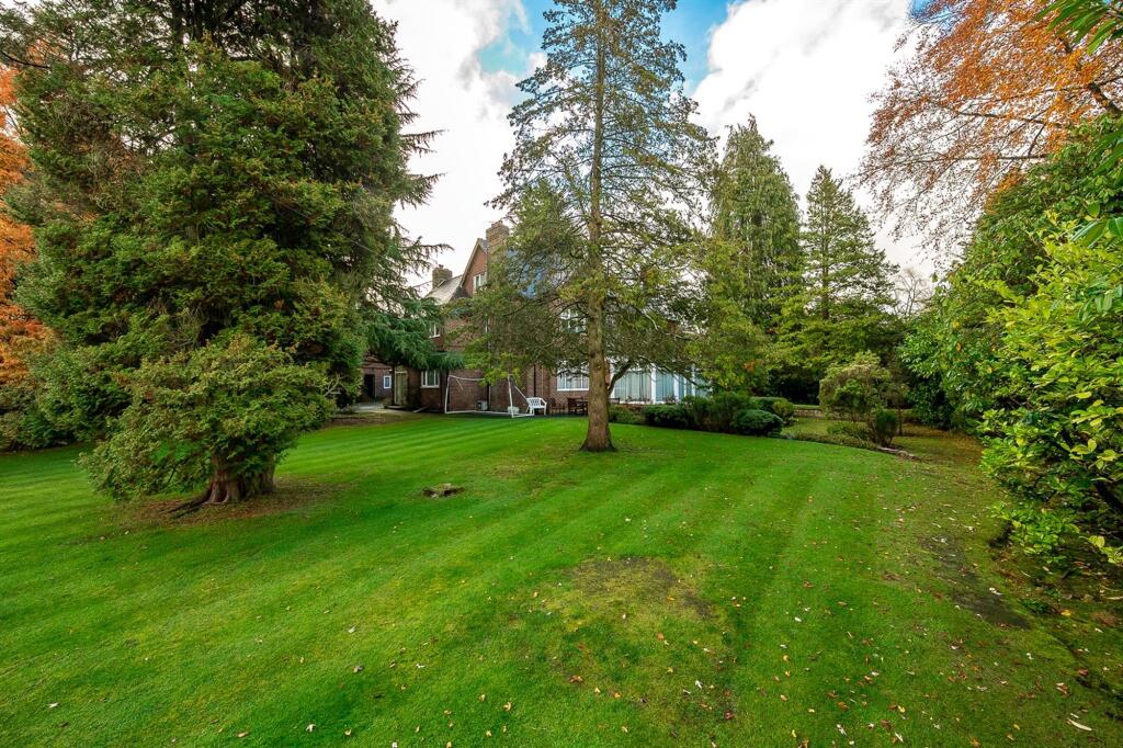
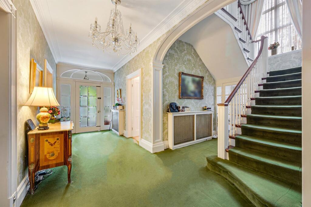
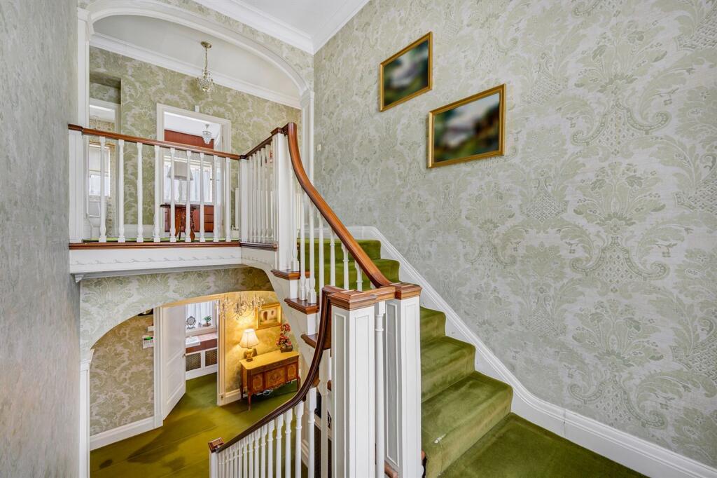
The Coppins
16, HILL TOP, ALTRINCHAM, HALE, GREATER MANCHESTER WA15 0NJ
Property details
Tenure
FREEHOLD
Council tax band
H
Last sold
£2,500,000 Nov 2025
Local average
£330,167 (+732.9%)
Deprivation
Decile 10 (33,139 of 33,755)
Street crime
0 incidents within 1 mile (May 2026)
Key features
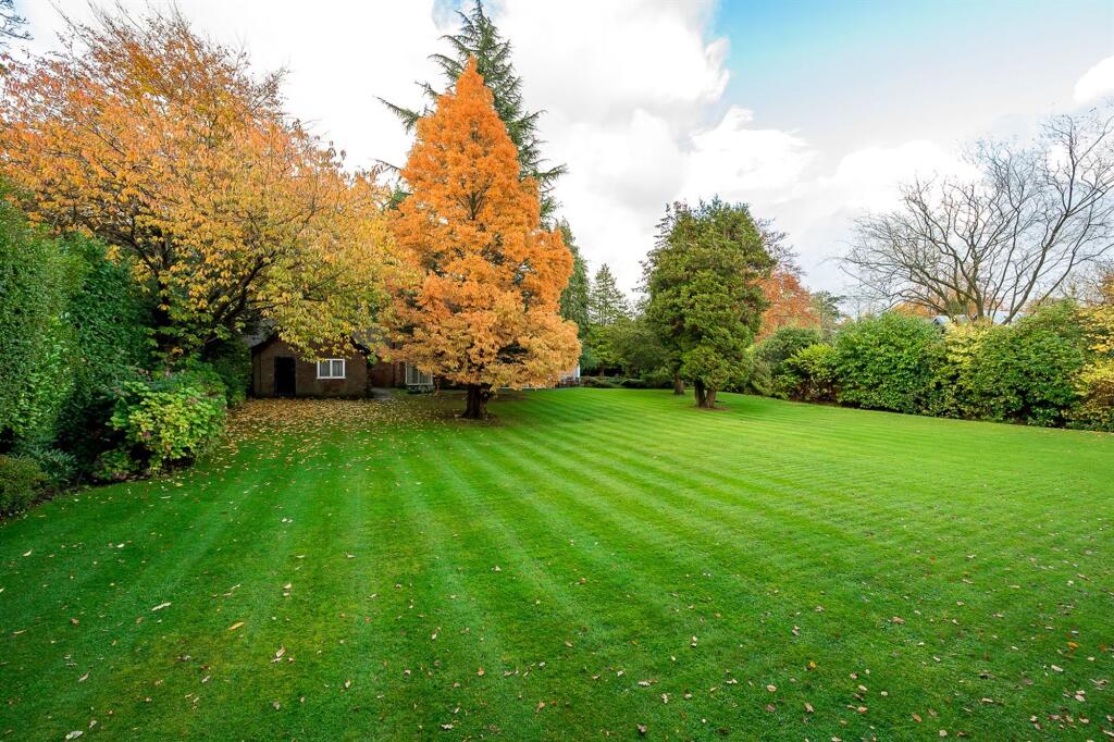
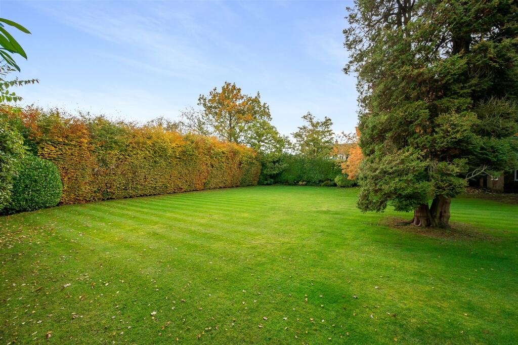
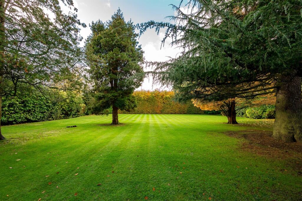
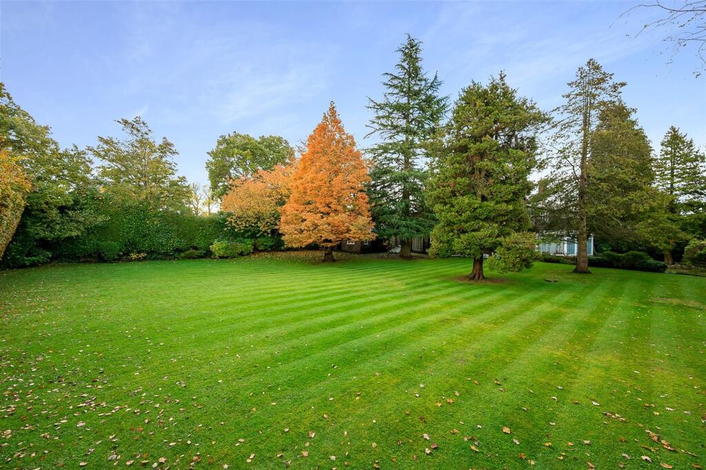
- Prestigious residential address in Hale
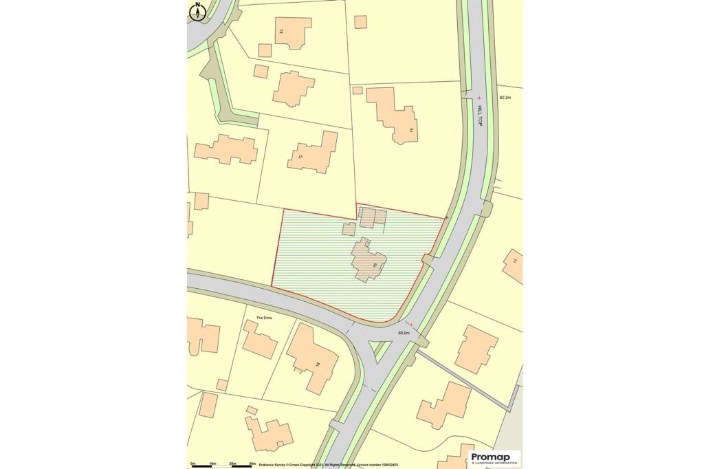
- Magnificent private garden plot, 0.9 acre.
- Garage block with carport, double garage and garden store
- Gated, sweeping driveway provides ample parking
Additional details
- Parking
- Yes
- Garden
- Private garden
- Listed property
- No
- Restrictions
- No
- Required access
- No
- Rights of way
- No
- Flooded in last 5 years
- No
- Flood defences
- No
Description
EPC Rating: E
Listed by
Hale
Gascoigne Halman - Connells
Reference: 174774803
EPC ratings on this postcode
We don't have a matched EPC for this property yet. Below are efficiency scores and details for other addresses on this postcode.
| Address | Current | Potential | Floor area | Age band | Type |
|---|---|---|---|---|---|
| 13, Hill Top, Hale | 22 | 44 | 331 m² | England and Wales: 1950-1966 | House |
| 16 Hill Top, Hale | 45 | 67 | 445 m² | England and Wales: 1900-1929 | House |
| 16 Hill Top, Hale, ALTRINCHAM | 45 | 67 | 445 m² | England and Wales: 1900-1929 | Detached |
| 7, Hill Top, Hale, ALTRINCHAM | 57 | 66 | 700 m² | England and Wales: 1900-1929 | Detached |
| 9, Hill Top, Hale | 81 | 83 | 543 m² | England and Wales: 2007-2011 | House |
| 9, Hill Top, Hale | 64 | 73 | 531 m² | England and Wales: 1976-1982 | House |
| 9, Hill Top, Hale, ALTRINCHAM | 81 | 83 | 543 m² | England and Wales: 2007-2011 | Detached |
| 9, Hill Top, Hale, ALTRINCHAM | 64 | 73 | 531 m² | England and Wales: 1976-1982 | Detached |
| Oak Bank, 10, Hill Top, Hale | 76 | 76 | 1,507 m² | — | House |
| Oak Bank, 10, Hill Top, Hale, ALTRINCHAM | 76 | 76 | 1,507 m² | — | Detached |
Flood risk
Zone: 1
Risk: Low
Job (default Low)
Floorplans
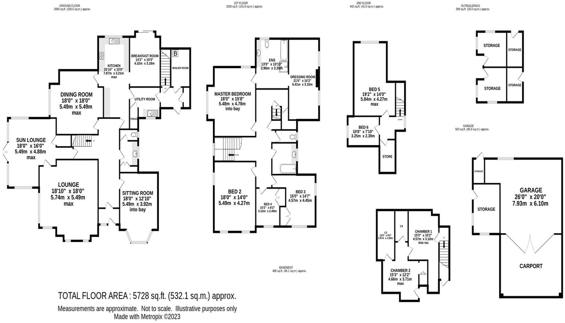
Floorplan 1
Price history
| Event | Date | Price | % change |
|---|---|---|---|
| Listed for sale | — | £2,750,000 | +10% |
| Sold | 26/11/2025 (8 months ago) | £2,500,000 | — |
Source: HM Land Registry Price Paid Data. Crown copyright.
Sold Comparables
Same street and nearby sales within 0.25 miles (last 5 years). Data from Land Registry Price Paid.
| Address | Price | Date | Type |
|---|---|---|---|
| 111 PARK ROAD, HALE, ALTRINCHAM, TRAFFORD, GREATER MANCHESTER, WA15 9JU | £1,895,000 | 11/03/2022 | Other |
Area average: £1,895,000 (1 sale)
Capital growth trend
Land Registry outcode average: last 12 months vs 5y and 10y ago (from sold prices).
House Price Index (HM Land Registry — official index, not sold-price averages): Trafford. Series: All dwelling types. As of April 2026.
Rental Range
Estimated market rent for Trafford. Low = conservative, Realistic = average, Optimistic = best case.
Based on Local Authority from postcode lookup → Trafford.
LHA (30th percentile) floor for North Cumbria: £738/mo (Apr 2025 – Mar 2026)
Location
Address
Hargate Drive
Nearby
Nearest stations, universities and amenities (distance from property).
| Type | Name | Distance |
|---|---|---|
| Bus stop | Ashley Heath, Arthog Road / near Alan Drive | 0.2 miles |
| Bus stop | Ashley Heath, Arthog Road / opposite Alan Drive | 0.2 miles |
| Hospital | The Priory Hospital Altrincham | 0.4 miles |
| Shop | Quality Fitters | 0.5 miles |
| Shop | Ampika Aesthetic training school | 0.6 miles |
| Train station | Hale | 1.0 miles |
| Train station | Ashley | 1.3 miles |
| Hospital | Altrincham Hospital | 1.3 miles |
| University | University Academy 92 | 6.2 miles |
| University | University of Manchester | 6.8 miles |
Street-level crime
| Category | Count |
|---|---|
| Total incidents | 0 |
Within 1 mile during May 2026. Source: data.police.uk (England & Wales).
Schools nearby
Nearest open schools with Ofsted ratings (England). Closed schools are not shown. Data from Get Information about Schools and Ofsted.
| Name | Type | Distance | Ofsted |
|---|---|---|---|
| Saint Ambrose College | Secondary | 0.3 miles | Good — 16 Mar 2020 |
| St Ambrose Prep School | Other | 0.5 miles | — (No rating) |
| Well Green Primary School | Primary | 0.5 miles | Good — 9 Dec 2021 |
| Elmridge Primary School | Primary | 0.8 miles | Good — 18 Jan 2024 |
| Hale Preparatory School | Other | 0.8 miles | — (No rating) |
Rental Comparables
Rental comparables are temporarily unavailable while listing-site fetches are paused. Try again later.
Rent-driven metrics
Based on Area rent estimate.
- Rent ratio — Monthly rent ÷ purchase price (1% rule). 1%+ = strong, 0.8–1% = okay, <0.8% = weak for cashflow.
- Max investor price — Rent ÷ 0.8%; the price at which rent would be 0.8% of price (Stoke-style target).
- Target investor price — Rent ÷ 1%; the price at which rent would be 1% of price (strong cashflow band).
- Gross yield — Annual rent as % of purchase price (no costs).
Enter House Number
Enter the house number to help us retrieve more accurate pricing history and property data.
Please log in to submit or correct the house number for this listing.
Log in to continue