The Old Stables
HAMMONDSTREET ROAD, WALTHAM CROSS, CHESHUNT, HERTFORDSHIRE EN7 6PQ
£1,575 pcm
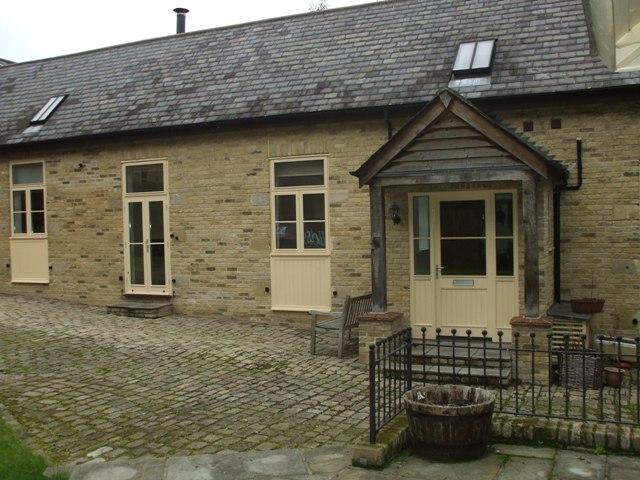
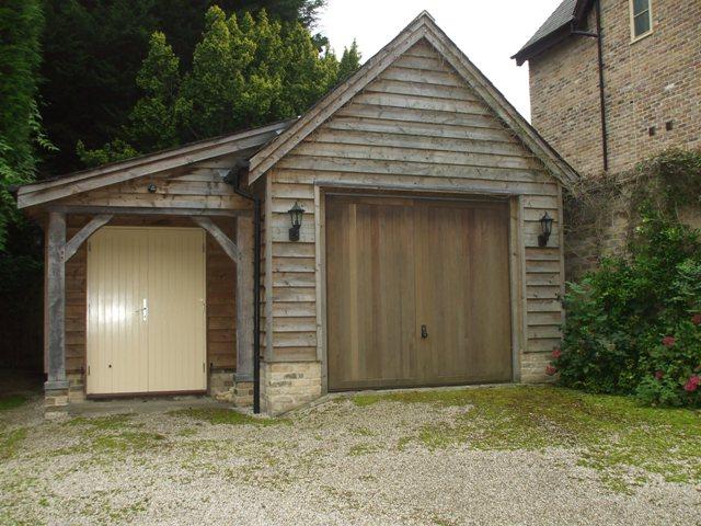
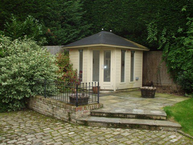
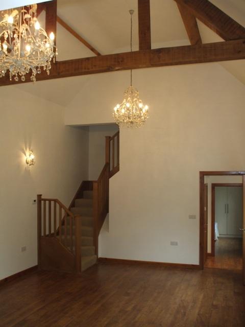
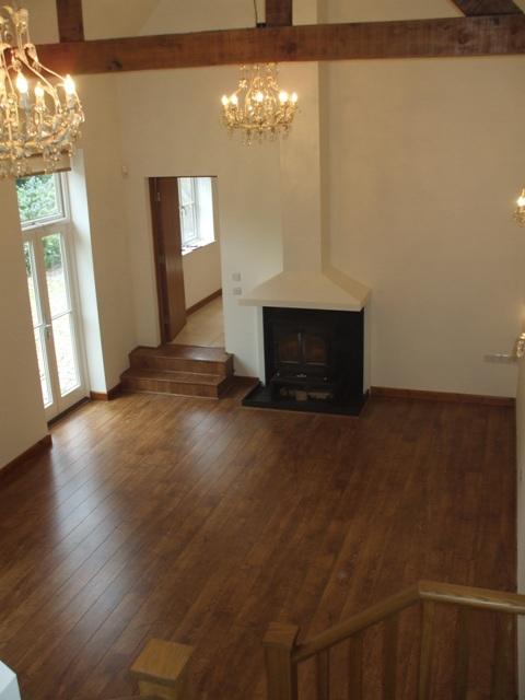
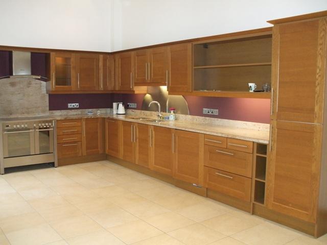
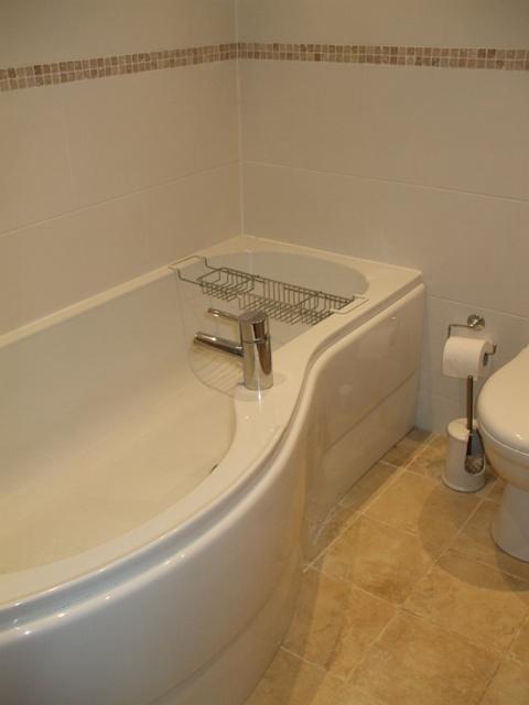
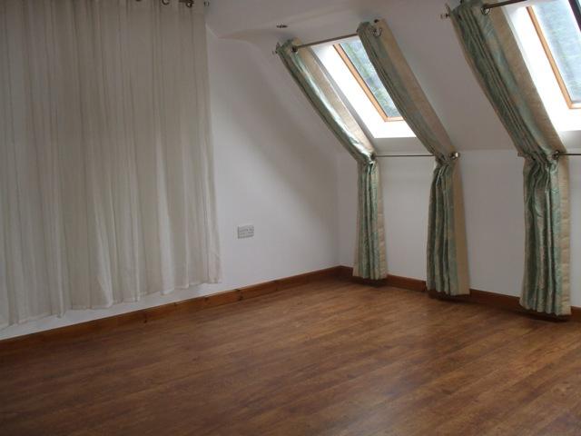
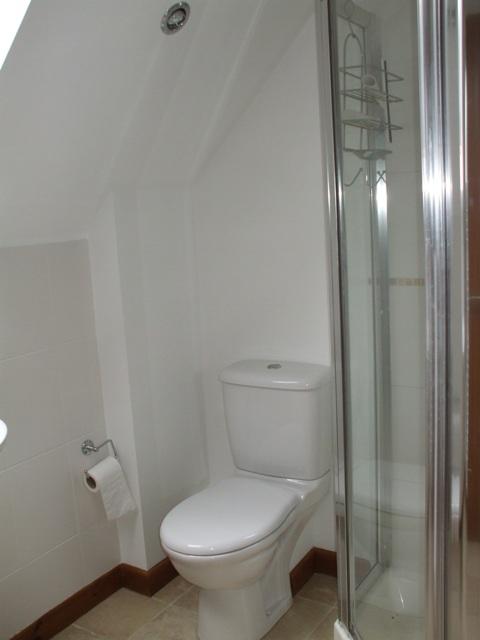
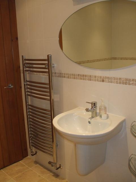
Photo 1 Garage Garden Photo 4 Living Room Kitchen Photo 7 First Bedroom En-suite to second b W.C
/ 10
Property details
Floor area
177 m²
Deprivation
Decile 8 (24,741 of 33,755)
Street crime
22 incidents within 1 mile (Apr 2026)
Key features
- Unfurnished
- Two bedroom Stables Conversion
- Electric Gates to House
- Large fitted kitchen with white goods
- Large Living Room
- Two En-suite Bathrooms
- Garage with store room attatched
- Heated summer house
- Downstairs W.C
- Available Immediately
Additional details
- Parking
- Yes
- Garden
- Yes
Description
Close to Cheshunt BR station with good links into London Liverpool Street and Close to Brookfield Shopping centre.
No smokers, No pets, No children
Available Immediately
Listed by
Ware
Lets Property Management
Reference: 43328984
EPC ratings on this postcode
We don't have a matched EPC for this property yet. Below are efficiency scores and details for other addresses on this postcode.
| Address | Current | Potential | Floor area | Age band | Type |
|---|---|---|---|---|---|
| 466 Hammondstreet Road, Cheshunt, WALTHAM CROSS | 67 | 72 | 271 m² | England and Wales: 1930-1949 | Detached |
| 466, Hammondstreet Road, Cheshunt, WALTHAM CROSS | 52 | 79 | 62 m² | England and Wales: 1967-1975 | Detached |
| 502 Hammondstreet Road, Cheshunt, WALTHAM CROSS | 81 | 86 | 199 m² | England and Wales: 1976-1982 | Detached |
| 504 Hammondstreet Road, Cheshunt, WALTHAM CROSS | 79 | 84 | 213 m² | England and Wales: 2007-2011 | Detached |
| Birch House, Tanfield Farm, Hammondstreet Road, Cheshunt, WALTHAM CROSS | 86 | 89 | 360 m² | — | Detached |
| Carers Accommodation, Tanfield Cottage,Tanfield Farm, Hammondstreet Road, Cheshunt, WALTHAM CROSS | 81 | 81 | 74 m² | — | Flat |
| FINCH LODGE, 4 TANFIELD FARM, HAMMONDSTREET ROAD, CHESHUNT | 87 | 90 | 360 m² | — | Detached |
| Lichen House, 2 Tanfield Farm, Hammondstreet Road, Cheshunt, WALTHAM CROSS | 88 | 91 | 420 m² | — | Detached |
| Maple House, Tanfield Farm, Hammondstreet Road, Cheshunt, WALTHAM CROSS | 86 | 90 | 290 m² | — | Detached |
| Meadow Place, 3 Tanfield Farm, Hammondstreet Road, CHESHUNT | 87 | 90 | 344 m² | — | Detached |
| Orchard House, Tanfield Farm, Hammondstreet, Cheshunt, WALTHAM CROSS | 86 | 90 | 360 m² | — | Detached |
| Tanfield Cottage, Tanfield Farm, Hammondstreet Road, Cheshunt, WALTHAM CROSS | 86 | 90 | 324 m² | — | Detached |
| The Cart Lodge, Tanfield Farm, Hammondstreet Road, Cheshunt, WALTHAM CROSS | 86 | 90 | 290 m² | — | Detached |
| The Old Dairy, Hammondstreet Road, Cheshunt, WALTHAM CROSS | 82 | 85 | 237 m² | England and Wales: 2007-2011 | Detached |
| The Old Dairy, Hammondstreet Road, Cheshunt, WALTHAM CROSS | 79 | 83 | 270 m² | England and Wales: 2003-2006 | Detached |
Flood risk
Zone: 1
Risk: Low
Job (default Low)
Rental Range
Estimated market rent for Broxbourne. Low = conservative, Realistic = average, Optimistic = best case.
Based on Local Authority from postcode lookup → Broxbourne.
LHA (30th percentile) floor for South East Herts: £1,047/mo (Apr 2025 – Mar 2026)
Location
Address
Tanfield Farm
Nearby
Nearest stations, universities and amenities (distance from property).
| Type | Name | Distance |
|---|---|---|
| Bus stop | Dahlia Close | 0.2 miles |
| Bus stop | Gladding Road | 0.3 miles |
| Shop | Cheers | 1.2 miles |
| Shop | Gentry Hair Salon | 1.2 miles |
| Train station | Cuffley | 1.7 miles |
| Train station | Bayford | 2.1 miles |
| Hospital | Cheshunt Community Hospital | 3.0 miles |
| University | University of Hertfordshire | 4.6 miles |
| Hospital | Priory Hospital | 6.8 miles |
| University | University of Portsmouth Walthamstow Campus | 10.4 miles |
Street-level crime
| Category | Count |
|---|---|
| Violence and sexual offences | 9 |
| Vehicle crime | 5 |
| Anti-social behaviour | 3 |
| Criminal damage and arson | 1 |
| Drugs | 1 |
| Other crime | 1 |
| Public order | 1 |
| Shoplifting | 1 |
| Total incidents | 22 |
Within 1 mile during Apr 2026. Source: data.police.uk (England & Wales).
Schools nearby
Nearest open schools with Ofsted ratings (England). Closed schools are not shown. Data from Get Information about Schools and Ofsted.
| Name | Type | Distance | Ofsted |
|---|---|---|---|
| Goffs Oak Primary & Nursery School | Primary | 1.1 miles | Good — 16 Jan 2023 |
| Ponsbourne St Mary's Church of England Primary School | Primary | 1.4 miles | Good — 6 Nov 2019 |
| Fairfields Primary School and Nursery | Primary | 1.4 miles | Good — 12 Jul 2013 |
| Flamstead End School | Primary | 1.5 miles | Outstanding — 2 Feb 2015 |
| Woodside Primary School | Primary | 1.5 miles | Good — 2 Jun 2015 |
Rental Comparables
Rental listings exist nearby, but none matched the 2-bedroom count for this property.
Enter House Number
Enter the house number to help us retrieve more accurate pricing history and property data.
Please log in to submit or correct the house number for this listing.
Log in to continue