Port Street
Middleport, Stoke-On-Trent, ST6 3PF
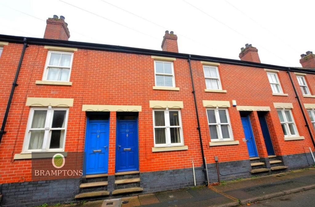

Property details
Deprivation
Decile 1 (1,116 of 33,755)
Street crime
340 incidents within 1 mile (Apr 2026)
Key features
- Ideal For Professionals / Single Occupants
- Close To Major Commuter Links
- Large Rear Garden & Parking
- Council Tax Band A
- Convenient For Access To Festival Park & Surrounding Areas (Including BET 365)
- EPC Rating C (77)
Additional details
- Parking
- Yes
- Garden
- Yes
Description
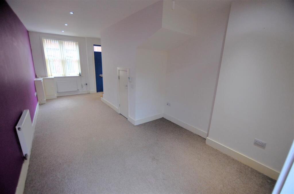
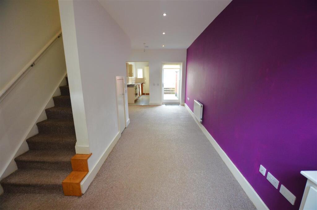
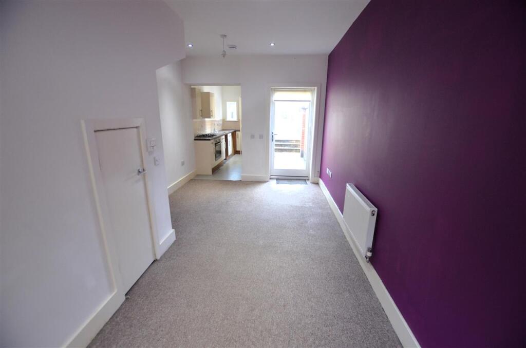
Lounge/Diner. 7.16m (23' 6") x 3.20m (10' 6")
Entrance door to front, wooden double glazed sash style window to front, double glazed door to rear (providing access to rear garden), fitted carpet throughout, boxed electric & gas meters, useful under stairs store cupboard, smoke alarm, radiator and spotlights to ceiling.
Lounge/Diner - Additional Photo.
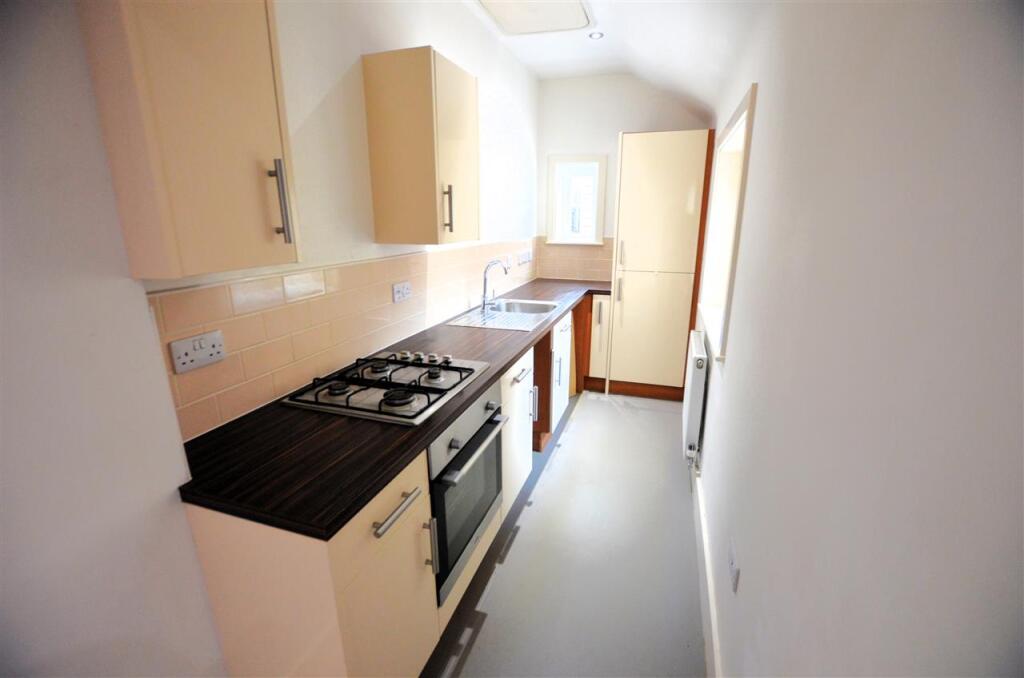
Kitchen. 4.05m (13' 3") x 1.45m (4' 9")
Features a range of wall / base units with contrasting roll edge worktops. Includes built in single oven with four ring gas hob, tiled splash backs, stainless steel sink with mixer tap, space / plumbing for washing machine (not included), space for tall fridge/freezer (not included), smoke alarm, carbon monoxide alarm, vinyl to floor and spotlights to ceiling. Double glazed windows to side & rear.
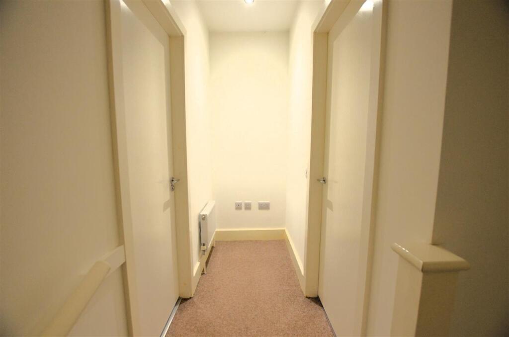
First Floor Landing.
Carpet to floor, radiator, smoke alarm, carbon monoxide alarm, extractor fan and spotlights to ceiling. This space could be useful as a little office area.
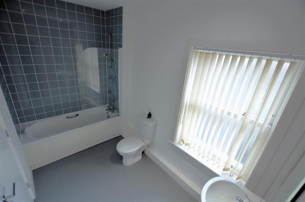
Bathroom. 3.25m (10' 8") x 1.86m (6' 1")
Suite comprising of low level w.c, wash hand basin with mixer tap and panelled bath with mixer tap / shower over. Finished with tiled splash backs, chrome towel radiator, cushion flooring and spotlights to ceiling. Wooden double glazed sash style window to rear.
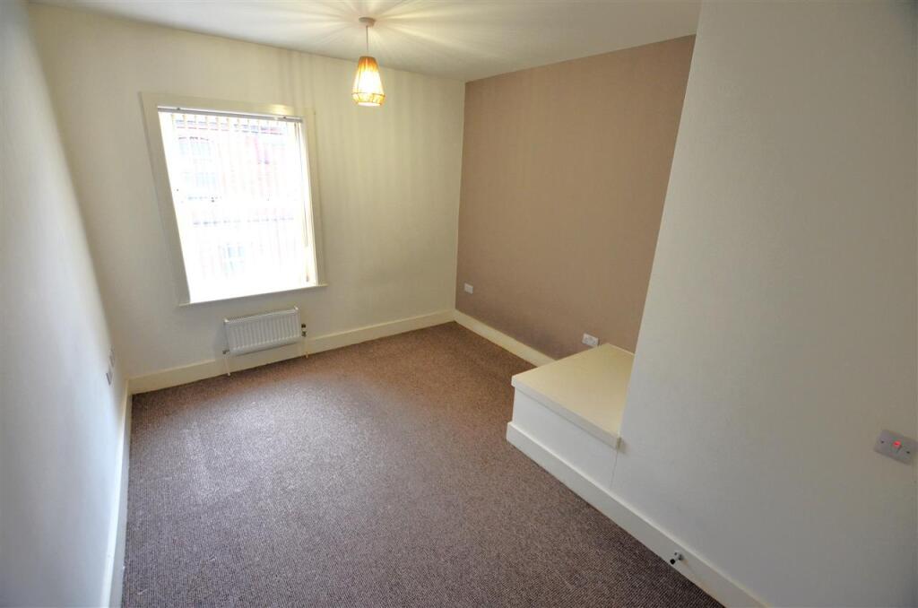
Bedroom 1. 4.15m (13' 7") x 3.21m (10' 6")
Wooden sash style double glazed window to front, carpet to floor, radiator, loft access point with pull down ladder and ceiling light fitting.
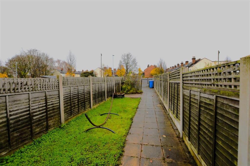
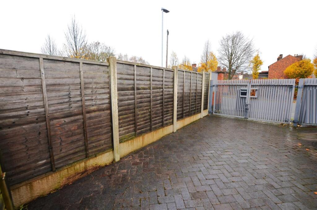
Exterior.
Paved path to rear extending onto spacious lawn garden. To the far rear is a paved gated driveway for off road parking. .
Viewing Arrangements.
Strictly through BRAMPTONS.
EPC.
Listed by
Newcastle-under-Lyme
Bramptons
Reference: 169296992
EPC Rating & Upgrade Cost
Fetching EPC data… Refresh this page in a moment.
Flood risk
Zone: 1
Risk: Low
Job (default Low)
EPC Graphs

EPC
Rental Range
Estimated market rent for Stoke-on-Trent. Low = conservative, Realistic = average, Optimistic = best case.
Based on Local Authority from postcode lookup → Stoke-on-Trent.
LHA (30th percentile) floor for Staffordshire North: £424/mo (Apr 2025 – Mar 2026)
Location
Address
2-66 Port Street
Nearby
Nearest stations, universities and amenities (distance from property).
| Type | Name | Distance |
|---|---|---|
| Shop | Spar | 0.2 miles |
| Shop | Greggs | 0.2 miles |
| Bus stop | Longport, Porthill Road / Longport Road | 0.2 miles |
| Train station | Longport | 0.3 miles |
| Hospital | St Augustine's Hospital | 1.0 miles |
| Hospital | Bradwell Hospital | 1.2 miles |
| Train station | Apedale Road | 2.4 miles |
| University | University of Staffordshire Stoke Campus | 2.4 miles |
Street-level crime
| Category | Count |
|---|---|
| Violence and sexual offences | 93 |
| Anti-social behaviour | 88 |
| Public order | 36 |
| Other theft | 24 |
| Shoplifting | 24 |
| Burglary | 20 |
| Criminal damage and arson | 19 |
| Vehicle crime | 18 |
| Other crime | 8 |
| Robbery | 4 |
| Drugs | 2 |
| Possession of weapons | 2 |
| Bicycle theft | 1 |
| Theft from the person | 1 |
| Total incidents | 340 |
Within 1 mile during Apr 2026. Source: data.police.uk (England & Wales).
Schools nearby
Nearest open schools with Ofsted ratings (England). Closed schools are not shown. Data from Get Information about Schools and Ofsted.
| Name | Type | Distance | Ofsted |
|---|---|---|---|
| Saint Nathaniel's Academy | Primary | 0.5 miles | Good — 20 Jun 2024 |
| Oaklands Nursery School | Nursery | 0.6 miles | Outstanding — 15 Feb 2013 |
| Kaleidoscope School | Other | 0.6 miles | Good — 10 Dec 2023 |
| Ellison Primary Academy | Primary | 0.6 miles | Good — 14 Sep 2023 |
| Cedars - Newcastle, Moorlands and Darwin Bases | Other | 0.7 miles | Good — 26 Jun 2015 |
Rental Comparables
Residential lets from OpenRent and Rightmove for the area (same bedroom count). Use to validate rent estimates. Student lets are excluded.
| Title | Rent | Beds | Distance | As seen on |
|---|---|---|---|---|
| Newcastle Street, Stoke-on-Trent, Staffordshire, ST6 | £750/mo | 1 | 0.22 miles | Rightmove |
| Westport Road, Stoke-On-Trent, ST6 | £625/mo | 1 | 0.5 miles | Rightmove |
| Lancashire Court, Federation Road, Burslem, Stoke-on-Trent, ST6 | £600/mo | 1 | 0.63 miles | Rightmove |
| Kingsware Road, Stoke On Trent | £825/mo | 1 | 0.72 miles | Rightmove |
| Kingsware Road, Burslem | £850/mo | 1 | 0.73 miles | Rightmove |
| Lingard Street, Burslem, Stoke-on-Trent, ST6 | £750/mo | — | 0.92 miles | Rightmove |
| High Street, Tunstall | £550/mo | — | 1.04 miles | Rightmove |
| High Street, Stoke-on-Trent, Staffordshire, ST6 | £550/mo | 1 | 1.12 miles | Rightmove |
| Wade Street, Burslem | £675/mo | 1 | 1.21 miles | Rightmove |
| The Boulevard, Stoke-on-Trent, ST6 | £595/mo | — | 1.26 miles | Rightmove |
Average rent: £677/mo (10 listings)