30 BROADMEAD ROAD
SOUTHAMPTON, NURSLING, HAMPSHIRE SO16 0XD
£995 pcm
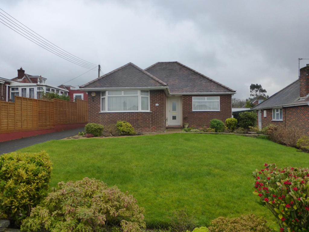
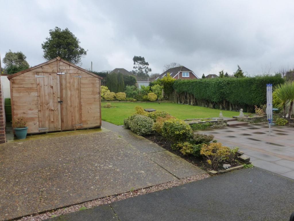
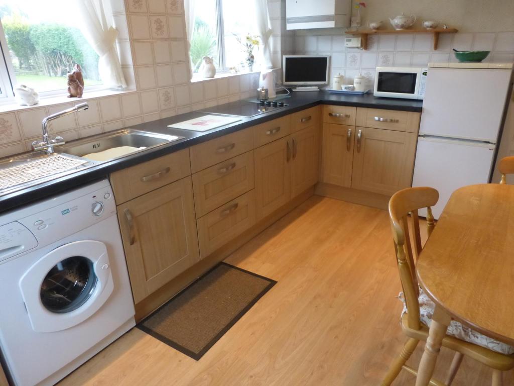
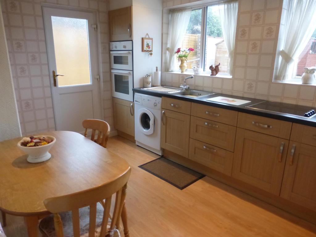
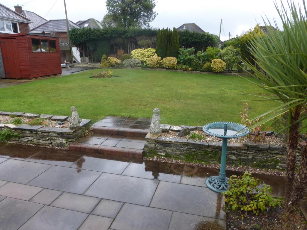
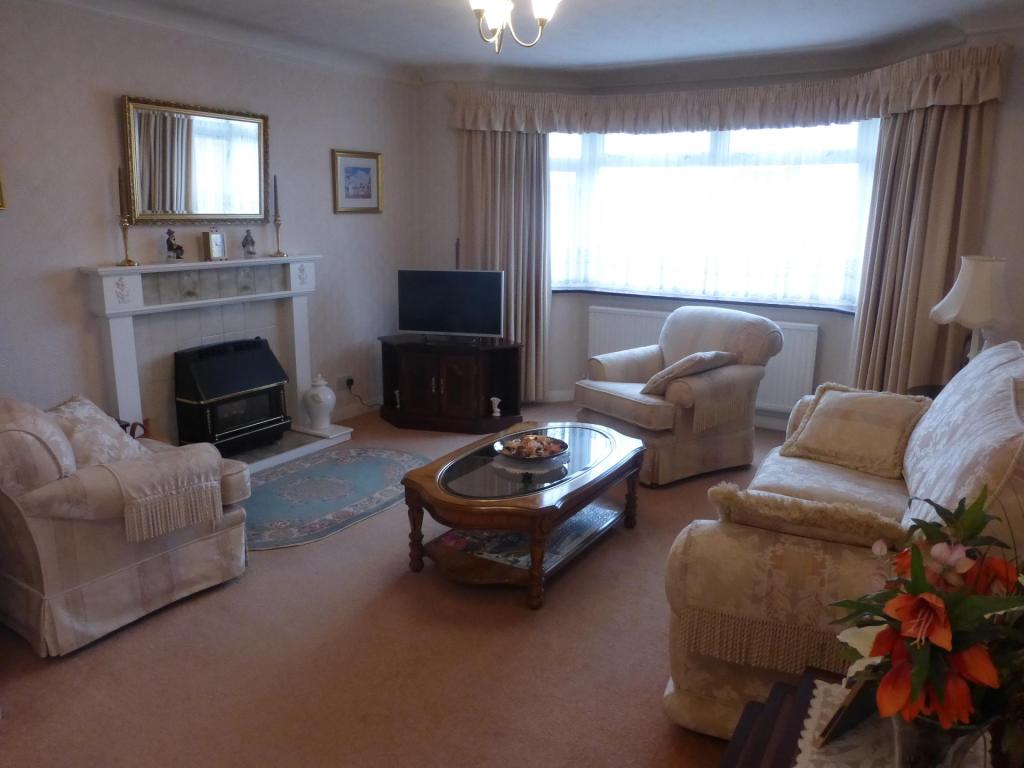
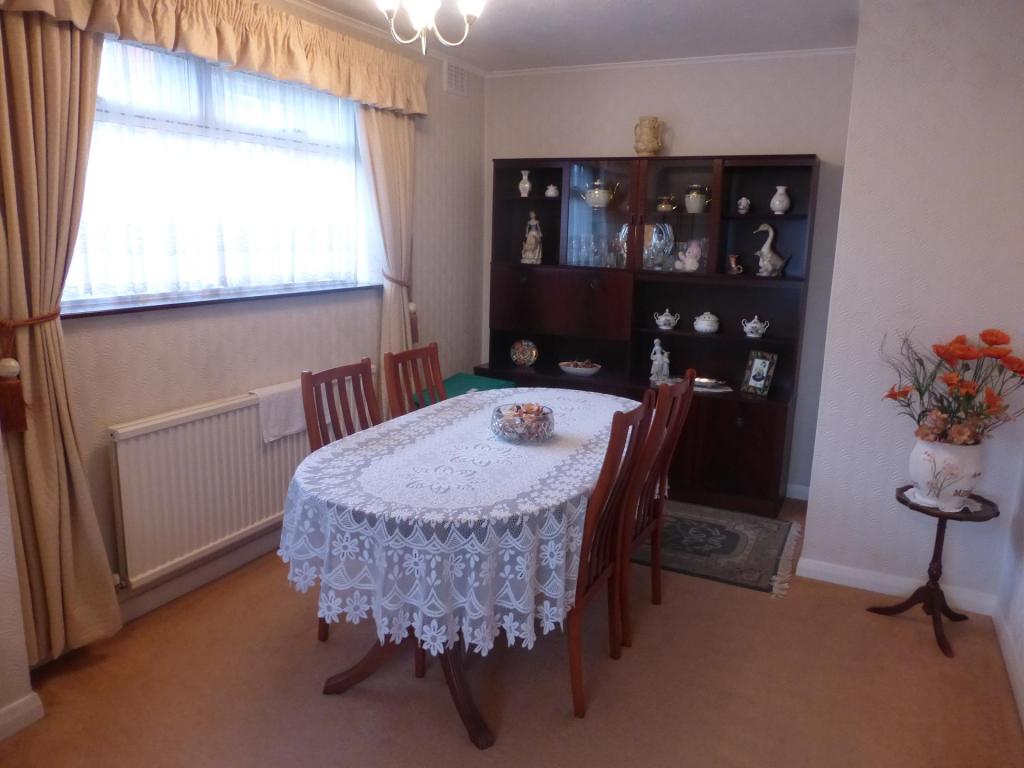
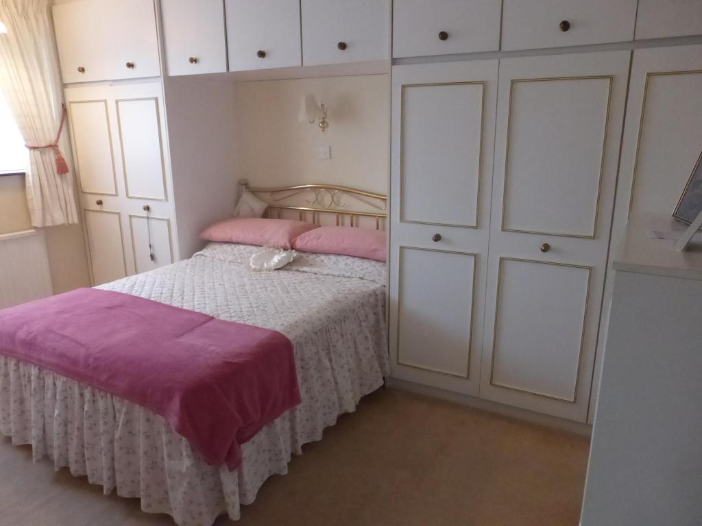
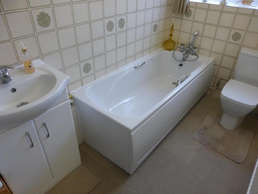
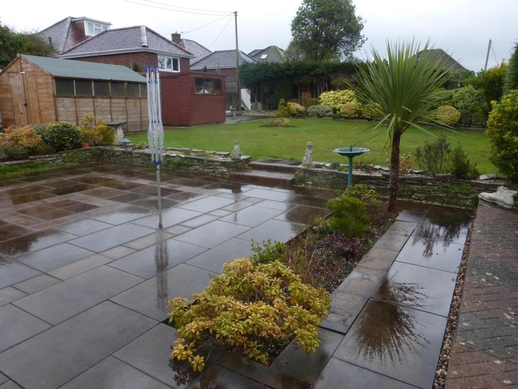
Photo 1 Photo 2 Photo 3 Photo 4 Photo 5 Photo 6 Photo 7 Photo 8 Photo 9 Photo 10 Photo 11
/ 11
Property details
Floor area
72 m²
Deprivation
Decile 10 (32,089 of 33,755)
Street crime
119 incidents within 1 mile (Apr 2026)
Key features
- Bungalow
- Two Bedrooms
- Refitted Kitchen
- Lounge
- Dining Room
- Driveway
Additional details
- Parking
- Yes
- Garden
- Yes
Description
Internally you are greeted by a spacious hallway which leads to all rooms. The lounge is neutrally decorated with beige carpets, magnolia walls and a feature fireplace. This leads into the dining area which is also neutral throughout. The kitchen provides space for a small dining table and has been refitted to offer modern up and over units with a lovely view over the rear garden.
There are two double bedrooms and the master bedroom comes with fitted wardrobes. The bathroom suite has been recently refitted and has a shower over the bath.
Externally the gardens are beautifully maintained, with mature shrubs and bushes. It is mainly laid to lawn but has a good sized patio area. Other features include double glazing and gas central heating.
To arrange a viewing then please contact Northwood Southampton on 02380337775 or alternatively visit our website www.northwooduk.com
Listed by
Southampton
The Property Franchise Group
Reference: 53057161
EPC Rating & Upgrade Cost
Fetching EPC data… Refresh this page in a moment.
Flood risk
Zone: 1
Risk: Low
Job (default Low)
EPC Graphs

EPC Graph
Rental Range
Estimated market rent for Test Valley. Low = conservative, Realistic = average, Optimistic = best case.
Based on Local Authority from postcode lookup → Test Valley.
LHA (30th percentile) floor for Southampton: £873/mo (Apr 2025 – Mar 2026)
Location
Nearby
Nearest stations, universities and amenities (distance from property).
| Type | Name | Distance |
|---|---|---|
| Shop | Unknown | 0.1 miles |
| Bus stop | Balmoral Way | 0.1 miles |
| Shop | Co-op Food | 0.1 miles |
| Hospital | Princess Anne Hospital | 1.5 miles |
| University | South Academic Block | 1.6 miles |
| Hospital | Southampton General Hospital | 1.6 miles |
| Train station | Redbridge | 1.9 miles |
| Train station | Totton | 2.1 miles |
| University | Boldrewood Innovation Campus | 2.7 miles |
Street-level crime
| Category | Count |
|---|---|
| Anti-social behaviour | 31 |
| Violence and sexual offences | 28 |
| Shoplifting | 11 |
| Criminal damage and arson | 10 |
| Public order | 10 |
| Vehicle crime | 10 |
| Burglary | 7 |
| Drugs | 3 |
| Other theft | 3 |
| Other crime | 2 |
| Theft from the person | 2 |
| Possession of weapons | 1 |
| Robbery | 1 |
| Total incidents | 119 |
Within 1 mile during Apr 2026. Source: data.police.uk (England & Wales).
Schools nearby
Nearest open schools with Ofsted ratings (England). Closed schools are not shown. Data from Get Information about Schools and Ofsted.
| Name | Type | Distance | Ofsted |
|---|---|---|---|
| Nursling Church of England Primary School | Primary | 0.2 miles | Good — 11 Nov 2019 |
| The Cedar School | Other | 0.4 miles | Good — 27 Jun 2014 |
| Rownhams St John's Church of England Primary School | Primary | 0.4 miles | Good — 28 Jun 2023 |
| Fairisle Infant and Nursery School | Primary | 0.6 miles | Good — 8 Dec 2010 |
| Fairisle Junior School | Primary | 0.6 miles | Good — 20 Apr 2018 |
Rental Comparables
Rental listings exist nearby, but none matched the 2-bedroom count for this property.