11 SCHOOL LANE
BUXTON, TADDINGTON, DERBYSHIRE SK17 9TW
Property details
Tenure
FREEHOLD
Floor area
88 m²
EPC rating
F
Year built
England and Wales: 1930-1949
Last sold
£302,500 Aug 2022
Price per m²
£3,011/m²
Local average
£316,864 (-16.4%)
Deprivation
Decile 5 (14,553 of 33,755)
Street crime
1 incident within 1 mile (Apr 2026)
Key features
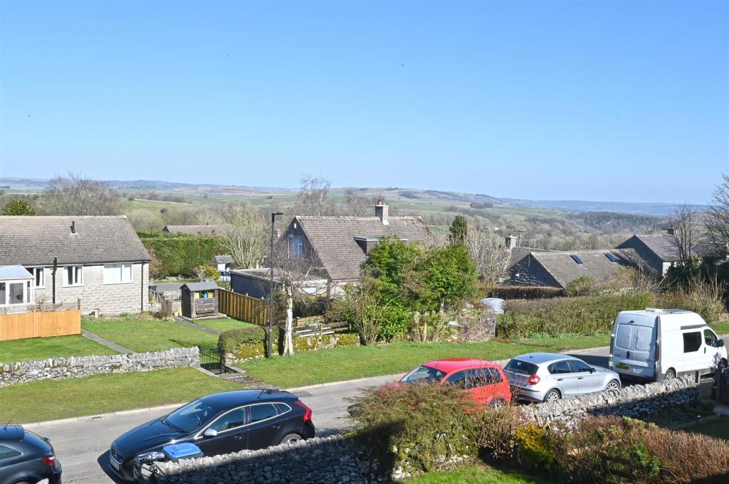
- Peaceful Picturesque Setting
- Rural Derbyshire Village
- Within Highly Regarded School Catchment
- Generous Gardens
- Offers Scope For Modernisation
- Garage & Off Road Parking
- No Upward Chain
- A Local Occupancy Clause Applies
- EPC: Rating F
- Viewings: Bakewell Office
Additional details
- Parking
- Yes
- Garden
- Yes
Description
£265,000 - £275,000 Guide Price.
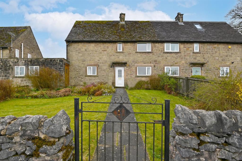
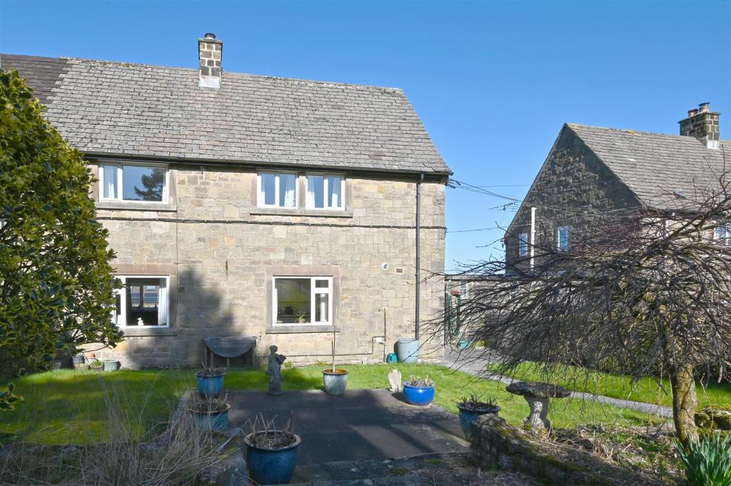
A three bedroom semi- detached family home with off road parking, garage and generous gardens, occupying a peaceful picturesque setting in the rural Village of Taddington in the heart of the PeakDistrict National Park. The property would benefit from a degree of modernisation and cosmetic enhancement throughout.
The village boasts a thriving local community, a primary school and a country pub as well as being well placed to access the amenities, shops and leisure facilities both Bakewell and Buxton have to offer.
The property is subject to the local Derbyshire Dales occupancy clause.
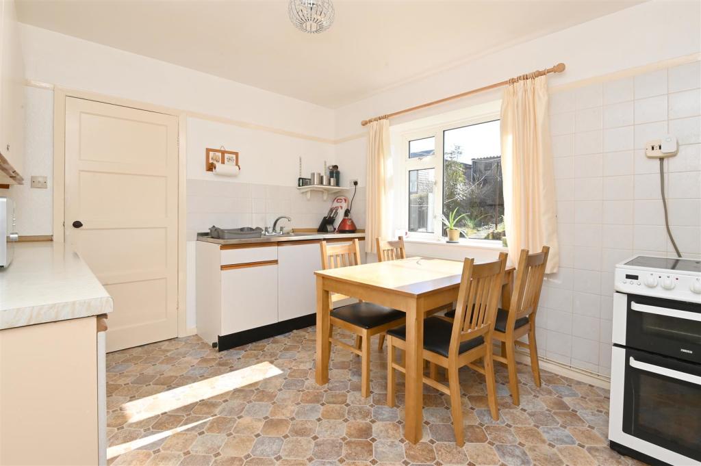
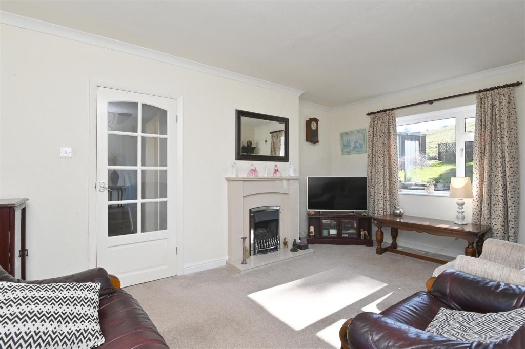
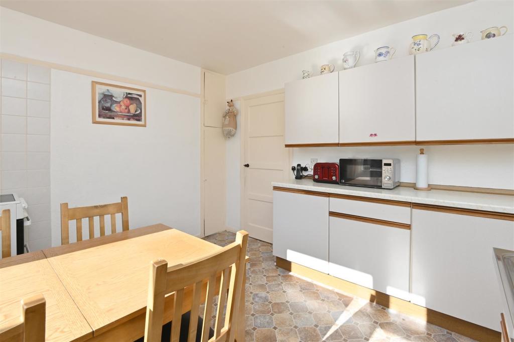
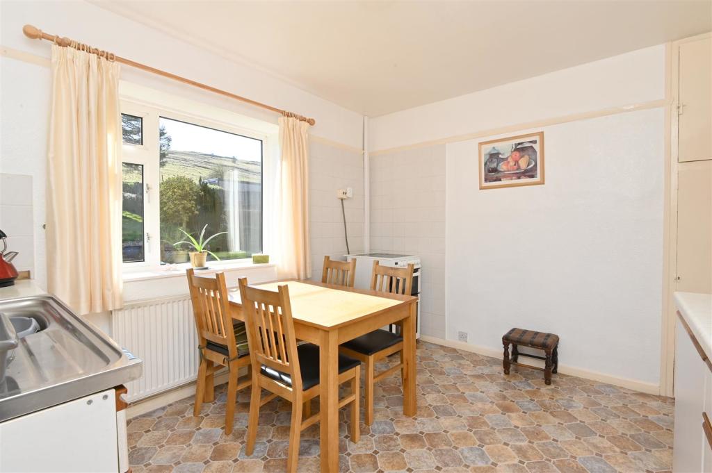
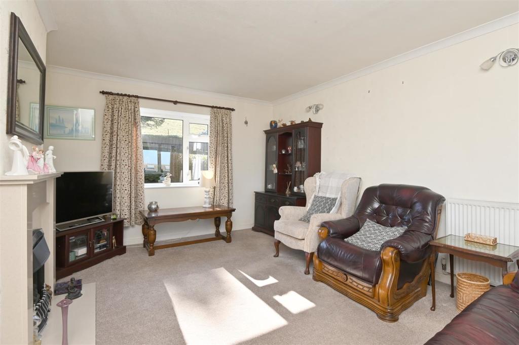
The accommodation comprises: entrance hallway, Front entrance lobby, hallway and a dual aspect sitting room. A fitted breakfast kitchen with a walk in pantry and a utility room. A further entrance opens into a store, W/C and a workshop, offering scope for reconfiguring if desired.
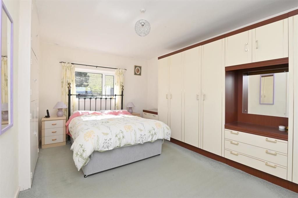
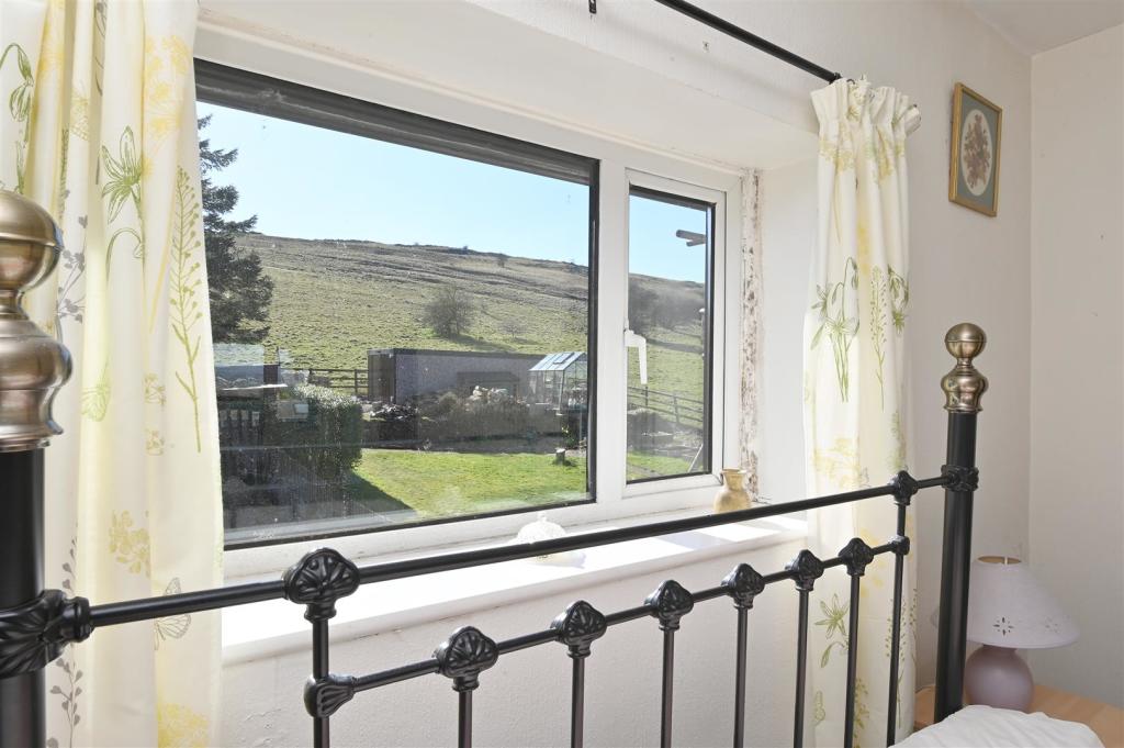
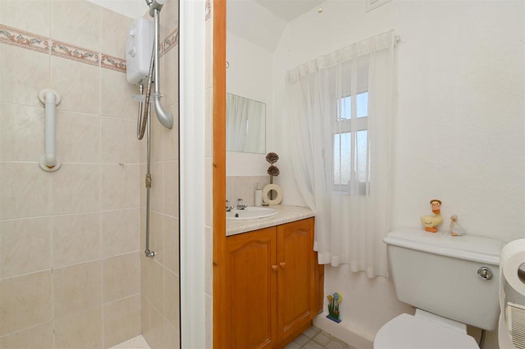
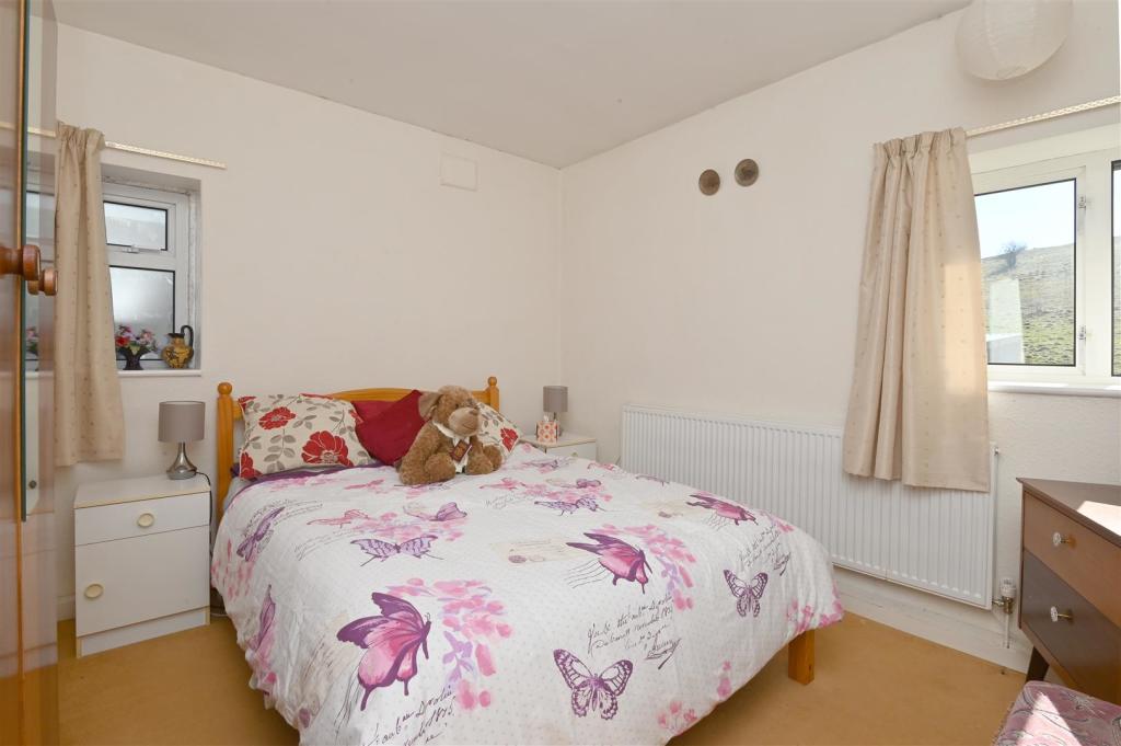
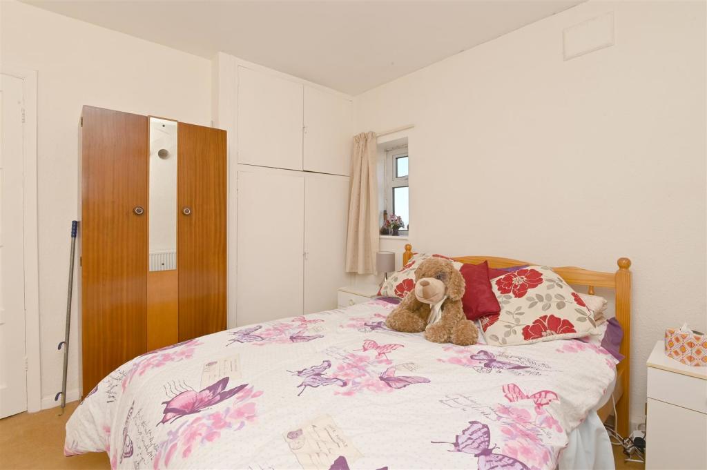
First floor: a dual aspect double bedroom with built in wardrobes, a shower room and two further bedrooms.
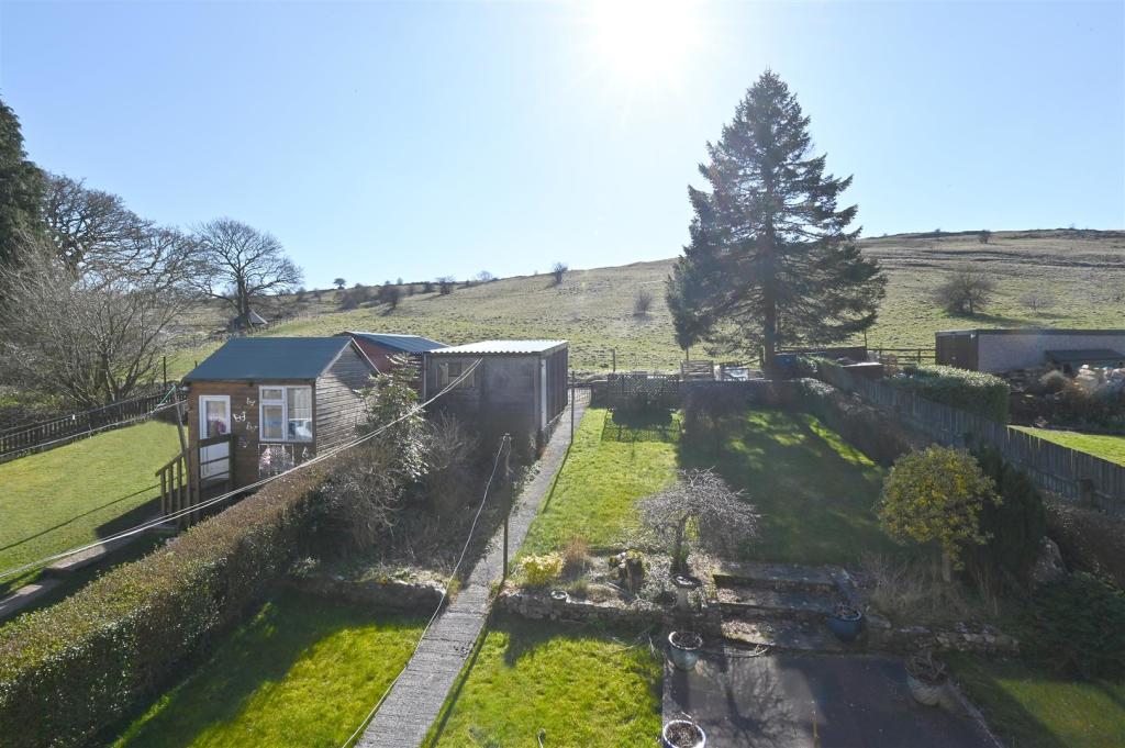
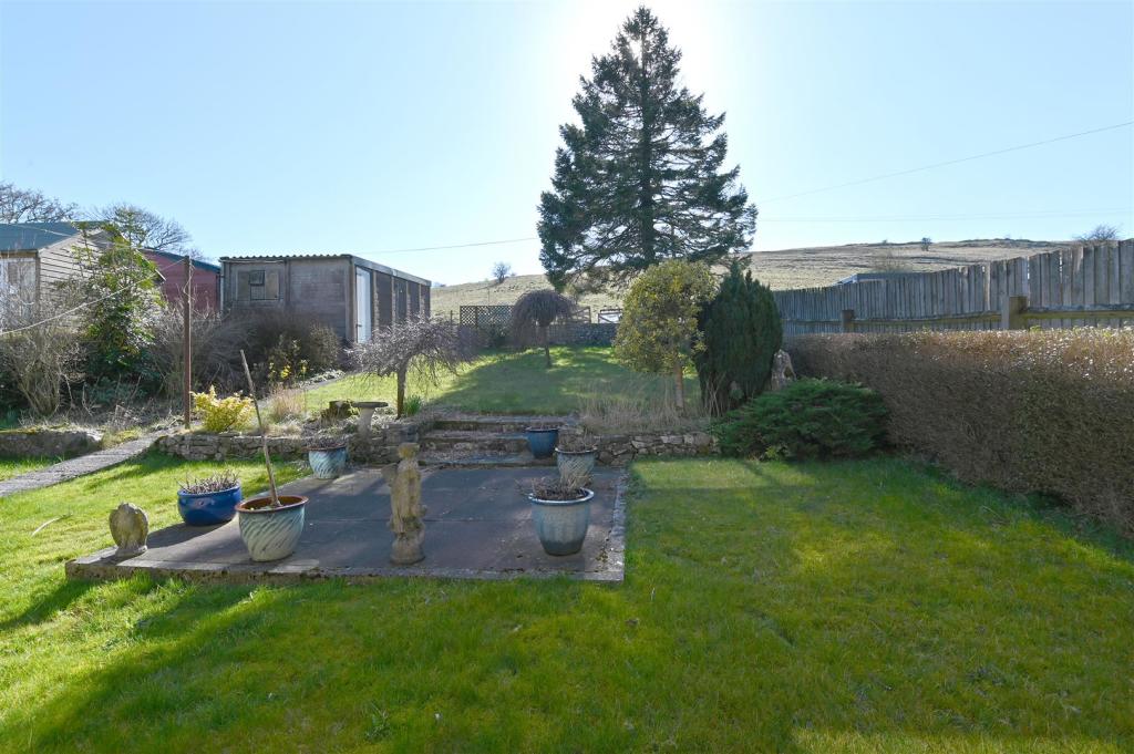
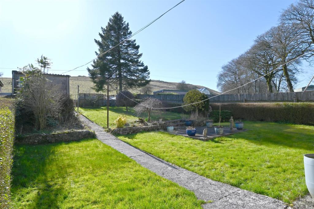
Exterior: to the front of the property is a garden mainly laid to lawn. To the rear is a single detached garage and off road parking. A pathway leads through a good sized garden with planted beds and borders and a seating terrace.
No Upward Chain.
Listed by
Bakewell
Saxton Mee
Reference: 122259227
EPC Rating & Upgrade Cost
Current rating: F
Potential rating: D
Inspection date: 24/03/2022
Expiry date: 23/03/2032
Current heating cost: £1,449/year
Potential heating cost: £977/year
Est. upgrade cost to C: £16,930
Recommendations
- Cavity wall insulation (£500 - £1,500)
- Floor insulation (solid floor) (£4,000 - £6,000)
- Low energy lighting for all fixed outlets (£30)
- Upgrade heating controls (£350 - £450)
- Solar water heating (£4,000 - £6,000)
- High performance external doors (£1,000)
- Solar photovoltaic panels, 2.5 kWp (£3,500 - £5,500)
Flood risk
Zone: 1
Risk: Low
Job (default Low)
Floorplans
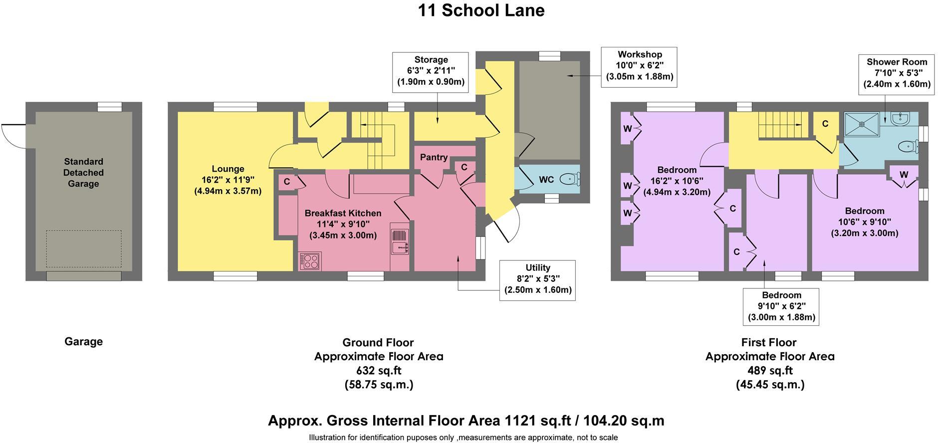
11 School Lane.jpg
EPC Graphs
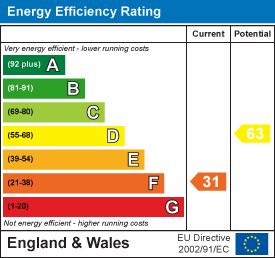
EE Rating
Price history
| Event | Date | Price | % change |
|---|---|---|---|
| Sold | 26/08/2022 (3 years ago) | £302,500 | — |
Source: HM Land Registry Price Paid Data. Crown copyright.
Sold Comparables
Same street and nearby sales within 0.25 miles (last 5 years). Data from Land Registry Price Paid.
| Address | Price | Date | Type |
|---|---|---|---|
| 2 HILLSIDE CROFT, TADDINGTON, BUXTON, DERBYSHIRE DALES, DERBYSHIRE, SK17 9TW | £300,000 | 31/03/2023 | Semi-detached |
| Same street ASHFIELD HOUSE SCHOOL LANE, TADDINGTON, BUXTON, DERBYSHIRE DALES, DERBYSHIRE, SK17 9TW | £678,000 | 30/09/2021 | Detached |
Street average: £678,000 (1 sale)
Area average: £300,000 (1 sale)
Capital growth trend
Land Registry outcode average: last 12 months vs 5y and 10y ago (from sold prices).
House Price Index (HM Land Registry — official index, not sold-price averages): Derbyshire Dales. Series: Semi-detached. As of March 2026.
Rental Range
Estimated market rent for Derbyshire Dales. Low = conservative, Realistic = average, Optimistic = best case.
Based on Local Authority from postcode lookup → Derbyshire Dales.
LHA (30th percentile) floor for Peaks & Dales: £693/mo (Apr 2025 – Mar 2026)
Location
Nearby
Nearest stations, universities and amenities (distance from property).
| Type | Name | Distance |
|---|---|---|
| Bus stop | Main Road | 0.0 miles |
| Shop | The Tech Division | 2.6 miles |
| Shop | NT Gibbs | 2.9 miles |
| Hospital | Buxton Hospital & Corbar Birth Centre | 4.8 miles |
| Train station | Buxton | 5.2 miles |
| University | University of Derby, Buxton | 5.3 miles |
| Train station | Buxton Miniature Railway | 5.3 miles |
| Hospital | Corbar hall | 5.5 miles |
| University | University of Derby | 11.2 miles |
Street-level crime
| Category | Count |
|---|---|
| Violence and sexual offences | 1 |
| Total incidents | 1 |
Within 1 mile during Apr 2026. Source: data.police.uk (England & Wales).
Schools nearby
Nearest open schools with Ofsted ratings (England). Closed schools are not shown. Data from Get Information about Schools and Ofsted.
| Name | Type | Distance | Ofsted |
|---|---|---|---|
| Taddington and Priestcliffe School | Primary | 0.1 miles | Good — 10 Sep 2024 |
| Flagg Nursery School | Nursery | 1.8 miles | Outstanding — 8 Jul 2015 |
| Litton CofE Primary School | Primary | 2.9 miles | Outstanding — 28 May 2012 |
| Monyash CofE Primary School | Primary | 3.0 miles | Good — 22 Mar 2017 |
| Bishop Pursglove CofE (A) Primary School | Primary | 3.1 miles | Good — 15 Jun 2015 |
Rental Comparables
Loading rental comparables for this postcode. Refresh in a few minutes.
Rent-driven metrics
Based on Area rent estimate.
- Rent ratio — Monthly rent ÷ purchase price (1% rule). 1%+ = strong, 0.8–1% = okay, <0.8% = weak for cashflow.
- Max investor price — Rent ÷ 0.8%; the price at which rent would be 0.8% of price (Stoke-style target).
- Target investor price — Rent ÷ 1%; the price at which rent would be 1% of price (strong cashflow band).
- Gross yield — Annual rent as % of purchase price (no costs).