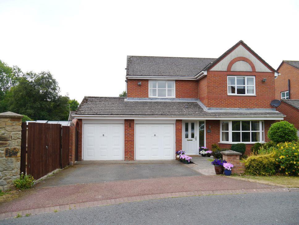
1 NORTH MASON LODGE
NEWCASTLE UPON TYNE, DINNINGTON, TYNE AND WEAR NE13 7LH
Property details
Floor area
157 m²
EPC rating
C
Year built
England and Wales: 1991-1995
Last sold
£385,000 Jan 2019
Price per m²
£2,452/m²
Local average
£403,998 (-4.7%)
Deprivation
Decile 6 (17,421 of 33,755)
Street crime
5 incidents within 1 mile (Apr 2026)
Key features
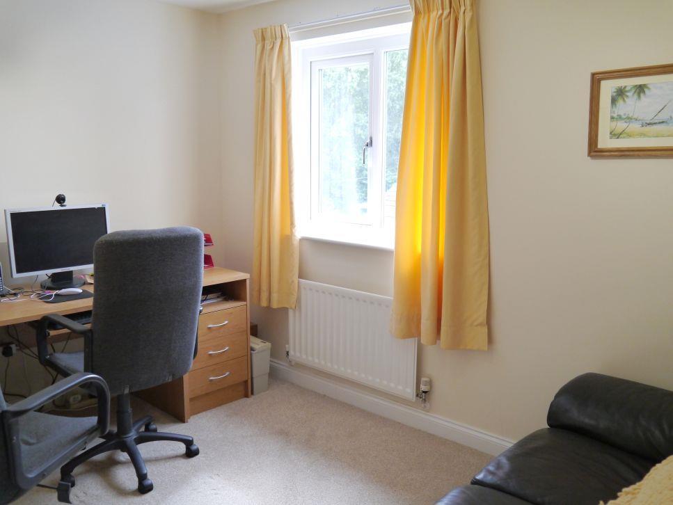
- 4 Bed Detached House
- Superbly Extended Family Accommodation
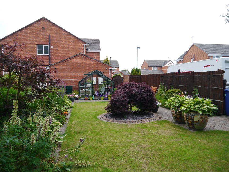
- Large Plot with Lovely Garden
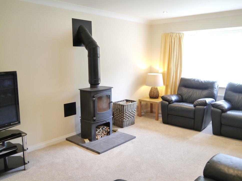
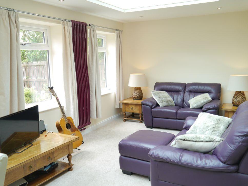
- Lounge with Wood Burning Stove
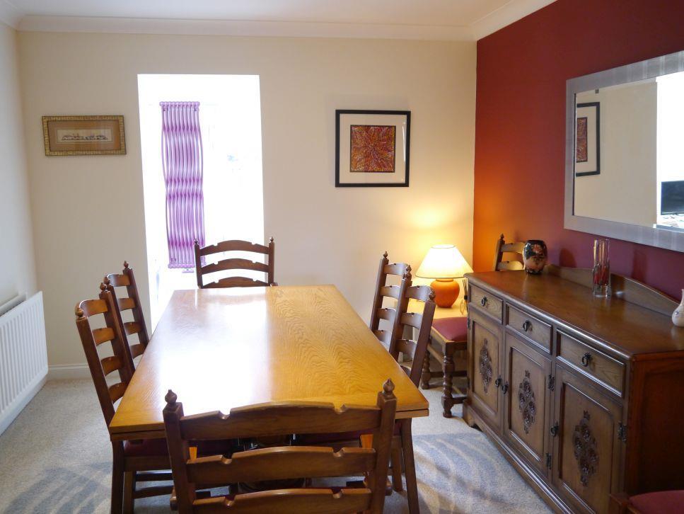
- Separate Dining Room
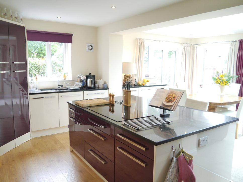
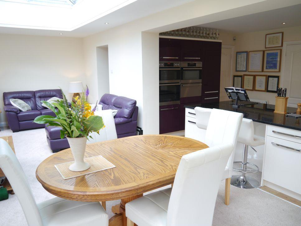
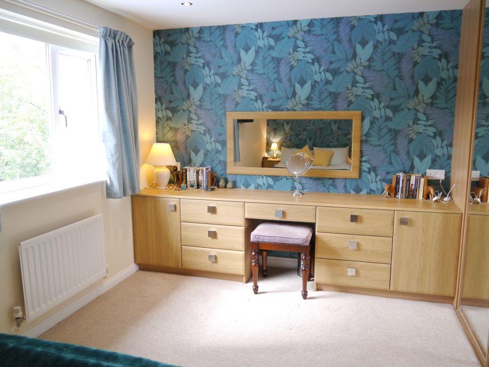
- Refurbished Breakfasting Kitchen
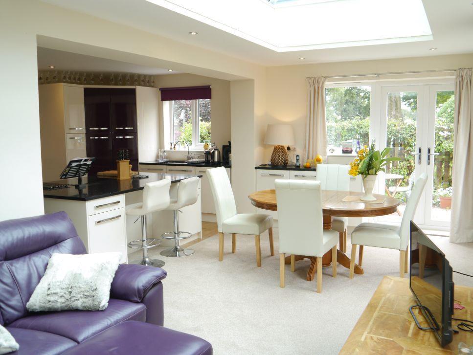
- 25' Family Room
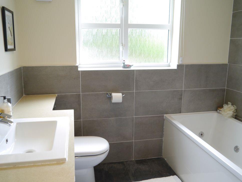
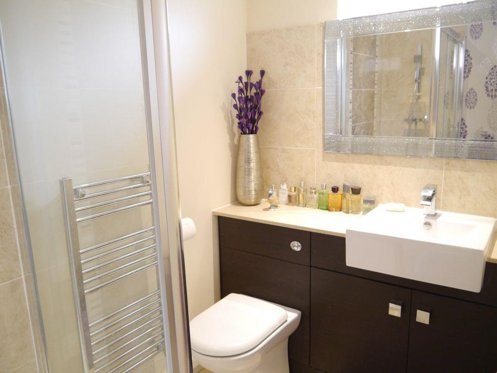
- En Suite & Family Bathroom
- Additional Hardstanding
- Fabulous Family House
Additional details
- Parking
- Yes
- Garden
- Yes
Description
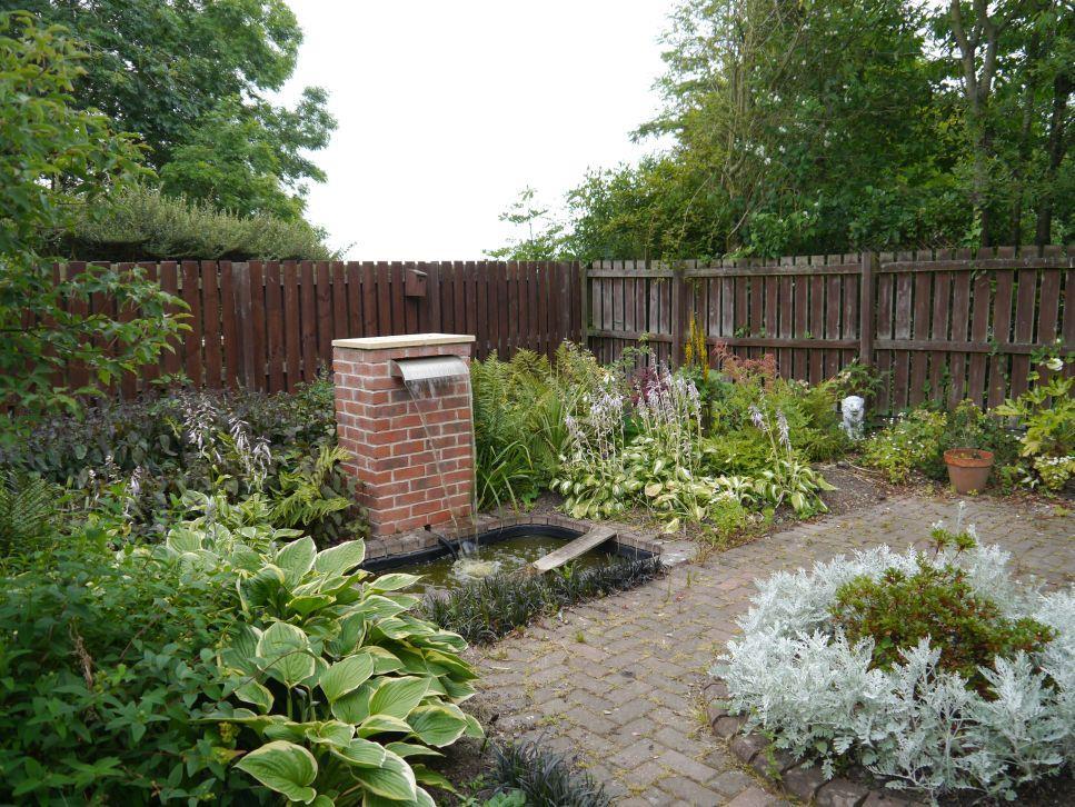
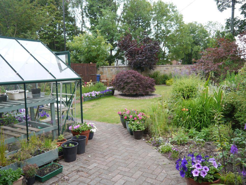
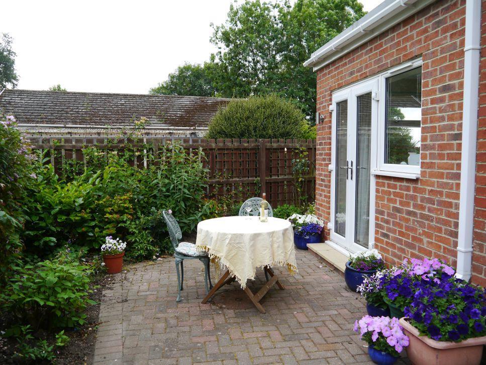
Externally, the Front Garden is lawned, with shrubs, plants and driveway to the garage. Double gates open to a hardstanding, ideal for a caravan and there is a well tendegarden with lawn, patio, green house and shed. The Rear Garden has a block paved patio, contemporary water feature and collection plants, shrubs and flowers.
Entrance Hall -
Reception Hall -
Cloakroom/Wc -
Lounge - 5.99m x 3.56m (19'8 x 11'8) -
Dining Room - 4.17m x 3.05m (13'8 x 10') -
Family Room - 7.67m x 3.15m (25'2 x 10'4) -
Breakfasting Kitchen - 5.03m x 2.90m (16'6 x 9'6) -
Utility Room - 2.49m x 1.57m (8'2 x 5'2) -
First Floor Landing -
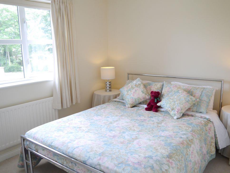
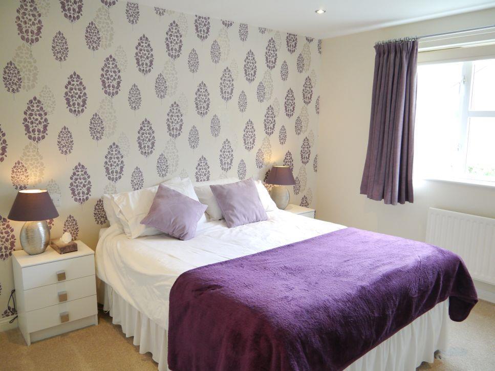
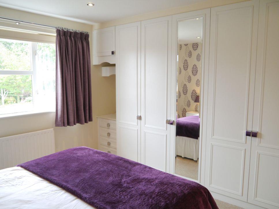
Bedroom 1 - 3.58m (+dr recess) x 3.58m (max) (11'9 (+dr recess -
En Suite Shower Room/Wc - 2.59m x 1.52m (+dr recess) (8'6 x 5' (+dr recess)) -
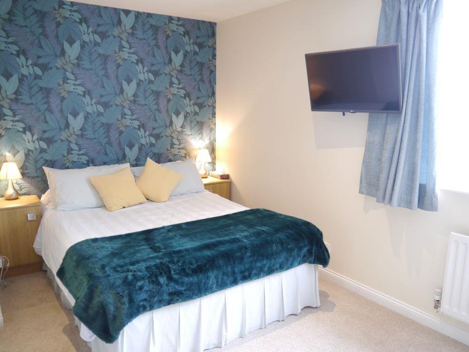
Bedroom 2 - 4.72m x 3.30m (max) (15'6 x 10'10 (max)) -
Bedroom 3 - 3.56m x 2.64m (11'8 x 8'8) -
Bedroom 4 - 3.56m x 2.44m (11'8 x 8') -
Bathroom/Wc - 2.59m x 2.44m (8'6 x 8' ) -
Double Garage -
Listed by
Ponteland
Goodfellows (estate agents)
Reference: 74395295
EPC Rating & Upgrade Cost
Current rating: C
Potential rating: B
Inspection date: 13/07/2018
Expiry date: 12/07/2028
Current heating cost: £826/year
Potential heating cost: £770/year
Est. upgrade cost to C: £11,500
Recommendations
- Floor insulation (solid floor) (£4,000 - £6,000)
- Solar photovoltaic panels, 2.5 kWp (£5,000 - £8,000)
Flood risk
Zone: 1
Risk: Low
Job (default Low)
Floorplans
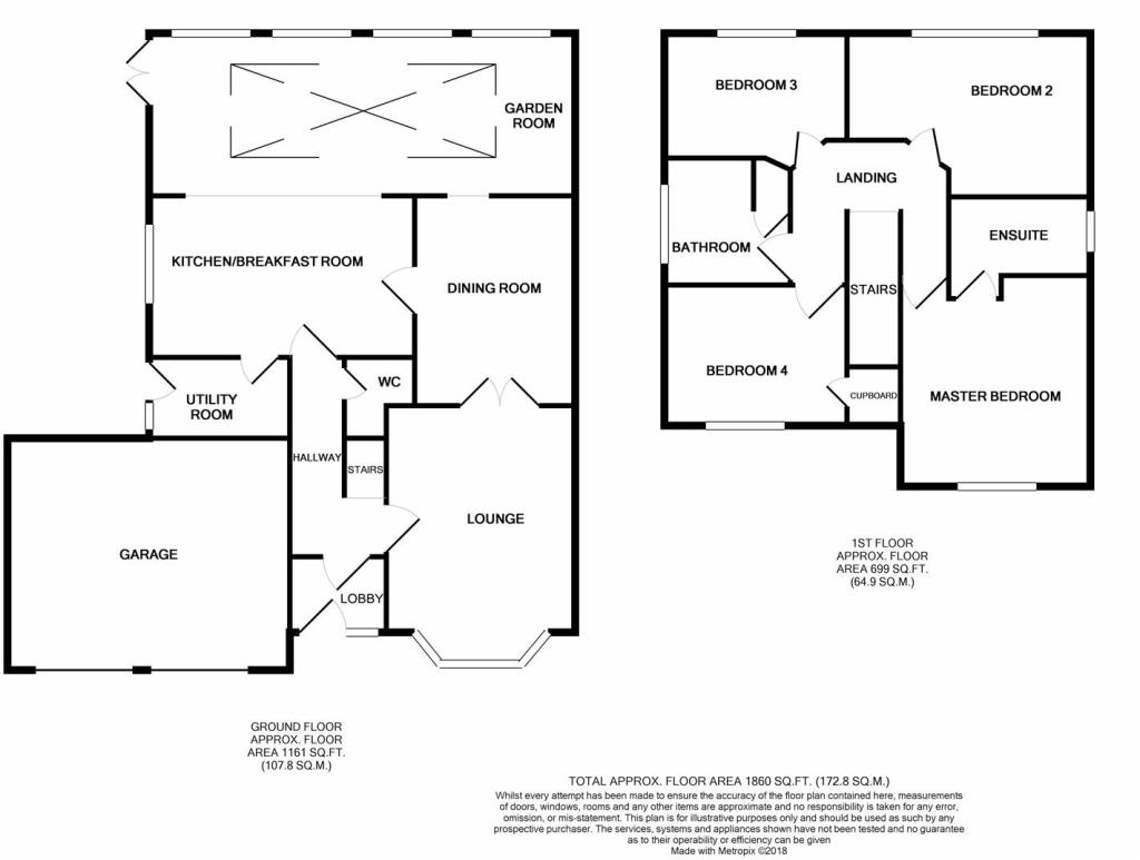
2D FP 1 North Mason Lodge NE13 7LH.jpg
EPC Graphs
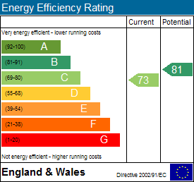
EE Rating
Price history
169% since 1996
| Event | Date | Price | % change |
|---|---|---|---|
| Sold | 30/01/2019 (7 years ago) | £385,000 | +28.3% |
| Sold | 01/10/2014 (11 years ago) | £300,000 | +109.8% |
| Sold | 12/12/1996 (29 years ago) | £143,000 | — |
Source: HM Land Registry Price Paid Data. Crown copyright.
Sold Comparables
Same street and nearby sales within 0.25 miles (last 5 years). Data from Land Registry Price Paid.
| Address | Price | Date | Type |
|---|---|---|---|
| 5 BOWMONT CHASE, DINNINGTON, NEWCASTLE UPON TYNE, TYNE AND WEAR, NE13 7FG | £265,000 | 12/10/2023 | Detached |
| 8 THE WINDING, DINNINGTON, NEWCASTLE UPON TYNE, TYNE AND WEAR, NE13 7LR | £215,000 | 20/06/2023 | Detached |
| 4 CHURCH CLOSE, DINNINGTON, NEWCASTLE UPON TYNE, TYNE AND WEAR, NE13 7LJ | £305,000 | 26/05/2022 | Detached |
| 3 REDE PLACE, DINNINGTON, NEWCASTLE UPON TYNE, TYNE AND WEAR, NE13 7FB | £340,000 | 04/05/2022 | Detached |
| 4 OAKFIELD GRANGE, DINNINGTON, NEWCASTLE UPON TYNE, TYNE AND WEAR, NE13 7JH | £510,000 | 15/11/2021 | Detached |
| 2 DUNSLEY GARDENS, DINNINGTON, NEWCASTLE UPON TYNE, TYNE AND WEAR, NE13 7LL | £218,000 | 30/09/2021 | Detached |
Area average: £308,833 (6 sales)
Capital growth trend
Land Registry outcode average: last 12 months vs 5y and 10y ago (from sold prices).
House Price Index (HM Land Registry — official index, not sold-price averages): Newcastle upon Tyne. Series: Detached. As of March 2026.
Rental Range
Estimated market rent for Newcastle upon Tyne. Low = conservative, Realistic = average, Optimistic = best case.
Based on Local Authority from postcode lookup → Newcastle upon Tyne.
LHA (30th percentile) floor for Tyneside: £922/mo (Apr 2025 – Mar 2026)
Location
Nearby
Nearest stations, universities and amenities (distance from property).
| Type | Name | Distance |
|---|---|---|
| Shop | Rehan Convenience | 0.1 miles |
| Bus stop | Dinnington | 0.1 miles |
| Shop | A Cut Above | 1.6 miles |
| Train station | Airport | 2.0 miles |
| Train station | Callerton Parkway | 2.2 miles |
| Hospital | St Nicholas Hospital | 3.8 miles |
| Hospital | Holmeside and Parkway Medical Groups | 4.4 miles |
| University | Northumbria University Coach Lane Campus | 5.4 miles |
| University | Campus for Ageing and Vitality | 5.5 miles |
Street-level crime
| Category | Count |
|---|---|
| Anti-social behaviour | 2 |
| Violence and sexual offences | 2 |
| Other crime | 1 |
| Total incidents | 5 |
Within 1 mile during Apr 2026. Source: data.police.uk (England & Wales).
Schools nearby
Nearest open schools with Ofsted ratings (England). Closed schools are not shown. Data from Get Information about Schools and Ofsted.
| Name | Type | Distance | Ofsted |
|---|---|---|---|
| Dinnington First School | Primary | 0.2 miles | Good — 18 Jan 2022 |
| Havannah First School | Primary | 1.6 miles | Good — 29 Jan 2014 |
| Brenkley School | Other | 1.9 miles | Good — 20 Jan 2022 |
| Hazlewood Community Primary School | Primary | 2.0 miles | Good — 28 Feb 2013 |
| Brunton First School | Primary | 2.2 miles | Good — 20 Nov 2015 |
Rental Comparables
Rental comparables are temporarily unavailable while listing-site fetches are paused. Try again later.
Rent-driven metrics
Based on Area rent estimate.
- Rent ratio — Monthly rent ÷ purchase price (1% rule). 1%+ = strong, 0.8–1% = okay, <0.8% = weak for cashflow.
- Max investor price — Rent ÷ 0.8%; the price at which rent would be 0.8% of price (Stoke-style target).
- Target investor price — Rent ÷ 1%; the price at which rent would be 1% of price (strong cashflow band).
- Gross yield — Annual rent as % of purchase price (no costs).