9
WOODFORD HOUSE, 4, THURSTAN STREET, LONDON, GREATER LONDON SW6 2GB
£2,600 pcm
Property details
Council tax band
E
Street crime
1021 incidents within 1 mile (Apr 2026)
Key features
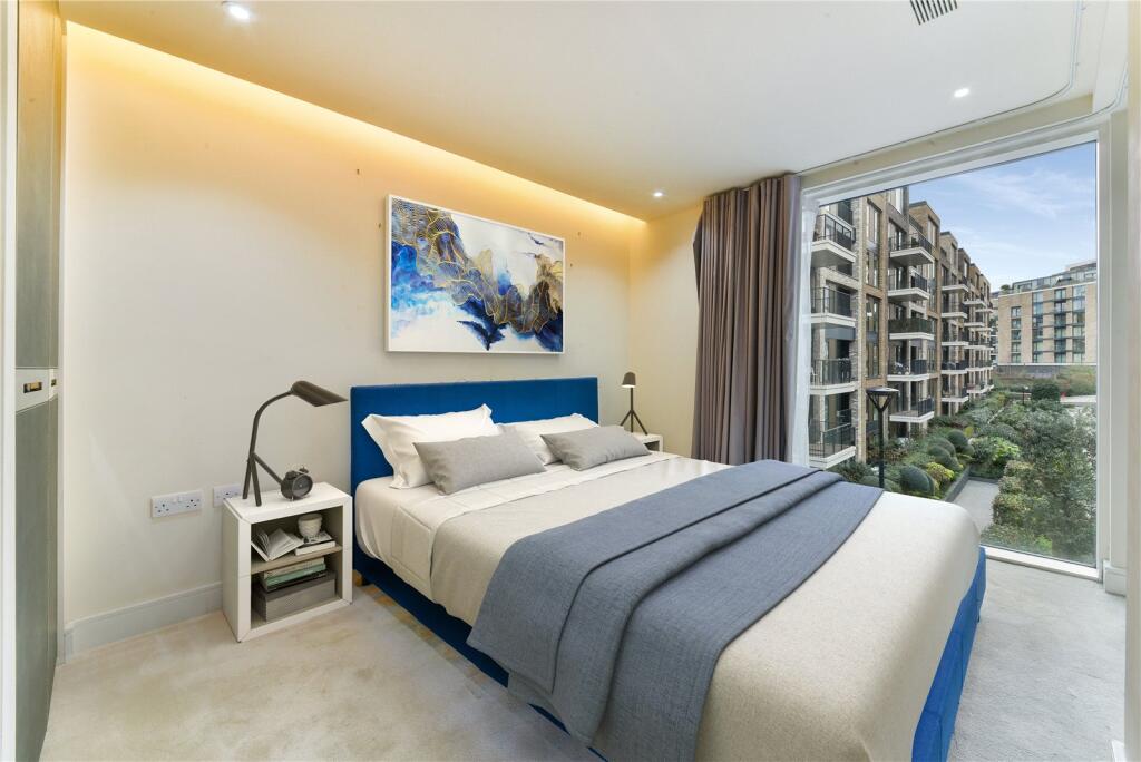
- Double Bedroom
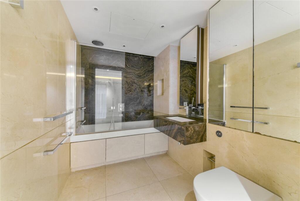
- Bathroom
- Reception Room
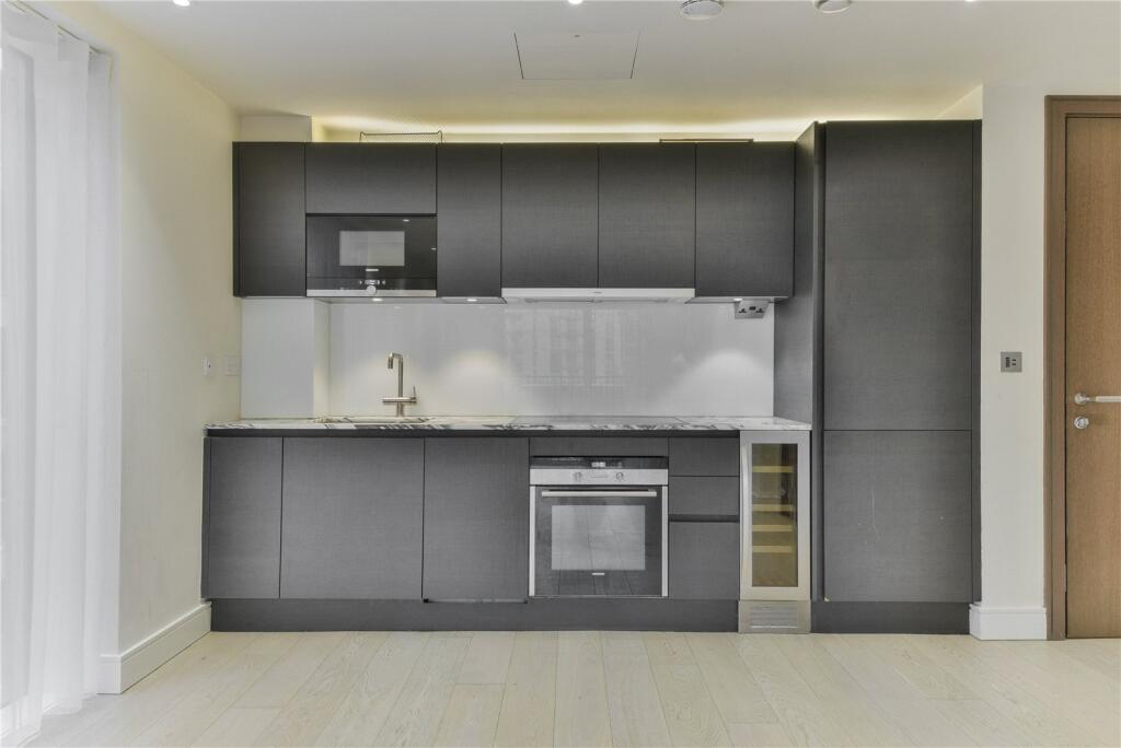
- Kitchen with dining area
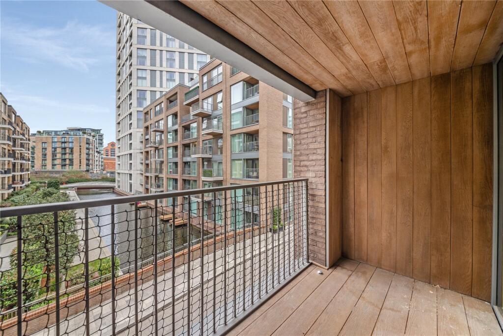
- BALCONY
- Swimming Pool , Gym and Spa
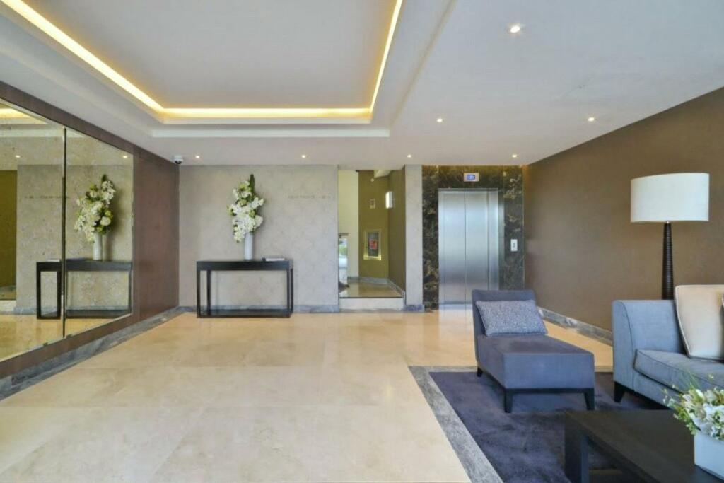
- 24 hour Concierge
- Lift
- 445 sq ft.
Description
This well designed apartment is situated on the second floor (with lift ) of this modern block .
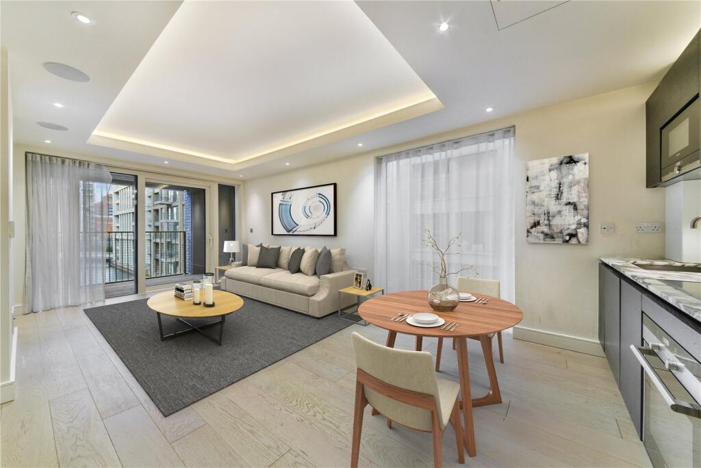
The apartment has been finished to a high specification and comprises open plan kitchen, reception room with access to a BALCONY, double bedroom with fitted wardrobes and bathroom. Features air cooling throughout.
The residents have the use of the superb onsite heath facilities including swimming pool, gym and spa complete with sauna and steam room.
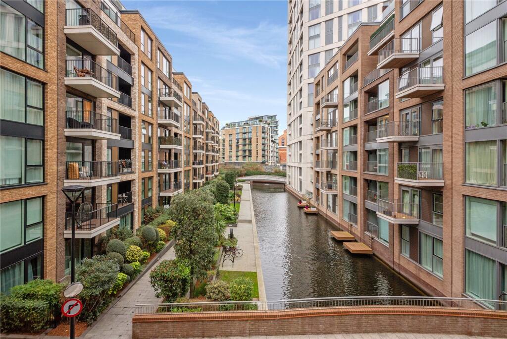
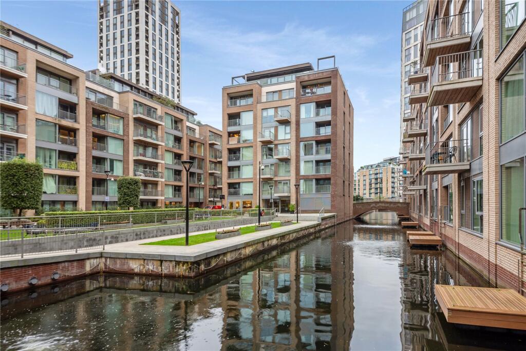
This riverside development is located a short walk from Imperial Wharf overground Station and a few minutes walk from the King's Road and Fulham Broadway underground station.
Available 21 March
FURNISHED. 445 sq ft.
* photos of CGI furniture
Listed by
Knightsbridge
Kay & Co
Reference: 158071820
EPC Rating & Upgrade Cost
Fetching EPC data… Refresh this page in a moment.
Flood risk
Zone: 1
Risk: Low
Job (default Low)
Floorplans
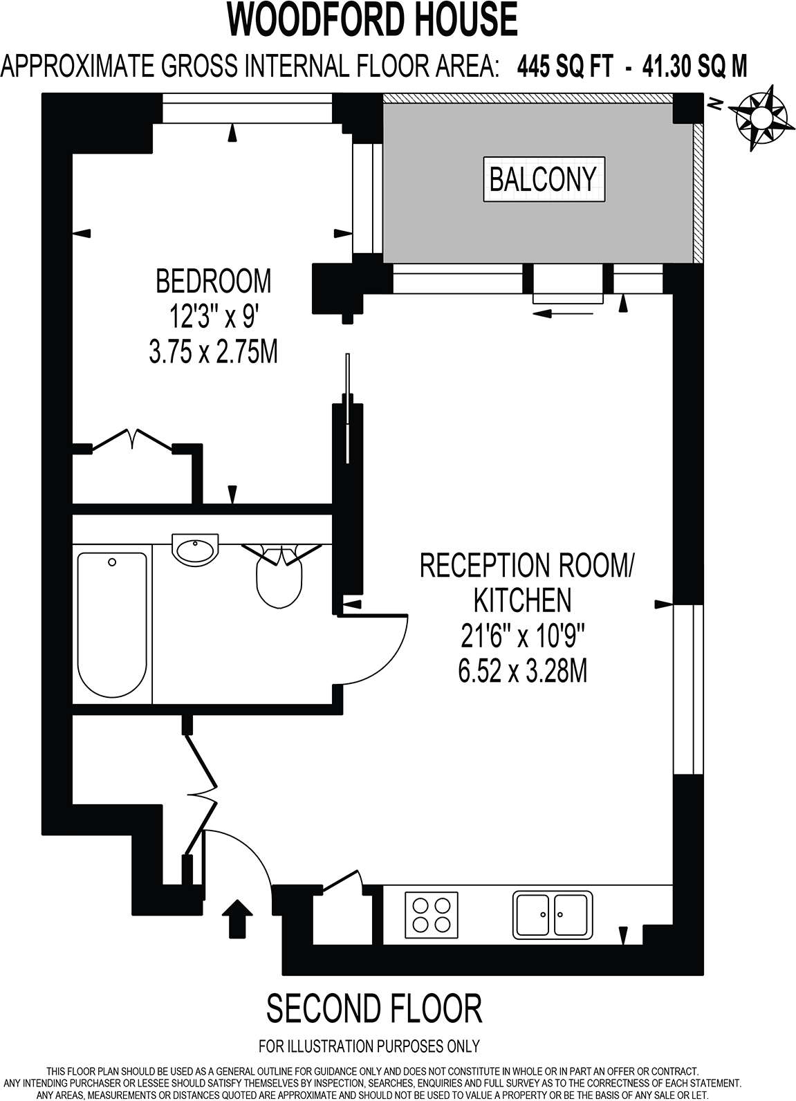
Floorplan
EPC Graphs
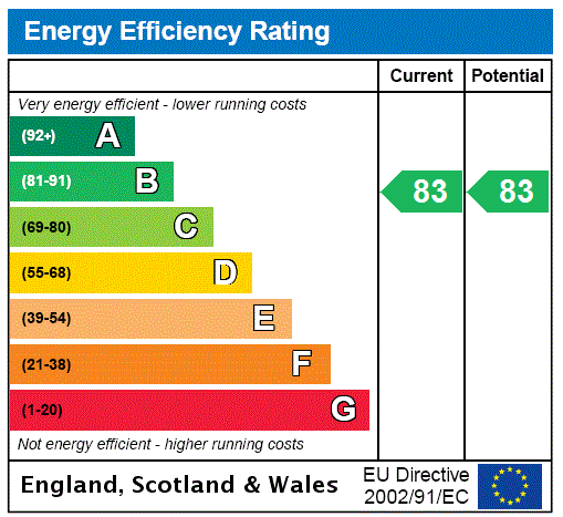
EPC Rating Graph
Rental Range
Estimated market rent for Hammersmith and Fulham. Low = conservative, Realistic = average, Optimistic = best case.
Based on Local Authority from postcode lookup → Hammersmith and Fulham.
LHA (30th percentile) floor for Bedford: £648/mo (Apr 2025 – Mar 2026)
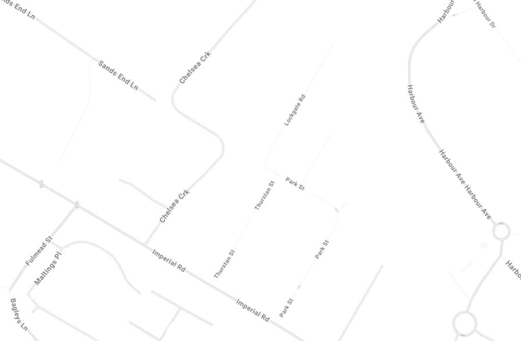
Location
Nearby
Nearest stations, universities and amenities (distance from property).
| Type | Name | Distance |
|---|---|---|
| Bus stop | Imperial Wharf Station / Chelsea Harbour | 0.1 miles |
| Bus stop | Imperial Road / Chelsea Harbour | 0.1 miles |
| Shop | Welchome | 0.1 miles |
| Train station | Imperial Wharf | 0.1 miles |
| Shop | Tesco Express | 0.1 miles |
| University | BIMM Institute London | 0.6 miles |
| Train station | Fulham Broadway | 0.6 miles |
| Hospital | Bridge Lane Health Centre | 0.8 miles |
| University | National Heart and Lung Institute | 1.0 miles |
| Hospital | Tunica Diagnostics | 3.6 miles |
Street-level crime
| Category | Count |
|---|---|
| Anti-social behaviour | 228 |
| Violence and sexual offences | 225 |
| Shoplifting | 102 |
| Vehicle crime | 97 |
| Other theft | 81 |
| Burglary | 66 |
| Public order | 58 |
| Criminal damage and arson | 38 |
| Drugs | 36 |
| Bicycle theft | 31 |
| Theft from the person | 24 |
| Robbery | 18 |
| Other crime | 11 |
| Possession of weapons | 6 |
| Total incidents | 1021 |
Within 1 mile during Apr 2026. Source: data.police.uk (England & Wales).
Schools nearby
Nearest open schools with Ofsted ratings (England). Closed schools are not shown. Data from Get Information about Schools and Ofsted.
| Name | Type | Distance | Ofsted |
|---|---|---|---|
| Chelsea Academy | Secondary | 0.2 miles | Good — 20 Nov 2023 |
| Langford Primary School | Primary | 0.2 miles | Outstanding — 17 Jan 2019 |
| L'Ecole des Petits School | Other | 0.3 miles | Outstanding — 12 May 2020 |
| Somerset Nursery School and Children's Centre | Nursery | 0.5 miles | Outstanding — 17 Oct 2014 |
| Thomas's Battersea | Other | 0.5 miles | — (No rating) |
Rental Comparables
Loading rental comparables for this postcode. Refresh in a few minutes.