Lily Street
Newcastle-under-Lyme, Staffordshire, ST5, ST5 0BE
£745 pcm
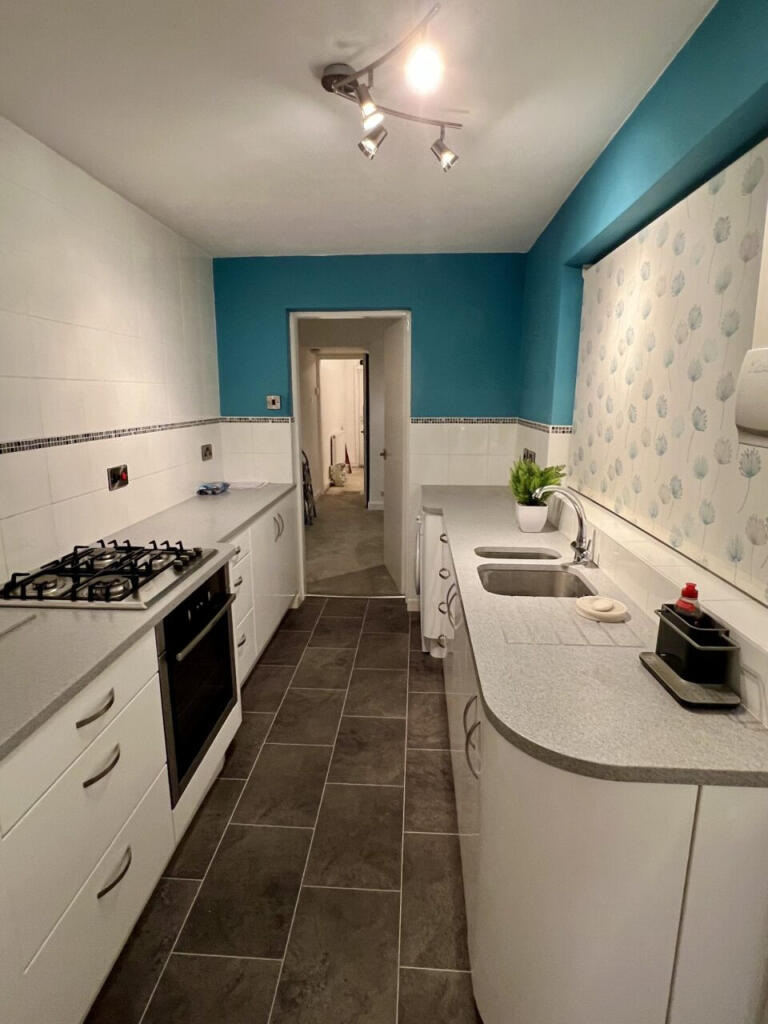
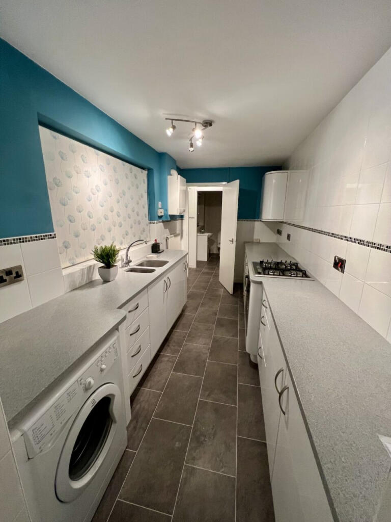
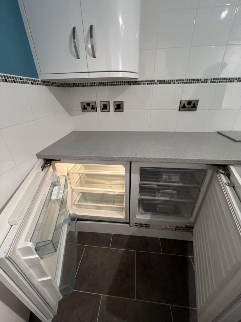
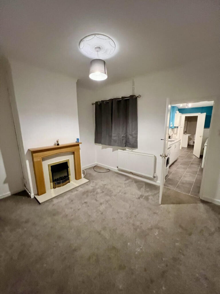
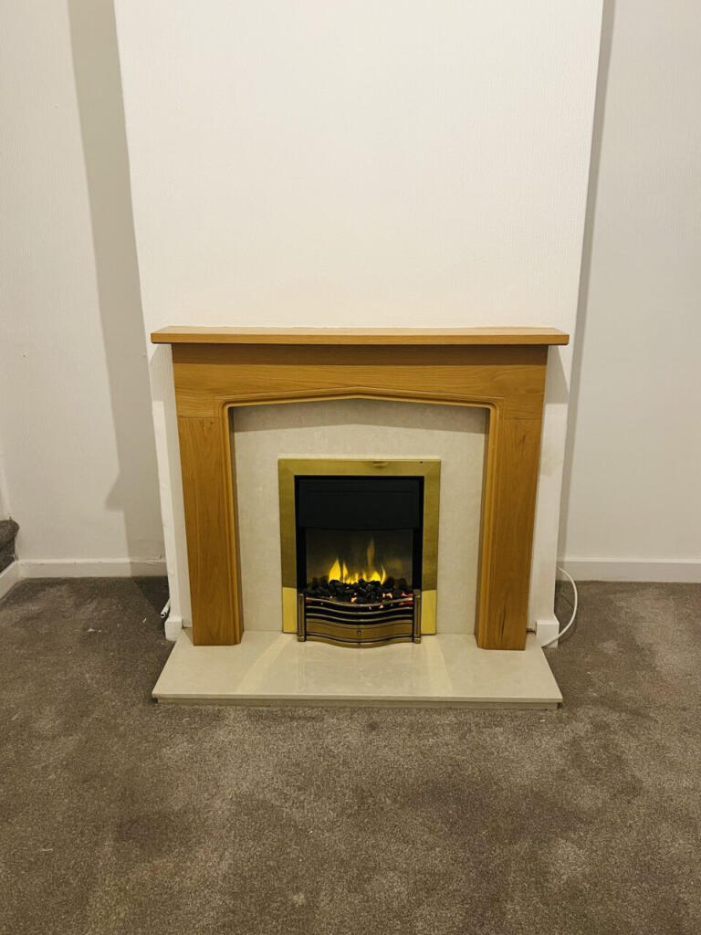
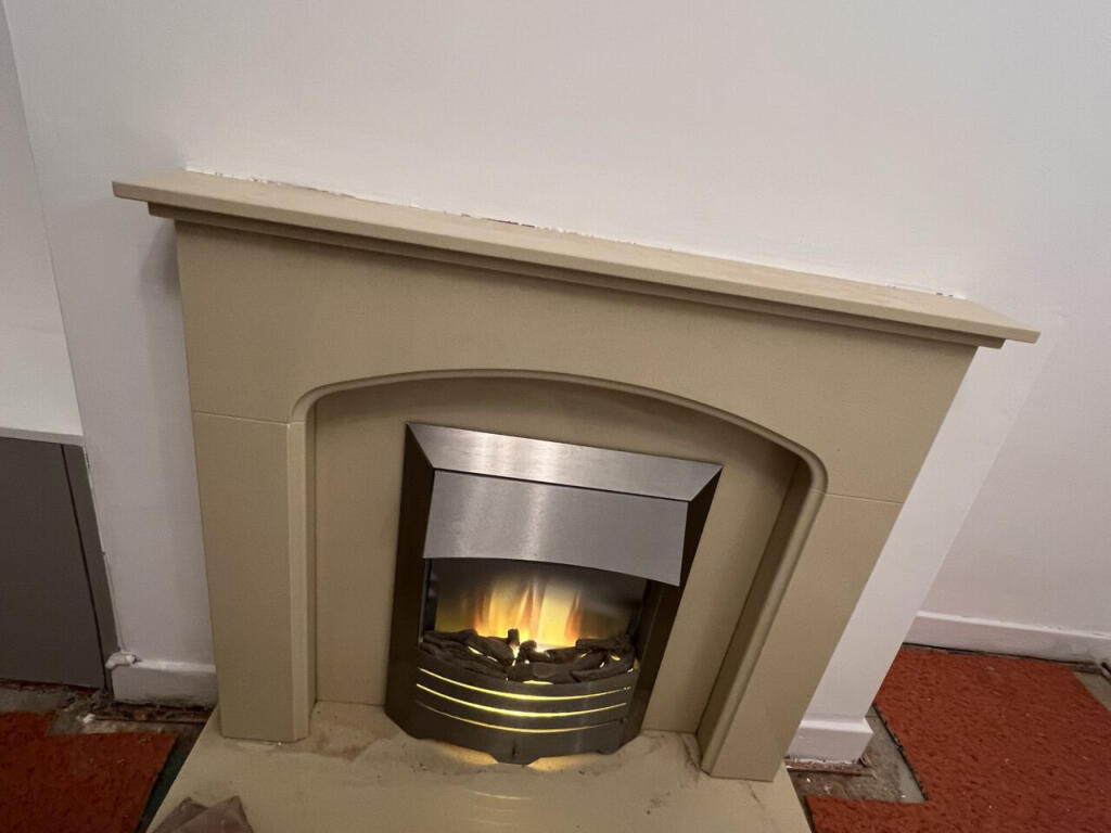
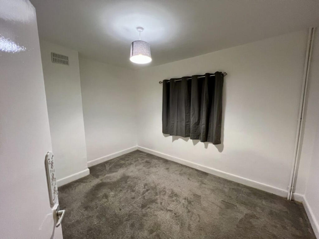
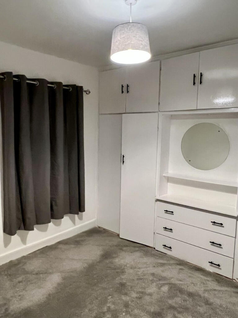
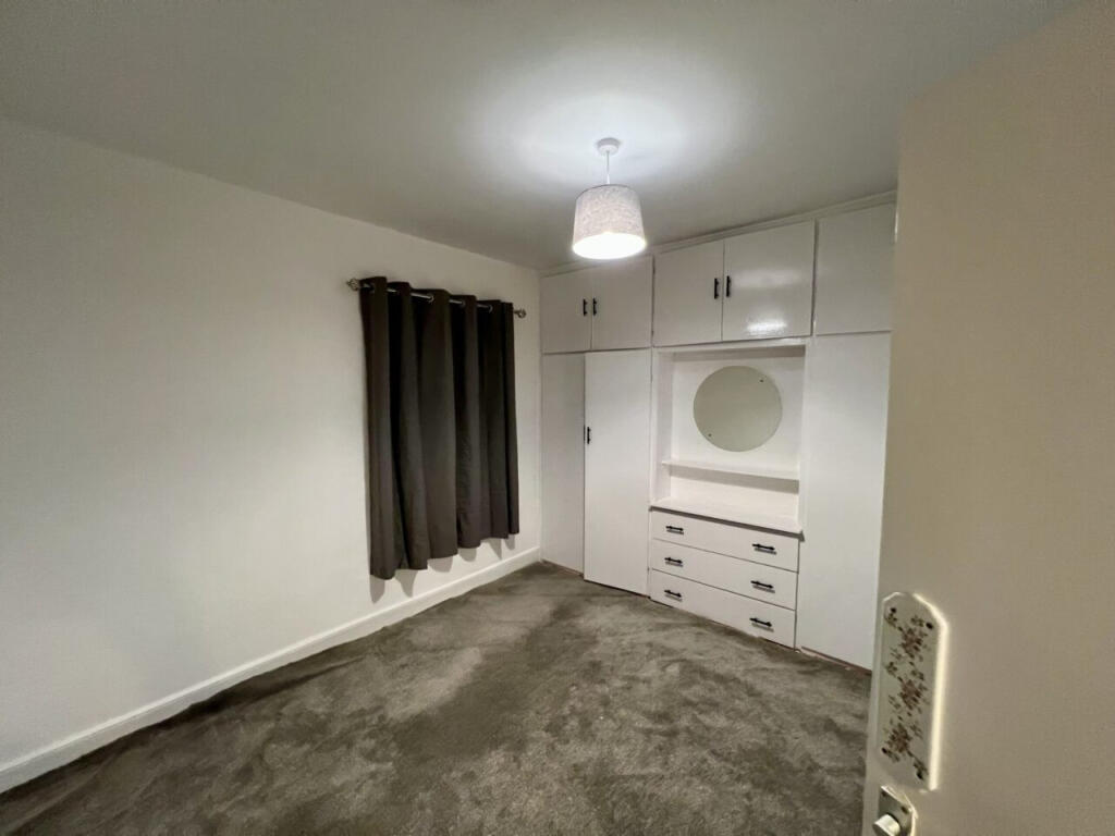
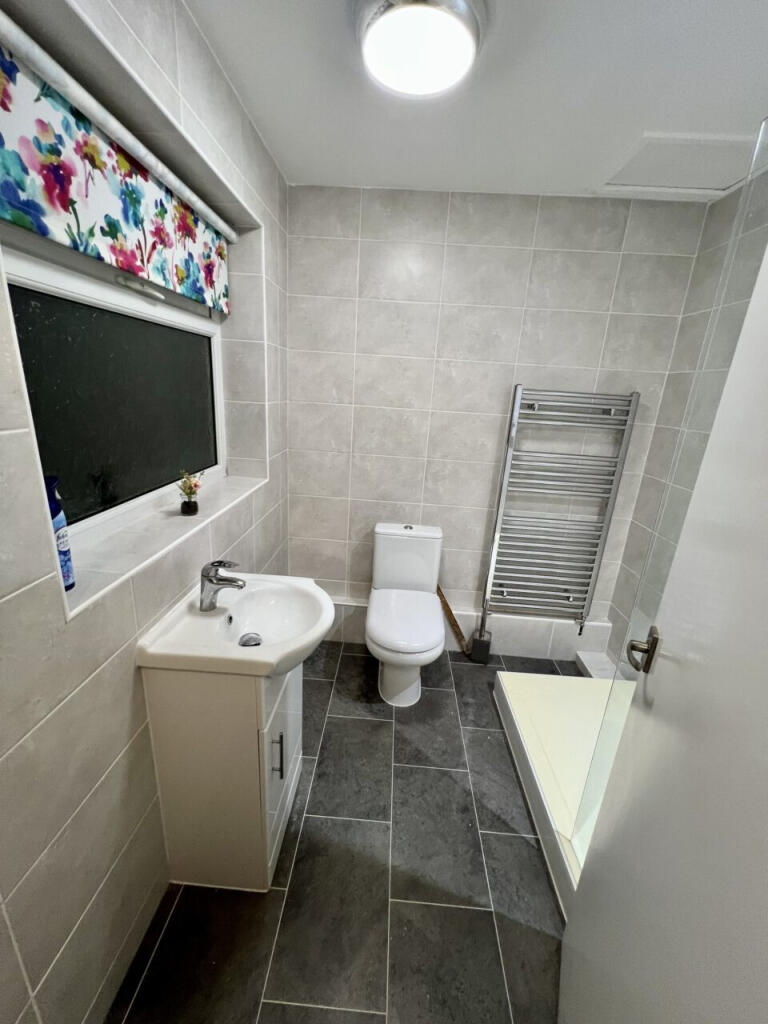
Photo 1 Photo 2 Photo 3 Photo 4 Photo 5 Photo 6 Photo 7 Photo 8 Photo 9 Photo 10
/ 10
Property details
Council tax band
A
Deprivation
Decile 6 (17,214 of 33,755)
Street crime
220 incidents within 1 mile (Mar 2026)
Key features
- Modern fitted kitchen with appliances
- spacious and comfortable living throughout
- Well Presented Throughout
- Two Good Sized Bedrooms
Additional details
- Broadband
- ADSL copper wire
- Listed property
- No
- Restrictions
- No
- Required access
- No
- Rights of way
- No
- Flooded in last 5 years
- No
- Flood defences
- No
Description
The property comprises a spacious lounge, a modern fitted kitchen with appliances and space for dining, and a contemporary family bathroom with a shower over the bath.
Upstairs features two good-sized bedrooms, ideal for couples or a small family.
HOW TO ARRANGE A VIEWING: The quickest way to enquire about this property is to register your interest via the enquiry button on this website. We will send you an email a moment later with an online enquiry form for you to complete. You will then be contacted to arrange your viewing
Deposit: £859 or Deposit free option
Sorry, no students or "Rent to Rent" lets
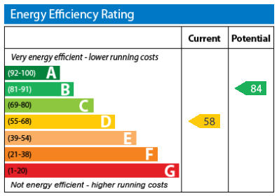
Energy efficiency rating: 58 – Band D
Council Tax Band: A
Reference: 009763
Please note, by submitting an enquiry regarding this property you agree that we may send your details to the landlord of this property so they may contact you in order to answer any questions, or arrange a convenient viewing time. STRICTLY NO AGENT OR SUB-LETTING CALLS.
Listed by
Bury St Edmunds
The Online Letting Agents Ltd
Reference: 88631496
EPC ratings on this postcode
We don't have a matched EPC for this property yet. Below are efficiency scores and details for other addresses on this postcode.
| Address | Current | Potential | Floor area | Age band | Type |
|---|---|---|---|---|---|
| 10, Lily Street, NEWCASTLE | 68 | 83 | 73 m² | England and Wales: 1900-1929 | Terraced |
| 11 LILY STREET, NEWCASTLE UNDER LYME, NEWCASTLE UNDER LYME | 63 | 85 | 86 m² | England and Wales: before 1900 | Terraced |
| 11, Lily Street, NEWCASTLE | 33 | 79 | 88 m² | England and Wales: 1900-1929 | Terraced |
| 12 Lily Street, NEWCASTLE | 68 | 85 | 72 m² | England and Wales: 1900-1929 | Terraced |
| 13 Lily Street, NEWCASTLE | 63 | 88 | 65 m² | England and Wales: 1900-1929 | Terraced |
| 15 Lily Street, NEWCASTLE | 58 | 84 | 71 m² | England and Wales: 1900-1929 | Terraced |
| 16, Lily Street, NEWCASTLE | 73 | 87 | 82 m² | England and Wales: 1950-1966 | Terraced |
| 16, Lily Street, NEWCASTLE | 76 | 90 | 64 m² | England and Wales: 1950-1966 | Terraced |
| 17 Lily Street, NEWCASTLE | 61 | 90 | 64 m² | England and Wales: 1900-1929 | Terraced |
| 18 LILY STREET, NEWCASTLE UNDER LYME, NEWCASTLE UNDER LYME | 66 | 85 | 67 m² | England and Wales: before 1900 | Terraced |
| 19, Lily Street, NEWCASTLE | 55 | 77 | 65 m² | England and Wales: before 1900 | Terraced |
| 20, Lily Street, NEWCASTLE | 70 | 89 | 71 m² | England and Wales: 1900-1929 | Terraced |
| 24 Lily Street, NEWCASTLE | 60 | 87 | 71 m² | England and Wales: 1900-1929 | Terraced |
| 24, Lily Street, NEWCASTLE | 54 | 86 | 71 m² | England and Wales: before 1900 | Terraced |
| 25, Lily Street, NEWCASTLE | 45 | 84 | 73 m² | England and Wales: before 1900 | Terraced |
Flood risk
Zone: 1
Risk: Low
Job (default Low)
EPC Graphs
EPC Graph
Rental Range
Estimated market rent for Newcastle-under-Lyme. Low = conservative, Realistic = average, Optimistic = best case.
Based on Local Authority from postcode lookup → Newcastle-under-Lyme.
LHA (30th percentile) floor for Staffordshire North: £479/mo (Apr 2025 – Mar 2026)
Location
Address
Lily Street
Nearby
Nearest stations, universities and amenities (distance from property).
| Type | Name | Distance |
|---|---|---|
| Bus stop | Marsh Avenue | 0.1 miles |
| Shop | The co-operative food | 0.1 miles |
| Bus stop | Morris Square | 0.1 miles |
| Shop | Unknown | 0.3 miles |
| Train station | Longport | 0.7 miles |
| Train station | Silverdale | 2.0 miles |
| Hospital | Haywood Hospital Walk-in Centre | 2.0 miles |
| Hospital | Royal Stoke University Hospital | 2.1 miles |
| University | Keele University | 3.1 miles |
| University | University of Buckingham Crewe Campus | 9.4 miles |
Street-level crime
| Category | Count |
|---|---|
| Violence and sexual offences | 71 |
| Anti-social behaviour | 70 |
| Public order | 18 |
| Vehicle crime | 14 |
| Criminal damage and arson | 10 |
| Burglary | 9 |
| Other theft | 8 |
| Shoplifting | 7 |
| Drugs | 4 |
| Bicycle theft | 3 |
| Other crime | 3 |
| Robbery | 2 |
| Possession of weapons | 1 |
| Total incidents | 220 |
Within 1 mile during Mar 2026. Source: data.police.uk (England & Wales).
Schools nearby
Nearest open schools with Ofsted ratings (England). Closed schools are not shown. Data from Get Information about Schools and Ofsted.
| Name | Type | Distance | Ofsted |
|---|---|---|---|
| Ellison Primary Academy | Primary | 0.1 miles | Good — 14 Sep 2023 |
| Cedars - Newcastle, Moorlands and Darwin Bases | Other | 0.1 miles | Good — 26 Jun 2015 |
| Oaklands Nursery School | Nursery | 0.2 miles | Outstanding — 15 Feb 2013 |
| St Margaret's CofE (VC) Junior School | Primary | 0.3 miles | Good — 1 May 2014 |
| Kaleidoscope School | Other | 0.3 miles | Good — 10 Dec 2023 |
Rental Comparables
Residential lets from OpenRent and Rightmove for the area (same bedroom count). Use to validate rent estimates. Student lets are excluded.
Average rent: £825/mo (45 listings)
Enter House Number
Enter the house number to help us retrieve more accurate pricing history and property data.
Please log in to submit or correct the house number for this listing.
Log in to continue