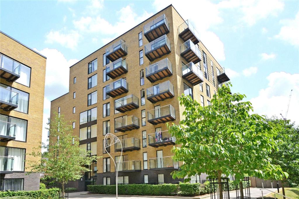
FLAT 408
HESTER HOUSE, 72 - 78, CONINGTON ROAD, LONDON, GREATER LONDON SE13 7FL
£975 pcm
Property details
Floor area
30 m²
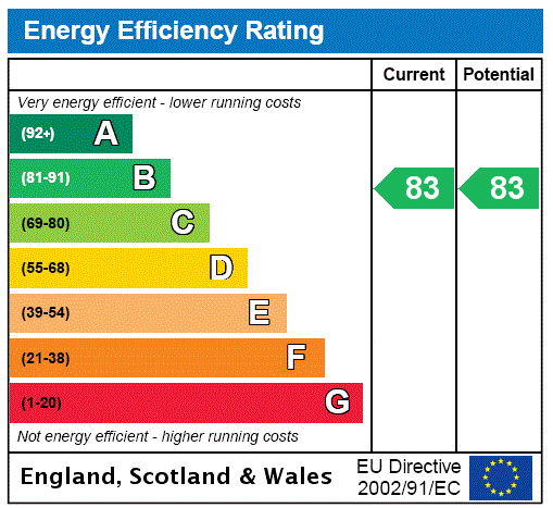
EPC rating
C
Year built
England and Wales: 2007-2011
Street crime
1006 incidents within 1 mile (Apr 2026)
Key features
- Studio apartment
- Great local amenities
- 24 hr concierge
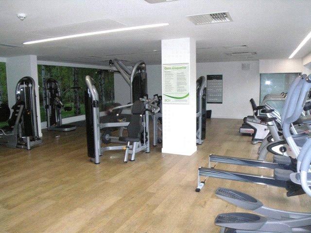
- Resident gym
- Close to Mainline & DLR Stations
- Approx 323 sq ft (30 sq m)
- Part furnished
- EPC: B
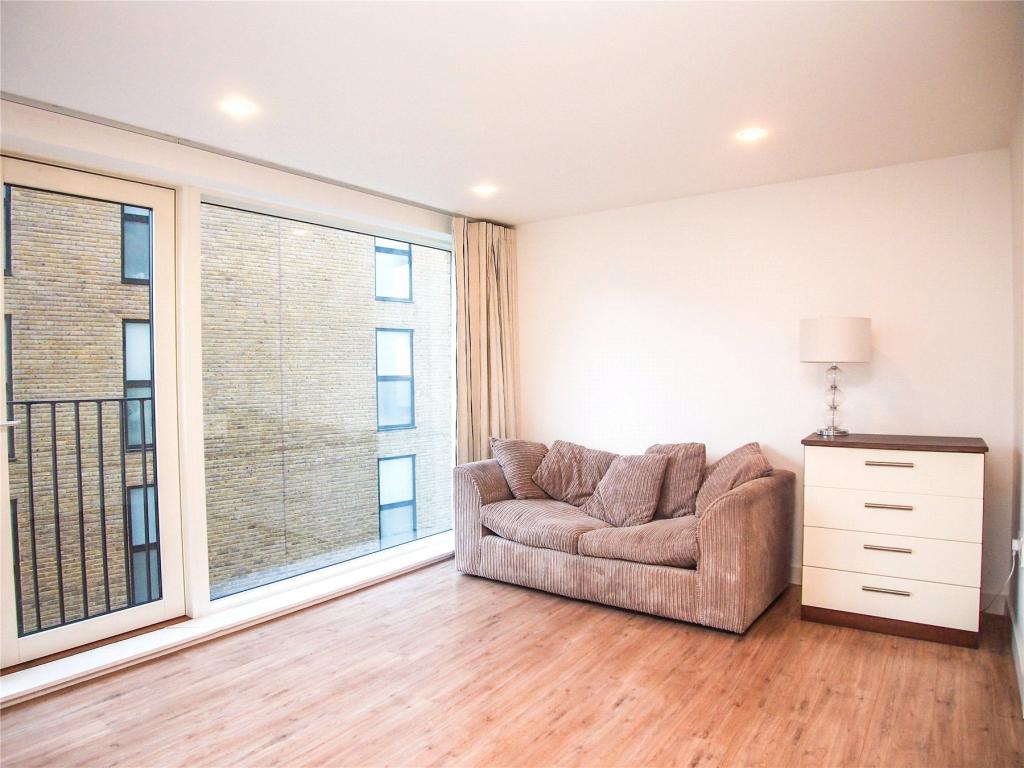
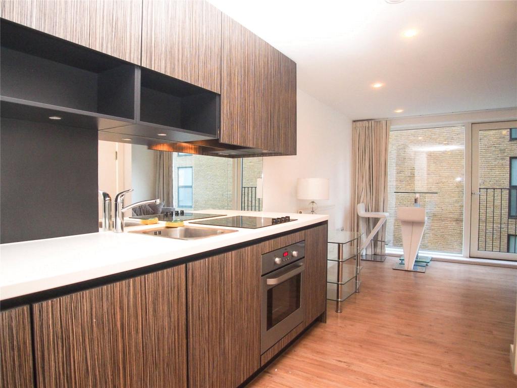
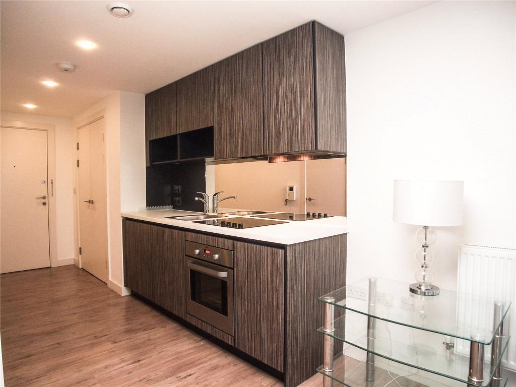
Description
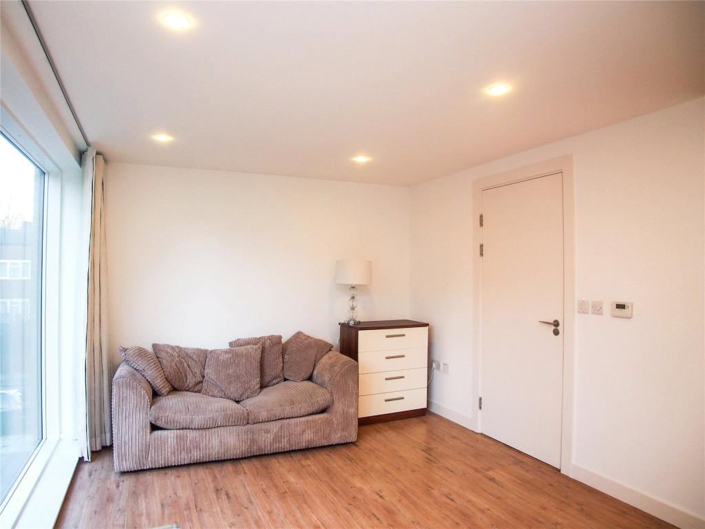
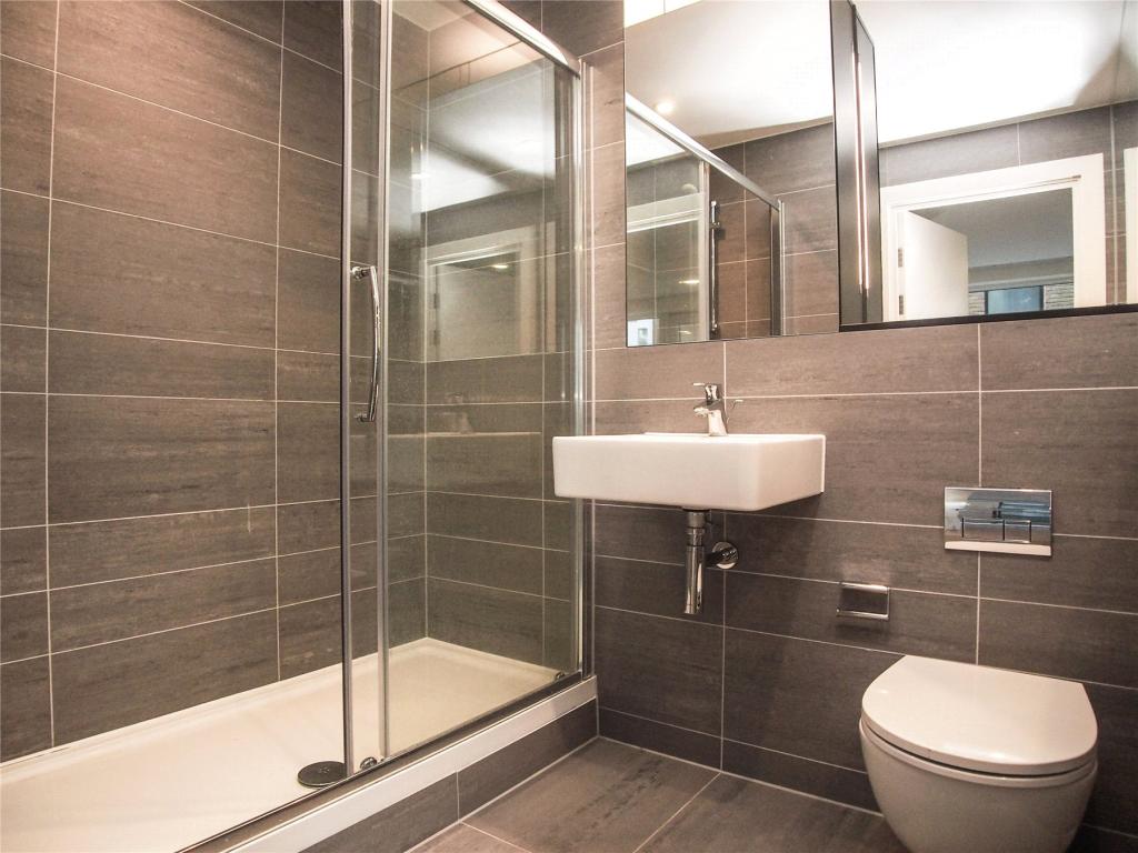
The property comprises a spacious modern kitchen with integrated appliances and living room/bedroom and modern bathroom. The property is offered part furnished and available from 25th August 2017.
Tenants fees - £240 inc VAT administration fee per property, £60 inc VAT referencing fee per Tenant/Guarantor.
Listed by
Greenwich
Jones Lang LaSalle
Reference: 61407073
EPC Rating & Upgrade Cost
Current rating: C
Potential rating: C
Inspection date: 24/09/2021
Expiry date: 23/09/2031
Current heating cost: £131/year
Potential heating cost: £131/year
Flood risk
Zone: 1
Risk: Low
Job (default Low)
EPC Graphs
EPC Rating Graph
Rental Range
Estimated market rent for Lewisham. Low = conservative, Realistic = average, Optimistic = best case.
Based on Local Authority from postcode lookup → Lewisham.
LHA (30th percentile) floor for Cambridge: Apr 2025 – Mar 2026
Location
Address
Conington Road
Nearby
Nearest stations, universities and amenities (distance from property).
| Type | Name | Distance |
|---|---|---|
| Shop | Grab-a-bite | 0.0 miles |
| Bus stop | Blackheath Rise | 0.1 miles |
| Shop | Unknown | 0.1 miles |
| Train station | Lewisham | 0.1 miles |
| Train station | Lewisham DLR | 0.2 miles |
| University | University of Greenwich | 1.1 miles |
| Hospital | Dental Hospital | 3.4 miles |
| Hospital | King's College Hospital Emergency Department | 3.4 miles |
| University | Northeastern University London | 3.7 miles |
Street-level crime
| Category | Count |
|---|---|
| Violence and sexual offences | 295 |
| Anti-social behaviour | 186 |
| Shoplifting | 145 |
| Public order | 65 |
| Other theft | 55 |
| Vehicle crime | 50 |
| Criminal damage and arson | 49 |
| Drugs | 44 |
| Theft from the person | 41 |
| Burglary | 29 |
| Robbery | 23 |
| Bicycle theft | 11 |
| Possession of weapons | 8 |
| Other crime | 5 |
| Total incidents | 1006 |
Within 1 mile during Apr 2026. Source: data.police.uk (England & Wales).
Schools nearby
Nearest open schools with Ofsted ratings (England). Closed schools are not shown. Data from Get Information about Schools and Ofsted.
| Name | Type | Distance | Ofsted |
|---|---|---|---|
| Morden Mount Primary School | Primary | 0.2 miles | Good — 28 Nov 2023 |
| Urban Mission School | Other | 0.2 miles | Good — 5 Oct 2022 |
| Prendergast Vale School | Other | 0.3 miles | Good — 5 Mar 2018 |
| Christ The King Sixth Form College | Other | 0.5 miles | — (No rating) |
| St Saviour's Catholic Primary School | Primary | 0.5 miles | Good — 7 Sep 2011 |
Rental Comparables
Residential lets from OpenRent and Rightmove for the area. Bedroom counts vary — use the Beds column to compare like-for-like lets. Student lets are excluded.
| Title | Rent | Beds | Distance | As seen on |
|---|---|---|---|---|
| 2 Bed Flat, Station Road, SE13 | £2,100/mo | 2 | 0.14 miles | OpenRent |
| 2 Bed Penthouse, Station Road, SE13 | £1,600/mo | 2 | 0.15 miles | OpenRent |
| 2 Bed Flat, Venice Corte, SE13 | £1,950/mo | 2 | 0.23 miles | OpenRent |
Average rent: £1,883/mo (3 listings)