Stockton Road
Chorlton, M21 9FB
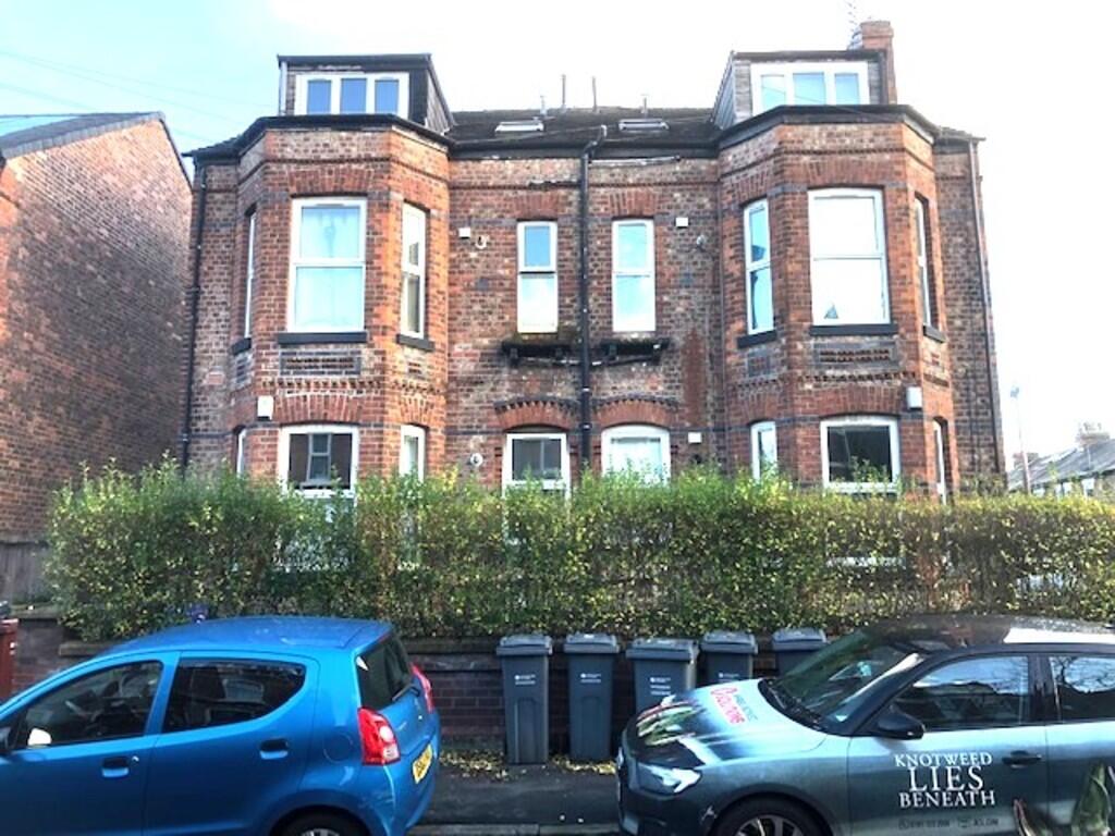
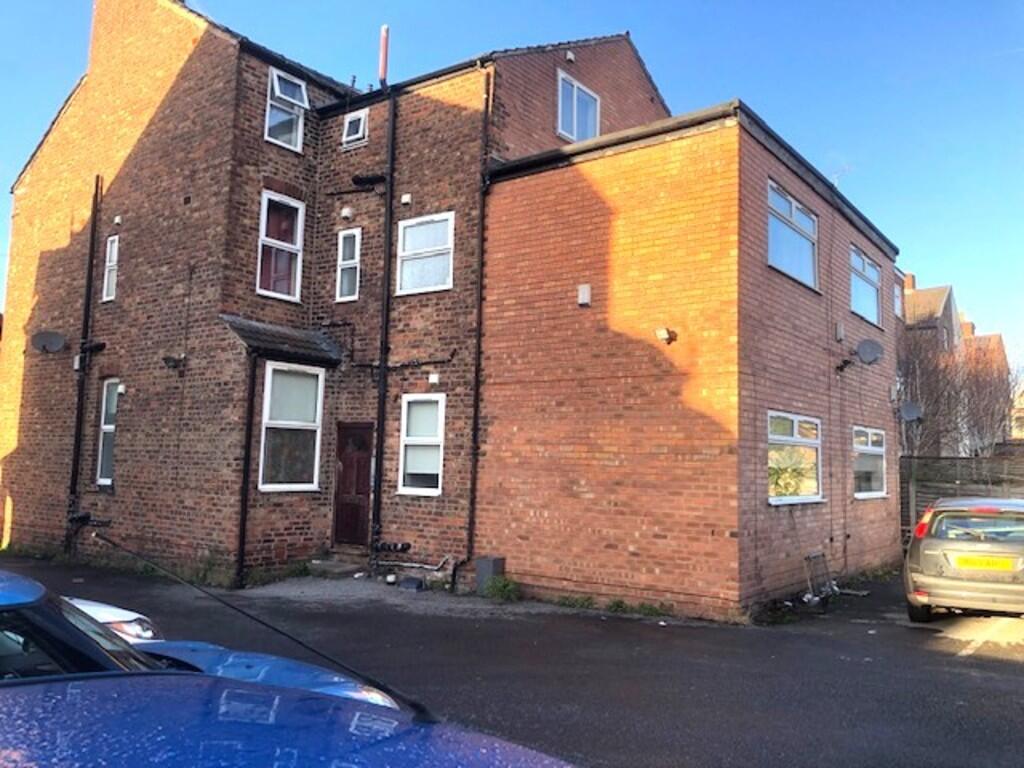
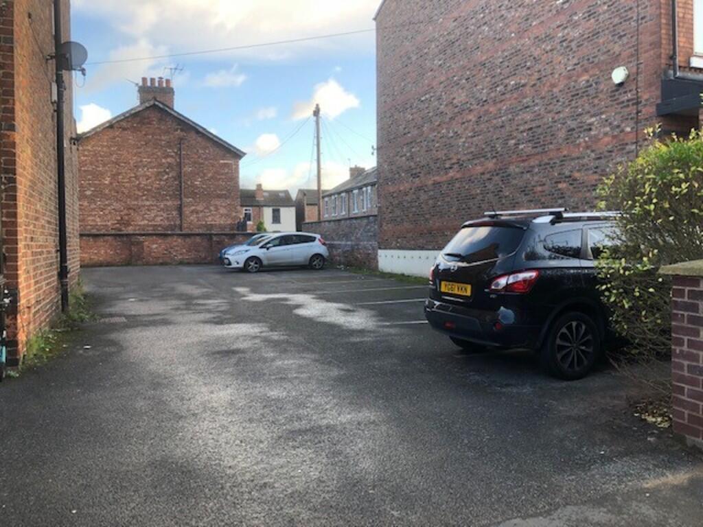
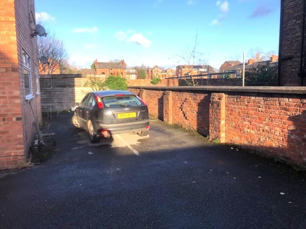
Photo 1 Photo 2 Photo 3 Photo 4
/ 4
Property details
Tenure
FREEHOLD
Local average
£562,250 (+104.5%)
Deprivation
Decile 6 (17,296 of 33,755)
Street crime
0 incidents within 1 mile (Apr 2026)
Additional details
- Heating
- Gas central
- Parking
- Off street
Description
Listed by
Manchester
Emma Hatton
Reference: 170857553
EPC ratings on this postcode
We don't have a matched EPC for this property yet. Below are efficiency scores and details for other addresses on this postcode.
| Address | Current | Potential | Floor area | Age band | Type |
|---|---|---|---|---|---|
| 1 Stockton Road | 62 | 83 | 161 m² | England and Wales: 1900-1929 | House |
| 1 Stockton Road, MANCHESTER | 62 | 83 | 161 m² | England and Wales: 1900-1929 | Detached |
| 1, Stockton Road | 43 | 59 | 169 m² | England and Wales: 1900-1929 | House |
| 19, Stockton Road | 39 | 75 | 178 m² | England and Wales: before 1900 | House |
| 19, Stockton Road, MANCHESTER | 39 | 75 | 178 m² | England and Wales: before 1900 | Detached |
| 1a Stockton Road | 89 | 97 | 119 m² | 2021 | House |
| 1a Stockton Road, MANCHESTER | 89 | 97 | 119 m² | — | Detached |
| 21 Stockton Road | 56 | 82 | 182 m² | England and Wales: 1900-1929 | House |
| 21 Stockton Road, MANCHESTER | 56 | 82 | 182 m² | England and Wales: 1900-1929 | Detached |
| 21, Stockton Road | 50 | 75 | 187 m² | England and Wales: before 1900 | House |
| 21, Stockton Road | 42 | 43 | 176 m² | England and Wales: before 1900 | House |
| 21, Stockton Road, MANCHESTER | 50 | 75 | 187 m² | England and Wales: before 1900 | Detached |
| 23 Stockton Road | 69 | 80 | 199 m² | England and Wales: 1967-1975 | House |
| 23 Stockton Road, MANCHESTER | 69 | 80 | 199 m² | England and Wales: 1967-1975 | Detached |
| 3, Stockton Road | 62 | 84 | 144 m² | England and Wales: 1900-1929 | House |
Flood risk
Zone: 1
Risk: Low
Job (default Low)
Price history
| Event | Date | Price | % change |
|---|---|---|---|
| Listed for sale | — | £1,150,000 | — |
Source: HM Land Registry Price Paid Data. Crown copyright.
Sold Comparables
Same street and nearby sales within 0.25 miles (last 5 years). Data from Land Registry Price Paid.
| Address | Price | Date | Type |
|---|---|---|---|
| Same street 1 STOCKTON ROAD, MANCHESTER, GREATER MANCHESTER, M21 9FB | £650,000 | 16/03/2023 | Semi-detached |
| JASMINE COTTAGE, 20 ST CLEMENTS ROAD, MANCHESTER, GREATER MANCHESTER, M21 9HU | £779,500 | 28/10/2022 | Detached |
| Same street 21 STOCKTON ROAD, MANCHESTER, GREATER MANCHESTER, M21 9FB | £890,000 | 19/08/2022 | Semi-detached |
| 2 STOCKTON ROAD, MANCHESTER, GREATER MANCHESTER, M21 9ED | £870,000 | 24/09/2021 | Detached |
Street average: £770,000 (2 sales)
Area average: £824,750 (2 sales)
Capital growth trend
Land Registry outcode average: last 12 months vs 5y and 10y ago (from sold prices).
House Price Index (HM Land Registry — official index, not sold-price averages): Manchester. Series: Detached. As of March 2026.
Rental Range
Estimated market rent for Manchester. Low = conservative, Realistic = average, Optimistic = best case.
Based on Local Authority from postcode lookup → Manchester.
LHA (30th percentile) floor for West Pennine: Apr 2025 – Mar 2026
Location
Address
Hardy Avenue
Nearby
Nearest stations, universities and amenities (distance from property).
| Type | Name | Distance |
|---|---|---|
| Shop | Franny and Filer | 0.1 miles |
| Shop | No 68 | 0.1 miles |
| Bus stop | Chorlton, St Clement's Road / near Vicars Road | 0.1 miles |
| Bus stop | St Clement's Road/Vicars Road | 0.1 miles |
| University | University Academy 92 | 1.3 miles |
| Hospital | Spire Manchester Hospital | 1.5 miles |
| Train station | Trafford Park | 1.7 miles |
| Hospital | Withington Community Hospital | 1.7 miles |
| Train station | Humphrey Park | 2.1 miles |
| University | University of Manchester | 2.2 miles |
Street-level crime
| Category | Count |
|---|---|
| Total incidents | 0 |
Within 1 mile during Apr 2026. Source: data.police.uk (England & Wales).
Schools nearby
Nearest open schools with Ofsted ratings (England). Closed schools are not shown. Data from Get Information about Schools and Ofsted.
| Name | Type | Distance | Ofsted |
|---|---|---|---|
| Manchester Islamic Grammar School for Girls | Other | 0.1 miles | Outstanding — 3 Apr 2019 |
| Chorlton CofE Primary School | Primary | 0.1 miles | — (Inspected (no overall grade)) |
| Brookburn Community School | Primary | 0.3 miles | Good — 25 Apr 2024 |
| Oswald Road Primary School | Primary | 0.4 miles | Good — 18 Oct 2018 |
| St John's RC Primary School | Primary | 0.5 miles | Good — 6 Nov 2019 |
Rental Comparables
Rental comparables are temporarily unavailable while listing-site fetches are paused. Try again later.
Rent-driven metrics
Based on Area rent estimate.
- Rent ratio — Monthly rent ÷ purchase price (1% rule). 1%+ = strong, 0.8–1% = okay, <0.8% = weak for cashflow.
- Max investor price — Rent ÷ 0.8%; the price at which rent would be 0.8% of price (Stoke-style target).
- Target investor price — Rent ÷ 1%; the price at which rent would be 1% of price (strong cashflow band).
- Gross yield — Annual rent as % of purchase price (no costs).
Enter House Number
Enter the house number to help us retrieve more accurate pricing history and property data.
Please log in to submit or correct the house number for this listing.
Log in to continue