84 OXFORD GARDENS
LONDON, GREATER LONDON W10 5UW
£4,750,000
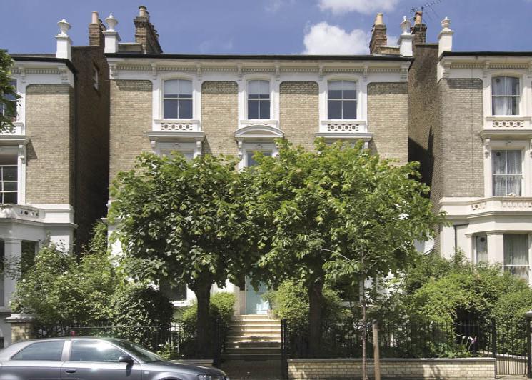
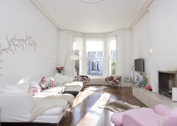
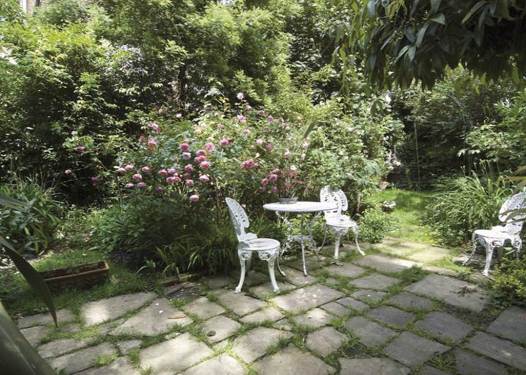
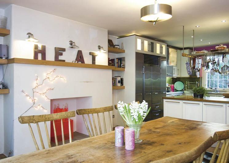
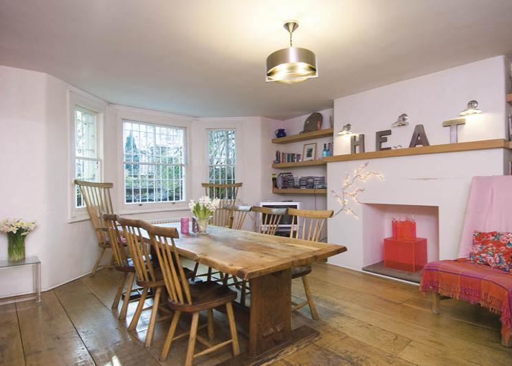
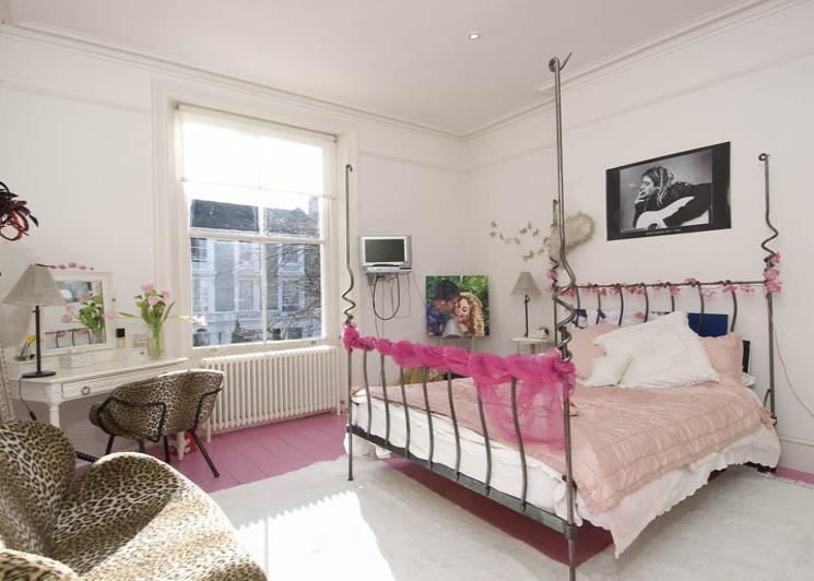
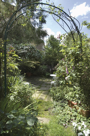
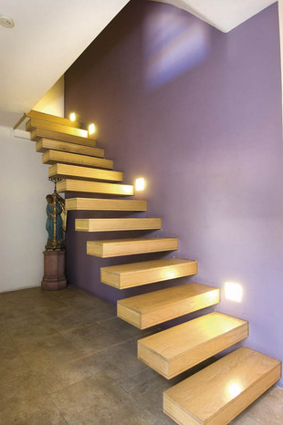
Photo 1 Photo 2 Photo 3 Photo 4 Photo 5 Photo 6 Photo 7 Photo 8
/ 8
Property details
Tenure
FREEHOLD
Floor area
522 m²
EPC rating
C
Year built
England and Wales: 1900-1929
Last sold
£4,000,000 Aug 2009
Price per m²
£9,100/m²
Local average
£1,456,500 (+226.1%)
Deprivation
Decile 4 (11,108 of 33,755)
Street crime
1565 incidents within 1 mile (Apr 2026)
Key features
- 6 bedrooms
- 3 reception rooms
- 4 bathrooms
- Study/bed 7
- Garden
Additional details
- Garden
- Yes
Description
Listed by
Kensington
Savills
Reference: 19585898
EPC Rating & Upgrade Cost
Current rating: C
Potential rating: B
Inspection date: 13/06/2022
Expiry date: 12/06/2032
Current heating cost: £2,464/year
Potential heating cost: £1,718/year
Est. upgrade cost to C: £9,000
Recommendations
- 50 mm internal or external wall insulation (£4,000 - £14,000)
Flood risk
Zone: 1
Risk: Low
Job (default Low)
Price history
| Event | Date | Price | % change |
|---|---|---|---|
| Sold | 27/08/2009 (16 years ago) | £4,000,000 | — |
Source: HM Land Registry Price Paid Data. Crown copyright.
Sold Comparables
Same street and nearby sales within 0.25 miles (last 5 years). Data from Land Registry Price Paid.
| Address | Price | Date | Type |
|---|---|---|---|
| Same street 72 OXFORD GARDENS, LONDON, KENSINGTON AND CHELSEA, GREATER LONDON, W10 5UW | £7,600,000 | 26/06/2023 | Detached |
| Same street 90 OXFORD GARDENS, LONDON, KENSINGTON AND CHELSEA, GREATER LONDON, W10 5UW | £7,440,000 | 28/10/2022 | Detached |
| 63E OXFORD GARDENS, LONDON, KENSINGTON AND CHELSEA, GREATER LONDON, W10 5UJ | £1,575,000 | 06/06/2022 | Other |
| 57 CHESTERTON ROAD, LONDON, KENSINGTON AND CHELSEA, GREATER LONDON, W10 6ES | £84,161 | 05/11/2021 | Other |
| 6 MALTON ROAD, LONDON, KENSINGTON AND CHELSEA, GREATER LONDON, W10 5UP | £50,000 | 27/08/2021 | Other |
| Same street 74 FLAT 4 OXFORD GARDENS, LONDON, KENSINGTON AND CHELSEA, GREATER LONDON, W10 5UW | £650,000 | 24/06/2021 | Flat |
Street average: £5,230,000 (3 sales)
Area average: £569,720 (3 sales)
Capital growth trend
Land Registry outcode average: last 12 months vs 5y and 10y ago (from sold prices).
House Price Index (HM Land Registry — official index, not sold-price averages): Kensington and Chelsea. Series: All dwelling types. As of March 2026.
Rental Range
Estimated market rent for Kensington and Chelsea. Low = conservative, Realistic = average, Optimistic = best case.
Based on Local Authority from postcode lookup → Kensington and Chelsea.
LHA (30th percentile) floor for Stevenage & North Herts: Apr 2025 – Mar 2026
Location
Nearby
Nearest stations, universities and amenities (distance from property).
| Type | Name | Distance |
|---|---|---|
| Bus stop | Oxford Gardens | 0.0 miles |
| Shop | Nu-Line | 0.1 miles |
| Shop | Kensington Autocare Ltd | 0.1 miles |
| Train station | Ladbroke Grove | 0.2 miles |
| Train station | Latimer Road | 0.4 miles |
| University | Scale Space White City | 0.4 miles |
| University | Kennet West Skills Centre | 0.7 miles |
| Hospital | The Portland Hospital | 3.1 miles |
| Hospital | Sleep & Health Clinic | 3.2 miles |
Street-level crime
| Category | Count |
|---|---|
| Anti-social behaviour | 343 |
| Violence and sexual offences | 330 |
| Shoplifting | 310 |
| Other theft | 110 |
| Public order | 104 |
| Vehicle crime | 81 |
| Drugs | 57 |
| Theft from the person | 56 |
| Burglary | 54 |
| Criminal damage and arson | 53 |
| Robbery | 25 |
| Bicycle theft | 23 |
| Other crime | 10 |
| Possession of weapons | 9 |
| Total incidents | 1565 |
Within 1 mile during Apr 2026. Source: data.police.uk (England & Wales).
Schools nearby
Nearest open schools with Ofsted ratings (England). Closed schools are not shown. Data from Get Information about Schools and Ofsted.
| Name | Type | Distance | Ofsted |
|---|---|---|---|
| Bassett House School | Other | 0.1 miles | — (No rating) |
| All Saints Catholic College | Secondary | 0.1 miles | Outstanding — 28 Nov 2022 |
| La Petite Ecole Francaise | Other | 0.2 miles | Outstanding — 23 Apr 2018 |
| The Lloyd Williamson School Foundation | Other | 0.2 miles | Good — 28 Sep 2022 |
| Oxford Gardens Primary School | Primary | 0.2 miles | Good — 8 May 2023 |
Rental Comparables
Residential lets from OpenRent and Rightmove for the area. Bedroom counts vary — use the Beds column to compare like-for-like lets. Student lets are excluded.
| Title | Rent | Beds | Distance | As seen on |
|---|---|---|---|---|
| 1 Bed Flat, Garden, W10 | £3,000/mo | 1 | 0.17 miles | OpenRent |
| 2 Bed Flat, Chesterton Road, W10 | £3,683/mo | 2 | 0.21 miles | OpenRent |
| 1 Bed Flat, St Lawrence Terrace, W10 | £1,950/mo | 1 | 0.24 miles | OpenRent |
| 3 Bed Flat, St Quinten Avenue, W10 | £3,250/mo | 3 | 0.24 miles | OpenRent |
| 2 Bed Flat, Cambridge Gardens, W10 | £2,470/mo | 2 | 0.31 miles | OpenRent |
| 4 Bed Maisonette, St. Ervans Road, W10 | £4,400/mo | 4 | 0.46 miles | OpenRent |
Average rent: £3,126/mo (6 listings)
Rent-driven metrics
Based on OpenRent comparables.
- Rent ratio — Monthly rent ÷ purchase price (1% rule). 1%+ = strong, 0.8–1% = okay, <0.8% = weak for cashflow.
- Max investor price — Rent ÷ 0.8%; the price at which rent would be 0.8% of price (Stoke-style target).
- Target investor price — Rent ÷ 1%; the price at which rent would be 1% of price (strong cashflow band).
- Gross yield — Annual rent as % of purchase price (no costs).
- Cost-to-rent — Price ÷ annual rent (from OpenRent comparables). Under 14× = strong, 14–16× = acceptable, 17×+ = compressed.
- Cashflow — Rent minus mortgage, 10% maintenance, £25/mo compliance. Assumes 75% LTV, 3.95% APR (5yr fixed), 25yr term.
- ROI — Annual profit ÷ cash in (deposit + 4% purchase costs).