5 UNDERWOOD ROAD
HIGH WYCOMBE, BUCKINGHAMSHIRE HP13 6YD
£184,950
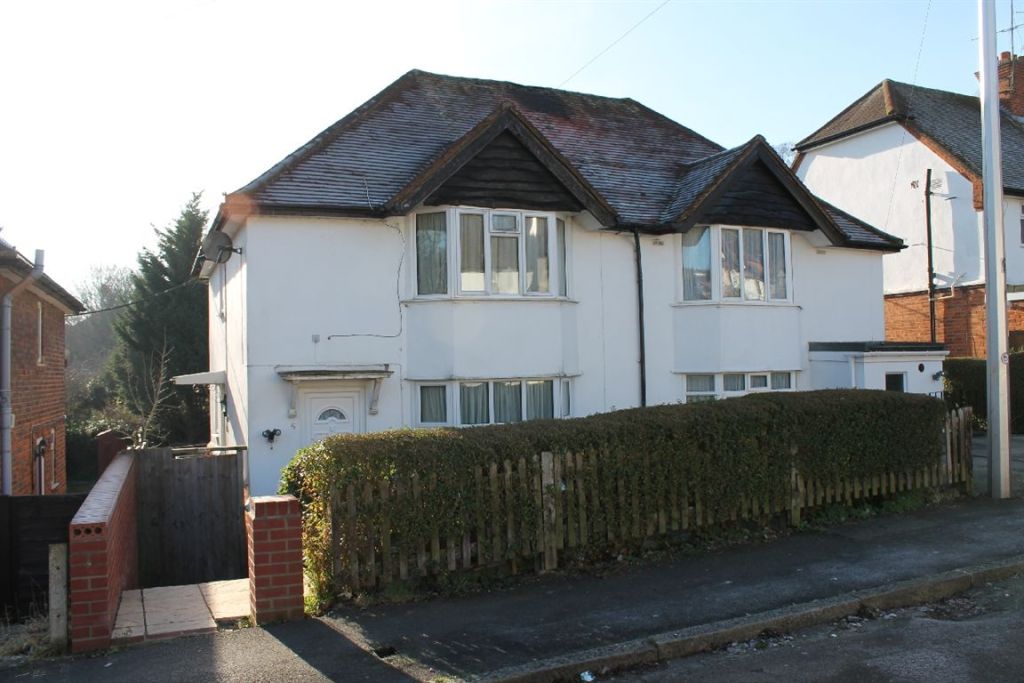
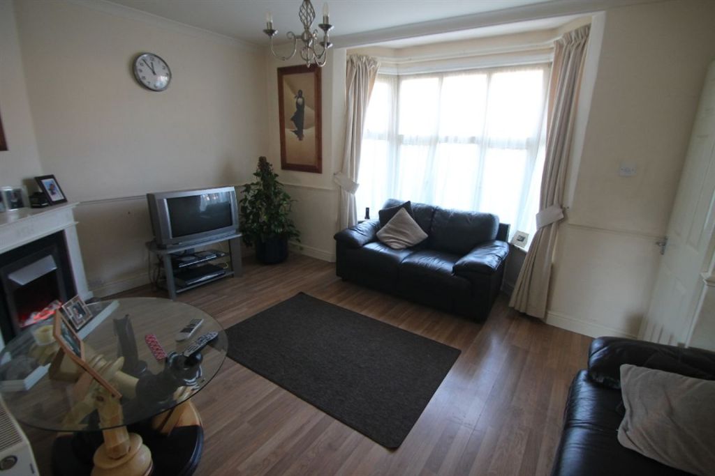
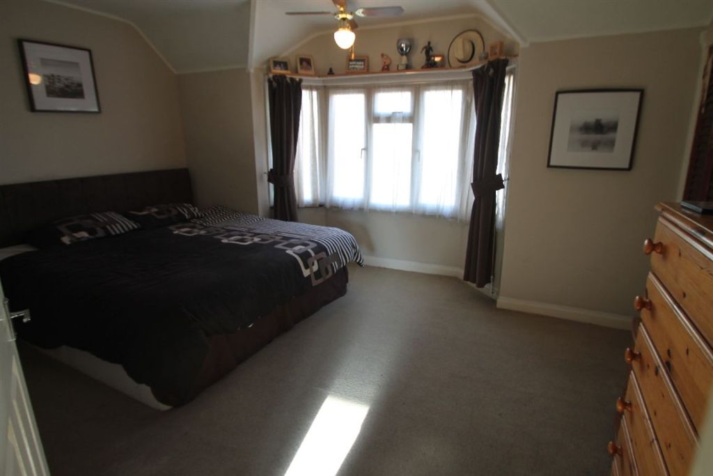
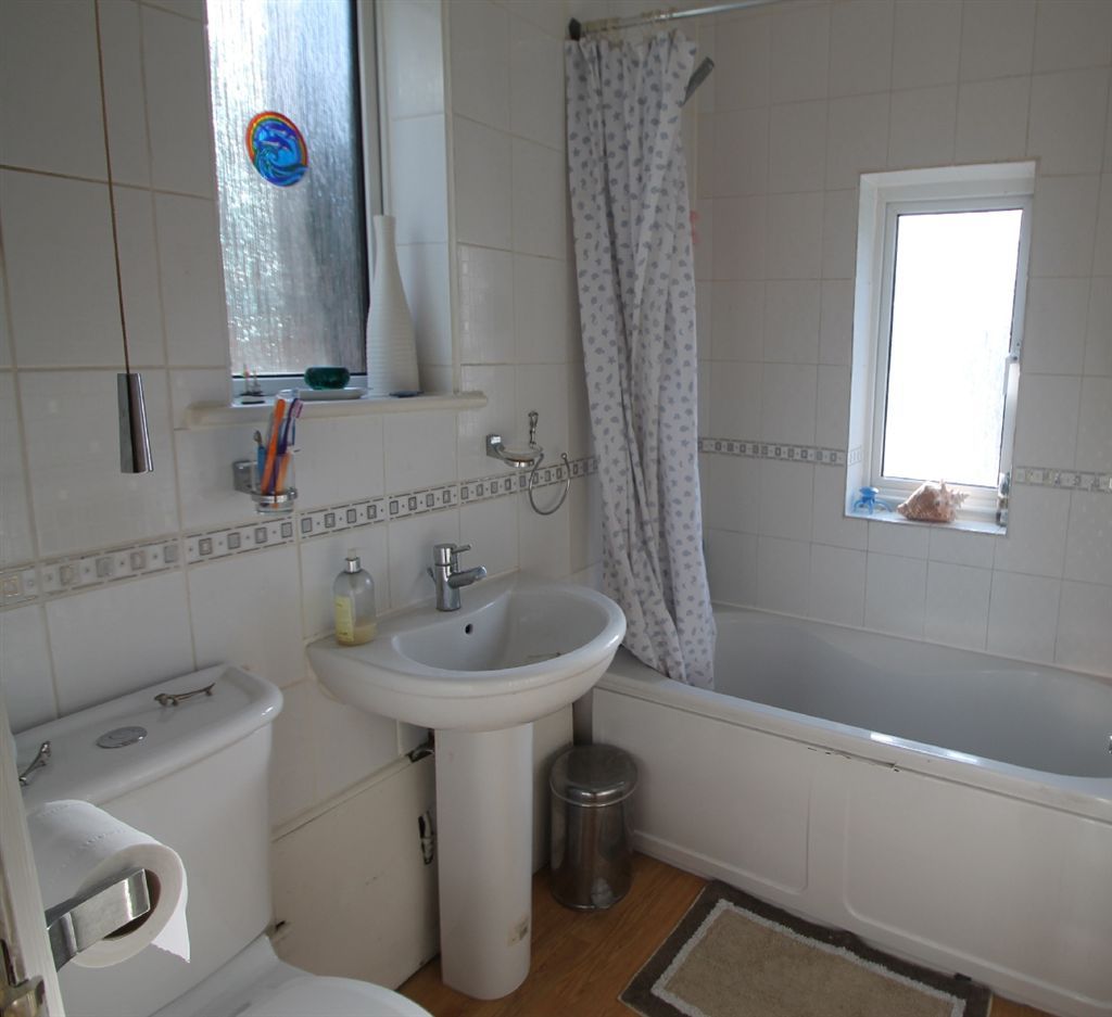
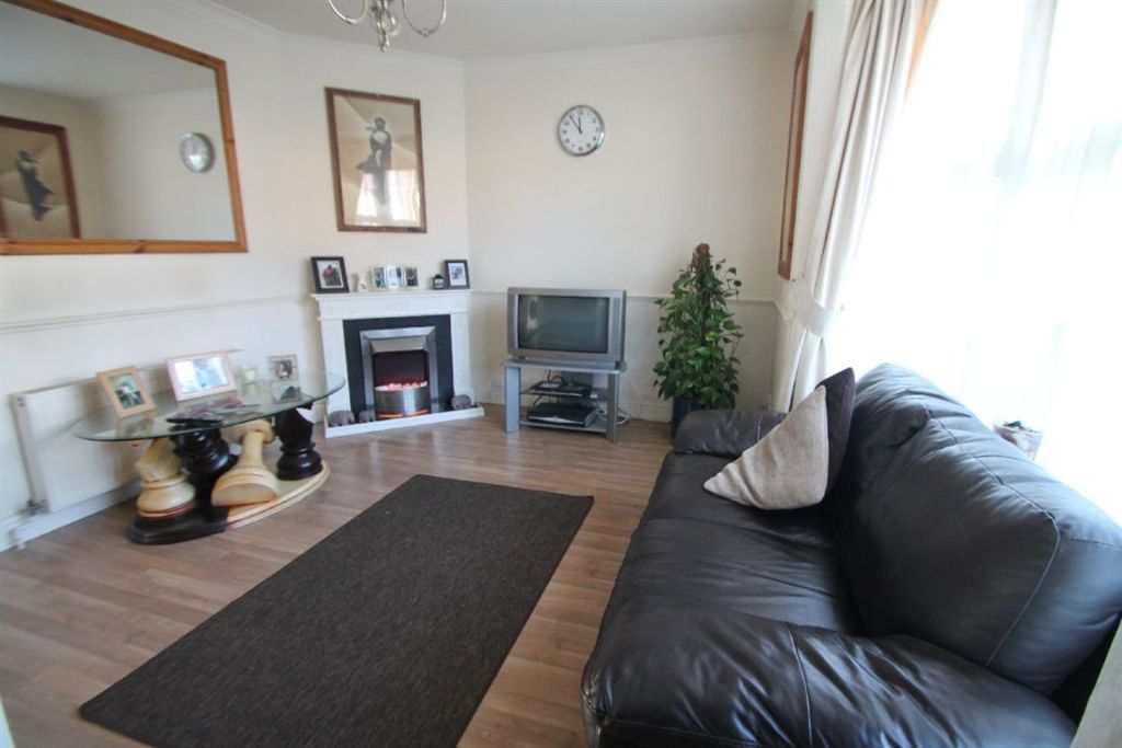
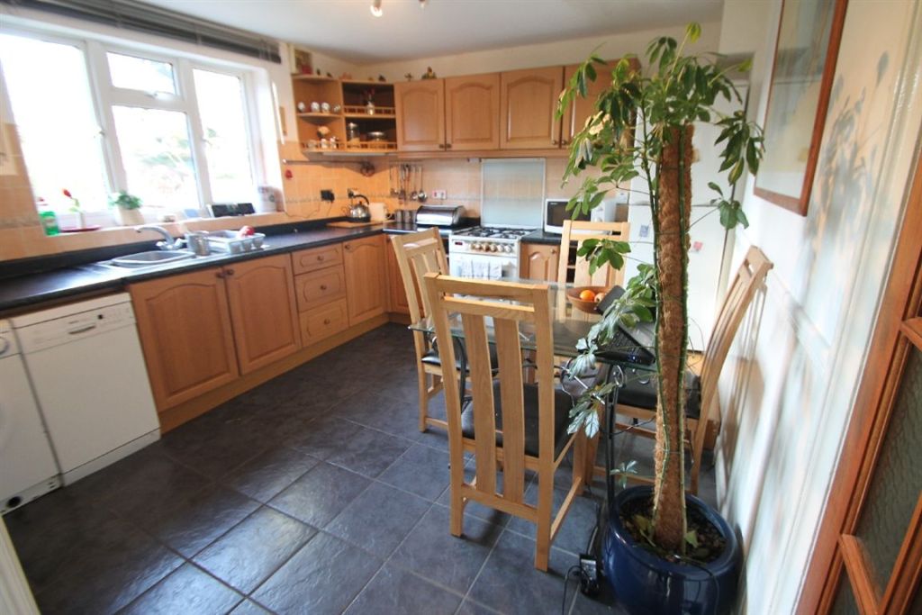
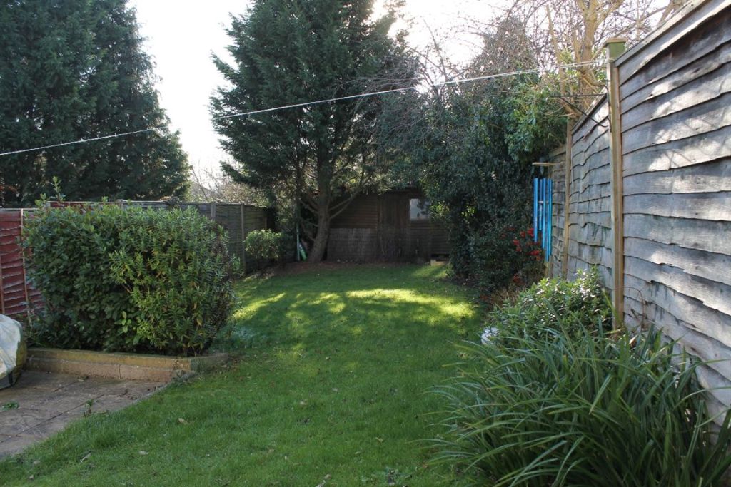
Photo 1 Photo 2 Photo 3 Photo 4 Photo 5 Photo 6 Photo 7
/ 7
Property details
Tenure
FREEHOLD
Floor area
77 m²
Year built
England and Wales: 1950-1966
Last sold
£348,000 Jan 2026
Price per m²
£2,402/m²
Local average
£812,500 (-77.2%)
Deprivation
Decile 3 (9,162 of 33,755)
Street crime
321 incidents within 1 mile (Apr 2026)
Key features
- NO CHAIN
- THREE BEDROOMS
- MODERN KITCHEN / DINER
- DOUBLE GLAZED
- GAS CENTRAL HEATING
- MATCHING BATHROOM SUITE
- CLOSE TO LOCAL AMENITIES
- GOOD CONDITION THROUGHOUT
Description
Bedroom 14.50m x 3.66m / 14'9 x 12'
Bedroom 23.33m x 2.84m / 10'11 x 9'4
Bedroom 32.51m x 2.39m / 8'3 x 7'10
Reception 14.47m x 3.63m / 14'8 x 11'11
Kitchen3.63m x 3.33m / 11'11 x 10'11
Listed by
South Buckinghamshire
Hurst Estate Agents
Reference: 37027949
EPC Rating & Upgrade Cost
Fetching EPC data… Refresh this page in a moment.
Flood risk
Zone: 1
Risk: Low
Job (default Low)
FENSA Certificates
This property has 1 FENSA certificate(s) on record, indicating window/door installations by FENSA-approved installers.
FENSA Certificate #9847509
Property Details
Street: 5 Underwood Road
Town: HIGH WYCOMBE
Postcode: HP13 6YD
Installation Details
Items: 7 windows
Certificate Issued: 28/10/2013
Work Completed: 04/09/2013
This certificate data was retrieved from FENSA's database
What is FENSA? FENSA (Fenestration Self-Assessment Scheme) is a government-authorised scheme that monitors building regulation compliance for replacement windows and doors. Certificates indicate that work was completed by FENSA-approved installers.
Price history
| Event | Date | Price | % change |
|---|---|---|---|
| Sold | 12/01/2026 (5 months ago) | £348,000 | — |
Source: HM Land Registry Price Paid Data. Crown copyright.
Sold Comparables
Same street and nearby sales within 0.25 miles (last 5 years). Data from Land Registry Price Paid.
| Address | Price | Date | Type |
|---|---|---|---|
| Same street 24 UNDERWOOD ROAD, HIGH WYCOMBE, BUCKINGHAMSHIRE, HP13 6YD | £275,000 | 28/04/2023 | Flat |
| Same street 24A UNDERWOOD ROAD, HIGH WYCOMBE, BUCKINGHAMSHIRE, HP13 6YD | £250,000 | 28/04/2023 | Flat |
| Same street 7 UNDERWOOD ROAD, HIGH WYCOMBE, BUCKINGHAMSHIRE, HP13 6YD | £370,000 | 24/06/2021 | Semi-detached |
Street average: £298,333 (3 sales)
Capital growth trend
Land Registry outcode average: last 12 months vs 5y and 10y ago (from sold prices).
House Price Index (HM Land Registry — official index, not sold-price averages): Buckinghamshire. Series: All dwelling types. As of March 2026.
Rental Range
Estimated market rent for Buckinghamshire. Low = conservative, Realistic = average, Optimistic = best case.
Based on Local Authority from postcode lookup → Buckinghamshire.
LHA (30th percentile) floor for Chilterns: £1,446/mo (Apr 2025 – Mar 2026)
Location
Nearby
Nearest stations, universities and amenities (distance from property).
| Type | Name | Distance |
|---|---|---|
| Shop | Imran's Hair Zone | 0.1 miles |
| Shop | UK Food Store | 0.1 miles |
| Bus stop | Unknown | 0.2 miles |
| Train station | High Wycombe | 0.4 miles |
| University | Buckinghamshire New University (Wycombe Campus) | 0.8 miles |
| Hospital | Wycombe General Hospital | 0.9 miles |
| Hospital | Priory Hospital High Wycombe | 2.7 miles |
| Train station | Bourne End | 4.0 miles |
| University | National Film and Television School | 4.7 miles |
Street-level crime
| Category | Count |
|---|---|
| Violence and sexual offences | 127 |
| Shoplifting | 54 |
| Anti-social behaviour | 39 |
| Public order | 26 |
| Criminal damage and arson | 20 |
| Vehicle crime | 14 |
| Drugs | 12 |
| Other theft | 10 |
| Other crime | 7 |
| Burglary | 3 |
| Robbery | 3 |
| Bicycle theft | 2 |
| Possession of weapons | 2 |
| Theft from the person | 2 |
| Total incidents | 321 |
Within 1 mile during Apr 2026. Source: data.police.uk (England & Wales).
Schools nearby
Nearest open schools with Ofsted ratings (England). Closed schools are not shown. Data from Get Information about Schools and Ofsted.
| Name | Type | Distance | Ofsted |
|---|---|---|---|
| Hannah Ball Academy | Primary | 0.3 miles | Requires improvement — 17 Jan 2022 |
| Aspire | Other | 0.3 miles | Outstanding — 17 Sep 2014 |
| Godstowe Preparatory School | Other | 0.4 miles | — (No rating) |
| Bowerdean Nursery School | Nursery | 0.4 miles | Outstanding — 18 Apr 2013 |
| The Chalfonts Independent Grammar School | Other | 0.5 miles | Good — 15 May 2020 |
Rental Comparables
Rental listings exist nearby, but none matched the 3-bedroom count for this property.
Rent-driven metrics
Based on Area rent estimate.
- Rent ratio — Monthly rent ÷ purchase price (1% rule). 1%+ = strong, 0.8–1% = okay, <0.8% = weak for cashflow.
- Max investor price — Rent ÷ 0.8%; the price at which rent would be 0.8% of price (Stoke-style target).
- Target investor price — Rent ÷ 1%; the price at which rent would be 1% of price (strong cashflow band).
- Gross yield — Annual rent as % of purchase price (no costs).