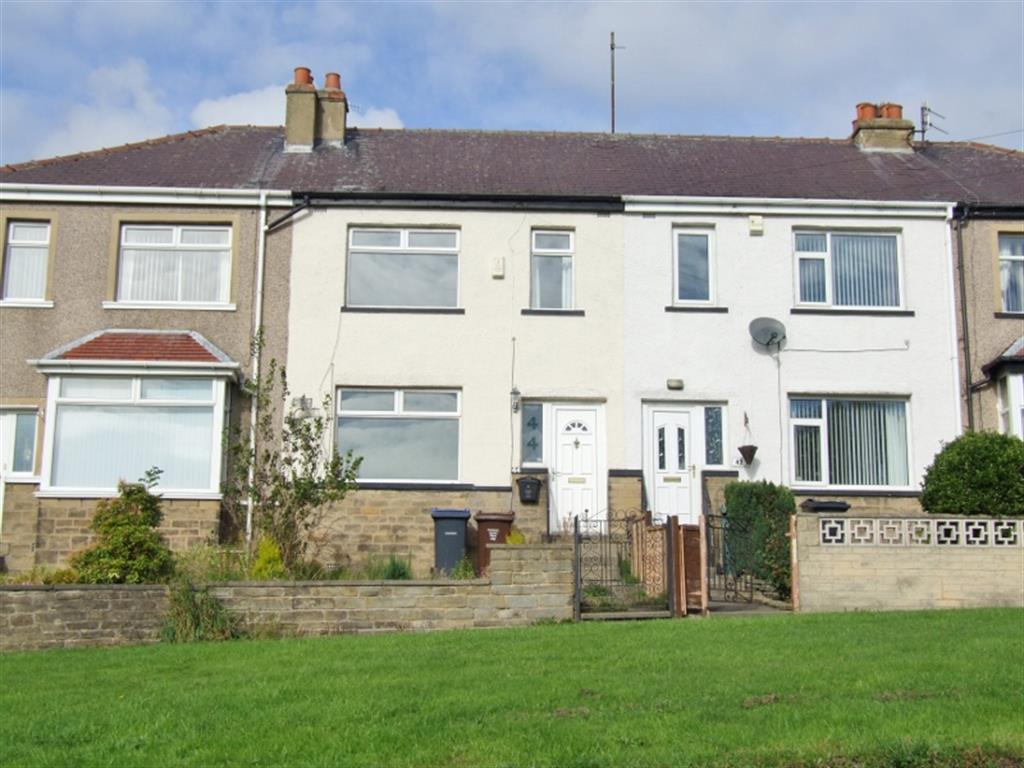
44 LEAVENTHORPE LANE
BRADFORD, WEST YORKSHIRE BD8 0EF
£95,000
Property details
Floor area
74 m²
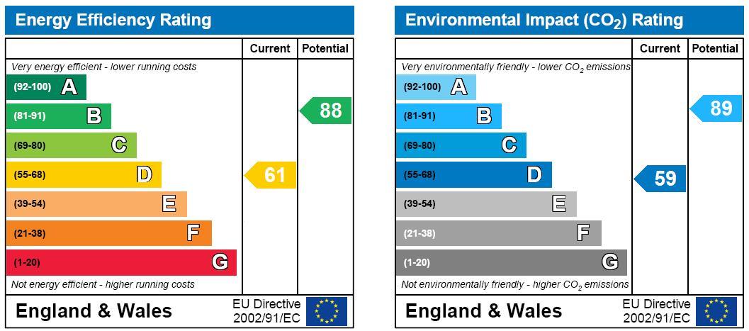
EPC rating
D
Year built
England and Wales: 1930-1949
Last sold
£91,000 Mar 2019
Price per m²
£1,284/m²
Local average
£127,544 (-25.5%)
Deprivation
Decile 2 (4,430 of 33,755)
Street crime
436 incidents within 1 mile (Apr 2026)
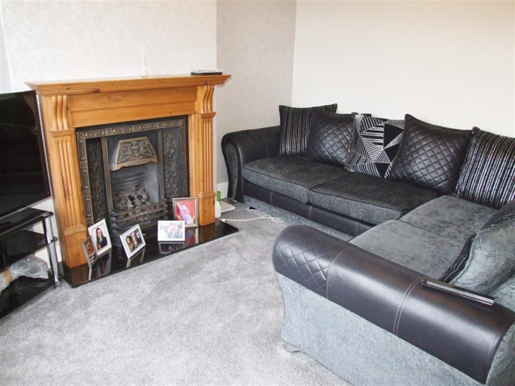
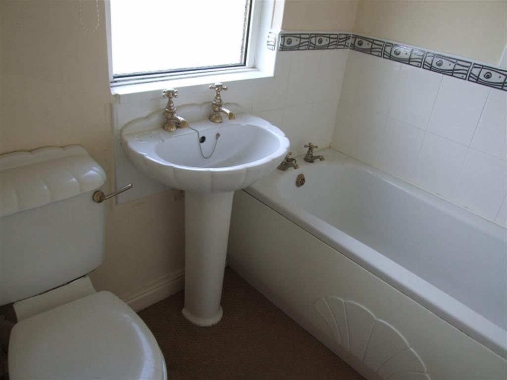
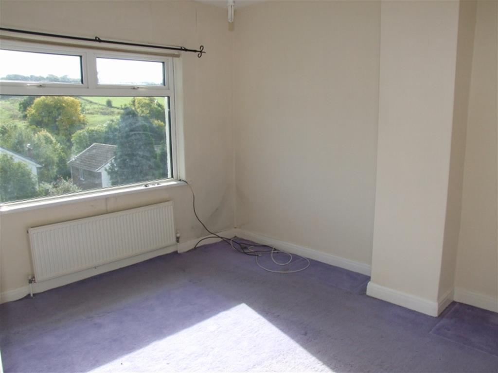
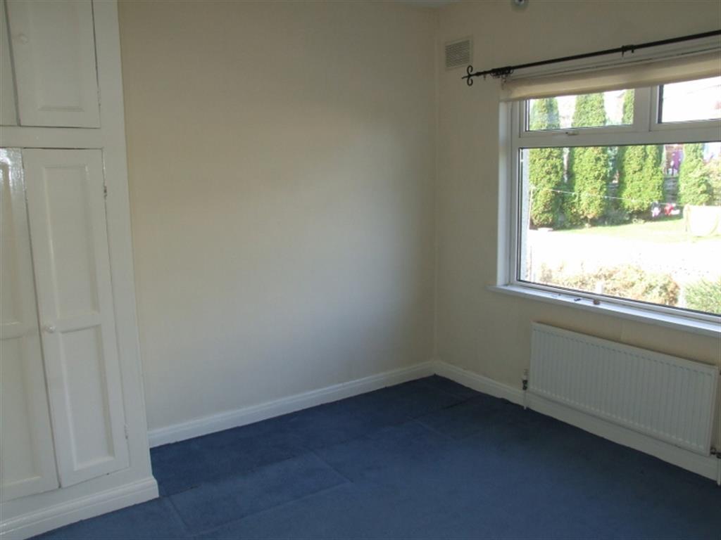
Key features
- MID TERRACE PROPERTY IN POPULAR AREA
- 3 BEDROOMS
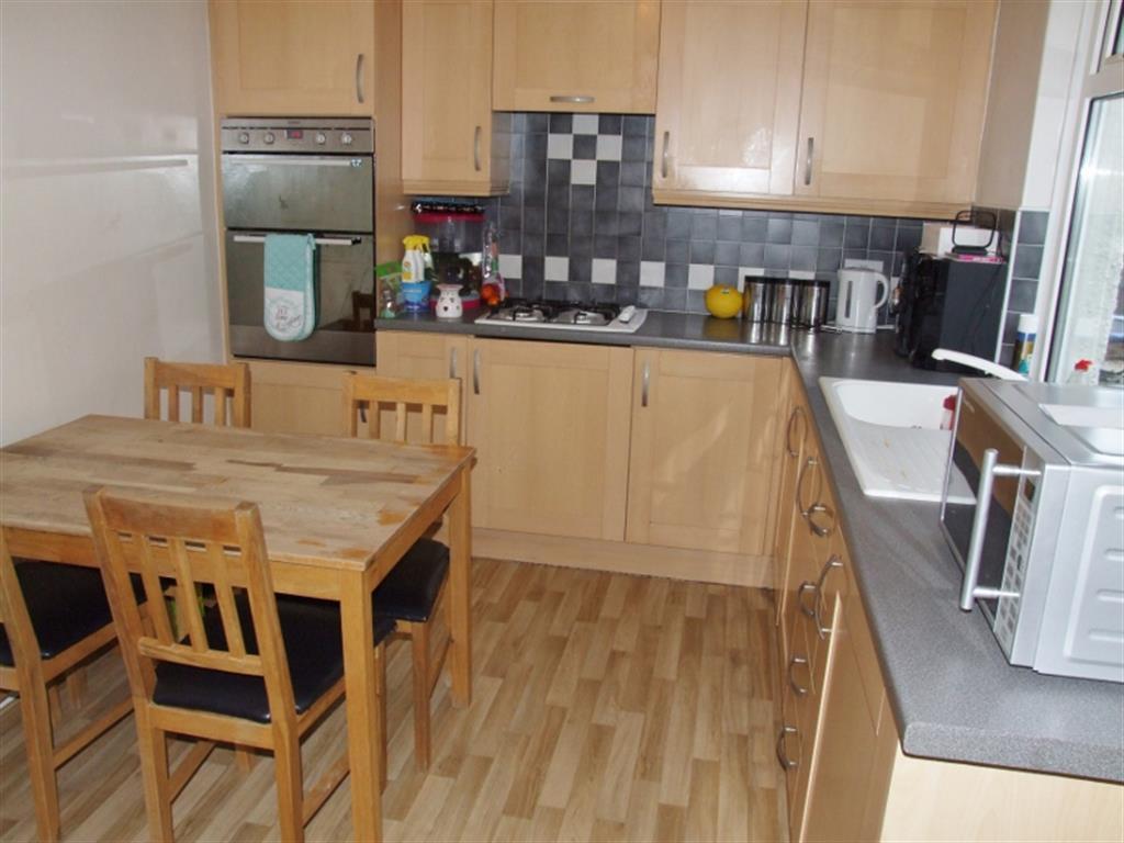
- DINING KITCHEN
- SEPARATE UTILITY
- CLOSE TO SCHOOLS AND AMENITIES
- GARDENS FRONT AND REAR
- ON STREET PARKING
- NO CHAIN
Additional details
- Garden
- Yes
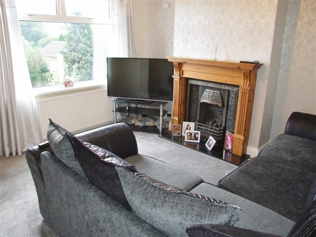
Description
Listed by
Elland Covering Halifax
Hunters Property Group Ltd
Reference: 76729547
EPC Rating & Upgrade Cost
Current rating: D
Potential rating: C
Inspection date: 28/03/2025
Expiry date: 27/03/2035
Current heating cost: £1,106/year
Potential heating cost: £820/year
Est. upgrade cost to C: £11,500
Recommendations
- Cavity wall insulation (£500 - £1,500)
- Floor insulation (suspended floor) (£800 - £1,200)
- Solar water heating (£4,000 - £6,000)
- Solar photovoltaic panels, 2.5 kWp (£3,500 - £5,500)
Flood risk
Zone: 1
Risk: Low
Job (default Low)
EPC Graphs
EPC
Price history
| Event | Date | Price | % change |
|---|---|---|---|
| Sold | 18/03/2019 (7 years ago) | £91,000 | — |
Source: HM Land Registry Price Paid Data. Crown copyright.
Sold Comparables
Same street and nearby sales within 0.25 miles (last 5 years). Data from Land Registry Price Paid.
| Address | Price | Date | Type |
|---|---|---|---|
| 125 LEAVENTHORPE LANE, BRADFORD, WEST YORKSHIRE, BD8 0EG | £258,000 | 23/01/2026 | Terraced |
| 127 LEAVENTHORPE LANE, BRADFORD, WEST YORKSHIRE, BD8 0EG | £230,000 | 11/08/2023 | Terraced |
| 10 LEAVENTHORPE LANE, BRADFORD, WEST YORKSHIRE, BD8 0EB | £171,500 | 02/12/2022 | Terraced |
| Same street 17 LEAVENTHORPE LANE, BRADFORD, WEST YORKSHIRE, BD8 0EF | £175,000 | 28/02/2022 | Semi-detached |
| 1025 THORNTON ROAD, BRADFORD, WEST YORKSHIRE, BD8 0PA | £124,000 | 21/09/2021 | Terraced |
| Same street 48 LEAVENTHORPE LANE, BRADFORD, WEST YORKSHIRE, BD8 0EF | £86,000 | 28/06/2021 | Terraced |
Street average: £130,500 (2 sales)
Area average: £195,875 (4 sales)
Capital growth trend
Land Registry outcode average: last 12 months vs 5y and 10y ago (from sold prices).
House Price Index (HM Land Registry — official index, not sold-price averages): Bradford. Series: Terraced. As of March 2026.
Rental Range
Estimated market rent for Bradford. Low = conservative, Realistic = average, Optimistic = best case.
Based on Local Authority from postcode lookup → Bradford.
LHA (30th percentile) floor for Bradford & South Dales: £633/mo (Apr 2025 – Mar 2026)
Location
Nearby
Nearest stations, universities and amenities (distance from property).
| Type | Name | Distance |
|---|---|---|
| Bus stop | Thornton Road Leaventhorpe Lane | 0.1 miles |
| Bus stop | Thornton Road Rhodesway | 0.1 miles |
| Shop | Unknown | 0.3 miles |
| Hospital | Moorlands View | 1.2 miles |
| University | Bradford University School of Management | 2.1 miles |
| Train station | Bradford Forster Square | 2.3 miles |
| Train station | Bradford Interchange | 2.4 miles |
| Hospital | Eccleshill NHS Treatment Centre | 4.5 miles |
| University | University of Bradford Oxenhope Field Site | 7.2 miles |
Street-level crime
| Category | Count |
|---|---|
| Violence and sexual offences | 187 |
| Shoplifting | 42 |
| Vehicle crime | 40 |
| Criminal damage and arson | 39 |
| Public order | 26 |
| Other theft | 25 |
| Burglary | 22 |
| Anti-social behaviour | 20 |
| Drugs | 19 |
| Other crime | 10 |
| Robbery | 3 |
| Bicycle theft | 1 |
| Possession of weapons | 1 |
| Theft from the person | 1 |
| Total incidents | 436 |
Within 1 mile during Apr 2026. Source: data.police.uk (England & Wales).
Schools nearby
Nearest open schools with Ofsted ratings (England). Closed schools are not shown. Data from Get Information about Schools and Ofsted.
| Name | Type | Distance | Ofsted |
|---|---|---|---|
| Crossley Hall Primary School | Primary | 0.5 miles | Good — 26 May 2016 |
| Dixons Allerton Academy | Other | 0.5 miles | Requires improvement — 27 Jun 2024 |
| Beckfoot Thornton | Secondary | 0.6 miles | Good — 15 Oct 2023 |
| St Anthony's Catholic Primary School, A Voluntary Academy | Primary | 0.6 miles | Good — 12 Sep 2013 |
| Lidget Green Primary School | Primary | 0.6 miles | Good — 2 Mar 2015 |
Rental Comparables
Residential lets from OpenRent and Rightmove for the area (same bedroom count). Use to validate rent estimates. Student lets are excluded.
| Title | Rent | Beds | Distance | As seen on |
|---|---|---|---|---|
| 3 Bed End Terrace, Springs Meadow, BD8 | £1,000/mo | 3 | 0.18 miles | OpenRent |
| 3 Bed Terraced House, Godfrey Street, BD8 | £795/mo | 3 | 0.2 miles | OpenRent |
| 3 Bed Semi-Detached House, Templars Way, BD8 | £995/mo | 3 | 0.44 miles | OpenRent |
| 3 Bed Semi-Detached House, Thirkleby Royd, BD14 | £950/mo | 3 | 0.75 miles | OpenRent |
| 3 Bed Semi-Detached House, St Wilfrids Crescent, BD7 | £1,150/mo | 3 | 0.94 miles | OpenRent |
Average rent: £978/mo (5 listings)
Rent-driven metrics
Based on OpenRent comparables.
- Rent ratio — Monthly rent ÷ purchase price (1% rule). 1%+ = strong, 0.8–1% = okay, <0.8% = weak for cashflow.
- Max investor price — Rent ÷ 0.8%; the price at which rent would be 0.8% of price (Stoke-style target).
- Target investor price — Rent ÷ 1%; the price at which rent would be 1% of price (strong cashflow band).
- Gross yield — Annual rent as % of purchase price (no costs).
- Cost-to-rent — Price ÷ annual rent (from OpenRent comparables). Under 14× = strong, 14–16× = acceptable, 17×+ = compressed.
- Cashflow — Rent minus mortgage, 10% maintenance, £25/mo compliance. Assumes 75% LTV, 3.95% APR (5yr fixed), 25yr term.
- ROI — Annual profit ÷ cash in (deposit + 4% purchase costs).