Rowarth
High Peak, SK22, SK22 1EA
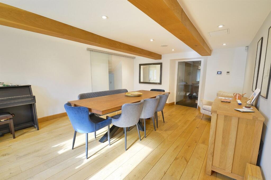
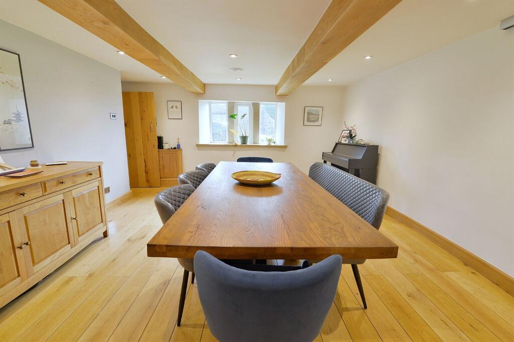
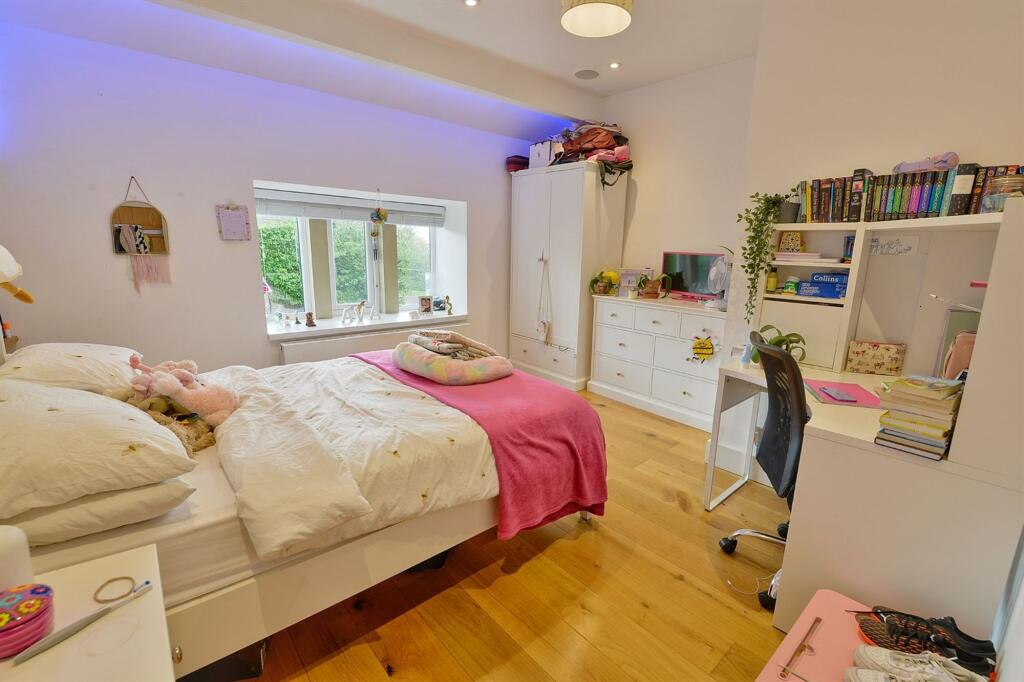
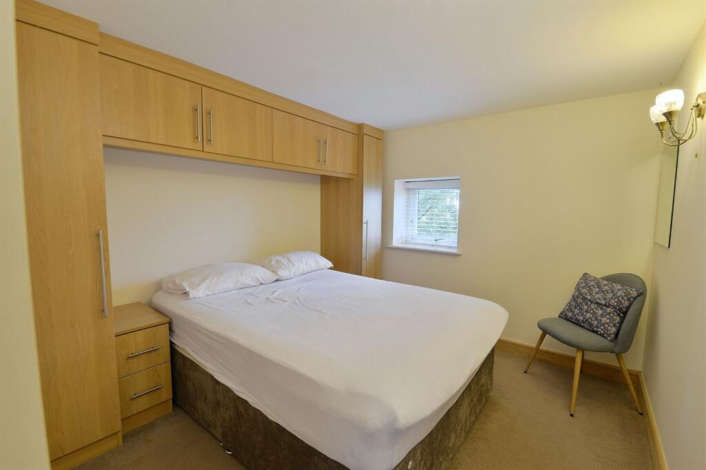
(Main) Entrance Outside Living Room Family Room Family Room 2 Bed Annexe 2 Bed Annexe Kitchen Kitchen Kitchen 2 Bed Annexe Bedroom Bedroom Bedroom En Suite Bathroom 2 Bed Annexe Land Outside Outside Outside Stables Stables Dining Room Dining Room Bedroom 2 Bed Annexe 2 Bed Annexe Arena Buildings Stables Outside Outside Outside
/ 35
Property details
Tenure
FREEHOLD
Local average
£150,000 (+900%)
Deprivation
Decile 7 (22,779 of 33,755)
Street crime
1 incident within 1 mile (Apr 2026)
Key features
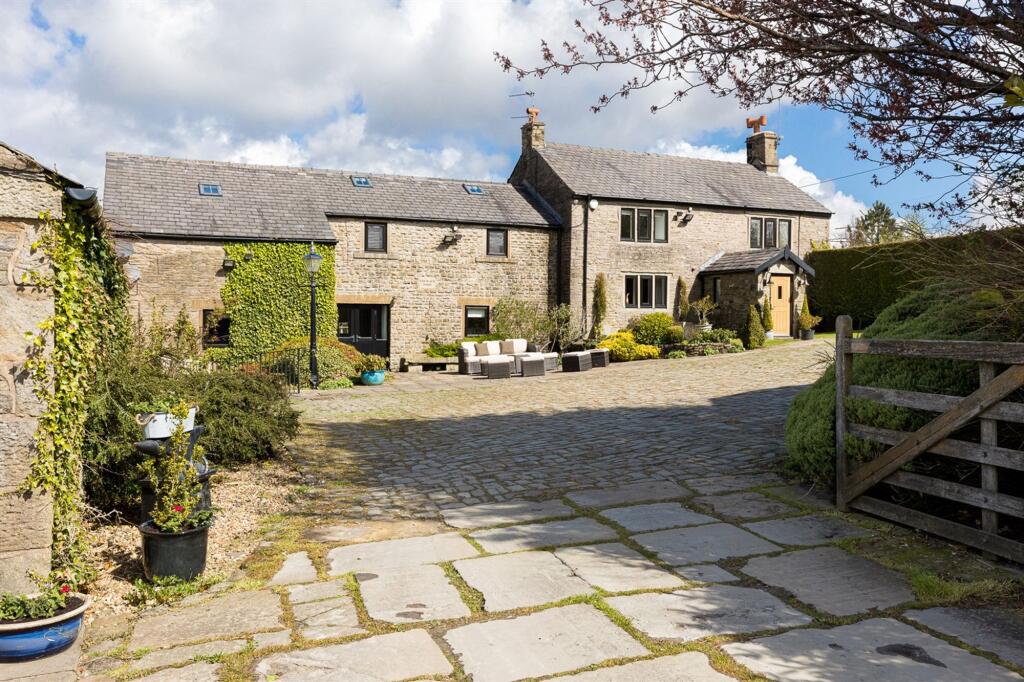
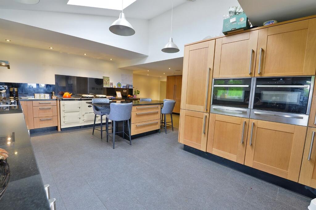
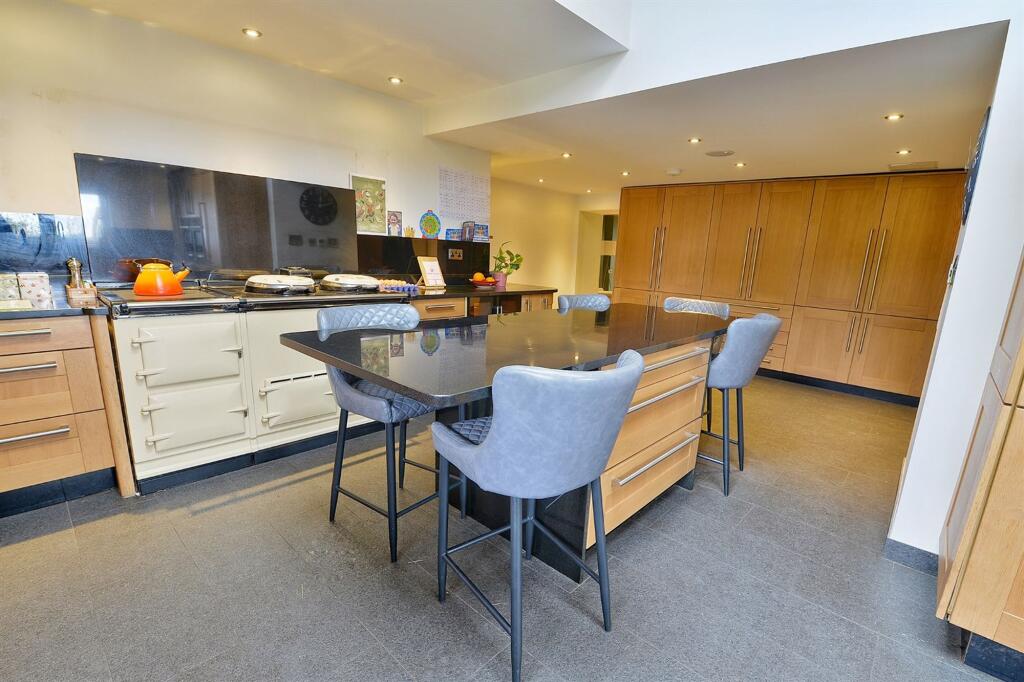
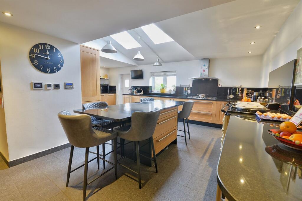
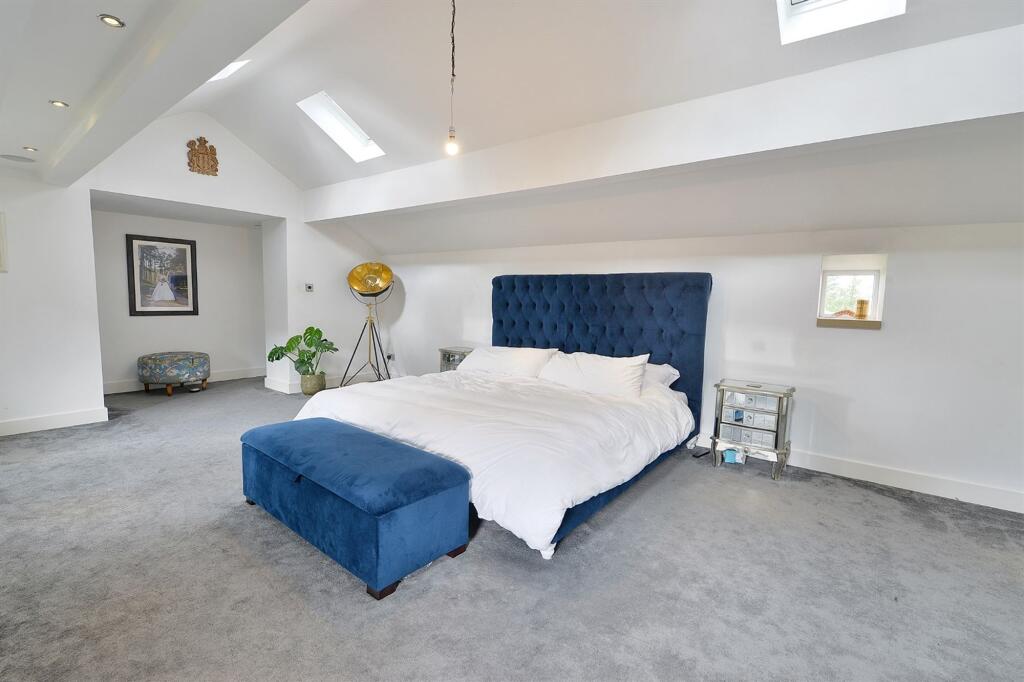
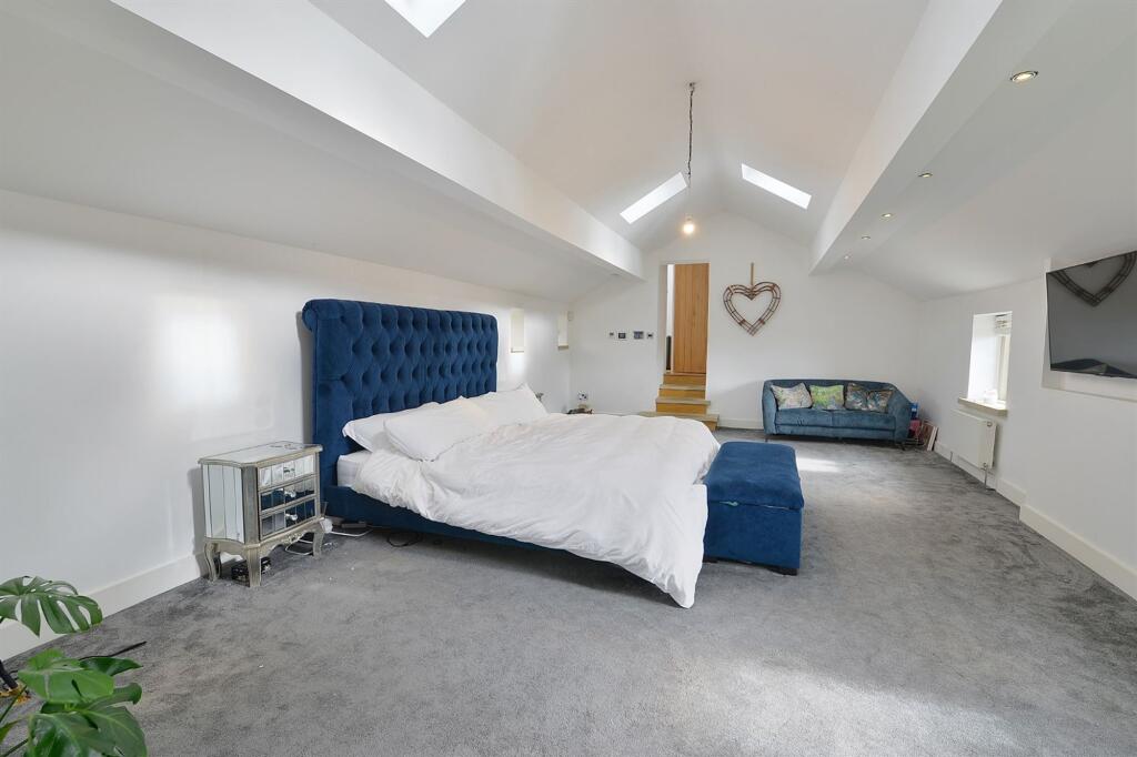
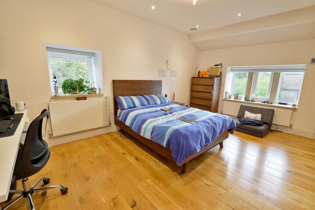
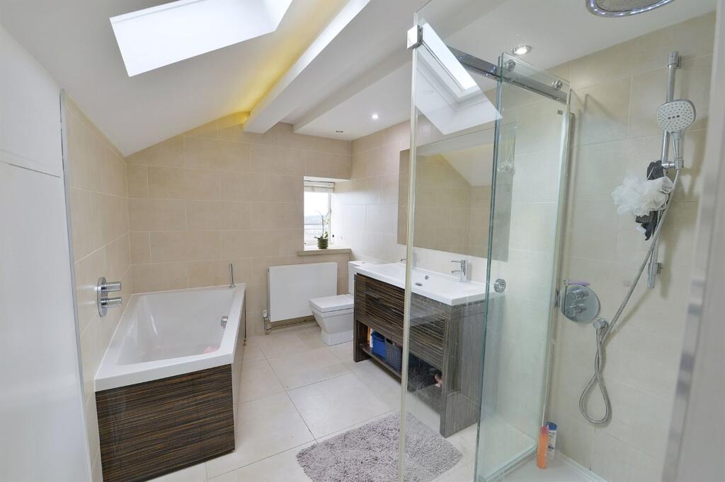
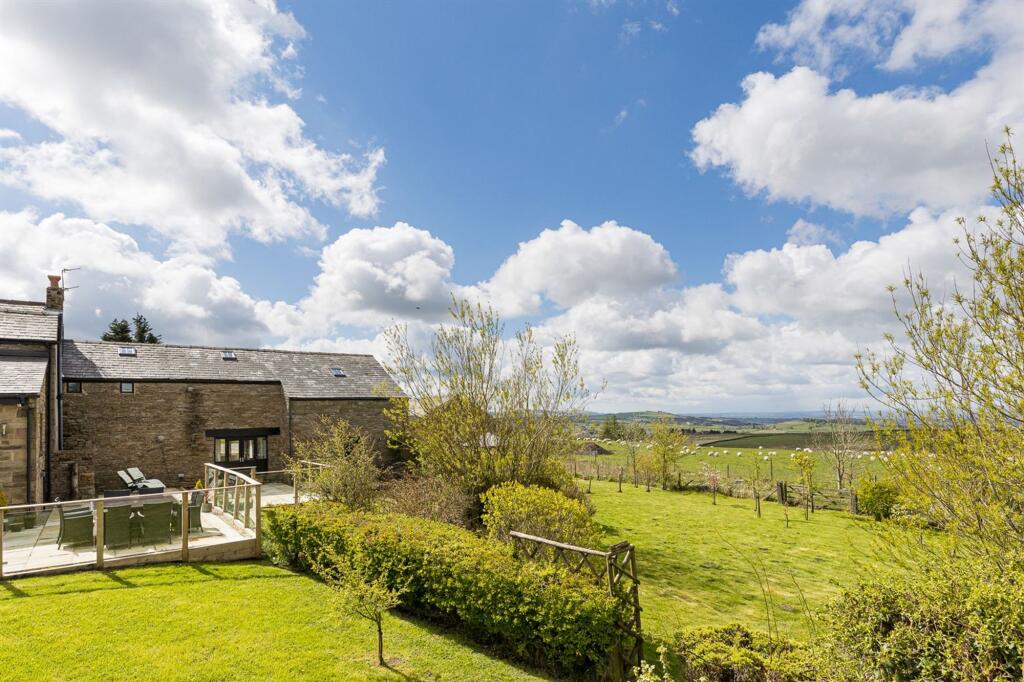
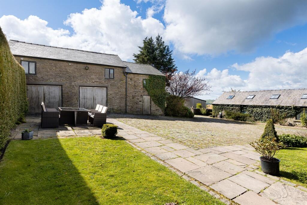
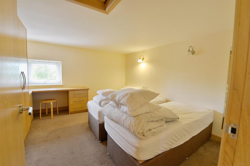
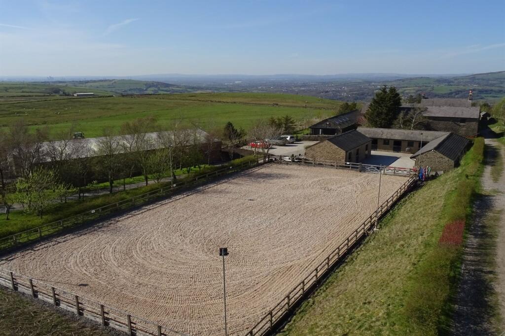
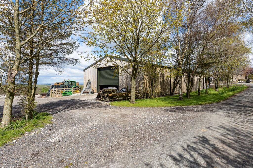
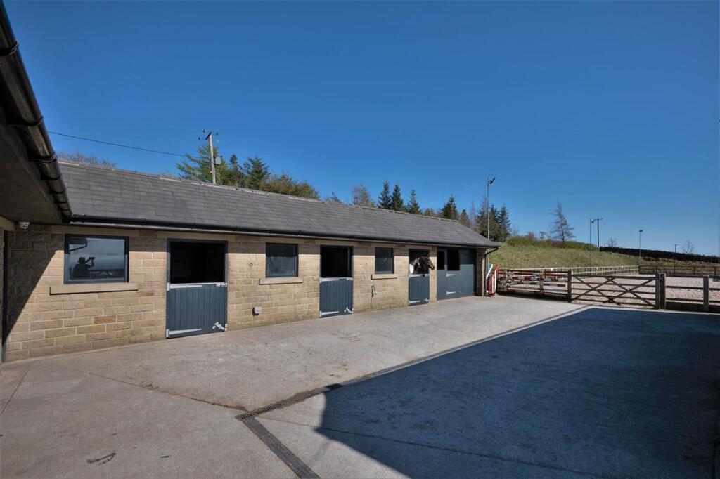
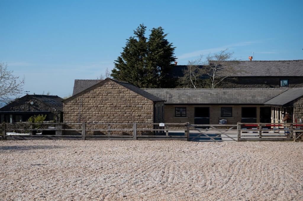
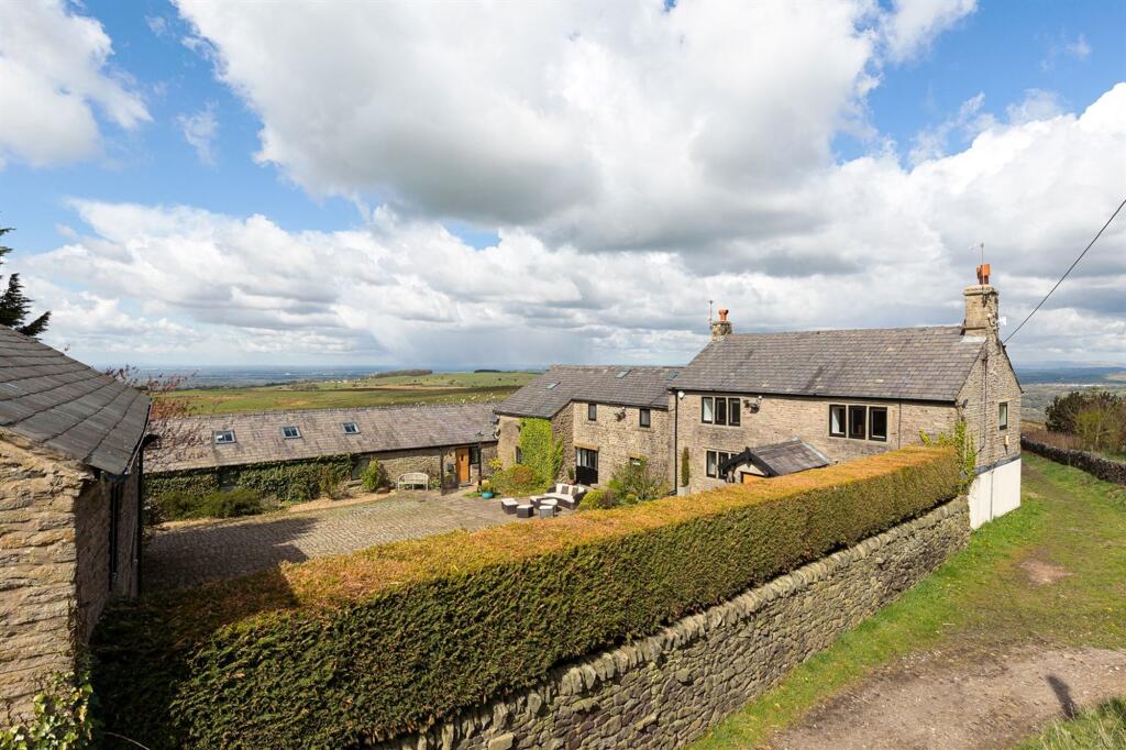
- An outstanding equestrian property
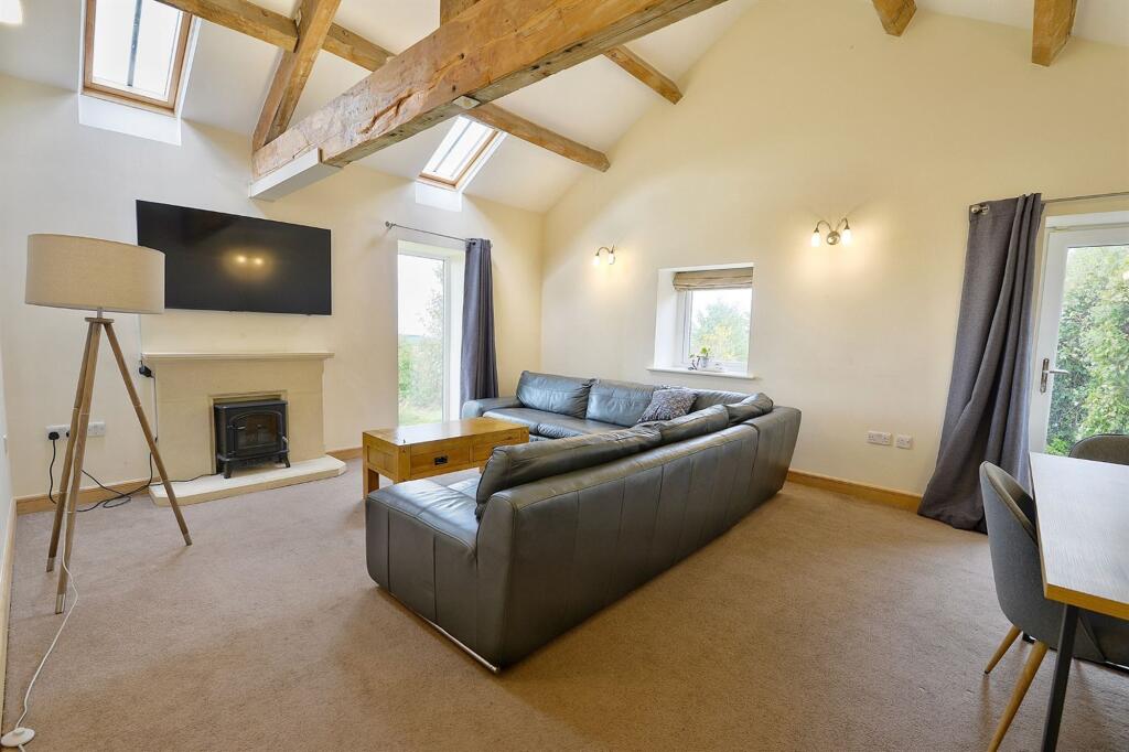
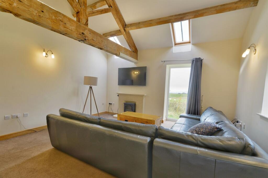
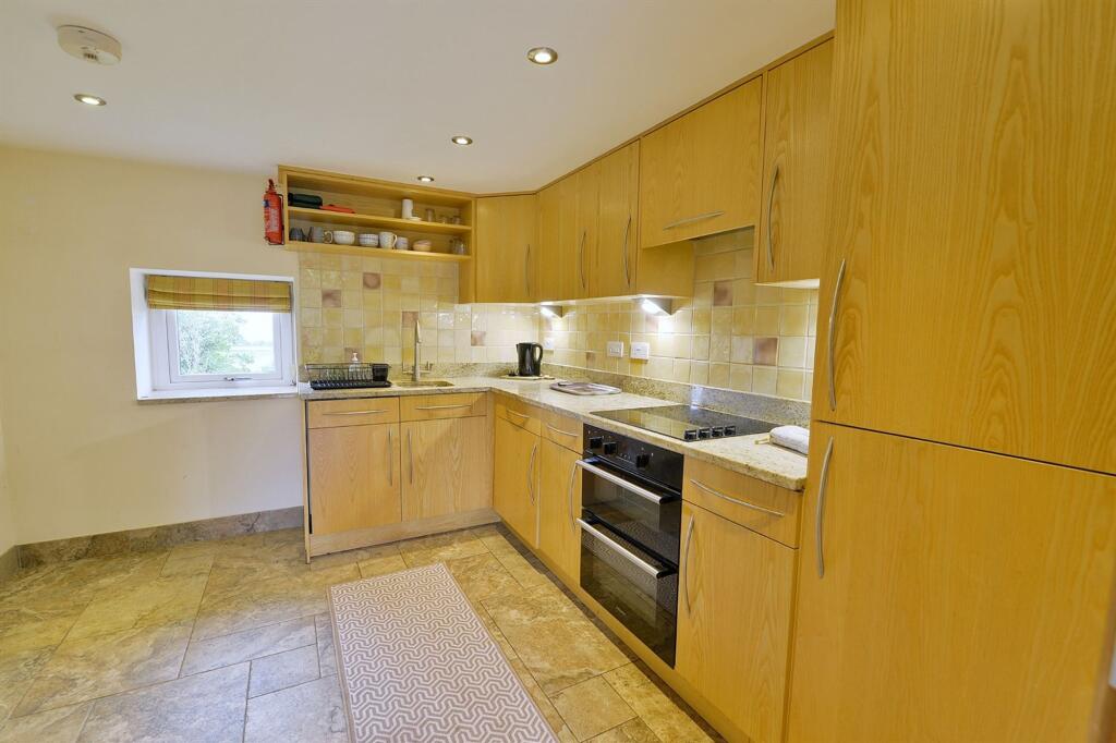
- Two bedroom self-contained annexe
- Large home office/gym
- Horse solarium & hot water shower
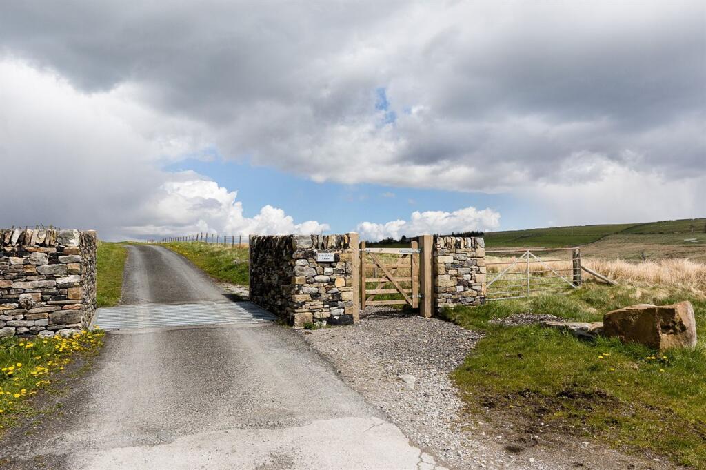
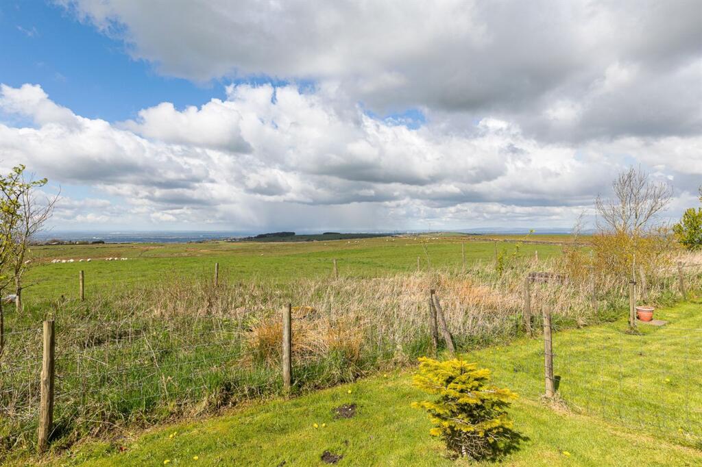
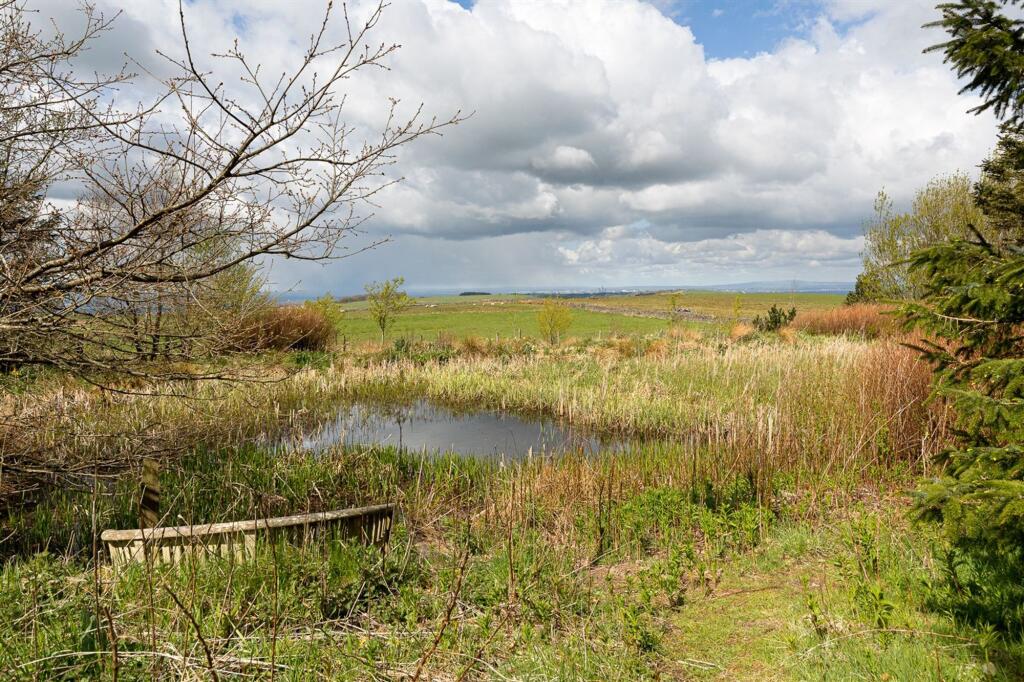
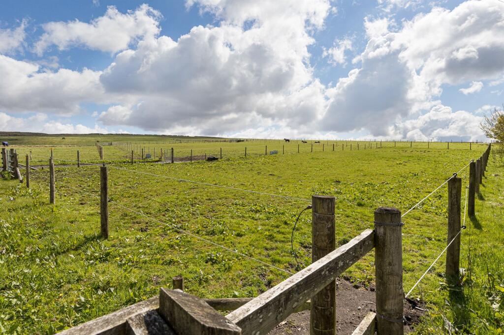
- Large parcel of land (aprox 80 acres) let to a local farmer and maintained
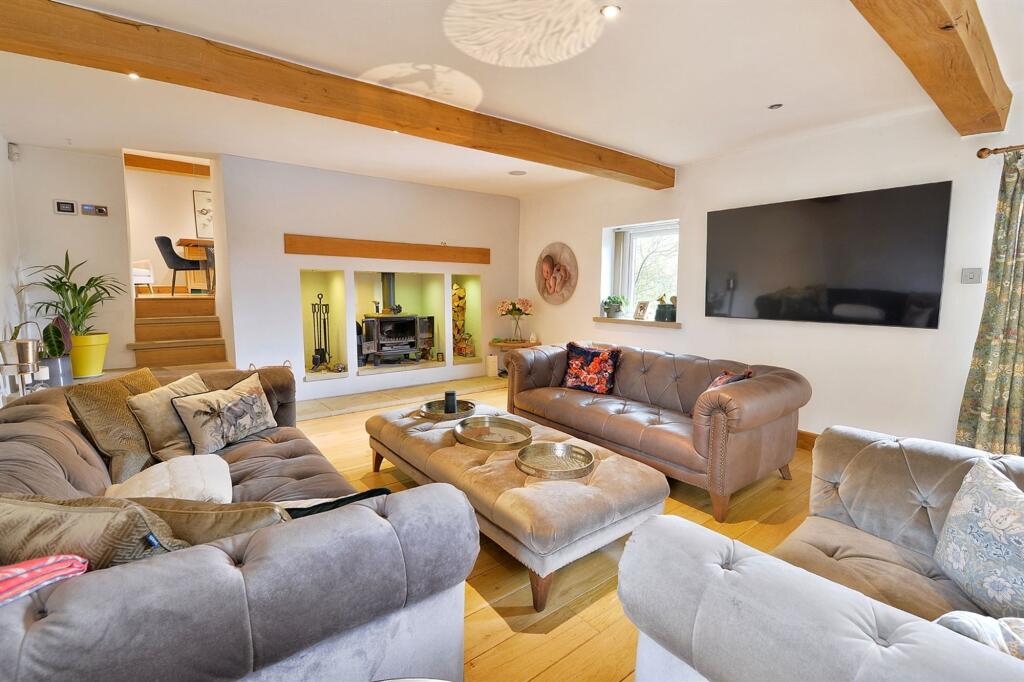
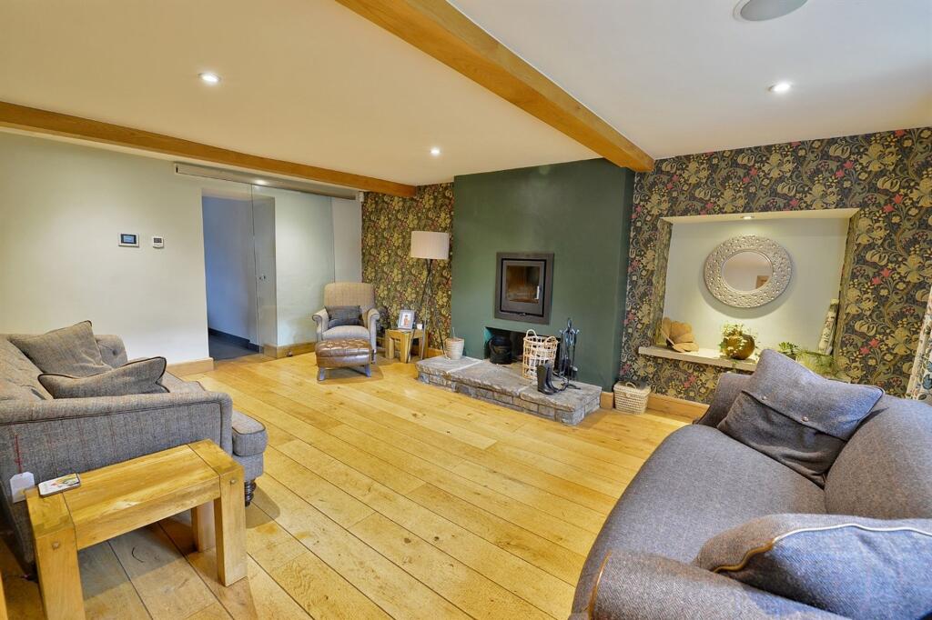
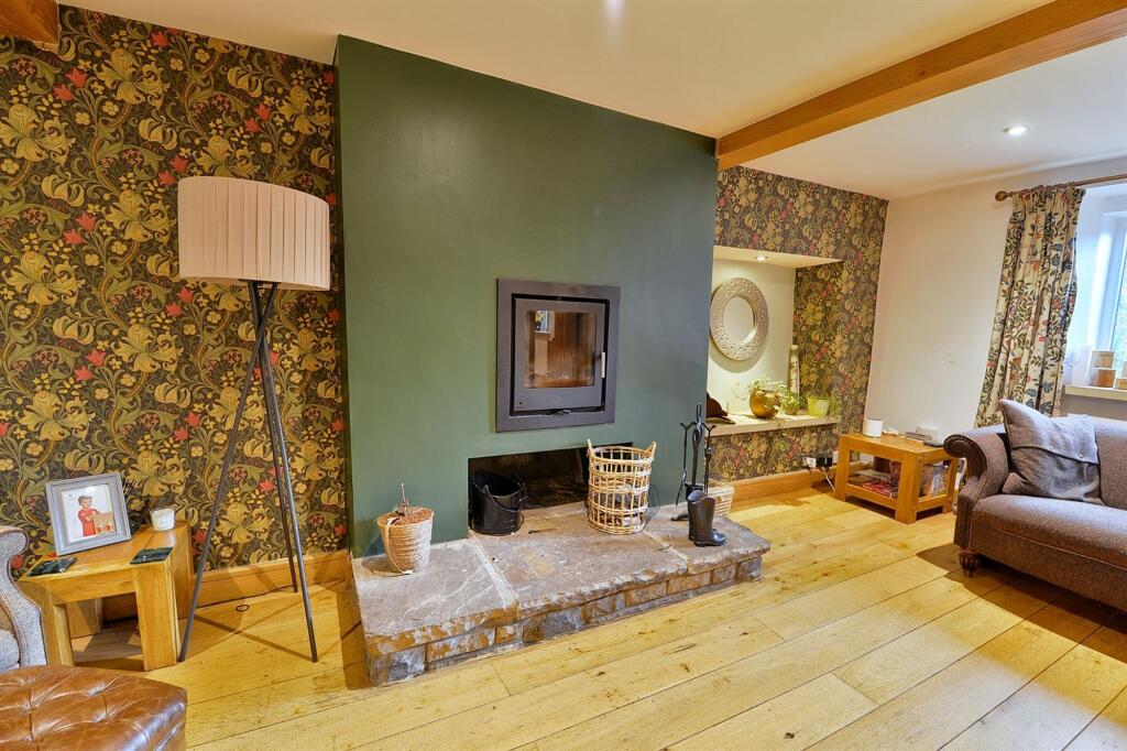
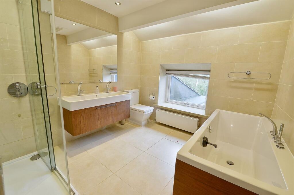
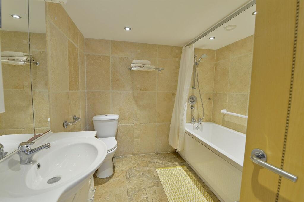
- Beautiful contemporary accommodation
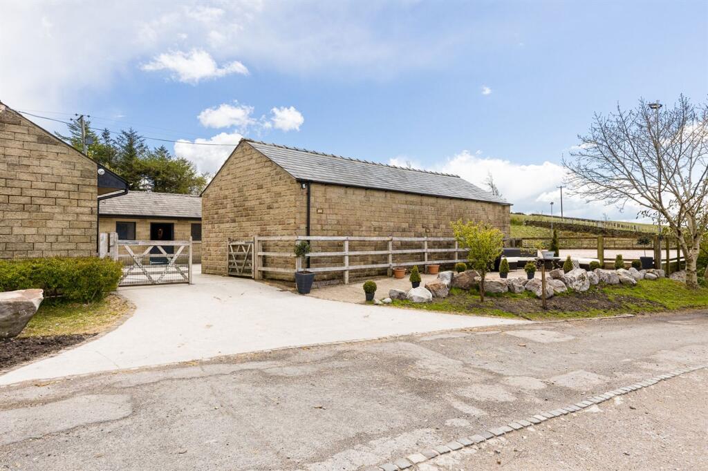
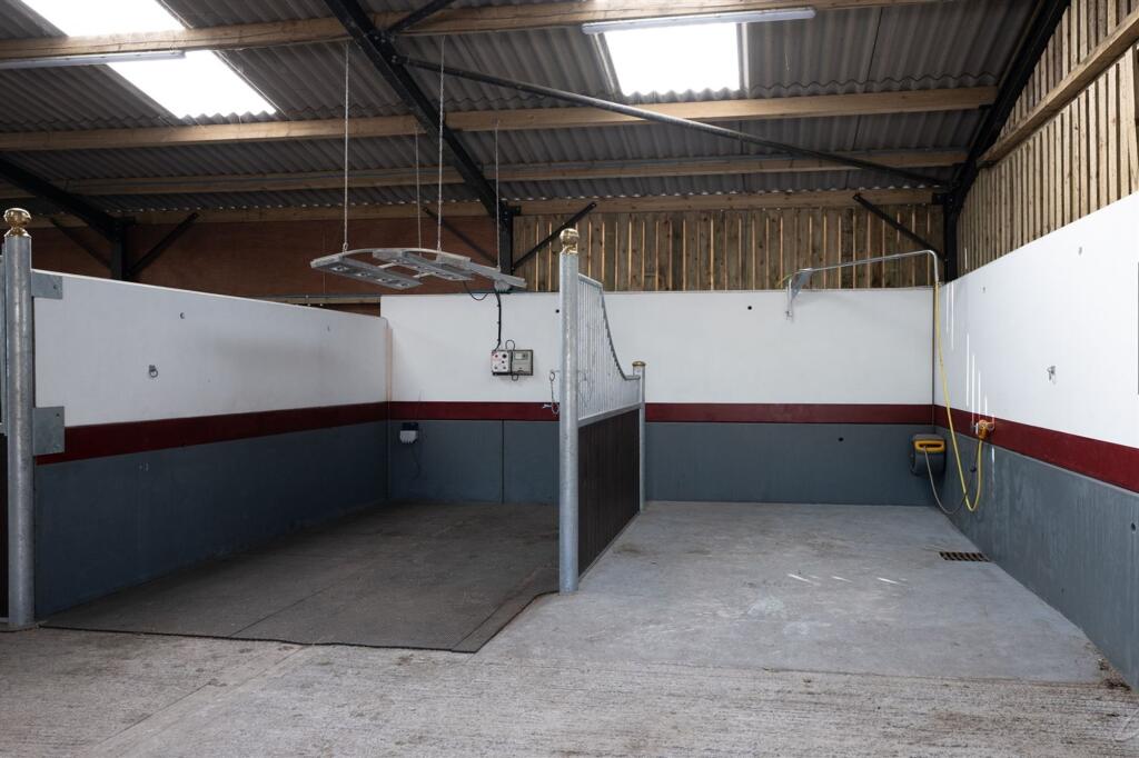
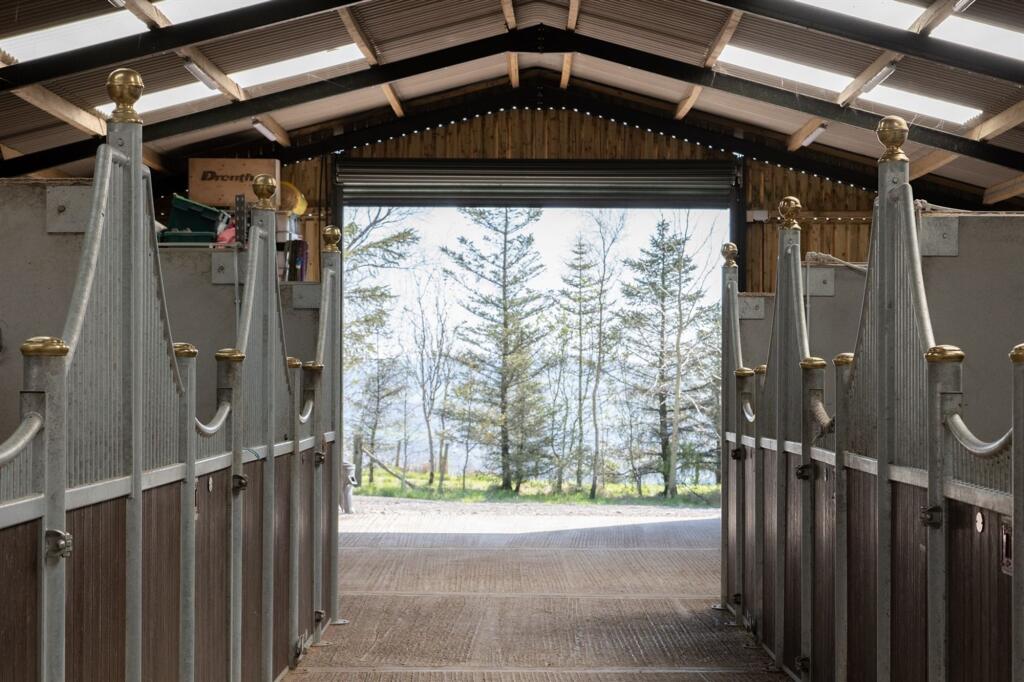
- 16 stables with potential for more
- VARIOUS ONSITE INCOME/BUSINESS OPPORTUNITIES , CONTACT MANAGER JAMES COPPOCK FOR MORE INFORMATION
Additional details
- Restrictions
- No
- Rights of way
- No
- Flooded in last 5 years
- No
- Flood defences
- No
Description
EPC Rating: E
Listed by
Marple Bridge
Gascoigne Halman - Connells
Reference: 174768155
EPC ratings on this postcode
We don't have a matched EPC for this property yet. Below are efficiency scores and details for other addresses on this postcode.
| Address | Current | Potential | Floor area | Age band | Type |
|---|---|---|---|---|---|
| Annexe Far Slack Farm, Rowarth | 70 | 88 | 76 m² | England and Wales: 1991-1995 | Bungalow |
| Annexe Far Slack Farm, Rowarth, HIGH PEAK | 70 | 88 | 76 m² | England and Wales: 1991-1995 | Detached |
| Far Slack Farm, Rowarth | 52 | 87 | 322 m² | England and Wales: 1900-1929 | House |
| Far Slack Farm, Rowarth | 66 | 79 | 505 m² | England and Wales: before 1900 | House |
| Far Slack Farm, Rowarth | 46 | 47 | 387 m² | England and Wales: before 1900 | House |
| Far Slack Farm, Rowarth, HIGH PEAK | 52 | 87 | 322 m² | England and Wales: 1900-1929 | Detached |
| Far Slack Farm, Rowarth, HIGH PEAK | 66 | 79 | 505 m² | England and Wales: before 1900 | Detached |
Flood risk
Zone: 1
Risk: Low
Job (default Low)
Floorplans
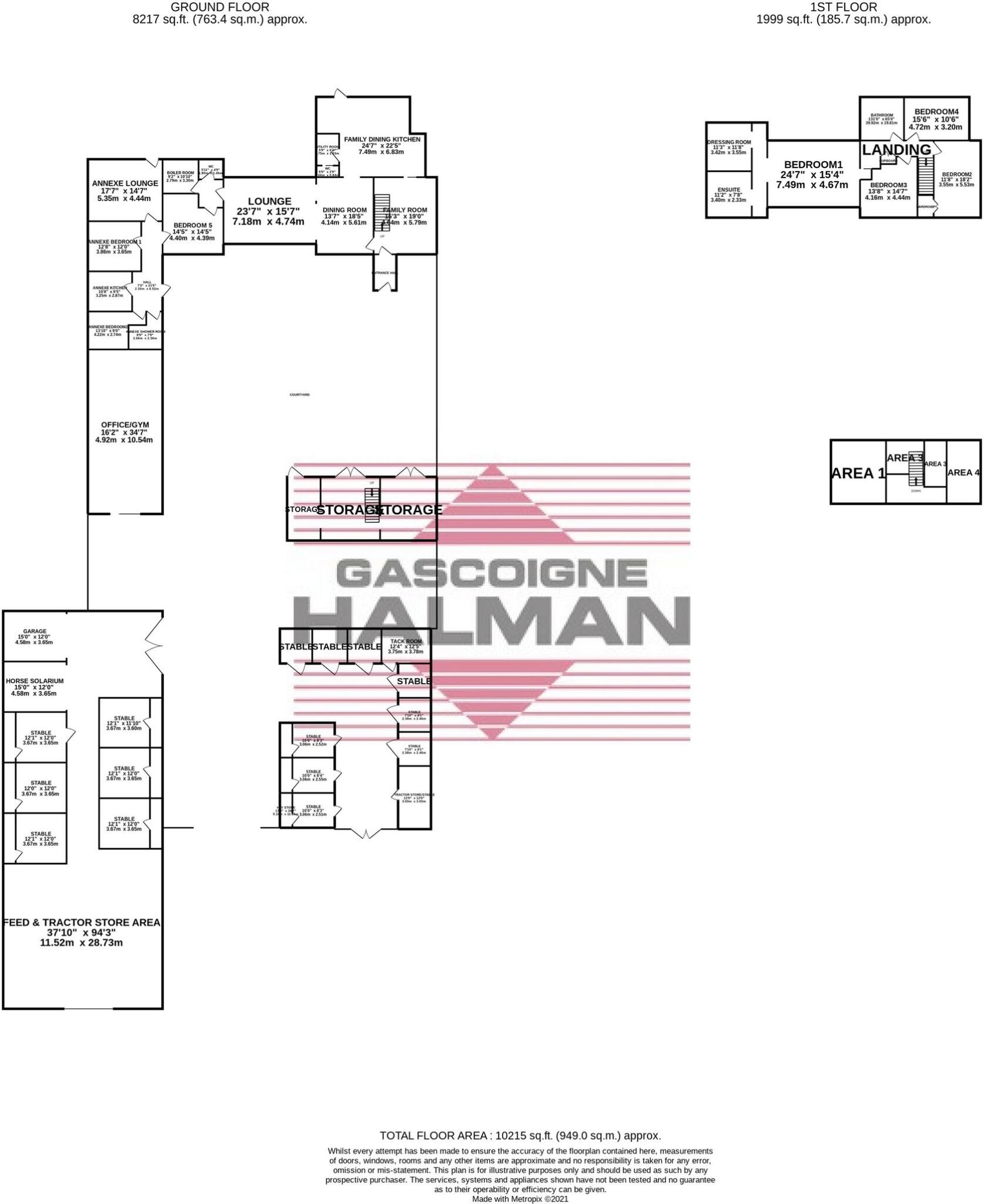
Floorplan 1
Price history
| Event | Date | Price | % change |
|---|---|---|---|
| Listed for sale | — | £1,500,000 | — |
Source: HM Land Registry Price Paid Data. Crown copyright.
Sold Comparables
Same street and nearby sales within 0.25 miles (last 5 years). Data from Land Registry Price Paid.
| Address | Price | Date | Type |
|---|---|---|---|
| FAR SLACK FARM, ROWARTH, HIGH PEAK, DERBYSHIRE, SK22 1EA | £1,580,000 | 18/03/2022 | Other |
Area average: £1,580,000 (1 sale)
Capital growth trend
Land Registry outcode average: last 12 months vs 5y and 10y ago (from sold prices).
House Price Index (HM Land Registry — official index, not sold-price averages): High Peak. Series: All dwelling types. As of March 2026.
Rental Range
Estimated market rent for High Peak. Low = conservative, Realistic = average, Optimistic = best case.
Based on Local Authority from postcode lookup → High Peak.
LHA (30th percentile) floor for Southern Greater Manchester: £1,396/mo (Apr 2025 – Mar 2026)
Location
Address
Gun Road
Nearby
Nearest stations, universities and amenities (distance from property).
| Type | Name | Distance |
|---|---|---|
| Bus stop | Chisworth, Marple Road / opposite Holehouse | 1.0 miles |
| Bus stop | Chisworth, Marple Road / adjacent Holehouse | 1.0 miles |
| Shop | Charlesworth Motors | 1.3 miles |
| Shop | Unknown | 1.3 miles |
| Train station | Broadbottom | 2.2 miles |
| Train station | Dinting | 2.5 miles |
| Hospital | Park Lodge Independent Hospital | 3.9 miles |
| Hospital | The Meadows | 5.6 miles |
| University | UK Management College | 8.3 miles |
| University | University of Manchester Fallowfield Campus | 9.5 miles |
Street-level crime
| Category | Count |
|---|---|
| Other crime | 1 |
| Total incidents | 1 |
Within 1 mile during Apr 2026. Source: data.police.uk (England & Wales).
Schools nearby
Nearest open schools with Ofsted ratings (England). Closed schools are not shown. Data from Get Information about Schools and Ofsted.
| Name | Type | Distance | Ofsted |
|---|---|---|---|
| Charlesworth Voluntary Controlled Primary School | Primary | 1.3 miles | Good — 26 Nov 2023 |
| St Margaret's Catholic Voluntary Academy | Primary | 1.9 miles | Good — 3 Nov 2016 |
| Simmondley Primary School | Primary | 1.9 miles | Good — 19 Jan 2016 |
| Whitfield St James' CofE (VC) Primary School | Primary | 2.2 miles | Good — 28 Sep 2023 |
| St Philip Howard Catholic Voluntary Academy | Secondary | 2.3 miles | Good — 15 Nov 2021 |
Rental Comparables
Loading rental comparables for this postcode. Refresh in a few minutes.
Rent-driven metrics
Based on Area rent estimate.
- Rent ratio — Monthly rent ÷ purchase price (1% rule). 1%+ = strong, 0.8–1% = okay, <0.8% = weak for cashflow.
- Max investor price — Rent ÷ 0.8%; the price at which rent would be 0.8% of price (Stoke-style target).
- Target investor price — Rent ÷ 1%; the price at which rent would be 1% of price (strong cashflow band).
- Gross yield — Annual rent as % of purchase price (no costs).
Enter House Number
Enter the house number to help us retrieve more accurate pricing history and property data.
Please log in to submit or correct the house number for this listing.
Log in to continue