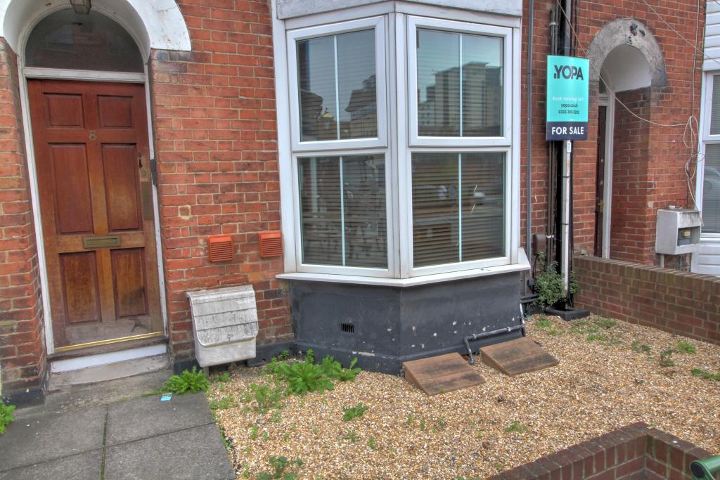
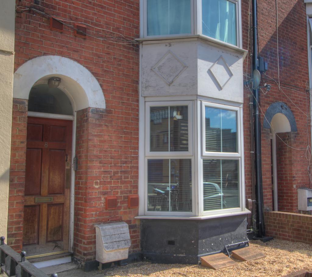
FLAT 1
8 BELLEVUE ROAD, SOUTHAMPTON, SOUTHAMPTON, SOUTHAMPTON SO15 2QD
Property details
Floor area
64 m²
EPC rating
D
Year built
England and Wales: 1967-1975
Last sold
£149,000 Jul 2007
Price per m²
£2,813/m²
Local average
£157,946 (+14%)
Deprivation
Decile 3 (9,906 of 33,755)
Street crime
1091 incidents within 1 mile (Apr 2026)
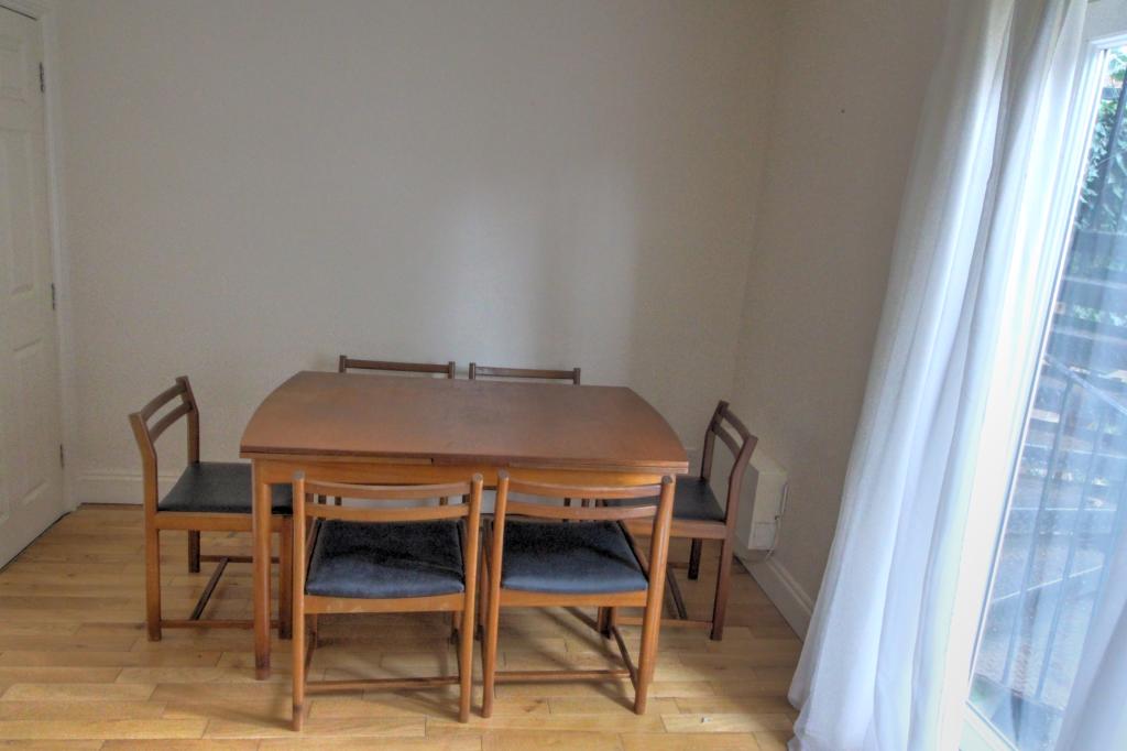
Key features
- Long lease
- Ideal 1st time buy
- Perfect investment
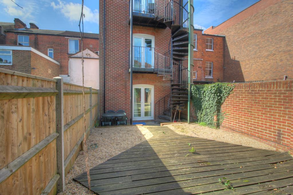
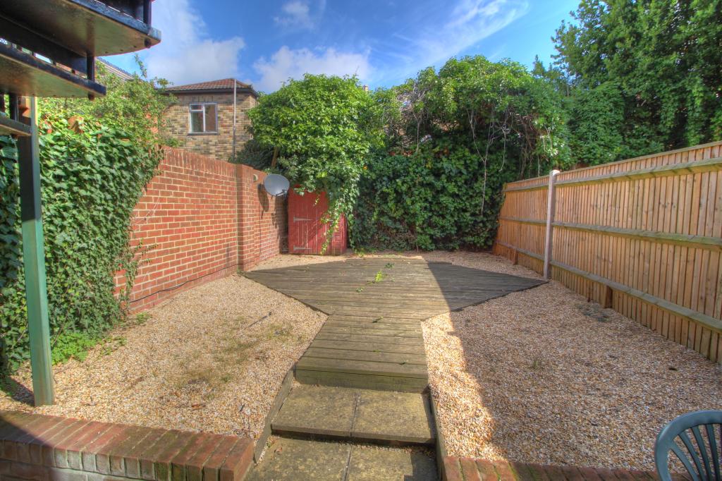
- Rear shared garden
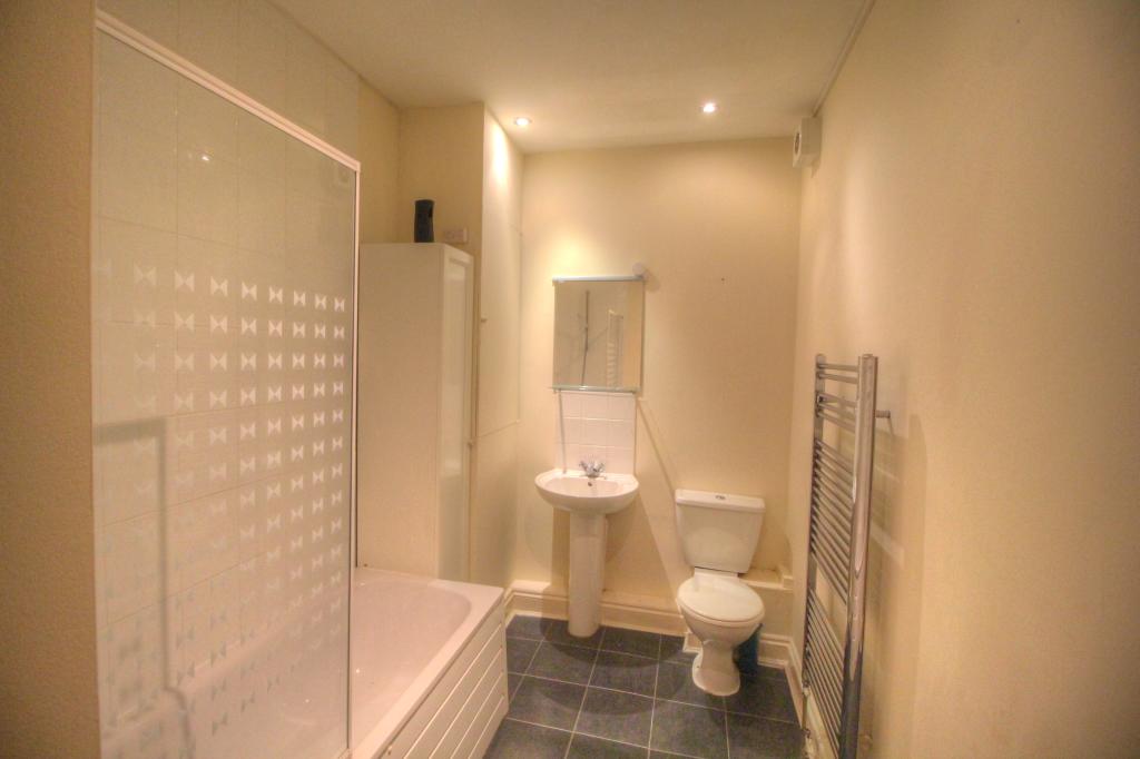
- Modern bathroom
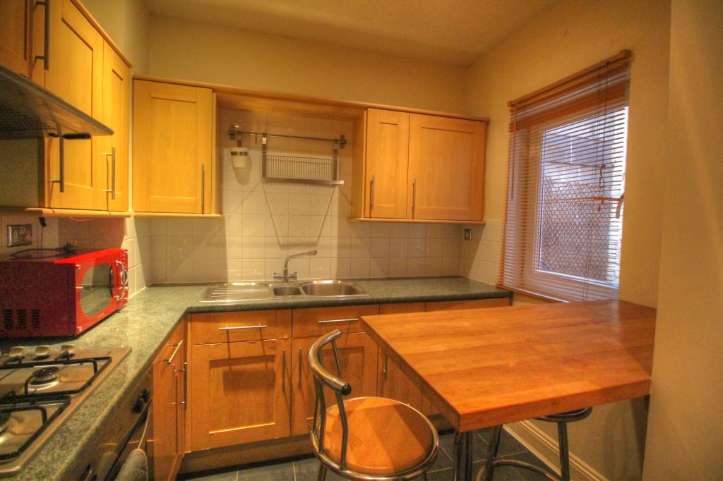
- Breakfast bar
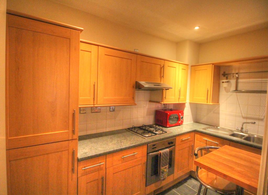
- Modern kitchen
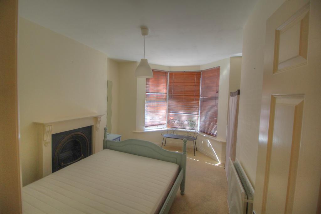
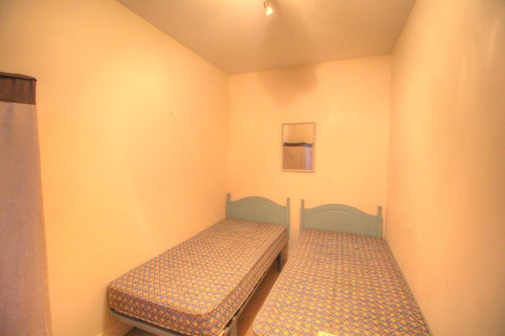
- Two double bedrooms
- Private garden
Additional details
- Garden
- Yes
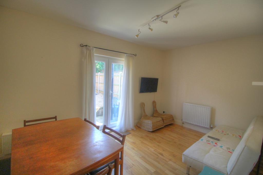
Description
This superb apartment is located near London Road and Bedford Place offering great shopping facilities, excellent public transport links including a short walk to city center railway station, all the major hub for all the bus routes and easy access to the M3/M27 to London.
DO NOT MISS OUT ON THIS GREAT OPPORTUNITY!!
Listed by
Nationwide
Yopa Property Ltd
Reference: 68328956
EPC Rating & Upgrade Cost
Current rating: D
Potential rating: C
Inspection date: 12/05/2020
Expiry date: 11/05/2030
Current heating cost: £528/year
Potential heating cost: £305/year
Est. upgrade cost to C: £14,025
Recommendations
- Cavity wall insulation (£500 - £1,500)
- 50 mm internal or external wall insulation (£4,000 - £14,000)
- Floor insulation (suspended floor) (£800 - £1,200)
- Low energy lighting for all fixed outlets (£25)
- Upgrade heating controls (£350 - £450)
- Replace boiler with new condensing boiler (£2,200 - £3,000)
Flood risk
Zone: 1
Risk: Low
Job (default Low)
Floorplans
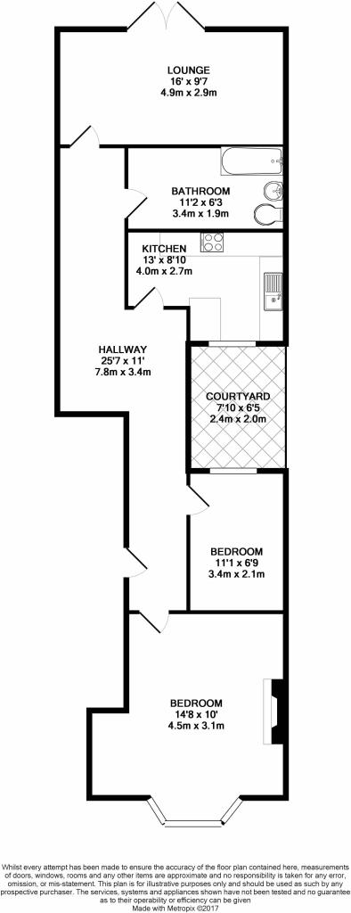
Bellevue-print.JPG
Price history
10% since 2004
| Event | Date | Price | % change |
|---|---|---|---|
| Sold | 20/07/2007 (18 years ago) | £149,000 | +9.6% |
| Sold | 09/02/2004 (22 years ago) | £136,000 | — |
Source: HM Land Registry Price Paid Data. Crown copyright.
Sold Comparables
Same street and nearby sales within 0.25 miles (last 5 years). Data from Land Registry Price Paid.
| Address | Price | Date | Type |
|---|---|---|---|
| 77 FLAT 4 LONDON ROAD, SOUTHAMPTON, SO15 2AA | £179,950 | 08/01/2025 | Flat |
| 77 FLAT 5 LONDON ROAD, SOUTHAMPTON, SO15 2AA | £95,000 | 26/10/2022 | Flat |
| 77 FLAT 1 LONDON ROAD, SOUTHAMPTON, SO15 2AA | £90,000 | 20/05/2022 | Flat |
| 77 FLAT 2 LONDON ROAD, SOUTHAMPTON, SO15 2AA | £90,000 | 29/03/2022 | Flat |
| 77 FLAT 3 LONDON ROAD, SOUTHAMPTON, SO15 2AA | £90,000 | 29/03/2022 | Flat |
Area average: £108,990 (5 sales)
Capital growth trend
Land Registry outcode average: last 12 months vs 5y and 10y ago (from sold prices).
House Price Index (HM Land Registry — official index, not sold-price averages): Southampton. Series: Flats and maisonettes. As of March 2026.
Rental Range
Estimated market rent for Southampton. Low = conservative, Realistic = average, Optimistic = best case.
Based on Local Authority from postcode lookup → Southampton.
LHA (30th percentile) floor for Cherwell Valley: £947/mo (Apr 2025 – Mar 2026)
Location
Nearby
Nearest stations, universities and amenities (distance from property).
| Type | Name | Distance |
|---|---|---|
| Shop | A Hair Salon | 0.0 miles |
| Shop | Rachael Katie Cosmetics | 0.1 miles |
| Bus stop | Law Courts | 0.1 miles |
| Hospital | Royal South Hants Urgent Treatment Centre | 0.3 miles |
| Train station | Southampton Central | 0.6 miles |
| Train station | St Denys | 0.9 miles |
| University | Waterfront Campus | 1.4 miles |
| University | Boldrewood Innovation Campus | 1.7 miles |
Street-level crime
| Category | Count |
|---|---|
| Violence and sexual offences | 351 |
| Anti-social behaviour | 135 |
| Shoplifting | 135 |
| Public order | 97 |
| Drugs | 89 |
| Criminal damage and arson | 73 |
| Other theft | 72 |
| Burglary | 32 |
| Vehicle crime | 32 |
| Robbery | 23 |
| Possession of weapons | 20 |
| Other crime | 14 |
| Bicycle theft | 12 |
| Theft from the person | 6 |
| Total incidents | 1091 |
Within 1 mile during Apr 2026. Source: data.police.uk (England & Wales).
Schools nearby
Nearest open schools with Ofsted ratings (England). Closed schools are not shown. Data from Get Information about Schools and Ofsted.
| Name | Type | Distance | Ofsted |
|---|---|---|---|
| St Anne's Catholic School | Secondary | 0.2 miles | Outstanding — 19 Apr 2016 |
| Southampton Solent University | Other | 0.4 miles | — (No rating) |
| Banister Primary School | Primary | 0.4 miles | Good — 29 Nov 2018 |
| Mount Pleasant Juniors | Primary | 0.4 miles | Outstanding — 30 Jul 2023 |
| Mount Pleasant Infants | Primary | 0.4 miles | Requires improvement — 8 Feb 2023 |
Rental Comparables
Loading rental comparables for this postcode. Refresh in a few minutes.
Rent-driven metrics
Based on Area rent estimate.
- Rent ratio — Monthly rent ÷ purchase price (1% rule). 1%+ = strong, 0.8–1% = okay, <0.8% = weak for cashflow.
- Max investor price — Rent ÷ 0.8%; the price at which rent would be 0.8% of price (Stoke-style target).
- Target investor price — Rent ÷ 1%; the price at which rent would be 1% of price (strong cashflow band).
- Gross yield — Annual rent as % of purchase price (no costs).