34 WICK ROAD
BRISTOL, CITY OF BRISTOL BS4 4HB
£1,750 pcm
Property details
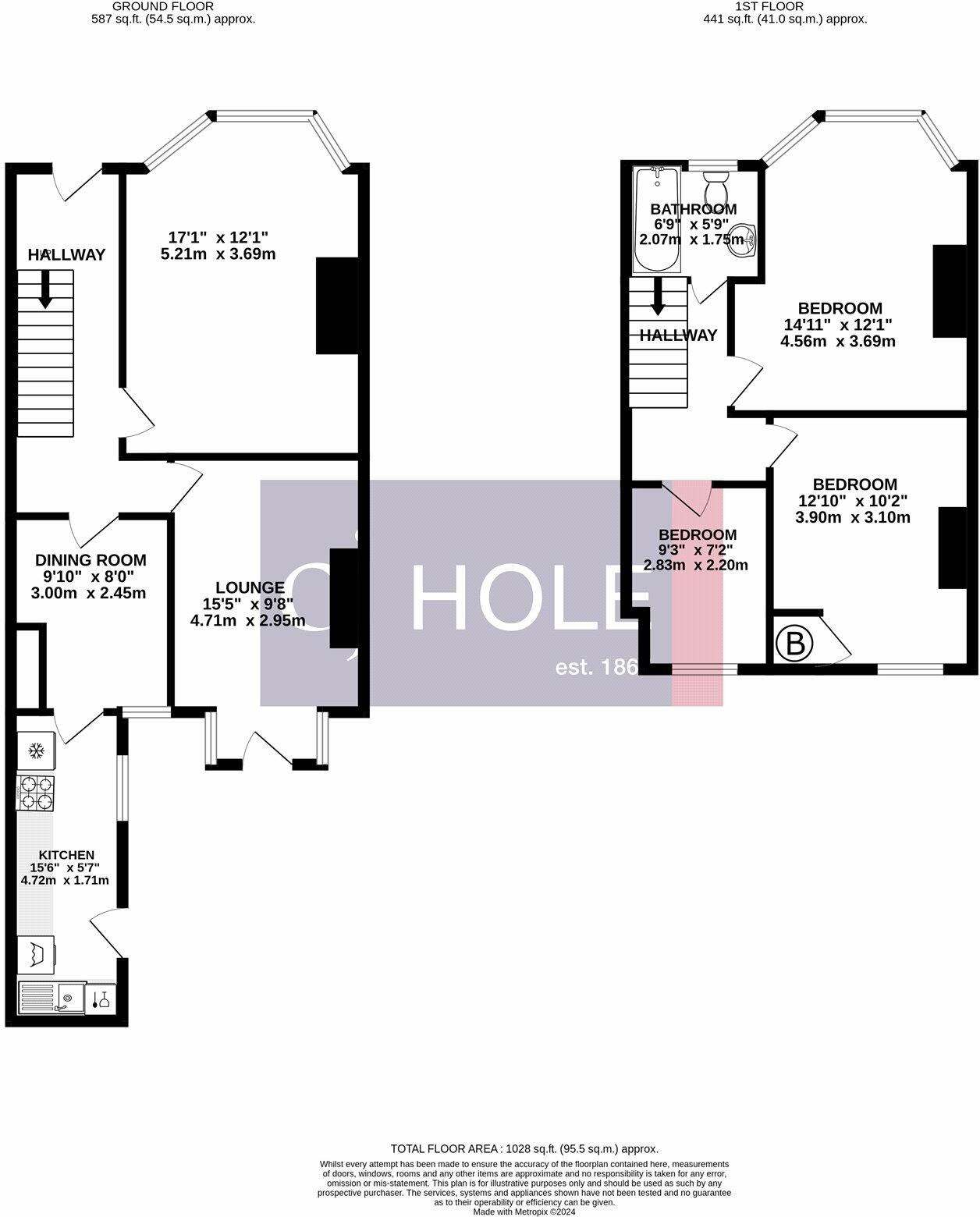
Floor area
103 m²
Council tax band
B
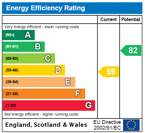
EPC rating
D
Year built
England and Wales: 1900-1929
Deprivation
Decile 7 (21,609 of 33,755)
Street crime
340 incidents within 1 mile (Apr 2026)
Key features
- Family Home
- Brislington Location
- White Goods Included
- Unfurnished
- Pets Considered
- Available Start of October
- On-Street Parking
- Call CJ Hole to Find Out More
Additional details
- Electricity
- Mains supply
- Water
- Mains supply
- Sewerage
- Mains supply
- Heating
- Gas
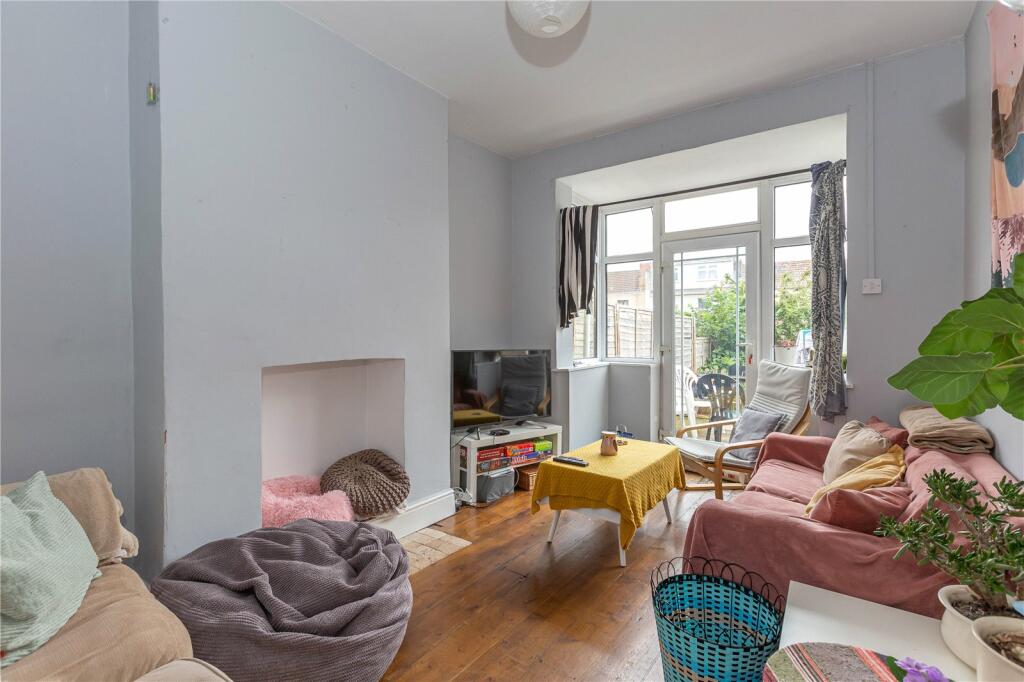
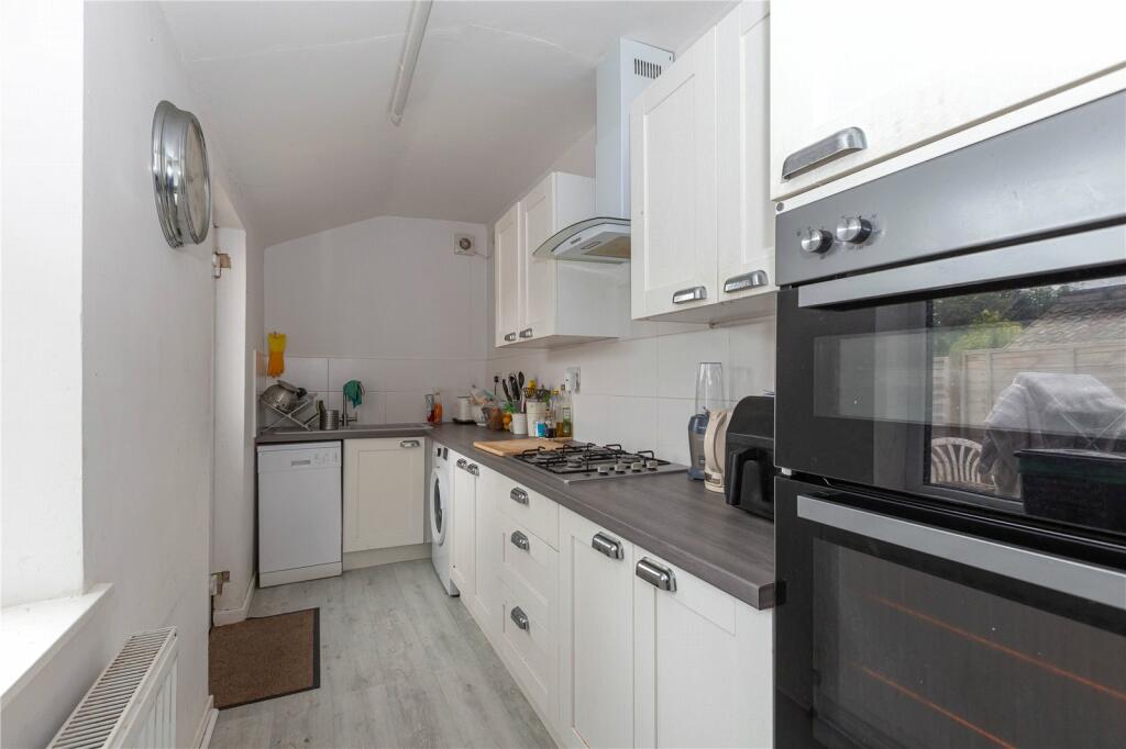
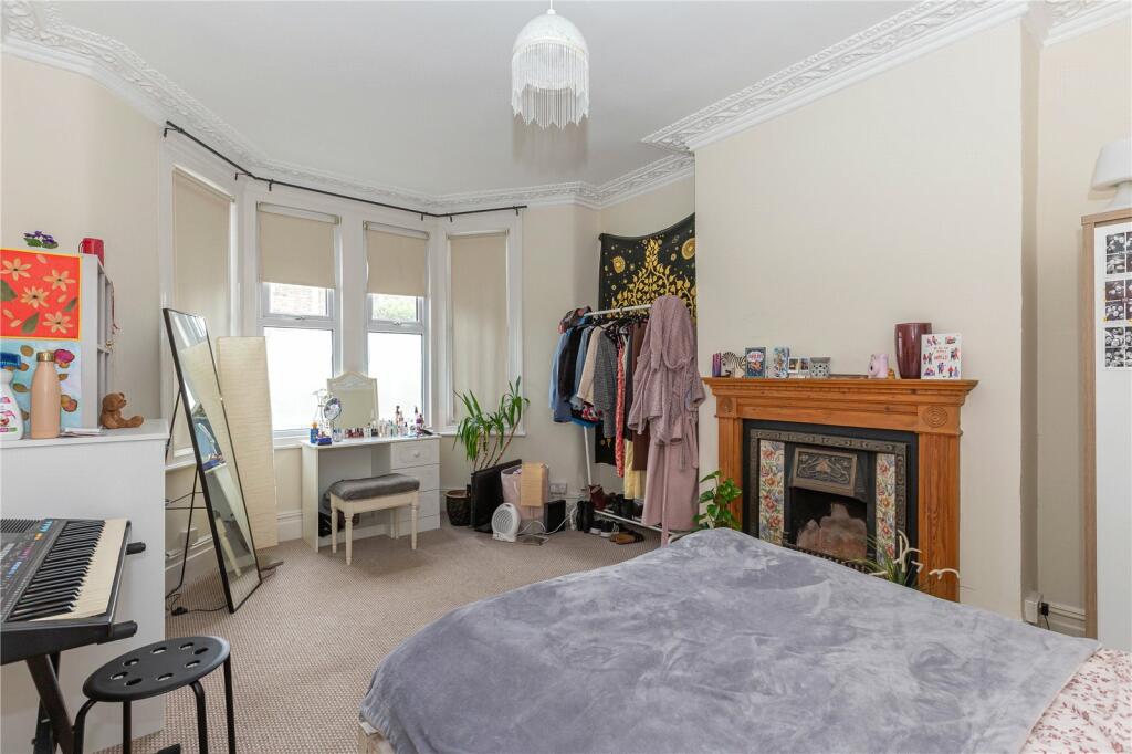
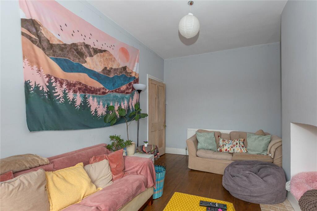
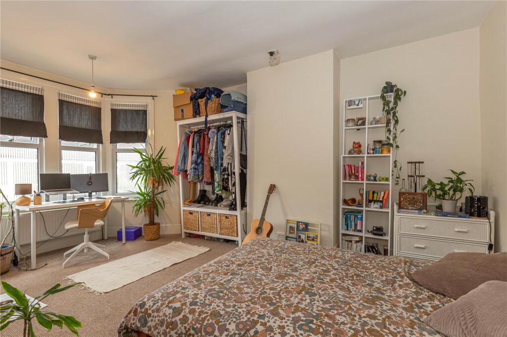
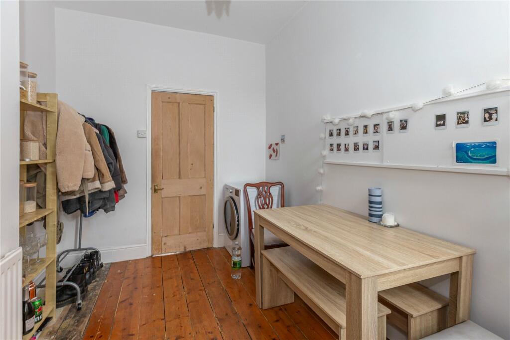
Description
Council Tax Band: A
Holding Deposit: £403.85
Security Deposit: £2,019.20
Listed by
Clifton
The Property Franchise Group
Reference: 86992152
EPC Rating & Upgrade Cost
Current rating: D
Potential rating: B
Inspection date: 21/05/2020
Expiry date: 20/05/2030
Recommendations
- Flat roof or sloping ceiling insulation (1,500)
- 50 mm internal or external wall insulation (14,000)
- Floor insulation (suspended floor) (1,200)
- Low energy lighting for all fixed outlets (50)
- Solar water heating (6,000)
- Solar photovoltaic panels, 2.5 kWp (5,500)
Flood risk
Zone: 1
Risk: Low
Job (default Low)
Floorplans
Picture No. 01
EPC Graphs
EPC Rating Graph
Rental Range
Estimated market rent for Bristol, City of. Low = conservative, Realistic = average, Optimistic = best case.
Based on Local Authority from postcode lookup → Bristol, City of.
LHA (30th percentile) floor for Bristol: £1,296/mo (Apr 2025 – Mar 2026)
Location
Nearby
Nearest stations, universities and amenities (distance from property).
| Type | Name | Distance |
|---|---|---|
| Bus stop | Eagle Road | 0.1 miles |
| Bus stop | Montrose Park | 0.1 miles |
| Shop | Bellevue Convenience Store | 0.2 miles |
| Shop | KPR convenience store | 0.2 miles |
| University | Bristol Digital Futures Institute | 1.4 miles |
| Train station | Bristol Temple Meads | 1.5 miles |
| Train station | Lawrence Hill | 1.6 miles |
| University | dBs Institute Bristol Campus | 1.9 miles |
| Hospital | St Michael's Hospital | 2.6 miles |
| Hospital | The Chesterfield | 3.0 miles |
Street-level crime
| Category | Count |
|---|---|
| Violence and sexual offences | 139 |
| Anti-social behaviour | 38 |
| Criminal damage and arson | 33 |
| Public order | 31 |
| Other theft | 28 |
| Shoplifting | 21 |
| Burglary | 15 |
| Vehicle crime | 15 |
| Drugs | 5 |
| Other crime | 5 |
| Bicycle theft | 3 |
| Robbery | 3 |
| Theft from the person | 3 |
| Possession of weapons | 1 |
| Total incidents | 340 |
Within 1 mile during Apr 2026. Source: data.police.uk (England & Wales).
Schools nearby
Nearest open schools with Ofsted ratings (England). Closed schools are not shown. Data from Get Information about Schools and Ofsted.
| Name | Type | Distance | Ofsted |
|---|---|---|---|
| Holymead Primary School | Primary | 0.2 miles | Good — 3 Jun 2014 |
| Prospect Education Trust | Other | 0.4 miles | — (No rating) |
| Broomhill Junior School | Primary | 0.6 miles | Good — 15 Dec 2011 |
| Wicklea Academy | Primary | 0.7 miles | Requires improvement — 11 Nov 2021 |
| West Town Lane Academy | Primary | 0.7 miles | Good — 18 Mar 2019 |
Rental Comparables
Residential lets from OpenRent and Rightmove for the area (same bedroom count). Use to validate rent estimates. Student lets are excluded.
| Title | Rent | Beds | Distance | As seen on |
|---|---|---|---|---|
| 3 Bed End Terrace, St Aubins Avenue, BS4 | £550/mo | 3 | 0.6 miles | OpenRent |
Average rent: £550/mo (1 listing)