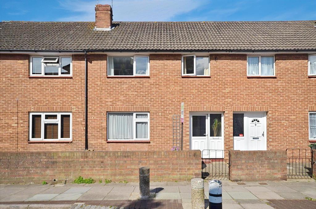
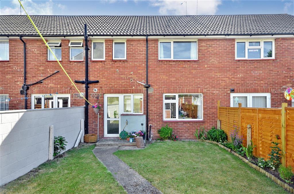
132 GUILDFORD ROAD
PORTSMOUTH, PORTSMOUTH PO1 5EB
£160,000
Property details
Floor area
79 m²
Last sold
£158,000 Nov 2014
Local average
£246,479 (-35.1%)
Deprivation
Decile 3 (7,968 of 33,755)
Street crime
986 incidents within 1 mile (Apr 2026)
Key features
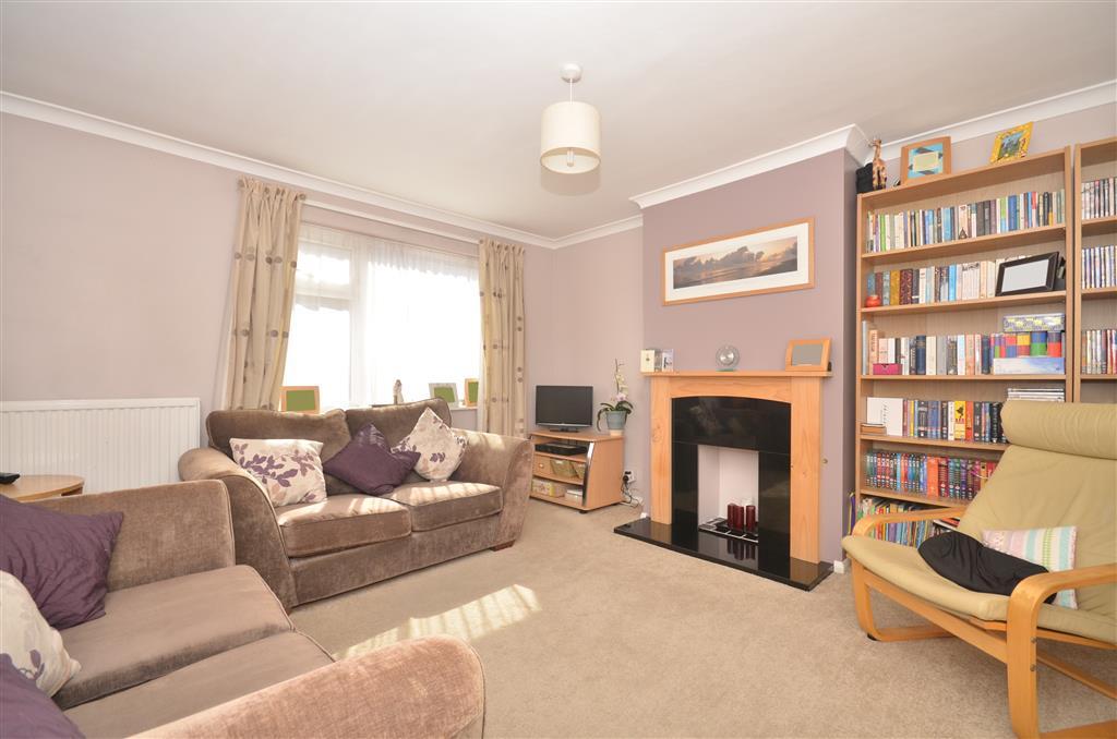
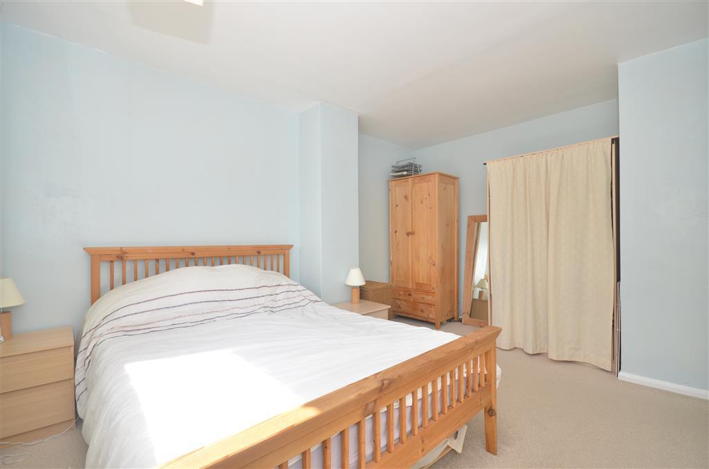
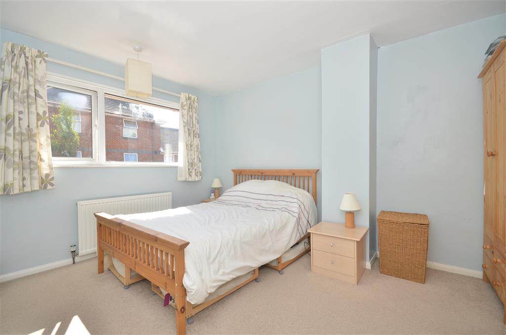
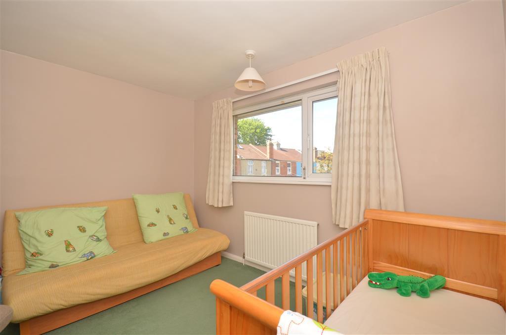
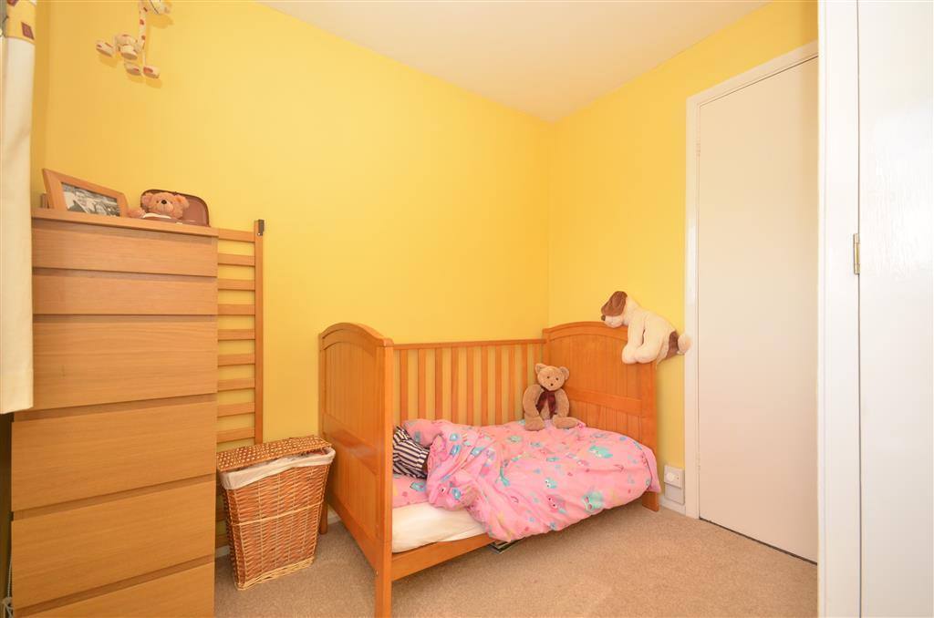
- 3 bedroom family home
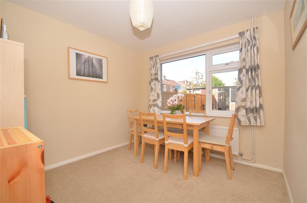
- 2 reception rooms
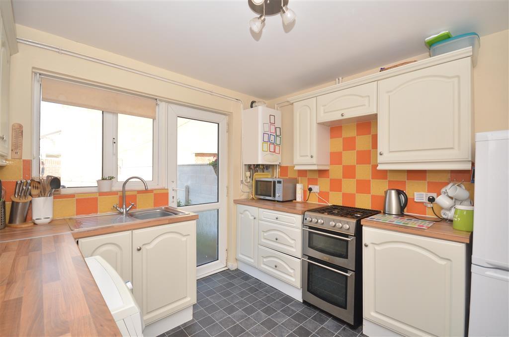
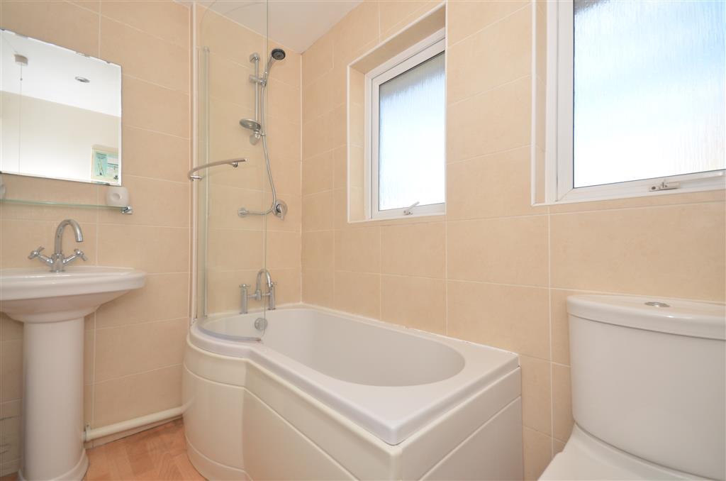
- Fitted kitchen & bathroom
- Centrally located
- Close to schools & amenities
- EPC energy rating C (70)
Additional details
- Parking
- Yes
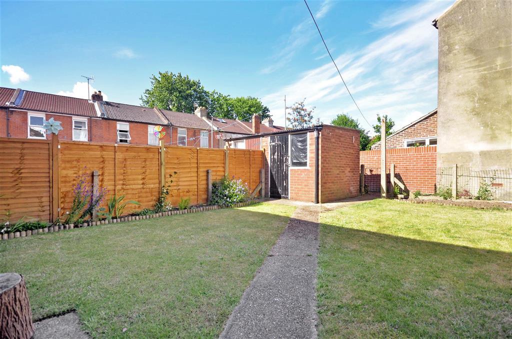
- Garden
- Yes
Description
We bought our home six years ago and have been very happy here. Our only reason for a move now is to upsize and move out of the city slightly, based on the expanding family. When we purchased we just really liked the position and the surrounding area. Everything you need daily is pretty much on your doorstep and you don't need to drive everywhere. Over the years we have upgraded and kept on top of decor, kept it neutral for the next owner(s) moving in. We hope whoever now guys our home takes as much enjoyment from it as we have over the years. Room sizes:Entrance HallLounge: 12'8 x 12'6 (3.86m x 3.81m)Dining Room: 9'8 x 9'7 (2.95m x 2.92m)Kitchen: 9'8 x 9'4 (2.95m x 2.85m)LandingBedroom 1: 14'2 x 12'8 (4.32m x 3.86m)Bedroom 2: 12'6 x 9'8 (3.81m x 2.95m)Bedroom 3: 9'8 x 7'9 (2.95m x 2.36m)Bathroom: 7'5 x 5'9 (2.26m x 1.75m)Garden
The information provided about this property does not constitute or form part of an offer or contract, nor may be it be regarded as representations. All interested parties must verify accuracy and your solicitor must verify tenure/lease information, fixtures & fittings and, where the property has been extended/converted, planning/building regulation consents. All dimensions are approximate and quoted for guidance only as are floor plans which are not to scale and their accuracy cannot be confirmed. Reference to appliances and/or services does not imply that they are necessarily in working order or fit for the purpose.
Listed by
Portsmouth
Arun Estates
Reference: 31363341
EPC Rating & Upgrade Cost
Fetching EPC data… Refresh this page in a moment.
Flood risk
Zone: 1
Risk: Low
Job (default Low)
Price history
| Event | Date | Price | % change |
|---|---|---|---|
| Sold | 14/11/2014 (11 years ago) | £158,000 | — |
Source: HM Land Registry Price Paid Data. Crown copyright.
Sold Comparables
Same street and nearby sales within 0.25 miles (last 5 years). Data from Land Registry Price Paid.
| Address | Price | Date | Type |
|---|---|---|---|
| 63 LIVERPOOL ROAD, FRATTON, PORTSMOUTH, PO1 5DY | £217,500 | 26/01/2026 | Terraced |
| 55 BROOKFIELD ROAD, FRATTON, PORTSMOUTH, PO1 5HZ | £189,000 | 16/12/2025 | Terraced |
| 1 LOWER BROOKFIELD ROAD, PORTSMOUTH, PO1 5HY | £188,000 | 12/12/2025 | Terraced |
| 2 LINCOLN ROAD, PORTSMOUTH, PO1 5BG | £210,000 | 11/12/2025 | Terraced |
| 103 NEWCOME ROAD, FRATTON, PORTSMOUTH, PO1 5DS | £233,000 | 14/11/2025 | Terraced |
| 165 CLIVE ROAD, FRATTON, PORTSMOUTH, PO1 5JD | £185,000 | 22/08/2025 | Terraced |
| 71 MANCHESTER ROAD, PORTSMOUTH, PO1 5EJ | £200,000 | 17/06/2025 | Terraced |
| 130 NEWCOME ROAD, FRATTON, PORTSMOUTH, PO1 5DX | £180,000 | 31/01/2025 | Terraced |
| Same street 110 GUILDFORD ROAD, PORTSMOUTH, PO1 5EB | £217,000 | 20/11/2024 | Terraced |
| 46 MANCHESTER ROAD, PORTSMOUTH, PO1 5EJ | £215,000 | 18/12/2023 | Terraced |
| 36 PURBROOK ROAD, FRATTON, PORTSMOUTH, PO1 5BH | £210,000 | 08/12/2023 | Terraced |
| 50 SHEFFIELD ROAD, PORTSMOUTH, PO1 5DP | £255,000 | 30/11/2023 | Terraced |
| 134 NEWCOME ROAD, FRATTON, PORTSMOUTH, PO1 5DX | £207,500 | 27/11/2023 | Terraced |
| 7 SHEFFIELD ROAD, PORTSMOUTH, PO1 5DP | £380,000 | 13/11/2023 | Terraced |
| 38 MANCHESTER ROAD, PORTSMOUTH, PO1 5EJ | £205,000 | 08/11/2023 | Terraced |
| 128 CLIVE ROAD, FRATTON, PORTSMOUTH, PO1 5JP | £225,000 | 03/11/2023 | Terraced |
| 35 LIVERPOOL ROAD, FRATTON, PORTSMOUTH, PO1 5DY | £230,000 | 27/10/2023 | Terraced |
| 24 MANCHESTER ROAD, PORTSMOUTH, PO1 5ED | £220,000 | 18/10/2023 | Terraced |
| 146 NEWCOME ROAD, FRATTON, PORTSMOUTH, PO1 5DX | £194,160 | 02/10/2023 | Terraced |
| 29 BARNES ROAD, PORTSMOUTH, PO1 5JG | £200,000 | 28/09/2023 | Terraced |
| 70 LIVERPOOL ROAD, FRATTON, PORTSMOUTH, PO1 5DZ | £180,000 | 26/09/2023 | Terraced |
| Same street 112 GUILDFORD ROAD, PORTSMOUTH, PO1 5EB | £210,000 | 30/06/2023 | Terraced |
| Same street 114 GUILDFORD ROAD, PORTSMOUTH, PO1 5EB | £220,000 | 19/08/2022 | Terraced |
Street average: £215,667 (3 sales)
Area average: £216,208 (20 sales)
Capital growth trend
Land Registry outcode average: last 12 months vs 5y and 10y ago (from sold prices).
House Price Index (HM Land Registry — official index, not sold-price averages): Portsmouth. Series: Terraced. As of March 2026.
Rental Range
Estimated market rent for Portsmouth. Low = conservative, Realistic = average, Optimistic = best case.
Based on Local Authority from postcode lookup → Portsmouth.
LHA (30th percentile) floor for Portsmouth: £997/mo (Apr 2025 – Mar 2026)
Location
Nearby
Nearest stations, universities and amenities (distance from property).
| Type | Name | Distance |
|---|---|---|
| Shop | Handy Stores | 0.1 miles |
| Shop | Penhale News | 0.1 miles |
| Bus stop | Arundel Street | 0.1 miles |
| Train station | Fratton | 0.2 miles |
| Train station | Portsmouth and Southsea | 0.8 miles |
| University | Careers and Employability Service | 0.9 miles |
| University | St Andrew's Court Information Centre | 1.0 miles |
| Hospital | Forton Medical Centre | 3.0 miles |
| Hospital | Elmleigh Hospital | 5.9 miles |
Street-level crime
| Category | Count |
|---|---|
| Violence and sexual offences | 361 |
| Anti-social behaviour | 129 |
| Shoplifting | 99 |
| Public order | 81 |
| Other theft | 63 |
| Criminal damage and arson | 59 |
| Drugs | 57 |
| Vehicle crime | 51 |
| Other crime | 18 |
| Possession of weapons | 16 |
| Burglary | 14 |
| Robbery | 14 |
| Bicycle theft | 13 |
| Theft from the person | 11 |
| Total incidents | 986 |
Within 1 mile during Apr 2026. Source: data.police.uk (England & Wales).
Schools nearby
Nearest open schools with Ofsted ratings (England). Closed schools are not shown. Data from Get Information about Schools and Ofsted.
| Name | Type | Distance | Ofsted |
|---|---|---|---|
| Penbridge Infant School & Nursery | Primary | 0.1 miles | Good — 10 Sep 2013 |
| The Portsmouth Academy | Secondary | 0.3 miles | Good — 23 May 2017 |
| Priory School | Secondary | 0.4 miles | Good — 15 Jan 2023 |
| Arundel Court Primary Academy and Nursery | Primary | 0.4 miles | Good — 10 Jul 2015 |
| St John's Cathedral Catholic Primary School | Primary | 0.4 miles | Good — 21 Sep 2022 |
Rental Comparables
Residential lets from OpenRent and Rightmove for the area (same bedroom count). Use to validate rent estimates. Student lets are excluded.
| Title | Rent | Beds | Distance | As seen on |
|---|---|---|---|---|
| 3 Bed Flat, Gunwharf Quays, PO1 | £3,100/mo | 3 | 1.34 miles | OpenRent |
Average rent: £3,100/mo (1 listing)
Rent-driven metrics
Based on OpenRent comparables.
- Rent ratio — Monthly rent ÷ purchase price (1% rule). 1%+ = strong, 0.8–1% = okay, <0.8% = weak for cashflow.
- Max investor price — Rent ÷ 0.8%; the price at which rent would be 0.8% of price (Stoke-style target).
- Target investor price — Rent ÷ 1%; the price at which rent would be 1% of price (strong cashflow band).
- Gross yield — Annual rent as % of purchase price (no costs).
- Cost-to-rent — Price ÷ annual rent (from OpenRent comparables). Under 14× = strong, 14–16× = acceptable, 17×+ = compressed.
- Cashflow — Rent minus mortgage, 10% maintenance, £25/mo compliance. Assumes 75% LTV, 3.95% APR (5yr fixed), 25yr term.
- ROI — Annual profit ÷ cash in (deposit + 4% purchase costs).