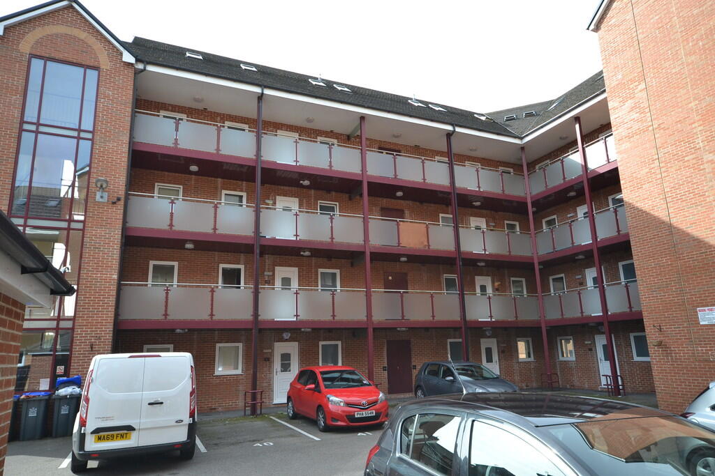
Hassells Bridge
Hassell Street, ST5 1BF
£925 pcm
Property details
Council tax band
C
Deprivation
Decile 4 (10,391 of 33,755)
Street crime
334 incidents within 1 mile (Apr 2026)
Key features
- Ground Floor Flat
- Two Double Bedrooms
- Master has Ensuite
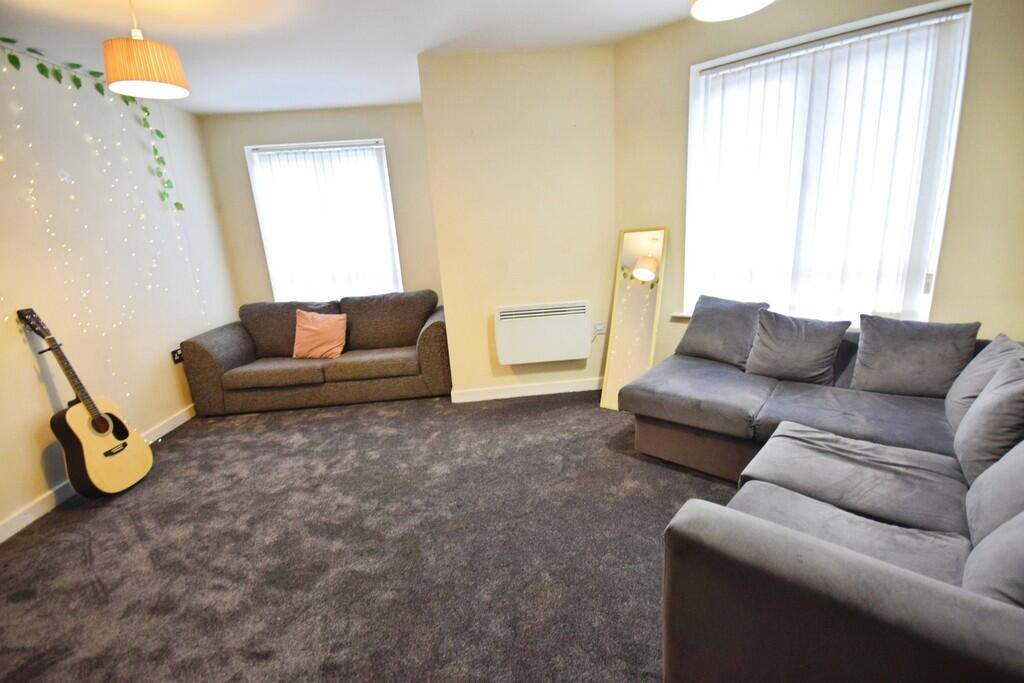
- Openplan Lounge/ Kitchen
- Close to Newcastle Town Centre
- Furnished
- Council Tax Band C
Additional details
- Parking
- Off street
Description
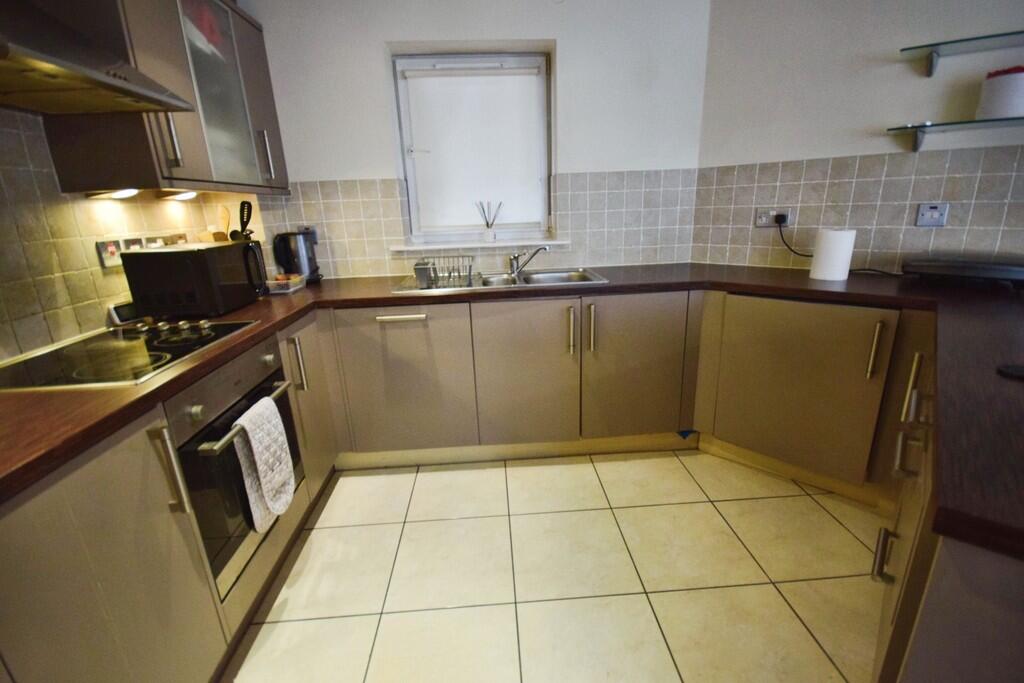
KITCHEN Tiled flooring. Brown kitchen units with built in oven and hob. Fridge/ freezer and shelving on the wall
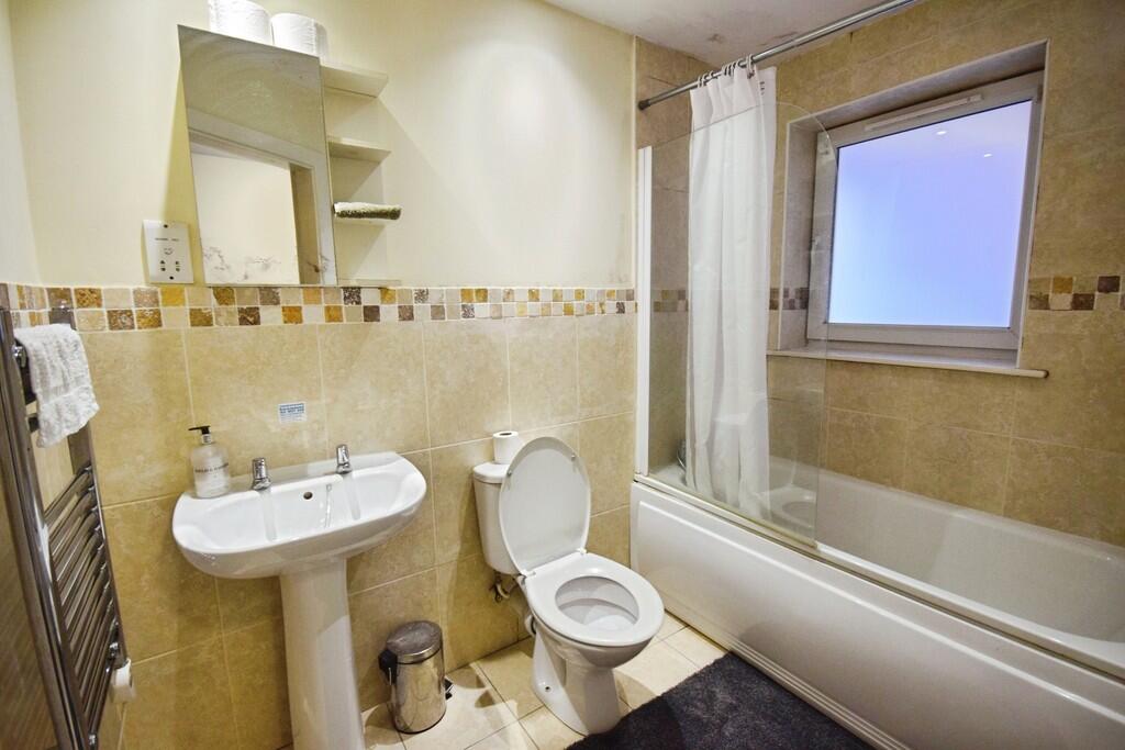
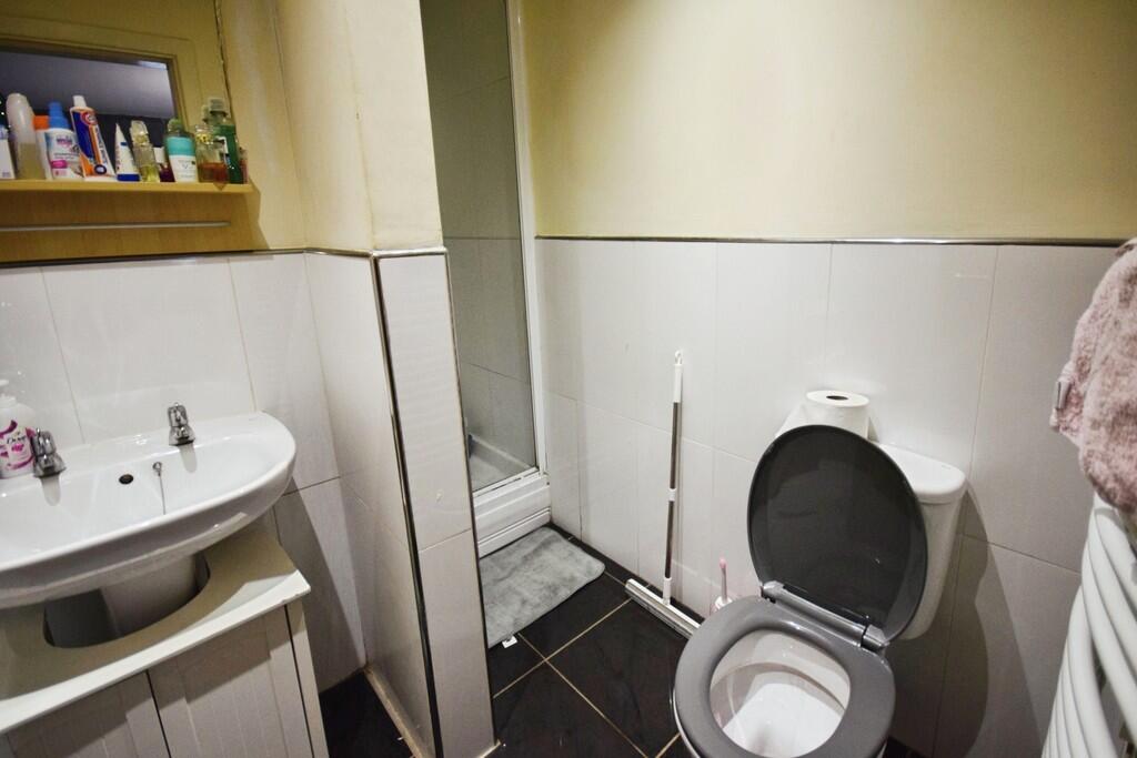
BATHROOM Tiled Flooring and tiling half way up the wall. White bathroom suite with shower over bath. Chrome towel radiator fitted to the wall.
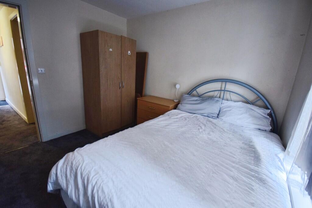
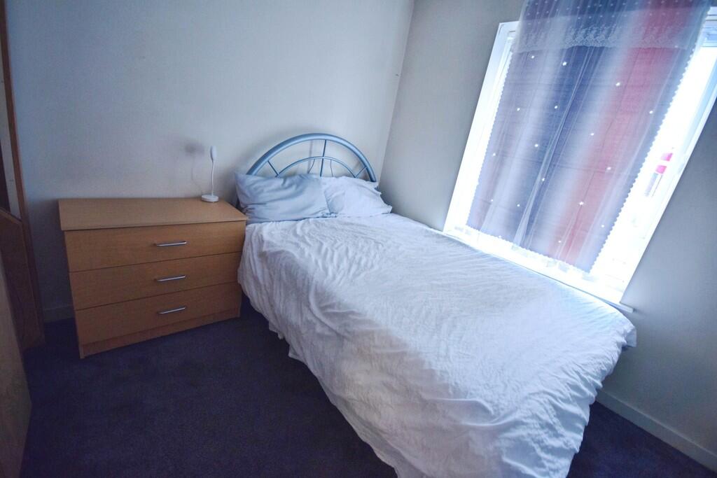
BEDROOM Carpeted floor with wardrobe, chest of drawers and bed. Window above bed.
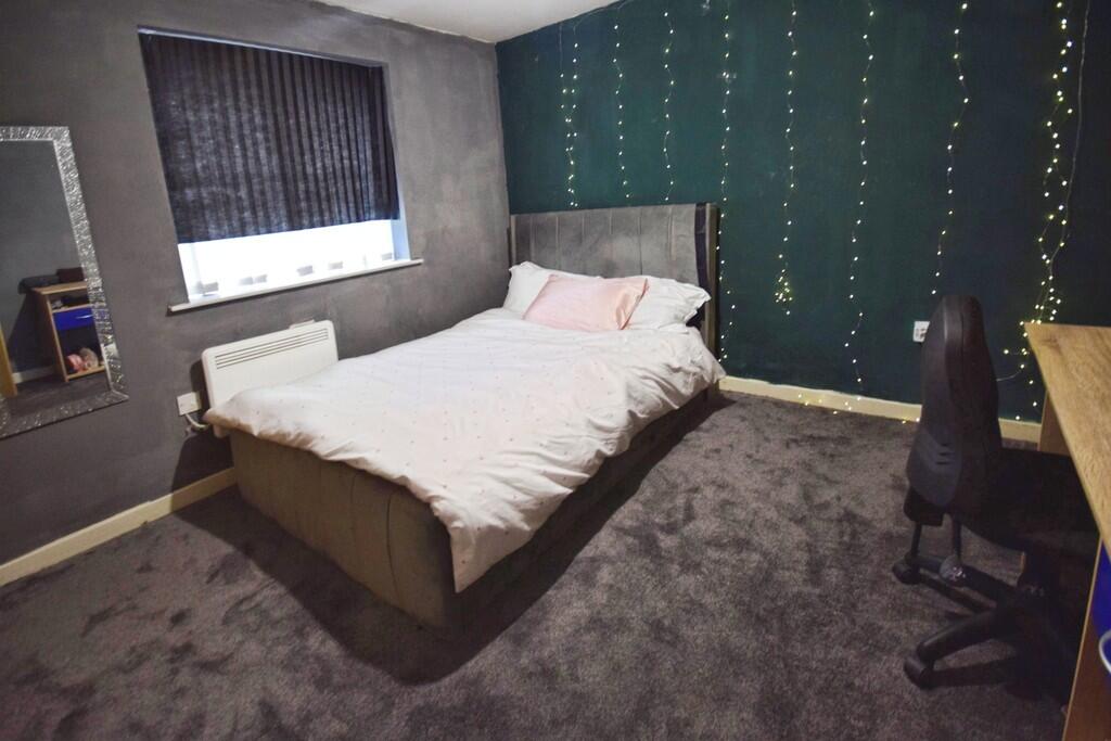
MASTER BEDROOM Carpeted floor. Bed and desk and radiator under window
ENSUITE ** Tiled flooring. Toilet, shower and sink. Towel radiator fitted to wall
Listed by
Stoke On Trent
The Property Franchise Group
Reference: 89310834
EPC ratings on this postcode
We don't have a matched EPC for this property yet. Below are efficiency scores and details for other addresses on this postcode.
| Address | Current | Potential | Floor area | Age band | Type |
|---|---|---|---|---|---|
| 1 Hassells Bridge, Hassell Street, NEWCASTLE | 73 | 81 | 61 m² | England and Wales: 2007-2011 | Flat |
| 1 Hassells Bridge, Hassell Street, NEWCASTLE | 64 | 81 | 61 m² | England and Wales: 2007-2011 | Flat |
| 1 Hassells Bridge, Hassell Street, NEWCASTLE | 77 | 82 | 65 m² | England and Wales: 2007-2011 | Flat |
| 10 Hassells Bridge, Hassell Street, NEWCASTLE | 68 | 82 | 71 m² | England and Wales: 2007-2011 | Flat |
| 11 Hassells Bridge, Hassell Street, NEWCASTLE | 66 | 81 | 56 m² | England and Wales: 2007-2011 | Flat |
| 12 Hassells Bridge, Hassell Street, NEWCASTLE | 70 | 84 | 58 m² | England and Wales: 2007-2011 | Flat |
| 12a Hassells Bridge, Hassell Street, NEWCASTLE | 73 | 82 | 60 m² | England and Wales: 2003-2006 | Flat |
| 14 Hassells Bridge, Hassell Street, NEWCASTLE | 72 | 85 | 58 m² | England and Wales: 2012 onwards | Flat |
| 15 Hassells Bridge, Hassell Street, NEWCASTLE | 74 | 86 | 59 m² | England and Wales: 2007-2011 | Flat |
| 16 Hassells Bridge, Hassell Street, NEWCASTLE | 73 | 85 | 58 m² | England and Wales: 2007-2011 | Flat |
| 17 Hassells Bridge, Hassell Street, NEWCASTLE | 74 | 85 | 58 m² | England and Wales: 2007-2011 | Flat |
| 18 Hassells Bridge, Hassell Street, NEWCASTLE | 71 | 84 | 58 m² | England and Wales: 2007-2011 | Flat |
| 19 Hassells Bridge, Hassell Street, NEWCASTLE | 72 | 85 | 59 m² | England and Wales: 2007-2011 | Flat |
| 20 Hassells Bridge, Hassell Street, NEWCASTLE | 72 | 85 | 56 m² | England and Wales: 2007-2011 | Flat |
| 21 Hassells Bridge, Hassell Street, NEWCASTLE | 78 | 85 | 58 m² | England and Wales: 2007-2011 | Flat |
Flood risk
Zone: 1
Risk: Low
Job (default Low)
Rental Range
Estimated market rent for Newcastle-under-Lyme. Low = conservative, Realistic = average, Optimistic = best case.
Based on Local Authority from postcode lookup → Newcastle-under-Lyme.
LHA (30th percentile) floor for Staffordshire North: £479/mo (Apr 2025 – Mar 2026)
Location
Address
West Street
Nearby
Nearest stations, universities and amenities (distance from property).
| Type | Name | Distance |
|---|---|---|
| Bus stop | Bus Station Stand 1 | 0.1 miles |
| Bus stop | Bus Station Stand 2 | 0.1 miles |
| Shop | Sports Direct | 0.1 miles |
| Shop | Malkophoto Framers | 0.1 miles |
| Hospital | Royal Stoke University Hospital | 0.7 miles |
| Hospital | North Staffordshire Nuffield Hospital | 1.6 miles |
| Train station | Stoke-on-Trent | 1.7 miles |
| University | Keele University | 2.1 miles |
| Train station | Longport | 2.2 miles |
| University | University of Buckingham Crewe Campus | 10.0 miles |
Street-level crime
| Category | Count |
|---|---|
| Violence and sexual offences | 98 |
| Anti-social behaviour | 64 |
| Public order | 38 |
| Criminal damage and arson | 26 |
| Shoplifting | 23 |
| Other theft | 19 |
| Burglary | 16 |
| Drugs | 14 |
| Vehicle crime | 10 |
| Other crime | 9 |
| Possession of weapons | 7 |
| Robbery | 6 |
| Theft from the person | 3 |
| Bicycle theft | 1 |
| Total incidents | 334 |
Within 1 mile during Apr 2026. Source: data.police.uk (England & Wales).
Schools nearby
Nearest open schools with Ofsted ratings (England). Closed schools are not shown. Data from Get Information about Schools and Ofsted.
| Name | Type | Distance | Ofsted |
|---|---|---|---|
| Hassell Primary School | Primary | 0.1 miles | Good — 25 Oct 2023 |
| Newcastle-under-Lyme School | Other | 0.2 miles | — (No rating) |
| Demetae Academy | Other | 0.3 miles | Good — 30 Jun 2022 |
| Lyme Brook Independent School | Other | 0.3 miles | Good — 22 Oct 2023 |
| Harpfield Primary Academy | Primary | 0.4 miles | Good — 10 Feb 2015 |
Rental Comparables
Residential lets from OpenRent and Rightmove for the area (same bedroom count). Use to validate rent estimates. Student lets are excluded.
Average rent: £842/mo (55 listings)
Enter House Number
Enter the house number to help us retrieve more accurate pricing history and property data.
Please log in to submit or correct the house number for this listing.
Log in to continue