17 BARK STREET
CLEETHORPES, NORTH EAST LINCOLNSHIRE DN35 8RD
£433 pcm
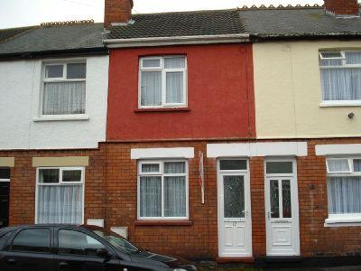
Photo 1
/ 1
Property details
Deprivation
Decile 4 (11,044 of 33,755)
Street crime
240 incidents within 1 mile (Apr 2026)
Key features
- 2 bedrooms
- Terrace house
Additional details
- Garden
- Yes
Description
Listed by
Grimsby
Jackson Green & Preston
Reference: 14778609
EPC Rating & Upgrade Cost
Fetching EPC data… Refresh this page in a moment.
Flood risk
Zone: 1
Risk: Low
Job (default Low)
FENSA Certificates
This property has 1 FENSA certificate(s) on record, indicating window/door installations by FENSA-approved installers.
FENSA Certificate #5484540
Property Details
Street: 17 Bark Street
Town: CLEETHORPES
Postcode: DN35 8RD
Installation Details
Items: 2 windows and 1 door
Certificate Issued: 04/03/2008
Work Completed: 28/01/2008
This certificate data was retrieved from FENSA's database
What is FENSA? FENSA (Fenestration Self-Assessment Scheme) is a government-authorised scheme that monitors building regulation compliance for replacement windows and doors. Certificates indicate that work was completed by FENSA-approved installers.
Rental Range
Estimated market rent for North East Lincolnshire. Low = conservative, Realistic = average, Optimistic = best case.
Based on Local Authority from postcode lookup → North East Lincolnshire.
LHA (30th percentile) floor for Grimsby: £479/mo (Apr 2025 – Mar 2026)
Location
Nearby
Nearest stations, universities and amenities (distance from property).
| Type | Name | Distance |
|---|---|---|
| Shop | Stevenson Motors | 0.1 miles |
| Shop | Skin Deep Tattoo Studio | 0.1 miles |
| Bus stop | Thrunscoe Road | 0.1 miles |
| Bus stop | Brighton Street | 0.1 miles |
| Train station | Kingsway Station | 0.5 miles |
| Train station | Cleethorpes | 0.5 miles |
| Hospital | St Hughs | 1.9 miles |
| Hospital | Harrison House | 2.0 miles |
| University | University Centre (University of Hull) | 2.7 miles |
| University | University Centre Grimsby | 2.7 miles |
Street-level crime
| Category | Count |
|---|---|
| Violence and sexual offences | 95 |
| Anti-social behaviour | 35 |
| Criminal damage and arson | 27 |
| Public order | 22 |
| Shoplifting | 15 |
| Other crime | 11 |
| Burglary | 10 |
| Other theft | 10 |
| Vehicle crime | 6 |
| Robbery | 3 |
| Drugs | 2 |
| Possession of weapons | 2 |
| Bicycle theft | 1 |
| Theft from the person | 1 |
| Total incidents | 240 |
Within 1 mile during Apr 2026. Source: data.police.uk (England & Wales).
Schools nearby
Nearest open schools with Ofsted ratings (England). Closed schools are not shown. Data from Get Information about Schools and Ofsted.
| Name | Type | Distance | Ofsted |
|---|---|---|---|
| St Peter's CofE Primary School | Primary | 0.2 miles | Good — 13 Oct 2010 |
| Thrunscoe Primary and Nursery Academy | Primary | 0.2 miles | Good — 15 Feb 2012 |
| Signhills Academy | Primary | 0.6 miles | Good — 21 Jan 2024 |
| Signhills Infant Academy | Primary | 0.6 miles | Good — 28 Jul 2022 |
| Reynolds Primary Academy | Primary | 0.8 miles | — (Inspected (no overall grade)) |
Rental Comparables
Residential lets from OpenRent and Rightmove for the area (same bedroom count). Use to validate rent estimates. Student lets are excluded.
| Title | Rent | Beds | Distance | As seen on |
|---|---|---|---|---|
| 2 Bed Flat, Clee Road, DN35 | £600/mo | 2 | 0.52 miles | OpenRent |
Average rent: £600/mo (1 listing)