1
EBENEZER COTTAGE, CAMDEN ROAD, TUNBRIDGE WELLS, TUNBRIDGE WELLS, KENT TN1 2QP
£1,100 pcm
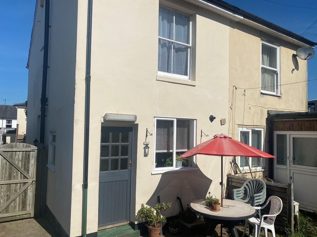
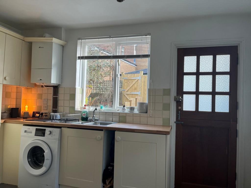
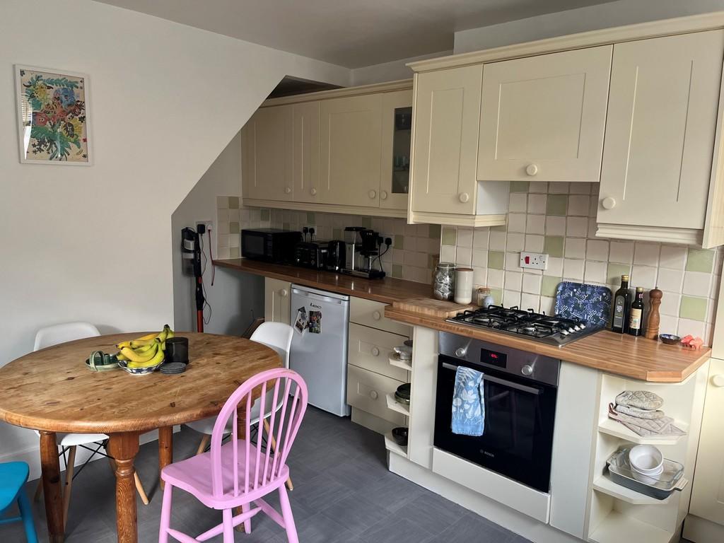
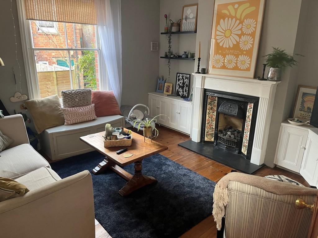
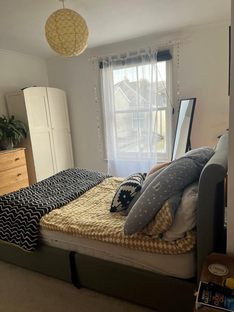
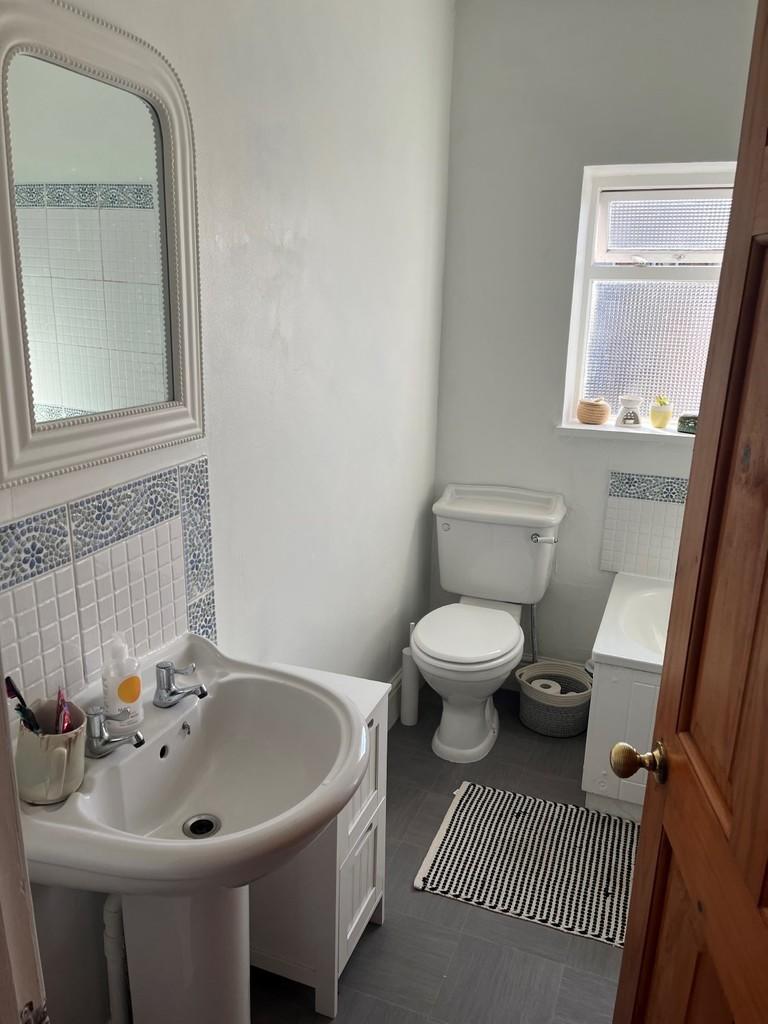
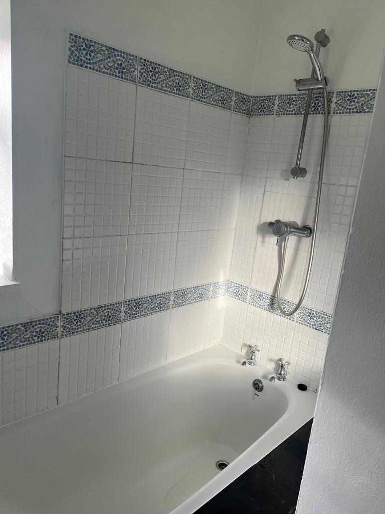
Photo 1 Photo 2 Photo 3 Photo 4 Photo 5 Photo 6 Photo 7 Photo 8 Photo 9
/ 9
Property details
Floor area
62 m²
EPC rating
D
Year built
England and Wales: before 1900
Deprivation
Decile 4 (13,011 of 33,755)
Street crime
225 incidents within 1 mile (Apr 2026)
Key features
- TWO DOUBLE BEDROOMS
- FRONT SITTING ROOM
- KITCHEN DINER
- 1ST FLOOOR BATHROOM
- REAR GARDEN WITH REAR AND SIDE ACCESS
- GAS FIRED CENTRAL HEATING
- SOME ORIGINAL FEATURES
Additional details
- Garden
- Yes
Description
Listed by
Tunbridge Wells
The Property Franchise Group
Reference: 124299233
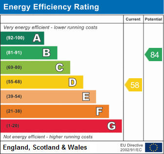
EPC Rating & Upgrade Cost
Current rating: D
Potential rating: B
Inspection date: 14/06/2021
Expiry date: 13/06/2031
Current heating cost: £686/year
Potential heating cost: £439/year
Est. upgrade cost to C: £24,500
Recommendations
- 50 mm internal or external wall insulation (£4,000 - £14,000)
- Floor insulation (suspended floor) (£800 - £1,200)
- Draughtproof single-glazed windows (£80 - £120)
- Solar water heating (£4,000 - £6,000)
- Replace single glazed windows with low-E double glazing (£3,300 - £6,500)
- Solar photovoltaic panels, 2.5 kWp (£3,500 - £5,500)
Flood risk
Zone: 1
Risk: Low
Job (default Low)
EPC Graphs
EPC 1
Rental Range
Estimated market rent for Tunbridge Wells. Low = conservative, Realistic = average, Optimistic = best case.
Based on Local Authority from postcode lookup → Tunbridge Wells.
LHA (30th percentile) floor for High Weald: £1,072/mo (Apr 2025 – Mar 2026)
Location
Address
97 Camden Road
Nearby
Nearest stations, universities and amenities (distance from property).
| Type | Name | Distance |
|---|---|---|
| Shop | Wild Side Cycles | 0.0 miles |
| Shop | World Of Sewing | 0.0 miles |
| Bus stop | Camden Centre | 0.1 miles |
| Bus stop | Royal Victoria Place | 0.1 miles |
| Train station | Tunbridge Wells | 0.5 miles |
| Train station | High Brooms | 1.0 miles |
| Hospital | Tunbridge Wells Independant Hospital | 3.6 miles |
| University | Tonbridge Adult Education Centre | 3.9 miles |
| Hospital | Hawkhurst Community Hospital | 11.3 miles |
| University | St Piers College | 11.5 miles |
Street-level crime
| Category | Count |
|---|---|
| Violence and sexual offences | 77 |
| Anti-social behaviour | 43 |
| Criminal damage and arson | 25 |
| Shoplifting | 24 |
| Vehicle crime | 15 |
| Other theft | 10 |
| Public order | 8 |
| Drugs | 7 |
| Burglary | 4 |
| Other crime | 4 |
| Theft from the person | 3 |
| Possession of weapons | 2 |
| Robbery | 2 |
| Bicycle theft | 1 |
| Total incidents | 225 |
Within 1 mile during Apr 2026. Source: data.police.uk (England & Wales).
Schools nearby
Nearest open schools with Ofsted ratings (England). Closed schools are not shown. Data from Get Information about Schools and Ofsted.
| Name | Type | Distance | Ofsted |
|---|---|---|---|
| St James' Church of England Voluntary Aided Primary School | Primary | 0.3 miles | Good — 24 Apr 2024 |
| St Barnabas CofE VA Primary School | Primary | 0.3 miles | Good — 19 Dec 2014 |
| The Wells Free School | Primary | 0.4 miles | Good — 29 Jun 2015 |
| St Peter's Church of England Primary School | Primary | 0.5 miles | Outstanding — 24 Apr 2014 |
| The Skinners' School | Secondary | 0.6 miles | Good — 13 Jan 2022 |
Rental Comparables
Residential lets from OpenRent and Rightmove for the area (same bedroom count). Use to validate rent estimates. Student lets are excluded.
| Title | Rent | Beds | Distance | As seen on |
|---|---|---|---|---|
| 2 Bed Flat, The Warehouse, TN1 | £1,775/mo | 2 | 0.17 miles | OpenRent |
Average rent: £1,775/mo (1 listing)