6
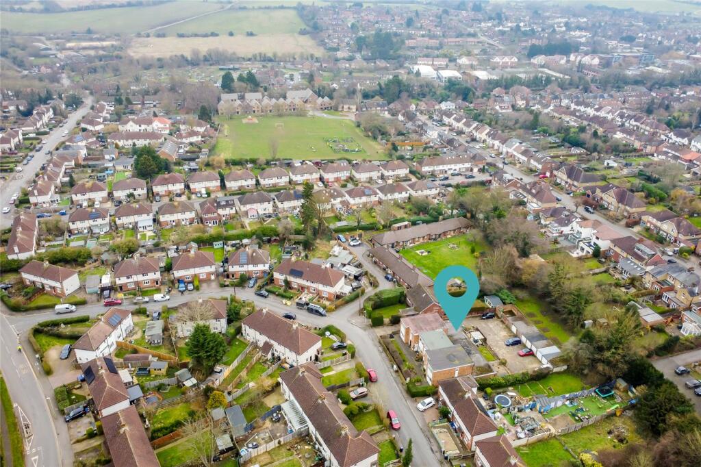
HARDING COURT, MASEFIELD ROAD, HARPENDEN, HERTFORDSHIRE AL5 4JW
£1,200 pcm
Property details
Floor area
53 m²
Council tax band
B
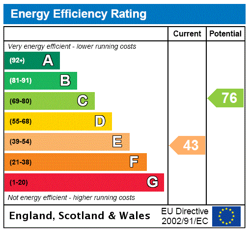
EPC rating
E
Year built
England and Wales: 1950-1966
Deprivation
Decile 8 (24,904 of 33,755)
Street crime
92 incidents within 1 mile (Apr 2026)
Key features
- Available End Of March 2026
- Unfurnished
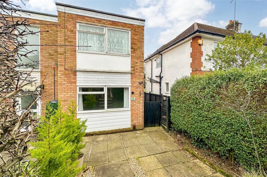
- Ground Floor
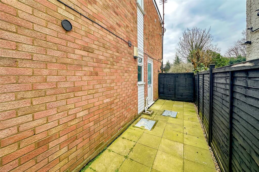
- Private Side Courtyard
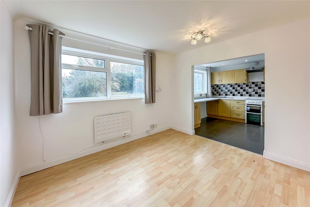
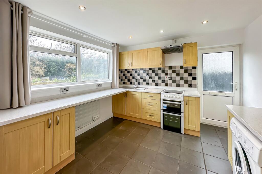
- Spacious Open Plan Kitchen / Living Space
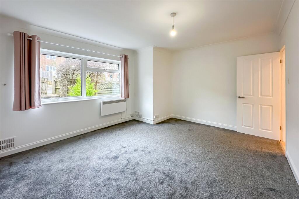
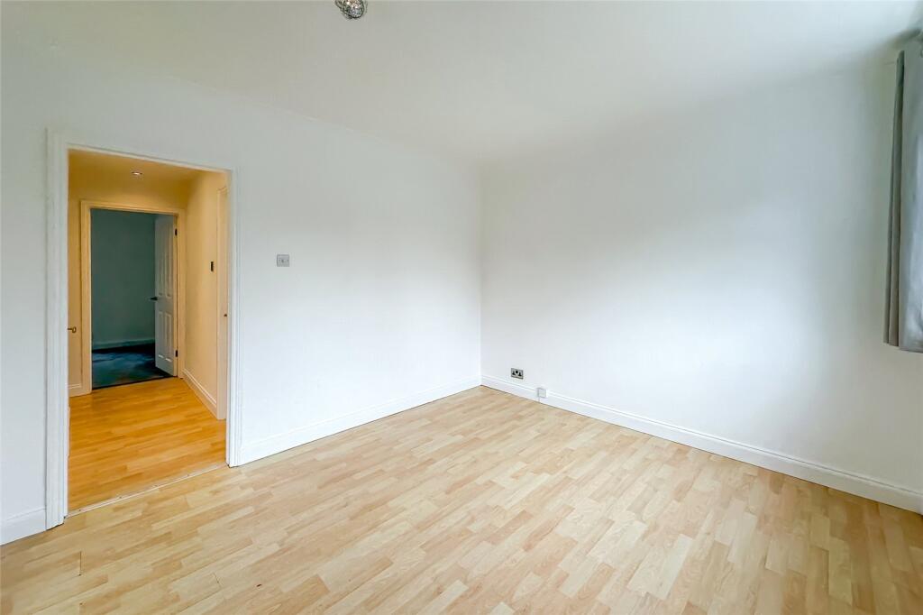
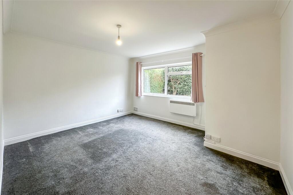
- Double Bedroom
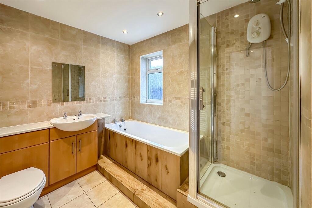
- Modern Bathroom
- No Smokers / No Pets
- Holding Deposit £276.92
- Security Deposit £1,384.60
Description
The property also benefits from a private side courtyard, offering a useful outdoor area for fresh air and additional storage options.
Located in a sought-after area, the flat is within easy reach of Harpenden town centre, just a brisk walk or a short bus ride away. Here, you’ll find a fantastic selection of shops, cafés, restaurants, and leisure facilities, as well as excellent transport links, including Harpenden train station, providing fast and frequent services into London St Pancras International and beyond.
Listed by
Harpenden
Bradford & Howley
Reference: 87675216
EPC Rating & Upgrade Cost
Current rating: E
Potential rating: C
Inspection date: 06/01/2017
Expiry date: 05/01/2027
Current heating cost: £868/year
Potential heating cost: £297/year
Recommendations
- Cavity wall insulation (1,500)
- Floor insulation (solid floor) (6,000)
- Low energy lighting for all fixed outlets (25)
- High heat retention storage heaters and dual immersion cylinder (1,200)
Flood risk
Zone: 1
Risk: Low
Job (default Low)
Floorplans
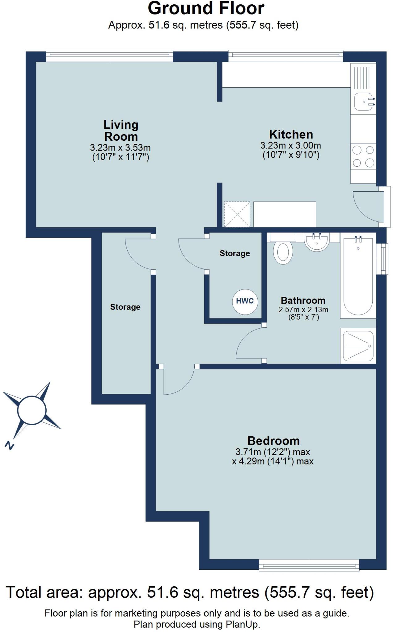
Floorplan
EPC Graphs
EPC Rating Graph
Rental Range
Estimated market rent for St Albans. Low = conservative, Realistic = average, Optimistic = best case.
Based on Local Authority from postcode lookup → St Albans.
LHA (30th percentile) floor for Luton: £698/mo (Apr 2025 – Mar 2026)
Location
Address
Masefield Road
Nearby
Nearest stations, universities and amenities (distance from property).
| Type | Name | Distance |
|---|---|---|
| Bus stop | Masefield Road | 0.0 miles |
| Bus stop | Hyde View Road | 0.1 miles |
| Hospital | Spire Hospital | 0.4 miles |
| Hospital | Harpenden Memorial Hospital | 0.6 miles |
| Shop | Tesco Express | 0.6 miles |
| Shop | Harpenden Turkish Barbers | 0.7 miles |
| Train station | Harpenden | 0.9 miles |
| Train station | Luton DART Parkway | 3.6 miles |
| University | University Of Bedfordshire | 4.2 miles |
Street-level crime
| Category | Count |
|---|---|
| Anti-social behaviour | 24 |
| Shoplifting | 15 |
| Violence and sexual offences | 13 |
| Other theft | 12 |
| Criminal damage and arson | 7 |
| Vehicle crime | 7 |
| Other crime | 4 |
| Public order | 3 |
| Bicycle theft | 2 |
| Drugs | 2 |
| Robbery | 2 |
| Burglary | 1 |
| Total incidents | 92 |
Within 1 mile during Apr 2026. Source: data.police.uk (England & Wales).
Schools nearby
Nearest open schools with Ofsted ratings (England). Closed schools are not shown. Data from Get Information about Schools and Ofsted.
| Name | Type | Distance | Ofsted |
|---|---|---|---|
| The Lea Primary School and Nursery | Primary | 0.2 miles | — (Inspected (no overall grade)) |
| Manland Primary School | Primary | 0.3 miles | Good — 18 Oct 2018 |
| St George's School | Secondary | 0.3 miles | Outstanding — 30 Sep 2014 |
| Katherine Warington School | Secondary | 0.4 miles | Good — 24 Apr 2024 |
| Sir John Lawes School | Secondary | 0.4 miles | Outstanding — 22 May 2023 |
Rental Comparables
Loading rental comparables for this postcode. Refresh in a few minutes.