18 PELHAM PLACE
LONDON, GREATER LONDON SW7 2NH
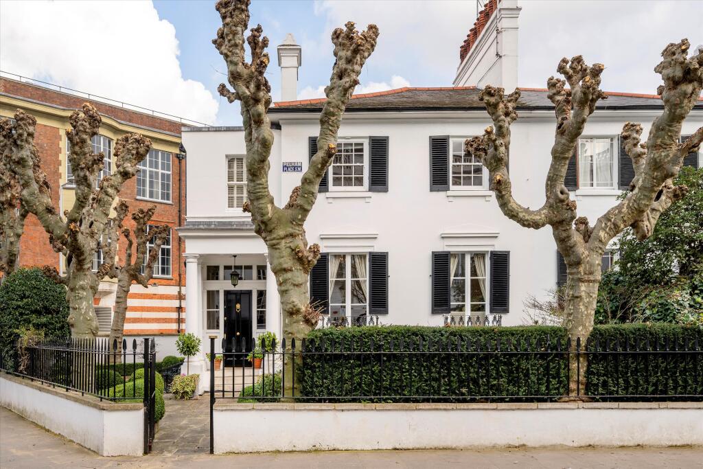
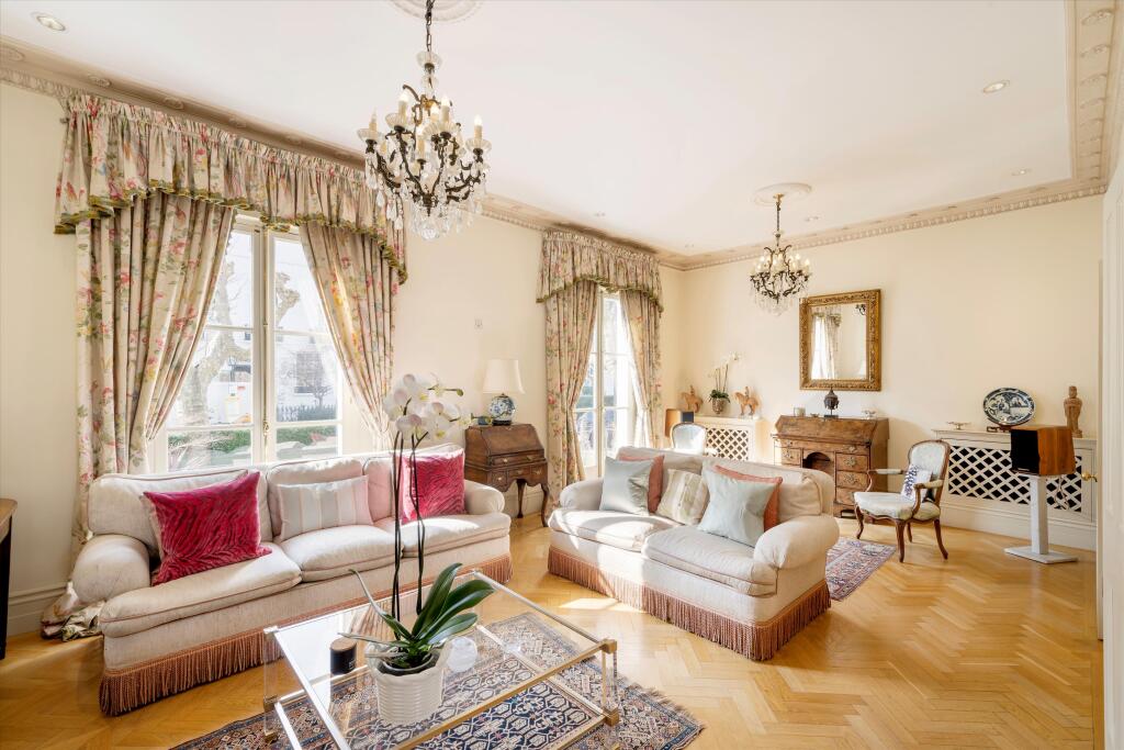
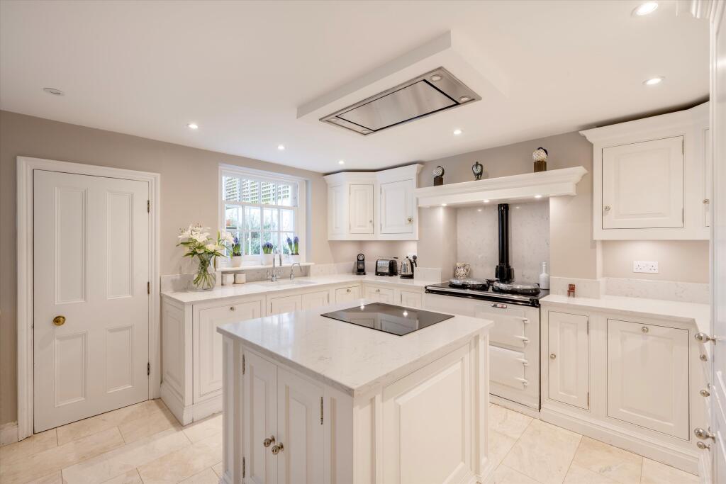
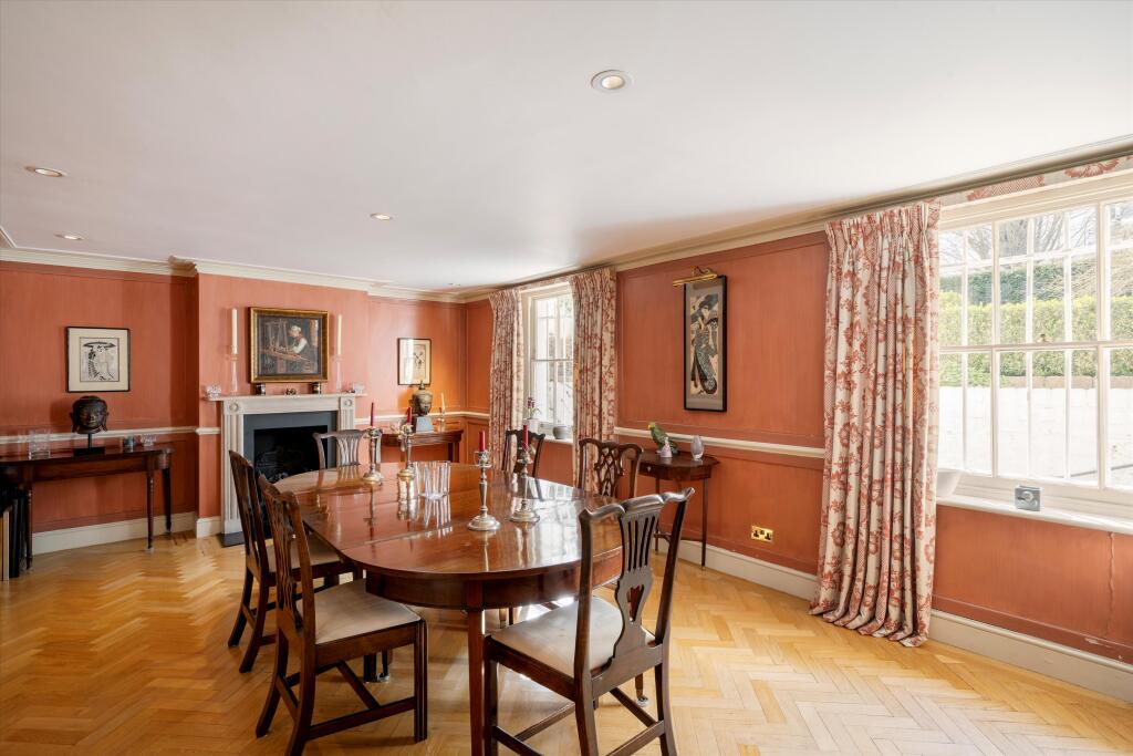

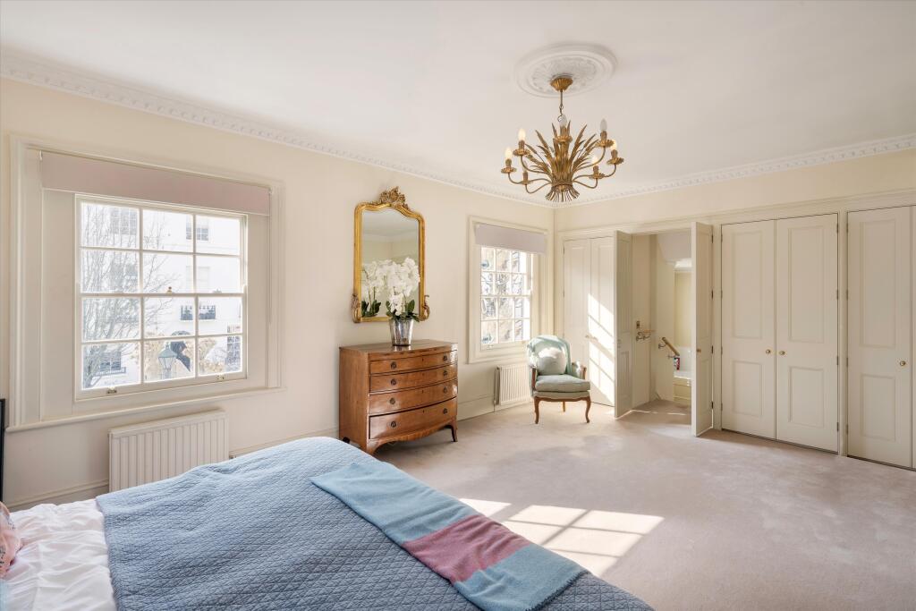
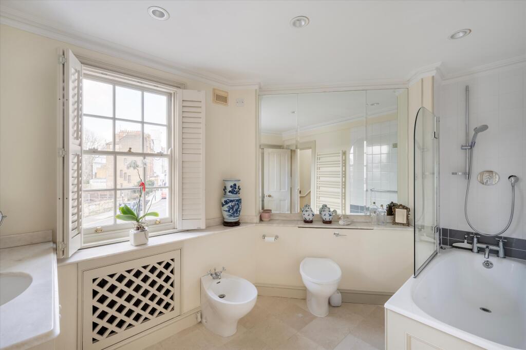
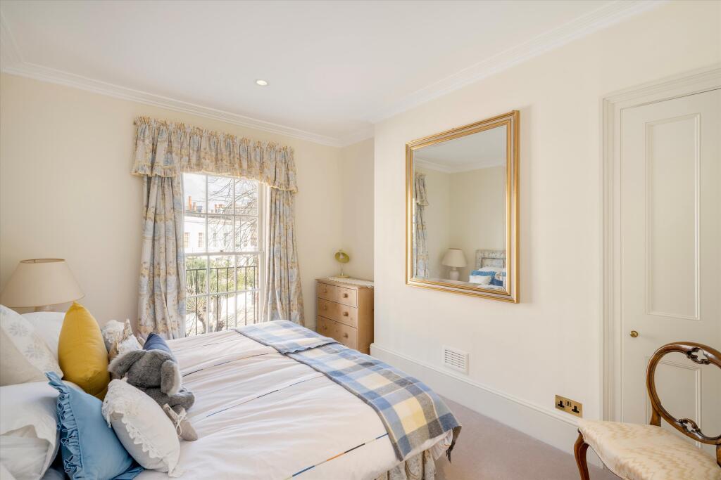
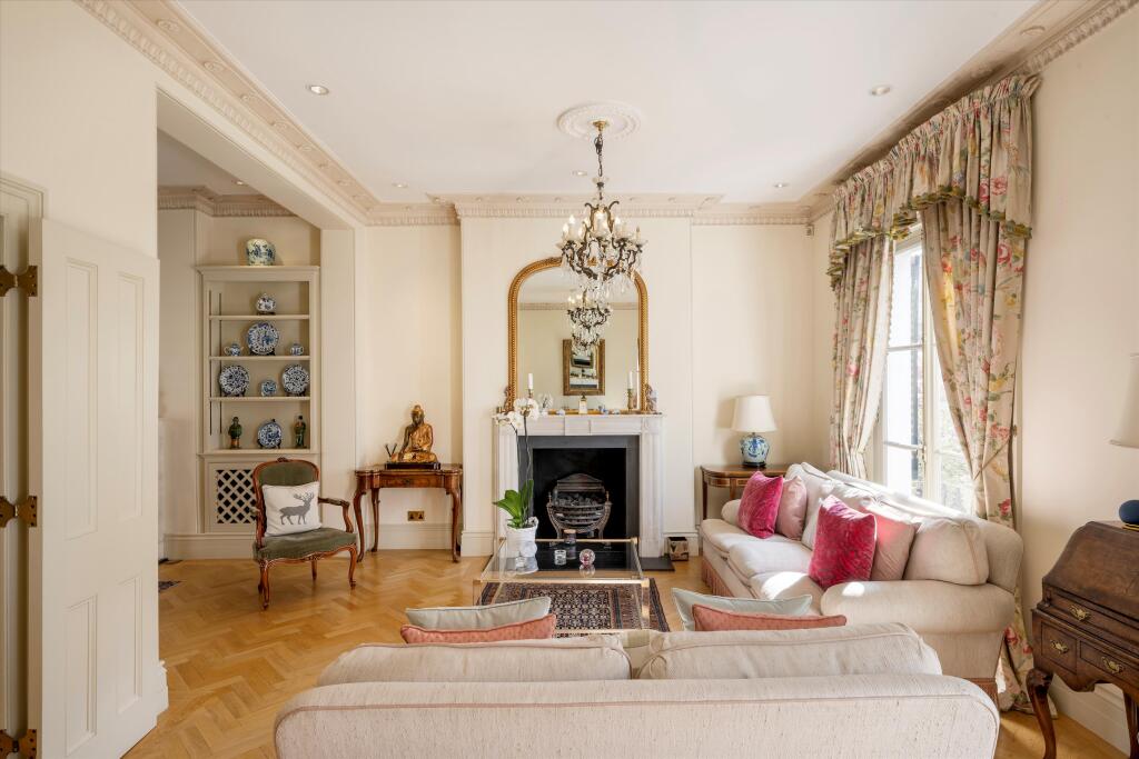
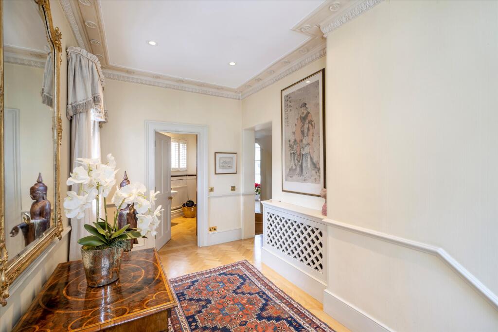

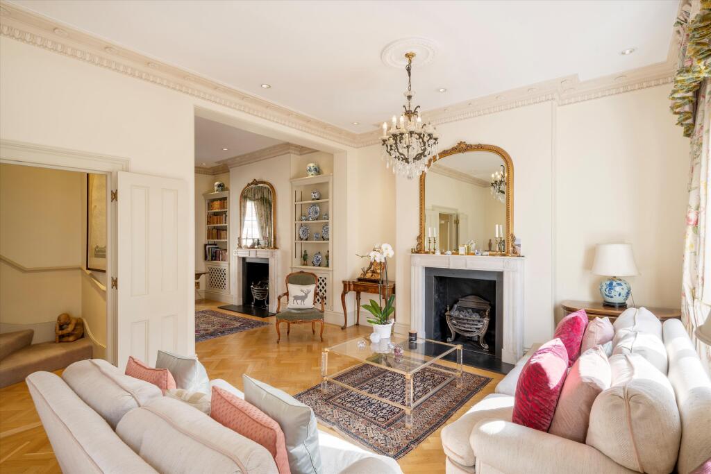
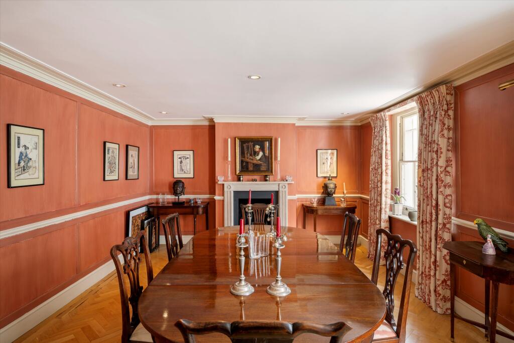
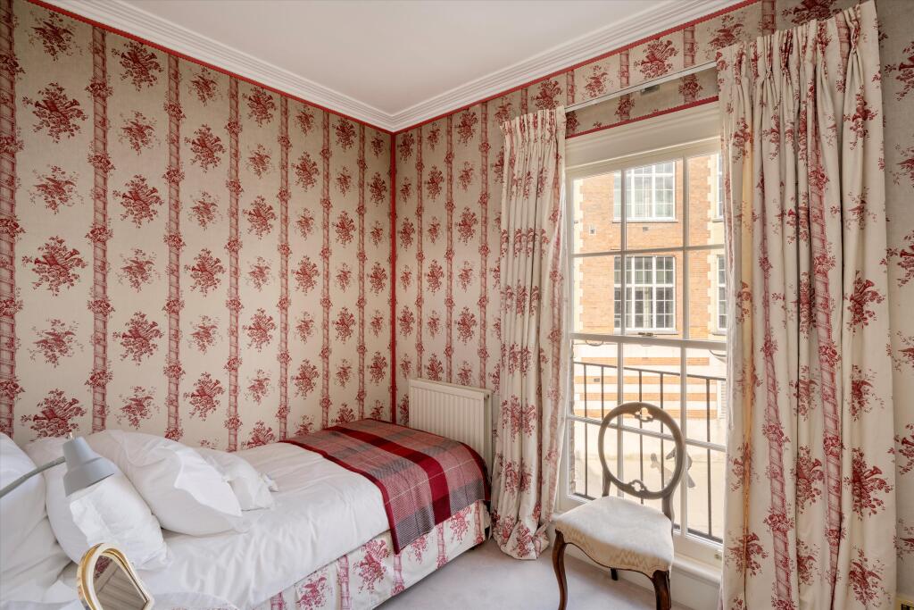

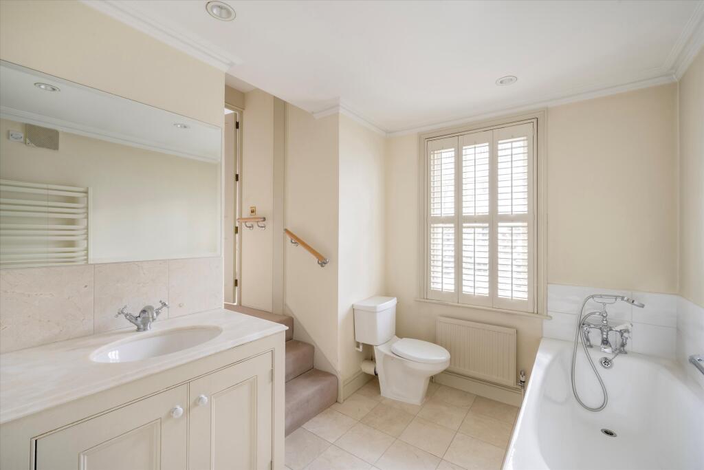
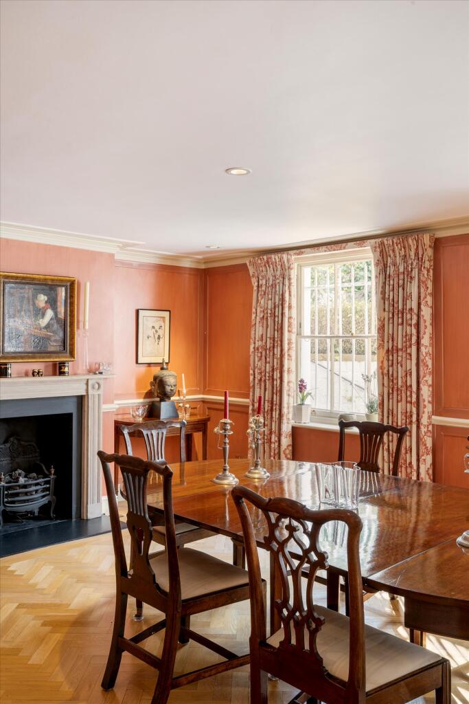
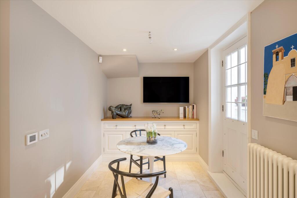
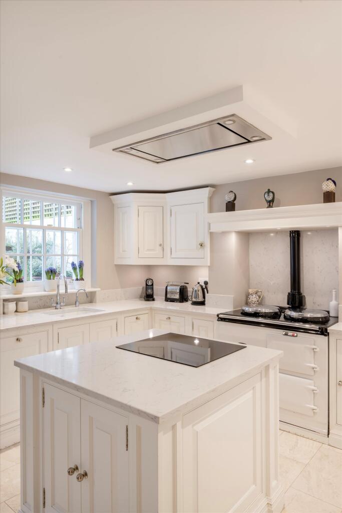
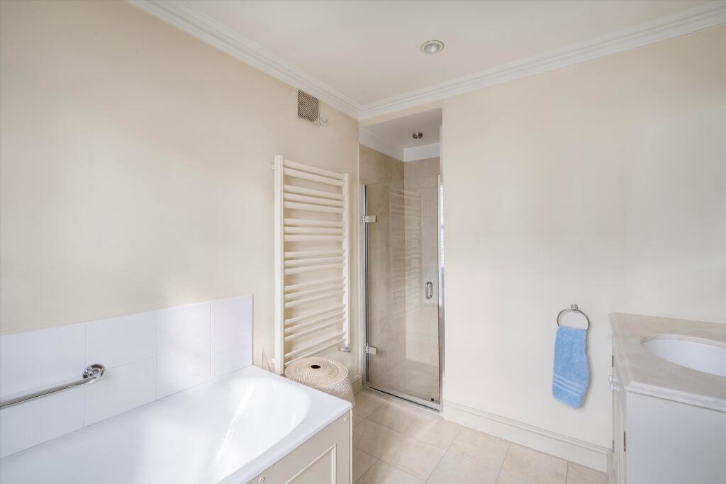
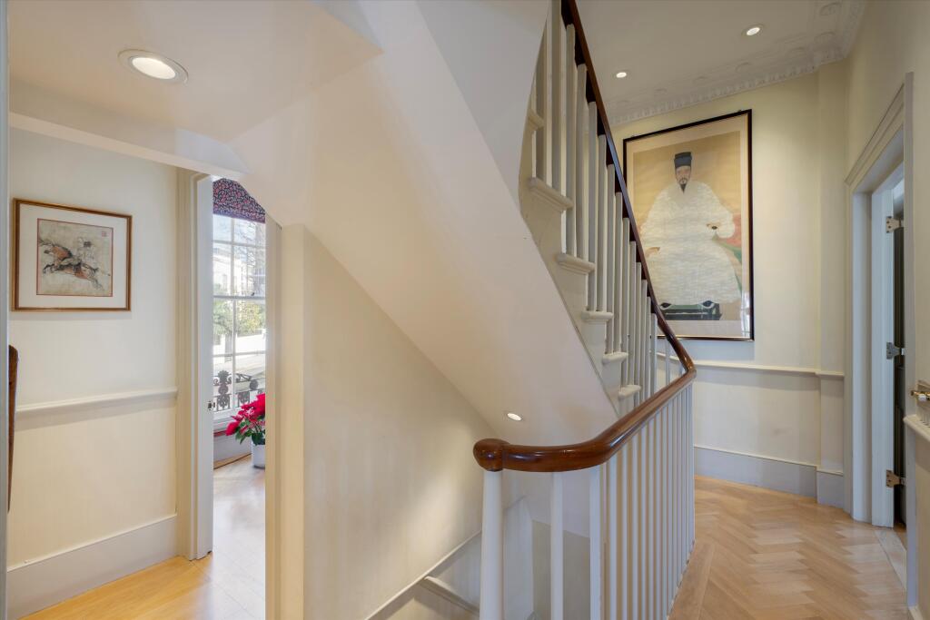
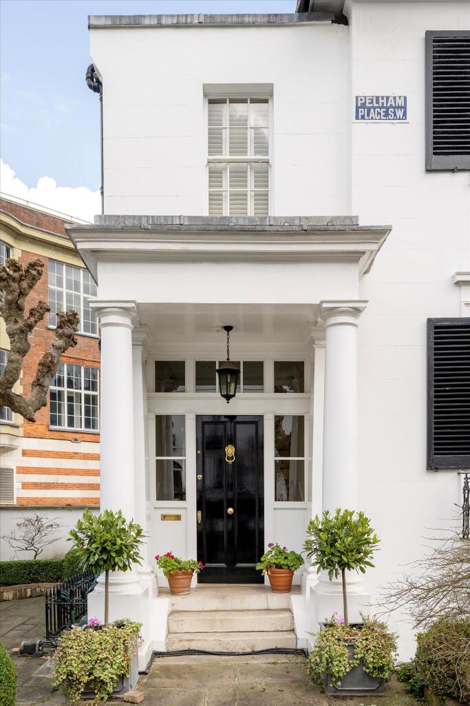
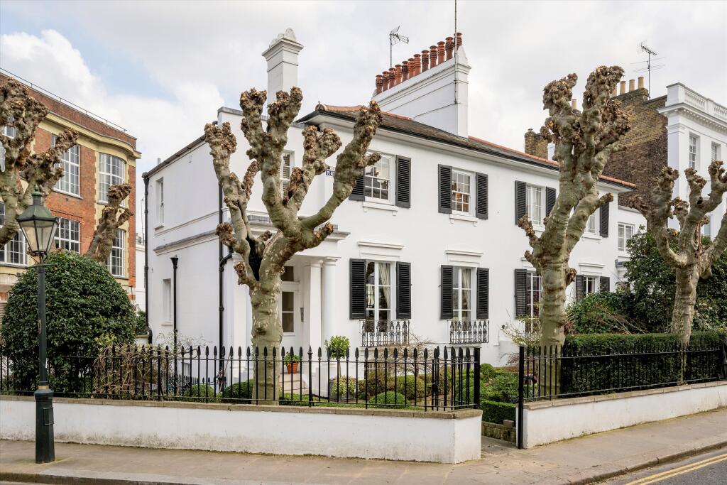
Photo 1 Photo 2 Photo 3 Photo 4 Photo 5 Photo 6 Photo 7 Photo 8 Photo 9 Photo 10 Photo 11 Photo 12 Photo 13 Photo 14 Photo 15 Photo 16 Photo 17 Photo 18 Photo 19 Photo 20 Photo 21 Photo 22 Photo 23
/ 23
Property details
Tenure
FREEHOLD
Floor area
229 m²
Council tax band
H
Last sold
£5,000,000 Mar 2025
Local average
£1,316,250 (+317.9%)
Deprivation
Decile 3 (9,344 of 33,755)
Street crime
1098 incidents within 1 mile (Mar 2026)
Key features
- 4 bedrooms
- 2 reception rooms
- 3 bathrooms
Additional details
- Garden
- Yes
Description
Upon arrival, you'll be greeted by a pretty front garden with mature trees, adding greenery and curb appeal to the property. Step inside, and you'll discover a classically designed interior. The wide, low-built layout enhances the sense of openness and airiness throughout the home, providing an inviting atmosphere for both relaxation and entertainment.Situated in an enviable location, this property offers convenient access to a wealth of amenities, including shops, restaurants, parks, and transportation links. Whether you're seeking a peaceful sanctuary away from the hustle and bustle of city life or a vibrant urban lifestyle right on your doorstep, this home caters to your every need.
Listed by
Knightsbridge
Knight Frank
Reference: 145937369
EPC Rating & Upgrade Cost
Fetching EPC data… Refresh this page in a moment.
Flood risk
Zone: 1
Risk: Low
Job (default Low)
Floorplans
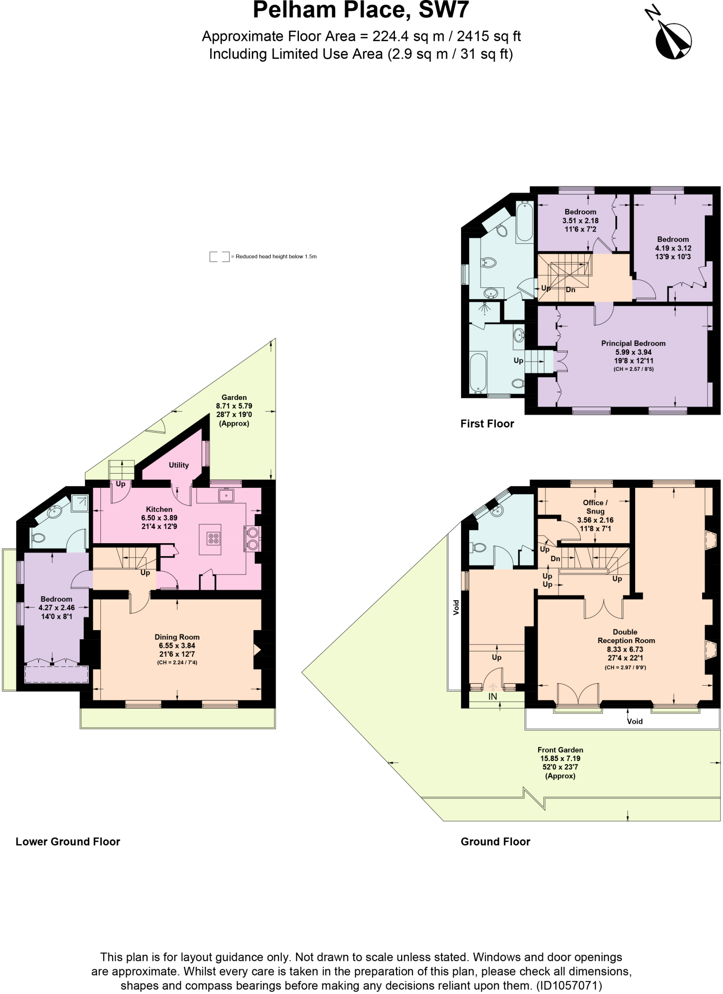
Floorplan.jpg
EPC Graphs
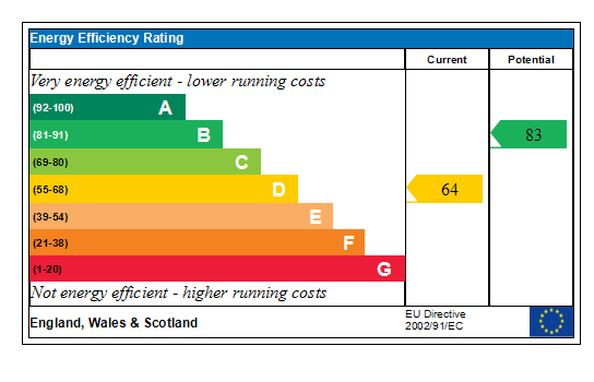
Generated EPC Graph.
FENSA Certificates
This property has 1 FENSA certificate(s) on record, indicating window/door installations by FENSA-approved installers.
FENSA Certificate #13630920
Property Details
Street: 18 Pelham Place
Town: LONDON
Postcode: SW7 2NH
Installation Details
Items: 2 windows
Certificate Issued: 01/07/2019
Work Completed: 12/06/2019
This certificate data was retrieved from FENSA's database
What is FENSA? FENSA (Fenestration Self-Assessment Scheme) is a government-authorised scheme that monitors building regulation compliance for replacement windows and doors. Certificates indicate that work was completed by FENSA-approved installers.
Price history
2023% since 1999
| Event | Date | Price | % change |
|---|---|---|---|
| Sold | 31/03/2025 (1 year ago) | £5,000,000 | +2023.1% |
| Sold | 10/08/1999 (26 years ago) | £235,500 | — |
Source: HM Land Registry Price Paid Data. Crown copyright.
Sold Comparables
Same street and nearby sales within 0.25 miles (last 5 years). Data from Land Registry Price Paid.
| Address | Price | Date | Type |
|---|---|---|---|
| Same street 14 PELHAM PLACE, LONDON, KENSINGTON AND CHELSEA, GREATER LONDON, SW7 2NH | £6,300,000 | 31/07/2023 | Terraced |
| Same street 16 PELHAM PLACE, LONDON, KENSINGTON AND CHELSEA, GREATER LONDON, SW7 2NH | £9,000,000 | 08/12/2022 | Terraced |
| 18 FLAT A THURLOE STREET, LONDON, KENSINGTON AND CHELSEA, GREATER LONDON, SW7 2ST | £1,930,000 | 08/03/2022 | Other |
Street average: £7,650,000 (2 sales)
Area average: £1,930,000 (1 sale)
Capital growth trend
Land Registry outcode average: last 12 months vs 5y and 10y ago (from sold prices).
House Price Index (HM Land Registry — official index, not sold-price averages): Kensington and Chelsea. Series: All dwelling types. As of March 2026.
Rental Range
Estimated market rent for Kensington and Chelsea. Low = conservative, Realistic = average, Optimistic = best case.
Based on Local Authority from postcode lookup → Kensington and Chelsea.
LHA (30th percentile) floor for South East Herts: £1,695/mo (Apr 2025 – Mar 2026)
Location
Nearby
Nearest stations, universities and amenities (distance from property).
| Type | Name | Distance |
|---|---|---|
| Bus stop | Pelham Street | 0.0 miles |
| Train station | South Kensington | 0.1 miles |
| Shop | Jonathan Adler | 0.1 miles |
| Shop | Iro | 0.1 miles |
| Bus stop | Onslow Square | 0.1 miles |
| University | National Heart and Lung Institute | 0.5 miles |
| Train station | Gloucester Road | 0.5 miles |
| Hospital | Bridge Lane Health Centre | 1.4 miles |
| University | BIMM Institute London | 1.4 miles |
| Hospital | Tunica Diagnostics | 2.3 miles |
Street-level crime
| Category | Count |
|---|---|
| Violence and sexual offences | 212 |
| Anti-social behaviour | 196 |
| Other theft | 171 |
| Shoplifting | 123 |
| Vehicle crime | 116 |
| Theft from the person | 86 |
| Public order | 56 |
| Criminal damage and arson | 41 |
| Burglary | 37 |
| Robbery | 19 |
| Bicycle theft | 16 |
| Drugs | 16 |
| Other crime | 8 |
| Possession of weapons | 1 |
| Total incidents | 1098 |
Within 1 mile during Mar 2026. Source: data.police.uk (England & Wales).
Schools nearby
Nearest open schools with Ofsted ratings (England). Closed schools are not shown. Data from Get Information about Schools and Ofsted.
| Name | Type | Distance | Ofsted |
|---|---|---|---|
| Oratory Roman Catholic Primary School | Primary | 0.2 miles | Outstanding — 11 Oct 2023 |
| Marlborough Primary School | Primary | 0.2 miles | — (Inspected (no overall grade)) |
| Institute of Cancer Research | Other | 0.3 miles | — (No rating) |
| Lycee Francais Charles de Gaulle | Other | 0.3 miles | Inadequate — 22 Jan 2023 |
| Queen's Gate School | Other | 0.3 miles | — (No rating) |
Rental Comparables
Loading rental comparables for this postcode. Refresh in a few minutes.
Rent-driven metrics
Based on Area rent estimate.
- Rent ratio — Monthly rent ÷ purchase price (1% rule). 1%+ = strong, 0.8–1% = okay, <0.8% = weak for cashflow.
- Max investor price — Rent ÷ 0.8%; the price at which rent would be 0.8% of price (Stoke-style target).
- Target investor price — Rent ÷ 1%; the price at which rent would be 1% of price (strong cashflow band).
- Gross yield — Annual rent as % of purchase price (no costs).