Scott Lidgett Road
Stoke-On-Trent, ST6, ST6 4NQ
£455 pcm
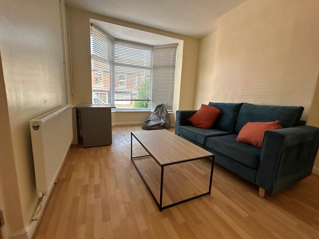
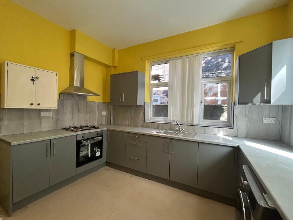
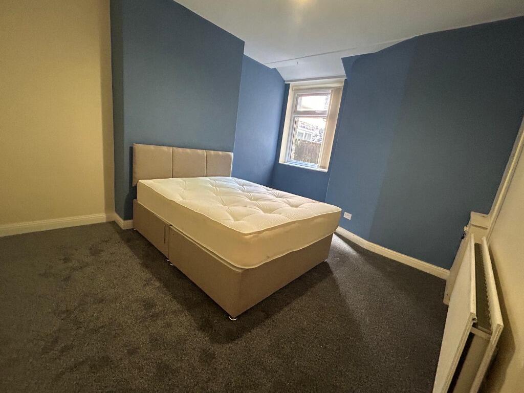
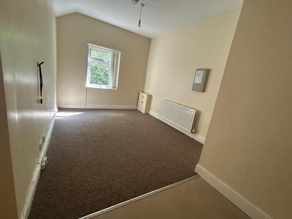
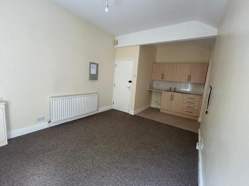
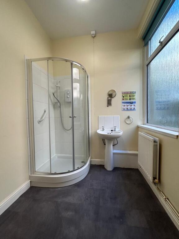
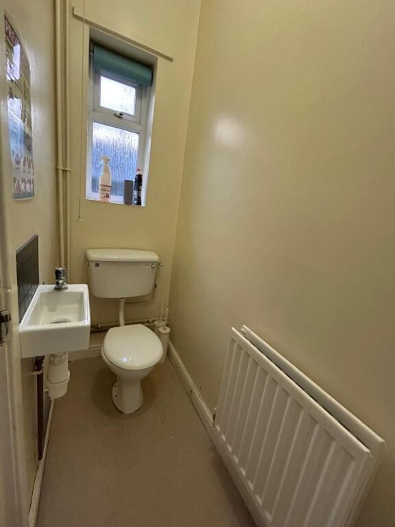
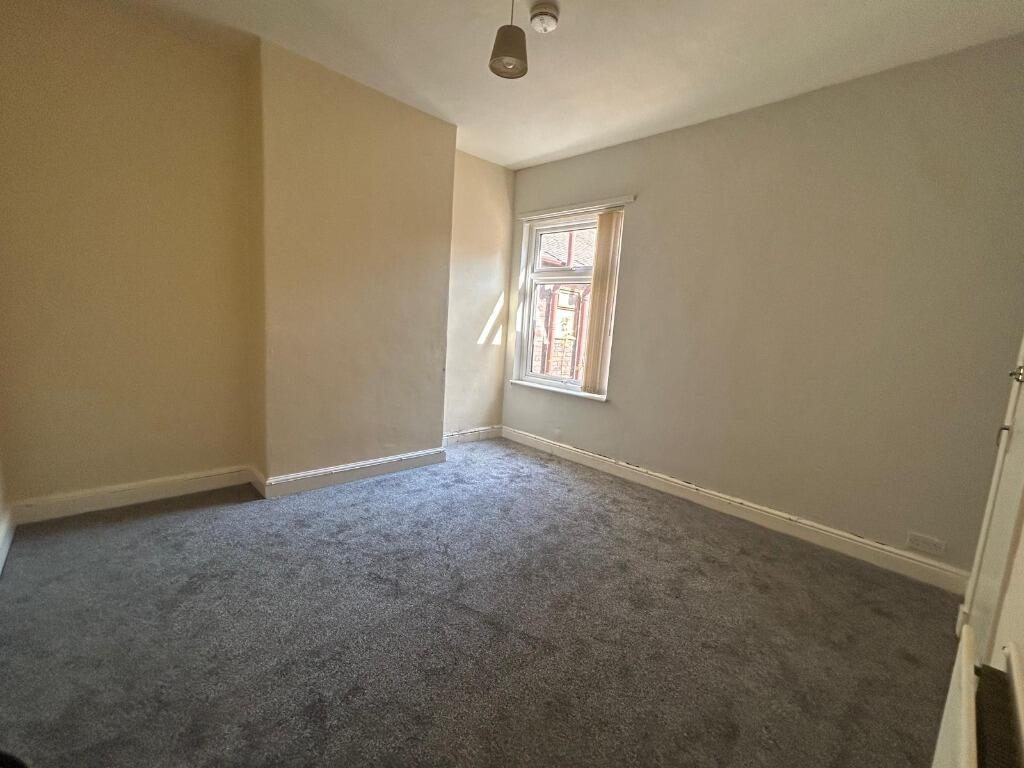
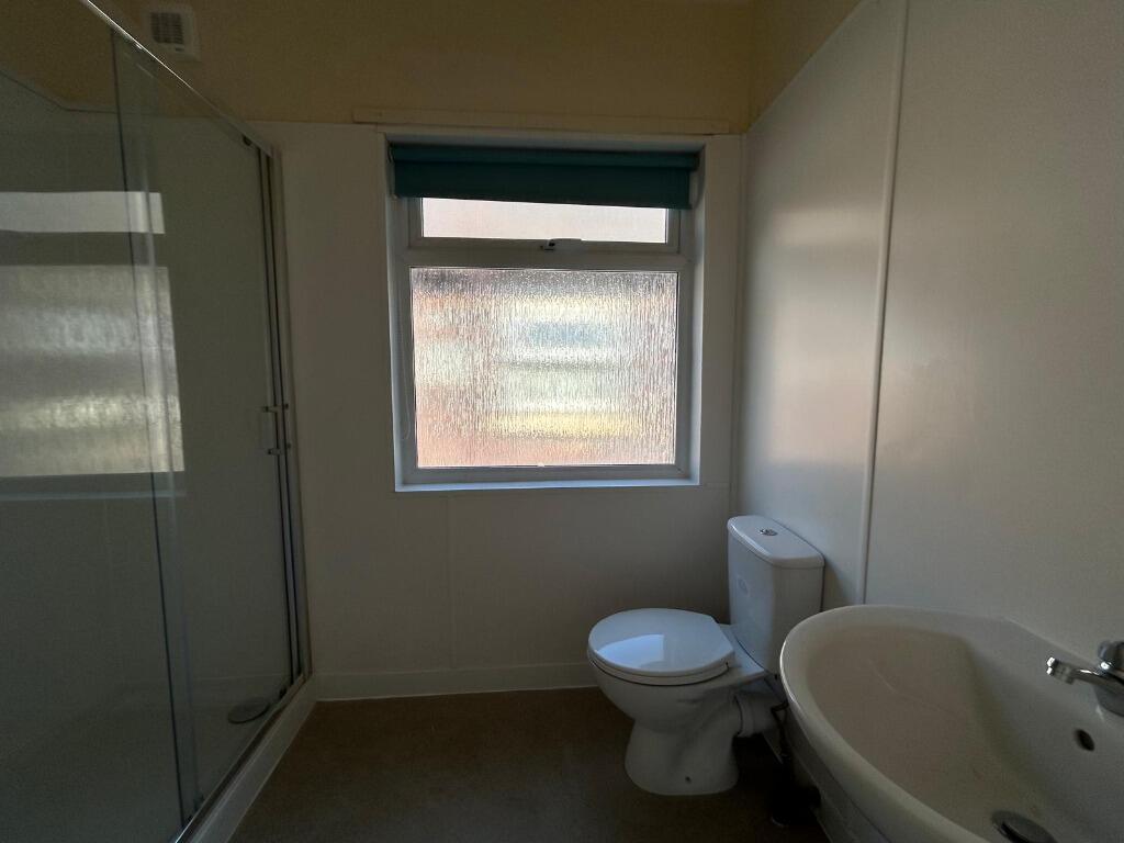

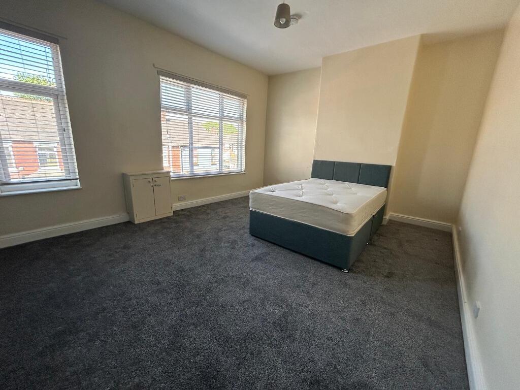
Photo 1 Photo 2 Photo 3 Photo 4 Photo 5 Photo 6 Photo 7 Photo 8 Photo 9 Photo 10 Photo 11
/ 11
Property details
Deprivation
Decile 1 (1,116 of 33,755)
Street crime
314 incidents within 1 mile (Apr 2026)
Key features
- HMO accommodation
- Individual Rooms
- Four Bedrooms
- Two Shared Shower Rooms
- One Communal Lounge
- One Communal Kitchen
- Available Now
Additional details
- Garden
- Private garden
Description
Rooms are £105.00pp per week including all bills.
Available Now and Must be viewed to appreciate the accommodation on offer EPC rating: C.
Listed by
Stoke-on-Trent
The Property Franchise Group
Reference: 89904510
EPC ratings on this postcode
We don't have a matched EPC for this property yet. Below are efficiency scores and details for other addresses on this postcode.
| Address | Current | Potential | Floor area | Age band | Type |
|---|---|---|---|---|---|
| 55, Scott Lidgett Road, STOKE-ON-TRENT | 69 | 83 | 144 m² | England and Wales: 1900-1929 | Terraced |
| 55, Scott Lidgett Road, STOKE-ON-TRENT | 57 | 85 | 136 m² | England and Wales: before 1900 | Terraced |
| 57, Scott Lidgett Road, STOKE-ON-TRENT | 69 | 82 | 144 m² | England and Wales: 1900-1929 | Terraced |
| 57, Scott Lidgett Road, STOKE-ON-TRENT | 58 | 87 | 127 m² | England and Wales: 1900-1929 | Terraced |
| 59, Scott Lidgett Road, STOKE-ON-TRENT | 58 | 87 | 80 m² | England and Wales: 1900-1929 | Terraced |
| 61 Scott Lidgett Road, STOKE-ON-TRENT | 53 | 72 | 78 m² | England and Wales: 1900-1929 | Terraced |
| 63 Scott Lidgett Road, STOKE-ON-TRENT | 64 | 85 | 79 m² | England and Wales: 1900-1929 | Terraced |
| 69 Scott Lidgett Road, Stoke-On-Trent | 45 | 84 | 115 m² | England and Wales: 1900-1929 | Terraced |
| 71 Scott Lidgett Road, STOKE-ON-TRENT | 72 | 86 | 127 m² | England and Wales: 1900-1929 | Terraced |
| 75, Scott Lidgett Road, STOKE-ON-TRENT | 62 | 81 | 133 m² | England and Wales: 1900-1929 | Terraced |
| 75, Scott Lidgett Road, STOKE-ON-TRENT | 48 | 83 | 123 m² | England and Wales: 1900-1929 | Terraced |
| 77 Scott Lidgett Road, STOKE-ON-TRENT | 66 | 83 | 123 m² | England and Wales: 1900-1929 | Terraced |
| 77 Scott Lidgett Road, STOKE-ON-TRENT | 82 | 89 | 126 m² | England and Wales: 1900-1929 | Terraced |
| 77, Scott Lidgett Road, STOKE-ON-TRENT | 60 | 77 | 110 m² | England and Wales: before 1900 | Terraced |
| Alden, Scott Lidgett Road, STOKE-ON-TRENT | 49 | 78 | 67 m² | England and Wales: 1930-1949 | Terraced |
Flood risk
Zone: 1
Risk: Low
Job (default Low)
EPC Graphs

EPC Certificate
Rental Range
Estimated market rent for Stoke-on-Trent. Low = conservative, Realistic = average, Optimistic = best case.
Based on Local Authority from postcode lookup → Stoke-on-Trent.
LHA (30th percentile) floor for Staffordshire North: £479/mo (Apr 2025 – Mar 2026)
Location
Address
Scott Lidgett Road
Nearby
Nearest stations, universities and amenities (distance from property).
| Type | Name | Distance |
|---|---|---|
| Bus stop | Longport, Porthill Road / Longport Road | 0.1 miles |
| Shop | Longport Convenience Store | 0.1 miles |
| Train station | Longport | 0.2 miles |
| Shop | Wayne Walker Quality Meats Factory Shop | 0.3 miles |
| Hospital | Haywood Hospital Walk-in Centre | 1.4 miles |
| Train station | Apedale Road | 2.3 miles |
| Hospital | Royal Stoke University Hospital | 2.7 miles |
| University | University of Staffordshire Stoke Campus | 2.8 miles |
| University | Buxton & Leek College | 9.1 miles |
Street-level crime
| Category | Count |
|---|---|
| Violence and sexual offences | 88 |
| Anti-social behaviour | 84 |
| Public order | 31 |
| Other theft | 24 |
| Criminal damage and arson | 20 |
| Shoplifting | 17 |
| Vehicle crime | 17 |
| Burglary | 16 |
| Other crime | 7 |
| Robbery | 4 |
| Bicycle theft | 2 |
| Possession of weapons | 2 |
| Drugs | 1 |
| Theft from the person | 1 |
| Total incidents | 314 |
Within 1 mile during Apr 2026. Source: data.police.uk (England & Wales).
Schools nearby
Nearest open schools with Ofsted ratings (England). Closed schools are not shown. Data from Get Information about Schools and Ofsted.
| Name | Type | Distance | Ofsted |
|---|---|---|---|
| Oaklands Nursery School | Nursery | 0.5 miles | Outstanding — 15 Feb 2013 |
| Saint Nathaniel's Academy | Primary | 0.5 miles | Good — 20 Jun 2024 |
| Kaleidoscope School | Other | 0.6 miles | Good — 10 Dec 2023 |
| Ellison Primary Academy | Primary | 0.6 miles | Good — 14 Sep 2023 |
| Cedars - Newcastle, Moorlands and Darwin Bases | Other | 0.7 miles | Good — 26 Jun 2015 |
Rental Comparables
Residential lets from OpenRent and Rightmove for the area (same bedroom count). Use to validate rent estimates. Student lets are excluded.
Average rent: £712/mo (28 listings)
Enter House Number
Enter the house number to help us retrieve more accurate pricing history and property data.
Please log in to submit or correct the house number for this listing.
Log in to continue