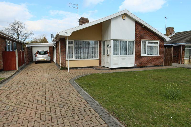
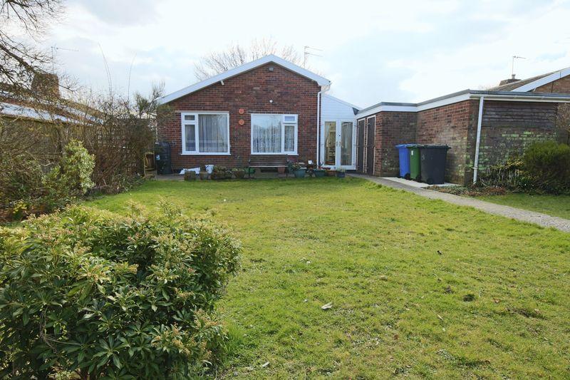
81 WESTWOOD AVENUE
LOWESTOFT, SUFFOLK NR33 9RS
Property details
Floor area
64 m²
Last sold
£220,000 Sep 2018
Local average
£349,007 (-37%)
Deprivation
Decile 9 (27,726 of 33,755)
Street crime
136 incidents within 1 mile (Apr 2026)
Key features
- POPULAR SOUGHT AFTER LOCALITY
- SPACIOUS DETACHED BUNGALOW
- GAS FIRED CENTRAL HEATING
- UPVC SEALED UNIT DOUBLE GLAZED
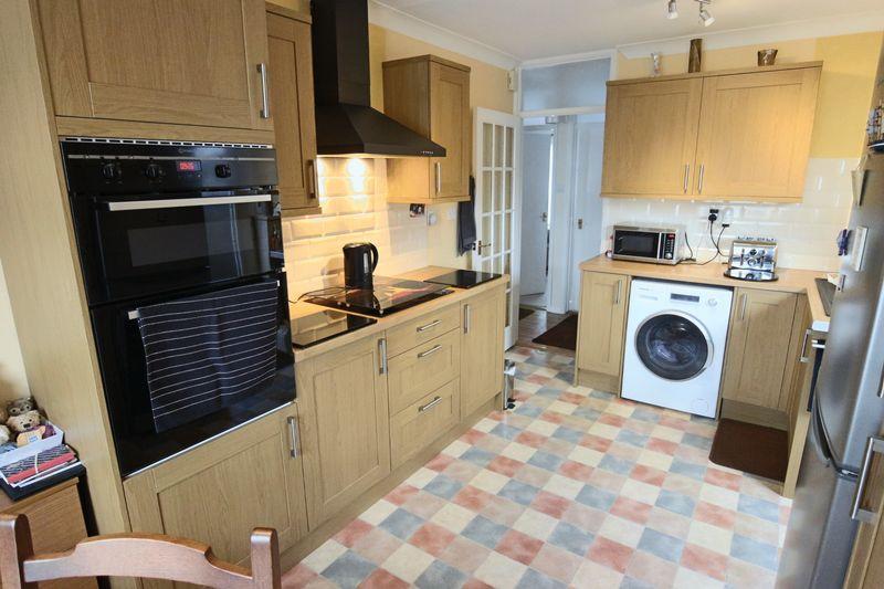
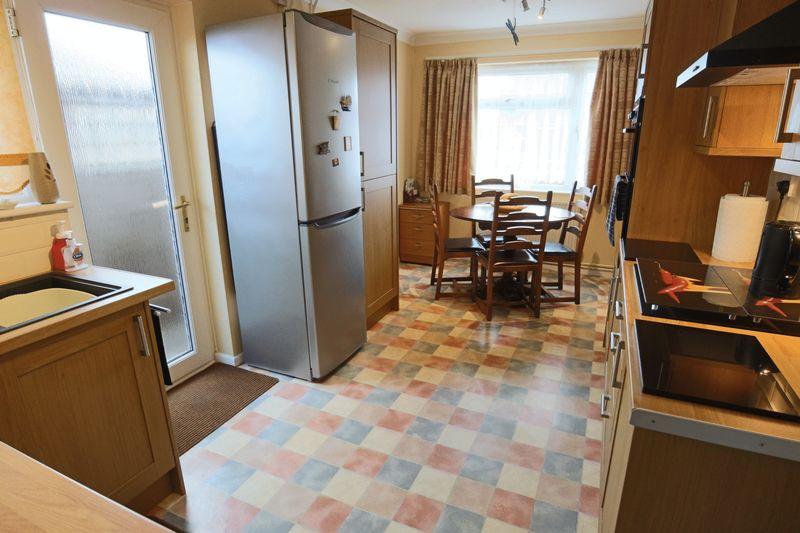
- RECENTLY RE-FITTED KITCHEN
- OFF ROAD PARKING
- CAR PORT AND GARAGE
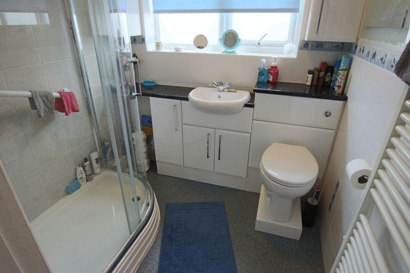
- REFURBISHED BATHROOM
Additional details
- Parking
- Yes
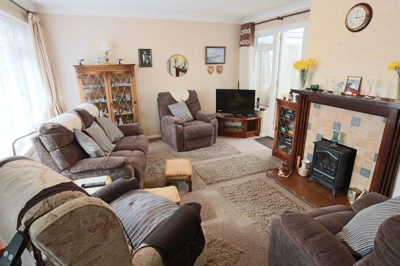
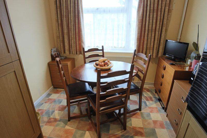
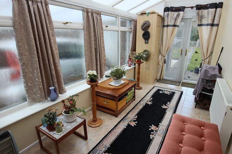
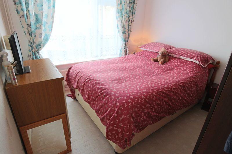
Description
Listed by
Lowestoft
LSL Franchise
Reference: 52597875
EPC Rating & Upgrade Cost
Fetching EPC data… Refresh this page in a moment.
Flood risk
Zone: 1
Risk: Low
Job (default Low)
Floorplans
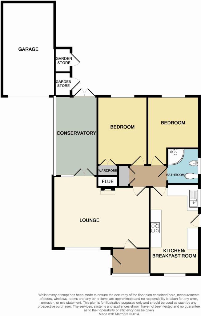
Floorplan 1
EPC Graphs

EPC (FULL DOCU...
FENSA Certificates
This property has 1 FENSA certificate(s) on record, indicating window/door installations by FENSA-approved installers.
FENSA Certificate #1275333
Property Details
Street: 81 WESTWOOD AVENUE
Town: LOWESTOFT
Postcode: NR33 9RS
Installation Details
Items: 1 window
Certificate Issued: 01/12/2003
Work Completed: 11/10/2003
This certificate data was retrieved from FENSA's database
What is FENSA? FENSA (Fenestration Self-Assessment Scheme) is a government-authorised scheme that monitors building regulation compliance for replacement windows and doors. Certificates indicate that work was completed by FENSA-approved installers.
Price history
20% since 2015
| Event | Date | Price | % change |
|---|---|---|---|
| Sold | 14/09/2018 (7 years ago) | £220,000 | +19.6% |
| Sold | 18/02/2015 (11 years ago) | £184,000 | — |
Source: HM Land Registry Price Paid Data. Crown copyright.
Sold Comparables
Same street and nearby sales within 0.25 miles (last 5 years). Data from Land Registry Price Paid.
| Address | Price | Date | Type |
|---|---|---|---|
| 2 BROADWATERS ROAD, LOWESTOFT, EAST SUFFOLK, SUFFOLK, NR33 9HT | £324,000 | 17/12/2025 | Detached |
| 22 ORCHARD AVENUE, LOWESTOFT, EAST SUFFOLK, SUFFOLK, NR33 9PD | £465,000 | 09/12/2025 | Detached |
| Same street 103 WESTWOOD AVENUE, LOWESTOFT, EAST SUFFOLK, SUFFOLK, NR33 9RS | £285,000 | 26/09/2025 | Semi-detached |
| 112 COLVILLE ROAD, LOWESTOFT, EAST SUFFOLK, SUFFOLK, NR33 9QZ | £272,000 | 27/10/2023 | Detached |
| Same street 117 WESTWOOD AVENUE, LOWESTOFT, EAST SUFFOLK, SUFFOLK, NR33 9RS | £345,000 | 21/09/2023 | Semi-detached |
| 36 LOXLEY ROAD, LOWESTOFT, EAST SUFFOLK, SUFFOLK, NR33 9PG | £280,000 | 19/06/2023 | Detached |
| 122 WESTWOOD AVENUE, LOWESTOFT, EAST SUFFOLK, SUFFOLK, NR33 9RN | £270,000 | 23/05/2023 | Detached |
| 39 BREYDON WAY, LOWESTOFT, EAST SUFFOLK, SUFFOLK, NR33 9AS | £270,000 | 07/03/2023 | Detached |
| 18 WINDWARD WAY, LOWESTOFT, EAST SUFFOLK, SUFFOLK, NR33 9HF | £405,000 | 07/11/2022 | Detached |
| 21 ORCHARD AVENUE, LOWESTOFT, EAST SUFFOLK, SUFFOLK, NR33 9PD | £555,000 | 02/11/2022 | Detached |
| 158 COLVILLE ROAD, LOWESTOFT, EAST SUFFOLK, SUFFOLK, NR33 9RB | £405,000 | 21/10/2022 | Detached |
| 37 WESTLAND ROAD, LOWESTOFT, EAST SUFFOLK, SUFFOLK, NR33 9AA | £228,000 | 10/08/2022 | Detached |
| 35 COTMER ROAD, LOWESTOFT, EAST SUFFOLK, SUFFOLK, NR33 9PL | £690,000 | 22/07/2022 | Detached |
| 18 LANDSPRING LANE, LOWESTOFT, EAST SUFFOLK, SUFFOLK, NR33 9RT | £240,000 | 13/05/2022 | Detached |
| 2 PENNYGATE DRIVE, LOWESTOFT, EAST SUFFOLK, SUFFOLK, NR33 9HL | £400,000 | 29/04/2022 | Detached |
| 1 PADDOCK HILL, LOWESTOFT, EAST SUFFOLK, SUFFOLK, NR33 9PB | £285,000 | 14/01/2022 | Detached |
| 9 PENNYGATE DRIVE, LOWESTOFT, EAST SUFFOLK, SUFFOLK, NR33 9HJ | £328,000 | 06/01/2022 | Detached |
| 17 FLEETDYKE DRIVE, LOWESTOFT, EAST SUFFOLK, SUFFOLK, NR33 9HD | £355,000 | 21/12/2021 | Detached |
| 93 COLVILLE ROAD, LOWESTOFT, EAST SUFFOLK, SUFFOLK, NR33 9RD | £267,500 | 16/12/2021 | Detached |
| 2 PADDOCK HILL, LOWESTOFT, EAST SUFFOLK, SUFFOLK, NR33 9PB | £400,000 | 03/12/2021 | Detached |
| 20 WINDWARD WAY, LOWESTOFT, EAST SUFFOLK, SUFFOLK, NR33 9HF | £335,000 | 29/10/2021 | Detached |
| 66 WESTWOOD AVENUE, LOWESTOFT, EAST SUFFOLK, SUFFOLK, NR33 9RJ | £205,000 | 30/09/2021 | Detached |
| Same street 117 WESTWOOD AVENUE, LOWESTOFT, EAST SUFFOLK, SUFFOLK, NR33 9RS | £260,000 | 30/06/2021 | Semi-detached |
Street average: £296,667 (3 sales)
Area average: £348,975 (20 sales)
Capital growth trend
Land Registry outcode average: last 12 months vs 5y and 10y ago (from sold prices).
House Price Index (HM Land Registry — official index, not sold-price averages): East Suffolk. Series: Detached. As of March 2026.
Rental Range
Estimated market rent for East Suffolk. Low = conservative, Realistic = average, Optimistic = best case.
Based on Local Authority from postcode lookup → East Suffolk.
LHA (30th percentile) floor for Lowestoft & Great Yarmouth: £573/mo (Apr 2025 – Mar 2026)
Location
Nearby
Nearest stations, universities and amenities (distance from property).
| Type | Name | Distance |
|---|---|---|
| Bus stop | Landspring Lane | 0.1 miles |
| Shop | HairWorld | 0.1 miles |
| Shop | Solebay Fish Co. | 0.2 miles |
| Train station | Oulton Broad South | 0.4 miles |
| Train station | Oulton Broad North | 0.9 miles |
| Hospital | Carlton Court Hospital | 1.1 miles |
| Hospital | Airey Close | 2.3 miles |
Street-level crime
| Category | Count |
|---|---|
| Violence and sexual offences | 68 |
| Criminal damage and arson | 16 |
| Anti-social behaviour | 12 |
| Other theft | 10 |
| Vehicle crime | 9 |
| Burglary | 6 |
| Bicycle theft | 5 |
| Drugs | 3 |
| Shoplifting | 3 |
| Robbery | 2 |
| Other crime | 1 |
| Public order | 1 |
| Total incidents | 136 |
Within 1 mile during Apr 2026. Source: data.police.uk (England & Wales).
Schools nearby
Nearest open schools with Ofsted ratings (England). Closed schools are not shown. Data from Get Information about Schools and Ofsted.
| Name | Type | Distance | Ofsted |
|---|---|---|---|
| Elm Tree Primary School | Primary | 0.2 miles | Good — 26 Sep 2022 |
| Dell Primary School | Primary | 0.3 miles | Good — 30 Jun 2022 |
| Westwood Primary School | Primary | 0.4 miles | Good — 20 Apr 2017 |
| Warren School | Other | 0.6 miles | — (Inspected (no overall grade)) |
| East Point Academy | Secondary | 0.7 miles | Good — 21 Nov 2016 |
Rental Comparables
Rental listings exist nearby, but none matched the 2-bedroom count for this property.
Rent-driven metrics
Based on Area rent estimate.
- Rent ratio — Monthly rent ÷ purchase price (1% rule). 1%+ = strong, 0.8–1% = okay, <0.8% = weak for cashflow.
- Max investor price — Rent ÷ 0.8%; the price at which rent would be 0.8% of price (Stoke-style target).
- Target investor price — Rent ÷ 1%; the price at which rent would be 1% of price (strong cashflow band).
- Gross yield — Annual rent as % of purchase price (no costs).