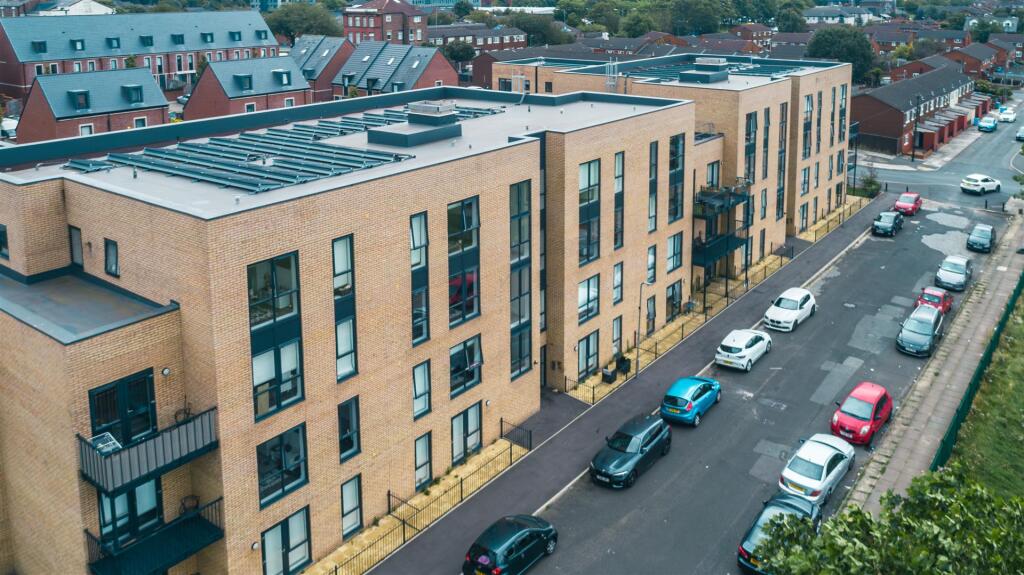
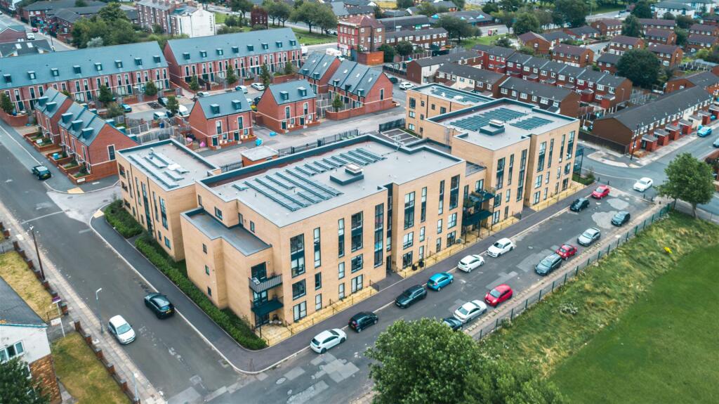
APARTMENT 25
52 HERIOT STREET, LIVERPOOL, MERSEYSIDE L5 7AA
£850 pcm
Property details
Council tax band
A
Street crime
546 incidents within 1 mile (Apr 2026)
Key features
- Brand New Development
- Available 3rd August 2026
- Near to Transport Links
- Furnished
- Council Tax Band A
- 1 Bedroom
Description
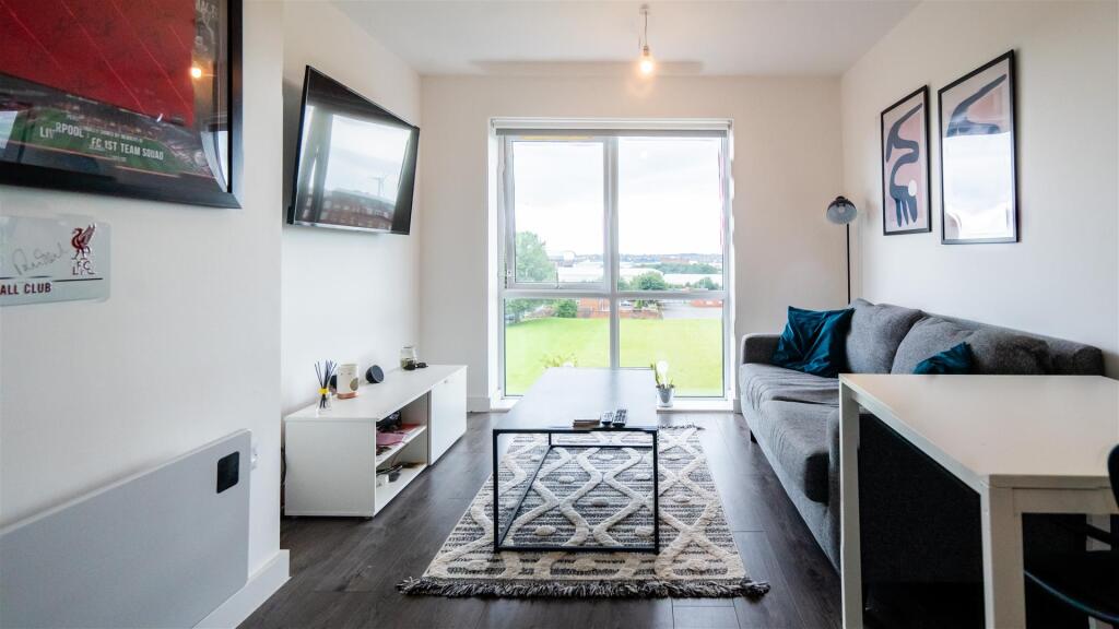
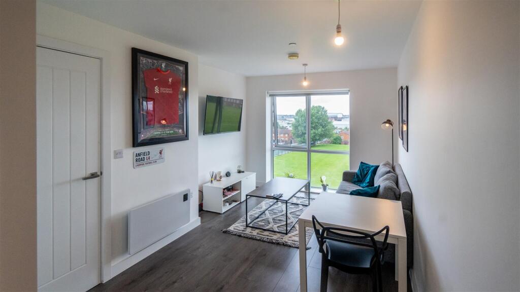
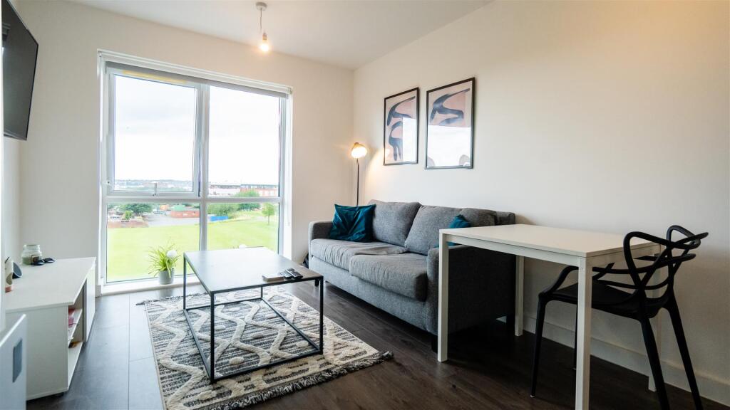
This contemporary living space offers an open-plan living room with expansive windows that provide picturesque views of a nearby field, flooding the room with natural light.
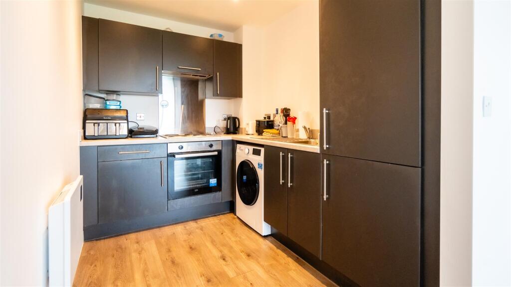
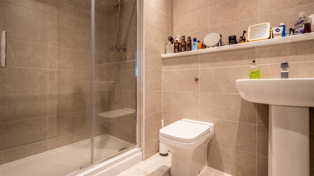
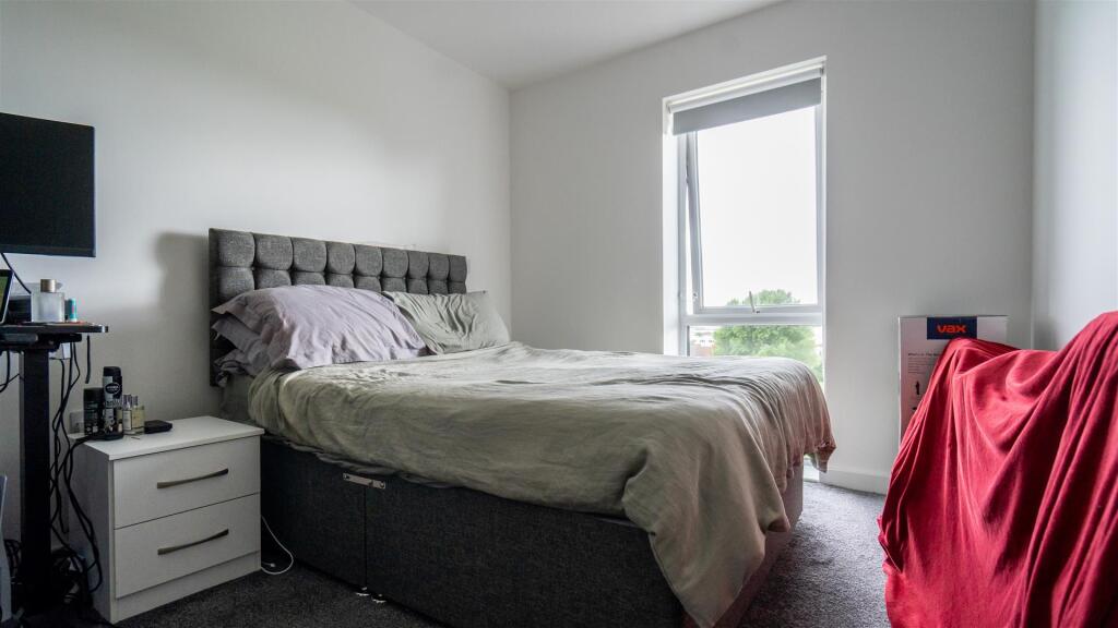
The sleek, matte black kitchen is a culinary enthusiast's dream, featuring integrated appliances that blend seamlessly into the modern design. The double bedroom is spacious and inviting, offering a peaceful retreat at the end of the day. The property also boasts a chic, modern bathroom with a walk-in shower, perfect for unwinding.
Located close to convenient transport links, this apartment is ideal for professionals or couples seeking a stylish and convenient lifestyle in Liverpool. Don't miss out on the opportunity to make this exceptional property your new home.
Deposit - £980
Holding Deposit - £190
Tax Band A
Available 3rd August 2026
Listed by
Liverpool
Ascend Estates Ltd
Reference: 89003082
EPC Rating & Upgrade Cost
Fetching EPC data… Refresh this page in a moment.
Flood risk
Zone: 1
Risk: Low
Job (default Low)
Floorplans
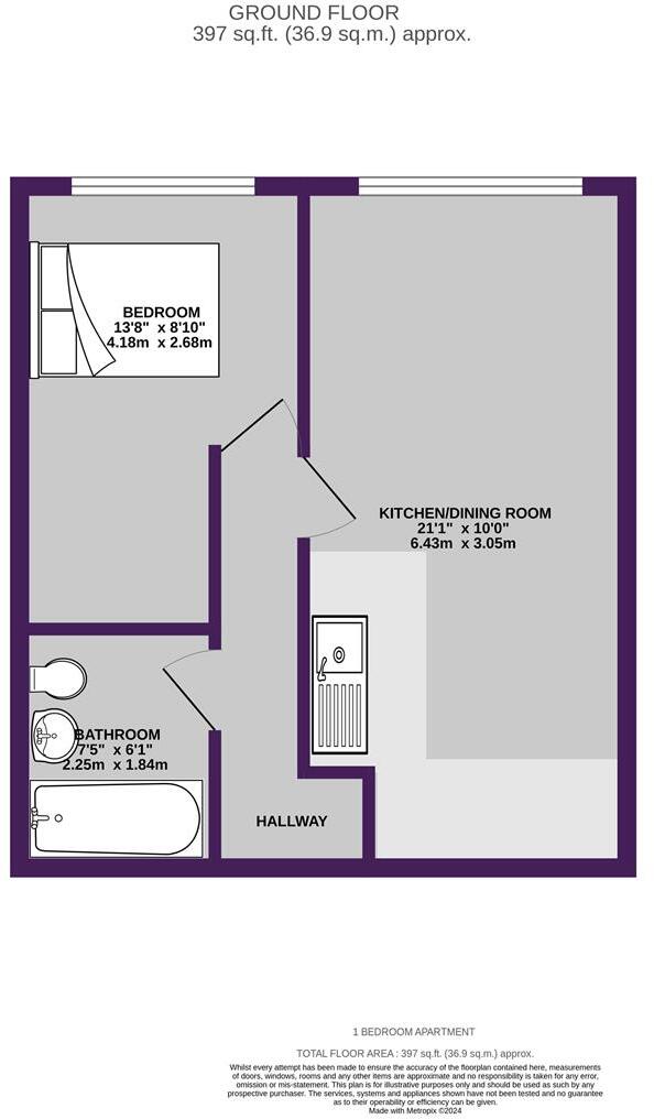
B25CityResidenceBlockB52HeriotStreetKirkdaleL57AA-
EPC Graphs
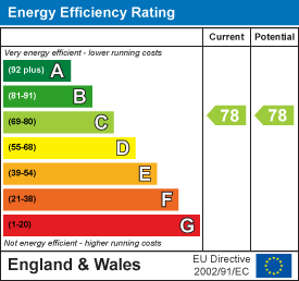
EE Rating
Company ownership
Registered legal owner is a company.
Company: NAV INVESTMENT LTD (10452974)
Rental Range
Estimated market rent for North West. Low = conservative, Realistic = average, Optimistic = best case.
Based on Postcode area L → North West.
LHA (30th percentile) floor for Greater Liverpool: £499/mo (Apr 2025 – Mar 2026)
Location
Nearby
Nearest stations, universities and amenities (distance from property).
| Type | Name | Distance |
|---|---|---|
| Shop | Kirkdale General Store | 0.1 miles |
| Bus stop | STANLEY ROAD/STERLING WAY | 0.1 miles |
| Bus stop | COMMERCIAL ROAD | 0.1 miles |
| Shop | MP Food News & Wine Store | 0.2 miles |
| Train station | Sandhills | 0.3 miles |
| Train station | Bank Hall | 0.7 miles |
| Hospital | Rathbone Hospital | 3.2 miles |
| Hospital | DRIVE THROUGH PHLEBOTOMY | 3.4 miles |
| University | University of Liverpool Leahurst Veterinary School | 9.7 miles |
| University | Edge Hill University | 10.2 miles |
Street-level crime
| Category | Count |
|---|---|
| Violence and sexual offences | 184 |
| Public order | 62 |
| Anti-social behaviour | 60 |
| Shoplifting | 58 |
| Drugs | 54 |
| Criminal damage and arson | 42 |
| Vehicle crime | 25 |
| Other theft | 21 |
| Other crime | 17 |
| Burglary | 10 |
| Possession of weapons | 6 |
| Bicycle theft | 3 |
| Robbery | 2 |
| Theft from the person | 2 |
| Total incidents | 546 |
Within 1 mile during Apr 2026. Source: data.police.uk (England & Wales).
Schools nearby
Nearest open schools with Ofsted ratings (England). Closed schools are not shown. Data from Get Information about Schools and Ofsted.
| Name | Type | Distance | Ofsted |
|---|---|---|---|
| Notre Dame Catholic Academy | Secondary | 0.3 miles | Requires improvement — 17 Jul 2022 |
| St John's Catholic Primary School | Primary | 0.5 miles | — (Inspected (no overall grade)) |
| Our Lady Immaculate Catholic Primary School | Primary | 0.5 miles | Good — 21 Nov 2023 |
| Kirkdale St Lawrence CofE VA Primary School | Primary | 0.6 miles | Good — 22 Jan 2013 |
| The Trinity Catholic Academy | Primary | 0.6 miles | Inadequate — 13 May 2019 |
Rental Comparables
Residential lets from OpenRent and Rightmove for the area (same bedroom count). Use to validate rent estimates. Student lets are excluded.
| Title | Rent | Beds | Distance | As seen on |
|---|---|---|---|---|
| 54 Heriot Street, Liverpool | £775/mo | 1 | 0.02 miles | Rightmove |
| 1 Bed Flat, Walton Road, L4 | £620/mo | 1 | 0.71 miles | OpenRent |
Average rent: £698/mo (2 listings)