13 SHELBURNE STREET
STOKE-ON-TRENT, STOKE-ON-TRENT ST4 5EY
£750 pcm
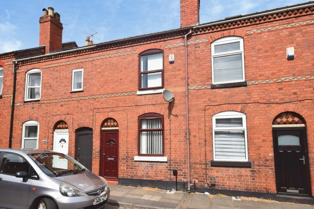
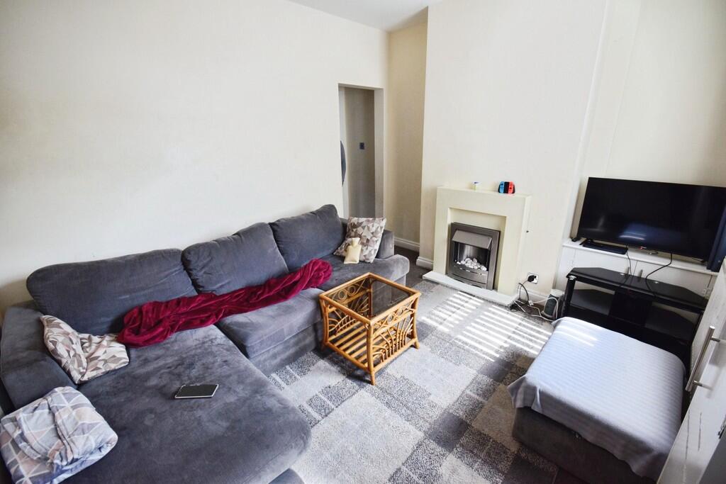
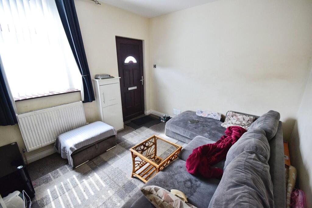
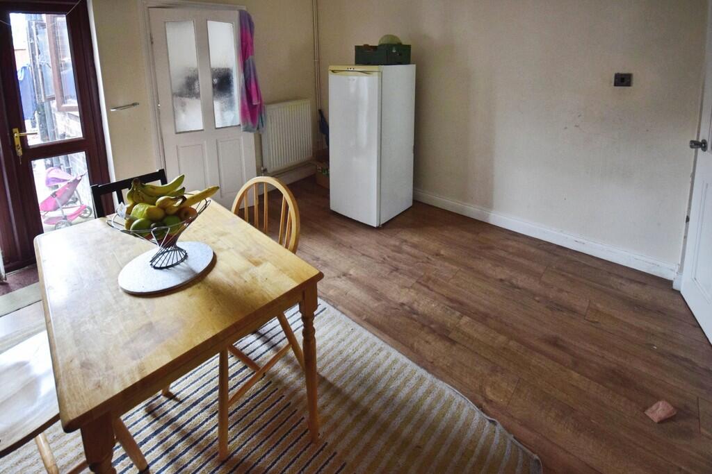
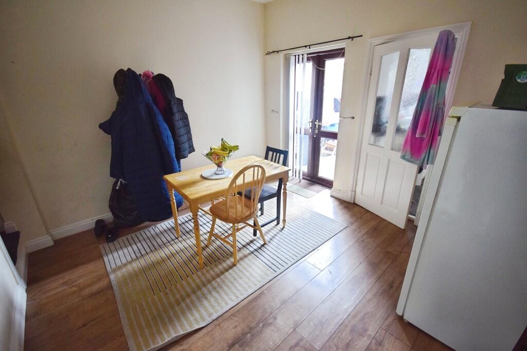
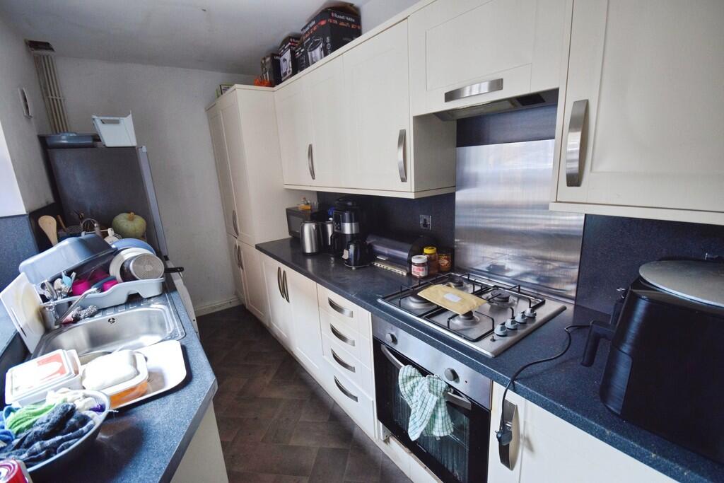
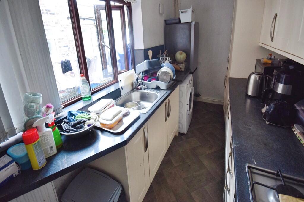
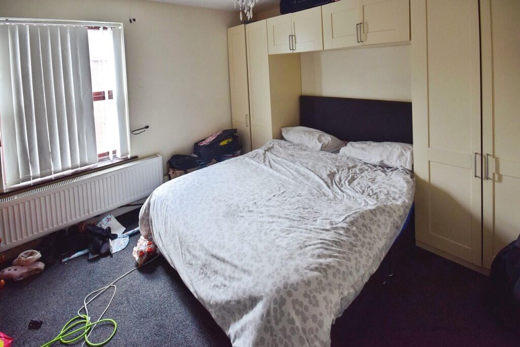
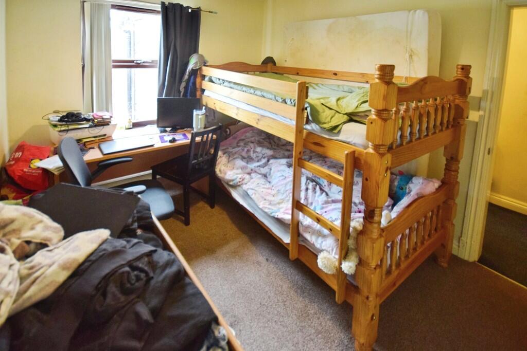
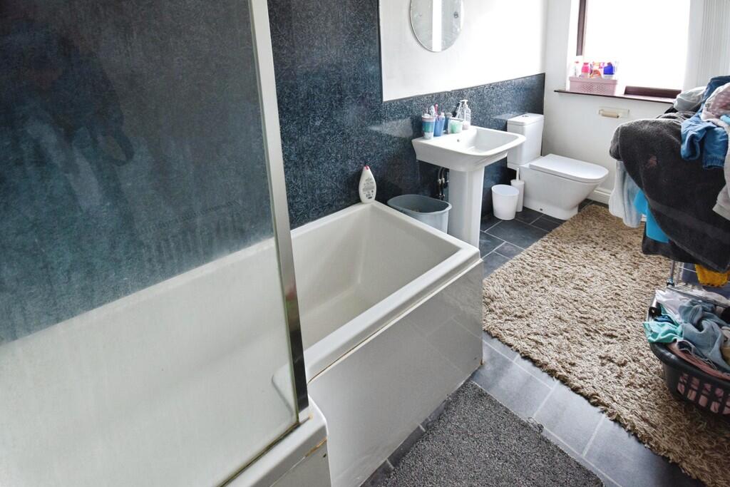
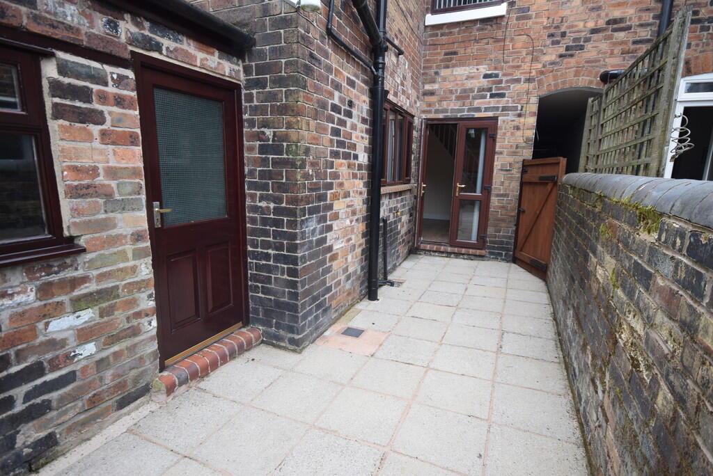
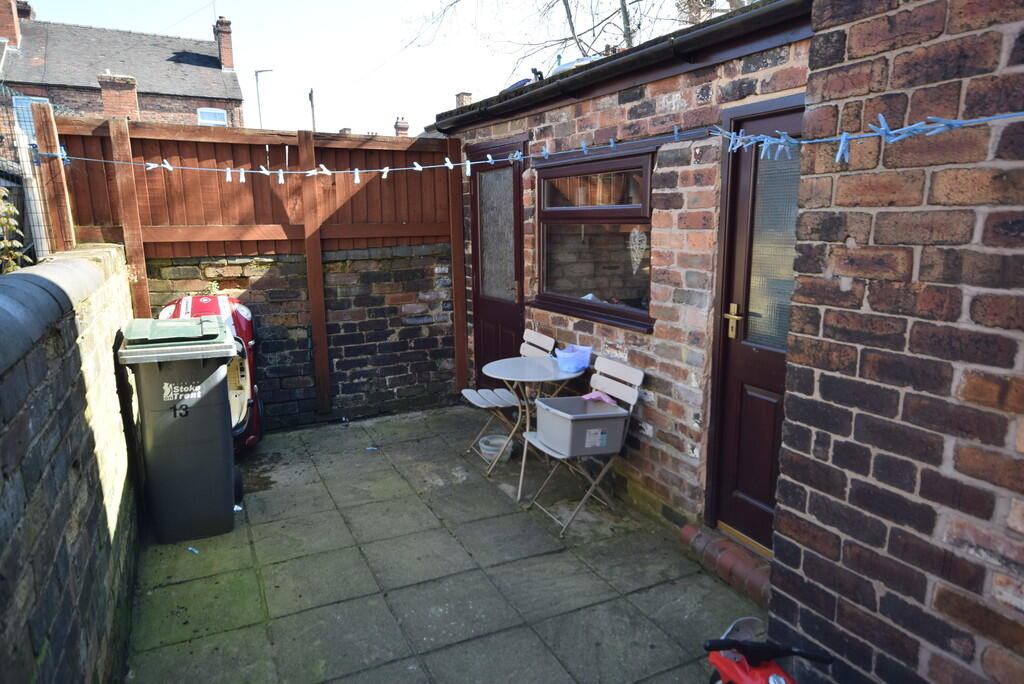
Photo 1 Photo 2 Photo 3 Photo 4 Photo 5 Photo 6 Photo 7 Photo 8 Photo 9 Photo 10 Photo 11 Photo 12
/ 12
Property details
Floor area
75 m²
Council tax band
A
Deprivation
Decile 3 (8,918 of 33,755)
Street crime
358 incidents within 1 mile (Apr 2026)
Key features
- Two Reception Rooms
- Two Double Bedrooms
- Gas Central Heating
- Double Glazed
- First Floor Bathroom
- Close To Hospital
- Rear garden
- Kitchen
- Council tax band A
Additional details
- Heating
- Gas central
- Parking
- On street
- Garden
- Yes
Description
FRONT RECEPTION ROOM Entered via UPVC door. Carpeted flooring, wall mounted radiator and UPVC double glazed window to front elevation
REAR RECEPTION ROOM Laminate flooring, wall mounted radiator, UPVC French Doors leading to rear yard area.
KITCHEN Fitted kitchen comprising of base units with contrasting worktops over, wall units, gas hob with extractor over, oven below. Stainless steel sink and drainer with mixer tap over. Vinyl flooring , wall mounted radiator and UPVC double glazed window to side elevation.
STAIRS AND LANDING Carpeted flooring and wall mounted radiator.
BEDROOM Double bedroom with carpeted flooring with carpeted flooring and UPVC double glazed window to front elevation.
BEDROOM Double bedroom with carpeted flooring with carpeted flooring and UPVC double glazed window to rear elevation.
BATHROOM ** White three piece suite comprising of WC, pedestal wash hand basin and bath with shower off taps, vinyl flooring, heated towel rail and UPVC double glazed window to rear elevation.
Listed by
Stoke On Trent
The Property Franchise Group
Reference: 88384830
EPC Rating & Upgrade Cost
Fetching EPC data… Refresh this page in a moment.
Flood risk
Zone: 1
Risk: Low
Job (default Low)
EPC Graphs
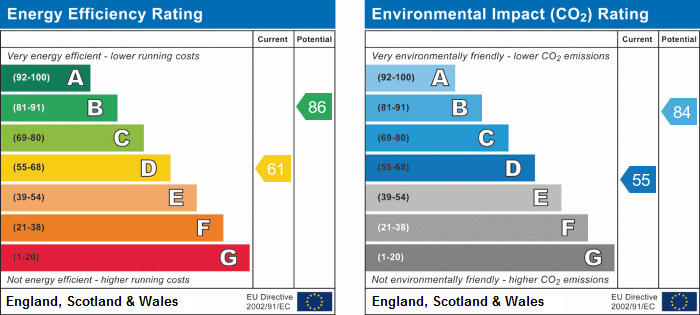
EPC 1
Rental Range
Estimated market rent for Stoke-on-Trent. Low = conservative, Realistic = average, Optimistic = best case.
Based on Local Authority from postcode lookup → Stoke-on-Trent.
LHA (30th percentile) floor for Staffordshire North: £479/mo (Apr 2025 – Mar 2026)
Location
Nearby
Nearest stations, universities and amenities (distance from property).
| Type | Name | Distance |
|---|---|---|
| Shop | West End Wines | 0.1 miles |
| Shop | Mingas | 0.1 miles |
| Bus stop | Unknown | 0.1 miles |
| Hospital | Harplands Hospital | 0.8 miles |
| Hospital | Car park site | 0.8 miles |
| Train station | Stoke-on-Trent | 1.0 miles |
| University | University of Staffordshire Stoke Campus | 1.1 miles |
| Train station | Longton | 2.4 miles |
Street-level crime
| Category | Count |
|---|---|
| Violence and sexual offences | 118 |
| Anti-social behaviour | 57 |
| Public order | 39 |
| Shoplifting | 34 |
| Criminal damage and arson | 28 |
| Burglary | 15 |
| Drugs | 14 |
| Other theft | 14 |
| Vehicle crime | 13 |
| Other crime | 11 |
| Possession of weapons | 7 |
| Robbery | 4 |
| Bicycle theft | 2 |
| Theft from the person | 2 |
| Total incidents | 358 |
Within 1 mile during Apr 2026. Source: data.police.uk (England & Wales).
Schools nearby
Nearest open schools with Ofsted ratings (England). Closed schools are not shown. Data from Get Information about Schools and Ofsted.
| Name | Type | Distance | Ofsted |
|---|---|---|---|
| Stoke Minster CofE Primary Academy | Primary | 0.5 miles | Inadequate — 27 Sep 2022 |
| Thistley Hough Academy | Secondary | 0.5 miles | Good — 26 Apr 2017 |
| Oakhill Primary School | Primary | 0.5 miles | Good — 4 Dec 2023 |
| The Willows Primary School | Primary | 0.6 miles | Good — 14 Dec 2010 |
| St Joseph's Preparatory School | Other | 0.6 miles | — (No rating) |
Rental Comparables
Residential lets from OpenRent and Rightmove for the area (same bedroom count). Use to validate rent estimates. Student lets are excluded.
Average rent: £774/mo (57 listings)