Wilton Crescent
Alderley Edge, SK9, SK9 7RF
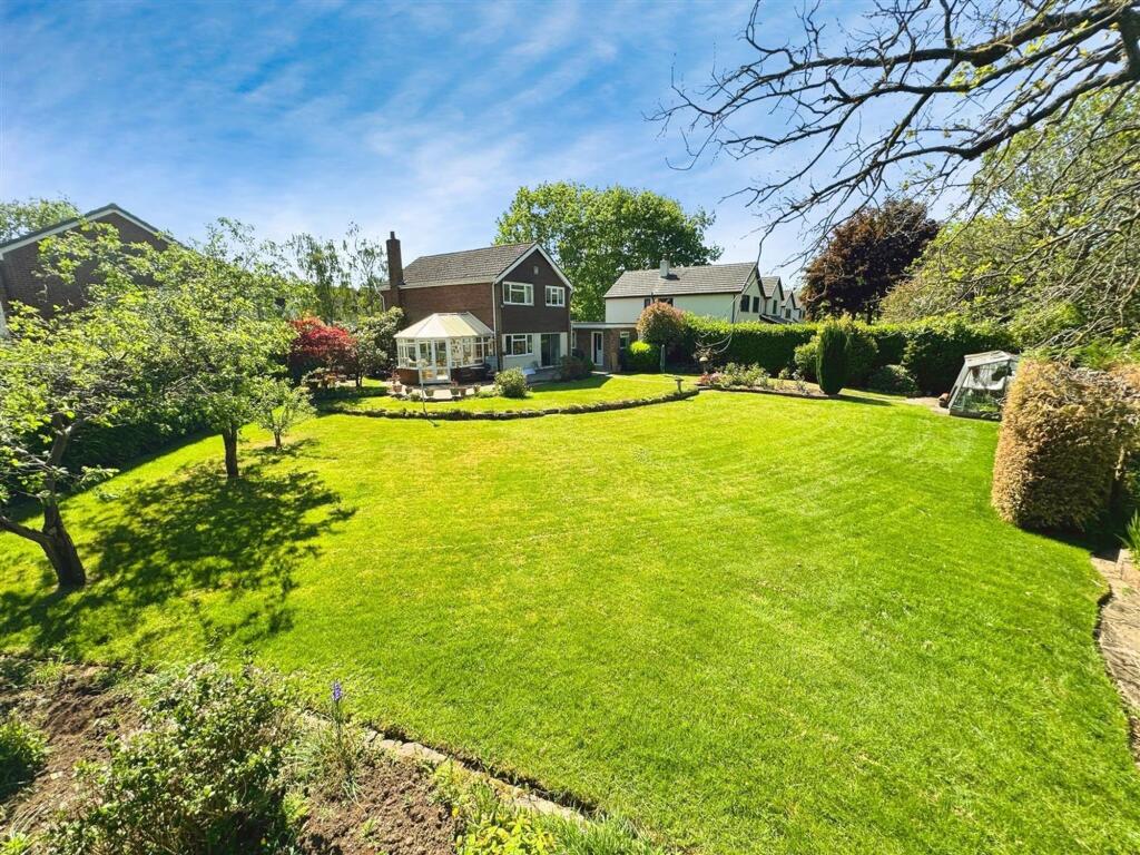
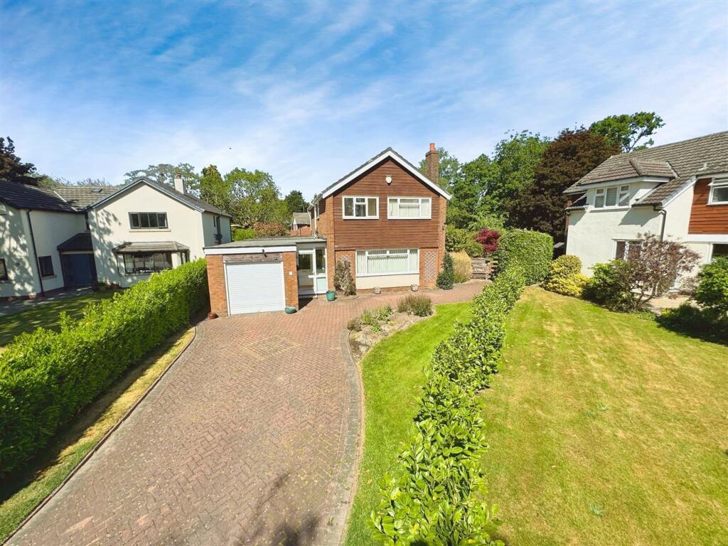
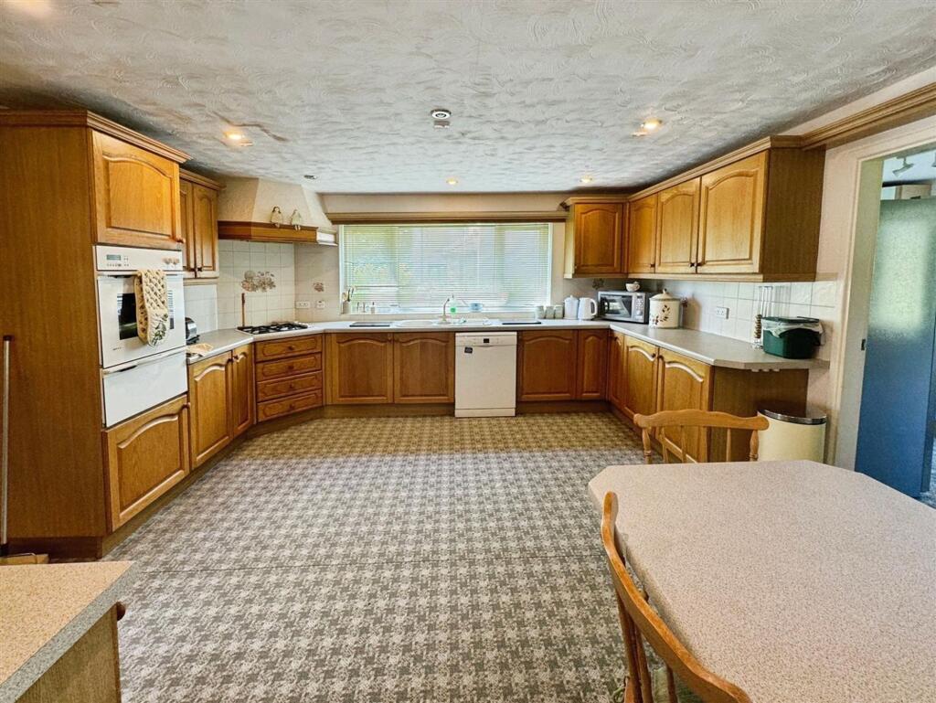
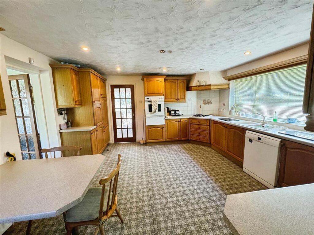
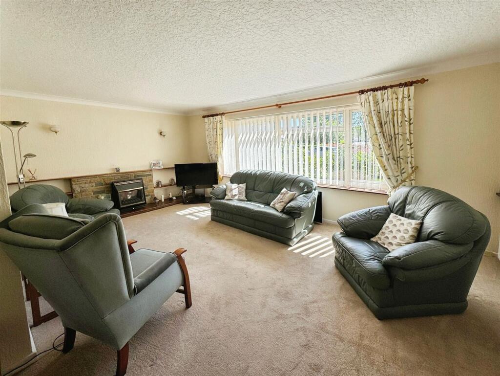
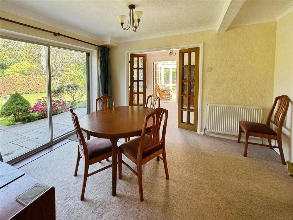
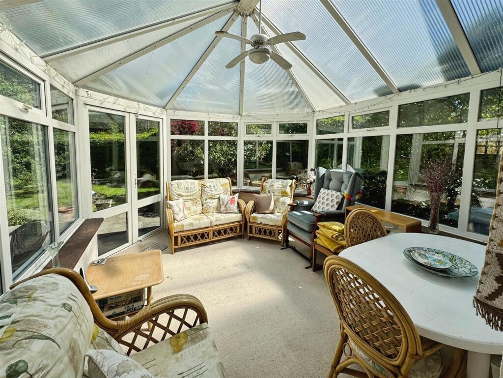
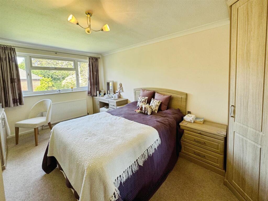

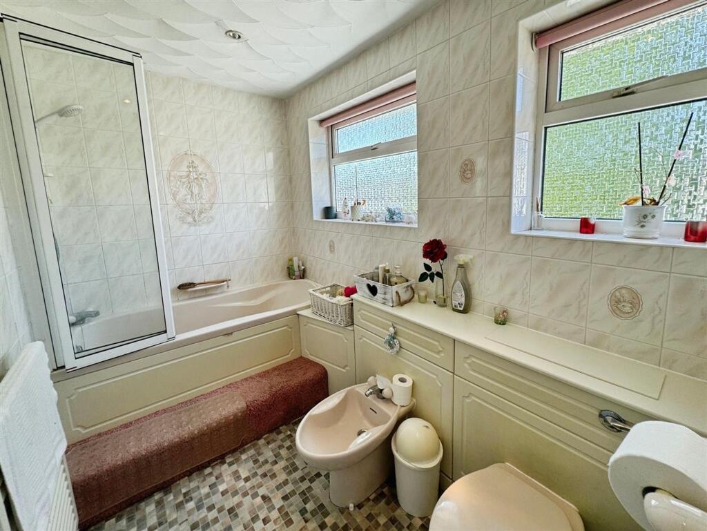
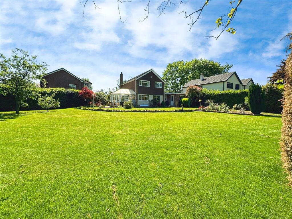
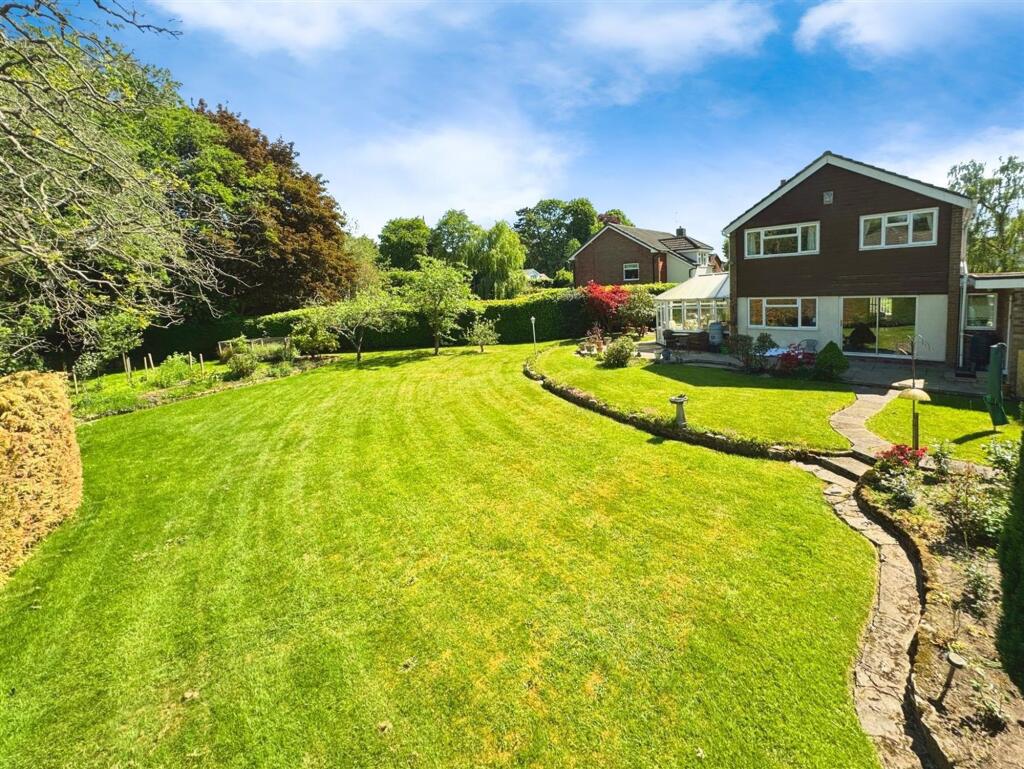
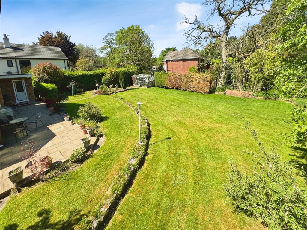
Photo 1 Photo 2 Photo 3 Photo 4 Photo 5 Photo 6 Photo 7 Photo 8 Photo 9 Photo 10 Photo 11 Photo 12 Photo 13
/ 13
Property details
Floor area
159 m²
Local average
£837,551 (-4.5%)
Deprivation
Decile 10 (32,229 of 33,755)
Street crime
36 incidents within 1 mile (Apr 2026)
Key features
- Popular Location
- Requires Modernisation
- Substantial Rear Garden
- Four Bedrooms
- Detached Family Home
- No Onward Chain
- Huge Potential
Additional details
- Parking
- Yes
- Garden
- Yes
- Listed property
- No
- Restrictions
- No
- Required access
- No
- Rights of way
- No
- Flooded in last 5 years
- No
- Flood defences
- No
Description
EPC Rating: D
Listed by
Alderley Edge
Mosley Jarman
Reference: 89815686
EPC Rating & Upgrade Cost
Fetching EPC data… Refresh this page in a moment.
Flood risk
Zone: 1
Risk: Low
Job (default Low)
Floorplans
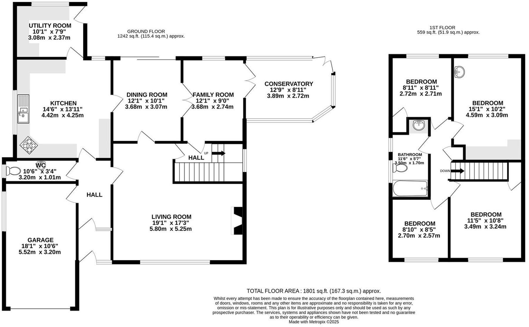
Floorplan 1
EPC Graphs
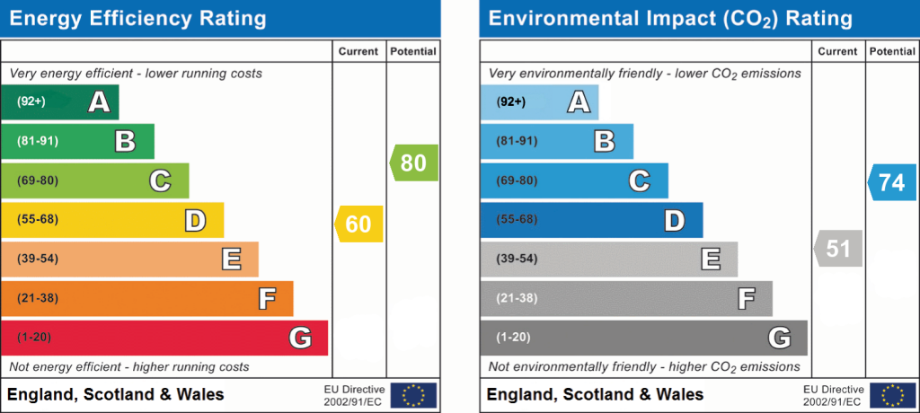
EPC 1
Price history
| Event | Date | Price | % change |
|---|---|---|---|
| Listed for sale | — | £800,000 | — |
Source: HM Land Registry Price Paid Data. Crown copyright.
Sold Comparables
Same street and nearby sales within 0.25 miles (last 5 years). Data from Land Registry Price Paid.
| Address | Price | Date | Type |
|---|---|---|---|
| RED ROOFS BROOK LANE, ALDERLEY EDGE, CHESHIRE EAST, SK9 7QG | £668,000 | 23/08/2024 | Other |
Area average: £668,000 (1 sale)
Capital growth trend
Land Registry outcode average: last 12 months vs 5y and 10y ago (from sold prices).
House Price Index (HM Land Registry — official index, not sold-price averages): Cheshire East. Series: All dwelling types. As of March 2026.
Rental Range
Estimated market rent for Cheshire East. Low = conservative, Realistic = average, Optimistic = best case.
Based on Local Authority from postcode lookup → Cheshire East.
LHA (30th percentile) floor for West Pennine: £760/mo (Apr 2025 – Mar 2026)
Location
Address
37 Wilton Crescent
Nearby
Nearest stations, universities and amenities (distance from property).
| Type | Name | Distance |
|---|---|---|
| Bus stop | Alderley Edge, Brook Lane / Hole Farm | 0.1 miles |
| Bus stop | Alderley Edge, Brook Lane / Woodleigh Court | 0.2 miles |
| Shop | Aldeli | 0.2 miles |
| Shop | Highams | 0.2 miles |
| Train station | Alderley Edge | 0.3 miles |
| Train station | Wilmslow | 1.6 miles |
| Hospital | Rosemount Resource Centre | 5.1 miles |
| Hospital | Altrincham Hospital | 7.1 miles |
| University | University of Manchester Fallowfield Campus | 9.6 miles |
| University | Fallowfield Reception and Richmond Amenities Building | 9.6 miles |
Street-level crime
| Category | Count |
|---|---|
| Violence and sexual offences | 14 |
| Drugs | 5 |
| Public order | 5 |
| Other theft | 3 |
| Anti-social behaviour | 2 |
| Burglary | 2 |
| Criminal damage and arson | 2 |
| Other crime | 1 |
| Robbery | 1 |
| Theft from the person | 1 |
| Total incidents | 36 |
Within 1 mile during Apr 2026. Source: data.police.uk (England & Wales).
Schools nearby
Nearest open schools with Ofsted ratings (England). Closed schools are not shown. Data from Get Information about Schools and Ofsted.
| Name | Type | Distance | Ofsted |
|---|---|---|---|
| Alderley Edge Community Primary School | Primary | 0.2 miles | — (Inspected (no overall grade)) |
| Alderley Edge School for Girls | Other | 0.2 miles | — (No rating) |
| The Ryleys School | Other | 0.3 miles | — (No rating) |
| Lindow Community Primary School | Primary | 0.7 miles | Good — 11 Mar 2014 |
| Ashdene Primary School | Primary | 0.8 miles | Outstanding — 23 Apr 2019 |
Rental Comparables
Loading rental comparables for this postcode. Refresh in a few minutes.
Rent-driven metrics
Based on Area rent estimate.
- Rent ratio — Monthly rent ÷ purchase price (1% rule). 1%+ = strong, 0.8–1% = okay, <0.8% = weak for cashflow.
- Max investor price — Rent ÷ 0.8%; the price at which rent would be 0.8% of price (Stoke-style target).
- Target investor price — Rent ÷ 1%; the price at which rent would be 1% of price (strong cashflow band).
- Gross yield — Annual rent as % of purchase price (no costs).