Weston Street
Walsall, WS1 4EJ
£62,950
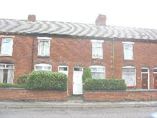
Photo 1
/ 1
Property details
Last sold
£63,500
Local average
£177,571 (-64.5%)
Deprivation
Decile 1 (1,262 of 33,755)
Street crime
538 incidents within 1 mile (Apr 2026)
Key features
- double glazing
- majority centrally heated
- rear garden
- downstairs bathroom
- two reception rooms
Description
Listed by
Walsall
Countrywide UK Sales - Connells
Reference: 2126766
EPC ratings on this postcode
We don't have a matched EPC for this property yet. Below are efficiency scores and details for other addresses on this postcode.
| Address | Current | Potential | Floor area | Age band | Type |
|---|---|---|---|---|---|
| 10 Weston Street | 71 | 88 | 68 m² | England and Wales: 1900-1929 | Terraced |
| 10, Weston Street, WALSALL | 72 | 89 | 69 m² | England and Wales: 1900-1929 | Terraced |
| 12, Weston Street, WALSALL | 62 | 87 | 72 m² | England and Wales: 1900-1929 | Terraced |
| 14, Weston Street, WALSALL | 53 | 80 | 74 m² | England and Wales: 1900-1929 | Terraced |
| 14, Weston Street, WALSALL | 56 | 88 | 73 m² | England and Wales: 1900-1929 | Terraced |
| 18, Weston Street, WALSALL | 57 | 84 | 72 m² | England and Wales: 1900-1929 | Terraced |
| 2 Weston Street, WALSALL | 59 | 85 | 96 m² | England and Wales: 1900-1929 | Detached |
| 22, Weston Street, WALSALL | 52 | 88 | 76 m² | England and Wales: 1900-1929 | Terraced |
| 22, Weston Street, WALSALL | 56 | 77 | 76 m² | England and Wales: before 1900 | Terraced |
| 24, Weston Street, WALSALL | 57 | 85 | 76 m² | England and Wales: 1900-1929 | Terraced |
| 26, Weston Street, WALSALL | 63 | 88 | 73 m² | England and Wales: before 1900 | Terraced |
| 28, Weston Street, WALSALL | 46 | 88 | 76 m² | England and Wales: 1900-1929 | Terraced |
| 30, Weston Street, WALSALL | 56 | 77 | 83 m² | England and Wales: 1900-1929 | Terraced |
| 30, Weston Street, WALSALL | 64 | 86 | 83 m² | England and Wales: 1900-1929 | Terraced |
| 30, Weston Street, WALSALL | 56 | 86 | 83 m² | England and Wales: 1900-1929 | Terraced |
Flood risk
Zone: 2
Risk: In flood risk area
Environment Agency Flood Risk Areas (APSFR)
Price history
No sales history found for this property in Land Registry Price Paid data.
Sold Comparables
Same street and nearby sales within 0.25 miles (last 5 years). Data from Land Registry Price Paid.
| Address | Price | Date | Type |
|---|---|---|---|
| 121 WESTON STREET, WALSALL, WEST MIDLANDS, WS1 4EF | £167,500 | 02/03/2026 | Terraced |
| 141 WESTON STREET, WALSALL, WEST MIDLANDS, WS1 4EF | £165,000 | 27/02/2026 | Terraced |
| 106 WHITEHALL ROAD, WALSALL, WEST MIDLANDS, WS1 4AT | £175,000 | 19/12/2025 | Terraced |
| 224 ALEXANDRA ROAD, WALSALL, WEST MIDLANDS, WS1 4AS | £130,000 | 23/07/2025 | Terraced |
| 88 WESTON STREET, WALSALL, WEST MIDLANDS, WS1 4EE | £185,000 | 08/05/2025 | Terraced |
| 41 WINDSOR STREET, WALSALL, WEST MIDLANDS, WS1 4DA | £150,000 | 24/11/2023 | Terraced |
| 164 WEST BROMWICH ROAD, WALSALL, WEST MIDLANDS, WS1 3HN | £162,000 | 27/09/2023 | Terraced |
| Same street 14 WESTON STREET, WALSALL, WEST MIDLANDS, WS1 4EJ | £150,000 | 25/08/2023 | Terraced |
| 55 THORPE ROAD, WALSALL, WEST MIDLANDS, WS1 4BT | £131,000 | 19/07/2023 | Terraced |
| 132 WEST BROMWICH STREET, WALSALL, WEST MIDLANDS, WS1 4DB | £161,666 | 30/06/2023 | Terraced |
| 95 WESTON STREET, WALSALL, WEST MIDLANDS, WS1 4EQ | £145,000 | 23/06/2023 | Terraced |
| 61 WESTON STREET, WALSALL, WEST MIDLANDS, WS1 4EQ | £156,000 | 09/06/2023 | Terraced |
| 95 WEST BROMWICH ROAD, WALSALL, WEST MIDLANDS, WS1 3HP | £115,500 | 19/05/2023 | Terraced |
| 92 WHITEHALL ROAD, WALSALL, WEST MIDLANDS, WS1 4AT | £90,000 | 16/05/2023 | Terraced |
| 36 VINCENT STREET, WALSALL, WEST MIDLANDS, WS1 3EJ | £172,500 | 09/05/2023 | Terraced |
| 152 WEST BROMWICH ROAD, WALSALL, WEST MIDLANDS, WS1 3HN | £155,000 | 20/04/2023 | Terraced |
| 90 WHITEHALL ROAD, WALSALL, WEST MIDLANDS, WS1 4AT | £137,000 | 14/04/2023 | Terraced |
| 192 ALEXANDRA ROAD, WALSALL, WEST MIDLANDS, WS1 4AS | £156,000 | 30/03/2023 | Terraced |
| 63 THORPE ROAD, WALSALL, WEST MIDLANDS, WS1 4BT | £90,000 | 17/03/2023 | Terraced |
| 76 WEST BROMWICH ROAD, WALSALL, WEST MIDLANDS, WS1 3HW | £116,000 | 08/03/2023 | Terraced |
| 57 WESTON STREET, WALSALL, WEST MIDLANDS, WS1 4EQ | £119,000 | 12/01/2023 | Terraced |
Street average: £150,000 (1 sale)
Area average: £143,958 (20 sales)
Capital growth trend
Land Registry outcode average: last 12 months vs 5y and 10y ago (from sold prices).
House Price Index (HM Land Registry — official index, not sold-price averages): Walsall. Series: Terraced. As of March 2026.
Rental Range
Estimated market rent for Walsall. Low = conservative, Realistic = average, Optimistic = best case.
Based on Local Authority from postcode lookup → Walsall.
LHA (30th percentile) floor for Black Country: £623/mo (Apr 2025 – Mar 2026)
Location
Address
Weston Street
Nearby
Nearest stations, universities and amenities (distance from property).
| Type | Name | Distance |
|---|---|---|
| Bus stop | Weston St / Redhouse St | 0.1 miles |
| Bus stop | Weston St / Weston Close | 0.1 miles |
| Shop | Broadway Booze & Convenience | 0.3 miles |
| Shop | Palm Medical | 0.4 miles |
| Train station | Bescot Stadium | 0.8 miles |
| Train station | Walsall | 0.8 miles |
| University | Maryvale Institute | 4.0 miles |
| Hospital | Bilston Street Surgery | 6.3 miles |
| University | BIMM University Birmingham | 7.8 miles |
| Hospital | krishna pemmaraju | 8.2 miles |
Street-level crime
| Category | Count |
|---|---|
| Violence and sexual offences | 196 |
| Shoplifting | 106 |
| Vehicle crime | 38 |
| Criminal damage and arson | 33 |
| Drugs | 30 |
| Public order | 30 |
| Other theft | 26 |
| Burglary | 24 |
| Anti-social behaviour | 18 |
| Other crime | 10 |
| Possession of weapons | 10 |
| Robbery | 8 |
| Theft from the person | 8 |
| Bicycle theft | 1 |
| Total incidents | 538 |
Within 1 mile during Apr 2026. Source: data.police.uk (England & Wales).
Schools nearby
Nearest open schools with Ofsted ratings (England). Closed schools are not shown. Data from Get Information about Schools and Ofsted.
| Name | Type | Distance | Ofsted |
|---|---|---|---|
| Whitehall Nursery and Infant School | Primary | 0.0 miles | Outstanding — 13 Jan 2015 |
| Abu Bakr Boys School | Other | 0.3 miles | Requires improvement — 17 Apr 2024 |
| Caldmore Primary Academy | Primary | 0.3 miles | Good — 17 Nov 2019 |
| Palfrey Infant School | Primary | 0.3 miles | Requires improvement — 24 Nov 2022 |
| Whitehall Junior Community School | Primary | 0.3 miles | Good — 8 Dec 2022 |
Rental Comparables
Loading rental comparables for this postcode. Refresh in a few minutes.
Rent-driven metrics
Based on Area rent estimate.
- Rent ratio — Monthly rent ÷ purchase price (1% rule). 1%+ = strong, 0.8–1% = okay, <0.8% = weak for cashflow.
- Max investor price — Rent ÷ 0.8%; the price at which rent would be 0.8% of price (Stoke-style target).
- Target investor price — Rent ÷ 1%; the price at which rent would be 1% of price (strong cashflow band).
- Gross yield — Annual rent as % of purchase price (no costs).
Enter House Number
Enter the house number to help us retrieve more accurate pricing history and property data.
Please log in to submit or correct the house number for this listing.
Log in to continue