34 SALTWOOD AVENUE
WORCESTER, BERKELEY ALFORD, WORCESTERSHIRE WR4 0JP
£675 pcm
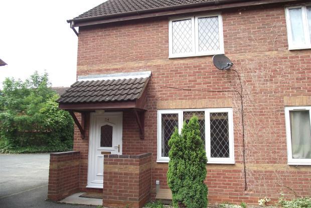
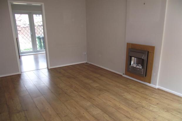
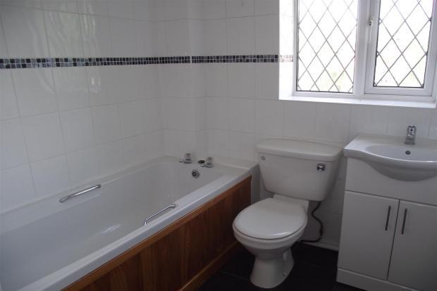
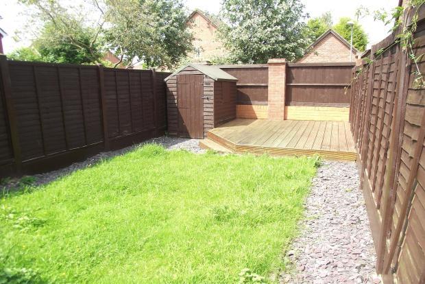
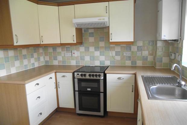
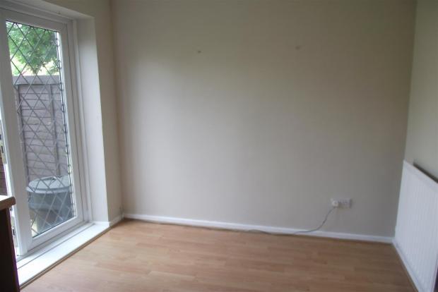
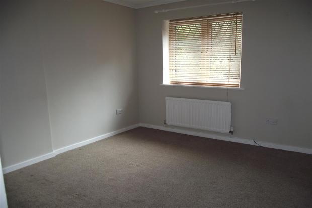
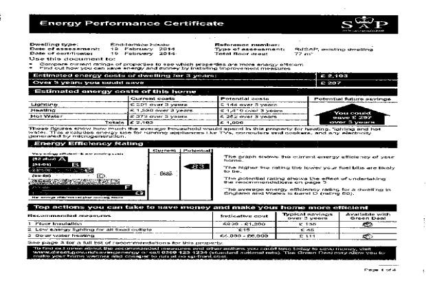
Photo 1 Photo 2 Photo 3 Photo 4 Photo 5 Photo 6 Photo 7 EPC
/ 8
Property details
Floor area
60 m²
EPC rating
C
Year built
England and Wales: 1991-1995
Deprivation
Decile 9 (27,676 of 33,755)
Street crime
154 incidents within 1 mile (Apr 2026)
Key features
- Well Presented
- Popular Location
- Two Allocated Parking Spaces
- En-Suite
- Rear Garden
- Light And Modern
Additional details
- Parking
- Yes
- Garden
- Yes
Description
Saltwood Avenue is convieniently located close to local ammenities, within easy reach of Worcester City centre and giving great travel links further afield and it is a few minutes drive from the M5 motorway.
Available early February - Dont miss out.
Listed by
Worcester
Countrywide UK Lettings - Connells
Reference: 38672277
EPC Rating & Upgrade Cost
Current rating: C
Potential rating: B
Inspection date: 22/03/2024
Expiry date: 21/03/2034
Current heating cost: £659/year
Potential heating cost: £612/year
Est. upgrade cost to C: £14,500
Recommendations
- Floor insulation (solid floor) (£4,000 - £6,000)
- Solar water heating (£4,000 - £6,000)
- Solar photovoltaic panels, 2.5 kWp (£3,500 - £5,500)
Flood risk
Zone: 1
Risk: Low
Job (default Low)
Rental Range
Estimated market rent for Worcester. Low = conservative, Realistic = average, Optimistic = best case.
Based on Local Authority from postcode lookup → Worcester.
LHA (30th percentile) floor for Worcester South: £698/mo (Apr 2025 – Mar 2026)
Location
Nearby
Nearest stations, universities and amenities (distance from property).
| Type | Name | Distance |
|---|---|---|
| Bus stop | Saltwood Avenue | 0.1 miles |
| Bus stop | Tamworth Avenue | 0.1 miles |
| Shop | Avant Garde | 0.4 miles |
| Shop | Drinks | 0.4 miles |
| Hospital | Worcestershire Royal Hospital | 1.1 miles |
| Train station | Worcester Shrub Hill | 1.7 miles |
| Train station | Worcester Foregate Street | 2.1 miles |
| Hospital | Spire Southbank Hospital | 2.5 miles |
| University | University of Worcester Lakeside Campus | 4.6 miles |
Street-level crime
| Category | Count |
|---|---|
| Violence and sexual offences | 63 |
| Criminal damage and arson | 24 |
| Shoplifting | 20 |
| Public order | 12 |
| Other theft | 10 |
| Burglary | 7 |
| Other crime | 4 |
| Bicycle theft | 3 |
| Drugs | 3 |
| Robbery | 3 |
| Possession of weapons | 2 |
| Vehicle crime | 2 |
| Theft from the person | 1 |
| Total incidents | 154 |
Within 1 mile during Apr 2026. Source: data.police.uk (England & Wales).
Schools nearby
Nearest open schools with Ofsted ratings (England). Closed schools are not shown. Data from Get Information about Schools and Ofsted.
| Name | Type | Distance | Ofsted |
|---|---|---|---|
| St Joseph's Catholic Primary School | Primary | 0.4 miles | Good — 6 Feb 2013 |
| Oasis Academy Warndon | Primary | 0.5 miles | Outstanding — 23 Jan 2023 |
| The Lyppard Grange Primary School | Primary | 0.5 miles | Good — 30 Apr 2014 |
| The Aspire Academy | Other | 0.7 miles | Good — 6 Jun 2017 |
| Carnforth School | Primary | 0.8 miles | Good — 10 Feb 2022 |
Rental Comparables
Rental listings exist nearby, but none matched the 2-bedroom count for this property.