FLAT 12
MARLBOROUGH, 61, WALTON STREET, LONDON, GREATER LONDON SW3 2JU
£1,820 pcm
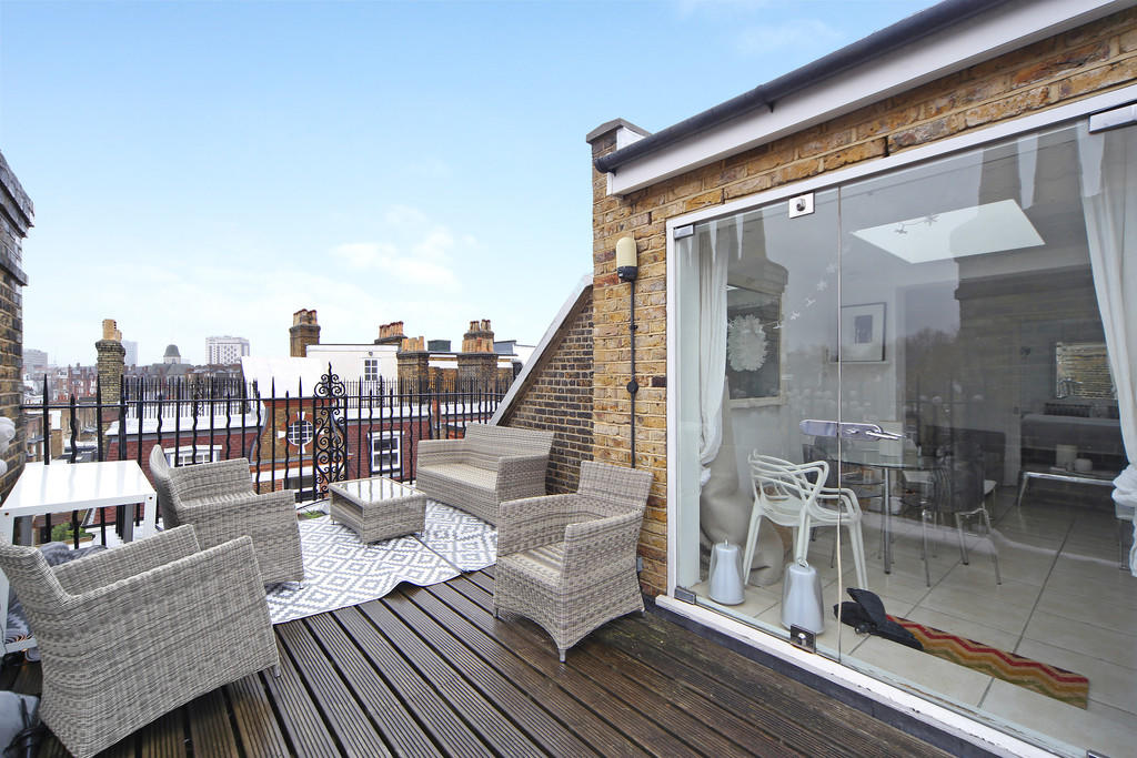
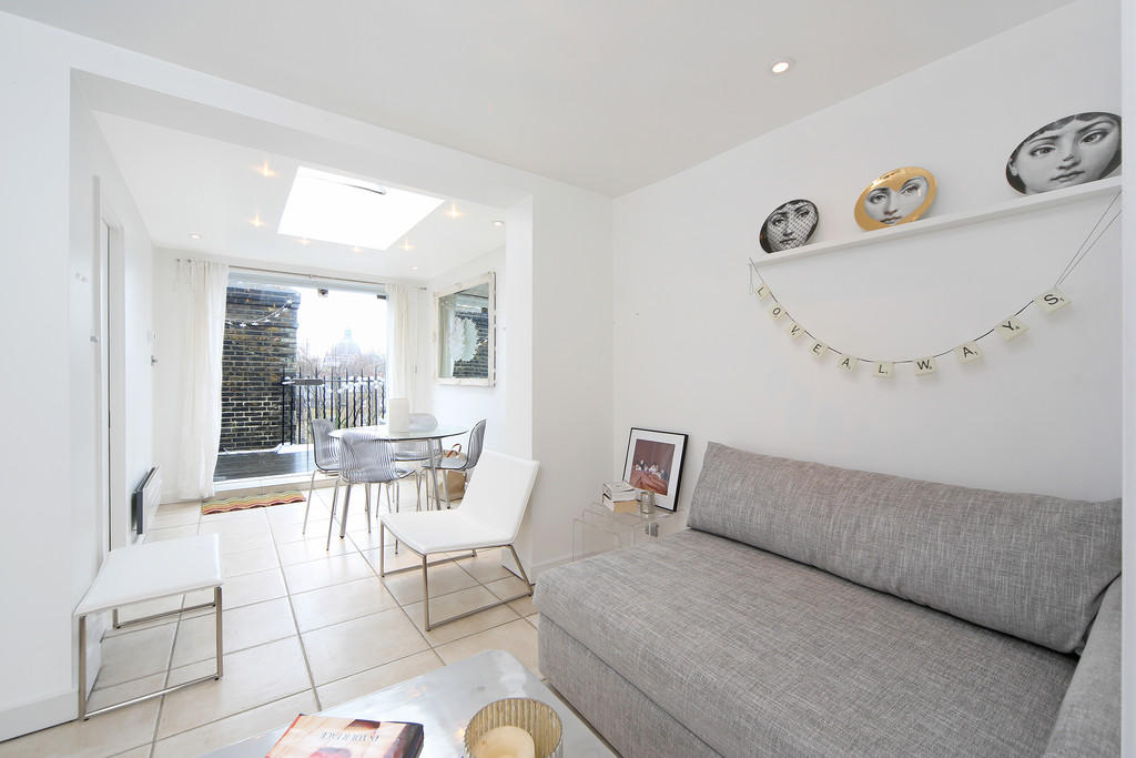
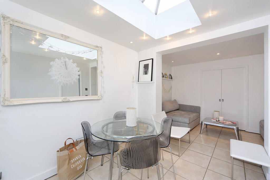
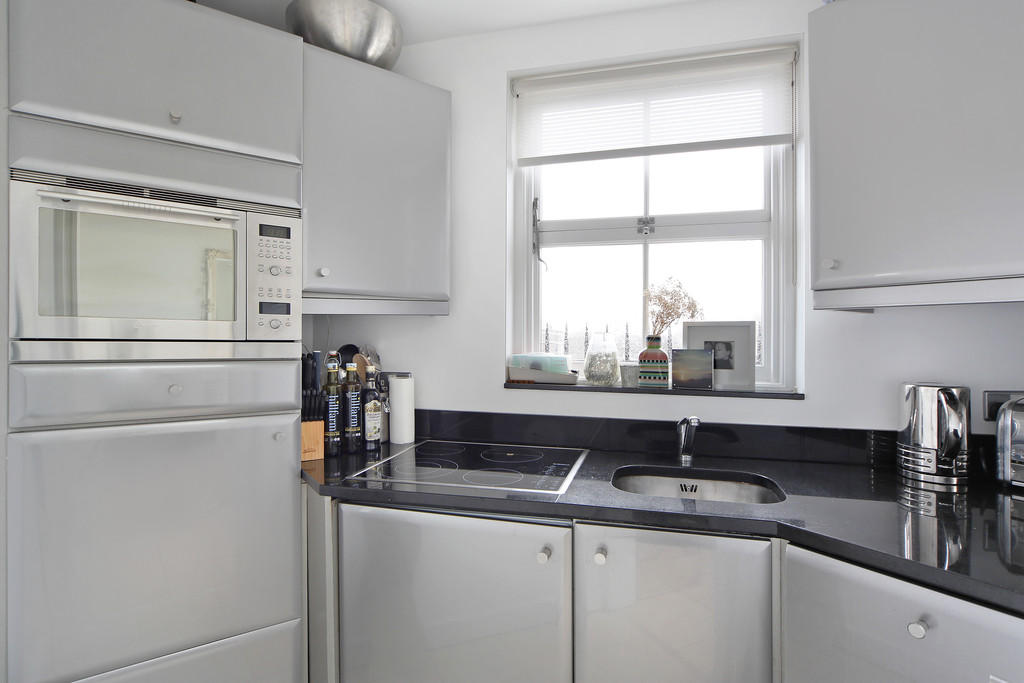
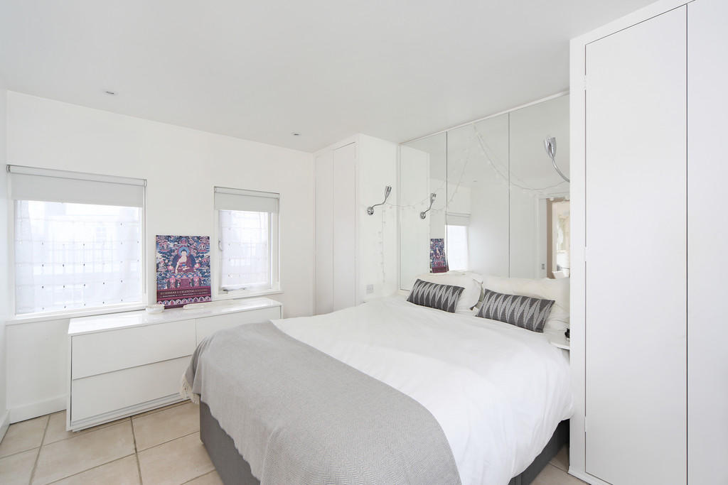
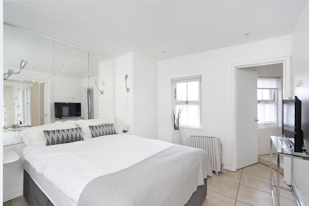
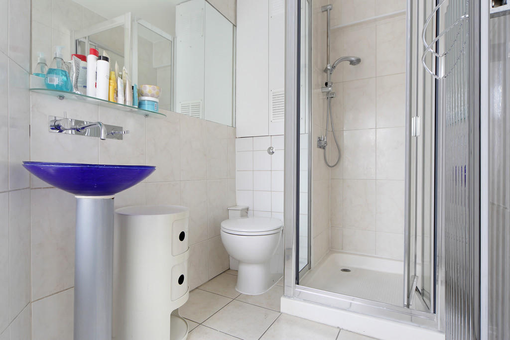
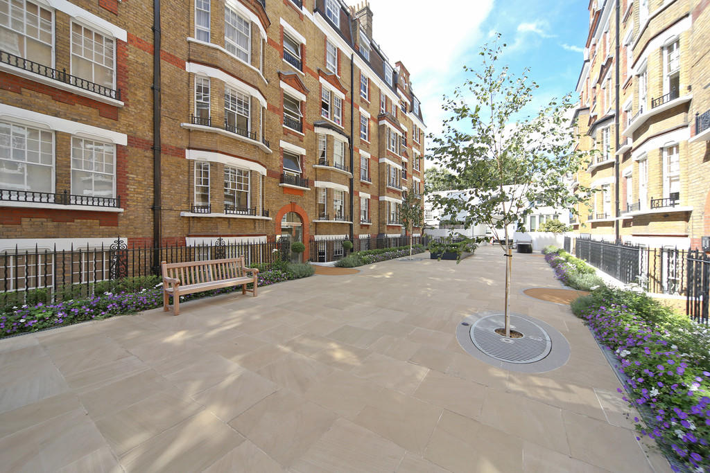
Photo 1 Photo 2 Photo 3 Photo 4 Photo 5 Photo 6 Photo 7 Photo 8
/ 8
Property details
Floor area
64 m²
Year built
England and Wales: 1930-1949
Deprivation
Decile 7 (23,591 of 33,755)
Street crime
1006 incidents within 1 mile (Apr 2026)
Key features
- Private Terrace
- Portered block
- Close proximity to South Kensington underground station
Description
Listed by
London
Maskells Estate Agents Ltd
Reference: 70554419
EPC Rating & Upgrade Cost
Fetching EPC data… Refresh this page in a moment.
Flood risk
Zone: 1
Risk: Low
Job (default Low)
Floorplans
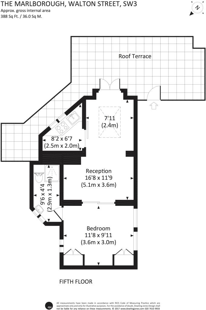
Floorplan 1
EPC Graphs
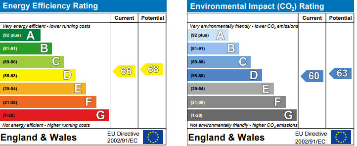
EPC 1
Rental Range
Estimated market rent for Kensington and Chelsea. Low = conservative, Realistic = average, Optimistic = best case.
Based on Local Authority from postcode lookup → Kensington and Chelsea.
LHA (30th percentile) floor for Huntingdon: £648/mo (Apr 2025 – Mar 2026)
Location
Address
21 Donne Place
Nearby
Nearest stations, universities and amenities (distance from property).
| Type | Name | Distance |
|---|---|---|
| Shop | EH Lifestyle | 0.0 miles |
| Shop | Caz | 0.0 miles |
| Bus stop | Fulham Road | 0.1 miles |
| Train station | South Kensington | 0.3 miles |
| Train station | Sloane Square | 0.5 miles |
| University | National Heart and Lung Institute | 0.6 miles |
| Hospital | Bridge Lane Health Centre | 1.5 miles |
| University | BIMM Institute London | 1.6 miles |
| Hospital | Tunica Diagnostics | 2.1 miles |
Street-level crime
| Category | Count |
|---|---|
| Anti-social behaviour | 186 |
| Other theft | 171 |
| Violence and sexual offences | 165 |
| Theft from the person | 108 |
| Shoplifting | 101 |
| Vehicle crime | 93 |
| Public order | 49 |
| Burglary | 29 |
| Drugs | 28 |
| Criminal damage and arson | 27 |
| Robbery | 19 |
| Bicycle theft | 17 |
| Other crime | 11 |
| Possession of weapons | 2 |
| Total incidents | 1006 |
Within 1 mile during Apr 2026. Source: data.police.uk (England & Wales).
Schools nearby
Nearest open schools with Ofsted ratings (England). Closed schools are not shown. Data from Get Information about Schools and Ofsted.
| Name | Type | Distance | Ofsted |
|---|---|---|---|
| Marlborough Primary School | Primary | 0.1 miles | — (Inspected (no overall grade)) |
| Knightsbridge School | Other | 0.2 miles | — (No rating) |
| St Joseph's Catholic Primary School | Primary | 0.2 miles | Outstanding — 12 Jun 2024 |
| St. Thomas More Language College | Secondary | 0.2 miles | Good — 21 Sep 2022 |
| Sussex House School | Other | 0.2 miles | — (No rating) |
Rental Comparables
Residential lets from OpenRent and Rightmove for the area (same bedroom count). Use to validate rent estimates. Student lets are excluded.
| Title | Rent | Beds | Distance | As seen on |
|---|---|---|---|---|
| Studio Flat, Pelham Court, SW3 | £2,383/mo | 1 | 0.24 miles | OpenRent |
| 1 Bed Flat, Pelham Court, SW3 | £3,293/mo | 1 | 0.24 miles | OpenRent |
Average rent: £2,838/mo (2 listings)