FLAT 10
84 OAKLEIGH ROAD NORTH, LONDON, GREATER LONDON N20 9FG
Property details
Floor area
72 m²
Council tax band
TBC
Street crime
210 incidents within 1 mile (Apr 2026)
Additional details
- Garden
- Yes
Description
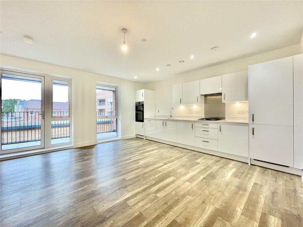
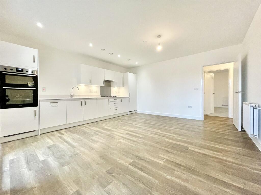
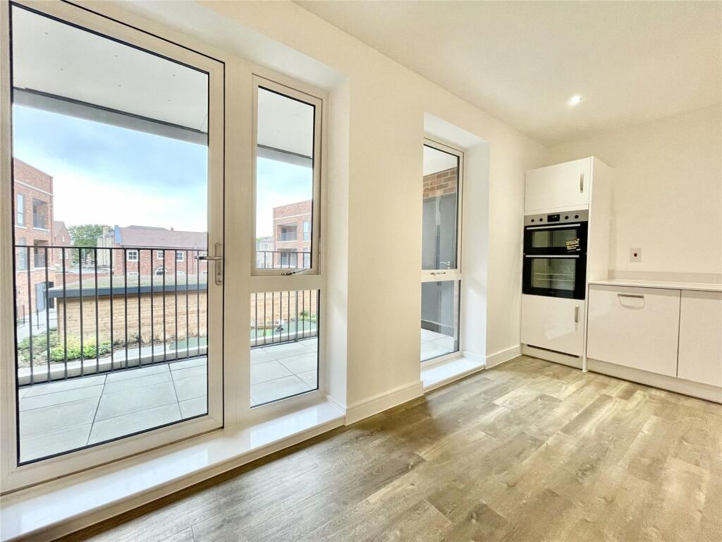
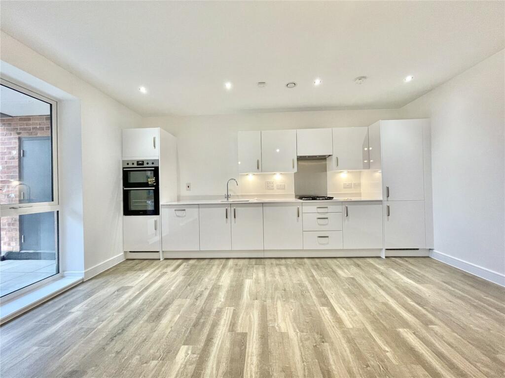
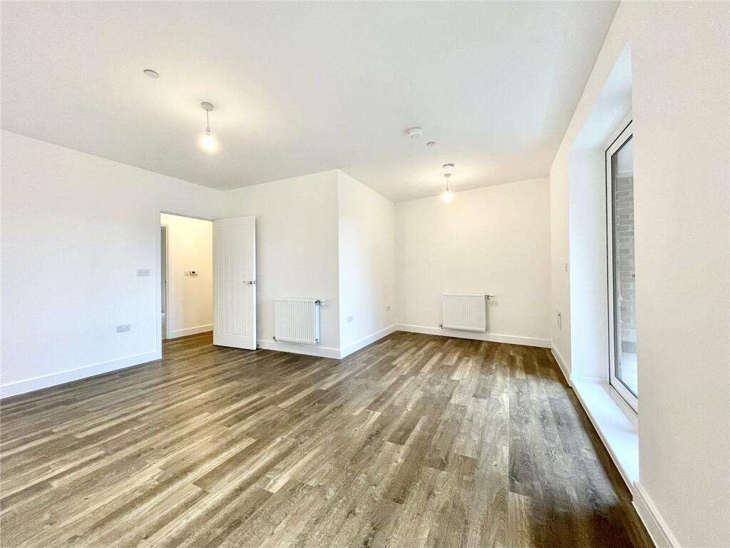
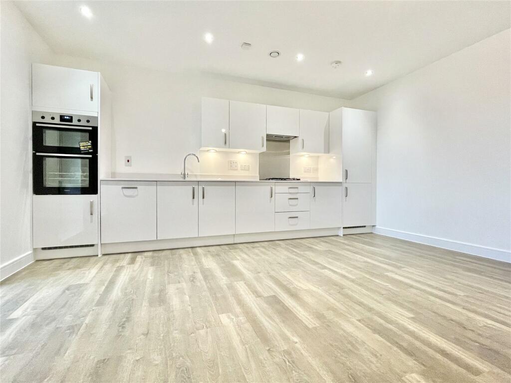
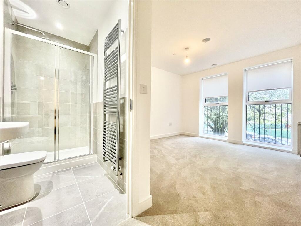
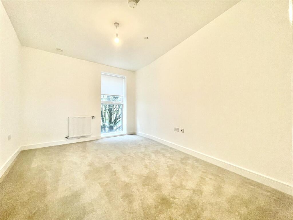
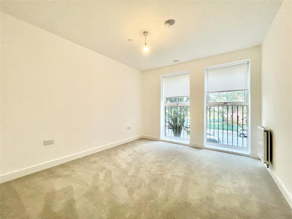
As you step inside, you'll be greeted by an open-concept living space that seamlessly connects the living, dining, and kitchen areas. The spaciousness of the layout allows for effortless entertaining and comfortable day-to-day living. Large windows adorn the living area, inviting in an abundance of natural light that accentuates the contemporary finishes and creates a warm ambiance.
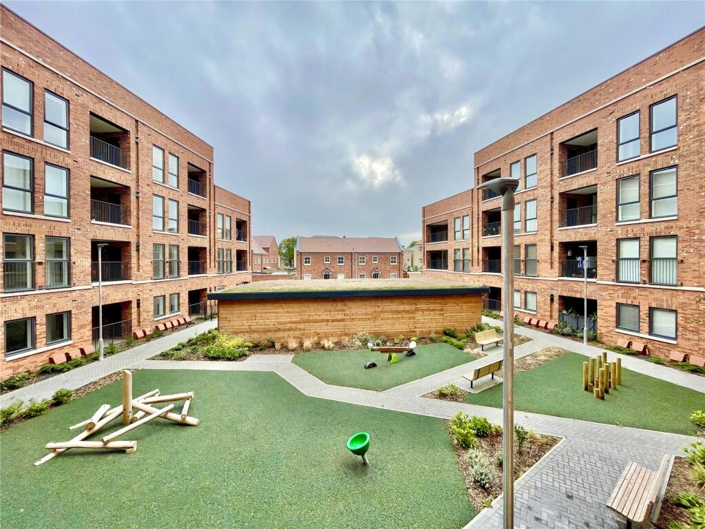
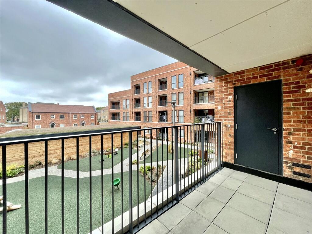
Step outside onto your private balcony and savor moments of relaxation while taking in the views of the surrounding neighbourhood. The apartment complex itself is thoughtfully designed, with communal spaces for residents to enjoy, such as landscaped gardens, a fitness center, and a communal lounge.
Located in the heart of Whetstone, you'll have easy access to a range of amenities including local shops, cafes, parks, and more. Commuting is a breeze with public transportation options and major roadways nearby, connecting you to the wider city.
Listed by
Barnet - Lettings
Statons
Reference: 141515507
EPC Rating & Upgrade Cost
Fetching EPC data… Refresh this page in a moment.
Flood risk
Zone: 1
Risk: Low
Job (default Low)
Floorplans
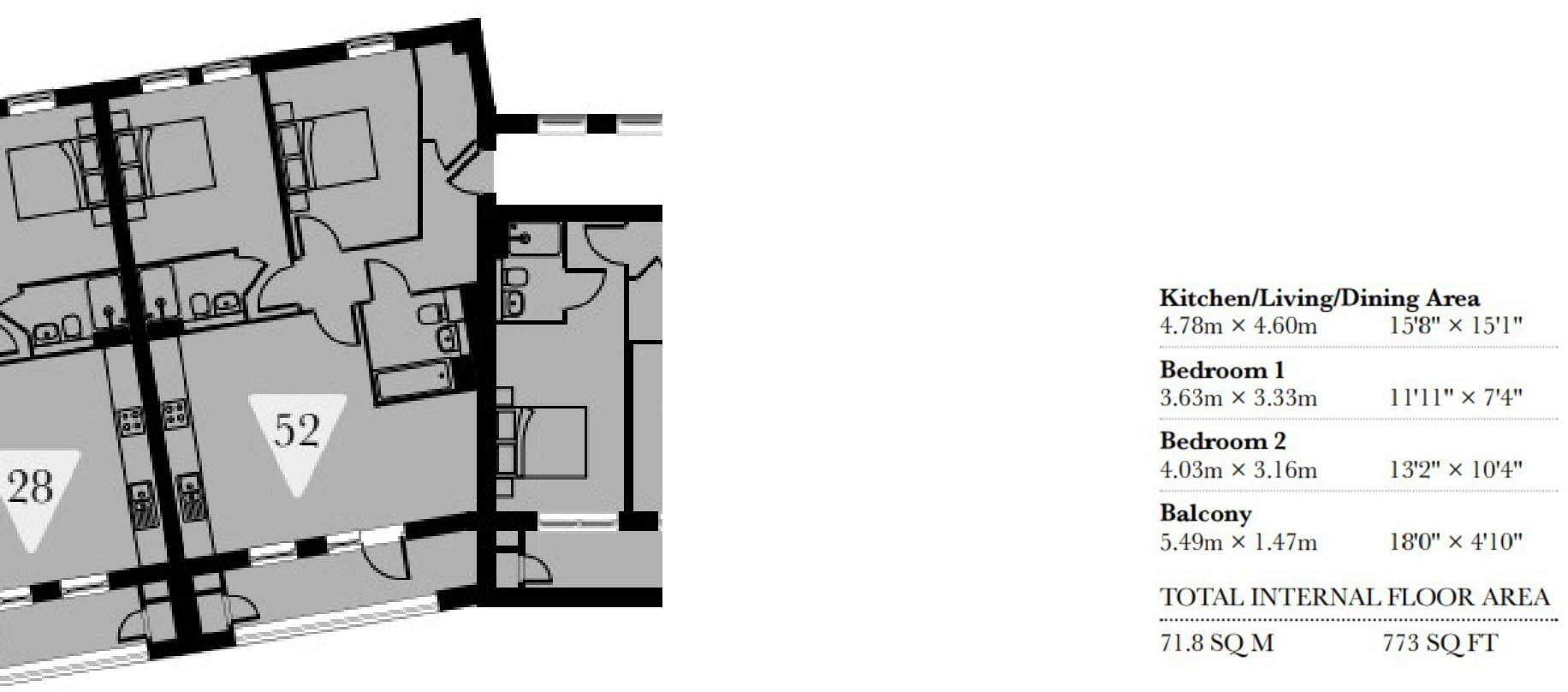
Floorplan
EPC Graphs
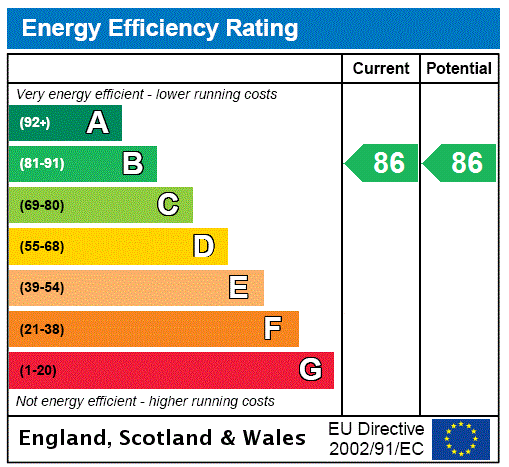
EPC Rating Graph
Company ownership
Registered legal owner is a company.
Rental Range
Estimated market rent for London. Low = conservative, Realistic = average, Optimistic = best case.
Based on Postcode area N → London.
LHA (30th percentile) floor for Peterborough: £698/mo (Apr 2025 – Mar 2026)
Location
Nearby
Nearest stations, universities and amenities (distance from property).
| Type | Name | Distance |
|---|---|---|
| Bus stop | Oakleigh Park North | 0.0 miles |
| Bus stop | Ashcroft Court | 0.1 miles |
| Shop | Asda Express | 0.2 miles |
| Shop | Charlies | 0.2 miles |
| Train station | Totteridge & Whetstone | 0.4 miles |
| Train station | Oakleigh Park | 0.6 miles |
| Hospital | Priory Hospital | 2.2 miles |
| Hospital | North London Hospice Winchmore Hill | 3.3 miles |
| University | Flood Hazard Research Centre | 3.9 miles |
| University | Middlesex University | 3.9 miles |
Street-level crime
| Category | Count |
|---|---|
| Violence and sexual offences | 60 |
| Anti-social behaviour | 45 |
| Vehicle crime | 23 |
| Burglary | 19 |
| Criminal damage and arson | 11 |
| Other theft | 10 |
| Shoplifting | 10 |
| Public order | 8 |
| Robbery | 8 |
| Drugs | 6 |
| Theft from the person | 5 |
| Other crime | 2 |
| Possession of weapons | 2 |
| Bicycle theft | 1 |
| Total incidents | 210 |
Within 1 mile during Apr 2026. Source: data.police.uk (England & Wales).
Schools nearby
Nearest open schools with Ofsted ratings (England). Closed schools are not shown. Data from Get Information about Schools and Ofsted.
| Name | Type | Distance | Ofsted |
|---|---|---|---|
| All Saints' CofE Nursery and Primary School N20 | Primary | 0.1 miles | Good — 17 Oct 2014 |
| Queenswell Infant & Nursery School | Primary | 0.2 miles | Good — 27 Jul 2023 |
| Queenswell Junior School | Primary | 0.2 miles | Good — 26 Feb 2014 |
| Alma Primary | Primary | 0.2 miles | Good — 5 Oct 2023 |
| Sacred Heart Roman Catholic Primary School | Primary | 0.3 miles | Good — 24 Jul 2023 |
Rental Comparables
Rental listings exist nearby, but none matched the 2-bedroom count for this property.