FLAT 2
27 LYNDHURST ROAD, HOVE, BRIGHTON AND HOVE BN3 6FB
£1,125 pcm
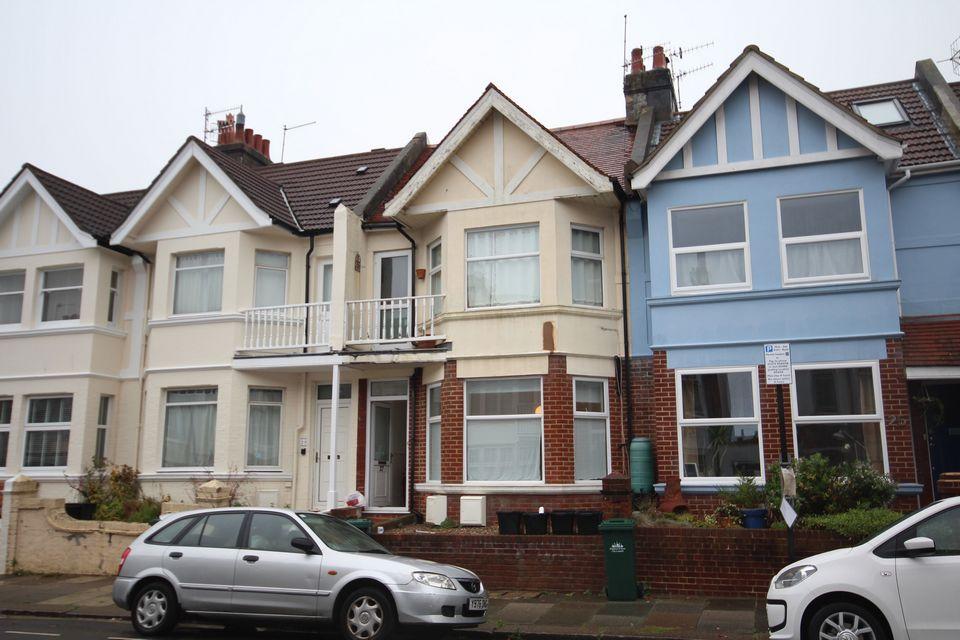
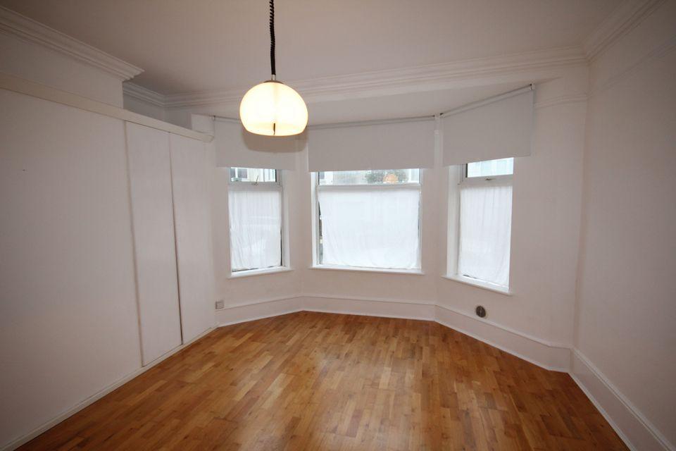
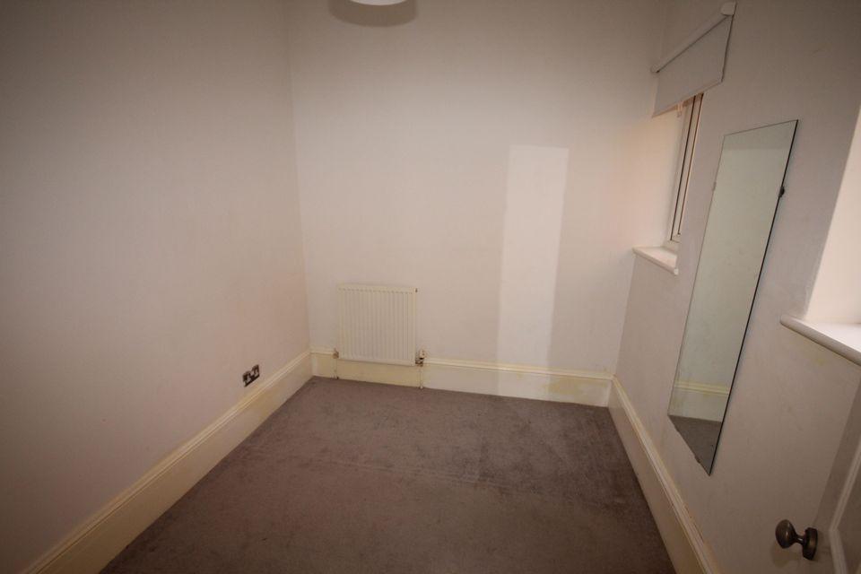
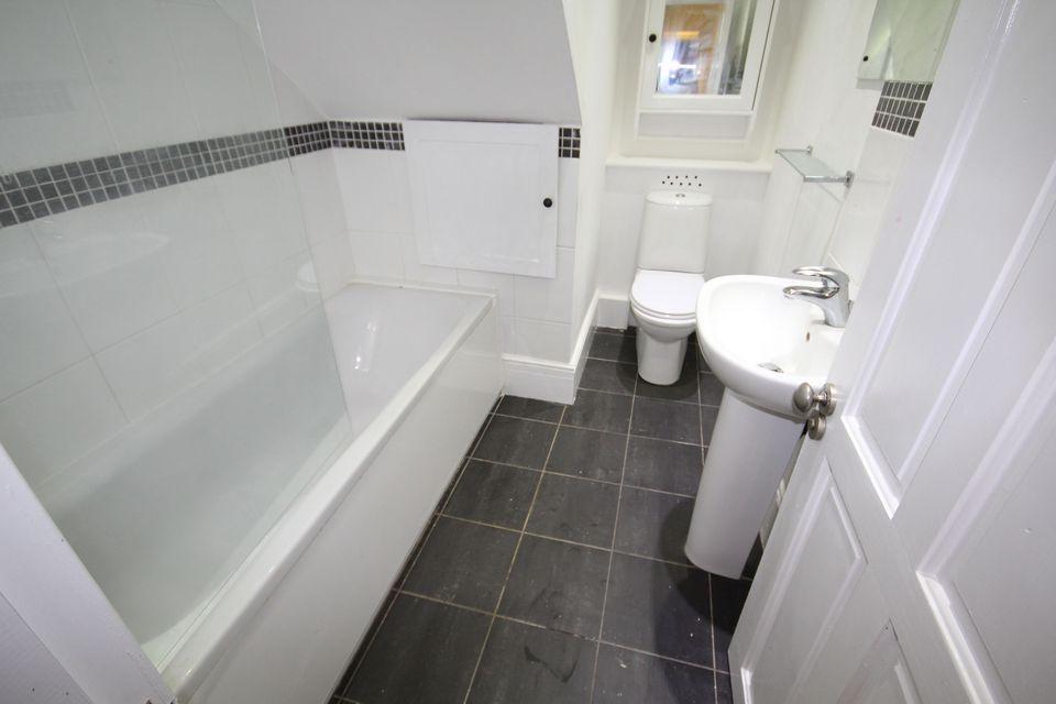
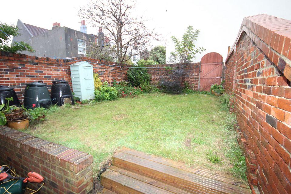
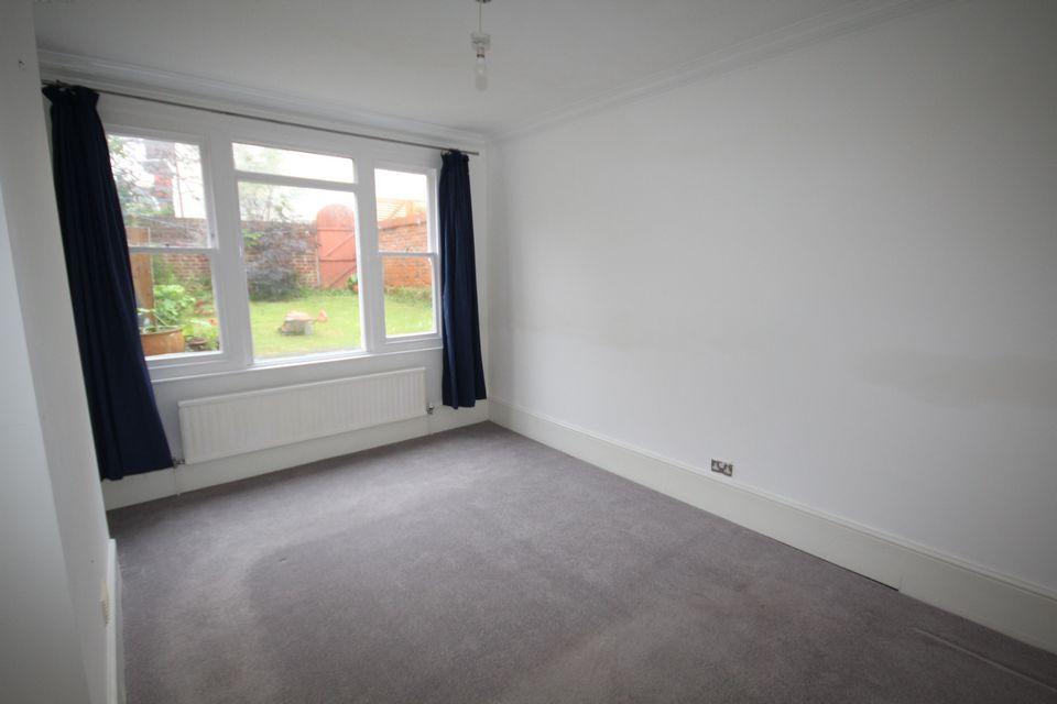
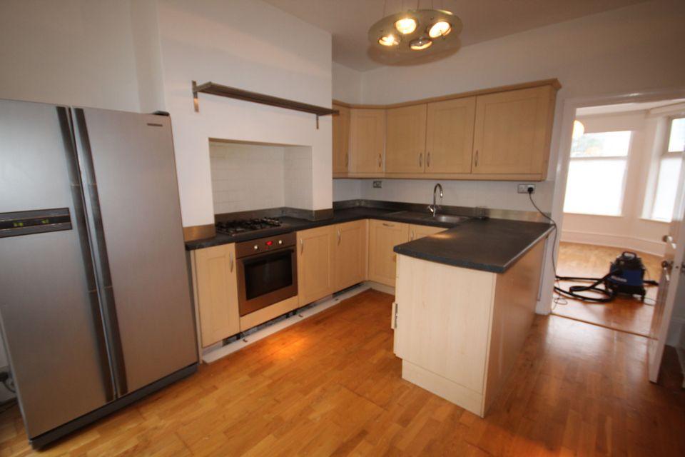
Photo 1 Photo 2 Photo 3 Photo 4 Photo 5 Photo 6 Photo 7
/ 7
Property details
Floor area
67 m²
Deprivation
Decile 8 (26,617 of 33,755)
Street crime
1243 incidents within 1 mile (Apr 2026)
Key features
- CLOSE TO BRIGHTON RAILWAY STATION
- LOVELY REAR WALLED REAR GARDEN
Additional details
- Garden
- Yes
Description
ENTRANCE
LIVING ROOM 14'5" (4.39m) x 12'1" (3.68m)
Large bay window, radiator, power points, range of built in cupboards also housing the gas fired central heating boiler.
KITCHEN 12'3" (3.73m) x 10'10" (3.30m)
Well fitted with single drainer stainless steel sink unit in working surfaces, stainless steel gas hob, oven under, washing machine, range of drawers and cupboards, eye level wall cupboards, tiles surrounds, power points, fridge/freezer. Patio door to rear GARDEN, radiator.
INNER HALL
Radiator, cupboards.
BEDROOM 2 8'9" (2.67m) x 8' (2.44m)
Radiator, power points.
BATHROOM
White suite with modern panelled bath, separate shower unit, pedestal wash hand basin, low level W.C. tiled surrounds, radiator, extractor.
BEDROOM 1 14'2" (4.32m) x 11'0" (3.35m)
Radiator, power points, window over looking rear garden.
OUTSIDE
Lovely walled rear garden.
Listed by
Brighton
Uden Estate Agents
Reference: 53146137
EPC Rating & Upgrade Cost
Fetching EPC data… Refresh this page in a moment.
Flood risk
Zone: 1
Risk: Low
Job (default Low)
EPC Graphs
EPC - 1

EPC 2
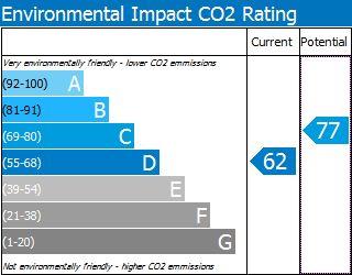
EPC - 2
Rental Range
Estimated market rent for Brighton and Hove. Low = conservative, Realistic = average, Optimistic = best case.
Based on Local Authority from postcode lookup → Brighton and Hove.
LHA (30th percentile) floor for Brighton and Hove: £1,197/mo (Apr 2025 – Mar 2026)
Location
Nearby
Nearest stations, universities and amenities (distance from property).
| Type | Name | Distance |
|---|---|---|
| Shop | Wickes | 0.1 miles |
| Shop | Tapi Carpets | 0.1 miles |
| Bus stop | Lyon Close | 0.1 miles |
| Hospital | The Montefiore Hospital | 0.1 miles |
| Train station | Hove | 0.6 miles |
| Train station | Brighton | 0.8 miles |
| University | University of Brighton Phoenix Halls | 1.2 miles |
| Hospital | Aldrington House | 1.2 miles |
| University | University of Brighton Moulesecoomb Campus | 1.8 miles |
Street-level crime
| Category | Count |
|---|---|
| Violence and sexual offences | 285 |
| Anti-social behaviour | 283 |
| Shoplifting | 239 |
| Public order | 131 |
| Other theft | 65 |
| Criminal damage and arson | 50 |
| Drugs | 40 |
| Other crime | 39 |
| Vehicle crime | 28 |
| Burglary | 22 |
| Bicycle theft | 21 |
| Robbery | 19 |
| Possession of weapons | 13 |
| Theft from the person | 8 |
| Total incidents | 1243 |
Within 1 mile during Apr 2026. Source: data.police.uk (England & Wales).
Schools nearby
Nearest open schools with Ofsted ratings (England). Closed schools are not shown. Data from Get Information about Schools and Ofsted.
| Name | Type | Distance | Ofsted |
|---|---|---|---|
| The Montessori Place | Other | 0.3 miles | Outstanding — 28 Sep 2022 |
| Cardinal Newman Catholic School | Secondary | 0.3 miles | — (Inspected (no overall grade)) |
| South England International School | Other | 0.3 miles | Good — 2 May 2023 |
| Brunswick Primary School | Primary | 0.3 miles | Requires improvement — 11 Jul 2024 |
| Brighton Hove and Sussex Sixth Form College | Other | 0.3 miles | — (No rating) |
Rental Comparables
Rental comparables are temporarily unavailable while listing-site fetches are paused. Try again later.