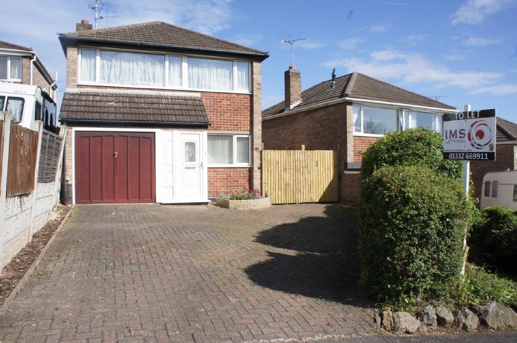
18 NETHERFIELD ROAD
NOTTINGHAM, SANDIACRE, DERBYSHIRE NG10 5LN
Property details
Floor area
74 m²
Deprivation
Decile 7 (23,508 of 33,755)
Street crime
139 incidents within 1 mile (Apr 2026)
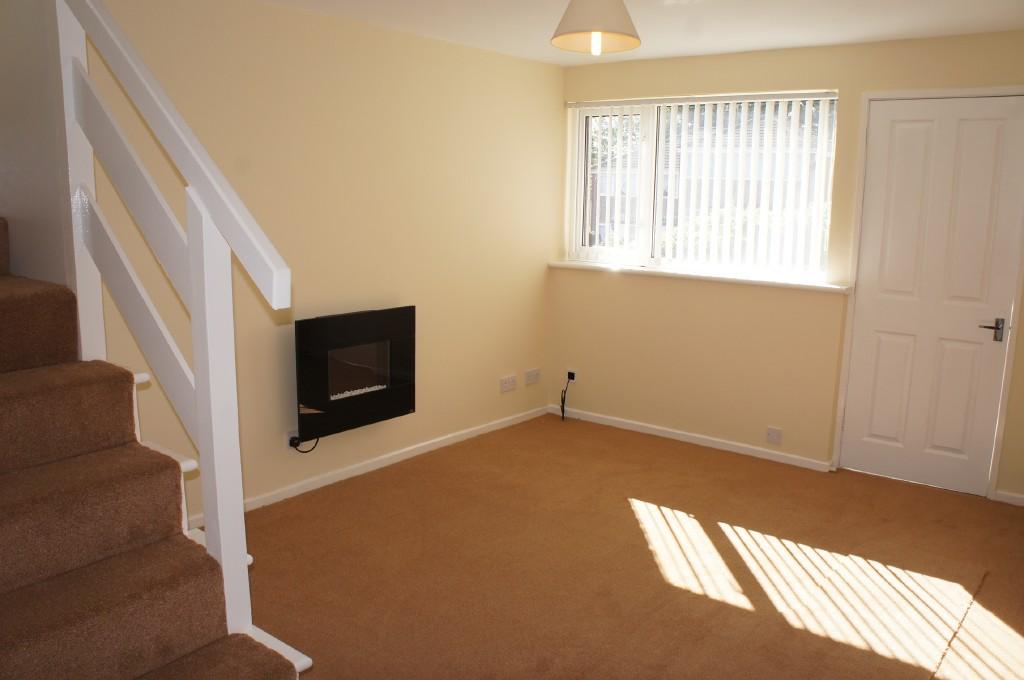
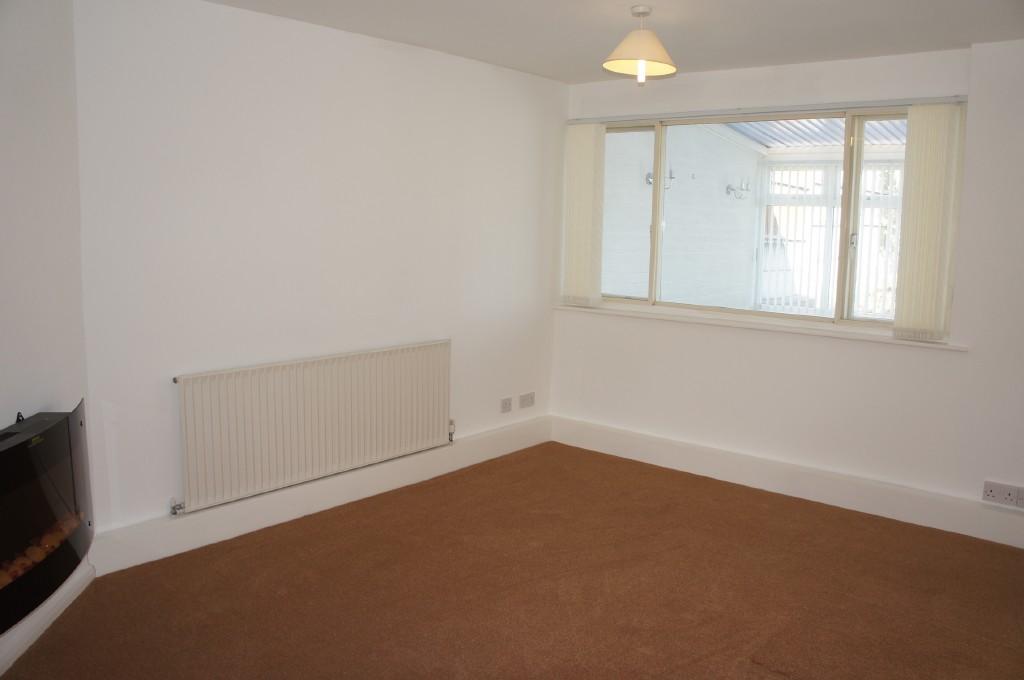
Key features
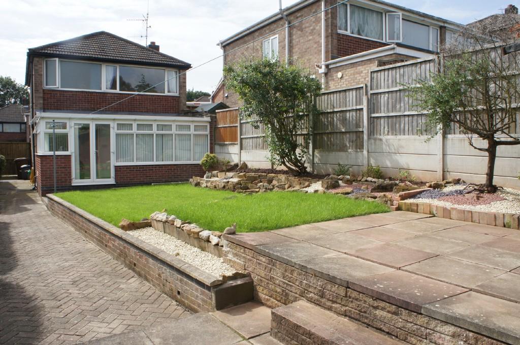
- Newly Decorated Detached House
- Wall Mounted Contemporary Electric Fire
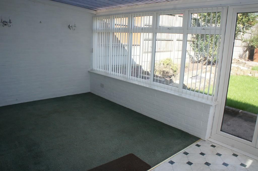
- Conservatory with Utility Room
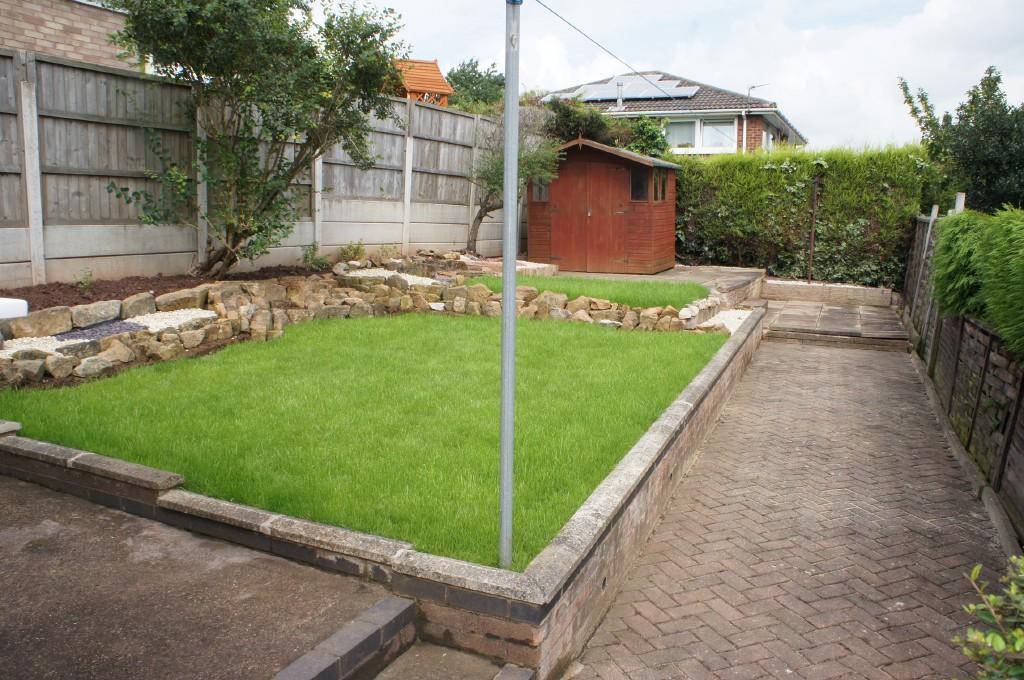
- Lanscaped Rear Garden
- Garage
- Driveway Parking for 2 vehicles
Additional details
- Parking
- Yes
- Garden
- Yes
Description
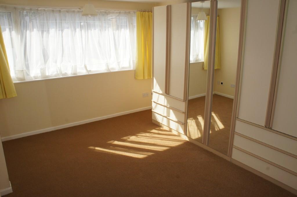
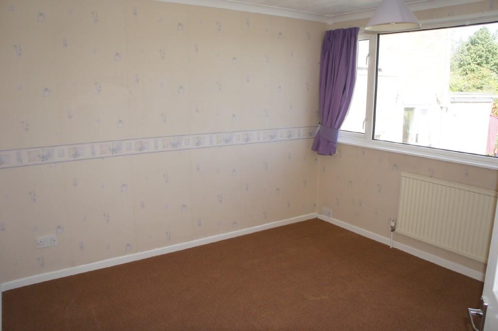
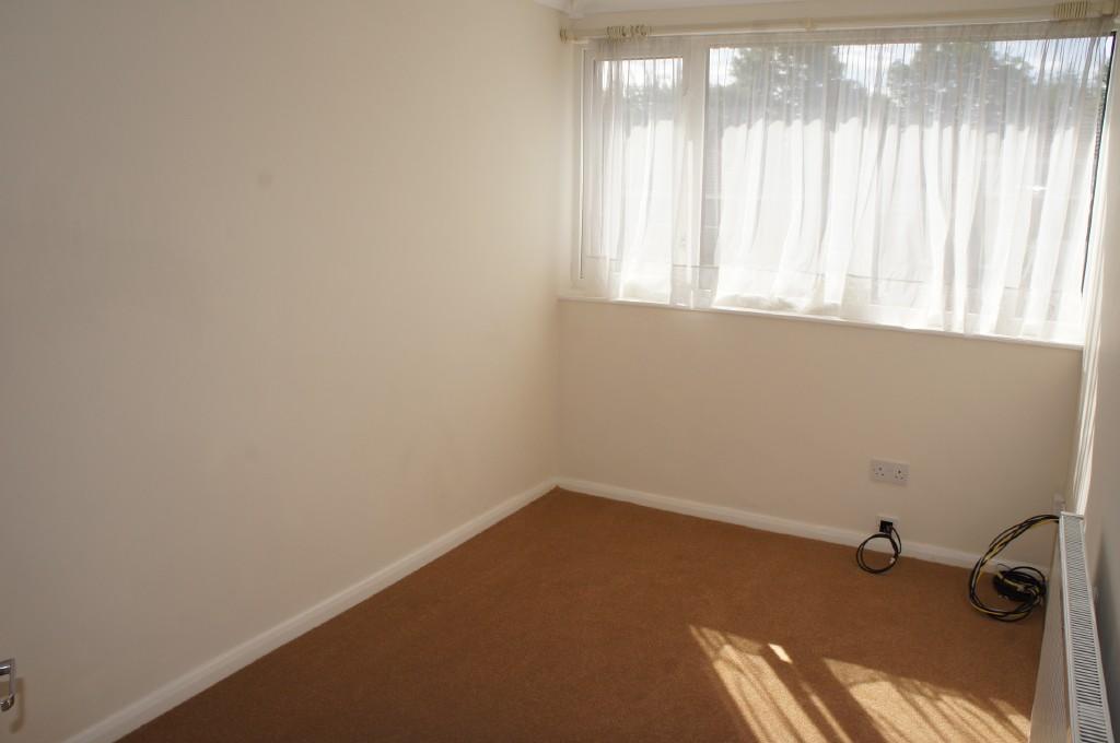
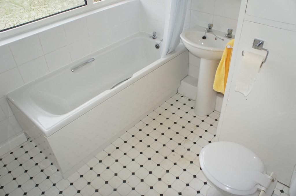
To the first floor is a carpeted landing having access to all rooms. Bedroom 1 (14'2" x 10'5") having new carpet, fitted wall wardrobes and drawers, neutral décor and window to front. Bedroom 2 (10'6" x 10'5") having new carpet and window to rear. Bedroom 3 (11'3" x 7'2") having new carpet, neutral décor and window to front. Bathroom has a 3 piece white suite with electric shower over bath, pedestal hand wash basin, WC, neutral décor and part tiled, neutral décor and obscure window to rear.
To the rear is a neat landscaped Garden having new lawn, rockery and pebbled areas, flowerbeds various patio seating areas and summer house. To the front is a paved driveway having parking for 2 vehicles, Garage, hedge and fenced borders and gated access to the rear.
Listed by
Derby
Leaders and Romans Group
Reference: 35537392
EPC Rating & Upgrade Cost
Fetching EPC data… Refresh this page in a moment.
Flood risk
Zone: 1
Risk: Low
Job (default Low)
Rental Range
Estimated market rent for Erewash. Low = conservative, Realistic = average, Optimistic = best case.
Based on Local Authority from postcode lookup → Erewash.
LHA (30th percentile) floor for Nottingham: £748/mo (Apr 2025 – Mar 2026)
Location
Nearby
Nearest stations, universities and amenities (distance from property).
| Type | Name | Distance |
|---|---|---|
| Bus stop | Sandringham Road / Kensington Road | 0.1 miles |
| Bus stop | Sandringham Drive | 0.1 miles |
| Shop | The Roshi | 0.5 miles |
| Shop | The Dog Barber | 0.7 miles |
| Train station | Long Eaton | 2.4 miles |
| Train station | Attenborough | 2.7 miles |
| University | Chaucer Study Space | 6.3 miles |
| Hospital | Highbury Hospital | 6.6 miles |
| Hospital | Unknown | 6.7 miles |
| University | University of Derby | 8.7 miles |
Street-level crime
| Category | Count |
|---|---|
| Violence and sexual offences | 53 |
| Anti-social behaviour | 30 |
| Criminal damage and arson | 12 |
| Shoplifting | 12 |
| Vehicle crime | 9 |
| Other theft | 8 |
| Public order | 8 |
| Drugs | 2 |
| Other crime | 2 |
| Bicycle theft | 1 |
| Burglary | 1 |
| Theft from the person | 1 |
| Total incidents | 139 |
Within 1 mile during Apr 2026. Source: data.police.uk (England & Wales).
Schools nearby
Nearest open schools with Ofsted ratings (England). Closed schools are not shown. Data from Get Information about Schools and Ofsted.
| Name | Type | Distance | Ofsted |
|---|---|---|---|
| Ladycross Infant School | Primary | 0.4 miles | — (Inspected (no overall grade)) |
| Longmoor Primary School | Primary | 0.5 miles | Good — 8 Jul 2016 |
| Friesland School | Secondary | 0.5 miles | Good — 18 Jan 2024 |
| Cloudside Academy | Primary | 0.7 miles | Good — 13 Feb 2022 |
| William Lilley Infant and Nursery School | Primary | 0.8 miles | Good — 13 Jun 2013 |
Rental Comparables
Loading rental comparables for this postcode. Refresh in a few minutes.