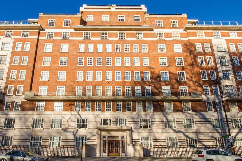
FLAT 120
15 PORTMAN SQUARE, LONDON, GREATER LONDON W1H 6LL
£2,817 pcm
120-15-Portman-Square (5).JPG 120-15-Portman-Square (3).JPG 120-15-Portman-Square (6).JPG PORTMAN SQUARE EXTERIOR.jpg 120-15-Portman-Square (2).JPG 120-15-Portman-Square (9).JPG 120-15-Portman-Square (4).JPG 120-15-Portman-Square (7).JPG 120-15-Portman-Square (8).JPG 120-15-Portman-Square (1).JPG
/ 10
Property details
Floor area
50 m²
Council tax band
F
Deprivation
Decile 8 (26,473 of 33,755)
Street crime
3180 incidents within 1 mile (Apr 2026)
Key features
- PORTMAN SQUARE
- 1 BED
- NEAR OXFORD STREET
- SELFRIDGES
- GARDEN SQUARE
- HEATING AND HOT WATER INCULDED
Additional details
- Garden
- Yes
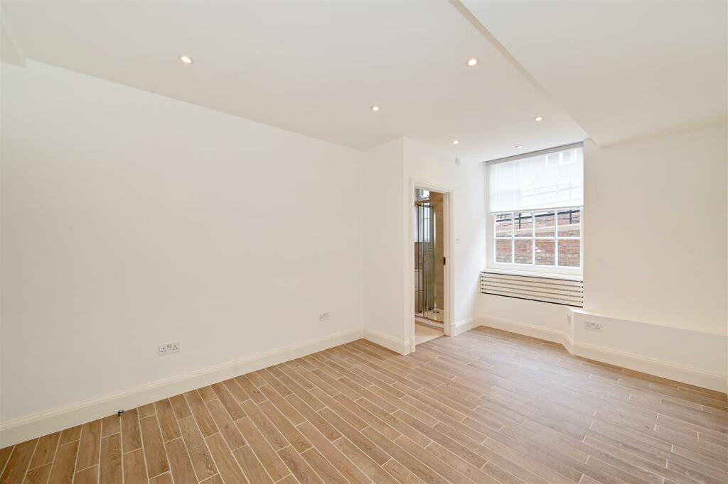
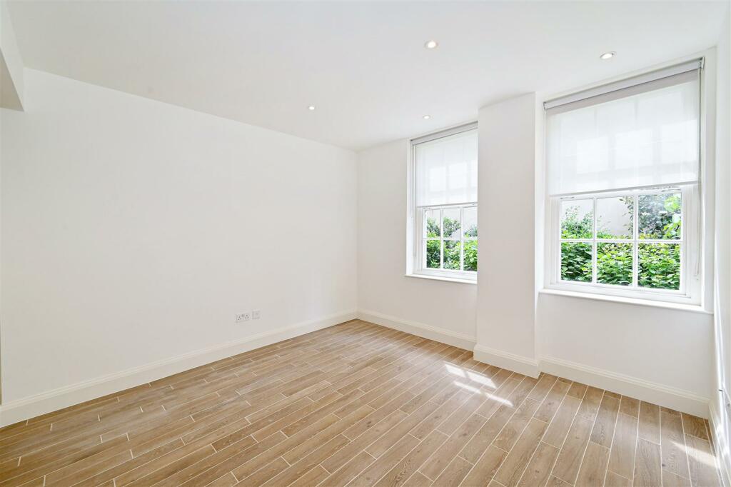
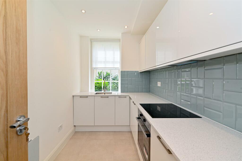
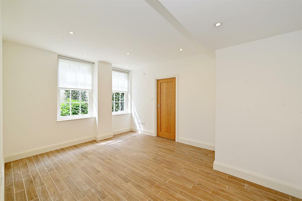
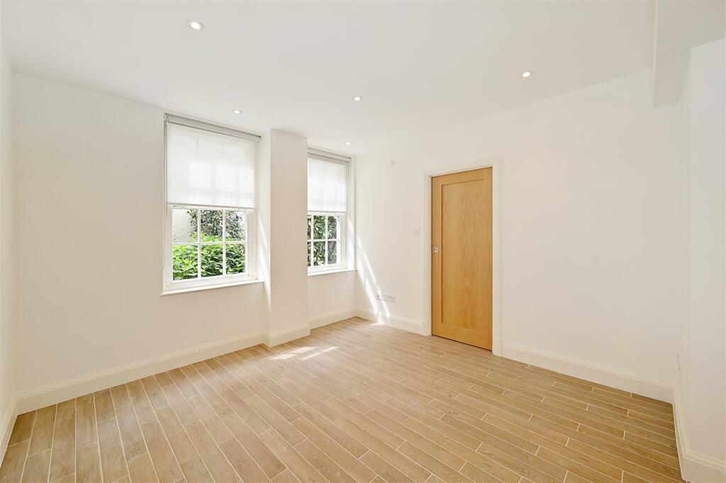
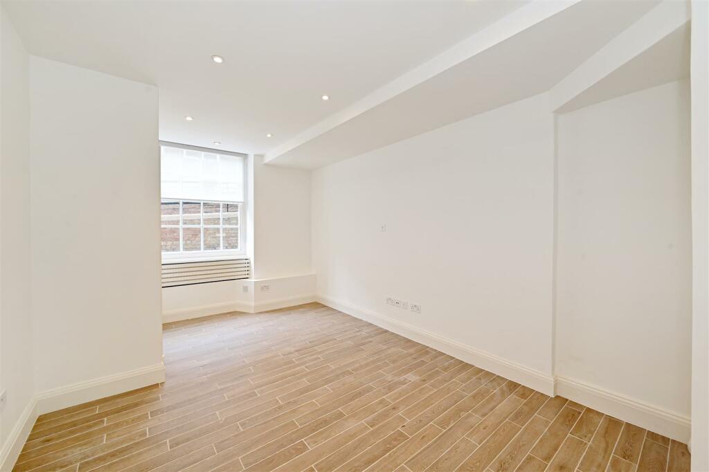
Description
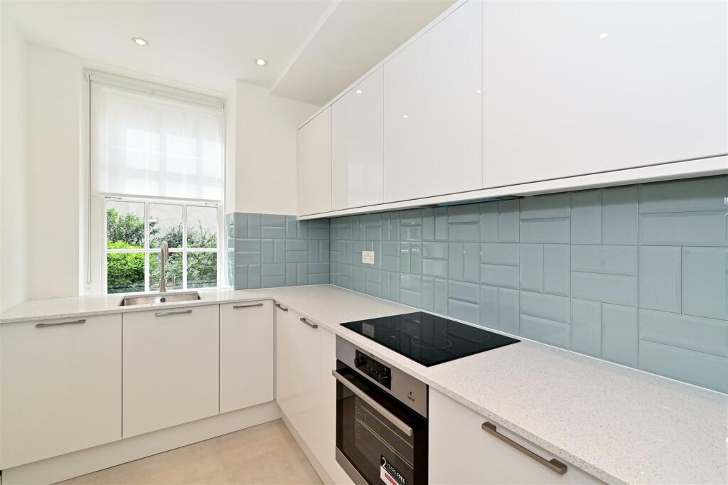
Available for Immediate occupation.
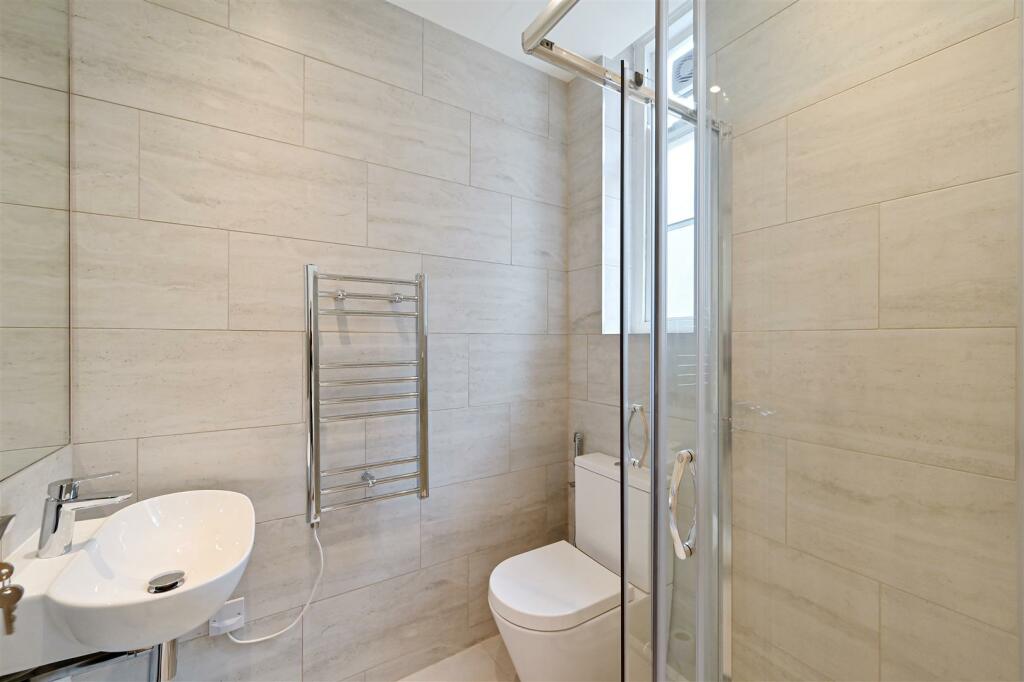
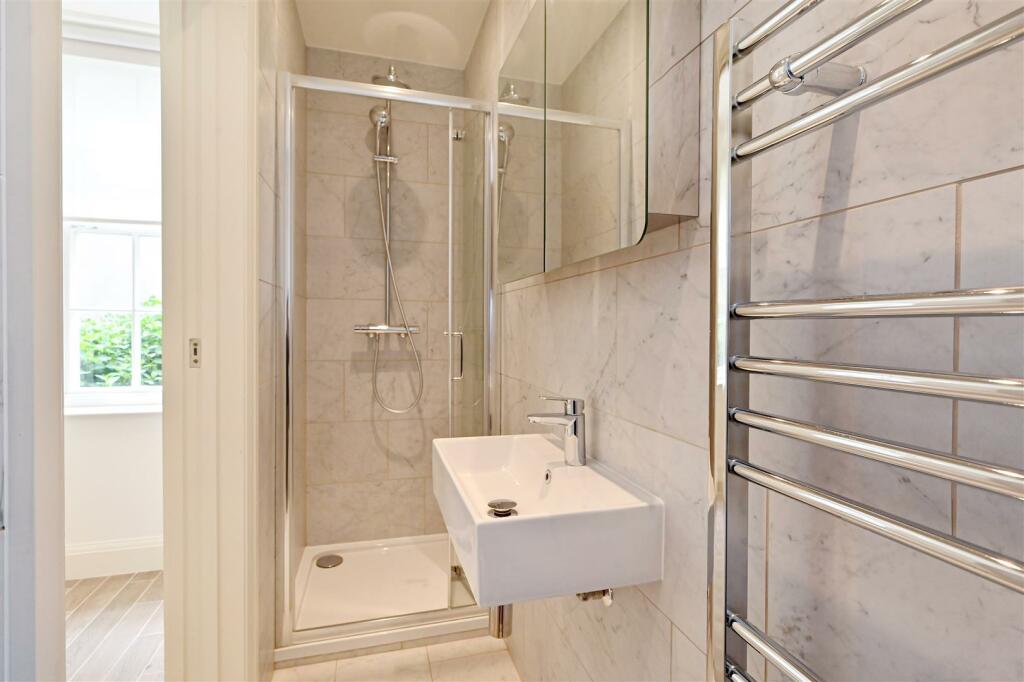
1 Bedroom : 2 Bathrooms : 24-Hour Porter : Westminster Council Tax Band F : EPC Rating D
Napier Watt Says - this recently refurbished apartment in 15 Portman Square would be a great pied-a-terre
Fees & Charges: Tenancies exceeding £100,000 Per annum £480 inc VAT, Tenancies where a company is a tenant £480 Inc VAT.
Listed by
London
Napier Watt Limited
Reference: 150508187
EPC Rating & Upgrade Cost
Fetching EPC data… Refresh this page in a moment.
Flood risk
Zone: 1
Risk: Low
Job (default Low)
Floorplans
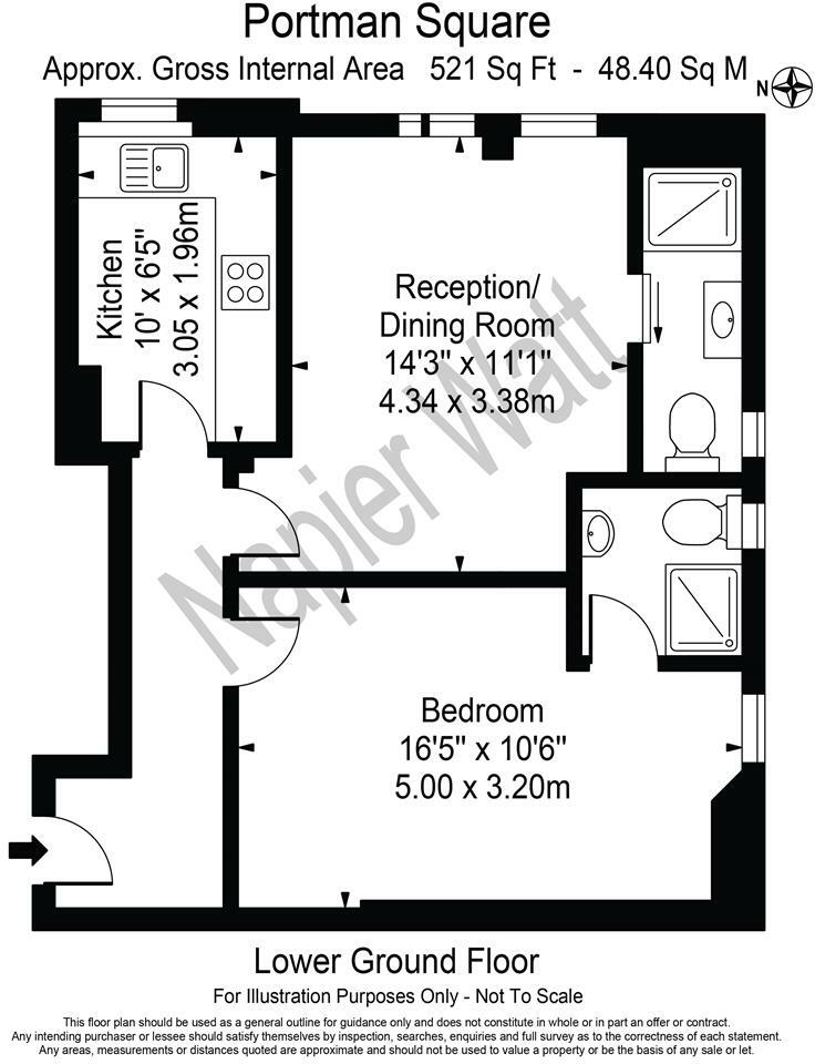
120, 15 Portman Square - hi.jpg
EPC Graphs
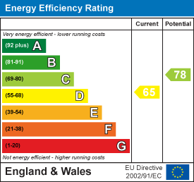
EE Rating
Company ownership
Registered legal owner is a company.
Rental Range
Estimated market rent for Westminster. Low = conservative, Realistic = average, Optimistic = best case.
Based on Local Authority from postcode lookup → Westminster.
LHA (30th percentile) floor for Central London: £1,436/mo (Apr 2025 – Mar 2026)
Location
Nearby
Nearest stations, universities and amenities (distance from property).
| Type | Name | Distance |
|---|---|---|
| Shop | Sharps | 0.0 miles |
| Bus stop | Portman Square | 0.0 miles |
| Shop | WED2B London | 0.1 miles |
| Train station | Marble Arch | 0.2 miles |
| Train station | Bond Street | 0.3 miles |
| University | LBS Behaviour Lab | 0.6 miles |
| Hospital | The Portland Hospital | 0.7 miles |
| Hospital | National Hospital for Neurology and Neurosurgery at Cleveland Street | 0.8 miles |
| University | Department of Geography | 1.1 miles |
Street-level crime
| Category | Count |
|---|---|
| Theft from the person | 693 |
| Other theft | 561 |
| Shoplifting | 432 |
| Anti-social behaviour | 392 |
| Violence and sexual offences | 368 |
| Drugs | 220 |
| Public order | 106 |
| Robbery | 105 |
| Burglary | 94 |
| Vehicle crime | 75 |
| Criminal damage and arson | 57 |
| Bicycle theft | 39 |
| Other crime | 20 |
| Possession of weapons | 18 |
| Total incidents | 3180 |
Within 1 mile during Apr 2026. Source: data.police.uk (England & Wales).
Schools nearby
Nearest open schools with Ofsted ratings (England). Closed schools are not shown. Data from Get Information about Schools and Ofsted.
| Name | Type | Distance | Ofsted |
|---|---|---|---|
| St Vincent's Catholic Primary School | Primary | 0.2 miles | Outstanding — 4 Feb 2024 |
| Wetherby Preparatory School | Other | 0.2 miles | — (No rating) |
| Wetherby Senior School | Other | 0.3 miles | — (No rating) |
| Halcyon London International School | Other | 0.3 miles | Outstanding — 27 May 2020 |
| Sylvia Young Theatre School | Other | 0.3 miles | — (No rating) |
Rental Comparables
Residential lets from OpenRent and Rightmove for the area (same bedroom count). Use to validate rent estimates. Student lets are excluded.
| Title | Rent | Beds | Distance | As seen on |
|---|---|---|---|---|
| 1 Bed Flat, Mandeville Place, W1U | £3,750/mo | 1 | 0.21 miles | OpenRent |
Average rent: £3,750/mo (1 listing)